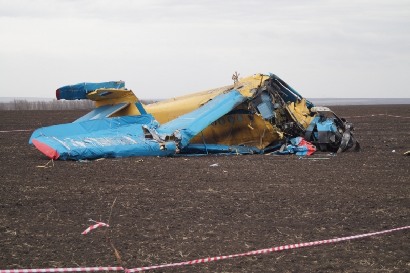
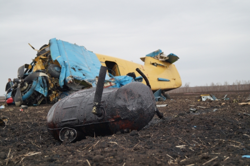
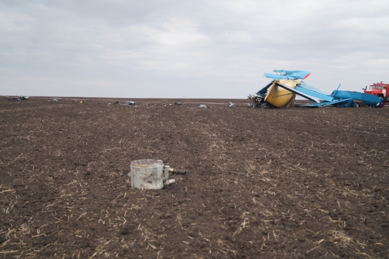
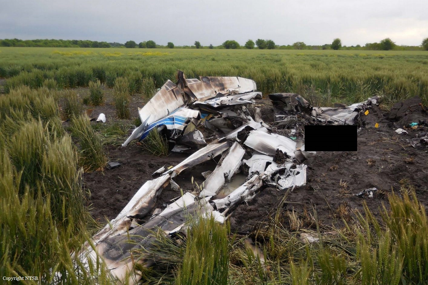
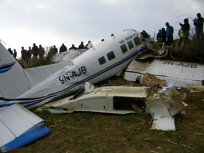
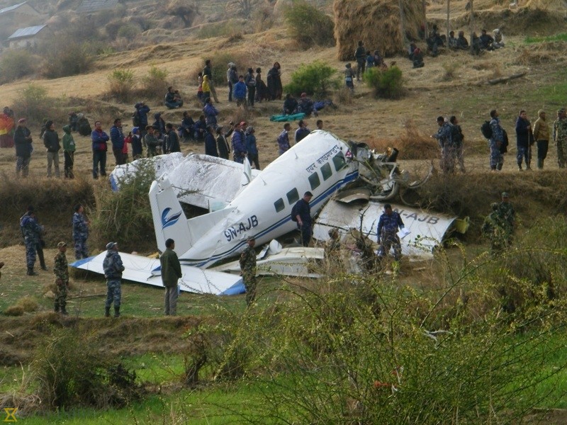
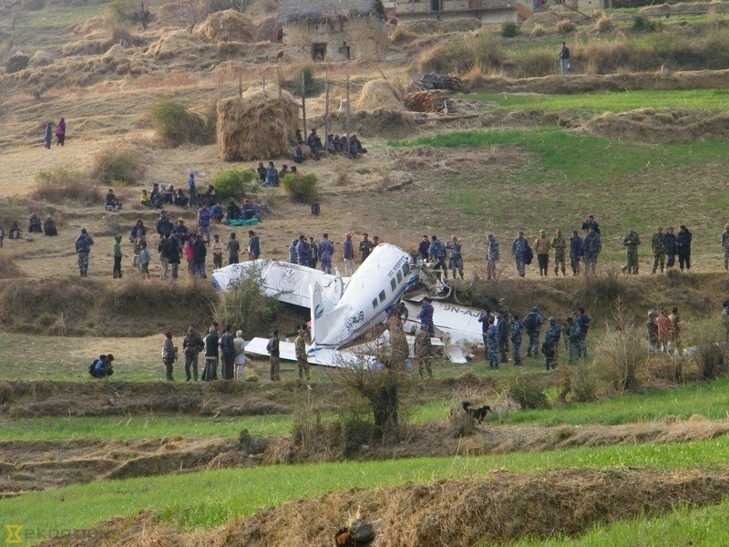
Crash of an IAI Arava 201 near Fátima: 22 killed

Date & Time: Mar 15, 2016 at 1430 LT
Type of aircraft:
Operator:
Registration:
E-206
Flight Phase:
Survivors:
No
Schedule:
Shell - Shell
MSN:
090
YOM:
1992
Location:
Country:
Crew on board:
3
Crew fatalities:
Pax on board:
19
Pax fatalities:
Other fatalities:
Total fatalities:
22
Circumstances:
The twin engine airplane departed Shell Airport at 1251LT for a local training exercice with a crew of three and 19 paratroopers on board. About an hour into the flight, the crew informed ground he was returning to his base due to the deterioration of the weather conditions. Shortly later, the aircraft entered an uncontrolled descent and crashed in a wooded area. All 22 occupants were killed. Up to date, this is the worst accident involving an IAI Arava 201.

Crash of a Beechcraft MC-12W Liberty in Kawrgosk

Date & Time: Mar 5, 2016
Type of aircraft:
Operator:
Registration:
N6351V
Flight Phase:
Flight Type:
Survivors:
Yes
Schedule:
Arbil - Arbil
MSN:
FL-751
YOM:
2011
Country:
Region:
Crew on board:
2
Crew fatalities:
Pax on board:
2
Pax fatalities:
Other fatalities:
Total fatalities:
0
Circumstances:
The twin engine airplane departed Arbil Airport on a military survey flight, carrying two passengers and two pilots. While cruising at an altitude of 20,000 feet, the left engine failed and smoke spread in the cabin. Confused and disoriented, the crew inadvertently shut down the right engine. During the descent, the crew was able to open the outflow valve, clearing the smoke. The crew then realized he could not reached the Arbil Airport so he attempted an emergency landing in a field located in Kawrgosk, about 17 km northwest of Arbil Airport. The aircraft slid on its belly for few dozen metres before coming to rest, and was damaged beyond repair. All four occupants evacuated safely.

Crash of a Cessna 208 Caravan I at Langebaanweg AFB

Date & Time: Mar 3, 2016
Type of aircraft:
Operator:
Registration:
3004
Flight Phase:
Flight Type:
Survivors:
Yes
Schedule:
Langebaanweg - Langebaanweg
MSN:
208-0130
YOM:
1988
Country:
Region:
Crew on board:
2
Crew fatalities:
Pax on board:
0
Pax fatalities:
Other fatalities:
Total fatalities:
0
Circumstances:
The crew was completing a local night training exercice at Langebaanweg AFB. While completing various manoeuvres, the airplane went out of control and crashed in an open field located near airbase, coming to rest upside down. The aircraft was destroyed and both pilots were injured.

Crash of a Travel Air 4000 in Palmer Lake: 2 killed

Date & Time: Mar 2, 2016 at 0800 LT
Type of aircraft:
Registration:
N6464
Flight Phase:
Flight Type:
Survivors:
No
Schedule:
Longmont – Casa Grande
MSN:
785
YOM:
1928
Crew on board:
1
Crew fatalities:
Pax on board:
1
Pax fatalities:
Other fatalities:
Total fatalities:
2
Captain / Total flying hours:
5000
Circumstances:
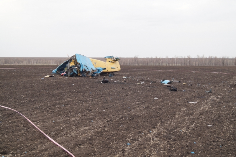
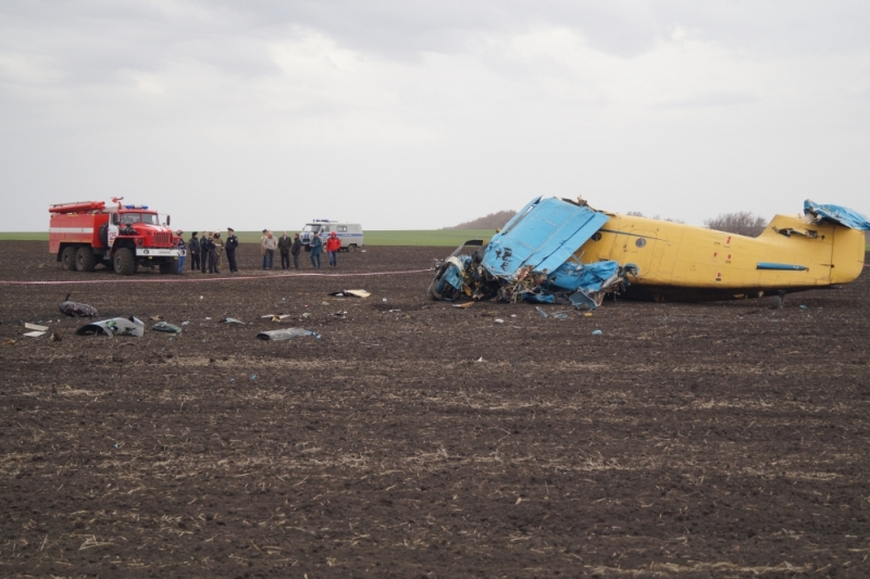
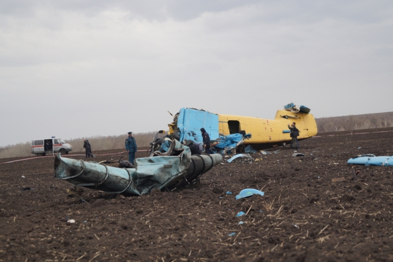
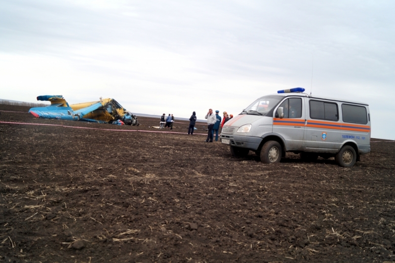
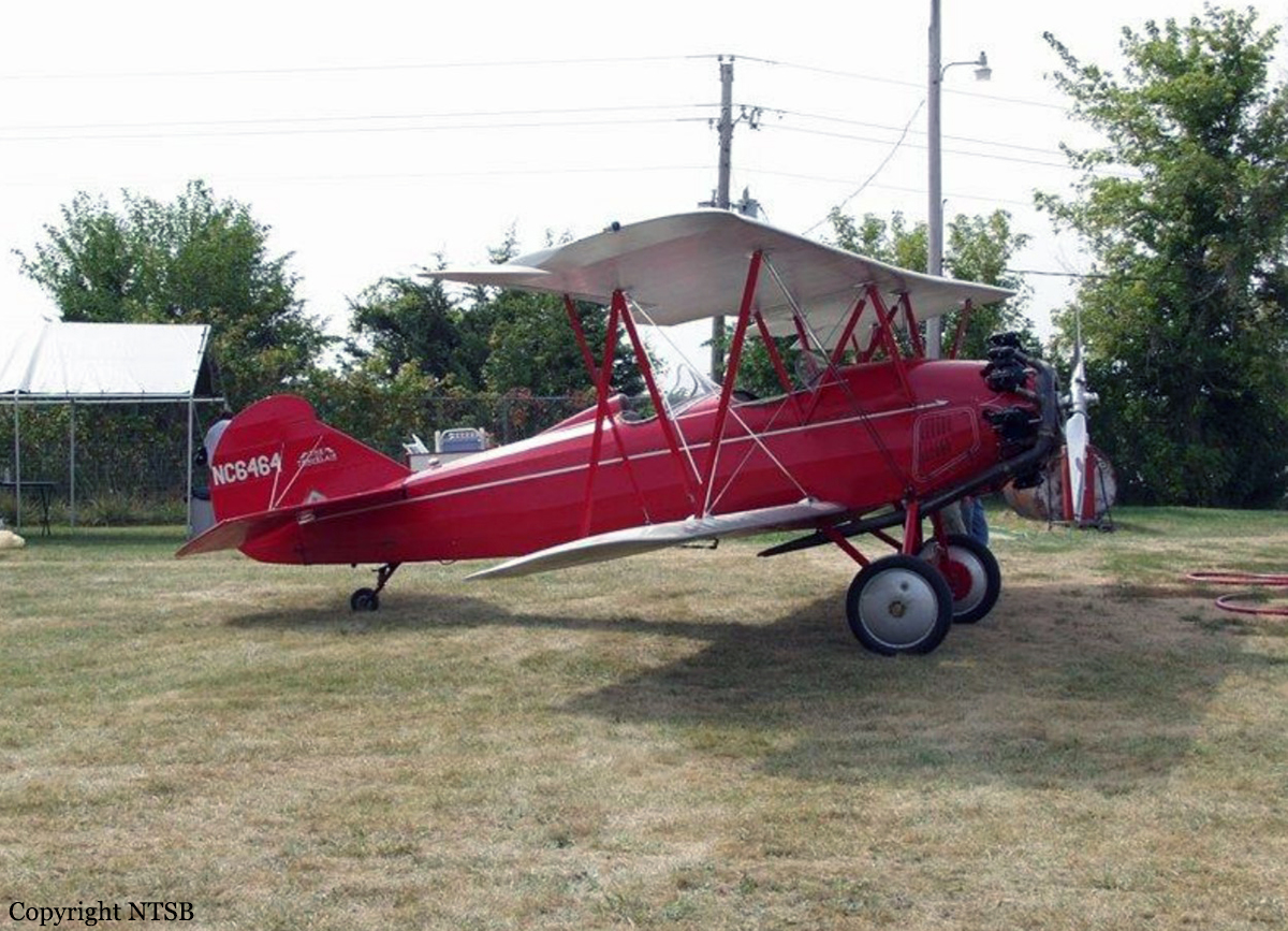
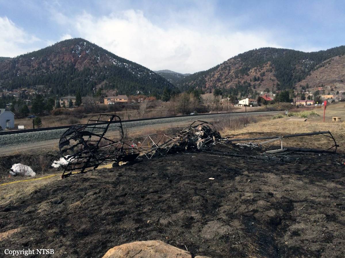
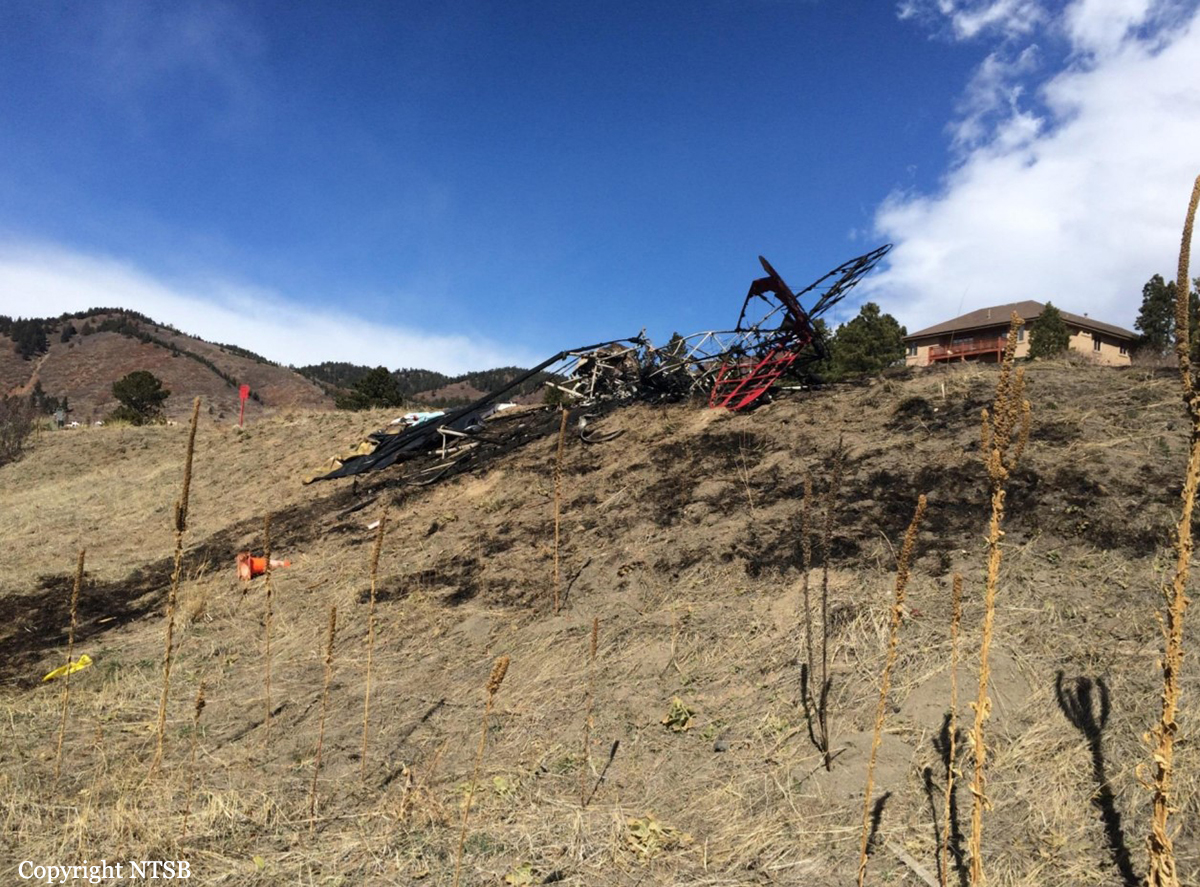
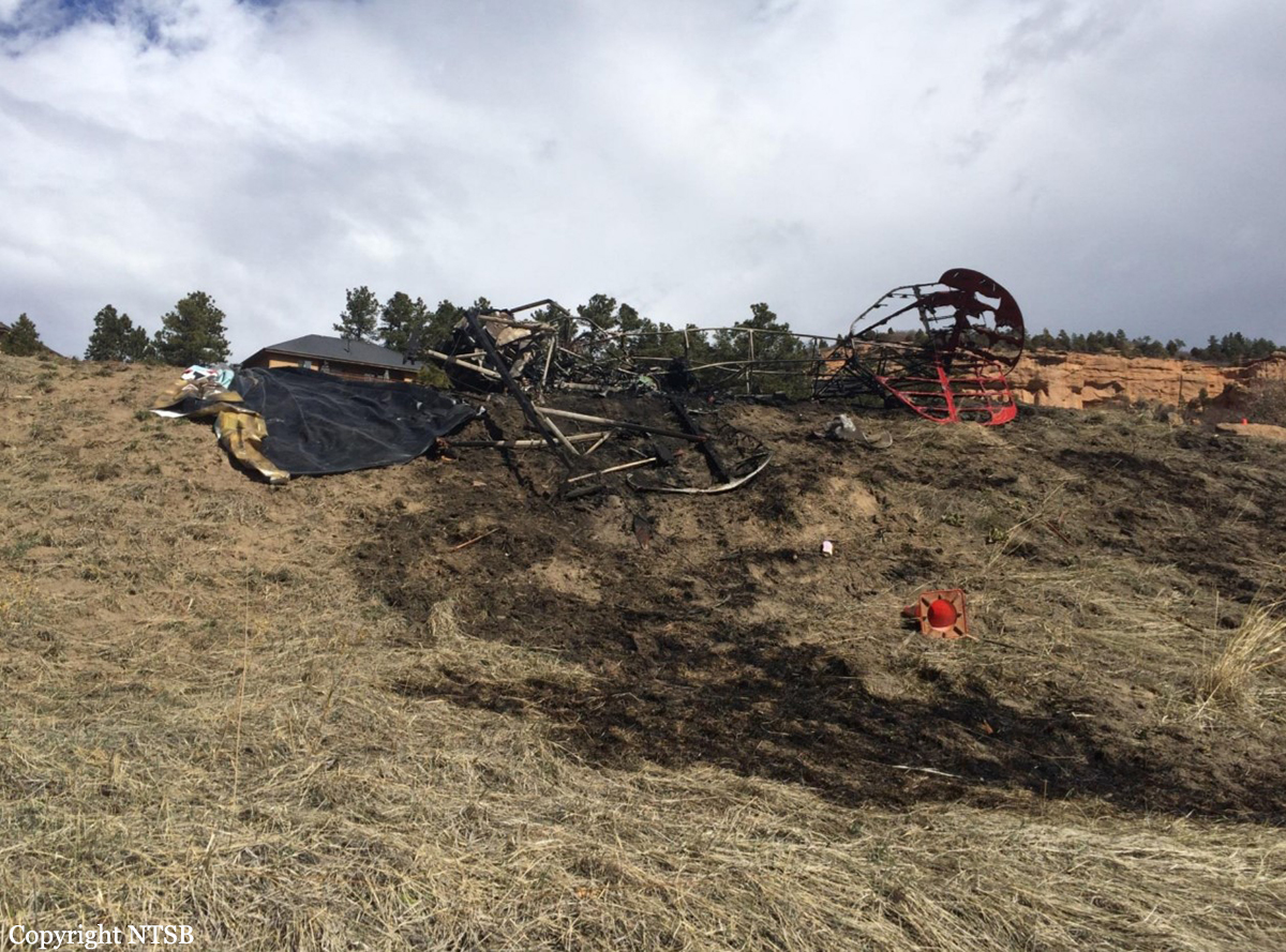
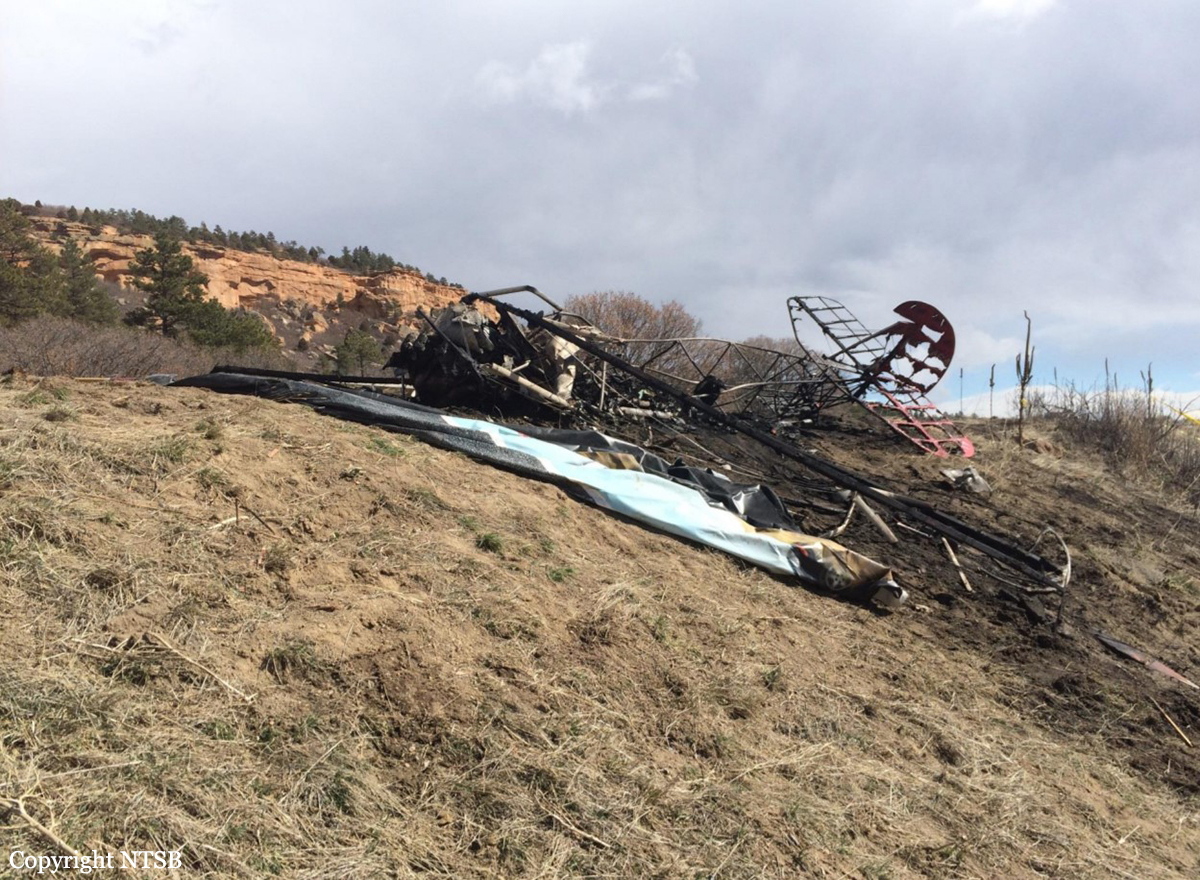
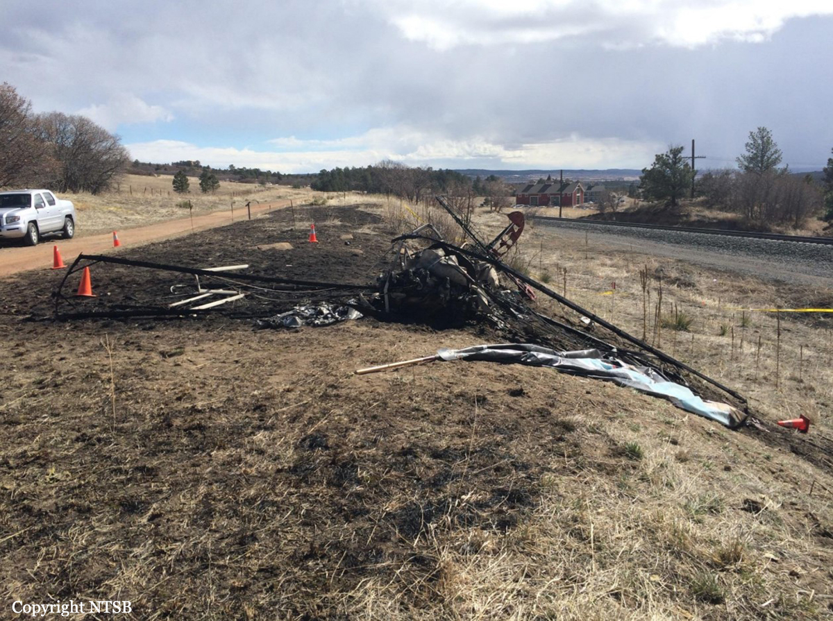
The commercial pilot and the pilot-rated passenger were flying the biplane to a fly-in gathering in another state. Witnesses saw the airplane flying over a frozen lake at a low altitude and low airspeed. One witness saw the airplane "listing" left and right before it entered a left turn, and he lost sight of it. Other witnesses saw the airplane turn left and nose-dive into the ground. A postimpact fire consumed most of the airplane. Damage to the wreckage indicated that the airplane impacted the ground in a nose down attitude. The examination did not reveal evidence of any preimpact anomalies with the airframe, engine, or the control system of the airplane. A witness reported that, at the time of the accident, the wind was from the south about 30 miles per hour. However, a burnt area extending east from the airplane's impact point indicated the wind was from the west. Additionally, although wind information from nearby weather stations varied in direction and intensity. One station, about 14 miles west-northwest of the accident site reported calm wind., However, another station, located about 11 miles south of the accident site, recorded wind from the west at 11 knots with gusts to 27 knots about the time of the accident and wind from the west at 33 knots with gusts to 48 knots about an hour after the accident. Further, the forecast for the accident area called for wind gusts to 40 knots from the west-northwest. Therefore, it is likely that strong gusty west winds prevailed in the accident area at the time of the accident. Although some witnesses speculated that the pilot may have been attempting to land the airplane on the frozen lake, the airplane was not equipped to land on ice, and the reason the pilot was maneuvering at a low altitude in strong gusty winds could not be determined. Based on the witness observations and the damage to the wreckage, it is likely that the pilot allowed the airspeed to decrease to a point where the critical angle of attack was exceeded, and the airplane entered an aerodynamic stall/spin. Although the pilot was known to have heart disease, it is unlikely that his medical condition contributed to the accident. The witness observations indicate that the pilot was actively flying the airplane before the loss of control. Toxicology testing showed the presence of chlorpheniramine in the pilot's blood at a level that was likely in the therapeutic range. Chlorpheniramine is a sedating antihistamine available in a number of over the counter products, and it carries the warning, "May impair mental and/or physical ability required for the performance of potentially hazardous tasks (e.g., driving, operating heavy machinery)." Because of its sedating effect, chlorpheniramine may slow psychomotor functioning and cause drowsiness. It has also been shown in a driving simulator (after a single dose) to suppress visual-spatial cognition and visual-motor coordinating functions when compared to placebo. Such functions would have been necessary for the pilot to maintain control of the airplane while maneuvering close to the ground in the strong gusty wind conditions. Therefore, it is likely that the pilot's ability to safely operate the plane was impaired by the effects of chlorpheniramine.
Probable cause:
The pilot's failure to maintain sufficient airspeed while maneuvering at low altitude in strong gusting winds, which resulted in exceedance of the airplane's critical angle of attack and an aerodynamic stall/spin. Contributing to the accident was the pilot's impairment due to the effects of a sedating antihistamine.
Final Report:

Crash of a Pacific Aerospace 750XL in Chilkhaya: 2 killed

Date & Time: Feb 26, 2016 at 1305 LT
Operator:
Registration:
9N-AJB
Flight Phase:
Survivors:
Yes
Schedule:
Nepalgunj - Jumla
MSN:
160
YOM:
2009
Country:
Region:
Crew on board:
2
Crew fatalities:
Pax on board:
9
Pax fatalities:
Other fatalities:
Total fatalities:
2
Circumstances:
The single aircraft departed Nepalgunj at 1230LT bound for Jumla. About 35 minutes into the flight, the crew encountered an unexpected situation and attempted an emergency landing in a field. The aircraft eventually collided with an earth bank and came to rest near the village of Chilkhaya. Both pilots were killed and all 9 passengers were injured. The aircraft destroyed.

Crash of a Casa CN-235M near Kuala Selangor

Date & Time: Feb 26, 2016 at 0840 LT
Operator:
Registration:
M44-07
Flight Phase:
Flight Type:
Survivors:
Yes
Schedule:
Subang - Subang
MSN:
N055
YOM:
2005
Flight number:
Sintar Sakti 02
Country:
Region:
Crew on board:
8
Crew fatalities:
Pax on board:
0
Pax fatalities:
Other fatalities:
Total fatalities:
0
Circumstances:
The crew departed Kuala Lumpur-Subang-Sultan Abdul Aziz Shah Airport at 0835LT on a local training flight. Ten minutes later, the left engine caught fire and failed, forcing the captain to attempt an emergency landing. The aircraft crash landed in the sea, few metres off the beaches of Taman Malawati Utama, south of Kuala Selangor. The copilot was injured (broken arm) while seven other occupants escaped unhurt. The aircraft was destroyed by a post crash fire.

Crash of a Viking Air DHC-6 Twin Otter 400 near Dana: 23 killed

Date & Time: Feb 24, 2016 at 0819 LT
Operator:
Registration:
9N-AHH
Flight Phase:
Survivors:
No
Site:
Schedule:
Pokhara – Jomsom
MSN:
926
YOM:
2015
Flight number:
TA193
Country:
Region:
Crew on board:
3
Crew fatalities:
Pax on board:
20
Pax fatalities:
Other fatalities:
Total fatalities:
23
Captain / Total flying hours:
20108
Captain / Total hours on type:
18500.00
Copilot / Total flying hours:
760
Copilot / Total hours on type:
560
Aircraft flight hours:
270
Aircraft flight cycles:
482
Circumstances:
As per the flight plan submitted on 23rd February 2016, the aircraft was scheduled for VFR flight to Jomsom (VNJS) on 24th February with estimated off-block time of 01:00, intended cruising speed of 150 knots, intended level of 10,500 ft and via direct track. The first and second alternate aerodromes were Bhairahawa (VNBW) and Pokhara (VNPK) respectively and estimated elapsed time was 20 minutes with the fuel endurance of 2 hours and 30 minute. Based on the information from the CVR, FDR and ATC records, the following description of the history of the flight was reconstructed: At 01:55, the first-officer contacted Pokhara tower requesting Jomsom and Bhairahawa weather. Upon receiving Jomsom weather which was 8 km visibility towards Lete (arrival track) and foothill partially visible; at 01:56 F/O requested start-up for Jomsom. First-officer then briefed the weather to the captain, in response to this the captain responded by saying 'Let‘s have a look, if not possible we will return' (Translated from Nepali conversation). While performing the 'before start checklist', they received weather of Bhairahawa as closed. After completing the checklist and start-up the first-officer at 02:00 requested taxi clearance. The ATC informed runway change to 22 instead of runway 04 and gave taxi clearance. At 02:03 while taxiing the captain considering bad weather condition expressed his concern over the runway change with F/O but failed to express it to the ATC. As briefed by captain earlier, the control was transferred to F/O and at 02:04 F/O made a normal take-off. At 02:08 the captain reported 5 miles at 6,200 ft to ATC. At 02:09, while passing through 7,000 ft the captain informed the actual weather, which was light haze, mountain not visible but had ground contact, to an ultra-light aircraft upon his request. As per the cockpit conversation, the crew were comparing the base of the cloud which was higher than the day before and proposed to continue climb to 12,500 ft if not on-top of the cloud at 10,500 ft. Around 5 miles before Ghorepani passing 10,100 ft, the captain told that cells were still present so advised F/O to continue climb to 12,000 ft and told that they will proceed till TATOPANI and decide to continue or divert. At 02:14 approaching GHOREPANI and passing 11,400 ft, Captain told F/O to maintain level to be in between the cloud layers and briefed F/O that if they had to divert it would be a left turn. At the same time captain asked repeatedly to F/O if his side was raining for which F/O told and confirmed not visual, after which captain told they would see and decide (regarding continuation of flight). At 02:14:50 while over Ghorepani area at 11,500 ft the EGPWS TERRAIN alert and at 02:14:52 PULL UP warning came while they were not visual and at 02:15:01 it was stated that they were visual and by 02:14:53 the warning stopped. At 02:15 while maintaining 11,500 ft the captain reported ATC that they are at Ghorepani at level 10,500 ft after which frequency changeover to Jomsom tower was given. At 02:15:27 the captain instructed F/O to maintain heading of 3300 and flight level just below the cloud, after which a shallow descent was initiated. At this time captain asked F/O if his side was visual, in response F/O replied somewhat visual. The Captain then instructed F/O to descent to 10,000 ft. Once the descent was started at 02:15:55 passing 11,000 ft an OVERSPEED warning sounded in the cockpit for 2 seconds as the speed reached 152 knots. At 02:16 while passing 10,700 ft captain advised F/O to make a left turn so that it would be easy to turn if required as he was able to see his side. Then F/O asked if left side was visual for which the captain informed that not that side (towards the track) but somewhat visual to the left of him and told that the TRACK TO GO was TO THE LEFT whereas they were actually left of the track and had descended to 10,300 ft. At 02:17:58 EGPWS TERRAIN alert sounded when the aircraft was at 10,200 ft and descending on heading of 3210 with right bank angle of around 30 . At 02:18:06 when the aircraft had descended to 10,100 ft the PULL UP WARNING sounded for which the captain said not to worry and at 02:18:12; when the aircraft was at 10,000 ft the captain took-over the control, continued descent and asked F/O if his side was visual. The F/O informed that right side was not visual at all by which the aircraft had continued shallow descent on heading 3250 with right bank angle reaching up to 130 at 2:18:19 and by 02:18:23 the aircraft once again returned back to 0° bank angle. At 02:18:23 the captain started left bank followed by right bank again while still on a shallow descent until 02:18:27.Upon reaching 9,850 ft (lowest altitude) the aircraft started very shallow climb. At 02:18:35 when aircraft was 9,920 ft the captain told F/O that they reached Landslide (a checkpoint which is on track to Jomsom on the right side of the Kali-Gandaki River). At 02:18:44 when aircraft reached 10,150 ft captain told ―what I will do is now I will turn to heading of LETTE‖ (another way point on route to Jomsom); while the PULL-UP warning was continuously sounding. At 02:18:49 when the aircraft was at 10,300 ft right bank angle increased up to 16° with pitch up attitude of 7°. At 02:18:52 the captain told that he would start climb when the aircraft had reached 10,350 ft; pitch attitude of 10° and still on right bank. The aircraft reached zero degree bank at 02:18:53 and started shallow left bank with pitch attitude of 12° nose up. By 02:18:57 the bank angle reached 200 left with pitch attitude of 11.8 and altitude of 10,550 ft and captain was still questioning F/O about the visibility towards his side but F/O informed his side not visible completely. The last data recorded in FDR was at 02:19:03 when the altitude had reached around 10,700 ft; pitch attitude of 7° nose up and left bank angle of 25° heading of 335° with EGPWS PULL-UP warning ON.
Probable cause:
The Commission concludes that the probable cause of this accident was the fact that despite of unfavourable weather conditions, the crew‘s repeated decision to enter into cloud during VFR flight and their deviation from the normal track due to loss of situational awareness aggravated by spatial disorientation leading to CFIT accident.
The contributing factors for the accident are:
1. Loss of situational awareness,
2. Deteriorating condition of weather,
3. Skill base error of the crew during critical phases of flight,
4. Failure to utilize all available resources (CRM), especially insensitivity to EGPWS cautions/warnings.
Final Report:

Crash of an Embraer EMB-820C Navajo in Santa Isabel

Date & Time: Feb 16, 2016 at 1430 LT
Operator:
Registration:
PT-WZA
Flight Phase:
Survivors:
Yes
Schedule:
Jacarepaguá – Campinas
MSN:
820-020
YOM:
1976
Country:
Crew on board:
1
Crew fatalities:
Pax on board:
2
Pax fatalities:
Other fatalities:
Total fatalities:
0
Circumstances:
En route, the pilot encountered an unexpected situation and attempted an emergency landing. After landing on a road in Santa Isabel, the airplane collided with various obstacles and came to rest. All three occupants evacuated safely and the airplane was damaged beyond repair.

Crash of a PZL-Mielec AN-2R near Gai: 3 killed

Date & Time: Feb 6, 2016 at 1244 LT
Type of aircraft:
Operator:
Registration:
RA-40204
Flight Phase:
Survivors:
No
Schedule:
Sterlitamak – Zilair – Akyar – Orsk – Akyar – Sterlitamak
MSN:
1G219-54
YOM:
1986
Country:
Region:
Crew on board:
2
Crew fatalities:
Pax on board:
1
Pax fatalities:
Other fatalities:
Total fatalities:
3
Captain / Total flying hours:
4332
Captain / Total hours on type:
1204.00
Copilot / Total flying hours:
454
Copilot / Total hours on type:
454
Aircraft flight hours:
6952
Aircraft flight cycles:
20236
Circumstances:
The crew was performing a flight from Sterlitamak to Orsk and return via Zilair and Akyar, taking part to an oil pipeline survey mission on behalf of the oil company Transneft. While flying at low height in marginal weather conditions, the crew initiated a turn when the single engine impacted the ground and crashed in a snowy field located 2 km southwest of Gai, about 25 km north of Orsk. The aircraft was destroyed by impact forces and all three occupants were killed. There was no fire. At the time of the accident, the visibility was reduced to 800 metres and down to 300 metres locally. The cloud base was at 90 metres with freezing fog.
Probable cause:
Most probably the fatal accident with An-2 RA-40204 aircraft was caused by spatial disorientation by the crew turning in visibility restriction conditions (fog) and "whiteout" of snow underlying surface that resulted in uncontrolled descending and aircraft ground impact.
Most probably the following factors contributed to the accident:
- Incorrect evaluation of weather conditions by the crew resulted in unreasonable decision to perform VFR flight,
- Flight operation at the unauthorized law height above ground,
- Lack of IFR operation skills, training and checks for minima reduction by PIC were formal, weather conditions during operations didn't comply with assigned minima requirements.
Final Report:

Crash of a Piper PA-46-350P Malibu Mirage in Ottawa

Date & Time: Jan 19, 2016 at 1250 LT
Registration:
N113WB
Flight Phase:
Flight Type:
Survivors:
Yes
Schedule:
Olathe - Olathe
MSN:
46-22193
YOM:
1995
Location:
Crew on board:
2
Crew fatalities:
Pax on board:
0
Pax fatalities:
Other fatalities:
Total fatalities:
0
Captain / Total flying hours:
2985
Captain / Total hours on type:
290.00
Copilot / Total flying hours:
2500
Copilot / Total hours on type:
800
Aircraft flight hours:
3100
Circumstances:
According to the flight instructor, he and the pilot rated student receiving instruction were operating under instrument flight rules in instrument meteorological conditions. He reported that throughout the flight the airplane accumulated light rime ice. He recalled that after holding at a Very High Frequency Omni-Directional Range (VOR), they completed a VOR approach, executed the missed approach procedure, set the power to climb at the airspeed of 130 knots indicated airspeed and began to climb to 5000 feet. He reported that as they climbed they encountered freezing rain, the airspeed began to deteriorate and the degree of ice accumulation increased from light to moderate. He reported that all of the airplane's de-ice systems were functioning yet he was not able to maintain altitude. He determined that landing at the destination airport was not an option and executed a forced landing in an open field. He affirmed that during the landing the airplane bounced several times before coming to a stop. The airplane sustained substantial damage to the firewall, forward pressure bulkhead and puncture holes in the airplane skin. The pilot reported that there were no mechanical failures or anomalies prior to or during the flight that would have prevented normal flight operation.
Probable cause:
The flight crews encounter with un-forecasted freezing rain resulting in an uncontrolled descent, forced landing, and substantial damage to the airplane's firewall, and forward pressure bulkhead.
Final Report: