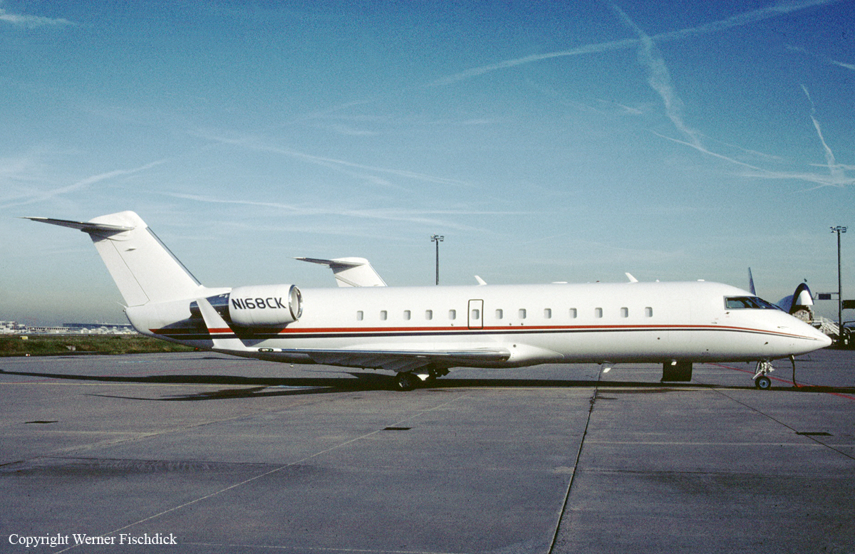
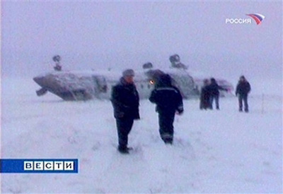
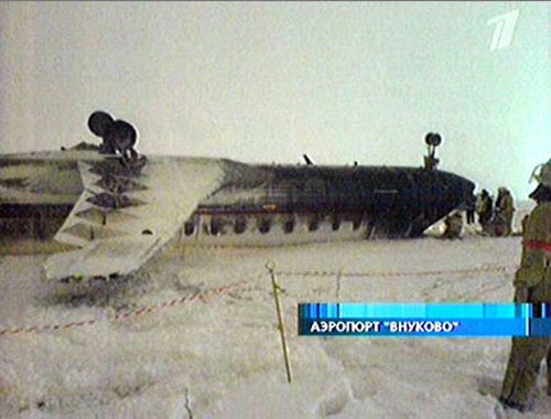
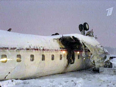
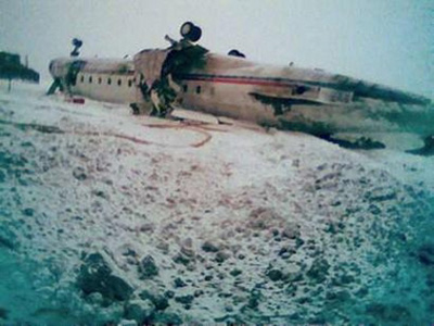
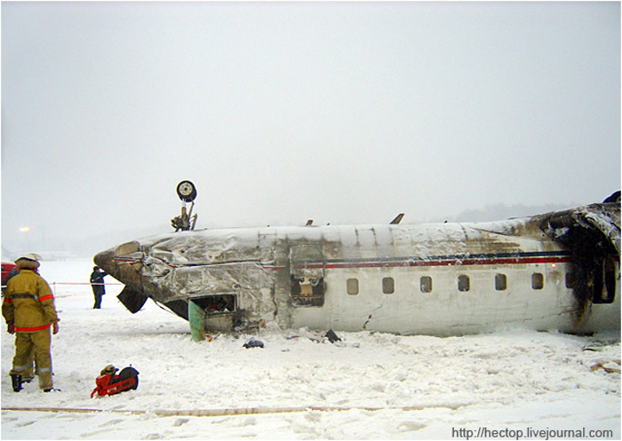
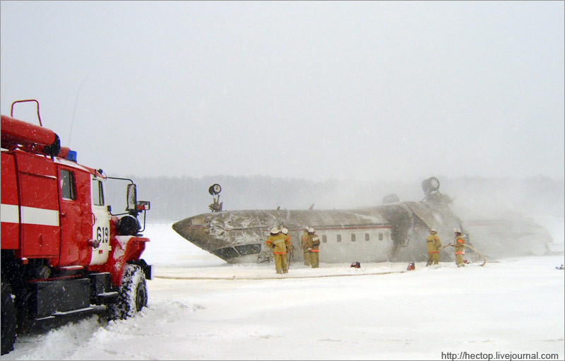
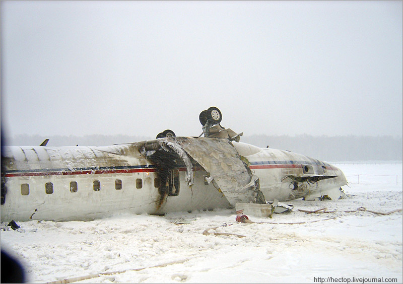
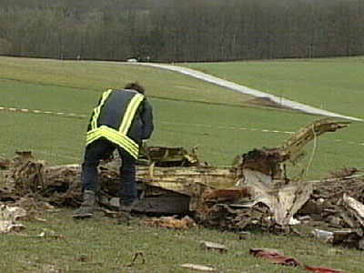
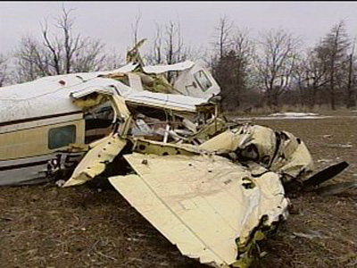
Crash of a Cessna 340A in Council Bluffs: 4 killed

Date & Time: Feb 16, 2007 at 2104 LT
Type of aircraft:
Operator:
Registration:
N111SC
Survivors:
No
Schedule:
Fayetteville – Council Bluffs
MSN:
340A-0335
YOM:
1977
Crew on board:
1
Crew fatalities:
Pax on board:
3
Pax fatalities:
Other fatalities:
Total fatalities:
4
Captain / Total flying hours:
3275
Aircraft flight hours:
6417
Circumstances:
The flight was on a VHF Omni Range (VOR) instrument approach to the destination airport at the time of the accident. Radar track data indicated that the airplane passed the VOR at 2,800 feet. After passing the VOR, it turned right, becoming established on an approximate 017- degree magnetic course. The published final approach course was 341 degrees. The airplane subsequently entered a left turn, followed immediately by a right turn, until the final radar data point. Altitude returns indicated that the pilot initiated a descent from 2,800 feet upon passing the VOR. The airplane descended through 2,000 feet during the initial right turn, and reached a minimum altitude of 1,400 feet. The altitude associated with the final data point was 1,600 feet. The initial impact point was about 0.18 nautical miles from the final radar data point, at an approximate elevation of 1,235 feet. The minimum descent altitude for the approach procedure was 1,720 feet. Review of weather data indicated the potential for moderate turbulence and low-level wind shear in the vicinity of the accident site. In addition, icing potential data indicated that the pilot likely encountered severe icing conditions during descent and approach. The pilot obtained a preflight weather briefing, during which the briefer advised the pilot of current Airman's Meteorological Information advisories for moderate icing and moderate turbulence along the route of flight. The briefer also provided several pilot reports for icing and turbulence. A postaccident inspection of the airframe and engines did not reveal any anomalies associated with a preimpact failure or malfunction.
Probable cause:
The pilot's continued flight into adverse weather, and his failure to maintain altitude during the instrument approach. Contributing factors were the presence of severe icing, moderate turbulence, and low-level wind shear.
Final Report:

Crash of a Cessna 208B Grand Caravan in Walikale: 1 killed

Date & Time: Feb 15, 2007
Type of aircraft:
Operator:
Registration:
5Y-BNN
Flight Type:
Survivors:
No
Schedule:
Goma – Walikale
MSN:
208B-0683
YOM:
1998
Region:
Crew on board:
1
Crew fatalities:
Pax on board:
0
Pax fatalities:
Other fatalities:
Total fatalities:
1
Circumstances:
The pilot was completing a cargo flight from Goma with a load of food on board. While approaching Walikale, weather conditions deteriorated. The pilot attempted three times to land but eventually initiated a go-around when the disappeared few minutes later. SAR operations were suspended after few days as no trace of the aircraft nor the pilot was found.

Crash of a Canadair RegionalJet CRJ-100SE in Moscow

Date & Time: Feb 13, 2007 at 1637 LT
Operator:
Registration:
N168CK
Flight Phase:
Flight Type:
Survivors:
Yes
Schedule:
Moscow - Berlin
MSN:
7099
YOM:
1996
Country:
Region:
Crew on board:
3
Crew fatalities:
Pax on board:
0
Pax fatalities:
Other fatalities:
Total fatalities:
0
Captain / Total flying hours:
9100
Copilot / Total flying hours:
2679
Copilot / Total hours on type:
68
Aircraft flight hours:
3814
Aircraft flight cycles:
1765
Circumstances:
The crew was completing a positioning flight from Moscow to Berlin for maintenance purposes. After the crew was cleared to start up the engines, the aircraft was towed to the deicing pad where the crew requested a two-step deicing procedure. The deicing was completed at 1618LT and the crew was cleared for takeoff at 1636LT. After a course of 1,500 metres on runway 06 in snow falls, the pilot-in-command started the rotation when the aircraft rolled left and right. The right wing struck the ground, the aircraft went out of control, got inverted and crashed in a snow covered area located 450 metres further and 35 metres to the right of the runway. All three crew members escaped with minor injuries while the aircraft was destroyed. At the time of the accident, weather conditions were as follow: wind from 130 at 10 knots, horizontal visibility 1,000 metres in snow falls, vertical visibility 300 feet, OAT -6° and dewpoint at -7°.
Probable cause:
Loss of control at liftoff due to a loss of lift caused by a stall consecutive to an excessive accumulation of ice/frost on the critical surfaces despite the aircraft had been deiced/anti-iced prior to takeoff. The following findings were identified:
- The aircraft was deiced in a two-step procedure - deicing with Type I then anti-icing with Type IV. The treatment was completed at 1618LT, 19 minutes prior to the accident,
- At the time of the accident, there were moderate to strong snow falls at the airport,
- The crew did not receive the full meteorological bulletin prior to departure and failed to determine the correct holdover time,
- Referring to the actual weather conditions, the crew failed to proceed with a second deicing/anti-icing procedure,
- Lack of adequate check by crew members and/or the airline representatives regarding the quality of the anti-icing treatment,
- The crew failed to comply with AFM relating to the actual weather conditions,
- The takeoff was started at a speed that was 12 knots below the reference speed, increasing the stall condition with leading edges that were slightly contaminated with frost/ice.
Final Report:

Crash of a Lockheed C-130J-30 Hercules in Amarah

Date & Time: Feb 12, 2007 at 2010 LT
Type of aircraft:
Operator:
Registration:
ZH876
Flight Type:
Survivors:
Yes
MSN:
5460
YOM:
1999
Country:
Region:
Crew on board:
6
Crew fatalities:
Pax on board:
58
Pax fatalities:
Other fatalities:
Total fatalities:
0
Circumstances:
The crew of ZH876 were tasked to fly a routine roulement of troops to a Tactical Landing Zone (TLZ) in Maysān province, Iraq. Weather at the TLZ was good, with a visibility of 25 km, no significant cloud and a light surface wind. The flight to the TLZ was routine and at approx 17:00 UTC the Hercules began to make its approach to the TLZ. Comms had already been established between ZH876 and the Tactical Air Traffic Controller (Tac ATC) at the TLZ, and the aircraft was subsequently cleared to land. An uneventful approach followed flown by the copilot. At 17:10:15 UTC, as the aircraft was about to touchdown at the TLZ, the crew experienced a load bang and a bright flash. The flash temporarily blinded the flight-deck crew. Virtually simultaneously, the aircraft touched down. The first flash was followed, a second later, by another flash and louder bang. The aircraft slewed off the left-hand side of the runway. The captain took over control of the aircraft. On regaining vision, the captain tried to steer the aircraft back onto the runway. However, the crew became aware of a fire on the port side, which was confirmed as a wing fire. The captain brought the aircraft to an immediate halt. The aircraft came to rest 50 m from the runway edge, some 700 m after touchdown. The aircraft sustained substantial damage and it was decided to blow up the plane because the damage was too difficult to repair and there was also a potential risk that anti-Iraqi forces might obtain information on specialist equipment.
Probable cause:
The evidence recovered from the incident site revealed that two IED [improvised explosive device] arrays had exploded in the near vicinity of ZH876's touchdown point at the TLZ. The Board quickly ruled out aircraft systems failure and other possible causes. The Board concluded that this deliberate enemy action was the sole cause of the damage sustained to ZH876 in this incident. The Board further concluded that there was a lack of understanding, by the Force Protection personnel, of TLZ sweep procedures and they had not received the appropriate training. This meant that the sweep procedures applied at the TLZ were inadequate to discover the IED arrays.

Crash of a Piper PA-31T Cheyenne II in Zweibrücken: 1 killed

Date & Time: Feb 12, 2007 at 1020 LT
Type of aircraft:
Operator:
Registration:
N160TR
Flight Phase:
Flight Type:
Survivors:
No
Schedule:
Zweibrücken – Split – Athens
MSN:
31-7920036
YOM:
1979
Country:
Region:
Crew on board:
1
Crew fatalities:
Pax on board:
0
Pax fatalities:
Other fatalities:
Total fatalities:
1
Circumstances:
The pilot departed Zweibrücken Airport on a flight to Athens with an intermediate stop in Split as the aircraft should be delivered to its new owner based in Greece. After takeoff from runway 21 at Zweibrücken Airport, while in initial climb, the aircraft deviated to the left while the standard departure route was a straight climb until 7 nm. The pilot was contacted by ATC and reported problems. Shortly later, the altitude of the aircraft fluctuated from 1,500 to 3,200 feet and again, the pilot was contacted by ATC to check the situation. Few seconds later, the aircraft entered an uncontrolled descent and crashed in an open field located in Rieschweiler, about 6 km northeast of the airport. The aircraft was totally destroyed upon impact and the pilot, sole on board, was killed. It was reported that, prior to departure, the pilot encountered difficulties to close the main cabin door and had to be shown how to operate it. A member of the FBO staff then asked the pilot if he should explain the aircraft's avionics and, after the pilot replied yes, went on to describe how to operate the RNAV system. The pilot then had difficulty in starting the right engine and was directed to the 'ignition switch' on the overhead panel.

Crash of a Cessna 414 Chancellor in Rocksprings: 2 killed

Date & Time: Feb 9, 2007 at 1715 LT
Type of aircraft:
Operator:
Registration:
N69845
Survivors:
No
Schedule:
Houston – Rocksprings
MSN:
414-0637
YOM:
1975
Crew on board:
1
Crew fatalities:
Pax on board:
1
Pax fatalities:
Other fatalities:
Total fatalities:
2
Captain / Total flying hours:
2212
Aircraft flight hours:
5466
Circumstances:
The 2,212-hour instrument rated commercial pilot collided with terrain while circling to land after completing an instrument approach to an uncontrolled non-towered airport. The airport had two instrument approaches to Runway 14; a VOR and a RNAV(GPS). The published minimums for a circling approach to Runway 32 are a 500 foot ceiling and one mile visibility (VOR14) and a 700 foot ceiling and one mile visibility for RNAV(GPS) to Runway 14. The weather at the airport at the time of the accident was reported as 300 overcast, visibility of 3/4 of a mile in mist, with winds from 020 degrees at 10 knots gusting to 14 knots. Two witnesses reported that the airplane circled over the airport and then descended straight to the ground. Radar data revealed that after the airplane made the instrument approach to Runway 14, at approximately 2,800 feet mean sea level (msl), the airplane initiated a circling turn to the left and a slight descent. The last radar hit showed the airplane at 2,600 feet at a groundspeed of 186 knots. A post impact fire consumed some of the airframe. The pilot's logbooks were not located during the course of the investigation and his instrument experience and currency could not be determined. The pilot was reported to be very familiar with the airport and the 2 instrument approaches. A detailed examination of the wreckage of the airplane failed to reveal any anomalies with the airframe, structure, or systems. Flight control continuity was established at the accident site. The engines were examined, and no mechanical anomalies were found. The propellers were shipped to the manufacturer's facility for examination and teardown. Both propellers were rotating at the time of ground impact. Neither of the two propellers was found in the feathered position. Blade damage was consistent with both propellers operating under power at the time of impact. No mechanical defects were noted with either propeller.
Probable cause:
The pilot's failure to maintain clearance with terrain. Contributing factors were the below approach/landing minimums weather and the drizzle/mist weather conditions.
Final Report:

Crash of a Beechcraft H18 in Great Bend: 1 killed

Date & Time: Feb 9, 2007 at 0850 LT
Type of aircraft:
Registration:
N45GM
Flight Type:
Survivors:
No
Schedule:
Wichita - Great Bend
MSN:
BA-717
YOM:
1965
Crew on board:
1
Crew fatalities:
Pax on board:
0
Pax fatalities:
Other fatalities:
Total fatalities:
1
Captain / Total flying hours:
3250
Captain / Total hours on type:
125.00
Aircraft flight hours:
7702
Circumstances:
Prior to the flight, the pilot obtained a weather briefing which included an AIRMET for IFR conditions and an AIRMET for icing that was "just off to the north." According to air traffic control (ATC) information, the en route portion of the flight was uneventful. ATC cleared the pilot for an ILS approach to runway 35, and the pilot acknowledged the approach clearance. When the airplane reached the outer marker ATC approved the pilot for a frequency change to the common traffic advisory frequency. The pilot acknowledged the frequency change, and no further communications were received from the pilot by ATC. Witnesses observed the airplane approximately 200 feet above ground level (agl) on a northwesterly heading, west of runway 35. The airplane then entered a climbing left turn to the south and disappeared into the overcast cloud layer. Shortly thereafter, the witness observed the airplane in a "20 degree nose down, wings level attitude" on a southeasterly heading. The witness then lost sight of the airplane due to hangars obstructing his view. At the time of the accident, the witness stated that the ceiling was approximately 500 foot overcast with mist. The published missed approach procedure instructed the pilot to initiate a climbing left turn to a fix and hold. Examination of the accident site revealed the airplane impacted the terrain in a right wing, nose-low attitude. No ground impact marks were noted except in the immediate vicinity of the wing leading edges, engines, and propeller assemblies. The flaps and landing gear were in the extended position. The leading edge surfaces of the vertical and horizontal stabilizers revealed 1/4 to 1/2 inches of clear ice. The upper fuselage antenna displayed 1/4 to 1/2 inches of clear ice. Local authorities reported observing a "layer of ice" on the leading edges of both wings when they arrived to the accident site. Examination of the airframe and engines revealed no anomalies that would have precluded normal operations.
Probable cause:
The pilot's failure to maintain aircraft control during the missed approach which resulted in an inadvertent stall and impact with terrain. A contributing factor was the icing conditions.
Final Report:

Crash of a Cessna 208B Grand Caravan in Alliance

Date & Time: Feb 8, 2007 at 0225 LT
Type of aircraft:
Operator:
Registration:
N1116Y
Flight Type:
Survivors:
Yes
Schedule:
Omaha - Alliance
MSN:
208-0368
YOM:
1993
Flight number:
SUB022
Crew on board:
1
Crew fatalities:
Pax on board:
0
Pax fatalities:
Other fatalities:
Total fatalities:
0
Captain / Total flying hours:
3232
Captain / Total hours on type:
226.00
Aircraft flight hours:
7248
Circumstances:
The pilot was dispatched on a nonscheduled cargo flight to an airport other than his usual destination because it had a precision instrument approach, while his usual destination airport did not. The pilot elected to fly to his usual airport, and attempted a non precision instrument approach. The airport had both a VOR and an NDB approach. The NDB approach was noted as being out of service, although there was still a radio signal coming from the navigation aid. The pilot was cleared for the VOR approach, although instrumentation inside the cockpit was found set for the NDB approach, and radar track data disclosed that the flight path was consistent with the NDB approach path, not the VOR's. The airport's reported weather was 1.25 miles visibility, with a 200-foot overcast in mist. The airport's minimum NDB approach altitude is 652 feet above touchdown height. The airplane did not reach the runway, and collided with a pole and a building. Inspection of the airplane disclosed no evidence of any preimpact mechanical malfunctions.
Probable cause:
The pilot's descent below minimum descent altitude while on a non precision approach. A contributing factor was a low ceiling.
Final Report:

Crash of a Douglas DC-8-71F in Miami

Date & Time: Feb 4, 2007 at 2255 LT
Type of aircraft:
Operator:
Registration:
HK-4277
Flight Type:
Survivors:
Yes
Schedule:
Medellín – Miami
MSN:
45976/372
YOM:
1968
Flight number:
TPA724
Crew on board:
3
Crew fatalities:
Pax on board:
0
Pax fatalities:
Other fatalities:
Total fatalities:
0
Circumstances:
Following an uneventful cargo flight from Medellín-José María Córdova (Rionegro) Airport, the crew completed the approach and landing on runway 09R at Miami-Intl Airport. After touchdown, following a course of 100-120 metres, the crew activated the thrust reverser systems when the right main gear collapsed. The aircraft veered to the right and came to rest near the taxiway U. All three crew members evacuated safely while the aircraft was damaged beyond repair.
Probable cause:
Failure of the right main gear after landing due to improper torque of a landing gear lockbolt by the company maintenance personnel during landing gear installation.

Crash of a PZL-Mielec AN-2R in Narsarsuaq

Date & Time: Feb 4, 2007
Type of aircraft:
Operator:
Registration:
LY-AJG
Flight Phase:
Flight Type:
Survivors:
Yes
Schedule:
Vágar - Reykjavik - Kulusuk - Narsarsuaq
MSN:
1G178-48
YOM:
1977
Country:
Region:
Crew on board:
2
Crew fatalities:
Pax on board:
0
Pax fatalities:
Other fatalities:
Total fatalities:
0
Circumstances:
On take off from Narsarsuaq Airport, the single engine aircraft was caught by strong winds, veered off runway and collided with a bank. Both left wings were damaged while the undercarriage were torn off. Both pilots escaped uninjured while the aircraft was damaged beyond repair. A snow storm was approaching Narsarsuaq at the time of the accident.