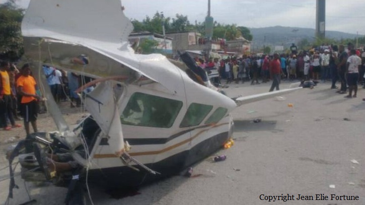
Crash of a Cessna 207 Skywagon in Carrefour: 6 killed

Date & Time: Apr 20, 2022 at 1600 LT
Registration:
HH-FAH
Flight Phase:
Flight Type:
Survivors:
No
Site:
Schedule:
Port-au-Prince – Jacmel
MSN:
207-0352
YOM:
1976
Location:
Country:
Crew on board:
1
Crew fatalities:
Pax on board:
4
Pax fatalities:
Other fatalities:
Total fatalities:
6
Circumstances:
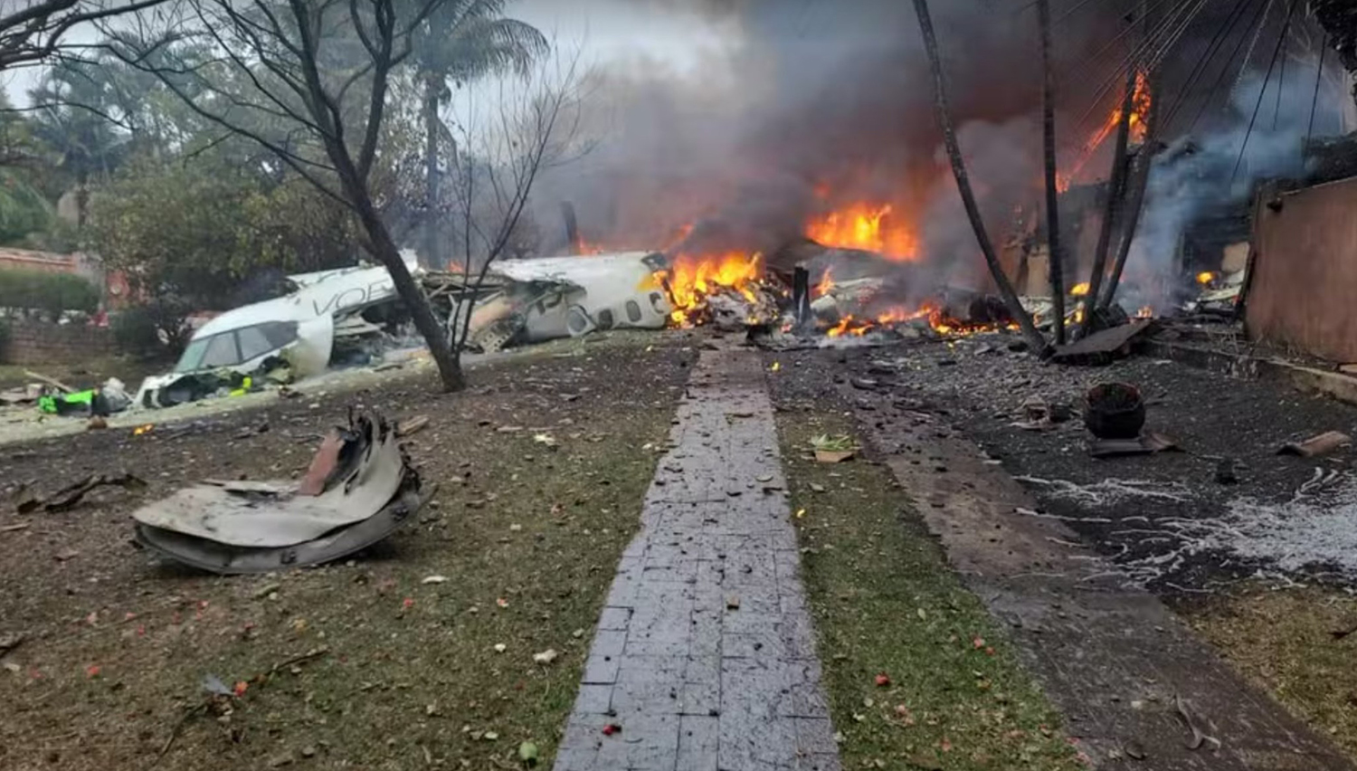
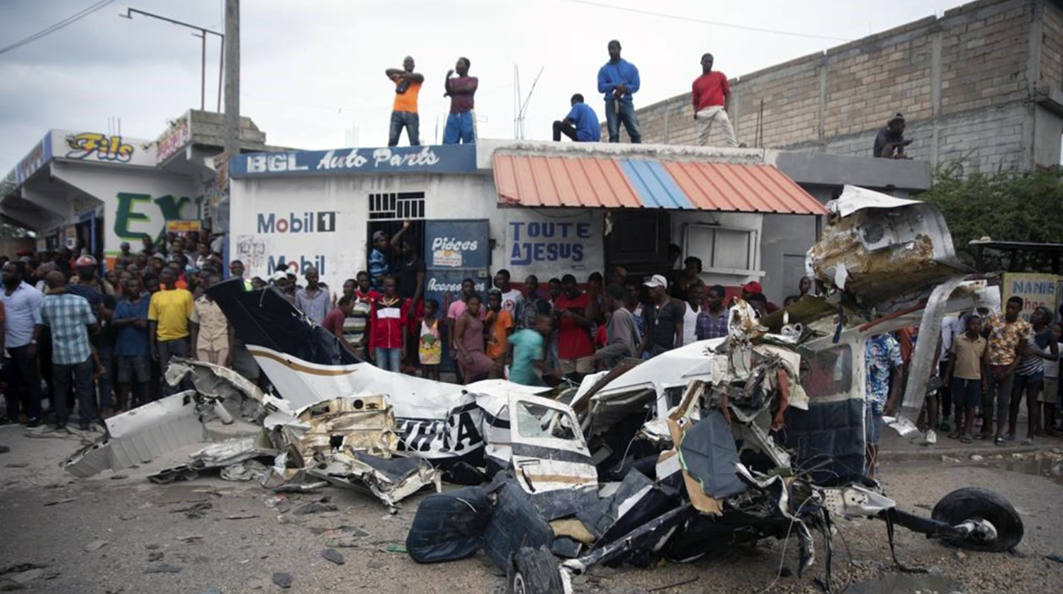
The single engine airplane departed Port-au-Prince-Toussaint Louverture Airport on a private flight to Jacmel, some 45 km southwest of the capital city. On board were four passengers and one pilot. During climbout, the pilot encountered problems and the airplane lost height until it collided with a truck and crashed on a road located in Carrefour, some 12 km southwest of Port-au-Prince Airport. A passenger was seriously injured while four other occupants as well as the truck driver were killed. The aircraft was destroyed. The only survivor died from his injuries few hours later.

Crash of a Cessna 208B Grand Caravan in Heyburn: 1 killed

Date & Time: Apr 13, 2022 at 0832 LT
Type of aircraft:
Operator:
Registration:
N928JP
Flight Type:
Survivors:
No
Site:
Schedule:
Salt Lake City – Burley
MSN:
208B-2428
YOM:
2013
Location:
Crew on board:
1
Crew fatalities:
Pax on board:
0
Pax fatalities:
Other fatalities:
Total fatalities:
1
Captain / Total flying hours:
1380
Captain / Total hours on type:
193.00
Aircraft flight hours:
5116
Circumstances:
The pilot flew two RNAV (GPS) runway 20 instrument approaches at the Burley Municipal Airport, Burley, Idaho in instrument meteorological conditions (IMC). The accident occurred during the second approach. For the first instrument approach, the pilot configured the airplane with flaps up and flew the final approach segment at speeds above the operator’s training standard of 120 knots indicated airspeed (KIAS).The pilot flew a low pass over the runway, most likely to assess the landing conditions in accordance with company policy, determined the conditions were acceptable, initiated the missed approach and requested to return flying the same approach. The pilot elected to not use flaps during the second approach but slowed the approach speed during the final approach leg. Reported weather had improved and visibility had increased to about 2.5 miles. During this approach, the airplane intercepted and remained on the glide path to the stepdown fix. The last automatic dependent surveillance - broadcast (ADS-B) equipment plot recorded the airplane about a mile past this fix, or about 0.6 nautical miles (nm) from the displaced threshold, on the glide path, and at an estimated 85 knots calibrated airspeed (KCAS), which was slower than the airplane’s 95-knot minimum speed for flaps up in icing conditions. Shortly afterward, the airplane descended about 130 ft below the glide path, striking an agglomerate stack atop a potato processing plant, fatally injuring the pilot and substantially damaging the airplane. A witness reported seeing the airplane come out of the clouds and immediately enter a steam cloud coming from six other stacks before striking the accident stack. A security camera at the processing plant captured the last moments of the airplane’s flight as it came into view in a wings-level, flaps-up, nose-high descent and just before it impacted the stack. While snow and visible moisture were present, the agglomerate stack was always in clear view during the Page 2 of 24 WPR22FA151 video, with only partial sections obscured. The witness’s account of hearing the engine noise increase and then the nose lift-up may have been the pilot’s attempt to avoid the obstacle. The Federal Aviation Administration’s (FAA) Aeronautical Information Manual advises pilots to avoid overflight of exhaust stacks; however, the accident stack was directly underneath the instrument approach course and overflight would be expected. Postaccident examination of the airplane, conducted hours after the accident, revealed no structural icing on the wings and empennage. Examination of the airframe and powerplant revealed no mechanical malfunctions or failures that would have precluded normal operation. The flaps were up, and a review of the manifest revealed the airplane was loaded within the specifications of the manifest and within the center of gravity limits. Between 2016 and 2017, the FAA conducted two aeronautical studies regarding the stack structures. In the first study, the FAA determined that many of the stack structures were a hazard to air navigation that required mitigation by the processing plant. As an interim measure, the FAA placed the runway 20 visual approach slope indicator (VASI) out of service because the stacks penetrated the obstruction clearance surface and were deemed hazardous to aviation. After determining that they needed to increase the height of the stacks, the plant then modified their proposal; the proposed height increase necessitated a second study. The second study determined the agglomerate stack and the row-of-six stacks exceeded the Code of Federal Regulations (CFR) section 77 standards and provided mitigating actions that included painting the stacks with high visibility white and aviation orange paint and equipping the stacks with red flashing warning lights. The control measures also included the permanent removal of the VASI. On the day of the accident, the agglomerate stack and row-of-six stacks had not been painted to the standard required by the FAA. The warning lights had been installed, and five of the row-of-six stacks were equipped with flashing red lights. The agglomerate stack warning light was stolen following the accident, so an accurate determination of its operating status could not be made. The existing paint scheme and the visible moisture emitted by the stacks provided a low contrast to the environmental background. This low contrast and the lack of a visual glide slope indicator may have caused difficulty for the pilot in maintaining a safe altitude during the visual portion of the approach to the runway. A white and aviation orange paint scheme, as identified in the regulations, may have offered a higher contrast and thus an adequate warning once the pilot transitioned to visual conditions.
Probable cause:
The pilot’s failure to maintain altitude during an instrument approach, which resulted in a descent below the approach path and impact with a vent stack. Also causal was the failure of the processing plant to correctly paint the vent stacks, which had been determined by the FAA to be a hazard to navigation due to their proximity to the landing approach path. Contributing to the accident was the likely distraction/illusion/obscuration created by steam from the processing plant, which intermittently obscured the runway.
Final Report:

Crash of a Beechcraft C90A King Air in Cuernavaca: 3 killed

Date & Time: Mar 28, 2022
Type of aircraft:
Operator:
Registration:
N426EM
Flight Type:
Survivors:
Yes
Site:
Schedule:
Acapulco – Cuernavaca
MSN:
LJ-1352
YOM:
1993
Country:
Crew on board:
1
Crew fatalities:
Pax on board:
6
Pax fatalities:
Other fatalities:
Total fatalities:
3
Circumstances:
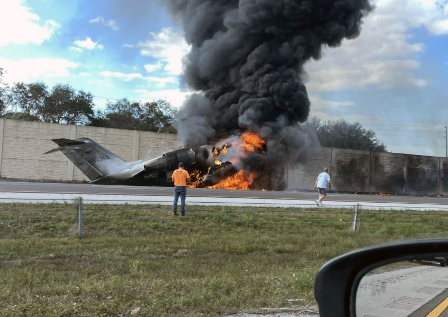
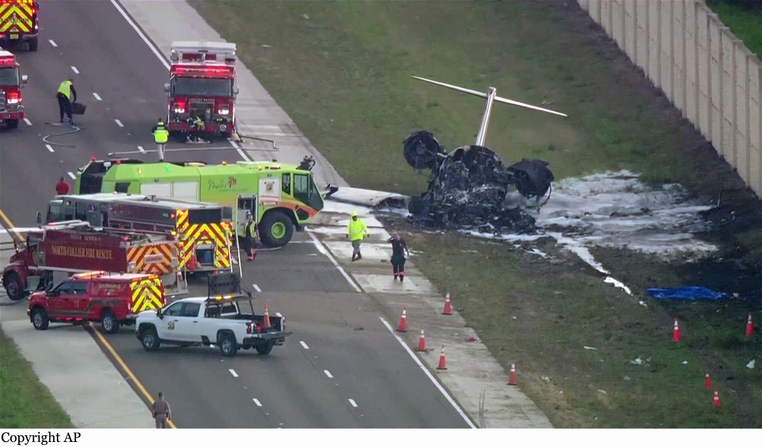
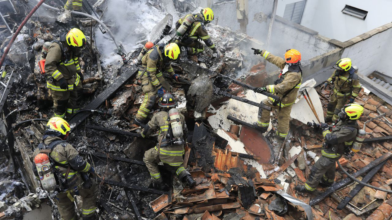
The twin engine airplane departed Acapulco-General Juan N. Álvarez Airport on a private flight to Cuernavaca, carrying six passengers and one pilot. On final approach to Cuernavaca Airport runway 20, the airplane crashed on a supermarket located in Temixco, some 2 km short of runway. The pilot and two passengers were killed while four other occupants were injured.

Crash of a Learjet 35A in Santee: 4 killed

Date & Time: Dec 27, 2021 at 1914 LT
Type of aircraft:
Operator:
Registration:
N880Z
Flight Type:
Survivors:
No
Site:
Schedule:
Santa Ana - Santee
MSN:
35A-591
YOM:
1985
Crew on board:
2
Crew fatalities:
Pax on board:
2
Pax fatalities:
Other fatalities:
Total fatalities:
4
Captain / Total flying hours:
2200
Copilot / Total flying hours:
1244
Aircraft flight hours:
13582
Circumstances:
Earlier on the day of the accident, the flight crew had conducted a patient transfer from a remote airport to another nearby airport. Following the patient transfer, the flight crew departed under night conditions to return to their home base. Review of air traffic control (ATC) communication, as well as cockpit voice recorder (CVR) recordings, showed that the flight crew initially was cleared on the RNAV (GPS) runway 17 instrument approach. The approach plate for the instrument approach stated that circling to runway 27R and 35 was not authorized at night. Following the approach clearance, the flight crew discussed their intent to cancel the approach and circle to land on runway 27R. Additionally, the flight crew discussed with each other if they could see the runway. Once the flight crew established visual contact with the runway, they requested to squawk VFR, then the controller cleared them to land on runway 17. The flight crew then requested to land on runway 27. The controller asked the pilot if they wanted to cancel their instrument flight rules (IFR) flight plan, to which the pilot replied, “yes sir.” The controller acknowledged that the IFR cancellation was received and instructed the pilot to overfly the field and enter left traffic for runway 27R and cleared them to land. Shortly after, the flight crew asked the controller if the runway lights for runway 27R could be increased; however, the controller informed them that the lights were already at 100 percent. Just before the controller’s response, the copilot, who was the pilot flying, then asked the captain “where is the runway.” As the flight crew maneuvered to a downwind leg, the captain told the copilot not to go any lower; the copilot requested that the captain tell him when to turn left. The captain told him to turn left about 10 seconds later. The copilot stated, “I see that little mountain, okay” followed by both the captain and co-pilot saying, “woah woah woah, speed, speed” 3 seconds later. During the following 5 seconds, the captain and copilot both stated, “go around the mountain” followed by the captain saying, “this is dicey” and the co-pilot responding, “yeah it’s very dicey.” Shortly after, the captain told the copilot “here let me take it on this turn” followed by the co-pilot saying, “yes, you fly.” The captain asked the copilot to watch his speed, and the copilot agreed. About 1 second later, the copilot stated, “speed speed speed, more more, more more, faster, faster… .” Soon after, the CVR indicated that the airplane impacted the terrain. Automatic dependent surveillance – broadcast (ADS-B) data showed that at the time the flight crew reported the runway in sight, they were about 360 ft below the instrument approach minimum descent altitude (MDA), and upon crossing the published missed approach point they were 660 ft below the MDA. The data showed that the flight overflew the destination airport at an altitude of about 775 ft mean sea level (msl), or 407 ft above ground level (agl), and entered a left downwind for runway 27R. While on the downwind leg, the airplane descended to an altitude of 700 ft msl, then ascended to an altitude of 950 ft msl while on the base leg. The last recorded ADS-B target was at an altitude of 875 ft msl, or about 295 ft agl.
Probable cause:
The flight crew’s decision to descend below the published MDA, cancel their IFR clearance to conduct an unauthorized circle-to-land approach to another runway while the airport was in nighttime IFR conditions, and the exceedance of the airplane’s critical angle of attack, and subsequently entering an aerodynamic stall at a low altitude. Contributing to the accident was the tower crew’s failure to monitor and augment the airport weather conditions as required, due in part to, the placement of the AWOS display in the tower cab and the lack of audible AWOS alerting.
Final Report:

Crash of a Cessna 340A in Santee: 2 killed

Date & Time: Oct 11, 2021 at 1214 LT
Type of aircraft:
Registration:
N7022G
Flight Type:
Survivors:
No
Site:
Schedule:
Yuma – San Diego
MSN:
340A-0695
YOM:
1979
Crew on board:
1
Crew fatalities:
Pax on board:
0
Pax fatalities:
Other fatalities:
Total fatalities:
2
Captain / Total flying hours:
1566
Circumstances:
The pilot was on a cross-country flight, receiving vectors for an instrument approach while in instrument meteorological conditions (IMC). The approach controller instructed the pilot to descend to 2,800 ft mean sea level (msl) until established on the localizer, and subsequently cleared the flight for the instrument landing system (ILS) approach to runway 28R, then circle to land on runway 23. About 1 minute later, the controller told the pilot that it looked like the airplane was drifting right of course and asked him if he was correcting back on course. The pilot responded “correcting, 22G.” About 9 seconds later, the pilot transmitted “SoCal, is 22G, VFR runway 23” to which the controller told the pilot that the airplane was not tracking on the localizer and subsequently canceled the approach clearance and instructed the pilot to climb and maintain 3,000 ft. As the pilot acknowledged the altitude assignment, the controller issued a low altitude alert, and provided the minimum vectoring altitude in the area. The pilot acknowledged the controller’s instructions shortly after. At this time, recorded advanced dependent surveillance-broadcast (ADS-B) data showed the airplane on a northwesterly heading at an altitude of 2,400 ft msl. Over the course of the following 2 minutes, the controller issued multiple instructions for the pilot to climb to 4,000 ft, which the pilot acknowledged; however, ADS-B data showed that the airplane remained between 2,500 ft and 3,500 ft. The controller queried the pilot about his altitude and the pilot responded, “2,500 ft, 22G.” The controller subsequently issued a low altitude alert and advised the pilot to expedite the climb to 5,000 ft. No further communication was received from the pilot despite multiple queries from the controller. ADS-B data showed that the airplane had begun to climb and reached a maximum altitude of 3,500 ft before it began a descending right turn. The airplane remained in the right descending turn at a descent rate of about 5,000 ft per minute until the last recorded target at 900 ft msl, located about 1,333 ft northwest of the accident site. The airplane and two houses were destroyed. The pilot and the driver of a UPS truck were killed. Two other people on the ground were injured.
Probable cause:
Loss of control due to spatial disorientation.
Final Report:

Crash of a Pilatus PC-12/47E in Milan: 8 killed

Date & Time: Oct 3, 2021 at 1307 LT
Type of aircraft:
Registration:
YR-PDV
Flight Phase:
Flight Type:
Survivors:
No
Site:
Schedule:
Milan - Olbia
MSN:
1532
YOM:
2015
Country:
Region:
Crew on board:
1
Crew fatalities:
Pax on board:
7
Pax fatalities:
Other fatalities:
Total fatalities:
8
Captain / Total flying hours:
1025
Captain / Total hours on type:
400.00
Aircraft flight hours:
504
Circumstances:
The single engine aircraft departed Milan-Linate Airport runway 36 at 1304LT, bound to Olbia with 8 people on board, seven passengers and one pilot. Ten seconds after takeoff, the pilot engaged the autopilot and the LNAV mode but both were disengaged about 1 minute and 40 seconds later. Instead of following the Standard Instrument Departure heading 130 after takeoff, the aircraft continued to turn to the west. Milano Area Control Center instructed the pilot to turn left heading 120 but instead, the aircraft turned right again then the altitude was stabilized. At an altitude of 5,300 feet, the aircraft entered an uncontrolled descent and crashed in a vertical attitude on an industrial building under construction and located about 1,8 km southwest of the runway 36 threshold. The aircraft disintegrated on impact and all 8 occupants were killed, among them the Romania businessman Dan Petrescu. The building suffered severe damages as well as few vehicles in the street. There were no injuries on the ground.
Probable cause:
The limitations imposed by the considerable level of destruction of the aircraft and the absence of data recorded by the LDR referable to the accident, did not allow to identify, with incontrovertible certainty, the cause of the event.
For the above reasons, it has not been possible to categorically exclude the occurrence of a failure that may have compromised the controlability of the aircraft; however, such hypothesis, on the basis of the evidence acquired, appears to be the least probable.
The cause of the event is reasonably attributable to the pilot's loss of control of the aircraft, which occurred during the execution of a SID in daytime IMC conditions, with the aircraft manually piloted.
It can be assumed that at the origin of the loss of control, there may have been a saturation of the pilot's cognitive processes, with consequent channeling of attention to the navigation system, which would have likely diverted the pilot's attention from the basic and manual conduct of the aircraft.
It cannot be excluded that a non-catastrophic technical issue may have contributed to this task saturation.
It is believed that a recurring lack of training may have contributed to the failure to control the aircraft, as well as an inadequate handling of a possible non-catastrophic technical failure
Due to the lack of flight data it was not possible to determine if the disengagement was voluntary by the pilot or caused by a failure.
Final Report:

Crash of a Cessna 560XLS+ Citation Excel in Plainville: 4 killed

Date & Time: Sep 2, 2021 at 0951 LT
Registration:
N560AR
Flight Phase:
Flight Type:
Survivors:
No
Site:
Schedule:
Plainville – Manteo
MSN:
560-6026
YOM:
2009
Crew on board:
2
Crew fatalities:
Pax on board:
2
Pax fatalities:
Other fatalities:
Total fatalities:
4
Captain / Total flying hours:
17400
Copilot / Total flying hours:
5594
Aircraft flight hours:
2575
Circumstances:
The flight crew was conducting a personal flight with two passengers onboard. Before departure, the cockpit voice recorder (CVR) captured the pilots verbalizing items from the before takeoff checklist, but there was no challenge response for the taxi, before takeoff, or takeoff checklists. Further, no crew briefing was performed and neither pilot mentioned releasing the parking brake. The left seat pilot, who was the pilot flying (PF) and pilot-in-command (PIC), initiated takeoff from the slightly upsloping 3,665-ft-long asphalt runway. According to takeoff performance data that day and takeoff performance models, the airplane had adequate performance capability to take off from that runway. Flight data recorder (FDR) data indicated each thrust lever angle was set and remained at 65° while the engines were set and remained at 91% N1. During the takeoff roll, the CVR recorded the copilot, who was the pilot monitoring (PM) and second-in-command (SIC), making callouts for “airspeed’s alive,” “eighty knots cross check,” “v one,” and “rotate.” A comparison of FDR data from the accident flight with the previous two takeoffs showed that the airplane did not become airborne at the usual location along the runway, and the longitudinal acceleration was about 33% less. At the time of the rotate callout, the airspeed was about 104 knots calibrated airspeed, and the elevator was about +9° airplane nose up (ANU). Three seconds after the rotate callout, the CVR recorded the sound of physical straining, suggesting the pilot was likely attempting to rotate the airplane by pulling the control yoke. The CVR also captured statements from both the copilot and pilot expressing surprise that the airplane was not rotating as they expected. CVR and FDR data indicated that between the time of the rotate callout and the airplane reaching the end of the airport terrain, the airspeed increased to about 120 knots, the weight-on-wheels (WOW) remained in an on-ground state, and the elevator position increased to a maximum value of about +16° ANU. However, the airplane’s pitch attitude minimally changed. After the airplane cleared the end of the airport terrain where the ground elevation decreased 20 to 25 ft, FDR data indicate that the WOW transitioned to air mode with near-full ANU elevator control input, and the airplane pitched up nearly 22° in less than 2 seconds. FDR data depicted forward elevator control input in response to the rapid pitch-up, and the CVR recorded a stall warning then stick shaker activation. An off airport witness reported seeing the front portion of the right engine impact a nearby pole past the departure end of the runway. The airplane then rolled right to an inverted attitude, impacted the ground, then impacted an off airport occupied building. The airplane was destroyed by impact forces and a post crash fire and all four occupants were killed. On ground, four other people were injured, one seriously.
Probable cause:
The pilot-in-command’s failure to release the parking brake before attempting to initiate the takeoff, which produced an unexpected retarding force and airplane-nose-down pitching moment that prevented the airplane from becoming airborne within the takeoff distance available and not before the end of the airport terrain. Contributing to the accident were the airplane’s lack of a warning that the parking brake was not fully released and the Federal Aviation Administration’s process for certification of a derivative aircraft that did not identify the need for such an indication.
Final Report:

Crash of a Pilatus PC-6/C-H2 Turbo Porter in Maturín

Date & Time: Aug 21, 2021 at 1638 LT
Operator:
Registration:
YV1912
Flight Phase:
Flight Type:
Survivors:
Yes
Site:
Schedule:
Maturín – Higuerote
MSN:
2048
YOM:
1971
Country:
Crew on board:
1
Crew fatalities:
Pax on board:
0
Pax fatalities:
Other fatalities:
Total fatalities:
0
Captain / Total flying hours:
5047
Aircraft flight hours:
5721
Circumstances:
Shortly after takeoff from Maturín-General José Tadeo Monagas Airport, while in initial climb, the engine failed. The pilot attempted an emergency when the airplane lost height, impacted trees and a concrete wall before coming to rest against a tree in a garden. The pilot was seriously injured.
Probable cause:
It was determined that the engine failed because the fuel was contaminated with a high amount of water. The malfunction of the engine regulator accessories was considered as a contributing factor.
Final Report:

Crash of a Cessna 421C Golden Eagle III in Monterey: 1 killed

Date & Time: Jul 13, 2021 at 1042 LT
Operator:
Registration:
N678SW
Flight Phase:
Flight Type:
Survivors:
No
Site:
Schedule:
Monterey – Salinas
MSN:
421C-1023
YOM:
1981
Crew on board:
1
Crew fatalities:
Pax on board:
0
Pax fatalities:
Other fatalities:
Total fatalities:
1
Captain / Total flying hours:
9337
Aircraft flight hours:
5818
Circumstances:
Before taking off, the pilot canceled an instrument flight rules (IFR) flight plan that she had filed and requested a visual flight rules (VFR) on-top clearance, which the controller issued via the Monterey Five departure procedure. The departure procedure included a left turn after takeoff. The pilot took off and climbed to about 818 ft then entered a right turn. The air traffic controller noticed that the airplane was in a right-hand turn rather than a left-hand turn and issued a heading correction to continue a right-hand turn to 030o , which the pilot acknowledged. The airplane continued the climbing turn for another 925 ft then entered a descent. The controller issued two low altitude alerts with no response from the pilot. No further radio communication with the pilot was received. The airplane continued the descent until it contacted trees, terrain, and a residence about 1 mile from the departure airport. Review of weather information indicated prevailing instrument meteorological conditions (IMC) in the area due to a low ceiling, with ceilings near 800 ft above ground level and tops near 2,000 ft msl. Examination of the airframe and engines did not reveal any anomalies that would have precluded normal operation. The airplane’s climbing right turn occurred shortly after the airplane entered IMC while the pilot was acknowledging a frequency change, contacting the next controller, and acknowledging the heading instruction. Track data show that as the right-hand turn continued, the airplane began descending, which was not consistent with its clearance. Review of the pilot’s logbook showed that the pilot had not met the instrument currency requirements and was likely not proficient at controlling the airplane on instruments. The pilot’s lack of recent experience operating in IMC combined with a momentary diversion of attention to manage the radio may have contributed to the development of spatial disorientation, resulting in a loss of airplane control.
Probable cause:
The pilot’s failure to maintain airplane control due to spatial disorientation during an instrument departure procedure in instrument meteorological conditions which resulted in a collision with terrain. Contributing to the accident was the pilot’s lack of recent instrument flying experience.
Final Report:

Crash of a Piper PA-60 Aerostar (Ted Smith 600) in LaBelle: 1 killed

Date & Time: May 6, 2021 at 1520 LT
Registration:
C-FAAZ
Flight Phase:
Flight Type:
Survivors:
Yes
Site:
Schedule:
LaBelle - LaBelle
MSN:
60-0148-065
YOM:
1973
Location:
Crew on board:
1
Crew fatalities:
Pax on board:
1
Pax fatalities:
Other fatalities:
Total fatalities:
1
Captain / Total flying hours:
10000
Captain / Total hours on type:
65.00
Aircraft flight hours:
5252
Circumstances:
The pilot, who was the owner of the airplane, and the pilot-rated passenger, whose maintenance facility had recently completed work on the airplane, departed on the second of two local flights on the day of the accident as requested by the pilot, since he had not flown the airplane recently. Flight track and engine monitor data indicated that, about 15 minutes after takeoff, fuel flow and engine exhaust gas temperature (EGT) values were consistent with a total loss of left engine power at an altitude about 2,500 ft. Engine power was fully restored about 4 minutes later. Between the time of the power loss and subsequent restoration, the airplane directly overflew an airport and was in the vicinity of a larger airport. It is likely that the left engine was intentionally shut down to practice one engine inoperative (OEI) procedures. Had the loss of power been unanticipated, the pilot would likely have initiated a landing at one of these airports in accordance with the airplane’s published emergency procedure, which was to land as soon as possible if engine power could not be restored; however, data indicated that engine power was restored, and the flight continued back to the departure airport. About 7.5 minutes later, about 6 nautical miles from the departure airport, engine data indicated a total loss of right engine power, followed almost immediately by a total loss of left engine power, at an altitude about 3,500 ft. A battery voltage perturbation consistent with starter engagement was recorded about 1 minute later, followed by a slight increase in left engine fuel flow; however, the data did not indicate that left engine power was fully restored during the remainder of the flight. The airplane continued in the direction of the departure airport as it descended and ultimately impacted a tree and terrain and came to rest upright. A witness saw the airplane flying toward her with the landing gear extended and stated that it appeared as though neither of the two propellers was turning. A doorbell security camera near the accident site captured the airplane as it passed overhead at low altitude. Sound spectrum analysis of the footage indicated that one engine was likely operating about 1,600 rpm while the other was operating at less than 1,000 rpm. The right propeller was found feathered at the accident site. An examination and test run of the right engine revealed no anomalies that would have precluded normal operation. The left propeller blades exhibited bending, twisting, and chordwise polishing consistent with the engine producing some power at the time of impact. Examination of the left engine and engine-driven fuel pump did not reveal any anomalies. Based on the available information, it is likely that the pilots were conducting practice OEI procedures and intentionally shut down the right engine. The loss of left engine power immediately after was likely the result of the pilot’s failure to properly identify and verify the “failed” engine before securing it, which resulted in an inadvertent shutdown of the left engine. Although partial left engine power was restored before the accident (as indicated by fuel flow values, damage to the left propeller, and sound spectrum analysis of security camera video), the left engine power available was inadequate to maintain altitude for reasons that could not be determined, and it is likely that the pilot was performing a forced landing when the accident occurred. It is also likely that the pilot’s decision to conduct intentional OEI flight at low altitude resulted in reduced time and altitude available for troubleshooting and restoration of engine power following the inadvertent shutdown of the left engine. The 67-year-old pilot was a Canadian national and had never applied for a Federal Aviation Administration medical certificate. According to the Transportation Safety Board of Canada, the pilot was issued a category 1 license with knowledge of a previous condition and knowledge of currently taking Xarelto (rivaroxabam). No acute or historical cardiovascular event was found on autopsy. Toxicology testing detected the sedating antihistamine cetirizine just below therapeutic levels in the pilot’s blood. A very low concentration of the narcotic pain medication codeine was detected in the pilot’s blood and urine; codeine’s metabolite morphine was also detected in his urine. The mood stabilizing medication lamotrigine was detected but not quantified in the pilot’s blood and urine. Thus, the pilot was taking some impairing medications and likely had a psychiatric condition that could impact decision-making and performance; however, given the circumstances of the accident, including the presence of the pilot-rated passenger to operate the airplane, the effects from the pilot’s use of cetirizine, codeine, and lamotrigine were not likely factors in this accident.
Probable cause:
The pilot's inadvertent shutdown of the left engine following an intentional shutdown of the right engine while practicing one engine inoperative (OEI) procedures. Contributing to the accident was the pilot’s decision to conduct OEI training at low altitude.
Final Report: