Crash of a Britten-Norman BN-2A Islander near Paso Canoas: 10 killed

Date & Time: Oct 8, 1968 at 0837 LT
Type of aircraft:
Operator:
Registration:
TI-1063C
Survivors:
No
Schedule:
San José – Paso Canoas
MSN:
14
YOM:
1968
Country:
Crew on board:
1
Crew fatalities:
Pax on board:
9
Pax fatalities:
Other fatalities:
Total fatalities:
10
Circumstances:
While approaching Paso Canoas Airstrip on a flight from San José, the twin engine airplane went out of control and crashed in the mouth of the Rio Grande de Terraba, about 7 km west of the airfield. The aircraft was destroyed and all 10 occupants were killed.

Crash of a De Havilland DH.104 Dove 6BA in Las Vegas: 4 killed

Date & Time: Oct 8, 1968 at 0335 LT
Type of aircraft:
Operator:
Registration:
N4040B
Flight Phase:
Survivors:
No
MSN:
04328
YOM:
1952
Crew on board:
2
Crew fatalities:
Pax on board:
2
Pax fatalities:
Other fatalities:
Total fatalities:
4
Captain / Total flying hours:
17091
Captain / Total hours on type:
348.00
Circumstances:
Shortly after a night takeoff from Las Vegas-McCarran Airport, while in initial climb, the airplane went out of control and crashed in flames near the runway end. The aircraft was destroyed by impact forces and a post crash fire and all four occupants were killed.
Probable cause:
The exact cause of the accident could not be determined. However, it was reported that the aircraft caught fire during initial climb and crashed following an uncontrolled descent. It is believed that the fire of undetermined origin beneath cockpit floorboard.
Final Report:

Crash of an Antonov AN-24B in Mary

Date & Time: Oct 6, 1968
Type of aircraft:
Operator:
Registration:
CCCP-46552
Flight Phase:
Survivors:
Yes
Schedule:
Mary – Ashgabat
MSN:
87304506
YOM:
1968
Country:
Region:
Crew on board:
0
Crew fatalities:
Pax on board:
0
Pax fatalities:
Other fatalities:
Total fatalities:
0
Circumstances:
Few minutes after takeoff from Mary Airport, while cruising at an altitude of 4,200 meters, the crew informed ATC about an engine failure and was cleared to return for a safe landing. While descending to Mary, the crew realize he could not reach the airport so he attempted a belly landing in an open field. The aircraft slid for several yards and came to rest. There were no injuries but the aircraft was written off.
Probable cause:
Engine failure in flight.

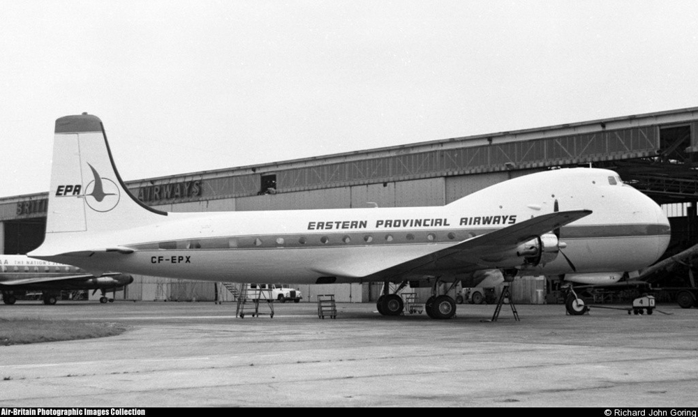
Crash of a Aviation Traders ATL-98 Carvair in Twin Falls

Date & Time: Sep 28, 1968
Operator:
Registration:
CF-EPX
Survivors:
Yes
Schedule:
Goose Bay – Twin Falls
MSN:
6/7480
YOM:
1944
Country:
Crew on board:
5
Crew fatalities:
Pax on board:
33
Pax fatalities:
Other fatalities:
Total fatalities:
0
Circumstances:
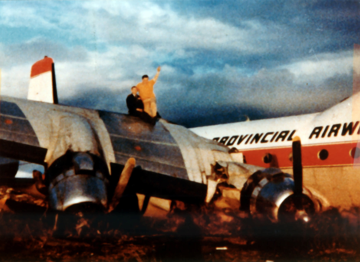
The pilot, who had limited experience on Carvair aircraft, possibly wanted to touch down as early as possible on the short runway. The main wheels however struck the top of an embankment about 8 feet from the runway threshold. The pilot overshoot and had to feather the no. 2 prop immediately, because the engine was not developing power. The aircraft circled for a while and then touched down on its nosegear. The plane settled on the left wing and swung off the runway.
Probable cause:
The pilot's distraction with the landing hazard led him to attempt a touchdown dangerously close to the runway threshold. The pilot was assigned to perform a landing on a marginal landing area.

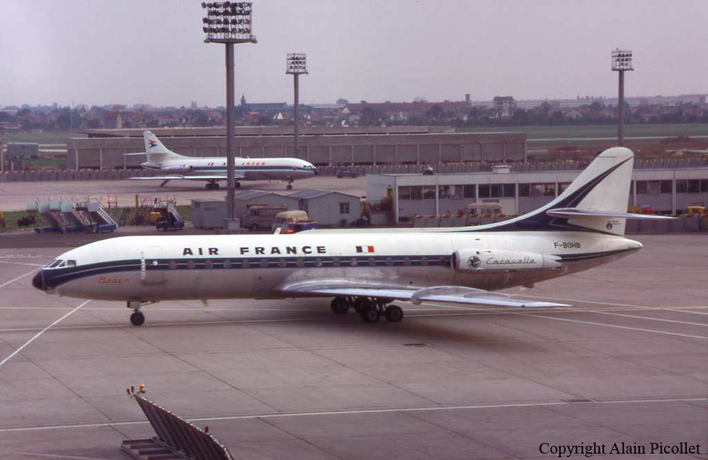
Crash of a Sud-Aviation SE-210 Caravelle III off Antibes: 95 killed

Date & Time: Sep 11, 1968 at 1034 LT
Operator:
Registration:
F-BOHB
Flight Phase:
Survivors:
No
Schedule:
Ajaccio - Nice
MSN:
244
YOM:
1968
Flight number:
AF1611
Country:
Region:
Crew on board:
6
Crew fatalities:
Pax on board:
89
Pax fatalities:
Other fatalities:
Total fatalities:
95
Captain / Total flying hours:
8836
Captain / Total hours on type:
2054.00
Copilot / Total flying hours:
4293
Copilot / Total hours on type:
676
Aircraft flight hours:
1001
Aircraft flight cycles:
579
Circumstances:
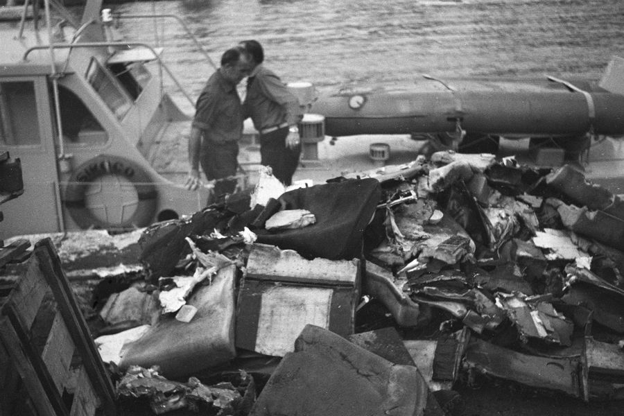
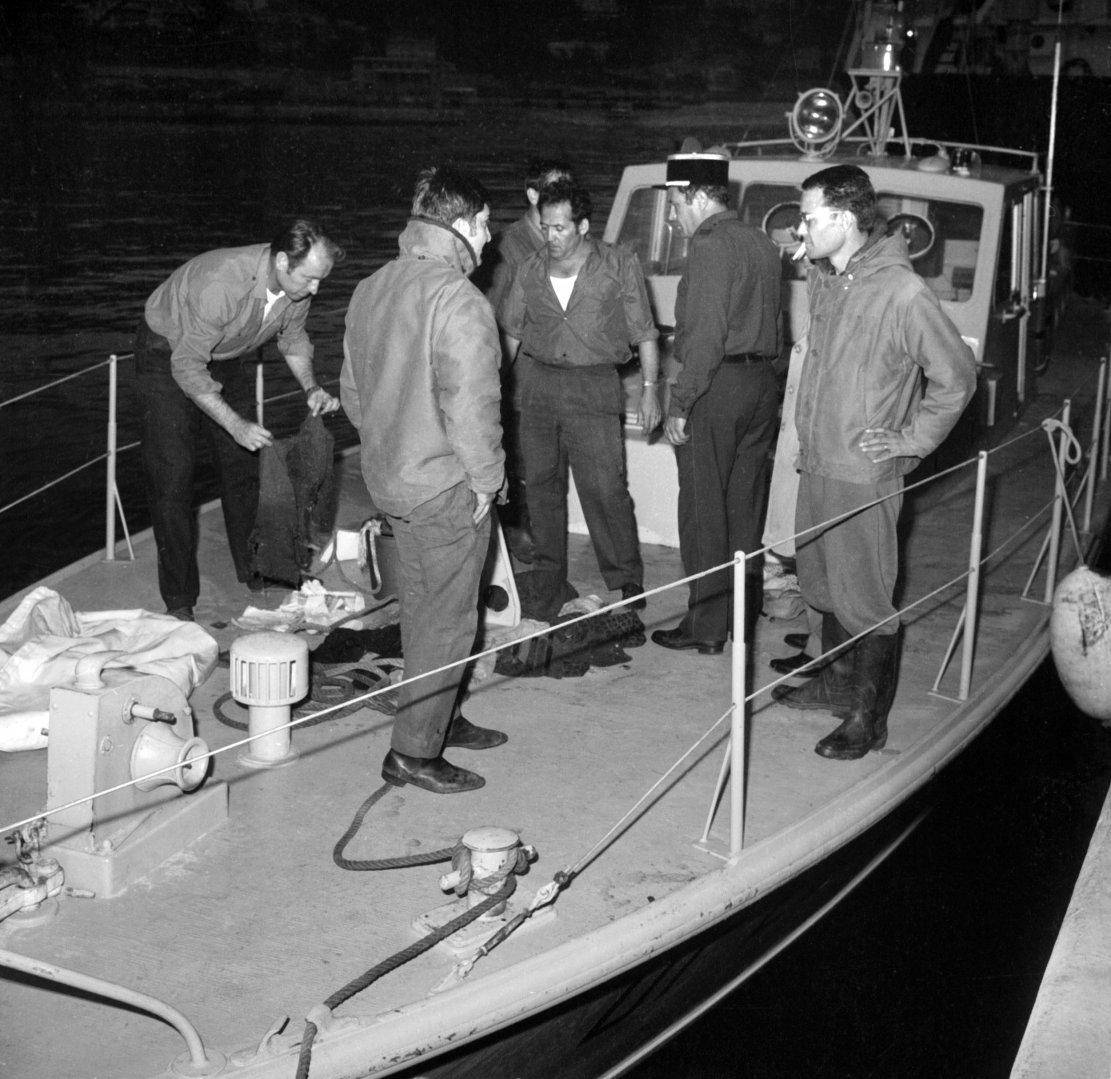
Following an uneventful flight from Ajaccio, the crew started the descent to Nice-Côte d'Azur Airport when the pilot sent a brief mayday message, saying 'fire on board, request urgent landing'. Few second later, the airplane went into a dive and crashed into the Mediterranean Sea some 40 km off Antibes. Few debris were found on water surface and none of the 95 occupants survived the crash.
Probable cause:
The exact cause of the accident could not be determined with certainty. At the beginning of the investigations, the board of inquiry reported that the following assumptions were not ruled out: pilot error, fire in the cockpit, aircraft shot down by a surface-to-air missile or the rupture of the hydraulic reservoir. Nevertheless, the aircraft totally disintegrated upon impact with the water surface as it was extremely violent, at a considerable speed and with a high rate of descent. It is believed the loss of control was the consequence of a fire that erupted in the rear part of the cabin, by the right lavatory and galley. Maybe the pilot became incapacitated by fumes but this was not confirmed. About 50 years after the accident, the French government may release some classified documents regarding this tragedy, reinforcing the assumption that the aircraft may have been shut down by a surface-to-air missile fired by the French Navy which was completing local exercises in the area at that time. In 2018, the real cause of this accident remains unclear.
Final Report:

Crash of a De Havilland DHC-3 Otter in Bradore Bay: 9 killed

Date & Time: Sep 6, 1968
Type of aircraft:
Operator:
Registration:
CF-RNP
Flight Phase:
Survivors:
No
Schedule:
Lourdes-de-Blanc-Sablon – Sainte-Augustine – Saint-Paul River – Lourdes-de-Blanc-Sablon
MSN:
164
YOM:
1956
Country:
Crew on board:
2
Crew fatalities:
Pax on board:
7
Pax fatalities:
Other fatalities:
Total fatalities:
9
Aircraft flight hours:
5088
Circumstances:
The single engine airplane departed Lourdes-de-Blanc-Sablon Airport at 1530LT on a trip to Sainte-Augustine, Saint-Paul River and back to Lourdes-de-Blanc-Sablon. Seven passengers embarked at Saint-Paul River Airstrip. On the last leg, weather conditions deteriorated with fog and clouds down to 200 feet. In unknown circumstances, control was lost and the airplane crashed in an uninhabited area located near Bradore Bay. As the airplane failed to return to its base, SAR operations were conducted and three days later, three dead bodies and few debris were found. A week later, all operations were suspended as no trace of the main wreckage or the rest of the occupants was found.
Probable cause:
Loss of control for undetermined reason.

Crash of a De Havilland DH.114 Heron 2D off Bodø

Date & Time: Sep 4, 1968
Type of aircraft:
Operator:
Registration:
LN-NPH
Flight Phase:
Survivors:
Yes
MSN:
14127
YOM:
1959
Location:
Country:
Region:
Crew on board:
0
Crew fatalities:
Pax on board:
0
Pax fatalities:
Other fatalities:
Total fatalities:
0
Circumstances:
Crashed in unknown circumstances into the sea few hundred meters off Bodø. While all occupants were rescued, the aircraft sank and was lost.

Crash of an Avro 748-2-215 in Maturín: 4 killed

Date & Time: Aug 20, 1968 at 0130 LT
Type of aircraft:
Operator:
Registration:
YV-C-AMY
Flight Phase:
Survivors:
Yes
Schedule:
Maturín – Tucupita
MSN:
1580
YOM:
1965
Country:
Crew on board:
3
Crew fatalities:
Pax on board:
4
Pax fatalities:
Other fatalities:
Total fatalities:
4
Circumstances:
Shortly after takeoff from Maturín-Quiriquire Airport, while climbing by night, one of the engine failed. The crew feathered the propeller and elected to return for an emergency landing when the airplane struck an obstacle and crashed. Four occupants were killed while three others were injured.
Probable cause:
Engine failure after takeoff.

Crash of an Antonov AN-24B into the Mediterranean Sea: 40 killed

Date & Time: Aug 18, 1968 at 1221 LT
Type of aircraft:
Operator:
Registration:
SU-AOL
Flight Phase:
Survivors:
No
Schedule:
Cairo - Damascus
MSN:
67302806
YOM:
1966
Country:
Region:
Crew on board:
7
Crew fatalities:
Pax on board:
33
Pax fatalities:
Other fatalities:
Total fatalities:
40
Circumstances:
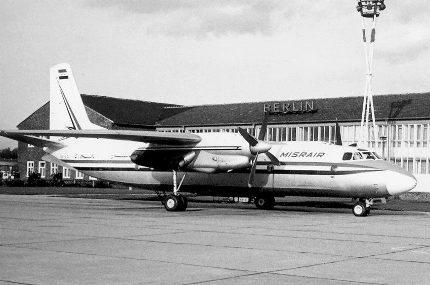
While in cruising altitude over the Mediterranean Sea on a flight from Cairo to Damascus, the aircraft went out of control and crashed in unknown circumstances into the sea. SAR operations were conducted and several debris were found about 180 km south of the Cyprus coast. None of 40 occupants was found alive and the main wreckage was not recovered.
Probable cause:
Due to lack of evidences, the exact cause of the accident could not be determined with certainty.

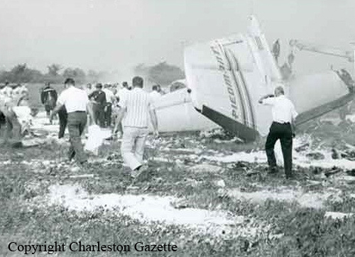
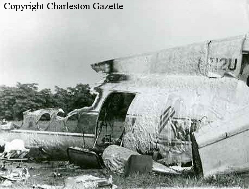
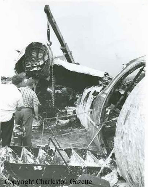
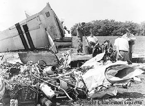
Crash of a Fairchild-Hiller FH-227B in Charleston: 35 killed

Date & Time: Aug 10, 1968 at 0857 LT
Type of aircraft:
Operator:
Registration:
N712U
Survivors:
Yes
Schedule:
Cincinnati - Charleston
MSN:
557
YOM:
1967
Flight number:
PI230
Crew on board:
3
Crew fatalities:
Pax on board:
34
Pax fatalities:
Other fatalities:
Total fatalities:
35
Captain / Total flying hours:
6884
Captain / Total hours on type:
2809.00
Copilot / Total flying hours:
3722
Copilot / Total hours on type:
403
Aircraft flight hours:
2197
Circumstances:
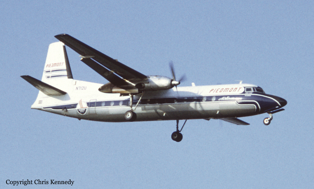
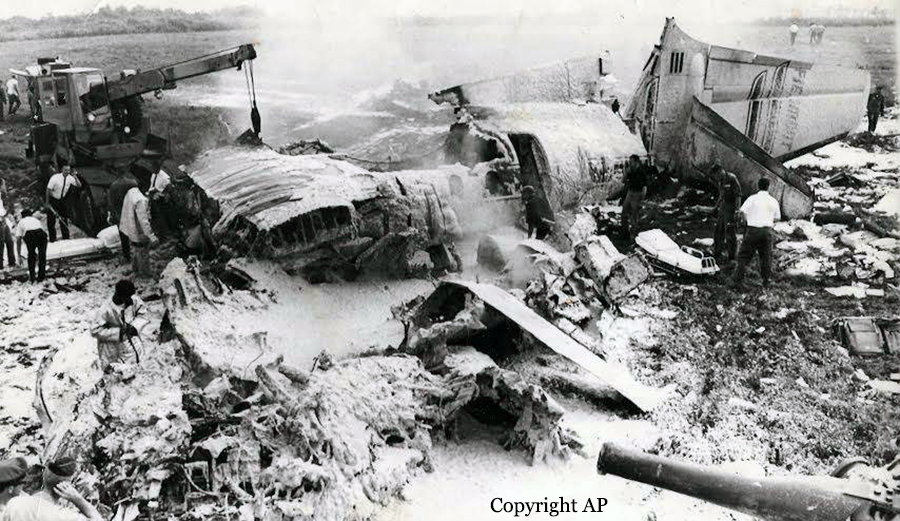
Flight 230 was a scheduled domestic flight from Louisville, Kentucky, to Roanoke, Virginia, with en-route stops at Cincinnati, Ohio and Charleston, Kanawha County Airport, West Virginia. The flight to Cincinnati was routine. At 0805 hours eastern daylight time the flight departed Cincinnati on an IFR clearance to Charleston via Victor Airways 128 south to York, thence Victor 128 to Charleston, to maintain 9 000 ft. At 0835 hours the flight contacted the Charleston Tower to request the latest weather information, which was provided as: sky partially obscured, visibility 4 mile fog and smoke, runway 23 visibility less than 1/8 of a mile. Shortly thereafter it was cleared by the Indianapolis ARTCC to the Milton Intersection (10 miles west-northwest of the Charleston VORTAC on Victor 128) and to descend to and maintain 5 000 ft. At approximately 0841 hours the flight contacted Charleston Approach Control and reported leaving 6 000 for 5 000 ft. The controller advised the flight that radar contact had been established and instructed the flight to take a 070' heading for a vector to the holding pattern at the ILS outer marker. The latest weather was also given at this time as: sky partially obscured, visibility 4 mile, fog and smoke, runway visibility runway 23 zero, altimeter setting 29.94 in. The flight was then provided with holding instructions to be followed upon arrival over the outer marker compass locator (LOM) and was given an expected approach time of 0915 hours subject to weather conditions. At 0850 hours prior to reaching the LOM, the flight was instructed to turn right to a heading of 140°, cleared to descend to 2 400 ft and advised that the runway visibility for runway 23 had improved to seven-eighths of a mile. At 0851 hours the flight was advised that it was seven miles northeast of the outer locator, instructed to turn right to a 200' heading and cleared for an ILS approach. The flight acknowledged the clearance and it shortly thereafter was advised by the approach controller that the glide path was out of service. At 0852 hours the flight was advised that it was 5 miles from the LOM and instructed to contact Charleston Tower on 120.3 MHz. At 0853 hours radio contact with the flight was established by the tower local 'controller who cleared the flight to land. By that time the landing check had been completed by the crew and descent was established at a fairly constant rate of descent of approximately 620 ft/min. At 0854:40 hours the flight reported passing the outer marker inbound and requested the wind which was given as being 230°/4 kt. At 0855:55 hours the flight asked the tower if the approach lights and high intensity runway lights were turned all the way up and the controller replied in the affirmative, adding "a little fog right off the end there and its wide open after you get by that, it's more than a mile and a half on the runway". This was the last known radio communication from the flight. At 0856:09 hours the pilot-in-command mentioned to the co-pilot that he was going to hold the present altitude which was approximately 1 250 ft AMSL (350 ft above the elevation of runway 23 threshold). At 0856:24 hours the co-pilot informed the pilot-in-command that he had the lights in sight "down low" and asked him if he could see them. The pilot-in-command replied he had them in sight and requested landing flaps. The co-pilot then commented "I got to get to the chart right here we're likely to lose it". At 0856:42 hours the co-pilot asked the pilot-in-command if he saw the lights "there", the pilot-in-command replied in the affirmative and shortly thereafter reduced the power and 2 sec later increased it - 1 sec later the co-pilot commented "watch it". About 1 sec later the aircraft crashed. The controller observed a column of smoke rising near the approach end of the runway and immediately activated the crash siren and called for the dispatch of airport emergency equipment. The aircraft struck the steep hillside about 250 ft short of the runway threshold at an elevation of 865 ft AMSL (approximately 33 ft below the elevation of the threshold). The aircraft then careened up and over the side of the hill and on to the airport, coming to rest off the right side of runway 23. The accident occurred at 0856:53 hours during daylight. Two passengers were seriously injured while 35 other occupants were killed.
Probable cause:
The Board determined that the probable cause of this accident was an unrecognized loss of altitude orientation during the final portion of an approach into shallow, dense fog. The disorientation was caused by a rapid reduction in the ground guidance segment available to the pilot, at a point beyond which a go-around could not be successfully effected. The following findings were reported:
- The aircraft was being operated in visual meteorological conditions until approximately 6 sec before the crash, when it entered a shallow fog overlying the approach lights and the approach end of runway 23,
- Visual range in the final portion of the approach zone and over the runway 23 threshold was 500 ft or less in the fog,
- Because of the visual guidance segment available in the initial part of the approach, the pilot would have no way of judging the visual range in fog until the moment of penetration,
- Descent below MDA into the restricted visibility was permissible under present regulations.
Final Report: