Crash of a Cessna 340 in Mendoza: 2 killed

Date & Time: Feb 7, 2005 at 0634 LT
Type of aircraft:
Registration:
N5790M
Flight Phase:
Survivors:
No
Site:
MSN:
340-0044
YOM:
1972
Location:
Country:
Crew on board:
2
Crew fatalities:
Pax on board:
0
Pax fatalities:
Other fatalities:
Total fatalities:
2
Circumstances:
On February 7, 2005, about 0634, Atlantic standard time, a Cessna 340, N5790M, registered to and operated by Ward County Irrigation District N°1, impacted with terrain in a mountainous area in Mendoza, Argentina. Visual meteorological conditions prevailed at the time and the flight plan information is unknown. The pilot and copilot received fatal injuries, and the airplane was destroyed. The flight originated from Aerodrome San Rafael (SAMR), Argentina, earlier that day, at an unspecified time. The initial notification from Argentina's Junta de Investigaciones de Accidentes de Aviacion Civil ( JIAAC) stated the airplane was on a cloud-seeding mission to prevent thunderstorms from developing in that agricultural area.

Crash of a Cessna 340A in Scappoose: 2 killed

Date & Time: Oct 18, 2003 at 1413 LT
Type of aircraft:
Registration:
N340P
Flight Type:
Survivors:
No
Schedule:
Red Bluff – Scappoose
MSN:
340A-0507
YOM:
1978
Crew on board:
1
Crew fatalities:
Pax on board:
1
Pax fatalities:
Other fatalities:
Total fatalities:
2
Captain / Total flying hours:
3850
Aircraft flight hours:
4041
Circumstances:
Witnesses first observed the aircraft on final approach for landing, with the engine(s) making a backfiring sound. While the aircraft was on short final, another aircraft pulled onto the runway and initiated its takeoff roll. The accident aircraft was observed to initiate a go-around, but did not appear to be gaining altitude and was at what the witnesses thought was a slow airspeed. About mid-field, the accident aircraft made an approximate 45 degree turn from runway heading. Within 1/4 mile from the runway, the aircraft lost altitude. The witness stated that the aircraft was about 80 feet agl when the aircraft stalled, rolled inverted (left wing down) and collided with the flat open terrain in a nose low attitude. A post-crash fire subsequently consumed the wreckage. During the post-crash inspection of the engines, it was found that both engines displayed signs of operating at a lean mixture setting. The left engine pistons and spark plugs displayed a more serious lean condition than the right side and displayed the early signs of detonation on the piston heads. No other mechanical failure or malfunction was noted to either the engines or airframe.
Probable cause:
The pilot's failure to maintain airspeed while maneuvering. An inadvertent stall, the pilot's failure to follow engine operation procedures and engine detonation were factors.
Final Report:

Crash of a Cessna 340A in Bishop: 1 killed

Date & Time: Aug 8, 2003 at 2132 LT
Type of aircraft:
Operator:
Registration:
N340DC
Flight Phase:
Flight Type:
Survivors:
No
Schedule:
Bishop - Upland
MSN:
340A-0968
YOM:
1980
Crew on board:
1
Crew fatalities:
Pax on board:
0
Pax fatalities:
Other fatalities:
Total fatalities:
1
Captain / Total flying hours:
1302
Captain / Total hours on type:
1.00
Aircraft flight hours:
1123
Circumstances:
During a nighttime takeoff initial climb, the airplane collided with terrain near the airport. Witnesses reported watching the airplane accelerate on runway 12, rotate, and climb to 200 to 300 feet above ground level. The climb rate decreased and the airplane appeared to initiate a left turn, with the roll continuing to a wings vertical attitude. At this point the airplane descended into the terrain. One witness north of the accident site described the landing lights going from horizontal to vertical followed by a decrease in engine sound just before impact. According to the airplane owner, the pilot had never flown the accident airplane before the first leg to the accident location to drop off the owner and another passenger. Examination of the pilot records failed to locate any previous flight time in Cessna 300 or 400 series airplanes. In the last 30 days he had given instruction in a smaller light twin engine airplane. Post accident examination of the wreckage revealed the landing gear to be in the down position at the time of impact. The retractable landing lights were extended and the nose gear taxi light was destroyed. Both propellers exhibited symmetrical power signatures. No preimpact mechanical malfunctions or failures were identified. The impact site was east of the airport about 0.68 nautical miles. The departure direction is towards a mountain range with sparse population and few ground reference lights. The moon's disk was 25 degrees above the southeastern horizon and was 89 percent illuminated. The FAA AC61-23C Pilot's Handbook of Aeronautical Knowledge addresses the environmental factors and potential in-flight visual illusions, which could affect pilot performance. The reference material describes Somatogravic Illusion as, "a rapid acceleration during takeoff can create the illusion of being in a nose up attitude. The disoriented pilot will push the airplane into a nose low, or dive attitude. A rapid deceleration by a quick reduction of the throttles can have the opposite effect, with the disoriented pilot pulling the airplane into a nose up, or stall attitude."
Probable cause:
The pilot's in-flight loss of control due to a Somatogravic illusion and/or spatial disorientation. Factors in the accident were the dark lighting conditions and the pilot's lack of familiarity with the airplane.
Final Report:

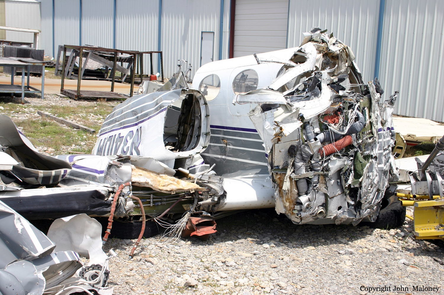
Crash of a Cessna 340 in Denver: 4 killed

Date & Time: Mar 24, 2002 at 1631 LT
Type of aircraft:
Operator:
Registration:
N341DM
Flight Type:
Survivors:
No
Schedule:
Aspen – Gunnison – Denver
MSN:
340-0347
YOM:
1974
Crew on board:
1
Crew fatalities:
Pax on board:
3
Pax fatalities:
Other fatalities:
Total fatalities:
4
Captain / Total flying hours:
3563
Captain / Total hours on type:
560.00
Aircraft flight hours:
3977
Circumstances:
The pilot was flying a three leg IFR cross-country, and was on an ILS approach in IMC weather conditions for his final stop. Radar data indicated that the pilot had crossed the final approach fix inbound and was approximately 3 nm from the runway threshold when he transmitted that he had "lost an engine." Radar data indicates that the airplane turned left approximately 180 degrees, and radar contact was lost. A witness said "the airplane appeared to gain a slight amount of altitude before banking sharply to the left and nose diving into the ground just over the crest of the hill." Postimpact fuel consumption calculations suggest that there should have been 50 to 60 gallons of fuel onboard at the time of the accident. Displaced rubber O-ring seals on two Rulon seals in the left fuel valve and hydraulic pressure/deflection tests performed on an exemplar fuel valve suggest that the fuel selector valve was in the auxiliary position at the time of impact. The airplane's Owner's Manual states: "The fuel selector valve handles should be turned to LEFT MAIN for the left engine and RIGHT MAIN for the right engine, during takeoff, landing, and all emergency operations." No preimpact engine or airframe anomalies, which might have affected the airplane's performance, were identified.
Probable cause:
The pilot not following procedures/directives (flying a landing approach with the left fuel selector in the auxiliary position). Contributing factors were the loss of the left engine power due to fuel starvation, the pilot's failure to maintain aircraft control, and the subsequent inadvertent stall into terrain.
Final Report:

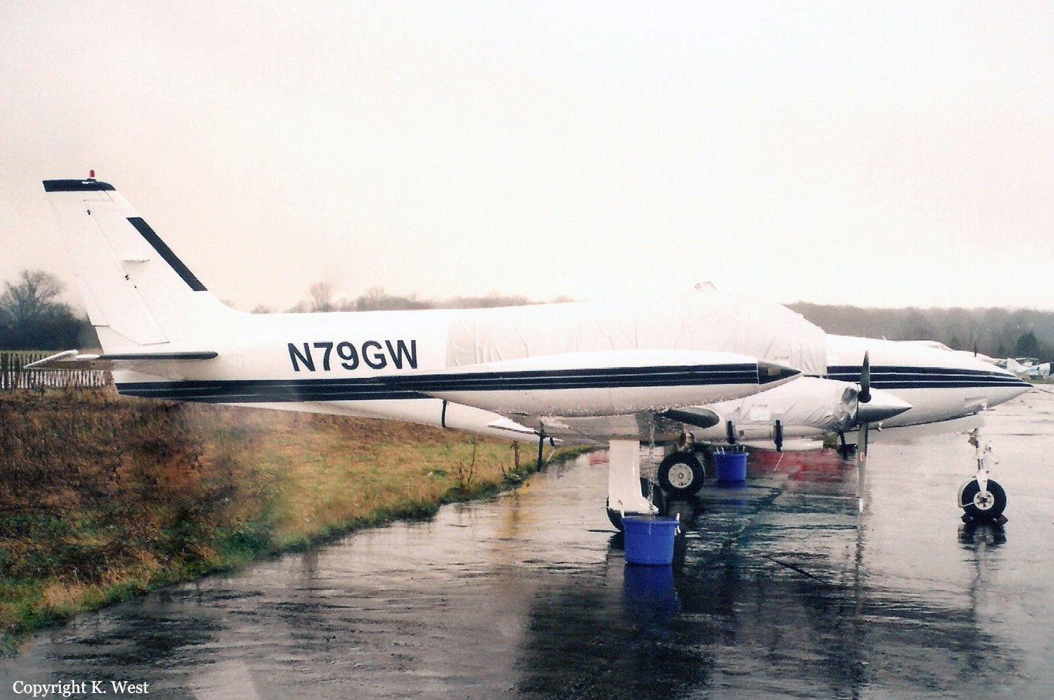
Crash of a Cessna 340A in Cairns

Date & Time: Mar 9, 2002 at 1729 LT
Type of aircraft:
Registration:
N79GW
Flight Type:
Survivors:
Yes
Schedule:
Bankstown – Cairns
MSN:
340A-0680
YOM:
1979
Country:
Region:
Crew on board:
1
Crew fatalities:
Pax on board:
3
Pax fatalities:
Other fatalities:
Total fatalities:
0
Circumstances:
The pilot of a Cessna 340 departed Bankstown, NSW at 1223 ESuT, for Townsville, Qld via Walgett, St George, Roma, Emerald and Clermont. He reported that he climbed the aircraft to 16,000 ft and adopted a long range power setting of about 49% which equated to a true air speed (TAS) of 168 kts and a fuel burn of 141 lbs per hour. As the pilot approached the ‘OLDER’ waypoint north of Clermont, he reviewed his fuel situation and, because of a strong tailwind decided to continue on to Cairns. He informed an enroute controller of his decision and requested, for fuel planning purposes, a clearance to allow him to track in the opposite direction on a one-way air route. The controller was unable to approve his request but offered the pilot a direct track to Biboohra, a navigation aid 20 NM west of Cairns. The pilot accepted the amended track with the intention of later requesting a more direct route to Cairns. About 15 minutes later, the pilot requested a more direct track, but was told to call the approach controller for a possible clearance. He contacted the approach controller and told the controller that he had minimum fuel. The controller asked the pilot if he was declaring an emergency, to which he replied affirmative. The pilot later commented that he did this in the hope of expediting his arrival. He was instructed to descend to 6,500 ft and track direct to Cairns. The controller asked the pilot if he preferred to join the runway 15 circuit via a left downwind or right downwind, to which the pilot requested to join a left downwind. The pilot later commented that the aircraft fuel flow gauges were indicating a total flow of 140 lbs per hour and the fuel quantity gauges for the selected main tanks, although wandering somewhat, were ‘displaying a healthy amount’ considering that he was about 12 NM from his destination. As the pilot approached 6,500 ft, he requested a clearance for further descent, to which the controller instructed the pilot to descend to 4,000 ft. As the aircraft descended to 4,000 ft, the pilot saw Cairns City, but could not see the runway at Cairns airport. The aircraft's distance measuring equipment (DME) indicated 9 NM to the DME navigation aid at Cairns Airport. The pilot reported that at about this time, he observed one of the fuel flow gauges indicating zero, while at the same time, one or both engines began to surge and run roughly. He immediately informed the controller of the situation. The controller asked the pilot if he was familiar with a local airstrip (Greenhill which is 10 NM to the southeast of Cairns airport), to which the pilot replied that he wasn't. The controller indicated to the pilot that the strip was situated in his two o'clock position at a range of about two miles and to be aware of power lines and the sugar cane. The pilot was unsure of what to look for and was unable to see the strip, but after conducting a number of steep turns, saw a cleared strip in a field. He decided that he had to land. He extended the landing gear, but realised that the aircraft was too high and attempted a 360-degree steep turn onto final to reposition the aircraft. However, the airspeed was rapidly decreasing and there was insufficient height to complete the approach. At 1729 EST, the aircraft impacted the ground short of the strip and slid for about 20 metres. The pilot was seriously injured and the passengers received minor injuries.
Probable cause:
The reason for the initial fuel flow fluctuations was not identified by the pilot. It is likely that the pilot assumed the zero reading indicated impending fuel exhaustion and concentrated on conducting a landing in unfamiliar terrain. During the landing approach the pilot lost control of the aircraft and it descended rapidly to the ground.
Final Report:

Crash of a Cessna 340A in Temple: 3 killed

Date & Time: Jan 17, 2002 at 1522 LT
Type of aircraft:
Registration:
N339S
Survivors:
Yes
Site:
Schedule:
League City – Killeen
MSN:
340A-0712
YOM:
1979
Crew on board:
1
Crew fatalities:
Pax on board:
4
Pax fatalities:
Other fatalities:
Total fatalities:
3
Captain / Total flying hours:
3464
Captain / Total hours on type:
10.00
Aircraft flight hours:
5877
Circumstances:
While on an IFR clearance, the pilot reported to approach control that he was unable to maintain 4,000 feet msl, and did not give a reason. Shortly thereafter, the pilot contacted approach control and stated that he had "fuel starvation" in the right engine and the left engine had just quit. Radar data depicted the aircraft at an altitude of 3,400 feet. The controller asked the pilot if they were completely without power, and the pilot responded, "yes, we're now gliding." The controller gave the pilot instructions to the nearest airport, which was approximately 4.5 nautical miles away. After passing 2,100 feet, the pilot informed the controller that he would be landing short. During the forced landing, the airplane struck the top of a tree, crossed over a house, struck another tree, struck a telephone wire which crossed diagonally over a street, and then cleared a set of wires which paralleled the street. The airplane then impacted a private residence within a residential area, and a fire erupted damaging the airplane and the private residence. Ten gallons of fuel were drained from the left locker tank, which supplements the left main fuel tank. Examination of the airframe and engines did not disclose any structural or mechanical anomalies that would have prevented normal operation. Examination of the propeller revealed that neither propeller had been
feathered.
Probable cause:
The pilot's mismanagement of fuel, which resulted in a total loss of engine power due to fuel starvation. Contributing factors were the pilot's failure to follow the checklist to feather the propellers in order to reduce drag.
Final Report:

Crash of a Cessna 340A in Santa Monica: 2 killed

Date & Time: Nov 13, 2001 at 1836 LT
Type of aircraft:
Registration:
N2RR
Flight Phase:
Flight Type:
Survivors:
No
Schedule:
Santa Monica – Van Nuys
MSN:
340A-0643
YOM:
1978
Crew on board:
1
Crew fatalities:
Pax on board:
1
Pax fatalities:
Other fatalities:
Total fatalities:
2
Captain / Total flying hours:
6200
Aircraft flight hours:
1036
Circumstances:
During an aborted nighttime takeoff, the airplane continued off the end of the 4,987-foot-long runway, vaulted an embankment, and impacted a guardrail on an airport service road 30 feet below. According to the manufacturer's pilot operating handbook, the takeoff distance required for the ambient conditions was 1,620 feet and the accelerate-stop distance was 2,945 feet. Several witnesses reported observing the airplane traveling along the runway at an unusually high speed, with normal engine sound, and without becoming airborne; followed by an abrupt reduction in engine power and the sound of screeching tires. Skid marks were present on the last 1,000 feet of the runway. In the wreckage, the gust lock/control lock was found engaged in the pilot's control column.
Probable cause:
The pilot's failure to remove the control gust lock prior to takeoff and his failure to abort the takeoff with sufficient runway remaining to stop the airplane on the runway.
Final Report:

Crash of a Cessna 340A in Selma: 1 killed

Date & Time: Nov 6, 2000 at 0400 LT
Type of aircraft:
Operator:
Registration:
N12273
Flight Type:
Survivors:
Yes
Schedule:
Paso Robles – Selma
MSN:
340A-1536
YOM:
1982
Crew on board:
1
Crew fatalities:
Pax on board:
1
Pax fatalities:
Other fatalities:
Total fatalities:
1
Captain / Total flying hours:
19000
Captain / Total hours on type:
2000.00
Aircraft flight hours:
4915
Circumstances:
The airline transport rated pilot was returning an organ transplant nurse passenger to an uncontrolled, no facilities airport, with ground fog present about 0400 in the morning. The pilot had obtained two abbreviated preflight weather briefings while waiting for his passenger, and prior to departing at 0235. According to witnesses he attempted to land twice on runway 28, then he made an approach and attempted a landing on runway 10. Witnesses reported that the airport was engulfed in ground fog at the time of the approaches. They said that you could see straight up but not horizontally. The airplane collided with grape vineyard poles and canal/wash berms, about 250 feet short of the runway 10 displaced threshold. Approach charts for two airports with instrument approaches within 20 miles were found lying on the instrument panel glare shield. The passenger's car was parked at the uncontrolled airport.
Probable cause:
The pilot's improper decision to attempt a visual approach and landing in instrument meteorological conditions and his failure to follow instrument flight rules procedures.
Final Report:

Crash of a Cessna 340A near Julian: 2 killed

Date & Time: Oct 26, 2000 at 1058 LT
Type of aircraft:
Operator:
Registration:
N4347C
Flight Phase:
Survivors:
No
Site:
Schedule:
Santa Ana – Calexico
MSN:
340A-0538
YOM:
1978
Crew on board:
2
Crew fatalities:
Pax on board:
0
Pax fatalities:
Other fatalities:
Total fatalities:
2
Captain / Total flying hours:
20000
Captain / Total hours on type:
180.00
Copilot / Total flying hours:
338
Aircraft flight hours:
3182
Circumstances:
During en route cruise flight at an assigned altitude of 11,000 feet (msl) in instrument meteorological conditions, the airplane impacted mountainous terrain at 5,300 feet, in wings level, descending flight. During the final 12 minutes of the flight (from 1046 to 1058 Pacific daylight time), recorded military search radar height values (primary radar returns) show the aircraft in a steady descent from 11,000 feet to 5,600 feet, where radar contact was lost. During the same time interval, recorded Mode C altitudes received at Los Angeles Air Traffic Control Center (Center) and SoCal Terminal Radar Approach Control (TRACON) indicated the aircraft was level at 11,000 feet. At 1055:49, when the pilot was handed off from SoCal TRACON to Los Angeles Center, the pilot checked in with the Center ". . . level at one one thousand." At 1057:28, the pilot asked the Center controller "what altitude you showing us at" to which the controller responded "not receiving your mode C right now sir." At 1057:37, the pilot transmitted "o k we'd like to climb to vfr on top, our uh altimeter just went down to uh fifty three hundred." The controller approved the pilot's request to climb to VFR conditions on-top and, at 1057:54, the pilot responded "roger we're out." No further transmissions were received from the aircraft. The airplane was equipped with a single instrument static pressure system with two heated static ports. The static system and static system instruments were damaged or destroyed by impact and post-crash fire sufficiently to preclude post-accident testing.
Probable cause:
Total blockage of the instrument static system due to ice.
Final Report:

Crash of a Cessna 340 off Nadi

Date & Time: Sep 29, 2000 at 1600 LT
Type of aircraft:
Registration:
N130DR
Flight Type:
Survivors:
Yes
Schedule:
Nouméa - Nadi
MSN:
340-0041
YOM:
1972
Country:
Region:
Crew on board:
1
Crew fatalities:
Pax on board:
0
Pax fatalities:
Other fatalities:
Total fatalities:
0
Circumstances:
On September 29, 2000, at 1600 hours local time, a Cessna 340, N130DR, was destroyed when it impacted the water in Nadi Bay, about 1,500 feet short of the runway 09 threshold at Nadi International Airport in the Republic of the Fiji Islands. The commercial pilot, a citizen of the United States and the sole occupant, received minor injuries. Visual meteorological conditions prevailed for the ferry flight, operated by Benchmark Aviation under 14 CFR Part 91, that departed from Magenta Airport, New Caledonia, NWWM at 1200.