Crash of a Pilatus PC-6/B2-H2 Turbo Porter in Mitú: 3 killed

Date & Time: Jun 24, 1993
Operator:
Registration:
FAC-1112
Flight Type:
Survivors:
No
Schedule:
Taraira - Mitú
MSN:
821
YOM:
1983
Country:
Crew on board:
2
Crew fatalities:
Pax on board:
1
Pax fatalities:
Other fatalities:
Total fatalities:
3
Aircraft flight hours:
3200
Circumstances:
While descending to Mitú-Fabio Alberto León Bentley Airport, the crew encountered poor visibility due to bad weather. On final, the single engine aircraft was too low, struck trees and crashed short of runway. All three occupants were killed.

Crash of a Britten-Norman BN-2A-21 Islander in Mitwaba

Date & Time: Jun 23, 1993
Type of aircraft:
Operator:
Registration:
9Q-CLW
Survivors:
Yes
Schedule:
Kisengwa - Mitwaba
MSN:
2030
YOM:
1981
Location:
Region:
Crew on board:
1
Crew fatalities:
Pax on board:
3
Pax fatalities:
Other fatalities:
Total fatalities:
0
Circumstances:
On final approach to Mitwaba Airfield, the pilot was completing a last turn to join the approach path when the aircraft stalled and crashed on hilly terrain about 3 km short of runway. All four occupants were injured and the aircraft was destroyed.
Probable cause:
It is believed that the loss of control was the consequence of strong downdrafts and severe atmospheric turbulences specific to this region.

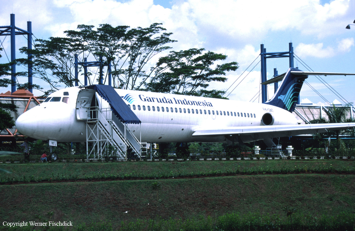
Crash of a Douglas DC-9-32 in Denpasar

Date & Time: Jun 21, 1993 at 1125 LT
Type of aircraft:
Operator:
Registration:
PK-GNT
Survivors:
Yes
Schedule:
Yogyakarta - Denpasar
MSN:
47790/907
YOM:
1979
Flight number:
GA630
Country:
Region:
Crew on board:
7
Crew fatalities:
Pax on board:
72
Pax fatalities:
Other fatalities:
Total fatalities:
0
Circumstances:
On approach to Denpasar-I Gusti Ngurah Rai Airport, Bali, the aircraft was too high on the glide. The captain made an overcorrection, causing the aircraft to approach the runway with a high rate of descent. In a nose-up attitude, the aircraft struck the runway surface with a positive acceleration of 5 g. After landing, the crew completed the deceleration and braking procedure, vacated the runway and rolled to the gate where all occupants disembarked safely. A complete inspection of the aircraft by technicians revealed that it suffered major fuselage damages and was later declared as damaged beyond repair.
Probable cause:
Wrong approach configuration on part of the flying crew.

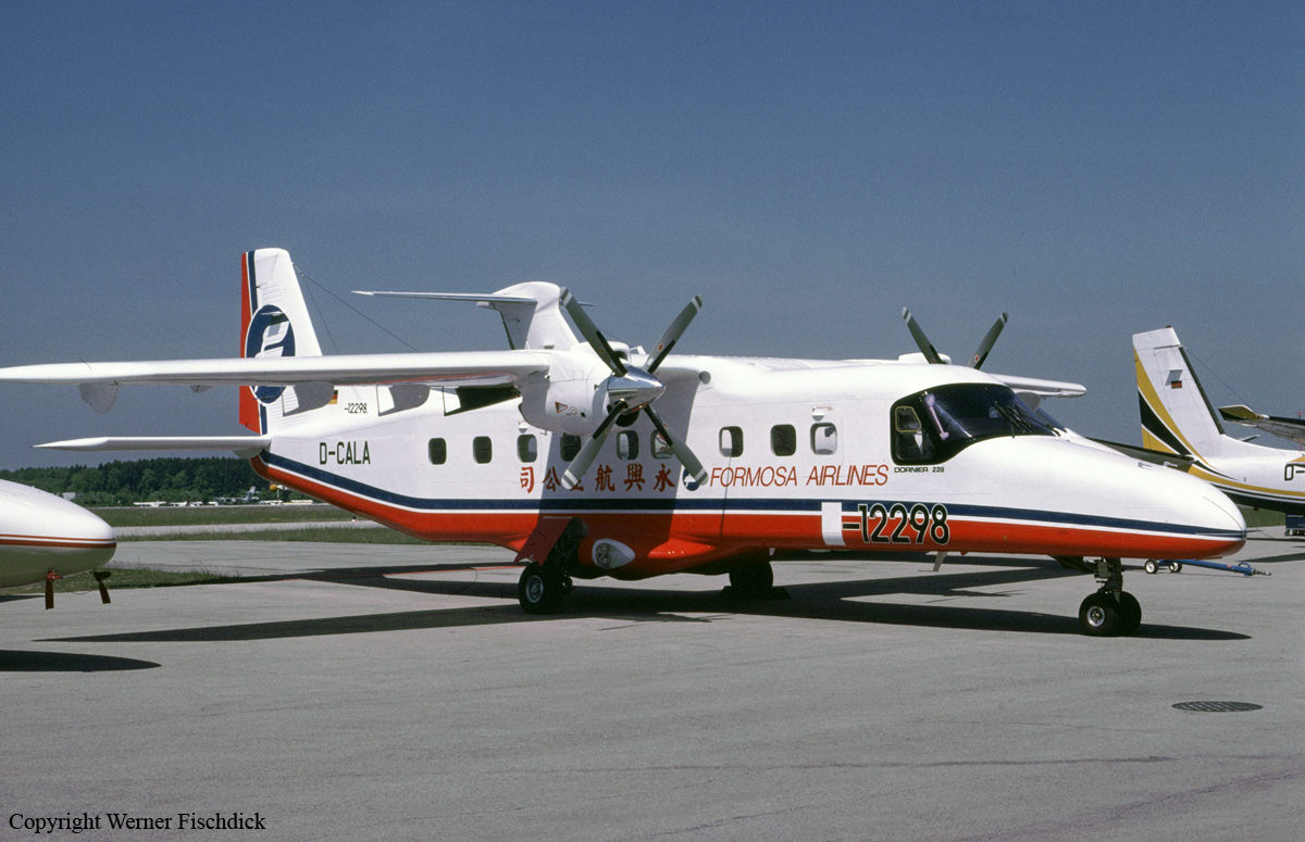
Crash of a Dornier DO228-201 in Lyudao

Date & Time: Jun 14, 1993
Type of aircraft:
Operator:
Registration:
B-12298
Survivors:
Yes
Schedule:
Taitung – Lyudao
MSN:
8151
YOM:
1988
Country:
Region:
Crew on board:
2
Crew fatalities:
Pax on board:
20
Pax fatalities:
Other fatalities:
Total fatalities:
0
Circumstances:
On final approach to Lyudao Airport, the crew failed to realize his altitude was too low when the aircraft struck the ground few metres short of runway threshold. Upon impact, the right main gear was torn off and the aircraft crash landed and came to rest on the main runway. All 22 occupants escaped uninjured while the aircraft was damaged beyond repair.
Probable cause:
The crew continued the approach at a too low altitude until the aircraft impacted ground short of runway.

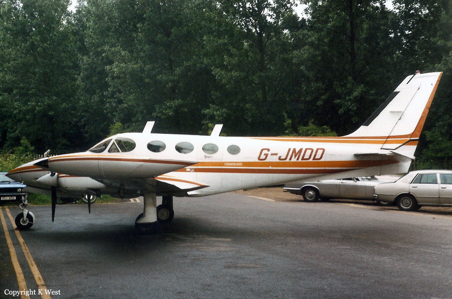
Crash of a Cessna 340A in Marshfield

Date & Time: Jun 12, 1993 at 1040 LT
Type of aircraft:
Registration:
G-JMDD
Survivors:
Yes
Schedule:
Ipswich - Marshfield
MSN:
340A-0313
YOM:
1977
Region:
Crew on board:
1
Crew fatalities:
Pax on board:
2
Pax fatalities:
Other fatalities:
Total fatalities:
0
Captain / Total flying hours:
1194
Captain / Total hours on type:
570.00
Circumstances:
On his second visit to Marshfield Airstrip, the pilot noted that the surface wind was blowing from 300°, across the 880 yard long grass strip which is oriented 08/26. He recalled that the strip had a significant slope which he thought was iphill on runway 08 and he decided to land in that direction to take advantage of the deceleration gained by landing uphill. The pilot made two approached to the strip followed by go-arounds during which he assessed the strength of the crosswind which was stronger than forecast. On the third approach the aircraft cleared trees close to the runway threshold and touched down between one third and one half of the way along the strip. The pilot stated that touchdown in this area was a deliberate decision on his part which was justified by the aircraft's ability to stop quickly on an uphill grass surface. Unfortunately, he had in fact landed in the downhill, downwind direction and was unable to stop the aircraft on the wet grass before the end of the strip. The aircraft passed through a low, dry stone wall at the end of the grass at a speed of 15 knots and came to rest some 10 metres beyond it after all three landing gears had collapsed rearwards. No one was hurt and there was no fire; all the occupants were able to leave the aircraft through the normal exit door. §
Probable cause:
The pilot landed on the wrong runway according to wind component.
Final Report:

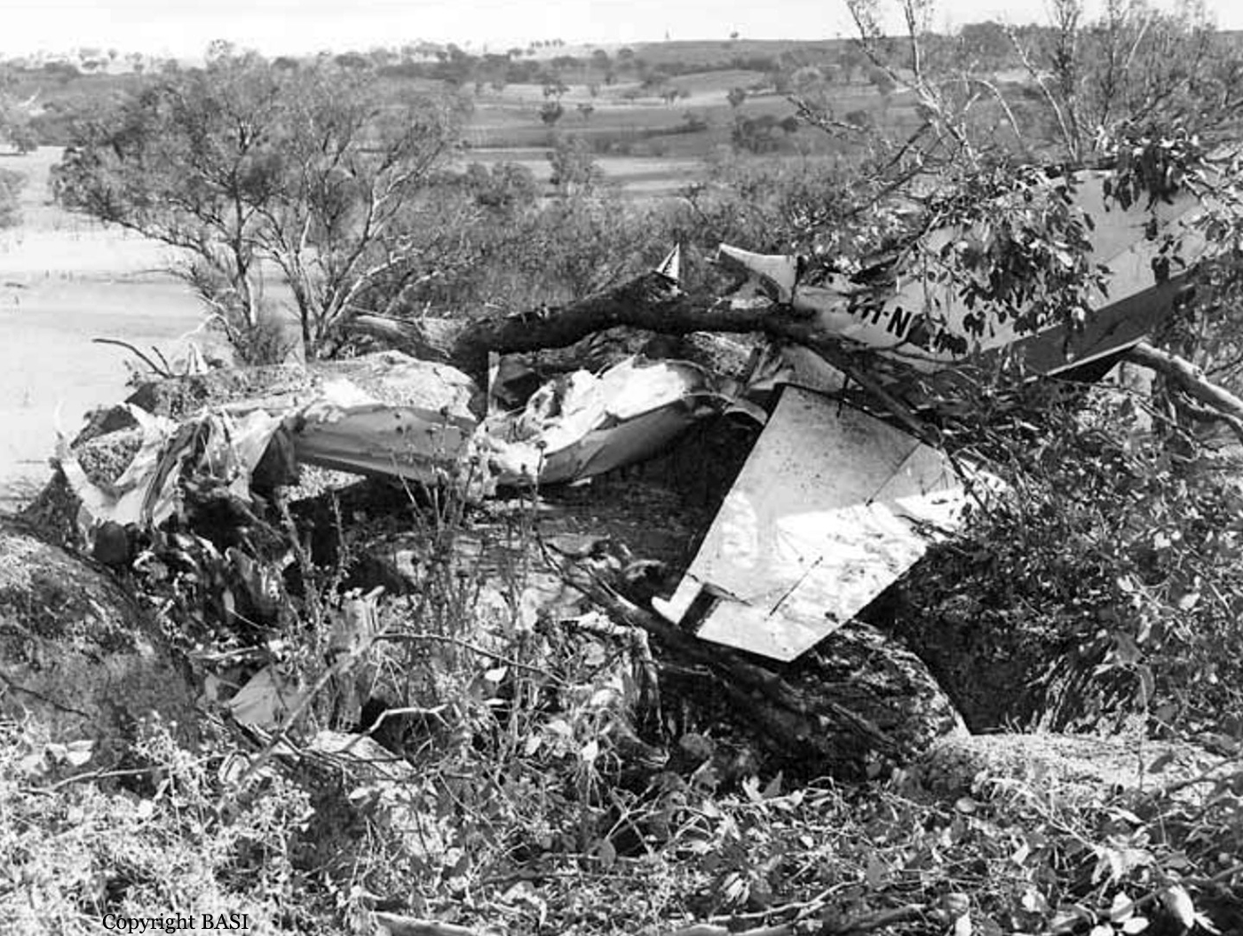
Crash of a Piper PA-31-350 Navajo Chieftain in Young: 7 killed

Date & Time: Jun 11, 1993 at 1918 LT
Registration:
VH-NDU
Survivors:
No
Schedule:
Sydney – Cowra – Young – Cootamundra
MSN:
31-8152083
YOM:
1981
Flight number:
OB301
Country:
Region:
Crew on board:
2
Crew fatalities:
Pax on board:
5
Pax fatalities:
Other fatalities:
Total fatalities:
7
Captain / Total flying hours:
1822
Captain / Total hours on type:
337.00
Copilot / Total flying hours:
954
Copilot / Total hours on type:
43
Aircraft flight hours:
3936
Circumstances:
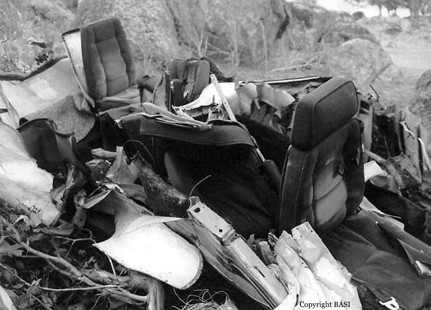
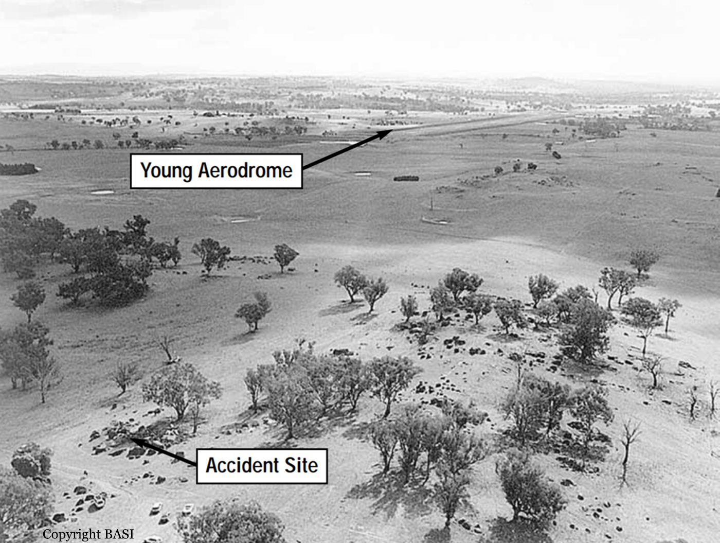
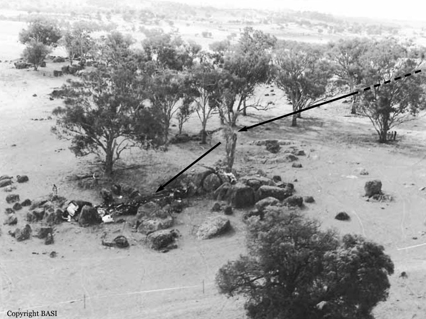
At about 1500 hours EST, 11 June 1993, a standard company flight plan held by the CAA at the Melbourne flight briefing facility was activated. The plan indicated that Piper PA-31-350 aircraft VH-NDU would be conducting flight OB 301, a regular public transport service from Sydney (Kingsford Smith) airport to Cootamundra NSW, with intermediate landings at Cowra and Young. The flight was planned to be operated in accordance with IFR procedures, with a scheduled departure time from Sydney of 1720. The aircraft was to be crewed by two pilots. Prior to departure, the company scheduled a second aircraft to operate the Sydney–Cowra sector. Consequently, VH-NDU was required to land only at Young and Cootamundra. At that time of the year, the 1720 departure time meant that the flight would be conducted entirely at night. VH-NDU departed Sydney at 1738 carrying five passengers, with a fuel endurance of about 253 minutes. The pilot-in-command occupied the left cockpit seat. The aircraft initially tracked via the direct Sydney to Cowra route and climbed to a cruising altitude of 8,000 feet. At 1801 the pilot reported to Sydney FIS that the aircraft was now tracking direct to Young, and would report at Riley, an en route reporting point located 62 NM from Young on the Katoomba– Young track. FIS advised the area QNH was 1003 hPa. At 1814 the pilot reported the aircraft was at Riley and estimated arrival at Young at 1835. By 1820 the pilot had reported on descent to Young, with in-flight conditions of cloud and heavy rain. Recorded radar data later showed that the aircraft passed 13.5 NM to the south-east of Riley, south of the direct Katoomba–Young track. At about 18.5 NM north-east of Rugby, the aircraft turned right and initially tracked about 280° before turning left to track direct to Young. When queried by FIS at 1836, the pilot amended the estimate for his arrival at Young to 1838. At 1842, after prompting from FIS, the pilot reported at Young that he was commencing an NDB approach, and would call again on the hour or in the circuit. Shortly after 1845 witnesses at Young aerodrome saw the lights of an aircraft, which they believed to be VH-NDU, pass low overhead after approaching from the east. Some minutes later the same aircraft was seen to pass over the aerodrome from the opposite direction and appear to climb away towards the east. On both occasions the runway and aerodrome lights were not illuminated, although the aerodrome was equipped with PAL and it was the responsibility of the pilot-in-command to activate it. At 1850 FIS advised VH-NDU of the proximity of Cessna 310 aircraft, VH-XMA, which was estimating arrival at Young at 1900. VH-XMA subsequently reported holding in visual conditions at about 8 NM north of Young. The pilot of VH-NDU reported at 1903 that he was on another overshoot at Young, about to commence another approach, and would report again at 1915. FIS provided additional traffic on Piper PA31 aircraft, VH-XML, which was also estimating Young at 1915. At about this time witnesses reported seeing the runway lights illuminate. VH-XMA then proceeded to Young and landed on runway 01 at about 1912. At 1916 VH-NDU reported in the Young circuit area and cancelled SARWATCH. A pilot witness said that the aircraft passed over the northern end of the aerodrome from a westerly direction before turning right and taking up a heading consistent with a right downwind leg for a landing on runway 01. The aircraft was then seen to turn right and pass to the south of the aerodrome before entering what appeared to be a right downwind leg for runway 19. When abeam the aerodrome the aircraft again turned right and overflew the aerodrome to enter a second right downwind leg for runway 01. Another witness thought the aircraft (VH-NDU) was significantly lower than another aircraft approaching from the east (VH-XML). Shortly after VH-NDU turned onto an apparent base leg the navigation lights were lost to sight. Almost immediately a fireball was observed, consistent with the final position of the aircraft (see figure 2). At 1918 the pilot of VH-XMA telephoned the 000 emergency services number and reported the accident to the Goulburn Ambulance Control Centre. By 1920 this information had been relayed to the Young Ambulance Service, the Young Police, and the Young SES. An off-duty Fire Brigade officer, who was waiting at the aerodrome, drove into Young and alerted the Fire Brigade at 1930. The emergency services initially travelled to Young Aerodrome but were unable to gain immediate access to the accident site, which was located on a hill some 2.2 km to the south-south-east of the aerodrome, in an area remote from roads and lighting. Access was finally gained from a road located south of the accident site. An ambulance reached the aircraft wreckage at 1952 and the crew were able to rescue and resuscitate the only survivor, who was critically injured, and transport her to the Young Hospital. She died at Camperdown Children’s Hospital at 0510 the next morning.
Probable cause:
Significant factors
1. The cloudbase in the Young circling area was below the minimum circling altitude, associated with dark night conditions and limited ground lighting.
2. The workload of the pilot-in-command was substantially increased by the effects of aircraft equipment deficiencies, with a possible consequent degrading of his performance as a result of skill fatigue.
3. The instrument approach and landing charts did not provide the flight crew with terrain information adequate for the assessment of obstacle clearance during a circling approach.
4. The Monarch operations manual did not provide the flight crew with guidance or procedures for the safe avoidance of terrain at Young during a night-circling approach.
5. The aircraft descended below the minimum circling altitude without adequate monitoring of obstacle clearance by the crew.
6. The visual cues available to the flight crew were insufficient as a sole source of height judgement.
7. There were organisational deficiencies in the management and operation of RPT services by Monarch.
8. There were organisational deficiencies in the safety regulation of Monarch RPT operations by the CAA.
Final Report:

Crash of a Britten-Norman BN-2A-20 Islander in Golgubip: 9 killed

Date & Time: Jun 9, 1993
Type of aircraft:
Operator:
Registration:
P2-SWA
Survivors:
Yes
Schedule:
Tabubil - Golgubip
MSN:
805
YOM:
1976
Region:
Crew on board:
1
Crew fatalities:
Pax on board:
10
Pax fatalities:
Other fatalities:
Total fatalities:
9
Circumstances:
On short final to Golgubip Airstrip, the twin engine airplane banked left, causing the left wing to struck the ground and the aircraft crashed 100 metres short of runway threshold. The pilot and a passenger were seriously injured while nine other occupants were killed.
Probable cause:
It was reported that the aircraft stalled and rolled to the left on final approach because its speed was insufficient.

Crash of a De Havilland DHC-6 Twin Otter 300 in Yopal: 2 killed

Date & Time: Jun 6, 1993 at 1330 LT
Operator:
Registration:
HK-2759
Flight Type:
Survivors:
No
Schedule:
Bogotá - Yopal
MSN:
771
YOM:
1981
Location:
Country:
Crew on board:
2
Crew fatalities:
Pax on board:
0
Pax fatalities:
Other fatalities:
Total fatalities:
2
Circumstances:
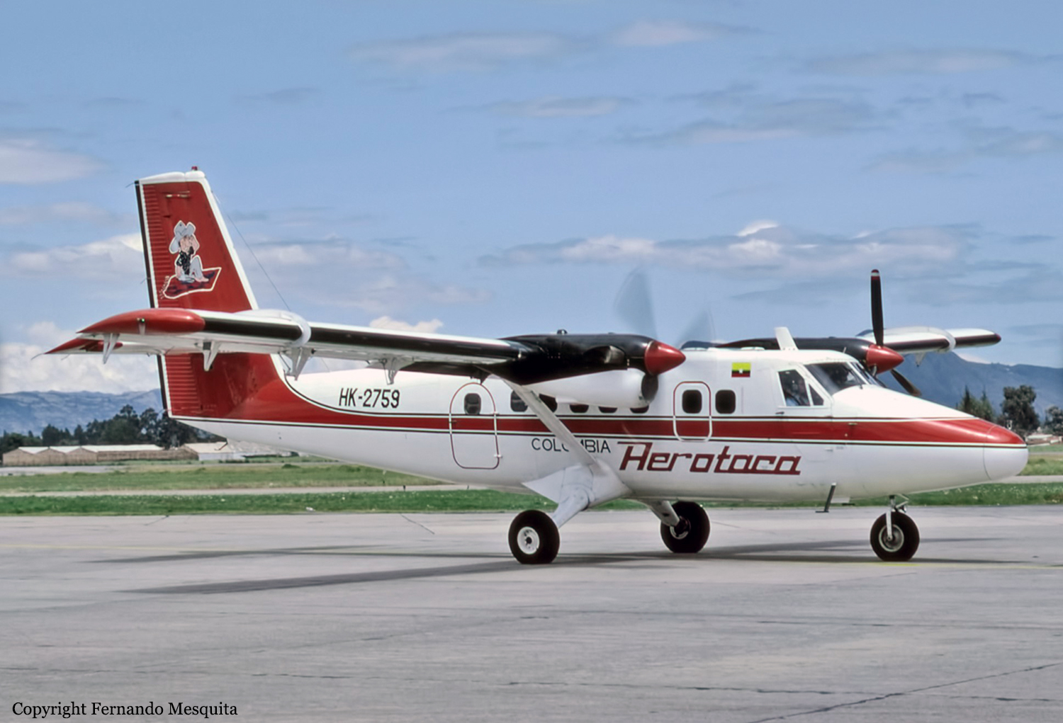
The crew was completing a cargo flight from Bogotá-El Dorado Airport to Yopal. On final approach in good weather conditions, the crew failed to realize his altitude was too low when the aircraft struck the slope of a mountain (900 metres high) located 5 km short of runway. The aircraft was destroyed upon impact and both pilots were killed.
Probable cause:
It was determined that the mountain was shrouded in light mist and the crew was approaching Yopal Airport below the minimum prescribed altitude for unknown reasons.

Crash of a Cessna 550 Citation II in Southampton

Date & Time: May 26, 1993 at 0634 LT
Type of aircraft:
Registration:
G-JETB
Flight Type:
Survivors:
Yes
Schedule:
Oxford - Southampton - Eindhoven
MSN:
550-0288
YOM:
1981
Region:
Crew on board:
2
Crew fatalities:
Pax on board:
0
Pax fatalities:
Other fatalities:
Total fatalities:
0
Captain / Total flying hours:
16700
Captain / Total hours on type:
850.00
Copilot / Total flying hours:
1322
Copilot / Total hours on type:
109
Aircraft flight hours:
4315
Aircraft flight cycles:
3306
Circumstances:
Cessna Citation G-JETB was to fly eight passengers from Southampton (SOU) to Eindhoven (EIN). Because G-JETB had arrived at Oxford (OXF) the previous evening, the airplane had to be ferried to Southampton early in the morning. This as a regular occurrence. The co-pilot had agreed with the airport authorities at both Oxford and Southampton that the aircraft would operate outside normal hours on the understanding that no fire cover would be provided. Following the takeoff from Oxford at 05:19 the crew contacted Brize Norton ATC and agreed a Flight Information Service. They maintained VMC for the transit at 2,400 feet QNH and called Southampton ATC on their alternate radio at 05:25 when they were approximately 30 nm from Southampton. The Southampton controller was surprised at their initial call and advised them that the airport did not open until 06:00. The crew informed him that arrangements had been made for an early arrival and the controller asked them to standby while he checked this agreement. At 05:27 he called G-JETB, informed the crew that they could land before the normal opening hours and asked them to confirm that no fire cover was required. The crew confirmed this and were then told that runway 02 was in use with a wind of 020 deg./14 kt and that there was a thunderstorm right over the airport. The crew then advised Brize Norton radar that they were going to Southampton ATC and left the Brize Norton frequency. Following a further check with Southampton they were given the 0520 weather observation: "Surface wind 040 deg/12 kt, thunderstorms, 2 oktas of stratus at 800 feet, 3 oktas of cumulonimbus at 1,800 feet, temperature 12 C, qnh 1007 mb, qfe 1006 mb, the runway is very wet." At 05:30 the controller asked the crew for the aircraft type and, after being told that it was a Citation II, told the crew that the visibility was deteriorating ("Now 2,000 metres in heavy thunderstorms" ) and cleared them to the Southampton VOR at 3,000 feet QNH. After checking that they were now IFR the controller confirmed the clearance, and the QNH of 1007 mb, and informed the crew that there was no controlled airspace and that he had no radar available to assist them. Shortly afterwards the controller advised the crew that: "Entirely at your discretion you may establish on the ILS localiser for runway 20 for visual break-off to land on runway 02." The commander accepted this offer and, within the cockpit, asked the co-pilot for the surface wind. He was informed that it was 040 degrees but that earlier they had been given 020 deg/14 kt. At 05:32 the commander had positioned on the ILS for runway 20 and began his descent; the co-pilot advised Southampton that they were established. The controller acknowledged this and again passed the QNH. Shortly afterwards he asked the crew to report at the outer marker and this message was acknowledged. At 05:33 the crew called that they were visual with the runway and the controller cleared them for a visual approach, left or right at their convenience, for runway 02. As this transmission was taking place, the commander informed his co-pilot that they would land on runway 20. The commander decided this because he could see that the weather at the other end of the runway appeared very black and he had mentally computed the tailwind component to be about 10 kt. After a confirmation request from the co-pilot to the commander, the co-pilot informed the Southampton controller that they would land on runway 20. The controller then advised them that: "You'll be landing with a fifteen knot, one five knot, tailwind component on a very wet runway" ; this was immediately acknowledged by the co-pilot with: "roger, copied thank you". The crew continued with their approach, initially at 15 kt above their computed threshold speed (VREF) of 110 kt and then at a constant VREF+10 kt. Within the cockpit the commander briefed the co-pilot that if they were too fast the co-pilot was to select flap to the takeoff position and they would go-around; they also discussed the use of the speedbrake and the commander stated that he would call for it when he wanted it. The speed at touchdown was within 5 kt of the target threshold speed and touchdown was in the vicinity of the Precision Approach Path Indicators (PAPIs), according to witnesses in the Control Tower and on the airport; the commander was certain that he had made a touchdown within the first 300 feet of the runway. The PAPIs are located 267 metres along the runway. Speedbrake was selected as the aircraft touched down and, although the commander applied and maintained heavy foot pressure on the brakes, no retardation was apparent; external observers reported heavy spray from around the aircraft. At some stage down the runway the commander stated that the brakes were not stopping them and the co-pilot called for a go-around ; the commander replied : "No we can't" as he considered that a go-around at that stage would be more dangerous. He maintained brake pressure and, in an attempt to increase distance, steered the aircraft to the right edge of the runway before trying to steer back left. Initially the aircraft nose turned to the left and the aircraft slid diagonally off the right side of the runway on to the grass. It continued across the grass for a distance of approximately 233 metres while at the same time yawing to the left. However, 90 metres beyond the end of the runway there is an embankment which forms the side of the M27 motorway and G-JETB slid down this embankment on to the motorway. The aircraft continued to rotate as it descended and came to rest, having turned through approximately 150 degrees, with its tail on the central barrier. During these final manoeuvres the aircraft collided with two cars travelling on the eastbound carriageway; the aircraft and one of the cars caught fire. During the approach of the aircraft, the airport Rescue and Fire Fighting Service (RFFS) duty officer had discussed with the duty ATC controller the imminent arrival of G-JETB. Although not all checks had been complete, the fire officer offered his two fire vehicles as a weather standby ; he did not declare his section operational but agreed with ATC that they would position themselves to the west of the runway. When the aircraft was 1/2 to 2/3 down the runway, the ATC controller considered that the aircraft would not stop in the runway available and activated the crash alarm. The fire section obtained clearance to enter the runway after G-JETB had passed their position and followed the aircraft. Assessing the situation on the move, the fire officer ordered the FIRE 2 vehicle to disperse through the crash gate to the motorway, and took his own vehicle (FIRE 1) to the edge of the embankment. On arrival, the fire section contained the fires. The occupants of the aircraft and cars escaped with minor injuries.
Probable cause:
The investigation identified the following causal factors:
- The commander landed with a reported tailwind of 15 knots which was outside the aircraft maximum tailwind limit of 10 knots specified in the Cessna 550 Flight Manual.
- The copilot did not warn the commander that he was landing with a reported tailwind component which was outside the aircraft limit.
- With a tailwind component of 10 knots, the landing distance available was less than the landing distance required.
Final Report:

Crash of a Swearingen SA226T Merlin III in Santa Fe: 4 killed

Date & Time: May 25, 1993 at 2114 LT
Type of aircraft:
Registration:
N241DT
Flight Type:
Survivors:
No
Schedule:
Albuquerque - Santa Fe
MSN:
T-242
YOM:
1973
Crew on board:
3
Crew fatalities:
Pax on board:
1
Pax fatalities:
Other fatalities:
Total fatalities:
4
Captain / Total flying hours:
7125
Captain / Total hours on type:
3550.00
Aircraft flight hours:
3677
Circumstances:
The purpose of the training flight was to conduct part 135 checkrides for a pilot-in-command and a second-in-command upon completion of the crew's training. The checkride was being observed by an FAA inspector seated in the cabin. After completing an ILS approach to runway 02, the flight was cleared to circle to land on runway 15. The airplane was observed overflying runway 15 and lined up for runway 20. The tower advised the pilot that he was lined up for runway 20, and was given the option to land on either runway 15 or runway 20. The pilot opted for runway 15 and was cleared to a right downwind. The airplane impacted a hill at the 6,870-feet level near the crest, approximately 5 miles west of the airport. The published circling MDA for the ILS runway 02 approach is 6,860 feet. The airport is located about 9 miles from the city, and several local pilots reported a total lack of visual reference in that segment. All four occupants were killed.
Probable cause:
The pilot's poorly planned circling approach, and his failure to maintain an adequate altitude. Factors which contributed to the accident were: the dark night and a lack of visual reference.
Final Report: