Country
code

New South Wales

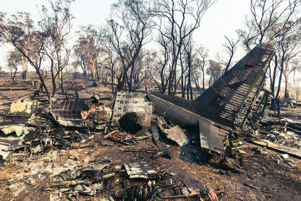
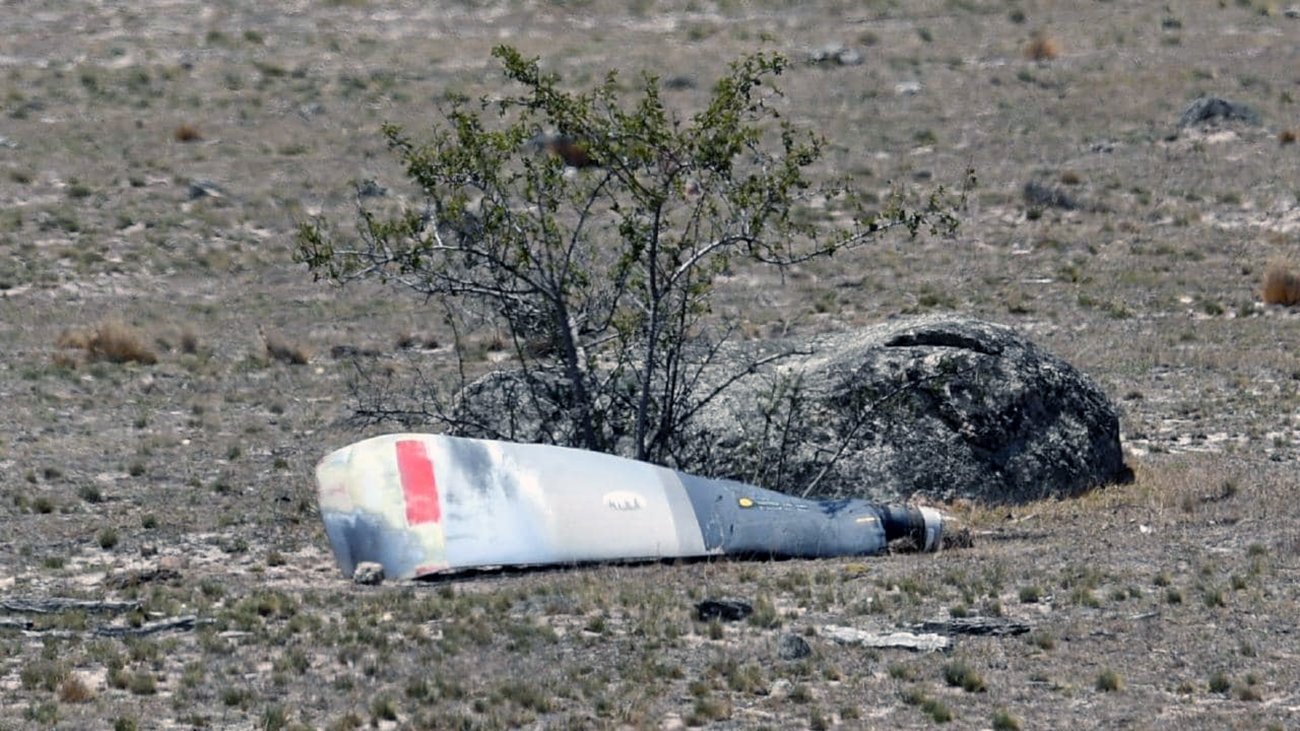
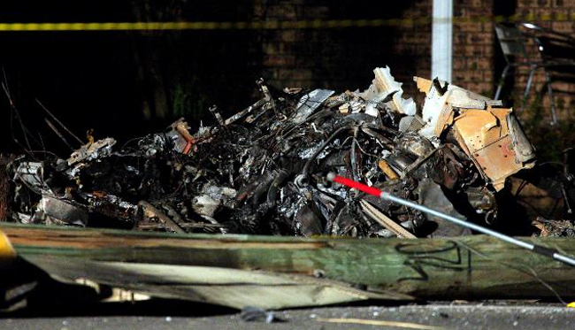
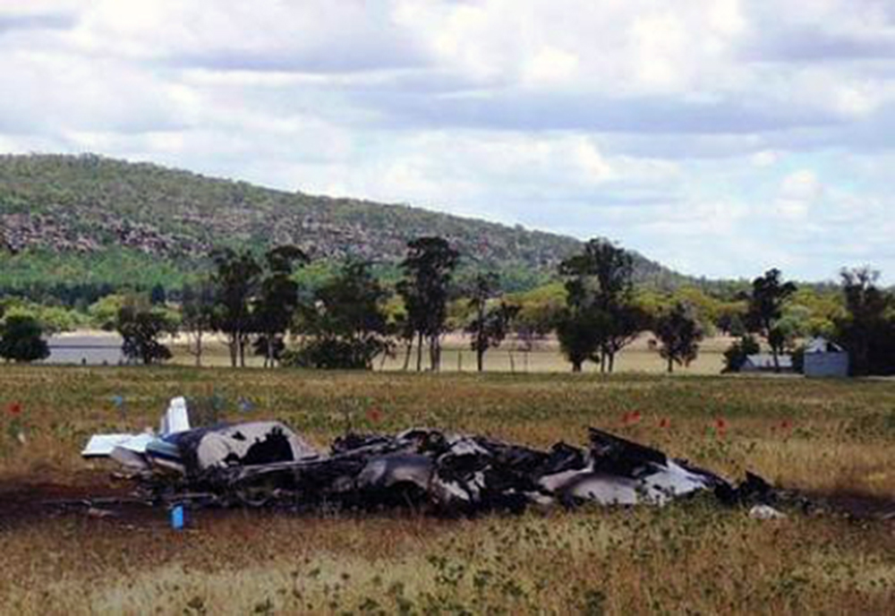
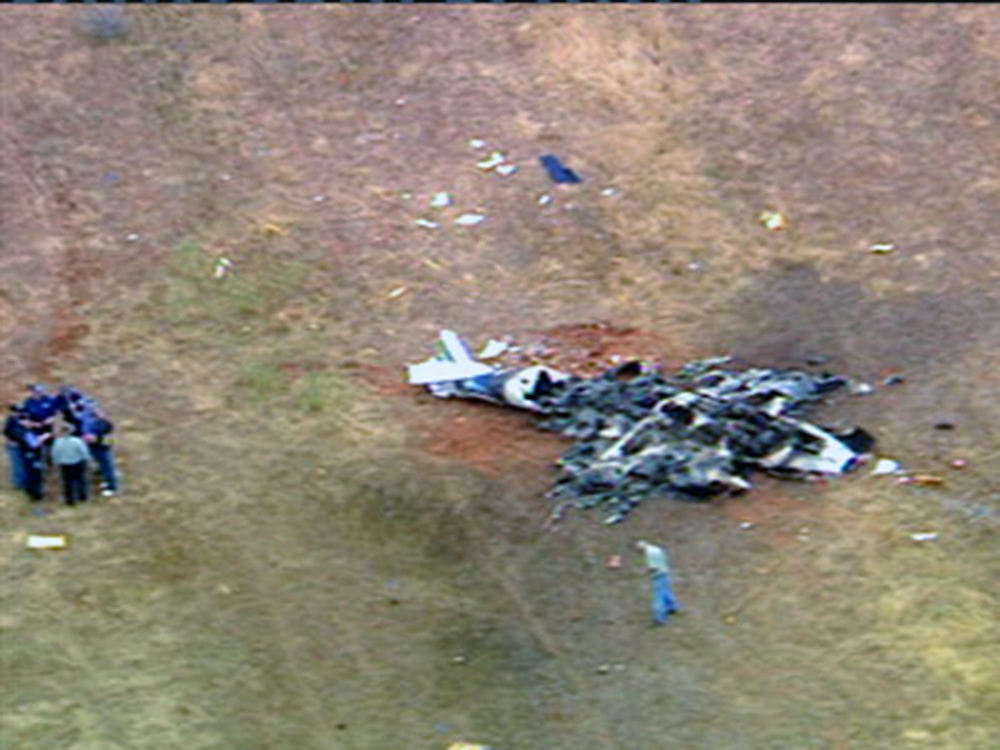
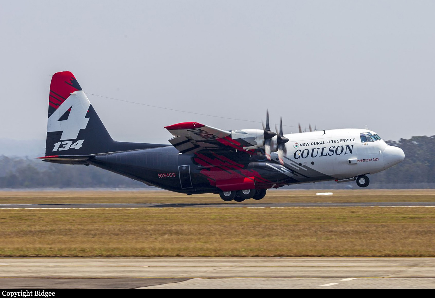
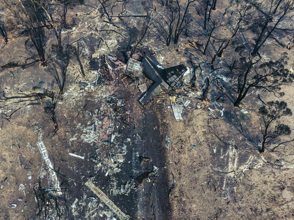
Crash of a Lockheed EC-130Q Hercules near Peak View: 3 killed

Date & Time: Jan 23, 2020 at 1315 LT
Type of aircraft:
Operator:
Registration:
N134CG
Flight Phase:
Flight Type:
Survivors:
No
Schedule:
Richmond - Richmond
MSN:
4904
YOM:
1981
Flight number:
Bomber 134
Country:
Region:
Crew on board:
3
Crew fatalities:
Pax on board:
0
Pax fatalities:
Other fatalities:
Total fatalities:
3
Captain / Total flying hours:
4010
Captain / Total hours on type:
3010.00
Copilot / Total flying hours:
1744
Copilot / Total hours on type:
1364
Aircraft flight hours:
11888
Circumstances:
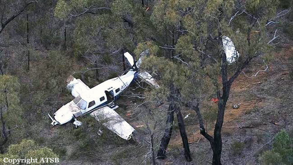
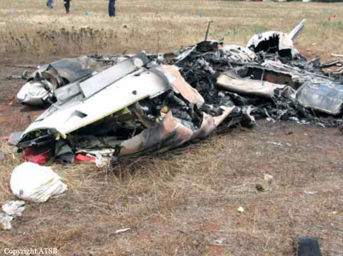
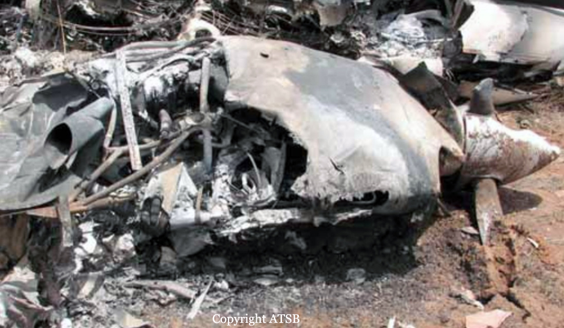
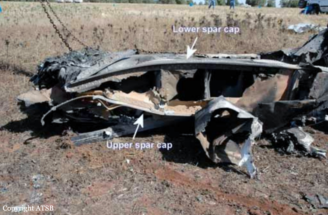
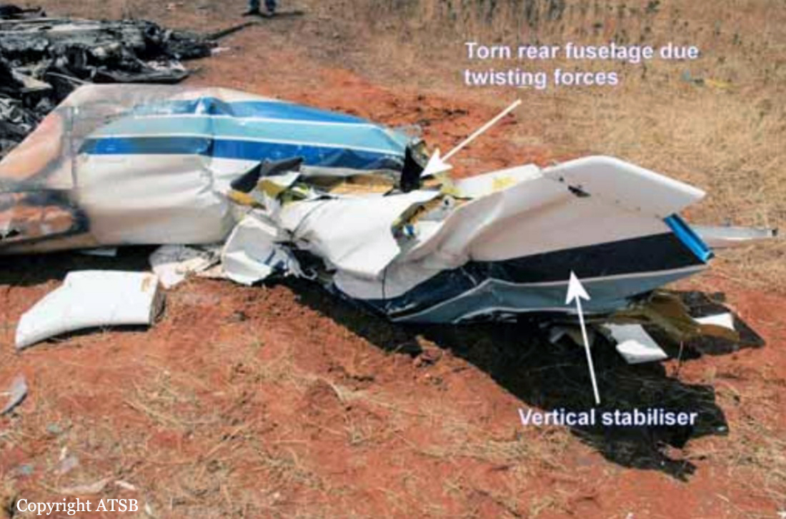
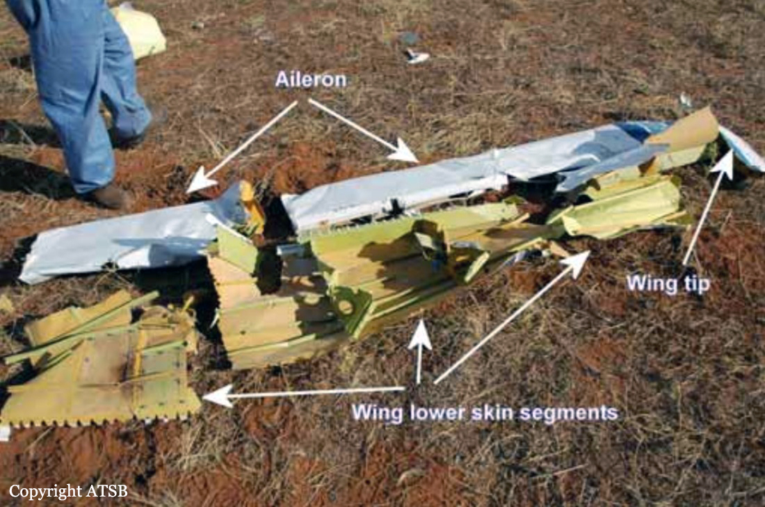
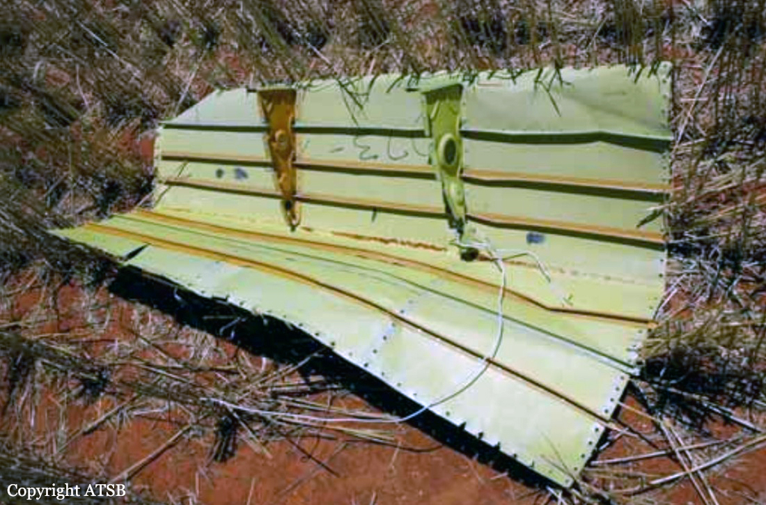
At about 1205, while B137 was overhead the Adaminaby fire-ground, and about the same time the SAD logged the birddog rejection, B134 departed Richmond as initial attack. On board were the PIC, the copilot and flight engineer. In response to the draft report, the RFS provided excerpts from the state operations controller (SOC) log. An entry was written in the log by the SOC following the accident. The SOC noted having been advised that the birddog had indicated it was ‘not safe to fly’ and that B137 was not returning to the area until the conditions had eased. However, B134 would continue with the PIC to make the ‘decision of safety of bombing operations’. The RFS advised the ATSB that the SOC had the authority to cancel B134’s tasking, but instead allowed it to proceed, with the intention of gathering additional intelligence to assist in determining whether further aerial operations would proceed. The RFS further reported that this indicated an ongoing intelligence gathering and assessment process by the SOC. At about 1235, while returning to Richmond, the PIC of B137 heard the PIC of B134 on the Canberra approach frequency, and contacted them via their designated operating frequency. At that time, B134 was about 112 km north-east of Adaminaby, en route to the fire-ground. In this conversation, the PIC of B137 informed them of the actual conditions and that they would not be returning to Adaminaby. The PIC of B137 reported that they could not recall the specific details of the call, but that the conversation included that they were ‘getting crazy winds’ and ‘you can go take a look’ ’but I am not going back’. It was also noted that the PIC of B134 had asked several questions. It was reported by the majority of the operator’s pilots that, despite receiving information from another pilot, they would have also continued with the tasking under these circumstances, to assess the conditions themselves. At about 1242, the crew of B134 contacted air traffic control to advise them of the coordinates they would be working at, provide an ‘ops normal’ call time, and confirm there was no reported instrument flight rules aircraft in the area. About 5 minutes later, the Richmond ABM also attempted to contact the crew of B134 to confirm ‘ops normal’, firstly by radio, and then by text to the PIC’s mobile phone, but did not receive a response. The automatic dependent surveillance broadcast (ADS-B) data showed that, after arriving at the Adaminaby fire-ground at about 1251, the crew of B134 completed several circuits at about 2,000 ft AGL. At about 1255, the crew advised the Cooma ARO that it was too smoky and windy to complete a retardant drop at that location. The Cooma ARO then provided the crew with the approximate coordinates of the Good Good fire, about 58 km to the east of Adaminaby. The ARO further indicated that they had no specific requirements, but they could look for targets of opportunity, with the objective of conducting structure and property protection near Peak View. At about 1259, the crew of B134 contacted air traffic control to advise that they had been re-tasked to the Good Good fire-ground, and provided updated coordinates. At about the same time, the RFS ground firefighters at the Good Good fire-ground, near Feeney’s Road in Peak View, contacted the Cooma FCC and requested additional assets for property protection. They were advised that a LAT would be passing overhead in about 10 minutes. The firefighters acknowledged the intention of a LAT retardant drop and advised the Cooma FCC they would wait in open country on Feeney’s Road, clear of any properties targeted for protection. At about 1307, B134 arrived overhead the drop area. The drop area was located to the east of a ridgeline, with the fire on the western side of the ridgeline. The aircraft’s recorded track data (SkyTrac) showed that the crew conducted 3 left circuits, at about 1,500 ft, 500 ft and 1,000 ft AGL respectively, prior to commencing the drop circuit. At about 1312, after conducting about 2 circuits, they advised the Cooma ARO of their intention to complete multiple drops on the eastern side of the Good Good fire, and that they would advise the coordinates after the first delivery. At 1315:15, a partial retardant drop was conducted on a heading of about 190°, at about 190 ft AGL (3,600 ft above mean sea level). During the drop, about 1,200 US gallons (4,500 L) of fire retardant was released over a period of about 2 seconds. A ground speed of 144 kt was recorded at the time of the drop. A witness video taken by ground fire-fighters captured the drop and showed the aircraft immediately after the drop in an initial left turn with a positive rate of climb, before it became obscured by smoke. While being intermittently obscured by smoke, the aircraft climbed to about 330 ft AGL (3,770 ft above mean sea level). At about this time, ATSB analysis of the video showed that the aircraft was rolling from about 18° left angle of bank to about a 6° right angle of bank. Following this, the aircraft descended and about 17 seconds after the completion of the partial retardant drop, it was seen at a very low height above the ground, in a slight left bank. Video analysis and accident site examination showed there was no further (emergency) drop of retardant. Throughout this period, the recorded groundspeed increased slightly to a maximum of 151 kt. Shortly after, there was a significant left roll just prior to ground impact. At about 1315:37, the aircraft collided with terrain and a post-impact fuel-fed fire ensued. The 3 crew were fatally injured and the aircraft was destroyed. A review of the Airservices Australia audio recording of the applicable air traffic control frequency found no distress calls were received by controllers prior to the impact.
Probable cause:
The following contributing factors were identified:
- Hazardous weather conditions were forecast and present at the drop site near Peak View, which included strong gusting winds and mountain wave activity, producing turbulence. These
conditions were likely exacerbated by the fire and local terrain.
- The Rural Fire Service continued the B134 tasking to Adaminaby when they learned that no other aircraft would continue to operate due to the environmental conditions. In addition, they relied on the pilot in command to assess the appropriateness of the tasking to Adaminaby without providing them all the available information to make an informed decision on flight safety.
- The pilot in command of B134 accepted the Adaminaby fire-ground tasking, which was in an area of forecast mountain wave activity and severe turbulence. After assessing the conditions as unsuitable, the crew accepted an alternate tasking to continue to the Good Good (Peak View) fire-ground, which was subject to the same weather conditions. The acceptance of these taskings were consistent with company practices.
- Following the partial retardant drop and left turn, the aircraft was very likely subjected to hazardous environmental conditions including low-level windshear and an increased tailwind component, which degraded the aircraft’s climb performance.
- While at a low height and airspeed, it was likely the aircraft aerodynamically stalled, leading to a collision with terrain.
- Coulson Aviation's safety risk management processes did not adequately manage the risks associated with large air tanker operations. There were no operational risk assessments conducted or a risk register maintained. Further, as safety incident reports submitted were mainly related to maintenance issues, operational risks were less likely to be considered or monitored. Overall, this limited their ability to identify and implement mitigations to manage the risks associated with their aerial firefighting operations. (Safety issue)
- Coulson Aviation did not provide a pre-flight risk assessment for their firefighting large air tanker crews. This would provide predefined criteria to ensure consistent and objective decision-making with accepting or rejecting tasks, including factors relating to crew, environment, aircraft and external pressures. (Safety issue)
- The New South Wales Rural Fire Service had limited large air tanker policies and procedures for aerial supervision requirements and no procedures for deployment without aerial supervision.(Safety issue)
- The New South Wales Rural Fire Service did not have a policy or procedures in place to manage task rejections, nor to communicate this information internally or to other pilots working in the same area of operation. (Safety issue)

Other factors that increased risk:
- The B134 crew were very likely not aware that the 'birddog' pilot had declined the tasking to Adaminaby fire-ground, and the smaller fire-control aircraft had ceased operations in the area, due to the hazardous environmental conditions
- In the limited time available, the remainder of the fire-retardant load was not jettisoned prior to the aircraft stalling.
- Coulson Aviation did not include a windshear recovery procedure or scenario in their C-130 Airplane Flight Manual and annual simulator training respectively, to ensure that crews consistently and correctly responded to a windshear encounter with minimal delay. (Safety issue)
- Coulson Aviation fleet of C-130 aircraft were not fitted with a windshear detection system, which increased the risk of a windshear encounter and/or delayed response to a windshear encounter during low level operations. (Safety issue)
- The New South Wales Rural Fire Service procedures allowed operators to determine when pilots were initial attack capable. However, they intended for the pilot in command to be certified by the United States Department of Agriculture Forest Service certification process. (Safety issue)

Other findings:
- The aircraft's cockpit voice recorder did not record the accident flight, which resulted in a valuable source of safety information not being available. This limited the extent to which potential factors contributing to the accident could be identified.
Final Report:
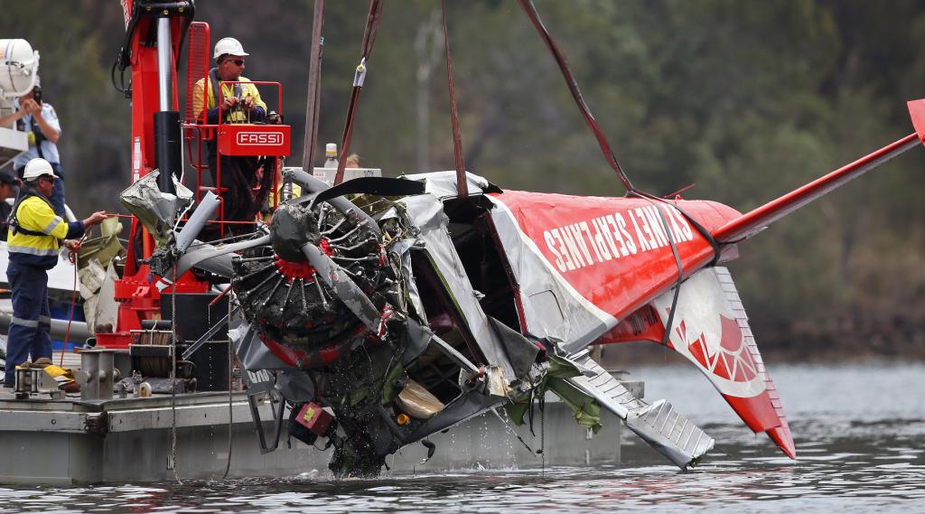
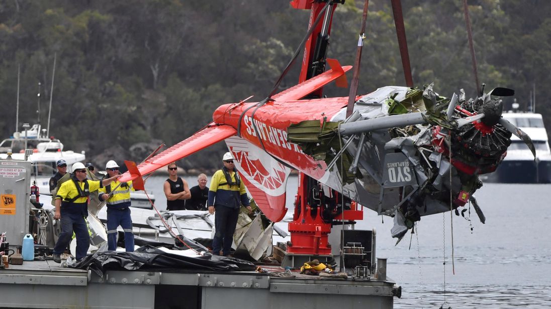
Crash of a De Havilland DHC-2 Beaver off Cottage Point: 6 killed

Date & Time: Dec 31, 2017 at 1515 LT
Type of aircraft:
Operator:
Registration:
VH-NOO
Flight Phase:
Survivors:
No
Schedule:
Cottage Point - Sydney
MSN:
1535
YOM:
1963
Country:
Region:
Crew on board:
1
Crew fatalities:
Pax on board:
5
Pax fatalities:
Other fatalities:
Total fatalities:
6
Captain / Total flying hours:
10762
Aircraft flight hours:
21872
Circumstances:
On 31 December 2017, at about 1045 Eastern Daylight-saving Time, five passengers arrived via water-taxi at the Sydney Seaplanes terminal, Rose Bay, New South Wales (NSW) for a charter fly-and-dine experience to a restaurant at Cottage Point on the Hawkesbury River. Cottage Point is about 26 km north of Sydney Harbour in the Ku-ring-gai Chase National Park, a 20 minute floatplane flight from Rose Bay. At about 1130, prior to boarding the aircraft, the passengers received a pre-flight safety briefing. At about 1135, the pilot and five passengers departed the Rose Bay terminal for the flight to Cottage Point via the northern beaches coastal route, in a de Havilland Canada DHC-2 Beaver floatplane, registered VH-NOO and operated by Sydney Seaplanes. The flight arrived at Cottage Point just before midday and the passengers disembarked. The pilot then conducted another four flights in VH-NOO between Cottage Point and Rose Bay. The pilot arrived at Cottage Point at about 1353. After securing the aircraft at the pontoon and disembarking passengers from that flight, the pilot walked to a kiosk at Cottage Point for a drink and food. At about 1415, the pilot received a phone call from the operator via the kiosk, asking the pilot to move the aircraft off the pontoon, which could only accommodate one aircraft at a time. This was to allow the pilot of the operator’s other DHC-2 aircraft (VH-AAM) to pick-up other restaurant passengers. The pilot of VH-NOO immediately returned to the aircraft and taxied away from the pontoon into Cowan Creek. The operator’s records indicated that VH-AAM arrived at the pontoon and shut down the engine at about 1419, and subsequently departed at about 1446. The pilot of VH-NOO returned to the pontoon after having taxied in Cowan Creek with the engine running for up to 27 minutes, while waiting for the other aircraft. During the taxi, closed-circuit television footage from a private residence at Cottage Point showed VH-NOO at 1444, with the pilot’s door ajar. After shutting down the aircraft, the pilot briefly went into the restaurant to see if the passengers were ready to leave, and then returned to the aircraft. The return flight to Rose Bay, scheduled to depart at 1500, provided sufficient time for the passengers to meet a previously booked water-taxi to transport them from Rose Bay to their hotel at 1545. At about 1457, the passengers commenced boarding the aircraft and at around 1504, the aircraft had commenced taxiing toward the designated take-off area in Cowan Creek. At about 1511, the aircraft took off towards the north-north-east in Cowan Creek, becoming airborne shortly before passing Cowan Point. The aircraft climbed straight ahead before commencing a right turn into Cowan Water. A witness, who was travelling east in a boat on the northern side of Cowan Water, photographed the aircraft passing over a location known as ‘Hole in the wall’. These photographs indicated that the aircraft was turning to the right with a bank angle of 15-20°. Witnesses observed the right turn continue above Little Shark Rock Point and Cowan Water. The last photograph taken by the passenger was when the aircraft was heading in a southerly direction towards Cowan Bay. At that time, the aircraft was estimated to be at an altitude of about 30 m (98 ft).Shortly after the turn in Cowan Water, several witnesses observed the aircraft heading directly towards and entering Jerusalem Bay flying level or slightly descending, below the height of the surrounding terrain. Witnesses also reported hearing the aircraft’s engine and stated that the sound was constant and appeared normal. About 1.1 km after entering Jerusalem Bay, near the entrance to Pinta Bay, multiple witnesses reported seeing the aircraft flying along the southern shoreline before it suddenly entered a steep right turn at low-level. Part-way through the turn, the aircraft’s nose suddenly dropped before the aircraft collided with the water, about 95 m from the northern shore and 1.2 km from the end of Jerusalem Bay. The aircraft came to rest inverted and with the cabin submerged. A number of people on watercraft who heard or observed the impact, responded to render assistance. Those people could not access the (underwater) aircraft cabin. The entire tail section and parts of both floats were initially above the waterline, but about 10 minutes later had completely submerged. The pilot and five passengers received fatal injuries.
Probable cause:
Contributing factors:
- The aircraft entered Jerusalem Bay, a known confined area, below terrain height with a level or slightly descending flight path. There was no known operational need for the aircraft to be
operating in the bay.
- While conducting a steep turn in Jerusalem Bay, it was likely that the aircraft aerodynamically stalled at an altitude too low to effect a recovery before colliding with the water.
- It was almost certain that there was elevated levels of carbon monoxide in the aircraft cabin, which resulted in the pilot and passengers having higher than normal levels of carboxyhaemoglobin in their blood.
- Several pre-existing cracks in the exhaust collector ring, very likely released exhaust gas into the engine/accessory bay, which then very likely entered the cabin through holes in the main
firewall where three bolts were missing.
- A 27 minute taxi before the passengers boarded, with the pilot’s door ajar likely exacerbated the pilot’s elevated carboxyhaemoglobin level.
- It was likely that the pilot's ability to safely operate the aircraft was significantly degraded by carbon monoxide exposure.
- Disposable chemical spot detectors, commonly used in general aviation, can be unreliable at detecting carbon monoxide in the aircraft cabin. Further, they do not draw a pilot's attention to a hazardous condition, instead they rely on the pilot noticing the changing colour of the sensor.
- There was no regulatory requirement from the Civil Aviation Safety Authority for piston-engine aircraft to carry a carbon monoxide detector with an active warning to alert pilots to the presence of elevated levels of carbon monoxide in the cabin. (Safety issue)

Other factors that increased risk:
- It was likely that the effectiveness of the disposable carbon monoxide chemical spot detector fitted to the aircraft was reduced due to sun bleaching.
- Although detectors were not required to be fitted to their aircraft, Sydney Seaplanes had no mechanism for monitoring the serviceability of the carbon monoxide detectors. (Safety issue)
- The in situ bolts used by the maintenance organisation to secure the magneto access panels on the main firewall were worn, and were a combination of modified AN3-3A bolts and non-specific bolts. This increased the risk of the bolts either not tightening securely on installation and/or coming loose during operations.
- The operator relied on volunteered passenger weights without allowances for variability, rather than actual passenger weights obtained just prior to a flight. This increased the risk of underestimating passenger weights and potentially overloading an aircraft.
- The standard passenger weights specified in Civil Aviation Advisory Publication (CAAP) 235-1(1) Standard passenger and baggage weights did not accurately reflect the average weights of the current Australian population. Further, the CAAP did not provide guidance on the use of volunteered passenger weights as an alternative to weights derived just prior to a flight.
- Australian civil aviation regulations did not mandate the fitment of flight recorders for passenger-carrying aircraft under 5,700 kg. Consequently, the determination of factors that influenced this accident, and other accidents, have been hampered by a lack of recorded data pertaining to the flight. This has likely resulted in the non-identification of safety issues, which continue to present a hazard to current and future passengercarrying operations. (Safety issue)
- Annex 6 to the Convention of International Civil Aviation did not mandate the fitment of flight recorders for passenger-carrying aircraft under 5,700 kg. Consequently, the determination of factors that influenced this accident, and numerous other accidents have been hampered by a lack of recorded data pertaining to the flight. This has likely resulted in important safety issues not being identified, which may remain a hazard to current and future passenger carrying operations. (Safety issue)

Other findings:
- It was very likely that the middle row right passenger did not have his seatbelt fastened at the time of impact, however, the reason for this could not be determined.
- The accident was not survivable due to the combination of the impact forces and the submersion of the aircraft.
- The pilot had no known pre-existing medical conditions that could explain the accident.
Final Report:

Crash of a Pacific Aerospace FU-24 Stallion in Upper Turon: 1 killed

Date & Time: Jun 16, 2017 at 1049 LT
Type of aircraft:
Registration:
VH-EUO
Flight Phase:
Survivors:
No
Schedule:
Upper Turon - Upper Turon
MSN:
3002
YOM:
1980
Country:
Region:
Crew on board:
1
Crew fatalities:
Pax on board:
0
Pax fatalities:
Other fatalities:
Total fatalities:
1
Captain / Total flying hours:
4688
Captain / Total hours on type:
786.00
Aircraft flight hours:
11059
Circumstances:
On 16 June 2017, a Pacific Aerospace Ltd FU24 Stallion, registered VH-EUO (EUO), was conducting aerial agricultural operations from a private airstrip at Redhill, 36 km north-north-east of Bathurst, New South Wales (NSW). The operations planned for that day involved the aerial application of fertiliser on three properties in the Upper Turon area of NSW. At about 0700 Eastern Standard Time on the morning of the accident, the pilot and loader drove to Bathurst Airport to fill the fuel tanker and then continued to the worksite at the Redhill airstrip in the Upper Turon area, arriving at about 0830. Work on the first property started at about 0900, with the first flight of the day commencing at 0920. Work on the first property continued until 1350 with two refuelling stops at 1048 and 1250. Approximately 40 tonnes of fertiliser was applied on the first job. In preparation for the second job, fertiliser and seed were loaded into the aircraft and maps of the second job area were passed to the pilot. At 1357, the aircraft took off for the first flight of the second job. The aircraft returned to reload, and at 1405 the aircraft took off for the second flight. A short time later, at 14:06:59, recorded flight data from the aircraft ceased. When the aircraft did not return as expected, the loader radioed the pilot. When the loader could not raise the pilot on the radio, he became concerned and drove his vehicle down the airstrip to see if the aircraft had experienced a problem on the initial climb. Finding no sign of the aircraft, he returned to the load site, while continuing to call the pilot on the radio. He then drove to the application area to search for the aircraft before returning to the load site. With no sign of the aircraft, the loader called emergency services to raise the alarm. By about 1500, police had arrived on site and a ground search commenced. A police helicopter also joined the search, which was eventually called off due to low light. The next morning, at about 0630, the search recommenced and included NSW Police State Emergency Service personnel, and local volunteers. At about 0757, the wreckage of the aircraft was found in dense bush on the side of a hill to the east of the application area. The pilot was found deceased in the aircraft. The aircraft was found approximately 17 hours after the last recorded flight data and there were no witnesses to the accident.
Probable cause:
From the evidence available, the following findings are made with respect to the collision with terrain involving a FU24 Stallion, VH-EUO 40 km north-east of Bathurst, New South Wales on 16 June 2017. These findings should not be read as apportioning blame or liability to any particular organisation or individual.
Contributing factors:
- The pilot flew the aircraft into an area of rising terrain that was outside the normal operating area for this job site.
- For reasons that could not be determined, the aircraft aerodynamically stalled and collided with terrain during re-positioning at the end of the application run.
Other findings:
- There was no evidence of any defect with the aircraft that would have contributed to the loss of control.
Final Report:

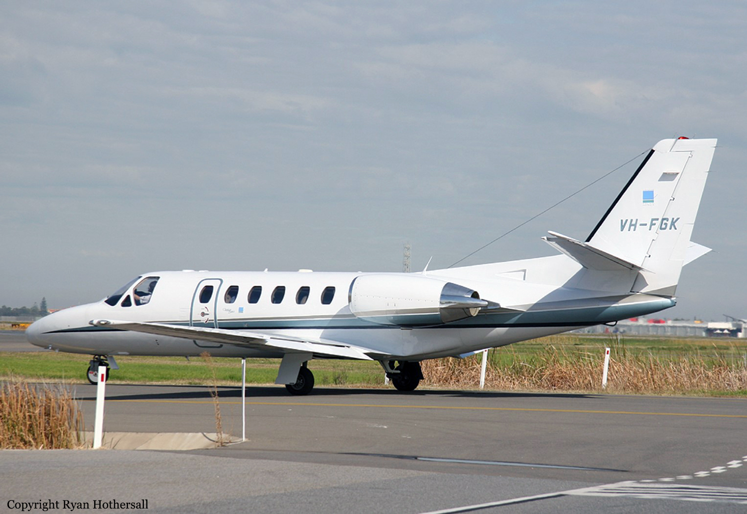
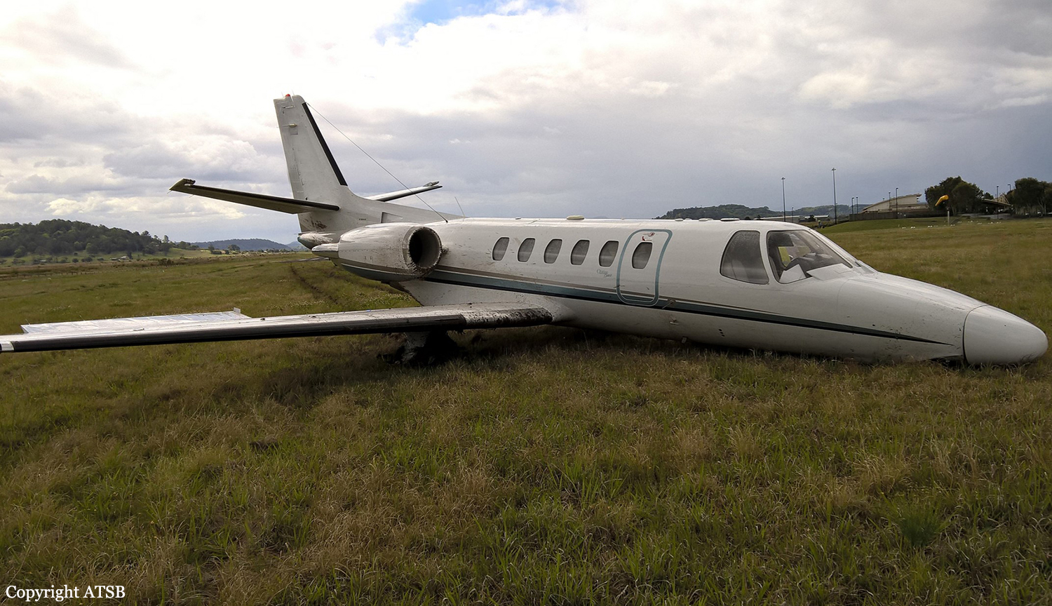
Crash of a Cessna 550 Citation Bravo in Lismore

Date & Time: Sep 25, 2015 at 1300 LT
Type of aircraft:
Operator:
Registration:
VH-FGK
Flight Phase:
Flight Type:
Survivors:
Yes
Schedule:
Lismore - Baryulgil
MSN:
550-0852
YOM:
1998
Country:
Region:
Crew on board:
2
Crew fatalities:
Pax on board:
0
Pax fatalities:
Other fatalities:
Total fatalities:
0
Captain / Total flying hours:
5937
Copilot / Total flying hours:
377
Aircraft flight hours:
2768
Circumstances:
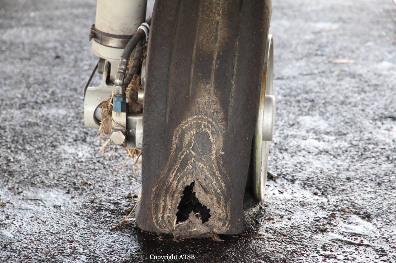
On the morning of 25 September 2015, the captain and copilot of a Cessna 550 aircraft (Citation Bravo), registered VH-FGK, prepared to conduct a private flight from Lismore Airport to Baryulgil, about 40 NM south-west of Lismore, New South Wales. The aircraft had been parked at the northern end of the airport overnight, with engine covers and control locks on. After arriving at the airport, the flight crew conducted a pre-flight inspection, with no abnormalities identified. They then commenced the normal pre-start checks, which included the disengagement of the flight control locks. The crew elected to use runway 15 for take-off, and used the Cessna simplified take-off performance criteria (see Take-off performance simplified criteria) to determine the thrust settings and take-off reference speeds. The resultant reference speeds were 105 kt for the decision speed (V1) and 108 kt for the rotation speed (VR). At about 1300 Eastern Standard Time, the flight crew started the engines and performed the associated checks, with all indications normal. The crew reported that they completed the after start checks, and the captain then taxied the aircraft to the holding point for runway 15, less than 200 m from where the aircraft was parked. While stopped at the holding point, the crew completed the taxi and pre-take-off checks, the copilot broadcast the standard calls on the common traffic advisory frequency, and the captain communicated with air traffic control (ATC). The captain taxied the aircraft onto the runway, and turned left onto the runway centreline to commence the take-off run from the intersection. While rolling along the runway, the captain advanced the thrust levers to the approximate take-off setting. The captain then called ‘set thrust’, and the copilot set the thrust levers to the more precise position needed to achieve the planned engine thrust for the take-off. As the aircraft accelerated, the copilot called ‘80 knots’ and crosschecked the two airspeed indicators were in agreement and reading 80 kt. The copilot called ‘V1’ and the captain moved their hands from the thrust levers to the control column in accordance with the operator’s normal procedure. A few seconds later, the copilot called ‘rotate’ and the captain initiated a normal rotate action on the control column. The crew reported that the aircraft did not rotate and that they did not feel any indication that the aircraft would lift off. The copilot looked outside and did not detect any change in the aircraft’s attitude as would normally occur at that stage. The captain stated to the copilot that the aircraft would not rotate, and pulled back harder on the control column. The copilot looked across and saw the captain had pulled the control column firmly into their stomach. Although the aircraft’s speed was then about 112 kt, and above VR, the crew did not detect any movement of the attitude director indicator or the nose wheel lifting off the ground, so the captain rejected the take-off; applied full brakes, and set the thrust levers to idle and then into reverse thrust. The aircraft continued to the end of the sealed runway and onto the grass in the runway end safety area (RESA), coming to rest slightly left of the extended centreline, about 100 m beyond the end of the runway. The aircraft sustained substantial damage and the flight crew, who were the only occupants of the aircraft, were uninjured. The nose landing gear separated from the aircraft during the overrun, and there was significant structural damage to the fuselage and wings. The right wheel tyre had deflated due to an apparent wheel lockup and flat spot, which had progressed to a point that a large hole had been worn in the tyre.
Probable cause:
Contributing factors:
- There was probably residual braking pressure in the wheel brakes during the take-off run.
- The aircraft’s parking brake was probably applied while at the holding point and not disengaged before taxing onto the runway for take-off.
- The Citation aircraft did not have an annunciator light to show that the parking brake is engaged, and the manufacturer’s before take-off checklist did not include a check to ensure the parking brake is disengaged.
- The aircraft experienced a retarded acceleration during the take-off run, and did not rotate as normal when the appropriate rotate speed was reached, resulting in a critical rejected take-off
and a runway overrun.
Final Report:

Crash of a Piper PA-46-310P Malibu near Narrabri

Date & Time: Jun 12, 2014 at 1630 LT
Operator:
Registration:
VH-TSV
Flight Phase:
Survivors:
Yes
Schedule:
Dubbo – Sunshine Coast
MSN:
46-8408022
YOM:
1984
Country:
Region:
Crew on board:
1
Crew fatalities:
Pax on board:
1
Pax fatalities:
Other fatalities:
Total fatalities:
0
Circumstances:
On 12 June 2014, at about 1530 Eastern Standard Time (EST), a Piper PA-46 aircraft, registered VH-TSV, departed Dubbo, New South Wales for a private flight to the Sunshine Coast, Queensland with a pilot and one passenger on board. The planned route was to track via Moree and Toowoomba at 13,500 ft above mean sea level (AMSL). The pilot had operated the aircraft from Sunshine Coast to Lightning Ridge, Brewarrina and Dubbo earlier that day and reported that all engine indications were normal on those flights. About 1 hour after departing Dubbo, when about 26 NM south of Narrabri, at about 13,500 ft AMSL, the pilot observed the engine manifold pressure gauge indicating 25 inches Hg, when the throttle position selected would normally have produced about 28 inches Hg. The pilot selected the alternate air1 which did not result in any increase in power. He then elected to descend to 10,000 ft, and at that power setting when normally the engine would have produced about 29 inches Hg, the gauge still indicated only about 25 inches Hg. He turned the aircraft towards Narrabri in an attempt to fly clear of the Pilliga State Forest. The pilot assessed that the aircraft had a partial engine failure and performed troubleshooting checks. As the aircraft descended through about 8,000 ft, he observed the oil pressure gauge indicating decreasing pressure. When passing about 6,500 ft, the oil pressure gauge indicated zero and the pilot heard two loud bangs and observed the cowling lift momentarily from above the engine. The passenger observed a puff of smoke emanating from the engine and momentarily a small amount of smoke in the cockpit. The pilot established the aircraft in a glide at about 90 kt, secured the engine and completed the emergency checklist. He broadcast a ‘Mayday’ 2 call on Brisbane Centre radio frequency advising of an engine failure and forced landing. The pilot looked for a clear area below in which to conduct a forced landing and also requested the passenger to assist in identifying any cleared areas suitable to land. Both only identified heavily treed areas. The pilot extended the landing gear and selected 10º of flap and, when at about 1,000 ft, the pilot shut the fuel off, deployed the emergency beacon then switched off the electrical system. As the aircraft entered the tree tops, he flared to stall3 the aircraft. On impact, the pilot was seriously injured and lost consciousness. The passenger reported the wings impacted with trees and the aircraft slid about 10 m before coming to rest. The passenger checked for any evidence of fuel leak or fire and administered basic first aid to the pilot. The aircraft sustained substantial damage.
Final Report:

Crash of a Gippsland GA-8 Airvan in Orange

Date & Time: Jul 6, 2010 at 1745 LT
Type of aircraft:
Operator:
Registration:
VH-YBH
Flight Type:
Survivors:
Yes
Schedule:
Parkes - Orange
MSN:
GA8-08-131
YOM:
2008
Country:
Region:
Crew on board:
1
Crew fatalities:
Pax on board:
0
Pax fatalities:
Other fatalities:
Total fatalities:
0
Circumstances:
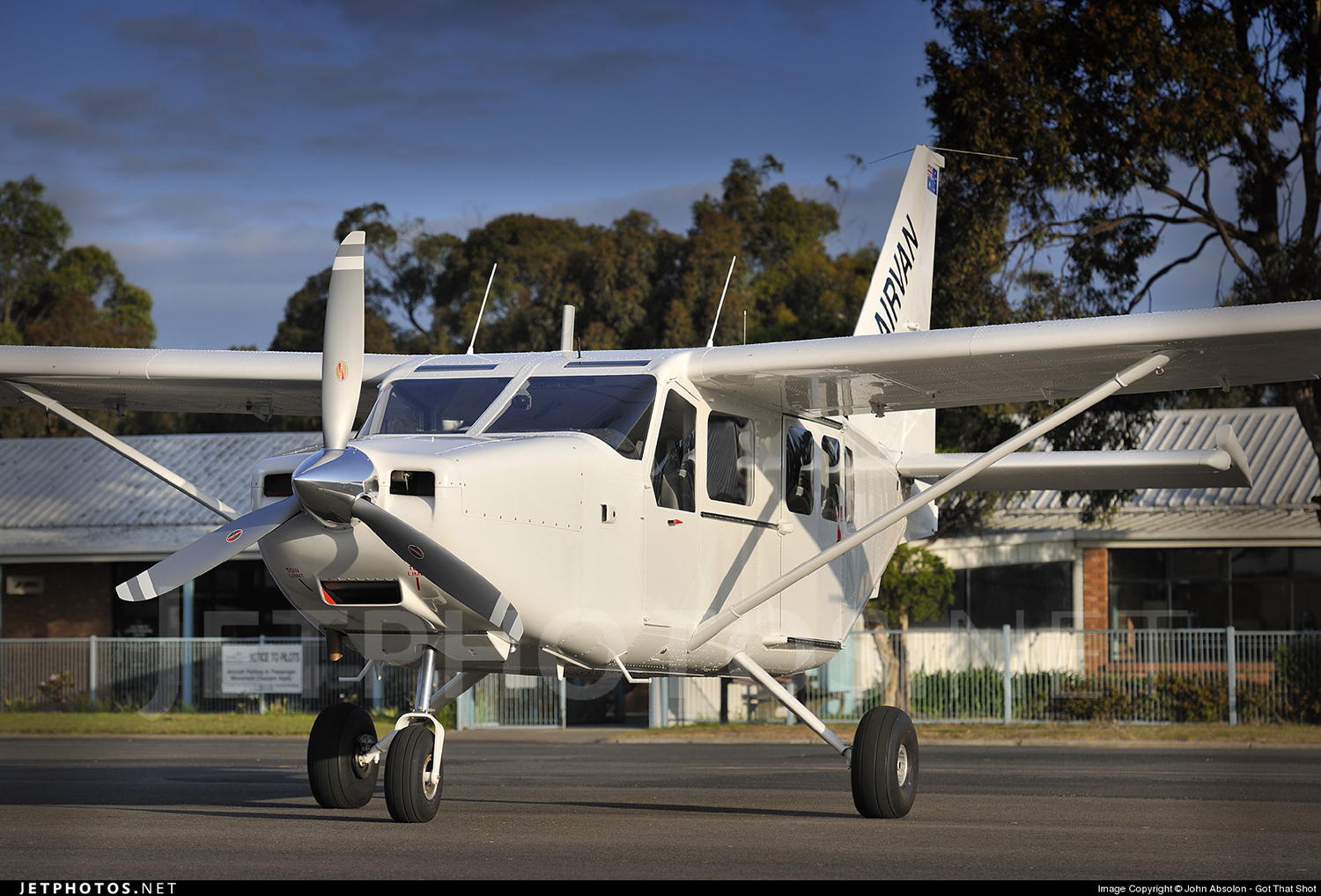
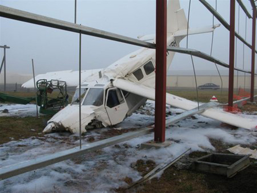
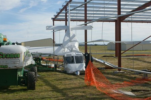
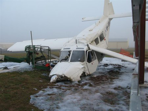
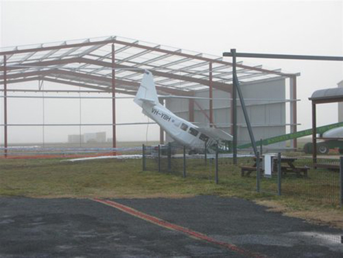
The pilot was performing a cargo flight from Parkes to Orange, New South Wales. On final approach, the single engine aircraft was too low and impacted the roof of a metal hangar located near the runway threshold. The aircraft stalled and struck the runway surface. Upon impact, the nose gear was torn off. Out of control, the aircraft veered off runway and eventually collided with a metal hangar under construction. While the pilot was injured, the aircraft was destroyed.

Crash of a Piper PA-31 Cheyenne in Bankstown: 2 killed

Date & Time: Jun 15, 2010 at 0805 LT
Type of aircraft:
Operator:
Registration:
VH-PGW
Flight Phase:
Flight Type:
Survivors:
No
Site:
Schedule:
Bankstown - Brisbane - Albury
MSN:
31-8414036
YOM:
1984
Country:
Region:
Crew on board:
1
Crew fatalities:
Pax on board:
1
Pax fatalities:
Other fatalities:
Total fatalities:
2
Captain / Total flying hours:
2435
Captain / Total hours on type:
779.00
Aircraft flight hours:
6266
Circumstances:
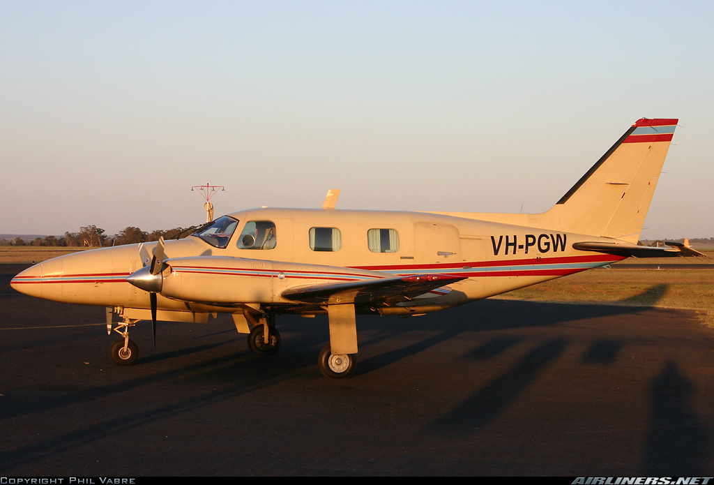
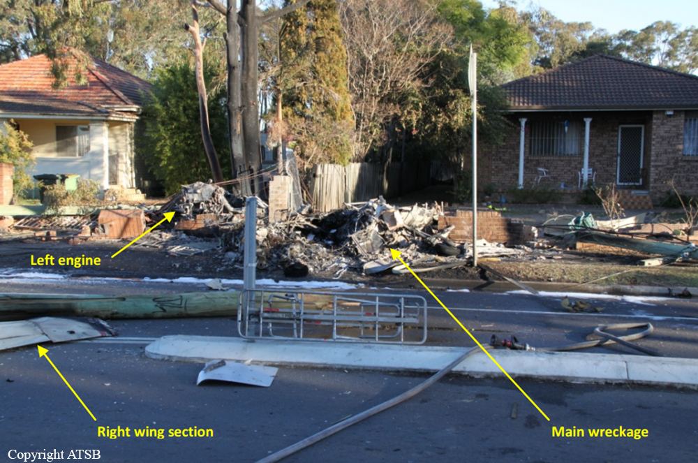
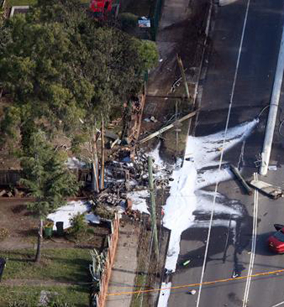
The twin engine aircraft, with a pilot and a flight nurse on board, was being operated by Skymaster Air Services under the instrument flight rules (IFR) on a flight from Bankstown Airport, New South Wales (NSW) to Archerfield Airport, Queensland. The aircraft was being positioned to Archerfield for a medical patient transfer flight from Archerfield to Albury, NSW. The aircraft departed Bankstown at 0740 Eastern Standard Time. At 0752, the pilot reported to air traffic control (ATC) that he was turning the aircraft around as he was having ‘a few problems. At about 0806, the aircraft collided with a powerline support pole located on the eastern side of the intersection of Sackville Street and Canley Vale Road, Canley Vale, NSW. The pilot and flight nurse sustained fatal injuries and the aircraft was destroyed by impact damage and a post-impact fire.
Probable cause:
Contributing safety factors:
• While the aircraft was climbing to 9,000 feet the right engine sustained a power problem and the pilot subsequently shut down that engine.
• Following the shutdown of the right engine, the aircraft's descent profile was not optimized for one engine inoperative flight.
• The pilot conducted a descent towards Bankstown Airport that was consistent with a normal arrival profile without first verifying that the aircraft was capable of achieving adequate performance with one engine inoperative.
• Following the engine problem, the aircraft's flightpath and the pilot’s communication with air traffic control indicated that the pilot's situation awareness was less than optimal.
• The aircraft collided with a powerline support pole on the eastern side of the intersection of Sackville Street and Canley Vale Road, Canley Vale, about 6 km north-west of Bankstown Airport.
Other safety factors:
• The pilot did not broadcast a PAN following the engine shutdown and did not provide air traffic control with further information about the nature of the problem in order for the controller to positively establish the severity of the situation.
• Section 4 of Civil Aviation Advisory Publication (CAAP) 5.23-2(0), Multi-engine Aeroplane Operations and Training of July 2007 did not contain sufficient guidance material to support the flight standard in Appendix A subsection 1.2 of the CAAP relating to Engine Failure in the Cruise. [Minor safety issue]
Other key finding:
• Given the pilot’s extensive experience and testing in the PA-31 aircraft type, and subsequent endorsement training on a high performance turboprop multi-engine aircraft since the issue by CASA in 2008 of a safety alert in respect of the pilot’s PA-31 endorsement, it was unlikely that any deficiencies in that endorsement training contributed to the accident.
Final Report:

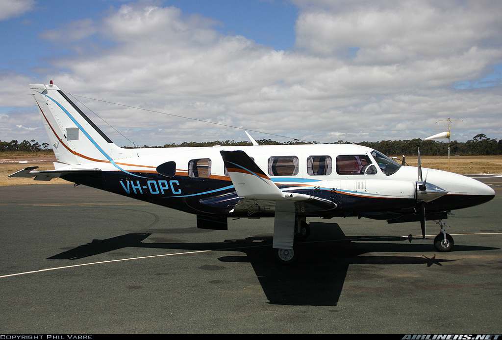
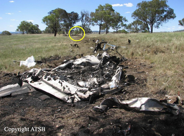
Crash of a Piper PA-31-350 Navajo Chieftain in Bathurst: 4 killed

Date & Time: Nov 7, 2008 at 2024 LT
Registration:
VH-OPC
Flight Phase:
Flight Type:
Survivors:
No
Schedule:
Melbourne – Bathurst – Port Macquarie
MSN:
31-7952082
YOM:
1979
Country:
Region:
Crew on board:
1
Crew fatalities:
Pax on board:
3
Pax fatalities:
Other fatalities:
Total fatalities:
4
Captain / Total flying hours:
2061
Aircraft flight hours:
11000
Circumstances:
On 7 November 2008, a Piper Aircraft Corp. PA-31-350 Chieftain, registered VH-OPC, was being operated on a private flight under the instrument flight rules (IFR) from Moorabbin Airport, Vic. to Port Macquarie via Bathurst, NSW. On board the aircraft were the owner-pilot and three passengers. The aircraft departed Moorabbin Airport at about 1725 Eastern Daylight-saving Time and arrived at Bathurst Airport at about 1930. The pilot added 355 L of aviation gasoline (Avgas) to the aircraft from a self-service bowser and spent some time with the passengers in the airport terminal. Recorded information at Bathurst Airport indicated that, at about 2012 (12 minutes after civil twilight), the engines were started and at 2016 the aircraft was taxied for the holding point of runway 35. The aircraft was at the holding point for about 3 minutes, reportedly at high engine power. At 2020, the pilot broadcast that he was entering and backtracking runway 35 and at 2022:08 the pilot broadcast on the common traffic advisory frequency that he was departing (airborne) runway 35. At 2023:30, the pilot transmitted to air traffic control that he was airborne at Bathurst and to standby for departure details. There was no record or reports of any further radio transmissions from the pilot. At about 2024, a number of residents of Forest Grove, a settlement to the north of Bathurst Airport, heard a sudden loud noise from an aircraft at a relatively low height overhead, followed shortly after by the sound of an explosion and the glow of a fire. A witness located about 550 m to the south-west of the accident site, reported seeing two bright lights that were shining in a constant direction and ‘wobbling’. There was engine noise that was described by one witness as getting very loud and ‘rattling’ or ‘grinding’ abnormally before the aircraft crashed. At 2024:51, the first 000 telephone call was received from witnesses and shortly after, emergency services were notified. The aircraft was seriously damaged by impact forces and fire, and the four occupants were fatally injured.
Probable cause:
From the evidence available, the following findings are made with respect to the collision with terrain involving Piper Aircraft Corp. PA-31-35 Chieftain, registered VH-OPC, 3 km north of Bathurst Airport on 7 November 2008 and should not be read as apportioning blame or liability to any particular organisation or individual.
Contributing safety factors:
• The aircraft descended at a steep angle before impacting the ground at high speed, consistent with uncontrolled flight into terrain.
Other key findings:
• Based on analysis of the available information, an airworthiness issue was considered unlikely to be a contributing factor to this accident.
• The investigation was unable to establish why the aircraft collided with terrain; however, pilot spatial disorientation or pilot incapacitation could not be discounted.
Final Report:
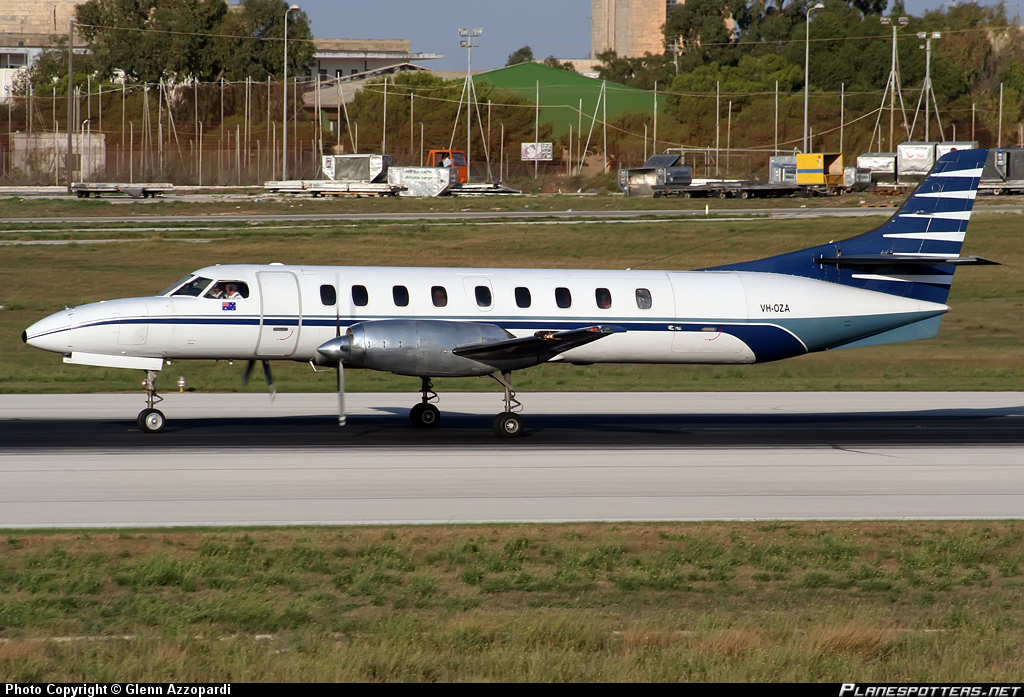
Crash of a Swearingen SA227AC Metro III off Sydney: 1 killed

Date & Time: Apr 9, 2008 at 2327 LT
Type of aircraft:
Operator:
Registration:
VH-OZA
Flight Phase:
Flight Type:
Survivors:
No
Schedule:
Sydney – Brisbane
MSN:
AC-600
YOM:
1984
Country:
Region:
Crew on board:
1
Crew fatalities:
Pax on board:
0
Pax fatalities:
Other fatalities:
Total fatalities:
1
Captain / Total flying hours:
4873
Captain / Total hours on type:
175.00
Aircraft flight hours:
32339
Aircraft flight cycles:
46710
Circumstances:
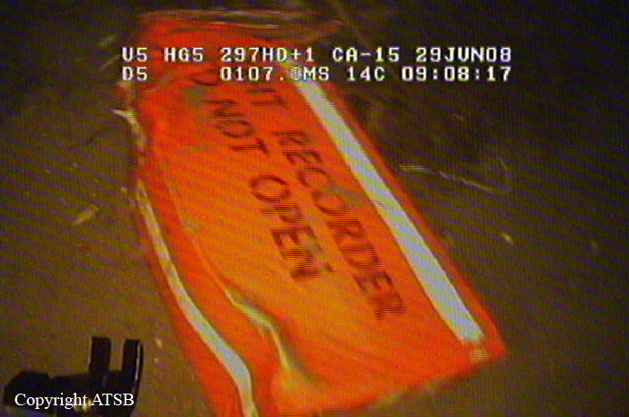
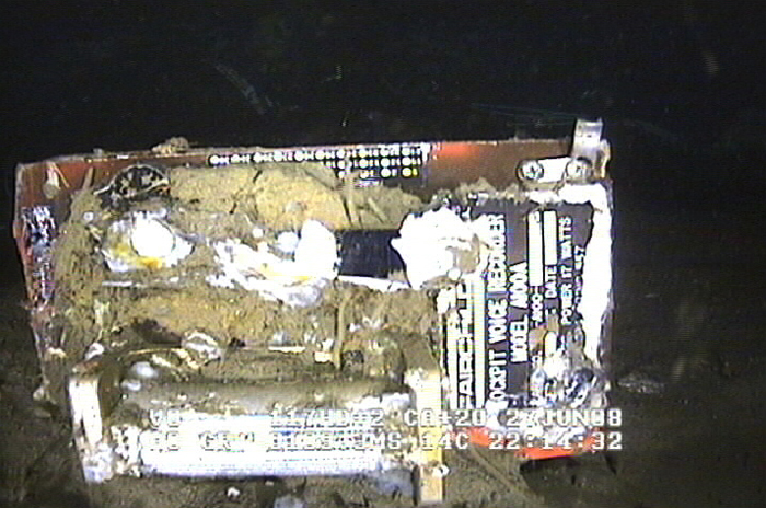
On 9 April 2008, at 2325 Eastern Standard Time, a Fairchild Industries Inc. SA227-AC (Metro III) aircraft, registered VH-OZA, departed Sydney Airport, New South Wales on a freight charter flight to Brisbane, Queensland with one pilot on board. The aircraft was subsequently observed on radar to be turning right, contrary to air traffic control instructions to turn left to an easterly heading. The pilot reported that he had a ‘slight technical fault’ and no other transmissions were heard from the pilot. Recorded radar data showed the aircraft turning right and then left, followed by a descent and climb, a second right turn and a second descent before radar returns were lost when the aircraft was at an altitude of 3,740 ft above mean sea level and descending at over 10,000 ft/min. Air traffic control initiated search actions and search vessels later recovered a small amount of aircraft wreckage floating in the ocean, south of the last recorded radar position. The pilot was presumed to be fatally injured and the aircraft was destroyed. Both of the aircraft’s on-board flight recorders were subsequently recovered from the ocean floor. They contained data from a number of previous flights, but not for the accident flight. There was no evidence of a midair breakup of the aircraft.
Probable cause:
Contributing Safety Factors:
- It was very likely that the aircraft’s alternating current electrical power system was not energised at any time during the flight.
- It was very likely that the aircraft became airborne without a functioning primary attitude reference or autopilot that, combined with the added workload of managing the ‘slight technical fault’, led to pilot spatial disorientation and subsequent loss of control.
Other Safety Factors:
- The pilot’s Metro III endorsement training was not conducted in accordance with the operator’s approved training and checking manual, with the result that the pilot’s competence and ultimately, safety of the operation could not be assured. [Significant safety issue].
- The chief pilot was performing the duties and responsibilities of several key positions in the operator’s organisational structure, increasing the risk of omissions in the operator’s training and checking requirements.
- The conduct of the flight single-pilot increased the risk of errors of omission, such as not turning on or noticing the failure of aircraft items and systems, or complying with directions.
Final Report:
Crash of a Piper PA-31-350 Navajo Chieftain near Condobolin: 4 killed
Date & Time: Dec 2, 2005 at 1350 LT
Registration:
VH-PYN
Flight Phase:
Flight Type:
Survivors:
No
Schedule:
Brisbane – Swan Hill
MSN:
31-8252075
YOM:
1982
Country:
Region:
Crew on board:
2
Crew fatalities:
Pax on board:
2
Pax fatalities:
Other fatalities:
Total fatalities:
4
Captain / Total flying hours:
4600
Captain / Total hours on type:
1000.00
Aircraft flight hours:
2900
Circumstances:
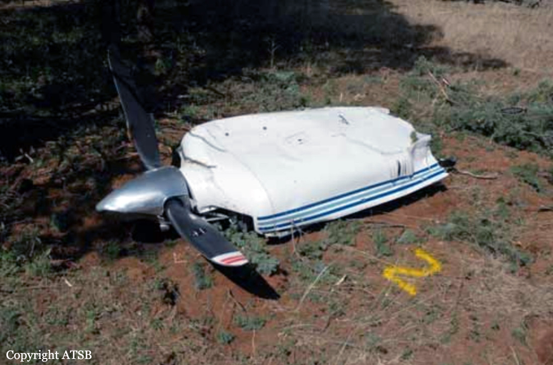
On 2 December 2005, at 1122 Eastern Daylight-saving Time, a Piper Aircraft Corporation PA-31-350 Chieftain aircraft, registered VH-PYN (PYN), departed Archerfield, Qld, on a private flight to Griffith, NSW. The flight was planned under the instrument flight rules (IFR). On board the aircraft were the pilot, two passengers and an observer-pilot who was on the flight to gain knowledge of the aircraft operation. The aircraft tracked direct to Moree and then Coonamble at 10,000 ft, in accordance with the flight plan. At 1303, the pilot amended the destination to Swan Hill, Vic, tracking via Hillston, NSW. At 1314, the pilot advised air traffic control that the aircraft had passed overhead Coonamble at 1312 maintaining 10,000 ft, and was estimating Hillston at 1418. At 1316, the pilot reported that he was tracking 5 NM (9 km) left of track due to weather. At 1337, the pilot advised that he was diverting up to 20 NM (37 km) left of track due to weather. At 1348, the pilot reported that he was diverting 29 NM (54 km) left of track, again due to weather. No further radio transmission from the pilot was heard. At about 1400, police received a report that an aircraft had crashed on a property approximately 28 km north of Condobolin, NSW. The extensively burned wreckage was subsequently confirmed as PYN. Other wreckage, spread along a trail up to 4 km from the main wreckage, was located the following day. Examination of air traffic control recorded radar data indicated that the aircraft entered radar coverage about 50 km north of Condobolin at 1346:34. The last valid radar data from the secondary surveillance radar located on Mount Bobbara was at 1349:53. During that 3 minute 19 second period, the recorded aircraft track was approximately 56 km left of the Coonamble to Hillston track and showed a change in direction from southerly to south-westerly. The aircraft’s groundspeed was in the range between 200 and 220 kts. The aircraft’s altitude remained steady at 10,000 ft. The last recorded radar position of the aircraft was approaching the limit of predicted radar coverage and was within 10 km of the location of the main aircraft wreckage. Earlier that day, the aircraft had departed Bendigo, Vic, at 0602 and arrived at Archerfield at 1034. The pilot and the observer-pilot were on board. The aircraft was refuelled to full tanks with 314 litres of aviation gasoline at Archerfield. The refuelling agent reported that the main and auxiliary tanks were full at the completion of refuelling. He also reported that the pilots had commented that the forecast for their return flight indicated that weather conditions would be ‘patchy’.
Probable cause:
Contributing factors:
• A line of thunderstorms crossed the aircraft’s intended track.
• The aircraft was operating in the vicinity of thunderstorm cells.
• In circumstances that could not be determined, the aircraft’s load limits were exceeded, causing structural failure of the airframe.
Other safety factors:
• Air traffic control procedures, did not require the SIGMET information to be passed to the aircraft.
• There were shortcomings in the Airservices Australia Hazard Alert procedures and guidelines for assessing SIGMET information.
• Air traffic control procedures for the dissemination of SIGMET information contained in the Aeronautical Information Publication were inconsistent with procedures contained in International Civil Aviation Organization (ICAO) Doc. 4444 and ICAO Doc. 7030.
Other key findings:
• The aircraft was not equipped with weather radar or lightning strike detection systems.
• The pilot did not make any request for additional information regarding the weather to air traffic services.
• The pilot in command was occupying the right cockpit seat and the observer- pilot the left cockpit seat at the time of the breakup, but that arrangement was not considered to have influenced the development of the accident.
Final Report: