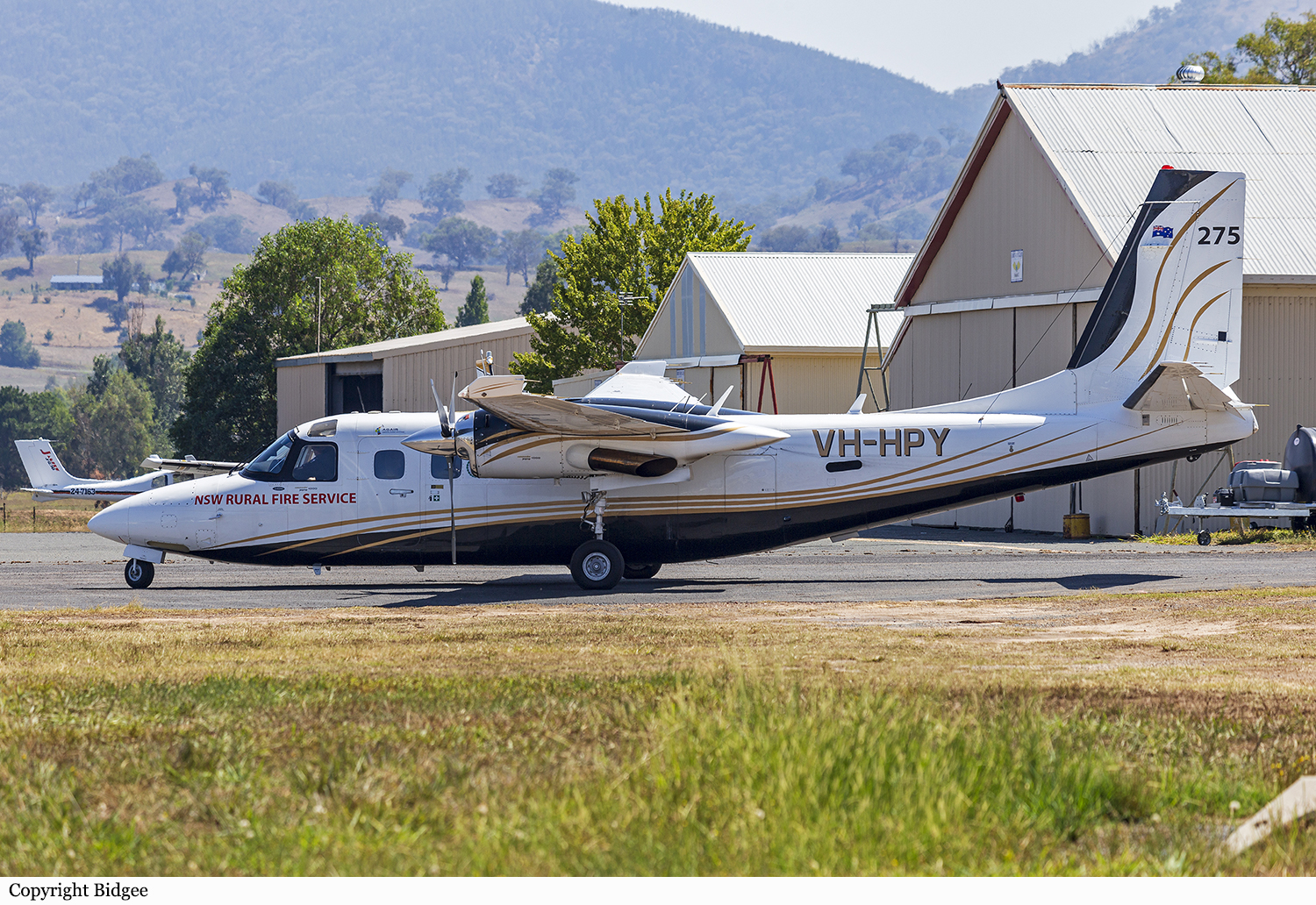
Crash of a Rockwell Gulfstream 695A Jetprop 1000 near Cloncurry: 3 killed

Date & Time: Nov 4, 2023 at 1430 LT
Operator:
Registration:
VH-HPY
Flight Phase:
Flight Type:
Survivors:
No
Schedule:
Toowoomba - Mount Isa
MSN:
96051
YOM:
1982
Flight number:
BDOG370
Country:
Region:
Crew on board:
3
Crew fatalities:
Pax on board:
0
Pax fatalities:
Other fatalities:
Total fatalities:
3
Circumstances:
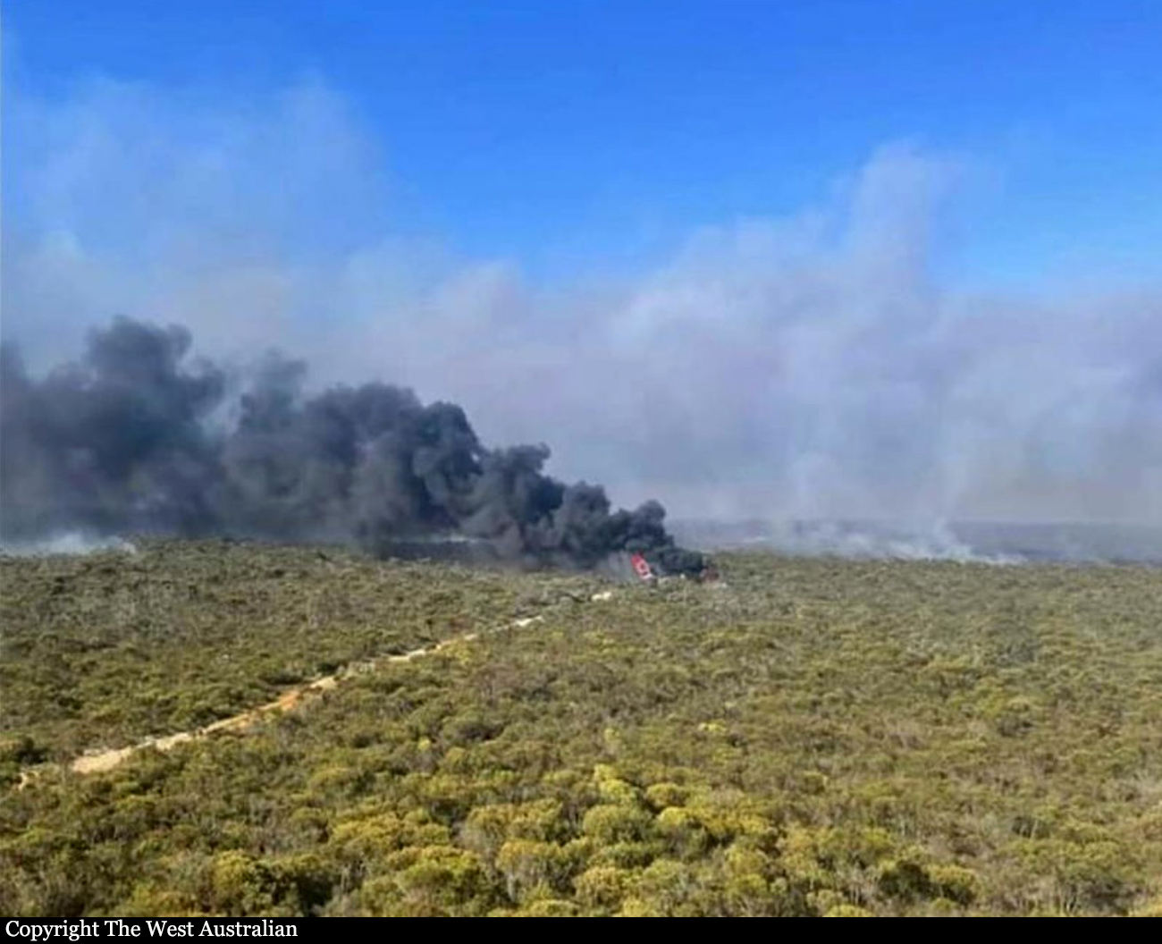
In the early afternoon, the twin engine airplane departed Toowoomba Airport on an aerial survey flight under callsign BDOG370 to Mount Isa with three people on board. The purpose of the flight was to conduct a survey mission of the area in case of bushfire. While cruising at an altitude of 28,000 feet, the airplane entered an uncontrolled descent. It reached a rate of descent of 9,600 feet per minute until it crashed in an uninhabited area located approximately 70 km southeast of Cloncurry. All three occupants were killed.

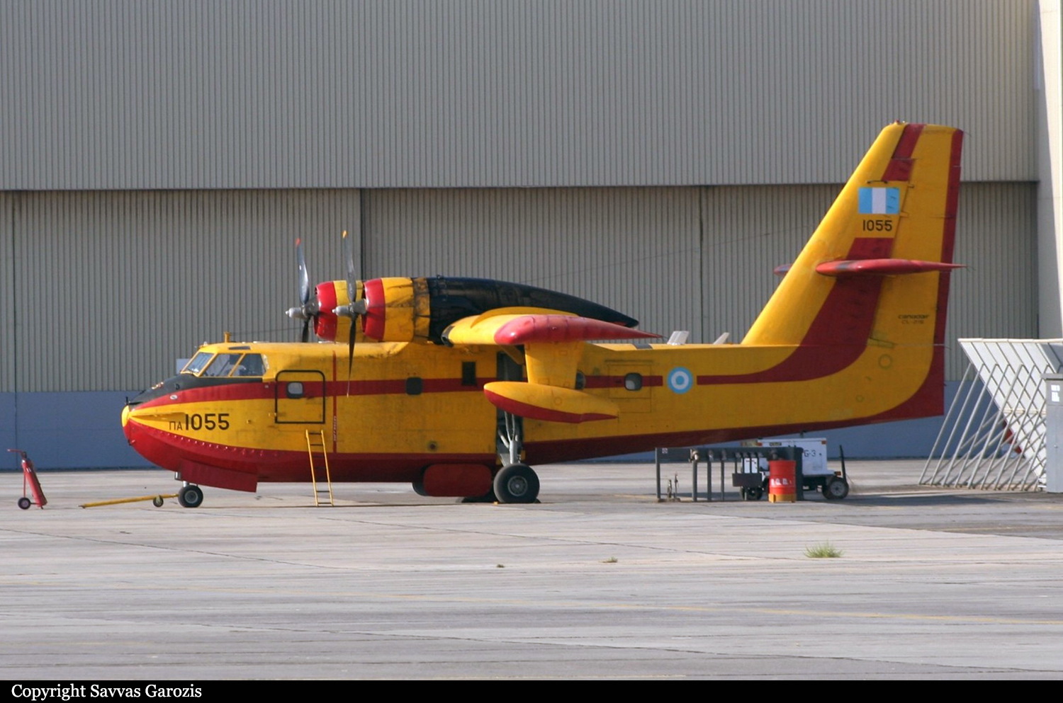
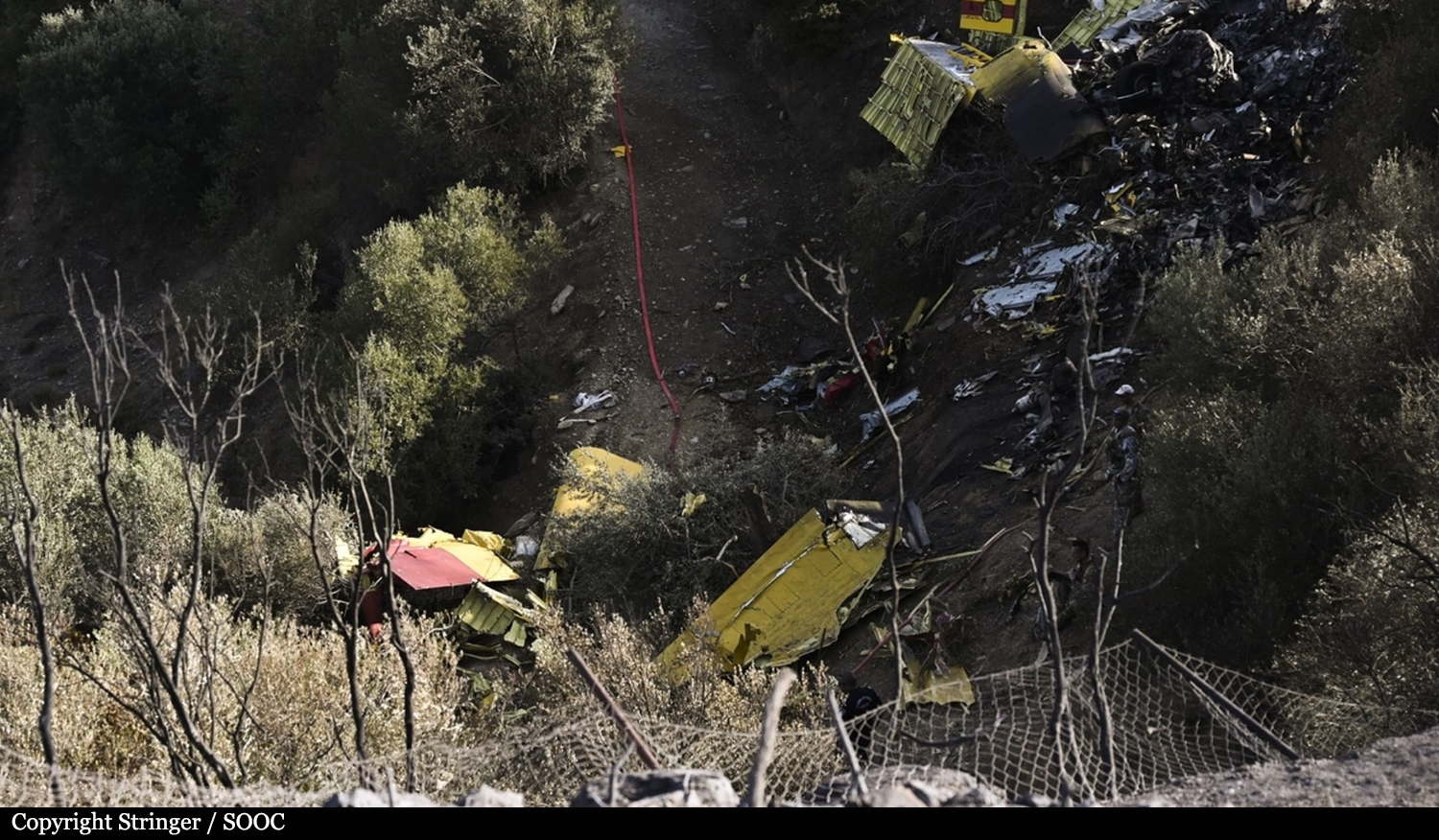
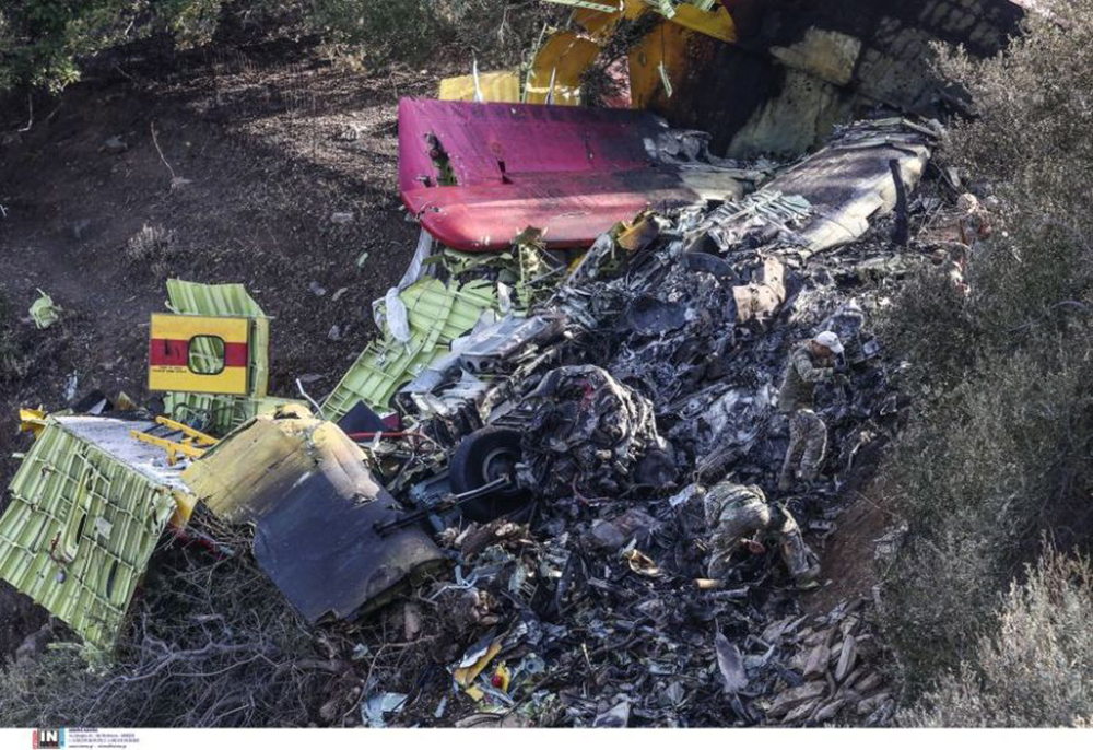
Crash of a Canadair CL-215-1A10 near Karystos: 2 killed

Date & Time: Jul 25, 2023 at 1505 LT
Type of aircraft:
Operator:
Registration:
1055
Flight Phase:
Flight Type:
Survivors:
No
Site:
Schedule:
Volos - Volos
MSN:
1055
YOM:
1979
Country:
Region:
Crew on board:
2
Crew fatalities:
Pax on board:
0
Pax fatalities:
Other fatalities:
Total fatalities:
2
Circumstances:
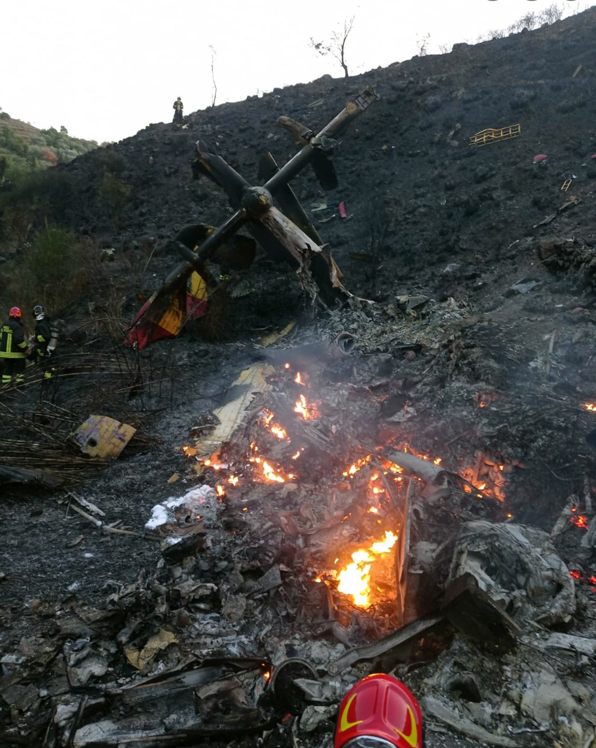
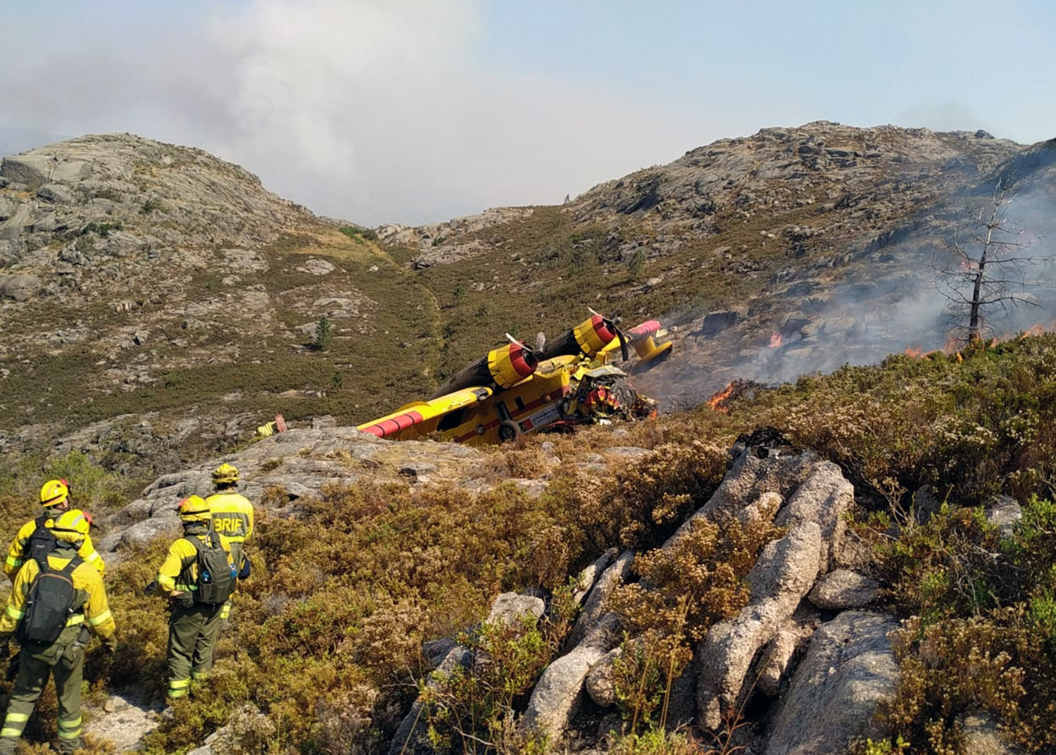
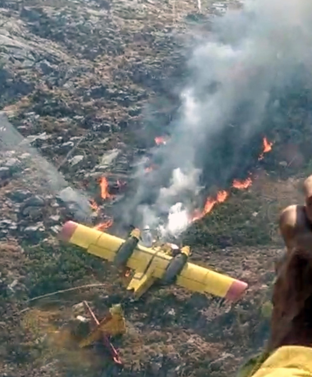
The crew departed Volos-Néa Anchialos Airport on a fire fighting mission in the area of Karystos, in the south of the Euboea Island. Approaching the zone under fire at low height, the crew dropped the load of water then elected to gain height when the right wing tip float struck a tree and was torn off. The airplane entered a right turn and descended to the ground, crashing in a hilly terrain southwest of the initial impact. The airplane was totally destroyed by impact forces and a post crash fire and both crew members were killed.
Crew:
S/L Christos Moulas, pilot,
Cpt Periklis Stafanidis, copilot.

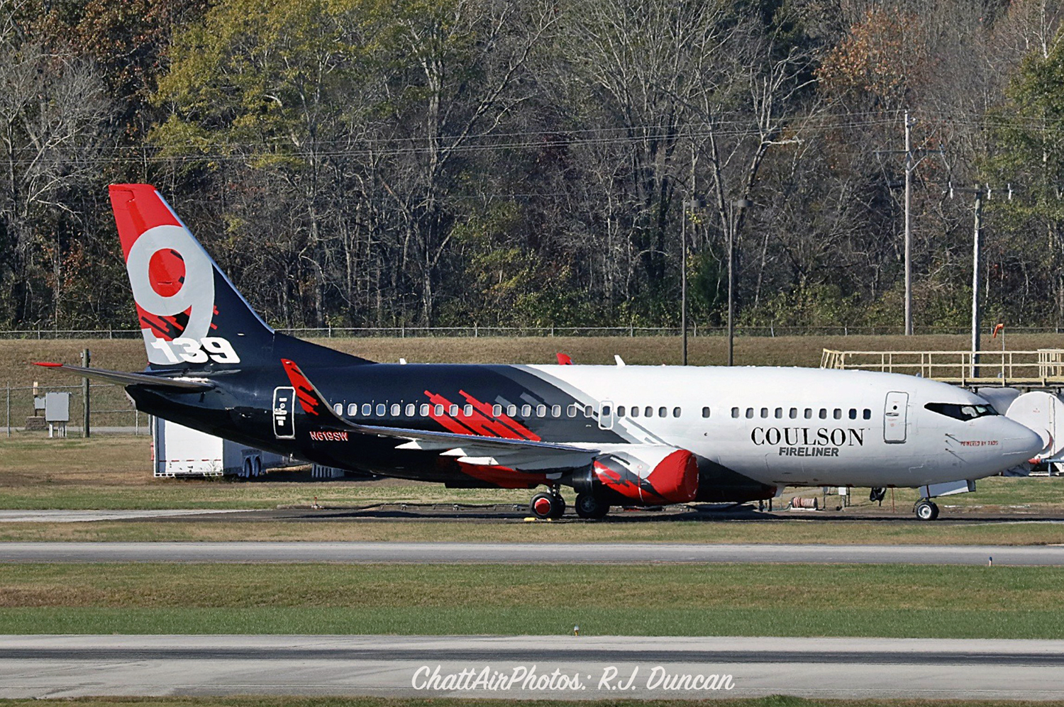
Crash of a Boeing 737-3H4 in the Fitzgerald River National Park

Date & Time: Feb 6, 2023 at 1613 LT
Type of aircraft:
Operator:
Registration:
N619SW
Flight Phase:
Flight Type:
Survivors:
Yes
Schedule:
Busselton - Busselton
MSN:
28035/2762
YOM:
1995
Flight number:
Bomber 139
Country:
Region:
Crew on board:
2
Crew fatalities:
Pax on board:
0
Pax fatalities:
Other fatalities:
Total fatalities:
0
Circumstances:
The airplane departed Busselton-Margaret River Airport at 1532LT on a fire fighting mission under callsign Bomber 139 (B139). Following a flight at FL290, the crew descended to the Fitzgerald River National Park and completed a circuit over the area. After the retardants were dropped, the crew elected to gain height when the airplane crashed in a wooded area, bursting into flames. Both pilots evacuated with minor injuries and the airplane was destroyed by fire.

Crash of a Canadair CL-415 near Linguaglossa: 2 killed

Date & Time: Oct 27, 2022
Type of aircraft:
Operator:
Registration:
I-DPCN
Flight Phase:
Flight Type:
Survivors:
No
Site:
Schedule:
Lamezia Terme - Lamezia Terme
MSN:
2070
YOM:
2008
Country:
Region:
Crew on board:
2
Crew fatalities:
Pax on board:
0
Pax fatalities:
Other fatalities:
Total fatalities:
2
Circumstances:
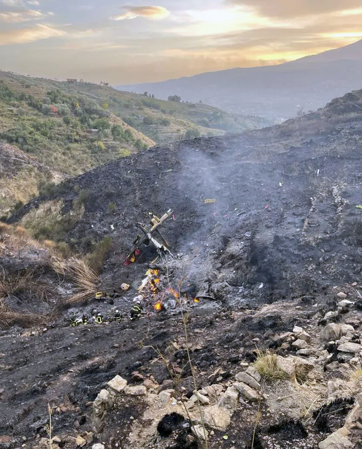
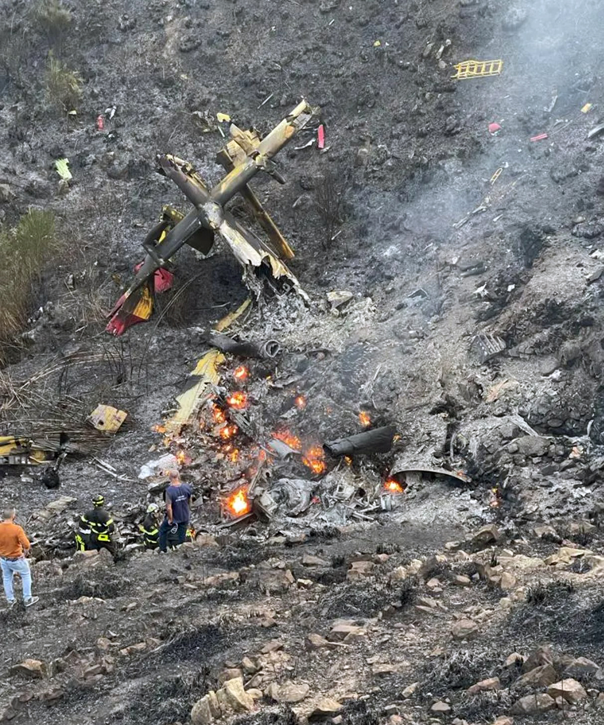
The crew departed Lamezia Terme Airport on a fire fighting mission at the foot of the Etna Volcano, north of Catania. Approaching the area on fire, the crew initiated a right hand turn and while descending to rising terrain, the right wing tip impacted the ground, causing the aircraft to crash, bursting into flames. Both pilots were killed.

Crash of a Beriev Be-200Chs near Kahramanmaraş: 8 killed

Date & Time: Aug 14, 2021
Type of aircraft:
Operator:
Registration:
RF-88450
Flight Phase:
Flight Type:
Survivors:
No
Site:
MSN:
64620090311
YOM:
2020
Country:
Region:
Crew on board:
8
Crew fatalities:
Pax on board:
0
Pax fatalities:
Other fatalities:
Total fatalities:
8
Circumstances:
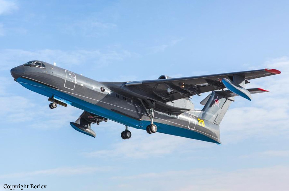
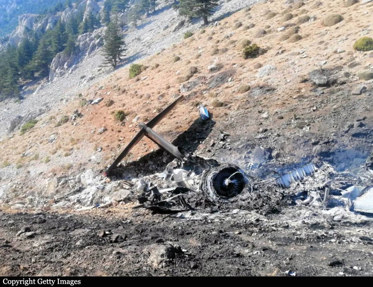
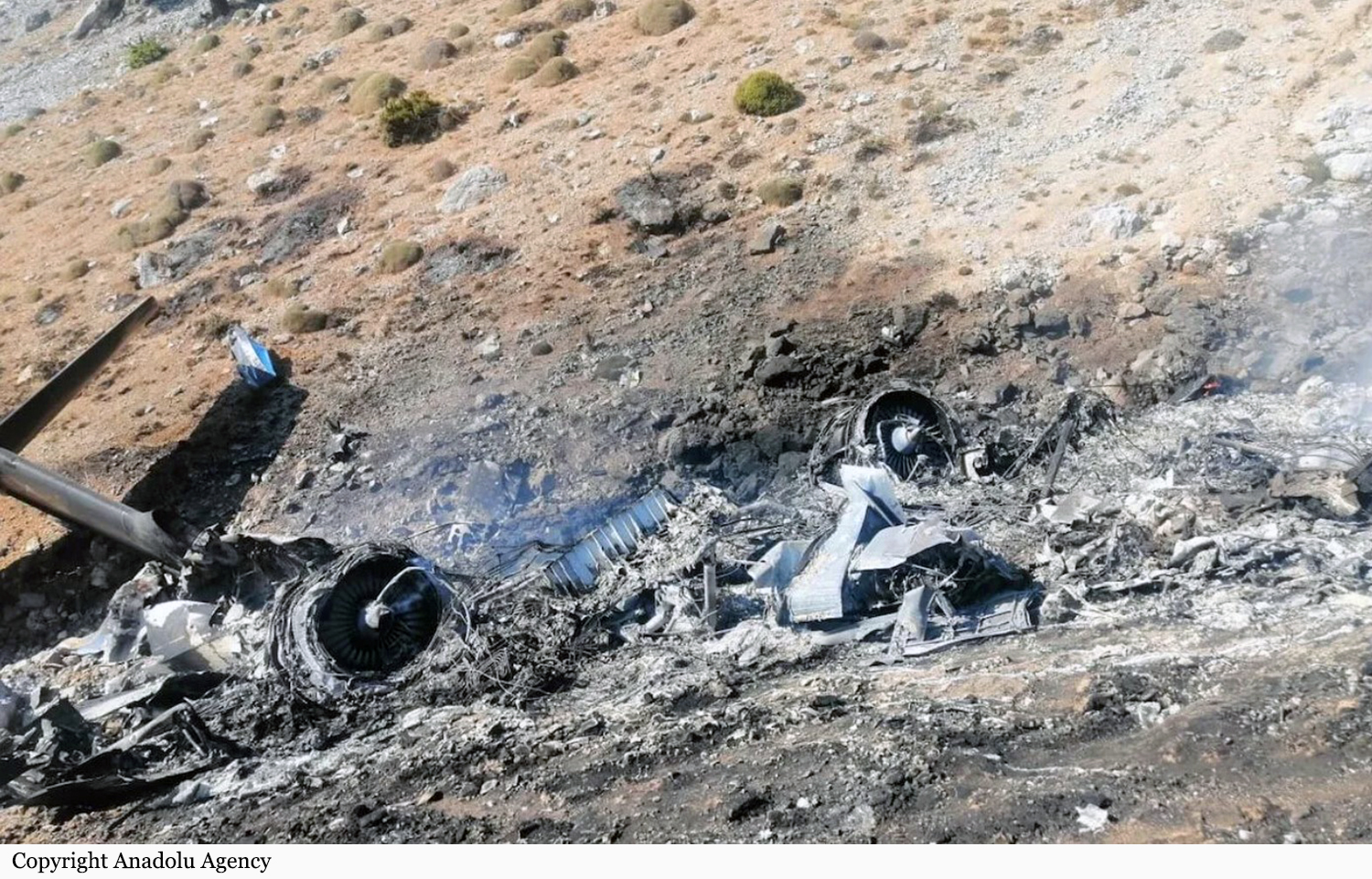
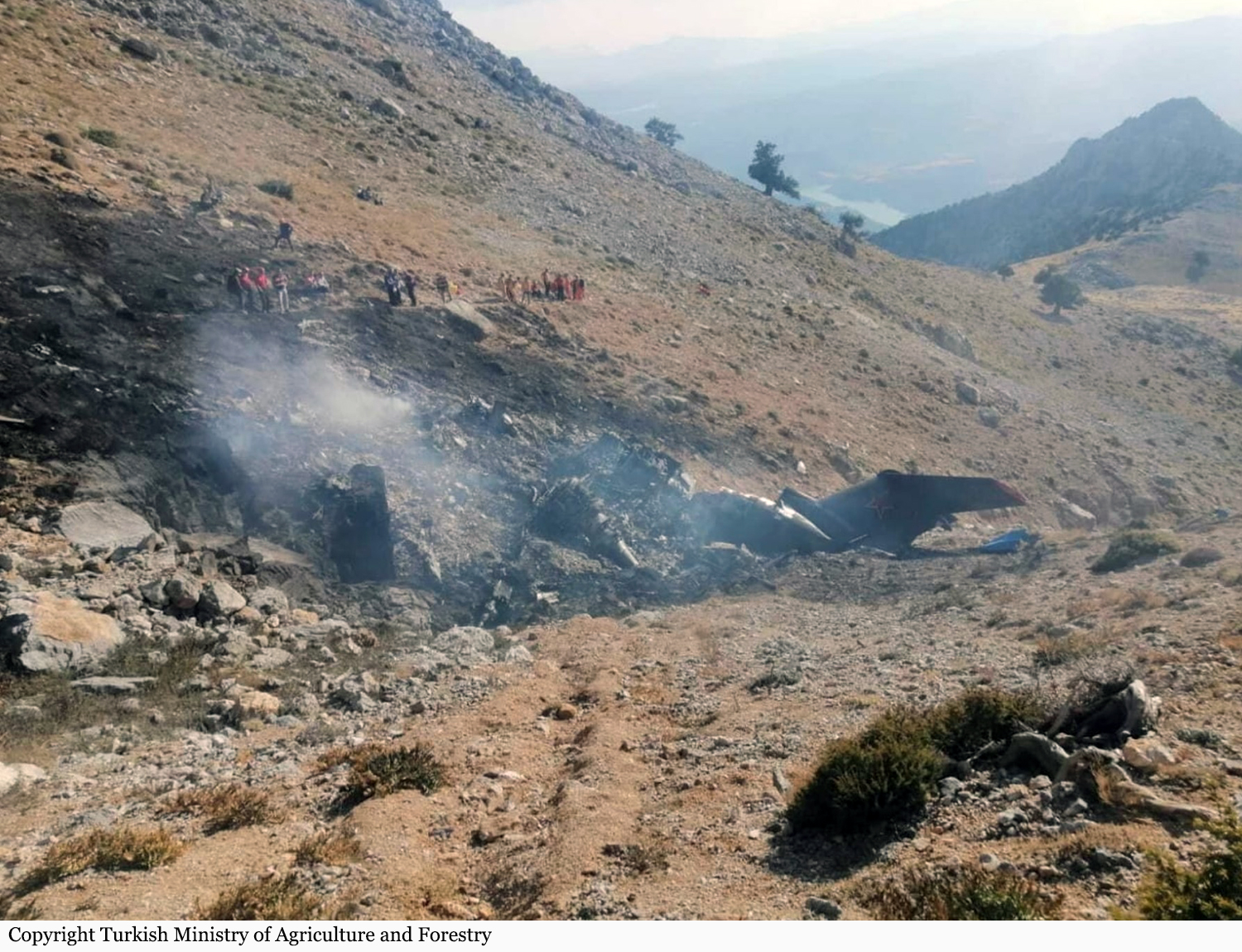
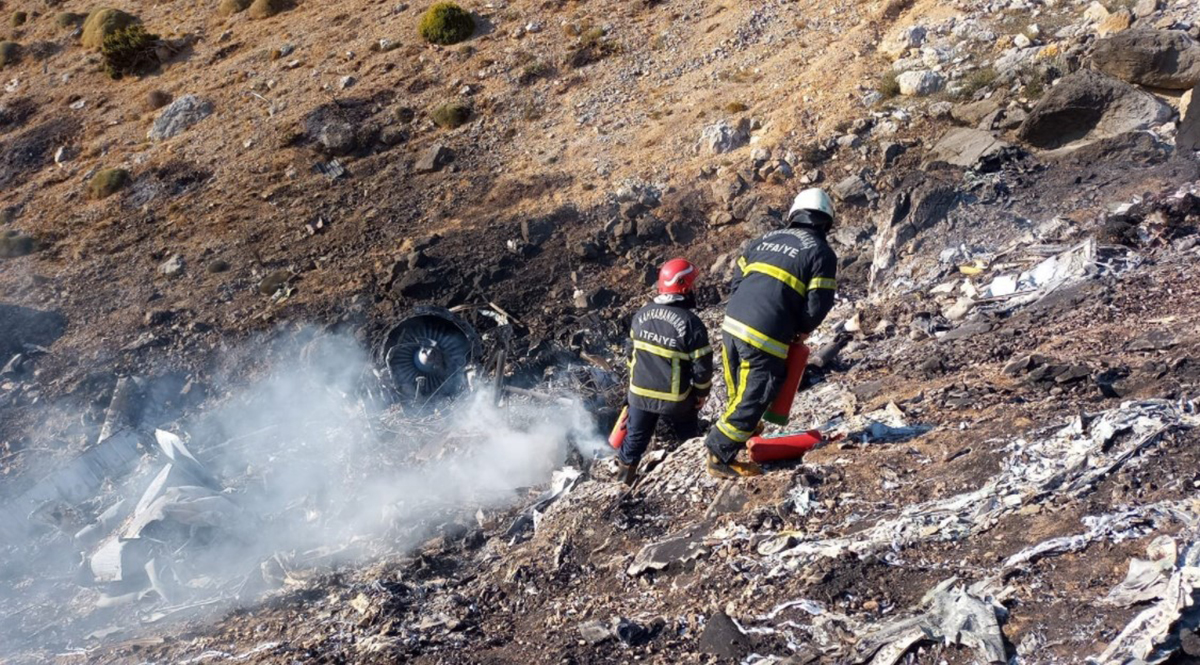
Owned and operated by the Russian Navy, the aircraft was dispatched in Turkey in July to help the Turkish government (General Directorate of Forestry) to fight raging forest fires in the southeast part of the country. On board were eight crew members, five Russian and three Turkish. After the aircraft drop water on fire, the crew elected to gain height when the aircraft impacted terrain and crashed on the slope of a mountain, bursting into flames. The aircraft was totally destroyed and all 8 occupants were killed.

Crash of a Beechcraft C90 King Air near Wikieup: 2 killed

Date & Time: Jul 10, 2021 at 1254 LT
Type of aircraft:
Operator:
Registration:
N3688P
Flight Phase:
Flight Type:
Survivors:
No
Site:
Schedule:
Marana - Wikieup
MSN:
LJ-915
YOM:
1980
Location:
Crew on board:
1
Crew fatalities:
Pax on board:
1
Pax fatalities:
Other fatalities:
Total fatalities:
2
Captain / Total flying hours:
10400
Aircraft flight hours:
17126
Circumstances:
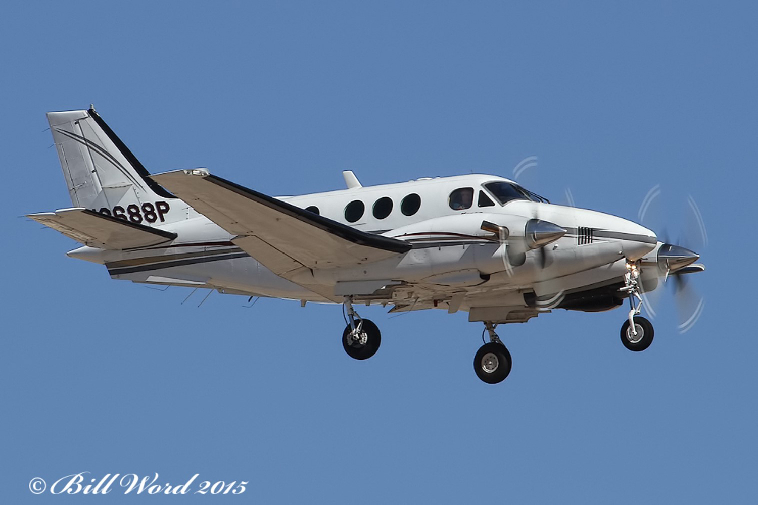
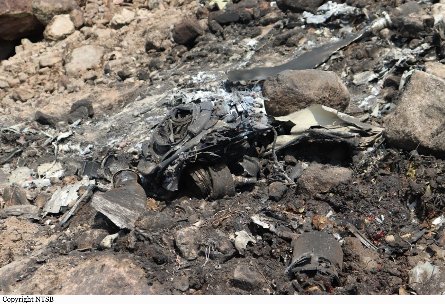
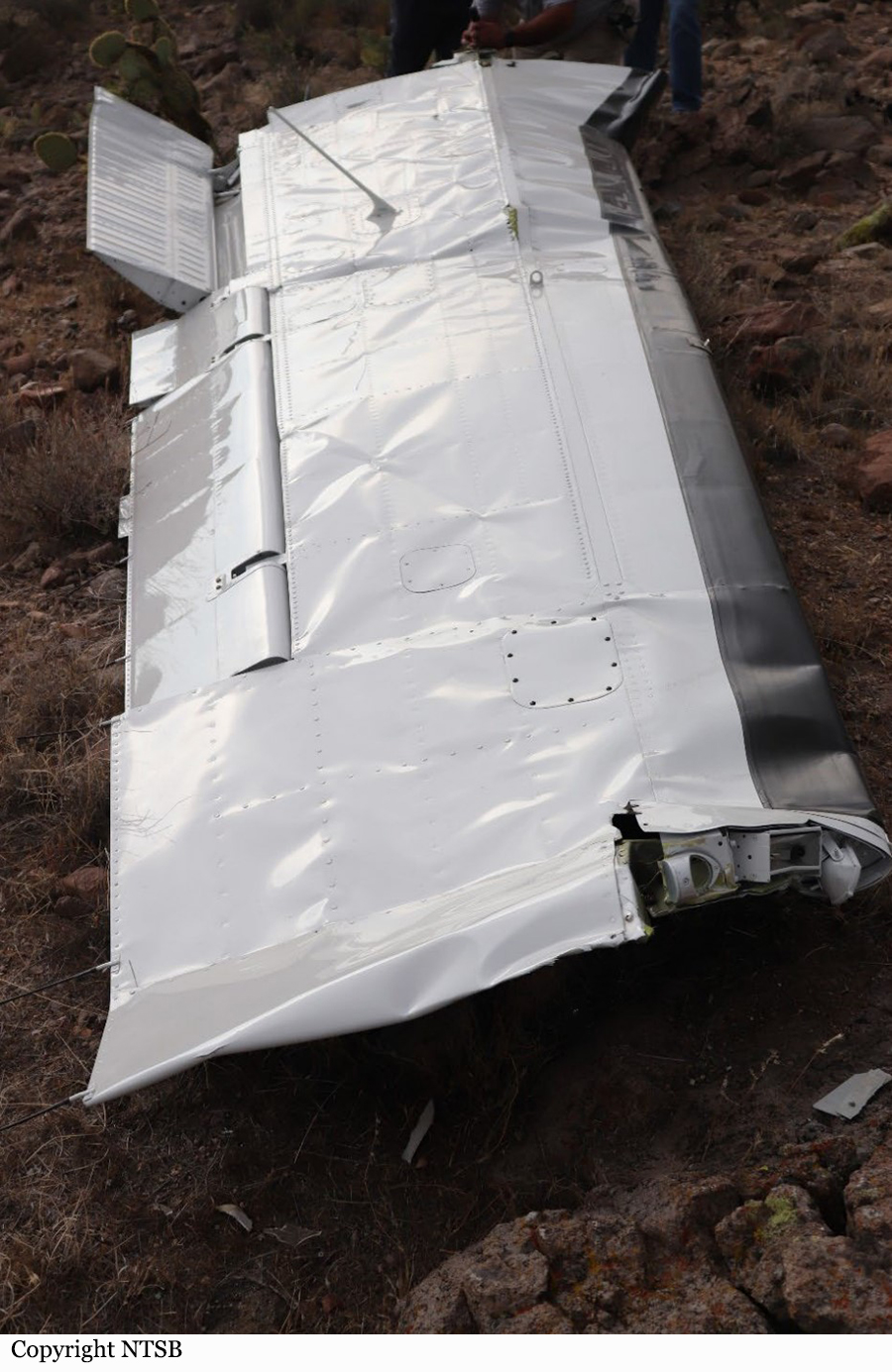
On July 10, 2021, about 1254 mountain standard time, a Beech C-90, turbo prop airplane, N3688P, was destroyed when it was involved in an accident near Wikieup, Arizona. The pilot and Air Tactical Group supervisor were fatally injured. The airplane was operated as a public use firefighting aircraft in support of the Bureau of Land Management conducting aerial reconnaissance and supervision. The airplane was on station for about 45 minutes over the area of the Cedar Basin fire. The ADS-B data showed the airplane had accomplished multiple orbits over the area of the fire about 2,500 ft above ground level (agl). The last ADS-B data point showed the airplane’s airspeed as 151 knots, its altitude about 2,300 ft agl, and in a descent, about 805 ft east southeast of the accident site. No distress call from the airplane was overheard on the radio. According to a witness, the airplane was observed in a steep dive towards the ground. The airplane impacted the side of a ridgeline in mountainous desert terrain. The main wreckage was mostly consumed by a post-crash fire. Debris was scattered over an area of several acres. Another witness observed the left wing falling to the ground after the aircraft had impacted the terrain. The left wing had separated outboard of the nacelle and was located about 0.79 miles northeast of the main wreckage and did not sustain thermal damage.
Probable cause:
The failure and separation of the left wing’s outboard section due to a fatigue crack in the lower spar cap. Contributing to the accident was the operator’s decision to repair the wing spar instead of replacing it as recommended by the aircraft manufacturer. Also contributing to the accident was the failure of the Non-Destructive Testing inspector to detect the fatigue crack during inspection.
Final Report:

Crash of a Canadair CL-215-1A10 near Lobios: 1 killed

Date & Time: Aug 8, 2020 at 1220 LT
Type of aircraft:
Operator:
Registration:
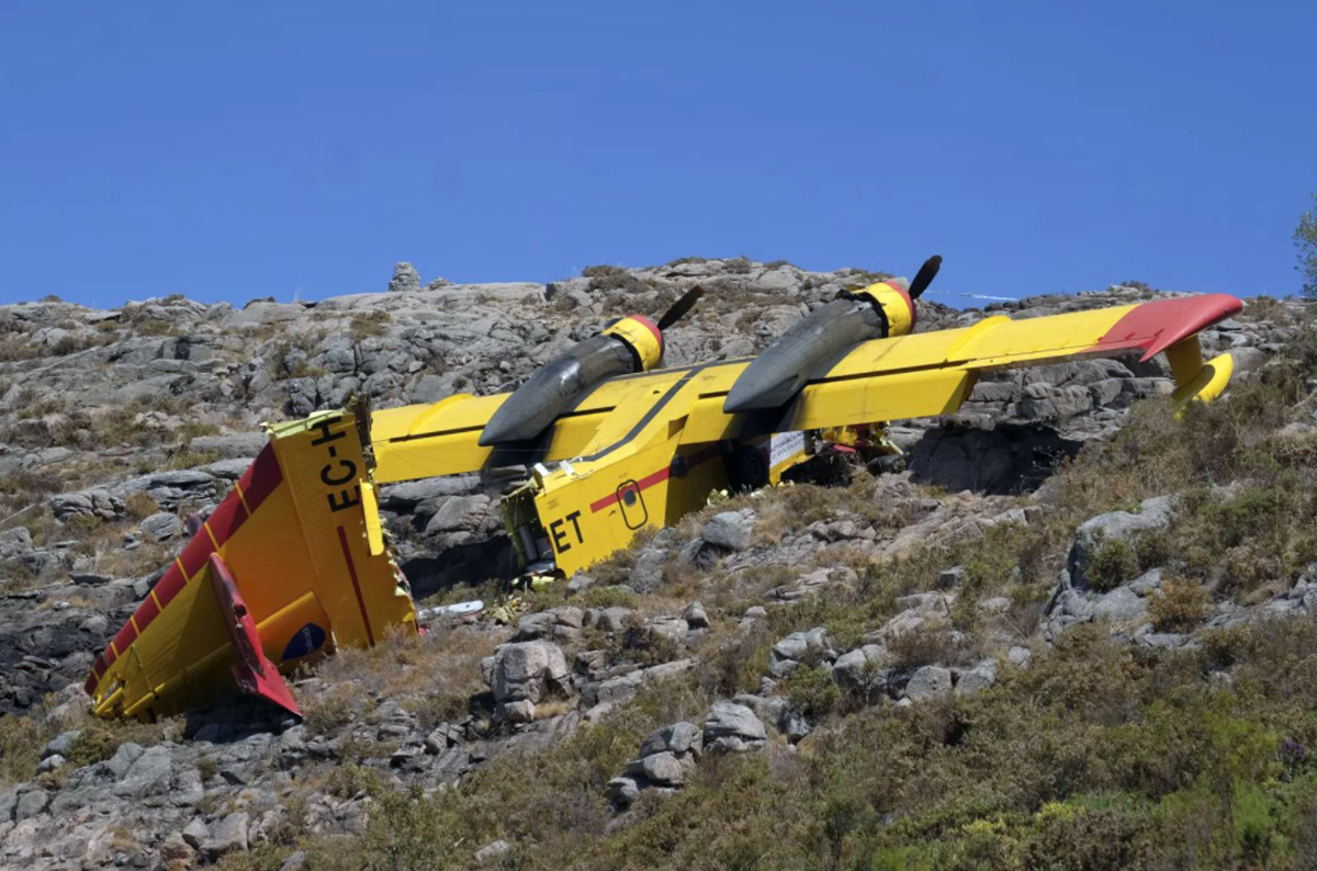
EC-HET
Flight Phase:
Flight Type:
Survivors:
Yes
Site:
Schedule:
Castelo Branco - Castelo Branco
MSN:
1034
YOM:
1974
Location:
Country:
Region:
Crew on board:
2
Crew fatalities:
Pax on board:
0
Pax fatalities:
Other fatalities:
Total fatalities:
1
Captain / Total flying hours:
2500
Captain / Total hours on type:
1120.00
Copilot / Total flying hours:
15150
Copilot / Total hours on type:
600
Aircraft flight hours:
12003
Aircraft flight cycles:
5645
Circumstances:
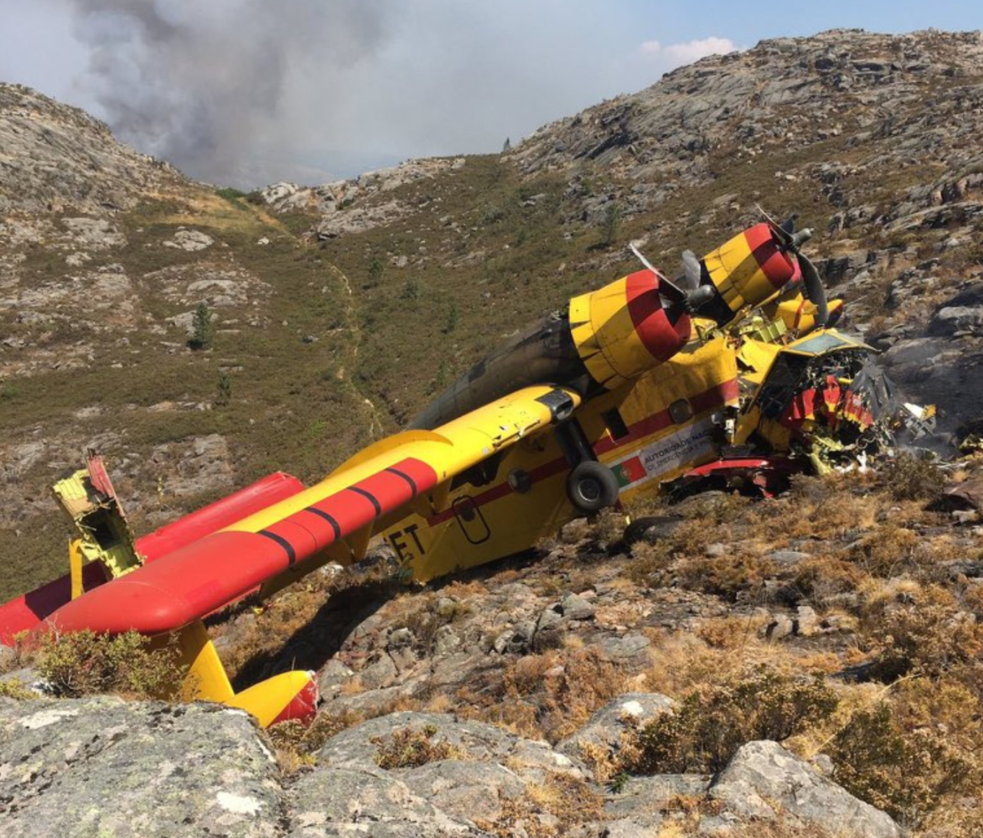
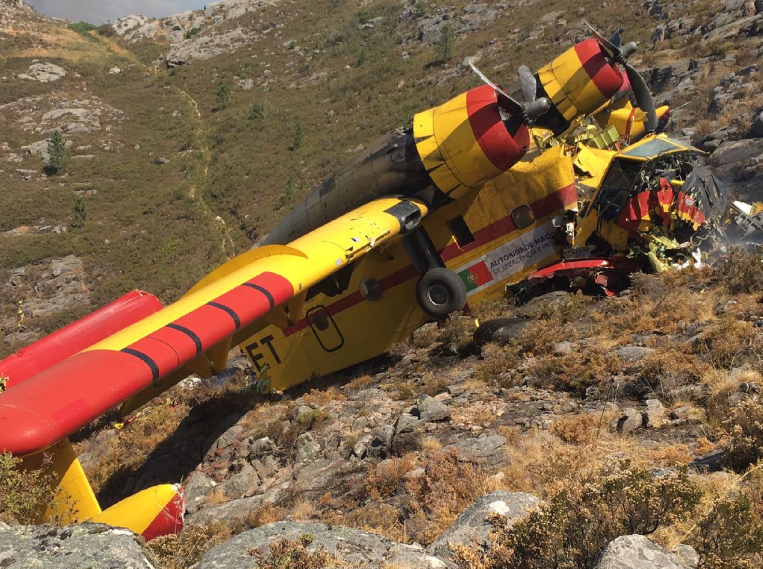
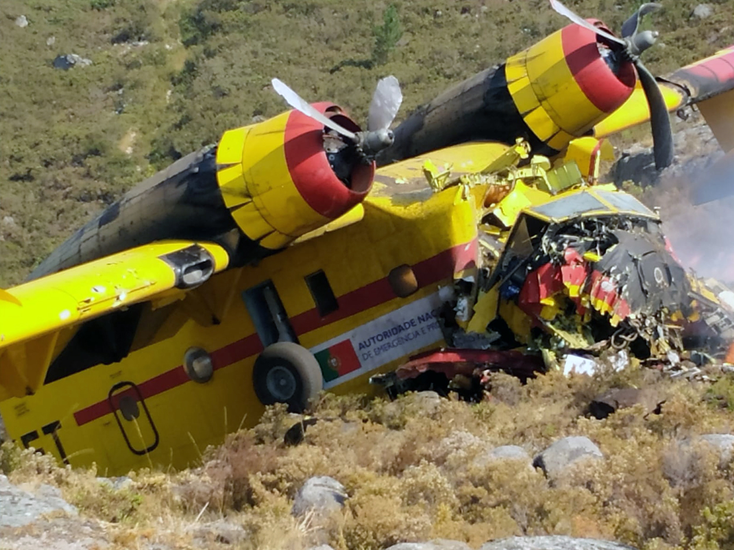
Operated by Babcock Spain, the aircraft was stationed at Castelo Branco Airport in Portugal on behalf of the Civil Security of Portugal (Autoridade Nacional de Emergência e Proteção Civil).. The airplane departed Castelo Branco Airfield at 0815LT with a second CL-215 and was dispatched over the region of Lindoso, at the border with Spain, to fight a fire. While approaching the area to treat, the airplane was too low and impacted ground, causing the tail to detach. The aircraft crashed on a rocky area located near Lobios, on Spanish territory. The cockpit was destroyed upon impact and the Portuguese copilot aged 66 was killed while the Spanish captain aged 39 was seriously injured and transferred to an hospital in Alto Minho.
Probable cause:
The accident was the consequence of an erroneous assessment of the aircraft's ability to climb over the mountain.
Final Report:

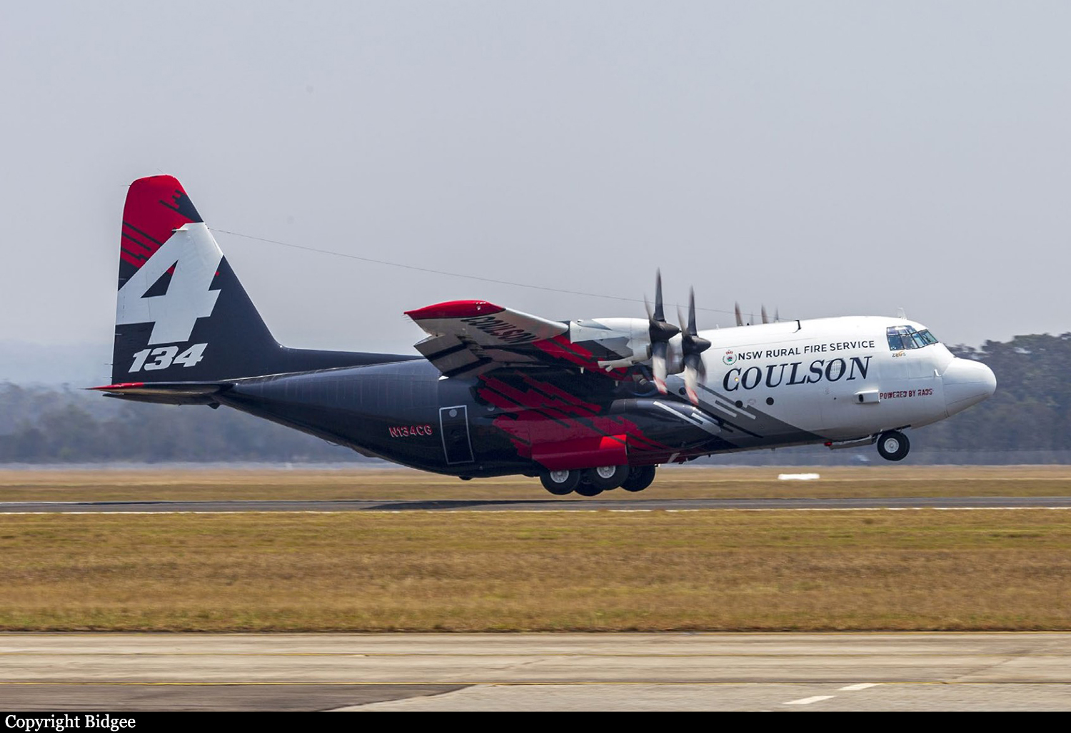
Crash of a Lockheed EC-130Q Hercules near Peak View: 3 killed

Date & Time: Jan 23, 2020 at 1315 LT
Type of aircraft:
Operator:
Registration:
N134CG
Flight Phase:
Flight Type:
Survivors:
No
Schedule:
Richmond - Richmond
MSN:
4904
YOM:
1981
Flight number:
Bomber 134
Country:
Region:
Crew on board:
3
Crew fatalities:
Pax on board:
0
Pax fatalities:
Other fatalities:
Total fatalities:
3
Captain / Total flying hours:
4010
Captain / Total hours on type:
3010.00
Copilot / Total flying hours:
1744
Copilot / Total hours on type:
1364
Aircraft flight hours:
11888
Circumstances:
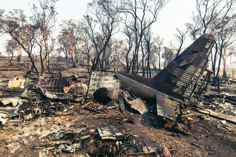
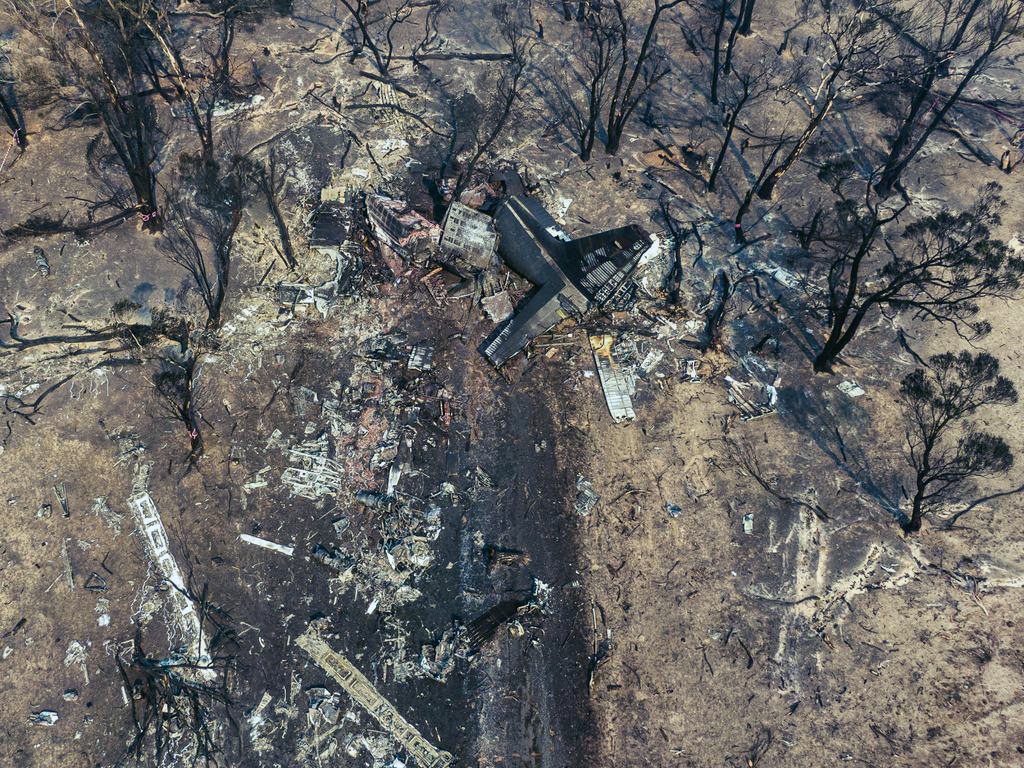
At about 1205, while B137 was overhead the Adaminaby fire-ground, and about the same time the SAD logged the birddog rejection, B134 departed Richmond as initial attack. On board were the PIC, the copilot and flight engineer. In response to the draft report, the RFS provided excerpts from the state operations controller (SOC) log. An entry was written in the log by the SOC following the accident. The SOC noted having been advised that the birddog had indicated it was ‘not safe to fly’ and that B137 was not returning to the area until the conditions had eased. However, B134 would continue with the PIC to make the ‘decision of safety of bombing operations’. The RFS advised the ATSB that the SOC had the authority to cancel B134’s tasking, but instead allowed it to proceed, with the intention of gathering additional intelligence to assist in determining whether further aerial operations would proceed. The RFS further reported that this indicated an ongoing intelligence gathering and assessment process by the SOC. At about 1235, while returning to Richmond, the PIC of B137 heard the PIC of B134 on the Canberra approach frequency, and contacted them via their designated operating frequency. At that time, B134 was about 112 km north-east of Adaminaby, en route to the fire-ground. In this conversation, the PIC of B137 informed them of the actual conditions and that they would not be returning to Adaminaby. The PIC of B137 reported that they could not recall the specific details of the call, but that the conversation included that they were ‘getting crazy winds’ and ‘you can go take a look’ ’but I am not going back’. It was also noted that the PIC of B134 had asked several questions. It was reported by the majority of the operator’s pilots that, despite receiving information from another pilot, they would have also continued with the tasking under these circumstances, to assess the conditions themselves. At about 1242, the crew of B134 contacted air traffic control to advise them of the coordinates they would be working at, provide an ‘ops normal’ call time, and confirm there was no reported instrument flight rules aircraft in the area. About 5 minutes later, the Richmond ABM also attempted to contact the crew of B134 to confirm ‘ops normal’, firstly by radio, and then by text to the PIC’s mobile phone, but did not receive a response. The automatic dependent surveillance broadcast (ADS-B) data showed that, after arriving at the Adaminaby fire-ground at about 1251, the crew of B134 completed several circuits at about 2,000 ft AGL. At about 1255, the crew advised the Cooma ARO that it was too smoky and windy to complete a retardant drop at that location. The Cooma ARO then provided the crew with the approximate coordinates of the Good Good fire, about 58 km to the east of Adaminaby. The ARO further indicated that they had no specific requirements, but they could look for targets of opportunity, with the objective of conducting structure and property protection near Peak View. At about 1259, the crew of B134 contacted air traffic control to advise that they had been re-tasked to the Good Good fire-ground, and provided updated coordinates. At about the same time, the RFS ground firefighters at the Good Good fire-ground, near Feeney’s Road in Peak View, contacted the Cooma FCC and requested additional assets for property protection. They were advised that a LAT would be passing overhead in about 10 minutes. The firefighters acknowledged the intention of a LAT retardant drop and advised the Cooma FCC they would wait in open country on Feeney’s Road, clear of any properties targeted for protection. At about 1307, B134 arrived overhead the drop area. The drop area was located to the east of a ridgeline, with the fire on the western side of the ridgeline. The aircraft’s recorded track data (SkyTrac) showed that the crew conducted 3 left circuits, at about 1,500 ft, 500 ft and 1,000 ft AGL respectively, prior to commencing the drop circuit. At about 1312, after conducting about 2 circuits, they advised the Cooma ARO of their intention to complete multiple drops on the eastern side of the Good Good fire, and that they would advise the coordinates after the first delivery. At 1315:15, a partial retardant drop was conducted on a heading of about 190°, at about 190 ft AGL (3,600 ft above mean sea level). During the drop, about 1,200 US gallons (4,500 L) of fire retardant was released over a period of about 2 seconds. A ground speed of 144 kt was recorded at the time of the drop. A witness video taken by ground fire-fighters captured the drop and showed the aircraft immediately after the drop in an initial left turn with a positive rate of climb, before it became obscured by smoke. While being intermittently obscured by smoke, the aircraft climbed to about 330 ft AGL (3,770 ft above mean sea level). At about this time, ATSB analysis of the video showed that the aircraft was rolling from about 18° left angle of bank to about a 6° right angle of bank. Following this, the aircraft descended and about 17 seconds after the completion of the partial retardant drop, it was seen at a very low height above the ground, in a slight left bank. Video analysis and accident site examination showed there was no further (emergency) drop of retardant. Throughout this period, the recorded groundspeed increased slightly to a maximum of 151 kt. Shortly after, there was a significant left roll just prior to ground impact. At about 1315:37, the aircraft collided with terrain and a post-impact fuel-fed fire ensued. The 3 crew were fatally injured and the aircraft was destroyed. A review of the Airservices Australia audio recording of the applicable air traffic control frequency found no distress calls were received by controllers prior to the impact.
Probable cause:
The following contributing factors were identified:
- Hazardous weather conditions were forecast and present at the drop site near Peak View, which included strong gusting winds and mountain wave activity, producing turbulence. These
conditions were likely exacerbated by the fire and local terrain.
- The Rural Fire Service continued the B134 tasking to Adaminaby when they learned that no other aircraft would continue to operate due to the environmental conditions. In addition, they relied on the pilot in command to assess the appropriateness of the tasking to Adaminaby without providing them all the available information to make an informed decision on flight safety.
- The pilot in command of B134 accepted the Adaminaby fire-ground tasking, which was in an area of forecast mountain wave activity and severe turbulence. After assessing the conditions as unsuitable, the crew accepted an alternate tasking to continue to the Good Good (Peak View) fire-ground, which was subject to the same weather conditions. The acceptance of these taskings were consistent with company practices.
- Following the partial retardant drop and left turn, the aircraft was very likely subjected to hazardous environmental conditions including low-level windshear and an increased tailwind component, which degraded the aircraft’s climb performance.
- While at a low height and airspeed, it was likely the aircraft aerodynamically stalled, leading to a collision with terrain.
- Coulson Aviation's safety risk management processes did not adequately manage the risks associated with large air tanker operations. There were no operational risk assessments conducted or a risk register maintained. Further, as safety incident reports submitted were mainly related to maintenance issues, operational risks were less likely to be considered or monitored. Overall, this limited their ability to identify and implement mitigations to manage the risks associated with their aerial firefighting operations. (Safety issue)
- Coulson Aviation did not provide a pre-flight risk assessment for their firefighting large air tanker crews. This would provide predefined criteria to ensure consistent and objective decision-making with accepting or rejecting tasks, including factors relating to crew, environment, aircraft and external pressures. (Safety issue)
- The New South Wales Rural Fire Service had limited large air tanker policies and procedures for aerial supervision requirements and no procedures for deployment without aerial supervision.(Safety issue)
- The New South Wales Rural Fire Service did not have a policy or procedures in place to manage task rejections, nor to communicate this information internally or to other pilots working in the same area of operation. (Safety issue)

Other factors that increased risk:
- The B134 crew were very likely not aware that the 'birddog' pilot had declined the tasking to Adaminaby fire-ground, and the smaller fire-control aircraft had ceased operations in the area, due to the hazardous environmental conditions
- In the limited time available, the remainder of the fire-retardant load was not jettisoned prior to the aircraft stalling.
- Coulson Aviation did not include a windshear recovery procedure or scenario in their C-130 Airplane Flight Manual and annual simulator training respectively, to ensure that crews consistently and correctly responded to a windshear encounter with minimal delay. (Safety issue)
- Coulson Aviation fleet of C-130 aircraft were not fitted with a windshear detection system, which increased the risk of a windshear encounter and/or delayed response to a windshear encounter during low level operations. (Safety issue)
- The New South Wales Rural Fire Service procedures allowed operators to determine when pilots were initial attack capable. However, they intended for the pilot in command to be certified by the United States Department of Agriculture Forest Service certification process. (Safety issue)

Other findings:
- The aircraft's cockpit voice recorder did not record the accident flight, which resulted in a valuable source of safety information not being available. This limited the extent to which potential factors contributing to the accident could be identified.
Final Report:

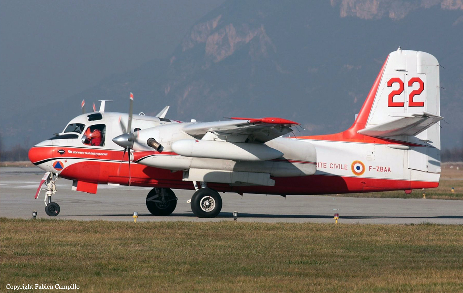
Crash of a Grumman S-2 Tracker in Générac: 1 killed

Date & Time: Aug 2, 2019 at 1718 LT
Type of aircraft:
Operator:
Registration:
F-ZBAA
Flight Phase:
Flight Type:
Survivors:
No
Schedule:
Nîmes - Nîmes
MSN:
456
YOM:
1958
Flight number:
Pélican 22
Location:
Country:
Region:
Crew on board:
1
Crew fatalities:
Pax on board:
0
Pax fatalities:
Other fatalities:
Total fatalities:
1
Captain / Total flying hours:
4854
Captain / Total hours on type:
830.00
Aircraft flight hours:
15050
Circumstances:
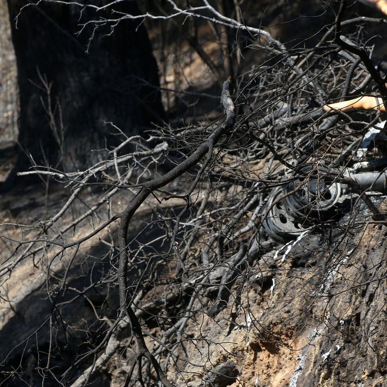
The pilot, sole on board, departed Nîmes-Garons Airport at 1648LT on a fire fighting mission over Générac, a village located about 5 km southwest of the airbase. While approaching the zone to be treated, the twin engine airplane struck trees and crashed, bursting into flames. The aircraft was destroyed by impact forces and a post crash fire and the pilot was killed. At the time of the accident, the visibility was reduced due to thick smoke.
Probable cause:
The following findings were identified:
- GASC (Groupement d’avions de la sécurité civile) has a small resource of Tracker pilots;
- Without a co-pilot, the pilot is deprived of the usual cross-checking of piloting decisions and actions;
- The pilot has little experience on established firefighting missions. He has never carried out a mission of this nature in a single-pilot aircraft;
- Certain limitations of the flight envelope are unknown to pilots, particularly at high weight and in steep turns;
- Pilots have little knowledge of the aerological phenomena associated with certain fires, and the associated turbulence;
- With the implementation of the Tracker withdrawal, pilots are concerned about their future within the GASC;
- Fatigued from sustained activity, the pilot had a false understanding of the situation;
- The pilot suffered from overconfidence;
- The pilot did not perceive the terrain. He flew a little low as he approached the hill ;
- He adopted a trajectory very close to the flame front and did not anticipate the risk of turbulence;
- Focused on a dwelling to protect, he did not detect the inappropriate altitude of his plane and maintained a strong bank;
- The left wing underwent a local stall causing a steep left bank, which caused the pilot to recover the aircraft too low in relation to the height of the trees, which he had a false idea of.
Final Report:

Crash of a PZL-Mielec AN-2R in Nizhneudinsk

Date & Time: Jun 27, 2018 at 1507 LT
Type of aircraft:
Operator:
Registration:
RA-62524
Flight Phase:
Flight Type:
Survivors:
Yes
Schedule:
Nizhneudinsk - Nizhneudinsk
MSN:
1G175-47
YOM:
1977
Flight number:
FU9350
Country:
Region:
Crew on board:
2
Crew fatalities:
Pax on board:
2
Pax fatalities:
Other fatalities:
Total fatalities:
0
Captain / Total flying hours:
5689
Captain / Total hours on type:
5474.00
Copilot / Total flying hours:
2252
Aircraft flight hours:
14683
Circumstances:
The single engine airplane departed Nizhneudinsk Airport on a forest fire survey mission, carrying two observers and two pilots. Shortly after takeoff, while climbing to a height of about 150-170 metres, the engine started to vibrate. The captain attempted an emergency landing when the aircraft crash landed in a marshy field located 4,9 km from the airport, coming to rest upside down. All four occupants escaped uninjured and the aircraft was damaged beyond repair.
Probable cause:
The accident was the consequence of a total engine failure during initial climb for reasons that could not be determined. The fact that the field was waterlogged and did not permit a safe landing was considered as a contributing factor.
Final Report: