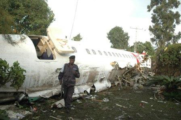
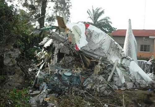
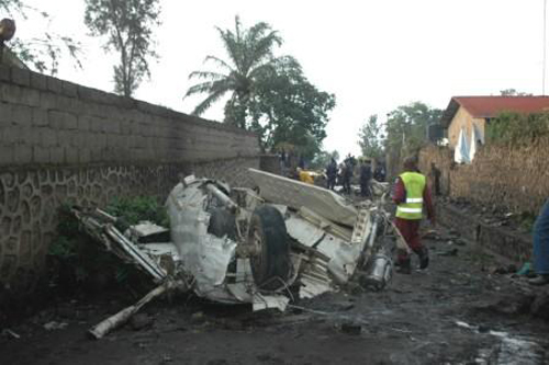
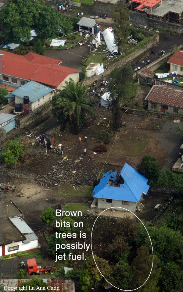
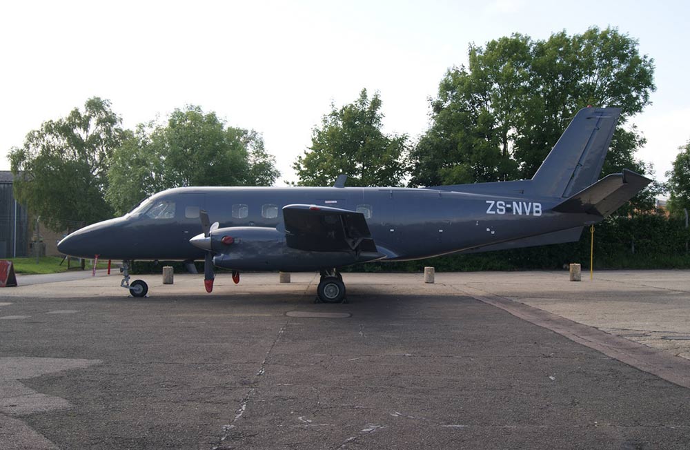
Crash of an Embraer EMB-110P1 Bandeirante in Francistown: 2 killed

Date & Time: Jun 29, 2013 at 0700 LT
Operator:
Registration:
ZS-NVB
Flight Type:
Survivors:
No
Schedule:
Lanseria - Francistown - Lubumbashi
MSN:
110-479
YOM:
1988
Country:
Region:
Crew on board:
2
Crew fatalities:
Pax on board:
0
Pax fatalities:
Other fatalities:
Total fatalities:
2
Circumstances:
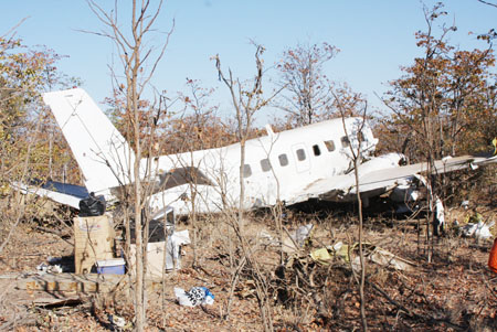
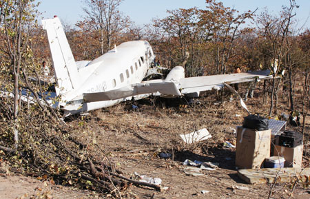
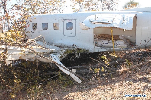
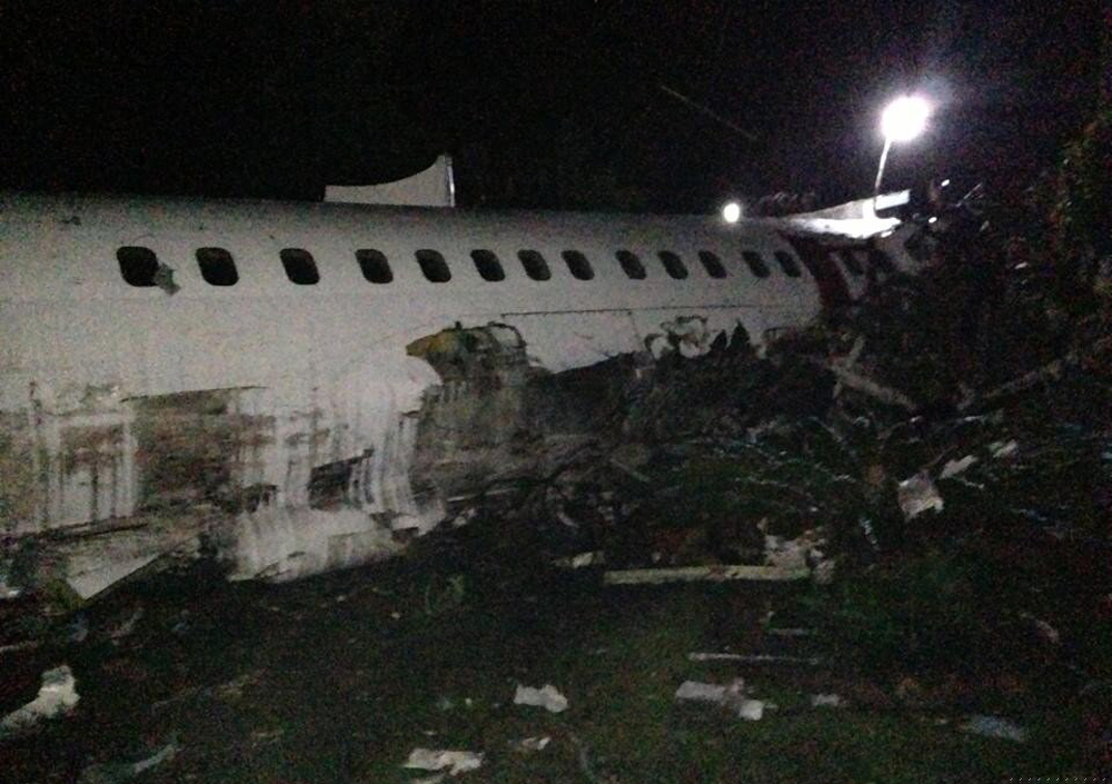
The crew was performing a cargo flight from Lanseria to Lubumbashi with an intermediate stop at Francistown Airport to refuel, and the aircraft was carrying a load of ion exchange resins for water purification. During an early morning approach, the crew encountered poor visibility due to foggy conditions, abandoned the approach and initiated a go-around procedure. During a second approach from the opposite direction, the crew informed ATC he established a visual contact with the runway when the aircraft crashed in a bushy area located some 4,6 km short of runway.

Crash of a BAe ATP in Wamena

Date & Time: May 31, 2013 at 0709 LT
Type of aircraft:
Operator:
Registration:
PK-DGI
Flight Type:
Survivors:
Yes
Schedule:
Jayapura - Wamena
MSN:
2027
YOM:
1990
Country:
Region:
Crew on board:
3
Crew fatalities:
Pax on board:
0
Pax fatalities:
Other fatalities:
Total fatalities:
0
Captain / Total flying hours:
3108
Captain / Total hours on type:
1366.00
Copilot / Total flying hours:
5648
Copilot / Total hours on type:
689
Aircraft flight hours:
15755
Aircraft flight cycles:
25431
Circumstances:
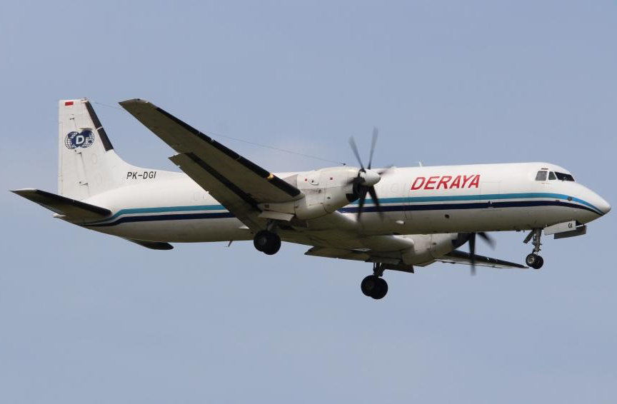
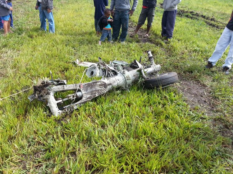
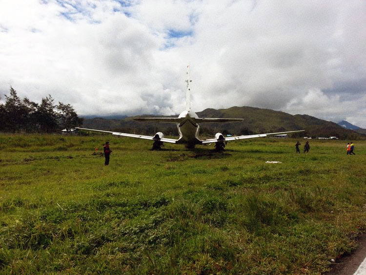
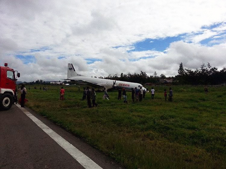
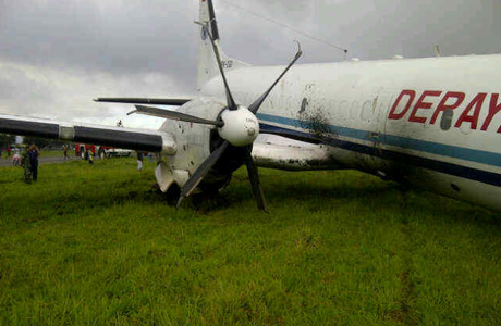
On 31 May 2013 aircraft BAe ATP freighter registered PK-DGI operated by PT. Deraya as scheduled cargo/ freight flight from Sentani Airport (WAJJ) to Wamena Airport (WAJW), Papua. On board in this flight were the Pilot in Command (PIC) acted as Pilot Flying (PF) and the Second in Command (SIC) acted as Pilot Monitoring (PM). At 2127 UTC (0627 LT) the aircraft departed from Sentani Airport. The aircraft cruised at 12,000 feet (FL 120)and estimated time of arrival Wamena Airport was 2207 UTC (0707 LT). The first pilot contact with Wamena Tower controller was at 2201 UTC, the aircraft position was approaching Pass Valley point, the controller informed that runway 15 expect to be used and the weather condition was wind calm, visibility 4 Km, low cloud at final area and QNH 1008 mbs. There was no specific of approach and landing briefing by pilot flying to the pilot non flying considering to such weather condition. At 2207 UTC, the pilot reported the position was on final runway 15. The controller requested the information of the flight condition and the pilot reported that the runway has not insight. At 2209 UTC, the pilot reported that the runway was insight and the controller provided the clearance to land and 25 seconds later the aircraft touched down on the centerline. During the landing roll at about 750 meters from the beginning of runway 15 the aircraft veered to the left of the runway shoulder, the pilot recovered by applying the right rudder and asymmetry reverses thrust but the aircraft continued veer to the left and stopped at about 10 meters on the left shoulder of the runway 15. On the landing roll, the FDR recorded that the left engine torque greater then right engine torque. The pilot shutdown both engines normally and evacuated the aircraft safely. The nose landing gear detached and found on the shoulder at about 250 meter from the aircraft final position. The main landing gears broken and all the propellers bent. No injured in this occurrence.
Probable cause:
The following contributing factors were identified:
- The flight did not meet the criteria according to the recommended elements of stabilized approach which required go around.
- The aircraft touched down with 2° misalignment with the runway direction then the aircraft veered off to the left.
- The recovery action was not in accordance to the correct technique according to the ALAR Tool Kit.
Final Report:

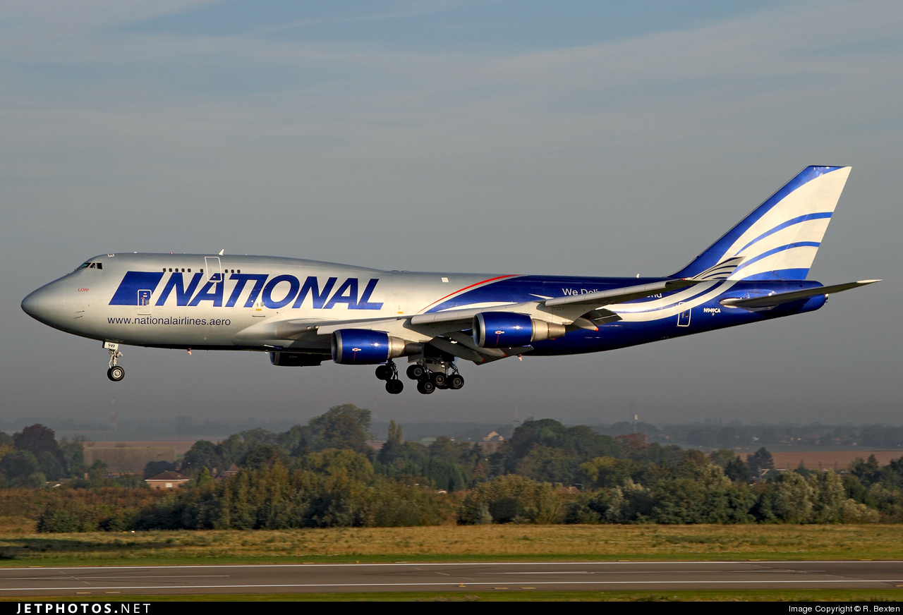
Crash of a Boeing 747-428BCF at Bagram AFB: 7 killed

Date & Time: Apr 29, 2013 at 1527 LT
Type of aircraft:
Operator:
Registration:
N949CA
Flight Phase:
Flight Type:
Survivors:
No
Schedule:
Camp Bastion - Bagram AFB - Dubaï
MSN:
25630/960
YOM:
1993
Flight number:
NCR102
Country:
Region:
Crew on board:
7
Crew fatalities:
Pax on board:
0
Pax fatalities:
Other fatalities:
Total fatalities:
7
Captain / Total flying hours:
6000
Captain / Total hours on type:
440.00
Copilot / Total flying hours:
1100
Copilot / Total hours on type:
209
Circumstances:
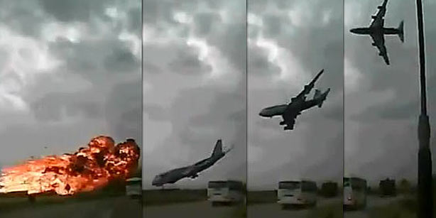
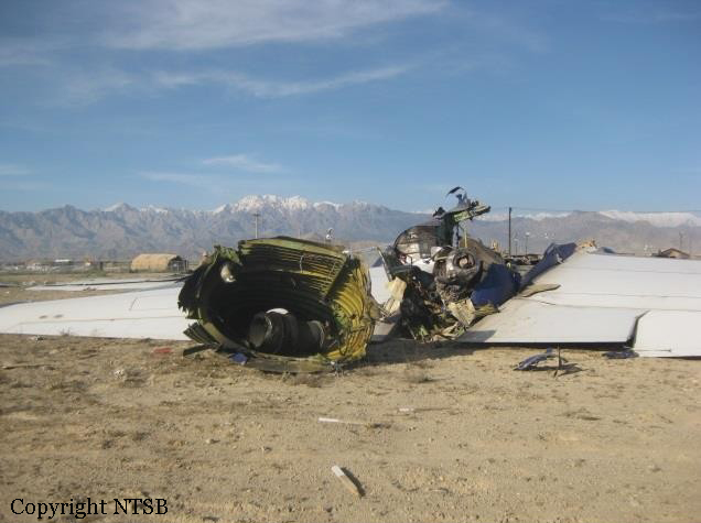
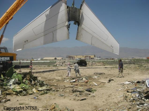
The aircraft crashed shortly after takeoff from Bagram Air Base, Bagram, Afghanistan. All seven crewmembers—the captain, first officer, loadmaster, augmented captain and first officer, and two mechanics—died, and the airplane was destroyed from impact forces and postcrash fire. The 14 Code of Federal Regulations Part 121 supplemental cargo flight, which was operated under a multimodal contract with the US Transportation Command, was destined for Dubai World Central - Al Maktoum International Airport, Dubai, United Arab Emirates. The airplane’s cargo included five mine-resistant ambush-protected (MRAP) vehicles secured onto pallets and shoring. Two vehicles were 12-ton MRAP all-terrain vehicles (M-ATVs) and three were 18-ton Cougars. The cargo represented the first time that National Airlines had attempted to transport five MRAP vehicles. These vehicles were considered a special cargo load because they could not be placed in unit load devices (ULDs) and restrained in the airplane using the locking capabilities of the airplane’s main deck cargo handling system. Instead, the vehicles were secured to centerline-loaded floating pallets and restrained to the airplane’s main deck using tie-down straps. During takeoff, the airplane immediately climbed steeply then descended in a manner consistent with an aerodynamic stall. The National Transportation Safety Board’s (NTSB) investigation found strong evidence that at least one of the MRAP vehicles (the rear M-ATV) moved aft into the tail section of the airplane, damaging hydraulic systems and horizontal stabilizer components such that it was impossible for the flight crew to regain pitch control of the airplane. The likely reason for the aft movement of the cargo was that it was not properly restrained. National Airlines’ procedures in its cargo operations manual not only omitted required, safety-critical restraint information from the airplane manufacturer (Boeing) and the manufacturer of the main deck cargo handling system (Telair, which held a supplemental type certificate [STC] for the system) but also contained incorrect and unsafe methods for restraining cargo that cannot be contained in ULDs. The procedures did not correctly specify which components in the cargo system (such as available seat tracks) were available for use as tie-down attach points, did not define individual tie-down allowable loads, and did not describe the effect of measured strap angle on the capability of the attach fittings.
Probable cause:
The NTSB determines that the probable cause of this accident was National Airlines’ inadequate procedures for restraining special cargo loads, which resulted in the loadmaster’s
improper restraint of the cargo, which moved aft and damaged hydraulic systems No . 1 and 2 and horizontal stabilizer drive mechanism components, rendering the airplane uncontrollable. Contributing to the accident was the FAA’s inadequate oversight of National Airlines’ handling of special cargo loads.
Final Report:

Crash of a Cessna 207 Skywagon in Island Lake

Date & Time: Apr 3, 2013 at 1458 LT
Operator:
Registration:
C-GHKB
Flight Phase:
Flight Type:
Survivors:
Yes
Schedule:
Island Lake – Saint Theresa Point
MSN:
207-0228
YOM:
1973
Country:
Crew on board:
1
Crew fatalities:
Pax on board:
0
Pax fatalities:
Other fatalities:
Total fatalities:
0
Circumstances:
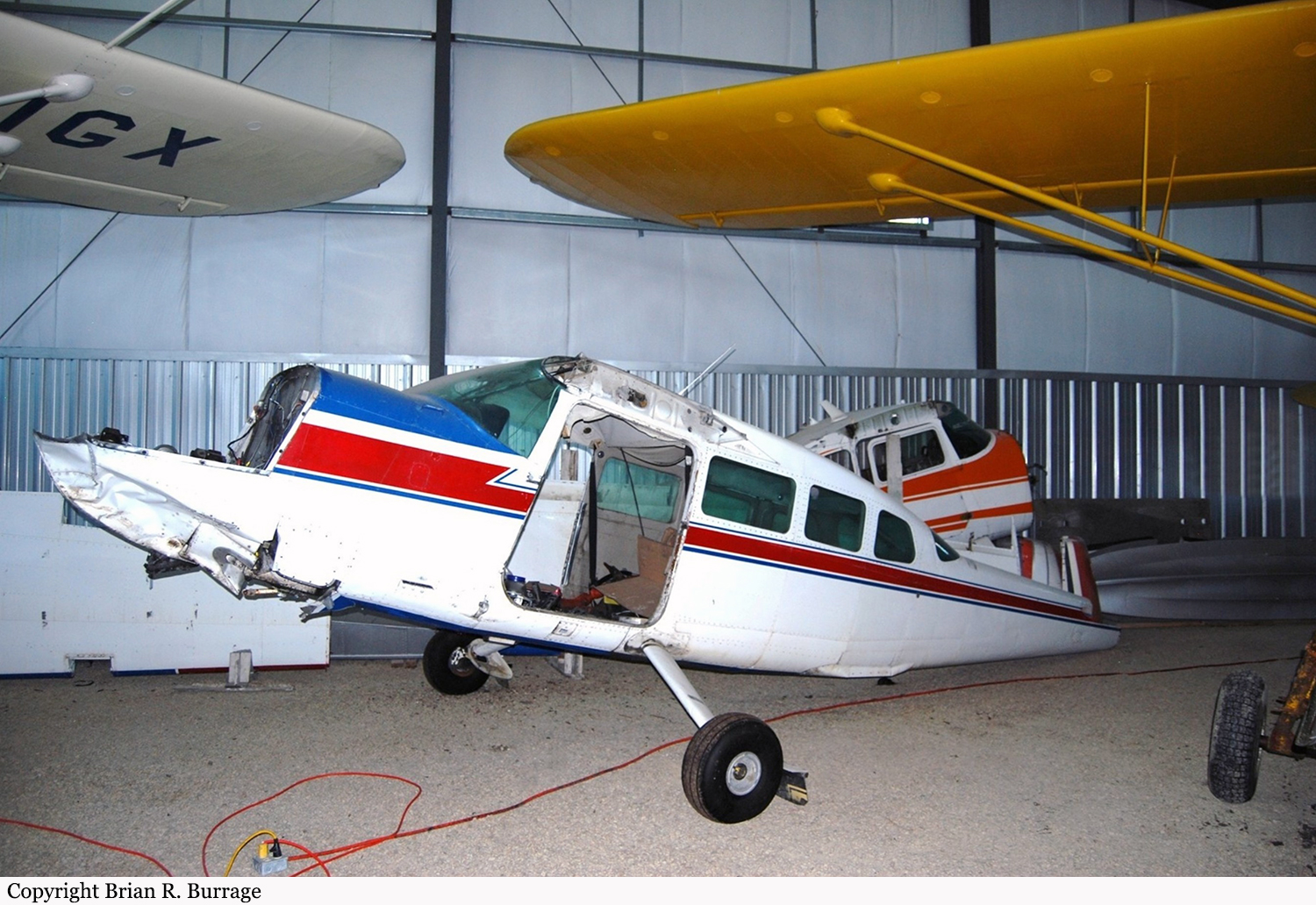
The Sandy Lake Seaplane Service Cessna 207, registration C-GHKB, was departing Island Lake, Manitoba, for St. Theresa Point, Manitoba, a VFR flight of about 7 miles. The aircraft departed runway 30 at 14:55 CDT and began a left turn about 300 feet. agl for a landing on runway 22 at St. Theresa Point. Almost immediately the aircraft entered white-out conditions in snow and blowing snow. The pilot was not IFR rated but attempted to stop the rate of descent that he noticed on the VSI. As the nose was pulled up the aircraft flew into the snow covered lake. There was no fire and the pilot was not injured. The pilot attempted to call FSS at 14:58 CDT. Communications were not established but FSS detected an ELT signal in the background of the transmission. The RCMP was notified and the pilot was rescued by snowmobile at 15:37 CDT. Company owner contacted Custom Helicopters and they dispatched two helicopters to pick up the downed pilot. Custom Helicopter was able to rescue the pilot and fly him to Island Lake nursing station. Pilot was shaken but otherwise uninjured.

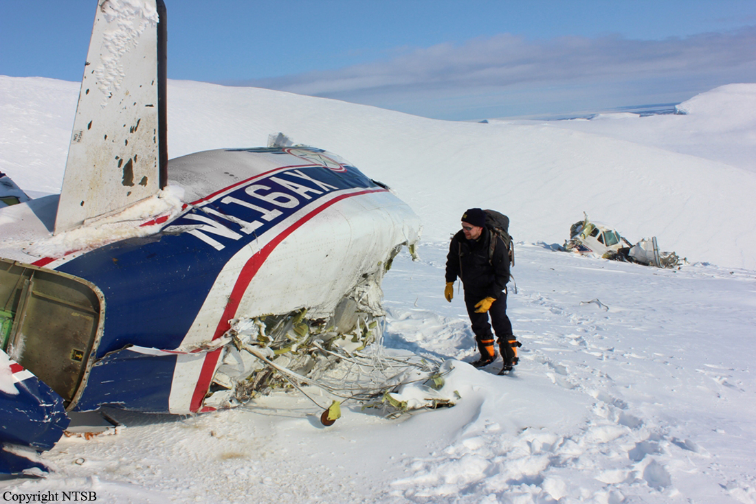
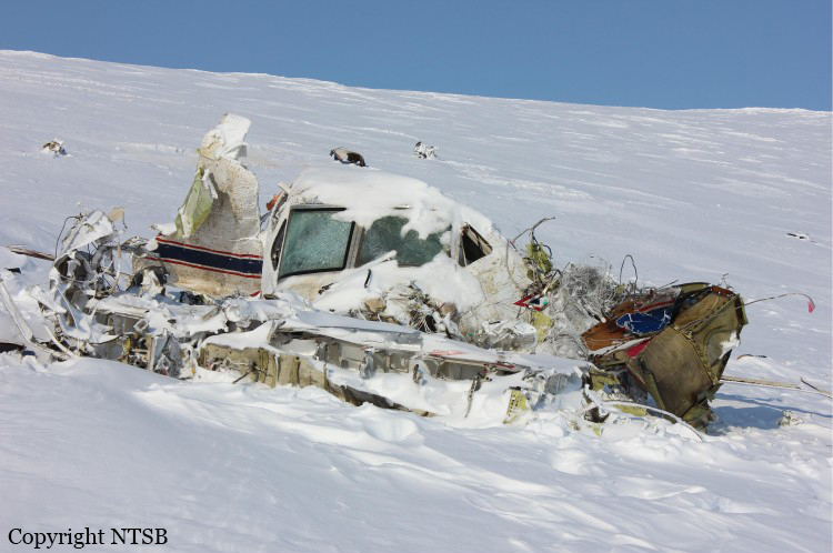
Crash of a Beechcraft 1900C-1 near Dillingham: 2 killed

Date & Time: Mar 8, 2013 at 0815 LT
Type of aircraft:
Operator:
Registration:
N116AX
Flight Type:
Survivors:
No
Site:
Schedule:
King Salmon - Dillingham
MSN:
UC-17
YOM:
1988
Flight number:
AER51
Crew on board:
2
Crew fatalities:
Pax on board:
0
Pax fatalities:
Other fatalities:
Total fatalities:
2
Captain / Total flying hours:
5770
Captain / Total hours on type:
5470.00
Copilot / Total flying hours:
470
Copilot / Total hours on type:
250
Aircraft flight hours:
29827
Circumstances:
Aircraft was destroyed when it impacted rising terrain about 10 miles east of Aleknagik, Alaska. The airplane was operated as Flight 51, by Alaska Central Express, Inc., Anchorage, Alaska, as an on demand cargo flight under the provisions of 14 Code of Federal Regulations (CFR) Part 135. The airline transport certificated captain and the commercial certificated first officer sustained fatal injuries. Instrument meteorological conditions were reported in the area at the time of the accident, and the airplane was operating on an instrument flight rules (IFR) flight plan. The flight had originally departed Anchorage about 0544, and made a scheduled stop at King Salmon, Alaska, before continuing on to the next scheduled stop, Dillingham, Alaska. According to Federal Aviation Administration (FAA) personnel, as the airplane approached Dillingham, the flight crew requested the RNAV GPS 19 instrument approach to the Dillingham Airport about 0757 from controllers at the Anchorage Air Route Traffic Control Center (ARTCC). The ARTCC specialist on duty subsequently granted the request by issuing the clearance, with instructions to proceed direct to the Initial Approach Fix (IAF) to begin the approach, and to maintain an altitude of 2,000 feet or above. A short time later the flight crew requested to enter a holding pattern at the IAF so that they could contact the Flight Service Station (FSS) for a runway conditions report, and the ARTCC specialist granted that request. The ARTCC specialist then made several attempts to contact the aircraft, but was unsuccessful and subsequently lost radar track on the aircraft. When the airplane failed to arrive at the Dillingham Airport, ARTCC personnel initiated a radio search to see if the airplane had diverted to another airport. Unable to locate the airplane, the FAA issued an alert notice (ALNOT) at 0835. Search personnel from the Alaska State Troopers, Alaska Air National Guard, and the U.S. Coast Guard, along with several volunteer pilots, were dispatched to conduct an extensive search effort. Rescue personnel aboard an Air National Guard C-130 airplane tracked 406 MHz emergency locater transmitter (ELT) signal to an area of mountainous terrain about 20 miles north of Dillingham, but poor weather prohibited searchers from reaching the site until the next morning. Once the crew of a HH-60G helicopter from the Air National Guard's 210th Air Rescue Squadron, Anchorage, Alaska, reached the steep, snow and ice-covered site, they confirmed that both pilots sustained fatal injuries.
Probable cause:
The flight crew's failure to maintain terrain clearance, which resulted in controlled flight into terrain in instrument meteorological conditions. Contributing to the accident were the flight crew's failure to correctly read back and interpret clearance altitudes issued by the air traffic controller, their failure to adhere to minimum altitudes depicted on the published instrument approach chart, and their failure to adhere to company checklists. Also contributing to the accident were the air traffic controller's issuance of an ambiguous clearance to the flight crew, which resulted in the airplane's premature descent, his failure to address the pilot's incorrect read back of the assigned clearance altitudes, and his failure to monitor the flight and address the altitude violations and issue terrain-based safety alerts.
Final Report:

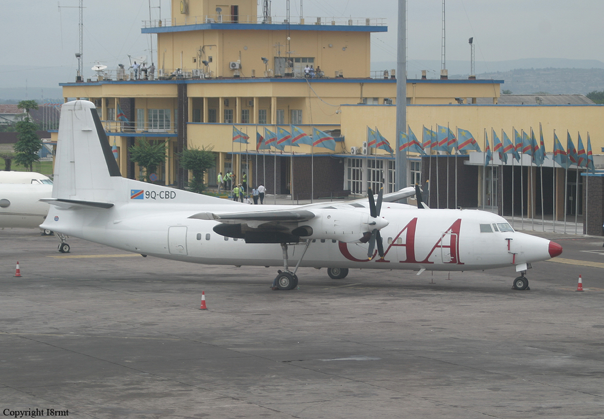
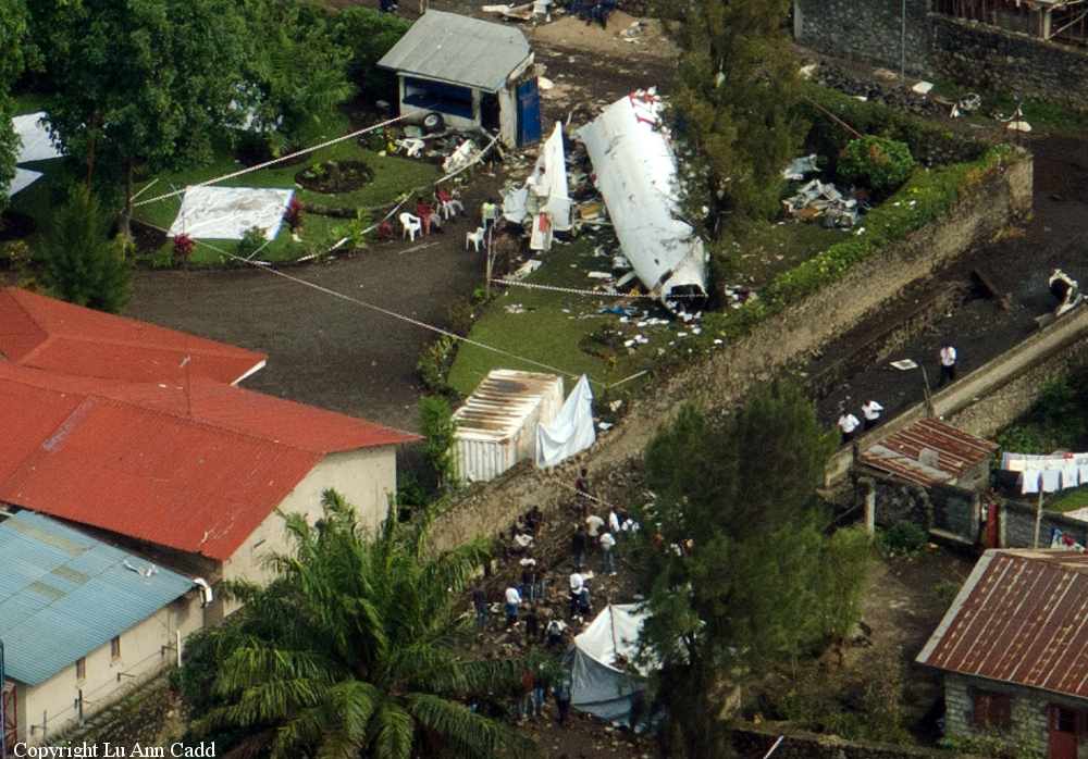
Crash of a Fokker 50 in Goma: 7 killed

Date & Time: Mar 4, 2013 at 1744 LT
Type of aircraft:
Operator:
Registration:
9Q-CBD
Flight Type:
Survivors:
Yes
Site:
Schedule:
Kananga - Lodja - Goma
MSN:
20270
YOM:
1992
Location:
Region:
Crew on board:
6
Crew fatalities:
Pax on board:
4
Pax fatalities:
Other fatalities:
Total fatalities:
7
Circumstances:
The aircraft was completing a cargo flight from Kananga to Goma with an intermediate stop in Lodja, carrying four passengers, 6 crew members and a load of various goods. On final approach to Goma Airport Runway 36, the crew encountered poor weather conditions with limited visibility due to heavy rain falls. On final, the aircraft contacted the roof of a house and crashed in the garden of a residential area, coming to rest upside down. Three passengers were seriously injured while seven other occupants were killed.

Crash of a Cessna 208B Super Cargomaster in Pellston: 1 killed

Date & Time: Jan 15, 2013 at 1958 LT
Type of aircraft:
Operator:
Registration:
N1120N
Flight Phase:
Flight Type:
Survivors:
No
Schedule:
Pellston - Lansing
MSN:
208B-0386
YOM:
1994
Flight number:
MRA605
Crew on board:
1
Crew fatalities:
Pax on board:
0
Pax fatalities:
Other fatalities:
Total fatalities:
1
Captain / Total flying hours:
1921
Captain / Total hours on type:
34.00
Aircraft flight hours:
10132
Circumstances:
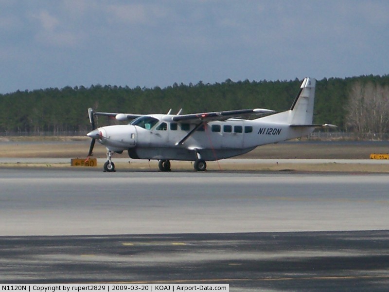
The pilot landed at the airport to refuel the airplane and pick up cargo. The pilot spoke with three employees of the fixed base operator who stated that he seemed alert and awake but wanted to make a "quick turn." After the airplane was fueled and the cargo was loaded, the pilot departed; the airplane crashed 1 minute later. Night visual meteorological conditions prevailed at the time. An aircraft performance GPS and simulation study indicated that the airplane entered a right bank almost immediately after takeoff and then made a 42 degree right turn and that it was accelerating throughout the flight, from about 75 knots groundspeed shortly after liftoff to about 145 knots groundspeed at impact. The airplane was climbing about 500 to 700 feet per minute to a peak altitude of about 260 feet above the ground before descending. The simulation showed a gas generator speed of about 93 percent throughout the flight. The study indicated that the load factor vectors, which were the forces felt by the pilot, could have produced a somatogravic illusion of a climb, even while the airplane was descending. The postaccident examination of the airframe and engine revealed no evidence of mechanical malfunctions or failures that would have precluded normal operation. Based on the findings from the aircraft performance GPS and simulation study, the degraded visual reference conditions present about the time of the accident, and the forces felt by the pilot, it is likely that he experienced spatial disorientation, which led to his inadvertent controlled descent into terrain.
Probable cause:
The pilot's inadvertent controlled descent into terrain due to spatial disorientation. Contributing to the accident was lack of visual reference due to night conditions.
Final Report:

Crash of a Piper PA-31-350 Navajo Chieftain near Payson: 1 killed

Date & Time: Dec 18, 2012 at 1825 LT
Operator:
Registration:
N62959
Flight Phase:
Flight Type:
Survivors:
No
Site:
Schedule:
Holbrook - Payson - Phoenix
MSN:
31-7752008
YOM:
1977
Flight number:
AMF3853
Location:
Crew on board:
1
Crew fatalities:
Pax on board:
0
Pax fatalities:
Other fatalities:
Total fatalities:
1
Captain / Total flying hours:
1908
Captain / Total hours on type:
346.00
Aircraft flight hours:
19188
Circumstances:
The pilot began flying the twin piston-engine airplane model for the cargo airline about 11 months before the accident. Although he had since upgraded to one of the airline’s twin turboprop airplane models, due to the airline’s logistical needs, the pilot was transferred back to the piston-engine model about 1 week before the accident. The flight originated at one of the airline’s outlying destination airports and was planned to stop at an interim destination to the southwest before continuing to the airline’s base as the final destination. The late afternoon departure meant that the flight would arrive at the interim destination about 10 minutes after sunset. That interim destination was situated in a sparsely populated geographic bowl just south of terrain that was significantly higher, and the ceilings there included multiple broken and overcast cloud layers near, or lower than, the surrounding terrain. Although not required by Federal Aviation Administration (FAA) regulations, the airline employed dedicated personnel who performed partial dispatch-like activities, such as providing relevant flight information, including weather, to the pilots. Before takeoff on the accident flight, the pilot conferred briefly with the dispatch personnel by telephone, and, with little discussion, they agreed that the flight would proceed under visual flight rules to the interim destination. Information available at the time indicated that the cloud cover almost certainly precluded access to the airport without an instrument approach; however, the airplane was not equipped to conduct the only available instrument approach procedure for that airport. Additionally, the pilot did not have in-flight access to any GPS or terrain mapping/database information to readily assist him in either locating the airport or remaining safely clear of the local terrain. Although the airplane was not being actively tracked or assisted by air traffic control (ATC) early in the flight, review of ground tracking radar data showed that the flight initially headed directly toward the interim destination but then began a series of turns, descents, and climbs. The airplane then disappeared from radar as the result of radar coverage floor limitations due to high terrain and radar antenna siting. The airplane reappeared on radar about 24 minutes after it disappeared and about 9 minutes after the FAA-defined beginning of night. Based on the flight track, it is likely that the pilot made a dedicated effort to access the airport, while concurrently remaining clear of the clouds and terrain, strictly by visual means. This task was made considerably more difficult and hazardous by attempting it in dusk conditions, and then darkness, instead of during daylight hours. About 15 minutes after the airplane reappeared on radar, when it was at an altitude of about 13,500 ft, the pilot contacted ATC and requested and was granted an instrument flight rules clearance to his final destination. About 3 minutes later, the controller cleared the flight to descend to 10,000 ft, and the airplane leveled off at that altitude about 6 minutes later. However, upon reaching 10,000 ft, the pilot requested a lower altitude to escape “heavy” upand down-drafts, but the controller was unable to comply because the ATC minimum vectoring altitude was 9,700 ft in that region. About 1 minute later, radar contact was lost. Shortly thereafter, the airplane impacted terrain in a steep nose-down attitude in a near-vertical trajectory. Although examination of the wreckage did not reveal any preimpact mechanical deficiencies that would have prevented normal operation and continued flight, the extent of the damage precluded, except on a macro scale, any determination of the preimpact integrity or functionality of any systems, subsystems, or components, including the ice protection systems, autopilot, and nose baggage door. Analysis of the radar data indicated that the airplane was above 10,000 ft for at least 41 minutes (possibly in two discontinuous periods) and above 12,000 ft (in two discontinuous periods) for at least 18 minutes. Although the airplane was reportedly equipped with supplemental oxygen, the investigation was unable to verify either its presence or its use by the pilot. Lack of supplemental oxygen at those altitudes for those periods could have contributed to a decrease in the pilot’s mental acuity and his ability to safely conduct the light. Analysis of air mass data revealed that mountain-wave activity and up- and downdrafts with vertical velocities of about 1,000 ft per minute (fpm) were present near the accident site and that the largest and most rapid transitions from up- to down-drafts occurred near the accident site, which was also supported by the airplane’s altitude data trace. The analysis also indicated that the last radar target from the airplane was located in a downdraft with a velocity of between 600 and 1,000 fpm. Other meteorological analysis indicated that the airplane encountered icing conditions, likely in the form of supercooled large droplets (SLD), several minutes before the accident. Aside from pilot reports from aircraft actually encountering SLD, no tools currently exist to detect airborne SLD. Further, the tools and processes to reliably forecast SLD do not exist. SLD is often associated with rapid ice accumulation, especially on portions of the airplane that are not served by ice protection systems. Airframe icing, whether due to accumulation rates or locations that exceed the airplane’s deicing system capabilities, mechanical failure, or the pilot’s failure to properly use the system, can impose significant adverse effects on airplane controllability and its ability to remain airborne. Because of the pilot’s recent transition from the Beechcraft BE-99, in which the pitot heat was always operating during flight, he may have forgotten that the accident airplane’s pitot heat procedures were different and that the pitot heat had to be manually activated when the airplane encountered the icing conditions. If the pitot heat is not operating in icing conditions, the airspeed information becomes unreliable and likely erroneous. Erroneous airspeed indications, particularly in night instrument meteorological conditions when the pilot has no outside references, could result in a loss of control. The investigation was unable to determine whether the pitot heat was operating during the final portion of the flight. The investigation was unable to determine whether the pilot used the autopilot during the last portion of the flight. If he was using the autopilot, it is possible that, at some point, he was forced to revert to flying the airplane manually due to the unit’s inability and to a corresponding Pilot’s Operating Handbook prohibition against using it to maintain altitude in the strong up- and downdrafts, which would increase the pilot’s workload. Another possibility is that the autopilot was unable to maintain altitude, and, instead of disconnecting it, the pilot overpowered it via the control wheel. If that occurred and the pilot overrode the autopilot for more than 3 seconds, the pitch autotrim system would have activated in the direction opposite the pilot’s input, and, when the pilot released the control wheel, the airplane could have been significantly out of trim, which could result in uncommanded pitch, altitude, and speed excursions and possible loss of control. Whether the pilot was hand-flying the airplane or was using the autopilot, the encounter with the strong up- and downdrafts and consequent altitude loss likely prompted the pilot to input corrective actions to regain the lost altitude, specifically increasing pitch and possibly power. Such corrections typically result in airspeed losses; those losses can sometimes be significant as a function of downdraft strength and the airplane’s climb capability. If that capability is compromised by the added weight, drag, and other adverse aerodynamic effects of ice, aerodynamic stall and a loss of control could result. Radar tracking data and ATC communications revealed that another, similar-model airplane flew a very similar track about 6 minutes behind the accident airplane, except that that other airplane was at 12,000 ft not 10,000 ft. The 10,000-ft ATC-mandated altitude placed the accident airplane closer to the underlying high terrain and into the clouds with the icing conditions and the strong vertical air movements. In contrast, the pilot of the second airplane reported that he was in and out of the cloud tops and did not report any weather-induced difficulties. The accident pilot did not have any efficient in-flight means for accurately determining the airborne meteorological conditions ahead, and the ATC controller did not advise him of any adverse conditions. Therefore, the pilot did not have any objective or immediate reason to refuse the ATC-assigned altitude of 10,000 ft. Ideally, based on both the AIRMET and the ambient temperatures, the pilot should have been aware of the likelihood of icing once he descended into clouds. That, particularly combined with his previously expressed lack of confidence in the airplane’s capability in icing conditions, could have prompted him to request either an interim stepdown altitude of 12,000 ft or an outright delay in a direct descent to 10,000 ft, but, for undetermined reasons, the pilot did not make any such request of ATC. Based on the available evidence, if the ATC controller had not descended the airplane to 10,000 ft when he did, either by delaying or by assigning an interim altitude of 12,000 ft, it is likely that the airplane would not have encountered the icing conditions and the strong up- and downdrafts. In addition, if the presence of SLD and/or strong up- and downdrafts had been known or explicitly forecast and then communicated to the pilot either via his weather briefing, his onboard equipment, or by ATC, it is likely that the pilot would have opted to avoid those phenomena to the maximum extent possible. The flight’s encounter with airframe icing and strong up-and downdrafts placed the pilot and airplane in an environment that either exacerbated or directly caused a situation that resulted in the loss of airplane control.
Probable cause:
The airplane’s inadvertent encounter, in night instrument meteorological conditions, with unforecast strong up- and downdrafts and possibly severe airframe icing conditions (which
likely included supercooled large droplets that the airplane was not certificated to fly in) that led to the pilot's loss of airplane control.
Final Report:

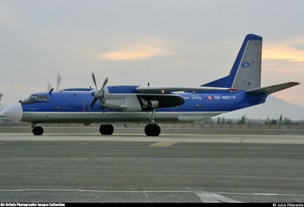
Crash of an Antonov AN-26-100 near Tomas: 4 killed

Date & Time: Dec 17, 2012 at 1042 LT
Type of aircraft:
Operator:
Registration:
OB-1887-P
Flight Phase:
Flight Type:
Survivors:
No
Site:
Schedule:
Lima - Las Malvinas
MSN:
66 06
YOM:
1978
Location:
Country:
Crew on board:
4
Crew fatalities:
Pax on board:
0
Pax fatalities:
Other fatalities:
Total fatalities:
4
Captain / Total flying hours:
13145
Captain / Total hours on type:
12308.00
Copilot / Total flying hours:
1373
Copilot / Total hours on type:
1193
Circumstances:
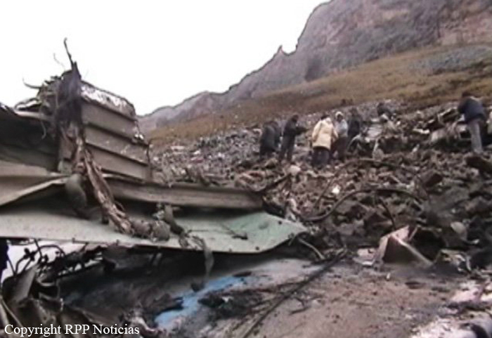
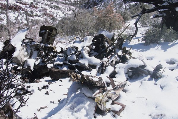
The crew was performing a cargo flight from Lima to Las Malvinas (Sabeti), and departed Lima-Jorge Chávez Airport at 1009LT for a 78-minutes flight. 32 minutes into the flight, while overflying the Andes mountains at FL195, the crew lost control of the airplane that crashed in a mountainous area located near Tomas. The wreckage was found the following day and all four occupants were killed while.
Probable cause:
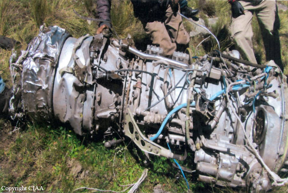
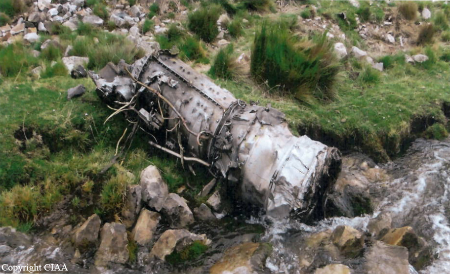
Both engines failed in flight due to icing accumulation and inappropriate use of the deicing systems. The following factors were considered as contributory:
- Poor flight planning on part of the crew,
- Poor crew resources management,
- Poor crew simulator training (icing detection and dual engine failure),
- Lack of procedures relating to icing conditions and dual engine failure,
- Marginal weather conditions which contributed to ice accumulation on engines and airframe.
Final Report:

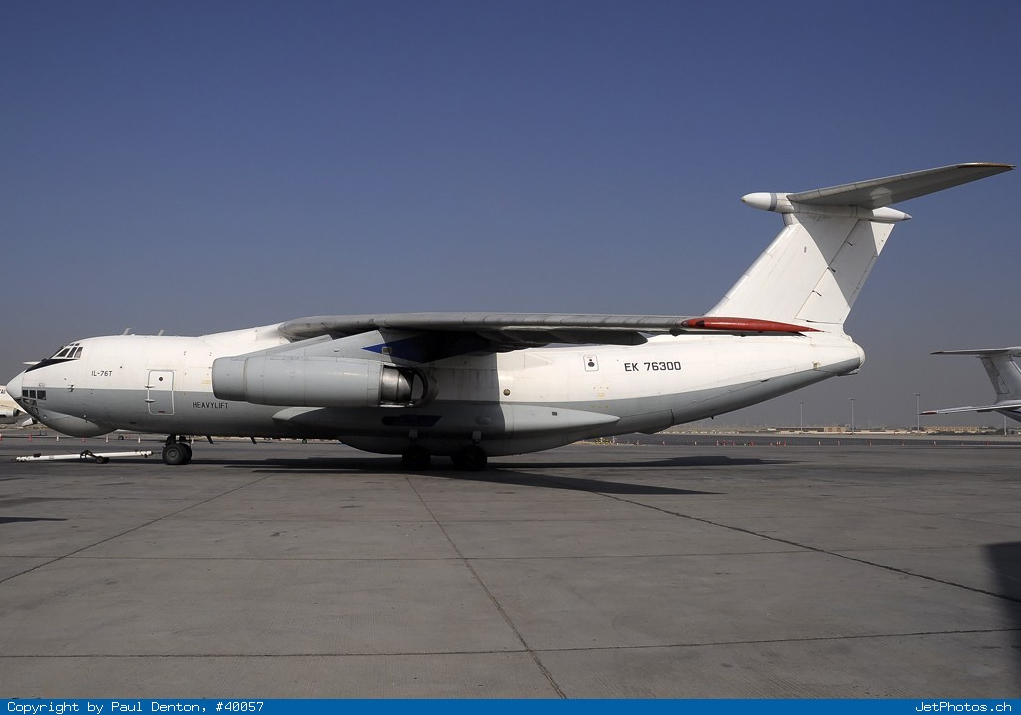
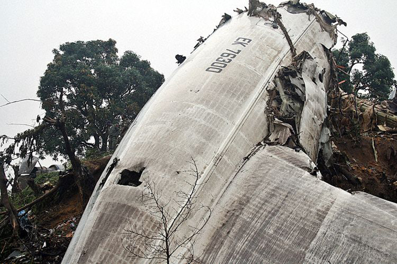
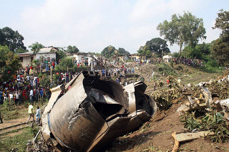
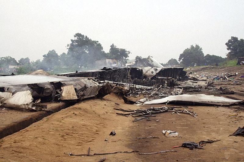
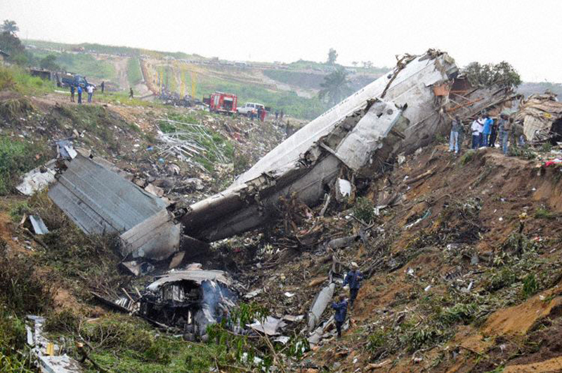
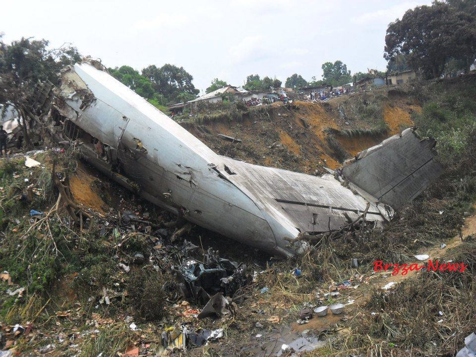
Crash of an Ilyushin II-76T in Brazzaville: 32 killed

Date & Time: Nov 30, 2012 at 1730 LT
Type of aircraft:
Operator:
Registration:
EK-76300
Flight Type:
Survivors:
No
Schedule:
Pointe-Noire - Brazzaville
MSN:
0834 10300
YOM:
1978
Country:
Region:
Crew on board:
6
Crew fatalities:
Pax on board:
1
Pax fatalities:
Other fatalities:
Total fatalities:
32
Circumstances:
The four engine aircraft was completing a cargo flight from Pointe-Noire to Brazzaville, carrying one passenger, a crew of six and a load consisting of automobiles and various goods. On final approach to runway 05L in poor weather conditions, the crew descended too low on the glide when the aircraft impacted houses and tree tops and eventually crashed in the district of La Poudrière, about 900 metres short of runway. All 7 occupants were killed as well as 25 people on the ground. Fourteen other people were injured. At the time of the accident, weather conditions were poor with thunderstorm activity, rain falls and limited visibility. MAK stated in February 2013 that they received the FDR from the Congolese authorities but the recorders show mechanical damages as a result of the impact forces.