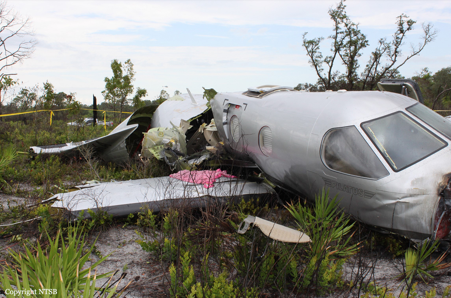
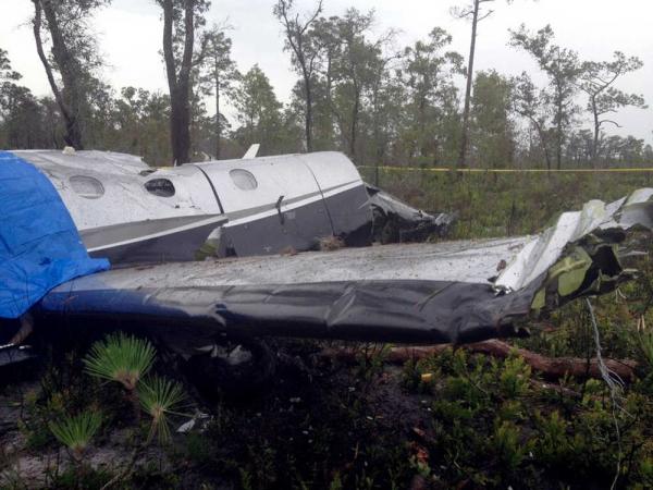
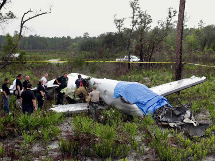
Crash of a Piper PA-31T Cheyenne II near Catacamas: 1 killed

Date & Time: Jul 3, 2012
Type of aircraft:
Operator:
Registration:
PT-OFH
Flight Phase:
Flight Type:
Survivors:
Yes
MSN:
31-7920034
YOM:
1979
Country:
Crew on board:
2
Crew fatalities:
Pax on board:
0
Pax fatalities:
Other fatalities:
Total fatalities:
1
Circumstances:
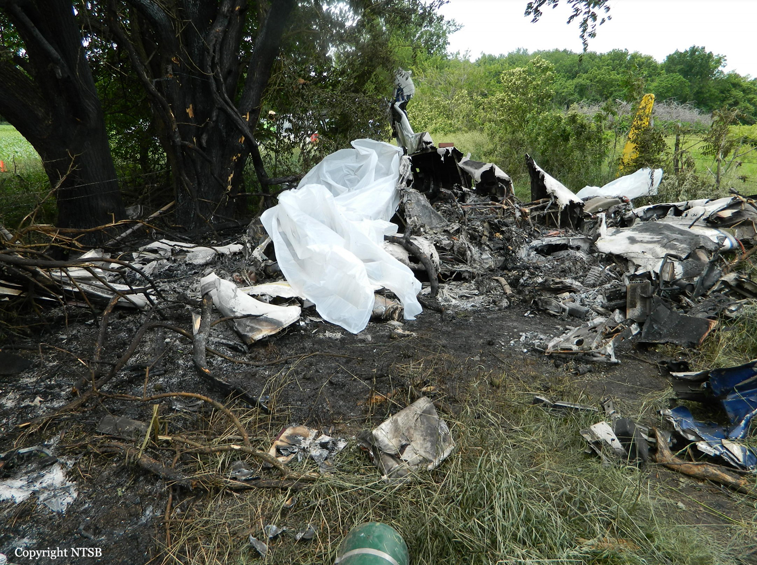
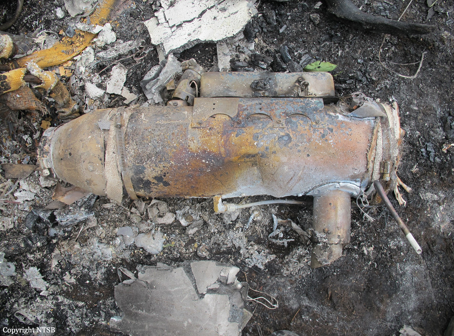
The twin engine aircraft was engaged in an illegal flight, carrying two pilots and a load consisting of 600 kilos of cocaine. After being tracked by the Honduran Police, the crew apparently attempted an emergency landing when the aircraft crashed. While the copilot was injured, the captain was killed.

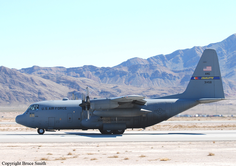
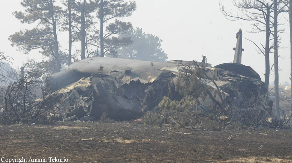
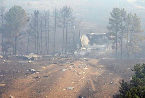
Crash of a Lockheed C-130H Hercules near Edgemont: 4 killed

Date & Time: Jul 1, 2012 at 1738 LT
Type of aircraft:
Operator:
Registration:
93-1458
Flight Phase:
Flight Type:
Survivors:
Yes
Schedule:
Colorado Springs - Colorado Springs
MSN:
5363
YOM:
1994
Crew on board:
6
Crew fatalities:
Pax on board:
0
Pax fatalities:
Other fatalities:
Total fatalities:
4
Captain / Total hours on type:
1966.00
Copilot / Total hours on type:
3647
Circumstances:
On 1 July 2012, at approximately 1738 Local time, a C-130H3, Tail Number 93-1458, assigned to the 145th Airlift Wing, North Carolina Air National Guard, Charlotte Douglas International Airport (KCLT), Charlotte, North Carolina, crashed on public land managed by the United States Forest Service (USFS), while conducting wildland firefighting operations near Edgemont, South Dakota. At the time of the mishap all members of the Mishap Crew (MC) were assigned or attached to the 156th Airlift Squadron, based at KCLT. The Mishap Crew (MC) consisted of Mishap Pilot 1 (MP1), Mishap Pilot 2 (MP2), Mishap Navigator (MN), Mishap Flight Engineer (ME), Mishap Loadmaster 1 (ML1) and Mishap Loadmaster 2 (ML2). For the mishap sortie, MP1 was the aircraft commander and pilot flying in the left seat. MP2 was in the right seat as the instructor pilot. MN occupied the navigator station on the right side of the flight deck behind MP2. ME was seated in the flight engineer seat located between MP1 and MP2, immediately aft of the center flight console. ML1 and ML2 were seated on the Modular Airborne Fire Fighting System (MAFFS) unit, near the right paratroop door. ML1 occupied the aft MAFFS control station seat and ML2 occupied the forward MAFFS observer station seat. MP1, MP2, MN and ME died in the mishap. ML1 and ML2 survived the mishap, but suffered significant injuries. The mishap aircraft (MA) and a USFS-owned MAFFS unit were destroyed. The monetary loss is valued at $43,453,295, which includes an estimated $150,000 in post aircraft removal and site environmental cleanup costs. There were no additional fatalities, injuries or damage to other government or civilian property.
Probable cause:
The accident investigation report released by the Air Force Air Mobility Command said:
I developed my opinion by inspecting the mishap site and wreckage, as well as analyzing factual data from the following: historical records, Air Force directives and guidance, USFS and Interagency guidance, reconstructing the mishap sortie in a C-130H3 simulator, engineering analysis, witness testimony, flight data, weather radar data, computer animated reconstruction, consulting with subject matter experts and information provided by technical experts. The failure of the Digital Flight Data Recorder severely complicated the recreation of the mishap, and impacted my ability to determine facts in this investigation. I find by clear and convincing evidence the cause of the mishap was MPl, MP2, MN and ME's inadequate assessment of operational conditions, resulting in the MA impacting the ground after flying into a microburst. Additionally, I find by the preponderance of evidence, the failure of the White Draw Fire Lead Plane aircrew and Air Attack aircrew to communicate critical operational information; and conflicting operational guidance concerning thunderstorm avoidance, substantially contributed to the mishap.
Final Report:

Crash of a Cessna 208B Grand Caravan in La Leona: 4 killed

Date & Time: Jun 23, 2012 at 1100 LT
Type of aircraft:
Operator:
Registration:
EJC-1131
Flight Phase:
Flight Type:
Survivors:
No
Schedule:
Tolemaida - Saravena
MSN:
208B-1199
YOM:
2007
Country:
Crew on board:
2
Crew fatalities:
Pax on board:
2
Pax fatalities:
Other fatalities:
Total fatalities:
4
Circumstances:
The crew was performing a flight from the Tolemaida Air Base to the airport of Saravena-Los Colonizadores. Few minutes after takeoff, while flying some 35 km from its departure point, the single engine aircraft crashed in unknown circumstances in a field located in La Leona. All four occupants were killed.

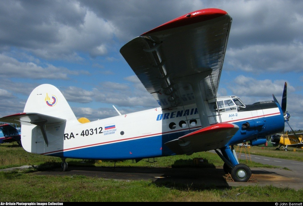
Crash of a PZL-Mielec AN-2R near Serov: 13 killed

Date & Time: Jun 11, 2012 at 2211 LT
Type of aircraft:
Operator:
Registration:
RA-40312
Flight Phase:
Flight Type:
Survivors:
No
Schedule:
Serov - Serov
MSN:
1G221-48
YOM:
1986
Country:
Region:
Crew on board:
1
Crew fatalities:
Pax on board:
12
Pax fatalities:
Other fatalities:
Total fatalities:
13
Captain / Total flying hours:
8281
Captain / Total hours on type:
5977.00
Aircraft flight hours:
3966
Aircraft flight cycles:
12000
Circumstances:
In the evening of 11JUN2012, a group of 13 people departed Serov Airport at 2200LT on an illegal trip with an unknown destination, maybe for fishing, sauna or any other party. The aircraft failed to return and was lost without trace. Local Authorities performed search and rescue on more than 275,000 square km until 23JUL2012 without success. It seems that all occupants were intoxicated when they took the airplane, among them the Chief of Serov City Police, three of his deputies, an airport guard and several others. On Saturday 05MAY2013, local hunters found the burnt wreckage and the skeletonized remains of the bodies on a marshland, some 10 km southwest of Serov Airport.
Probable cause:
It is believed that the airplane was flying at low height when its left lower wing impacted tree tops. The aircraft then rolled to the left to an angle of 90° and crashed, bursting into flames. At the time of the accident, the pilot and other occupants were intoxicated.
Final Report:

Crash of a Piper PA-31-325 Navajo C/R near Two Harbors: 1 killed

Date & Time: Jun 8, 2012 at 1427 LT
Type of aircraft:
Registration:
N174BH
Flight Phase:
Flight Type:
Survivors:
No
Schedule:
South Saint Paul - South Saint Paul
MSN:
31-7612038
YOM:
1976
Crew on board:
1
Crew fatalities:
Pax on board:
0
Pax fatalities:
Other fatalities:
Total fatalities:
1
Circumstances:
On June 8, 2012, about 1307 central daylight time, a Piper PA-31-325, N174BH, departed from the South St Paul Municipal Airport-Richard E Fleming Field (SGS), South St Paul, Minnesota for a maintenance test flight. The airplane reportedly had one of its two engines replaced and the pilot was to fly for about 4 hours to break-in the engine. The airplane did not return from the flight and was reported overdue. The airplane is missing and is presumed to have crashed. The airline transport pilot has not been located. The airplane was registered to Family Celebrations LLC, and was operated as a 14 Code of Federal Regulations Part 91 personal flight. Visual meteorological conditions prevailed and no flight plan was filed. The flight departed SGS with the intention of returning to SGS at the conclusion of the flight. The airplane was reported missing and an alert notification issued about 2225. The last reported contact with the airplane and pilot was about 1300 when the fixed base operator at SGS towed the airplane to the fuel pumps. When he returned about 15 minutes later, the airplane was no longer there. Aircraft radar track data from various ground based sources indicated that the airplane departed SGS about 1307. The airplane maneuvered east of SGS before turning toward the north. The airplane's track continued north toward Duluth, Minnesota. Once the airplane reached Duluth, it followed the west shoreline of Lake Superior. Radar track data indicated that the airplane was at a pressure altitude of 2,800 feet when it reached the shoreline. The airplane continued along the west shoreline toward Two Harbors, Minnesota, flying over the water while maintaining a distance of about 0.5 miles from the shore. As the airplane approached Two Harbors, it descended. The airplane's last recorded position at 1427 was about 30 miles northeast of Duluth, Minnesota, at an uncorrected pressure altitude of 1,600 feet. The Air Force Rescue Coordination Center coordinated a search for the missing airplane. The Civil Air Patrol, United States Coast Guard, and other entities participated in the search efforts. Search efforts were suspended on July 4, 2012.
Probable cause:
Undetermined because the airplane was not found
Final Report:

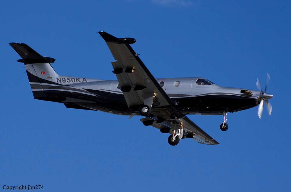
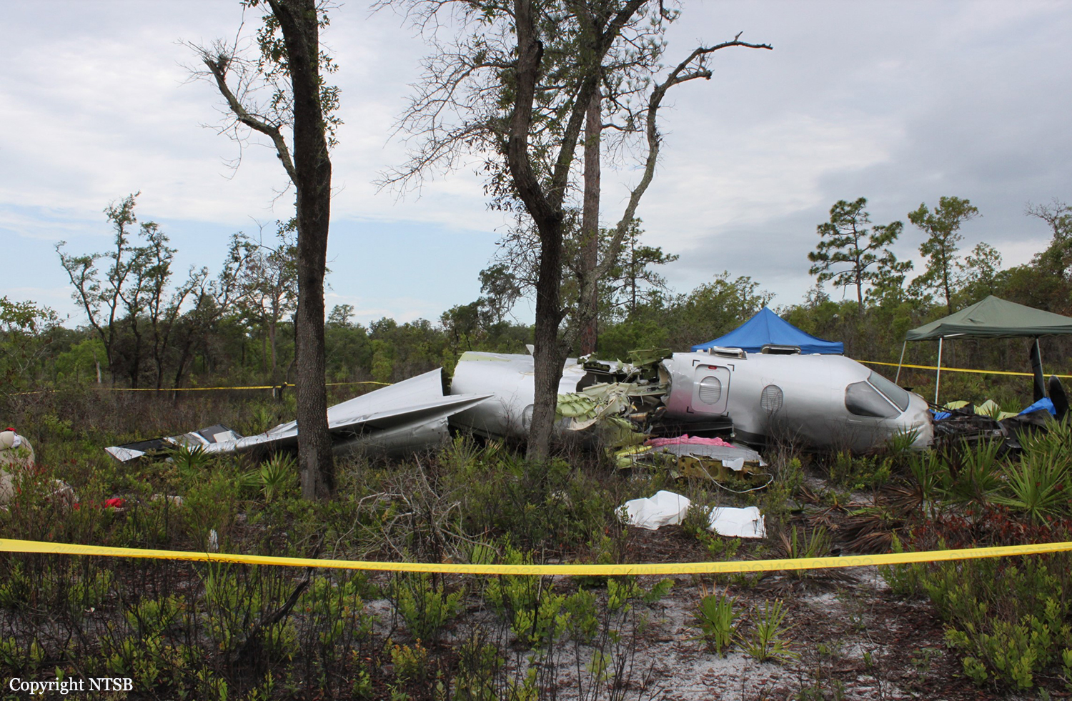
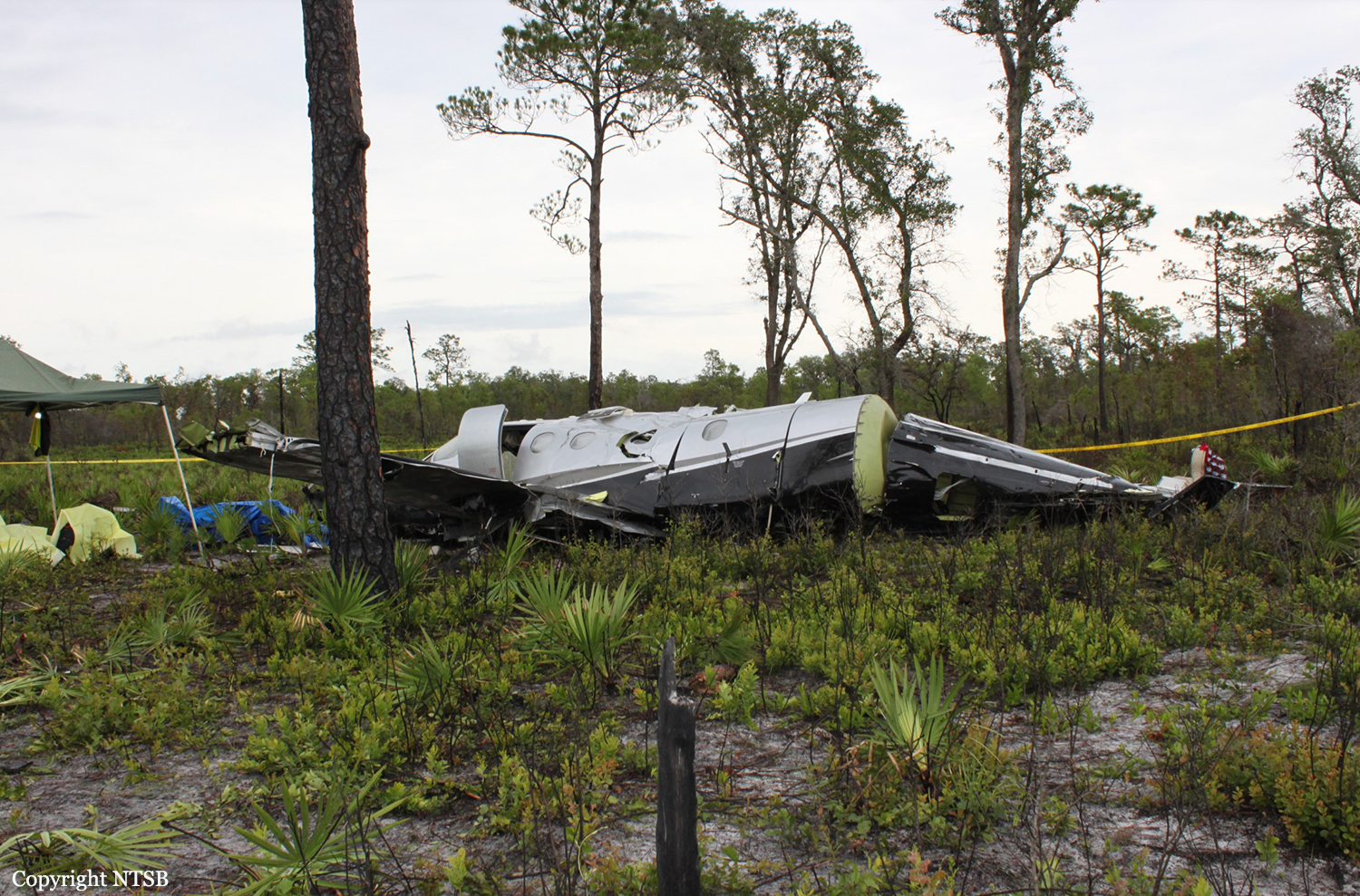
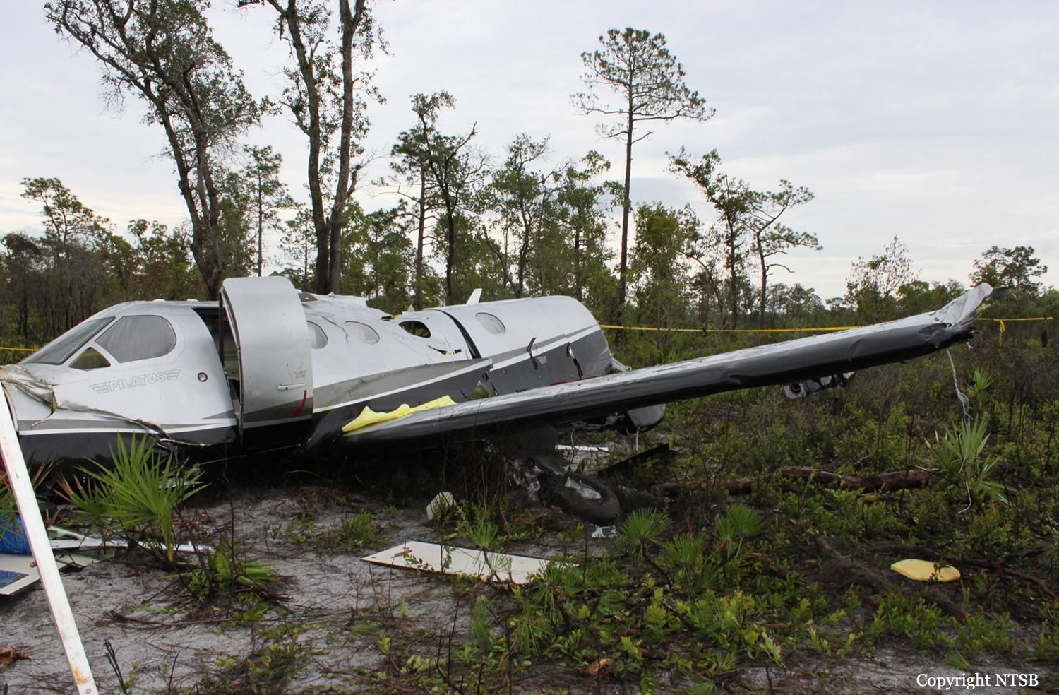
Crash of a Pilatus PC-12/47 in Lake Wales: 6 killed

Date & Time: Jun 7, 2012 at 1235 LT
Type of aircraft:
Registration:
N950KA
Flight Phase:
Flight Type:
Survivors:
No
Schedule:
Fort Pierce - Junction City
MSN:
730
YOM:
2006
Crew on board:
1
Crew fatalities:
Pax on board:
5
Pax fatalities:
Other fatalities:
Total fatalities:
6
Captain / Total flying hours:
755
Captain / Total hours on type:
38.00
Aircraft flight hours:
1263
Circumstances:
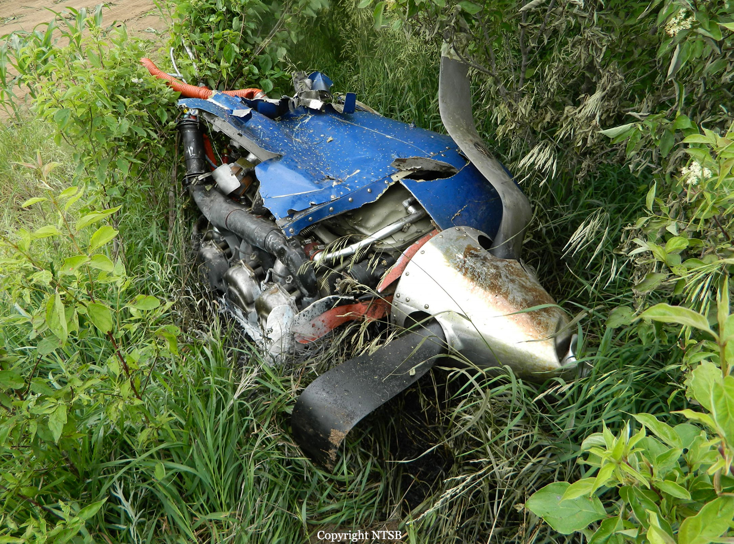
The airplane, registered to and operated by Roadside Ventures, LLC, departed controlled flight followed by subsequent inflight breakup near Lake Wales, Florida. Instrument meteorological conditions prevailed at the altitude and location of the departure from controlled flight and an instrument flight rules (IFR) flight plan was filed for the 14 Code of Federal Regulations (CFR) Part 91 personal flight from St Lucie County International Airport (FPR), Fort Pierce, Florida, to Freeman Field Airport (3JC), Junction City, Kansas. The airplane was substantially damaged and the private pilot and five passengers were fatally injured. The flight originated from FPR about 1205. After departure while proceeding in a west-northwesterly direction and climbing, air traffic control communications were transferred to Miami Air Route Traffic Control Center (Miami ARTCC). The pilot remained in contact with various sectors of that facility from 1206:41, to the last communication at 1233:16. About 6 minutes after takeoff the pilot was advised by the Miami ARTCC Stoop Sector radar controller of an area of moderate to heavy precipitation twelve to two o'clock 15 miles ahead of the airplane's position; the returns were reported to be 30 miles in diameter. The pilot asked the controller if he needed to circumnavigate the weather, to which the controller replied that deviations north of course were approved and when able to proceed direct LAL, which he acknowledged. A trainee controller and a controller providing oversight discussed off frequency that deviation to the south would be better. The controller then questioned the pilot about his route, to which he replied, and the controller then advised the pilot that deviations south of course were approved, which he acknowledged. The flight continued in generally a west-northwesterly direction, or about 290 degrees, and at 1230:11, while at flight level (FL) 235, the controller cleared the flight to FL260, which the pilot acknowledged. At 1232:26, the aircraft's central advisory and warning system (CAWS) recorded that the pusher system went into "ice mode" indicating the pilot had selected the propeller heat on and inertial separator open. At that time the aircraft's engine information system (EIS) recorded the airplane at 24,668 feet pressure altitude, 110 knots indicated airspeed (KIAS), and an outside air temperature of minus 11 degrees Celsius. At 1232:36, the Miami ARTCC Avon Sector radar controller advised the pilot of a large area of precipitation northwest of Lakeland, with moderate, heavy and extreme echoes in the northwest, and asked him to look at it and to advise what direction he needed to deviate, then suggested deviation right of course until north of the adverse weather. The pilot responded that he agreed, and the controller asked the pilot what heading from his position would keep the airplane clear, to which he responded at 1233:04 with, 320 degrees. At 1233:08, the Miami ARTCC Avon Sector radar controller cleared the pilot to fly heading 320 degrees or to deviate right of course when necessary, and when able proceed direct to Seminole, which he acknowledged at 1233:16. There was no further recorded communication from the pilot with the Miami ARTCC. Radar data showed that between 1233:08, and 1233:26, the airplane flew on a heading of approximately 290 degrees, and climbed from FL250 to FL251, while the EIS recorded for the same time the airplane was at either 109 or 110 KIAS and the outside air temperature was minus 12 degrees Celsius. The radar data indicated that between 1233:26 and 1233:31, the airplane climbed to FL252 (highest recorded altitude from secondary radar returns). At 1233:30, while at slightly less than 25 degrees of right bank based on the NTSB Radar Performance Study based on the radar returns, 109 KIAS, 25,188 feet and total air temperature of minus 12 degrees Celsius based on the data downloaded from the CAWS, autopilot disengagement occurred. This was recorded on the CAWS 3 seconds later. The NTSB Performance Study also indicates that based on radar returns between 1233:30, and 1233:40, the bank angle increased from less than approximately 25 degrees to 50 degrees, while the radar data for the approximate same time period indicates the airplane descended to FL249. The NTSB Performance Study indicates that based on radar returns between 1233:40 and 1234:00, the bank angle increased from 50 degrees to approximately 100 degrees, while the radar data indicates that for the approximate same time frames, the airplane descended from FL249 to FL226. The right descending turn continued and between 1233:59, and 1234:12, the airplane descended from 22,600 to 16,700, and a change to a southerly heading was noted. The NTSB Performance Study indicates that the maximum positive load factor of 4.6 occurred at 1234:08, while the NTSB Electronic Device Factual Report indicates that the maximum recorded airspeed value of 338 knots recorded by the EIS occurred at 1234:14. The next recoded airspeed value 1 second later was noted to be zero. Simultaneous to the zero airspeed a near level altitude of 15,292 feet was noted. Between 1234:22, and 1234:40, the radar data indicated a change in direction to a northeast occurred and the airplane descended from 13,300 to 9,900 feet. The airplane continued generally in a northeasterly direction and between 1234:40 and 1235:40 (last secondary radar return), the airplane descended from 9,900 to 800 feet. The last secondary radar return was located at 27 degrees 49.35 minutes North latitude and 081 degrees 28.6332 minutes West longitude. Plots of the radar targets of the accident site including the final radar targets are depicted in the NTSB Radar Study which is contained in the NTSB public docket. At 1235:27, the controller asked the pilot to report his altitude but there was no reply. The controller enlisted the aid of the flight crew of another airplane to attempt to establish contact with the pilot on the current frequency and also 121.5 MHz. The flight crew attempted on both frequencies but there was no reply. At 1236:30, the pilot of a nearby airplane advised the controller that he was picking up an emergency locator transmitter (ELT) signal. The pilot of that airplane advised the controller at 1237:19, that, "right before we heard that ELT we heard a mayday mayday." The controller inquired whether the pilot had heard the mayday on the current frequency or 121.5 MHz, to which he replied that he was not sure because he was monitoring both frequencies. The controller inquired with the flight crews of other airplanes if they heard the mayday call on the frequency and the response was negative, though they did report hearing the ELT on 121.5 MHz. The controller verified with the flight crew's that were monitoring 121.5 MHz whether they heard the mayday call on that frequency and they advised they did not. A witness who was located about 1.5 nautical miles south-southwest from the crash site reported that on the date and time of the accident, he was inside his house and first heard a sound he attributed to a propeller feathering or later described as flutter of a flight control surface. The sound lasted 3 to 4 cycles of a whooshing high to low sound, followed by a sound he described as an energy release. He was clear the sound he heard was not an explosion, but more like mechanical fracture of parts. He ran outside, and first saw the airplane below the clouds (ceiling was estimated to be 10,000 feet). He noted by silhouette that parts of the airplane were missing, but he did not see any parts separate from the airplane during the time he saw it. At that time it was not raining at his location. He went inside his house, and got a digital camera, then ran back outside to his pool deck, and videotaped the descent. He reported the airplane was in a spin but could not recall the direction. The engine sound was consistent the whole time; there was no revving; he reported there was no forward movement. He called 911 and reported the accident. Another witness who was located about .4 nautical mile east-southeast of from the crash site reported hearing a boom sound that he attributed to a lawn mower which he thought odd because it had just been raining, though it was not raining at the time of the accident. He saw black smoke trailing the airplane which was spinning in what he described as a clockwise direction and flat. He ran to the side of their house, and noted the airplane was still spinning; the smoke he observed continued until he lost sight. His brother came by their back door, heard a thud, and both ran direct to the location of where they thought the airplane had crashed. When they arrived at the wreckage, they saw fire in front of the airplane which one individual attempted to extinguish by throwing sand on it, but he was unable. The other individual reported the left forward door was hard to open, but he pushed it up and then was able to open it. Both attempted to render assistance, and one individual called 911 to report the accident. One individual then guided local first responders to the accident site. The airplane crashed in an open field during daylight conditions. The location of the main wreckage was determined to be within approximately 100 feet from the last secondary radar return. Law Enforcement personnel responded to the site and accounted for five occupants. A search for the sixth occupant was immediately initiated by numerous personnel from several state agencies; he was located the following day about 1420. During that search, parts from the airplane located away from the main wreckage were documented and secured in-situ.

Probable cause:
The failure of the pilot to maintain control of the airplane while climbing to cruise altitude in instrument meteorological conditions (IMC) following disconnect of the autopilot. The reason for the autopilot disconnect could not be determined during postaccident testing. Contributing to the accident was the pilot's lack of experience in high-performance, turbo-propeller airplanes and in IMC.
Final Report:

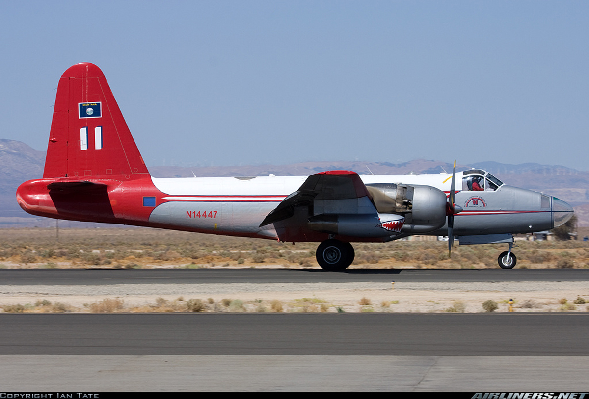
Crash of a Lockheed P2V-7 Neptune near Modena: 2 killed

Date & Time: Jun 3, 2012 at 1347 LT
Type of aircraft:
Operator:
Registration:
N14447
Flight Phase:
Flight Type:
Survivors:
No
Site:
Schedule:
Cedar City - Cedar City
MSN:
826-8010
YOM:
1959
Flight number:
Tanker 11
Location:
Crew on board:
2
Crew fatalities:
Pax on board:
0
Pax fatalities:
Other fatalities:
Total fatalities:
2
Captain / Total flying hours:
6145
Captain / Total hours on type:
1850.00
Copilot / Total flying hours:
4288
Copilot / Total hours on type:
38
Aircraft flight hours:
12313
Circumstances:
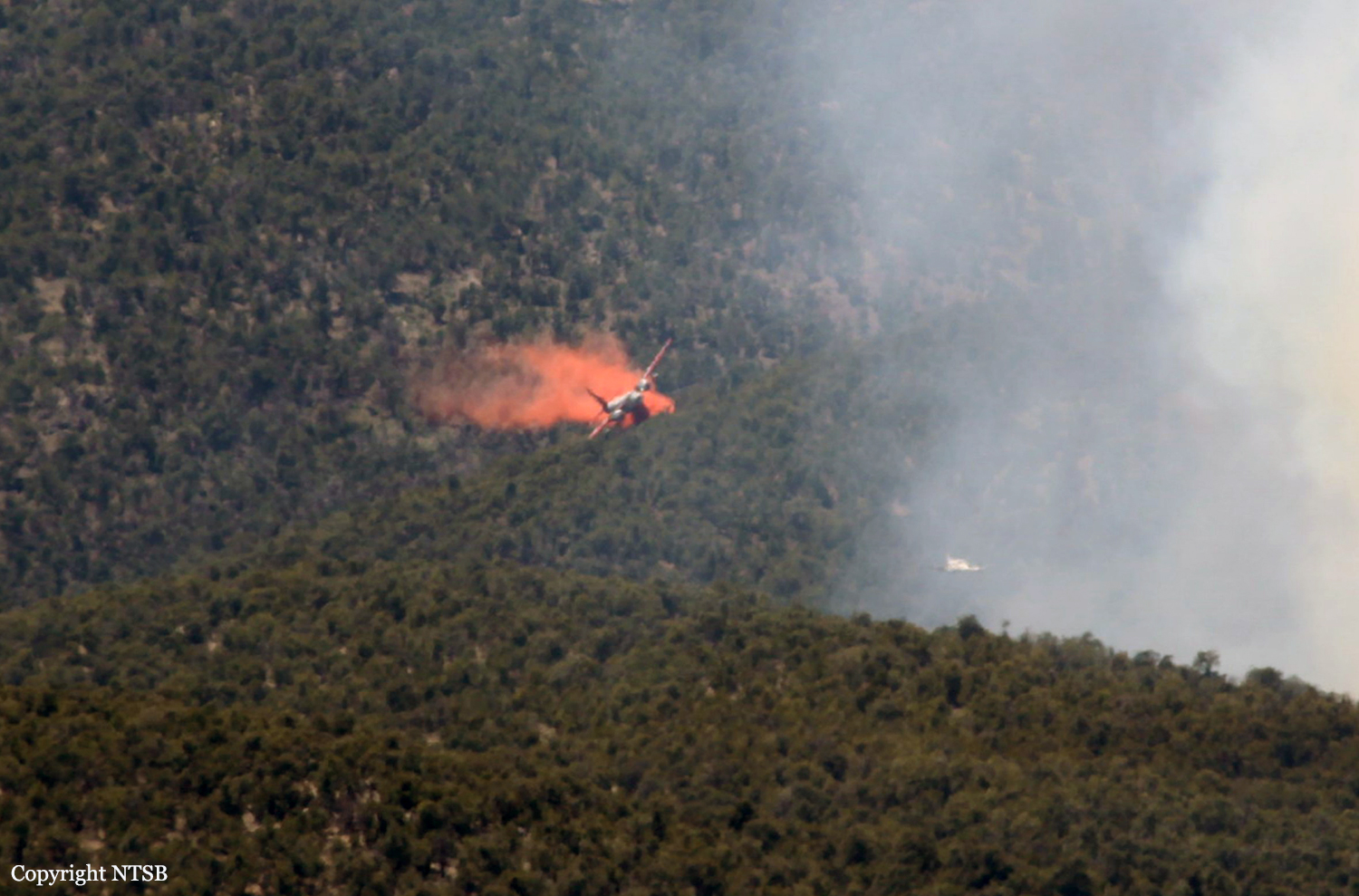
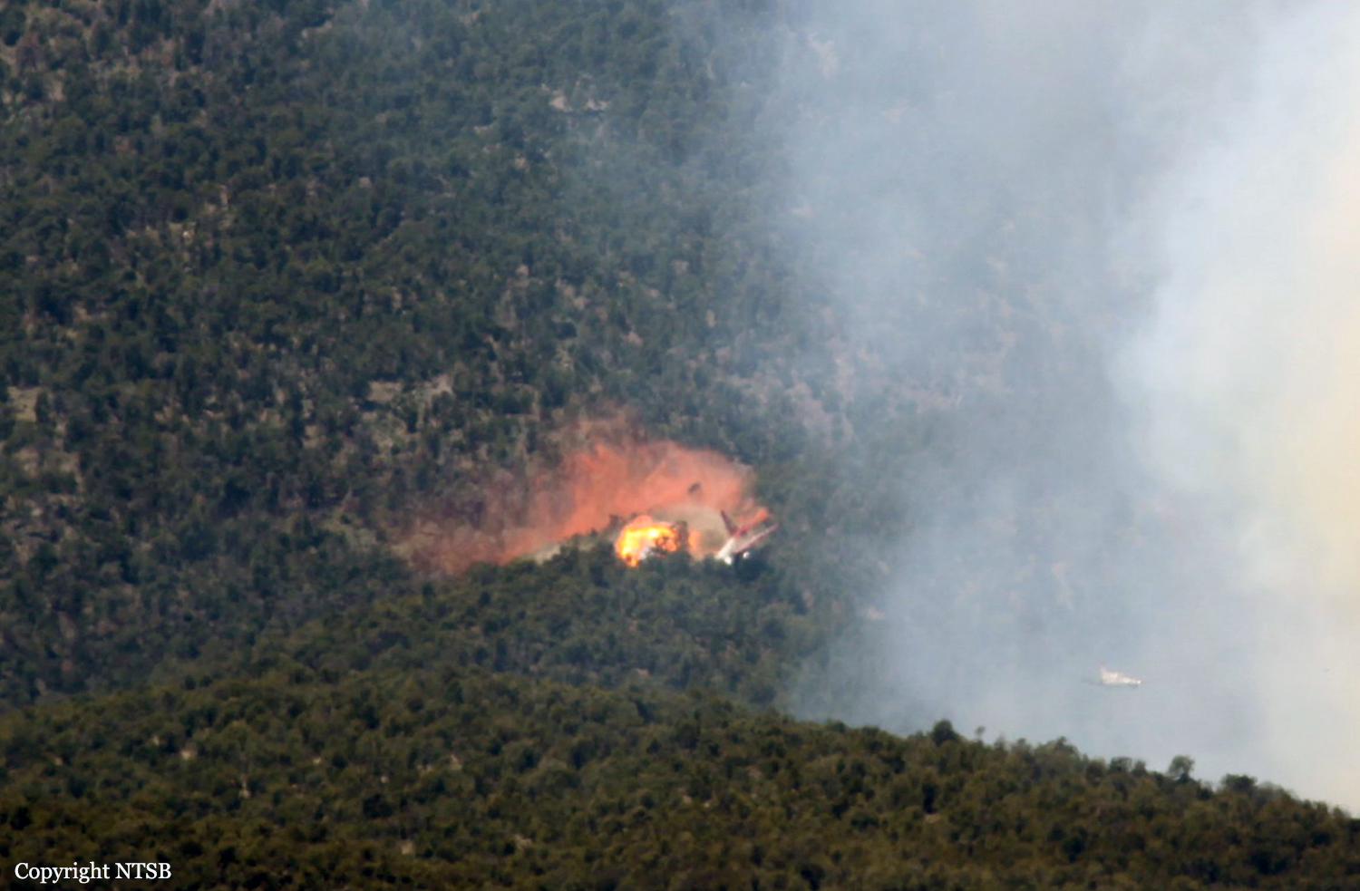
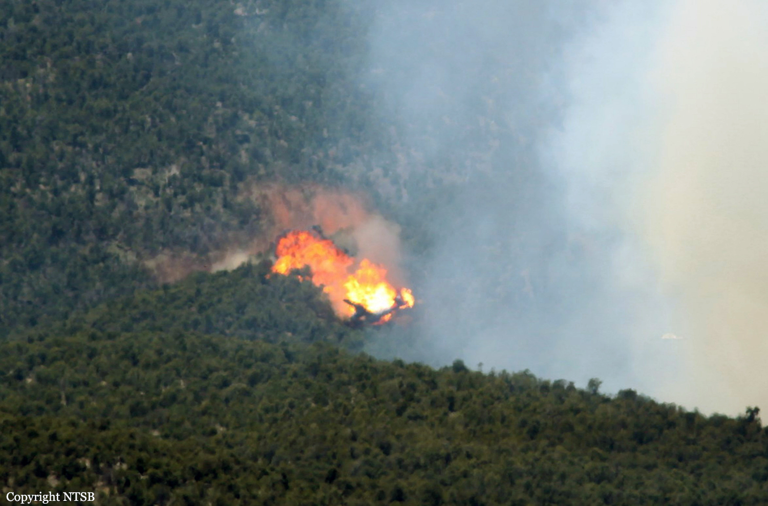
The airplane collided with mountainous terrain while conducting firefighting operations, 20 miles north of Modena, Utah. The airplane was operated by Neptune Aviation Services under contract with the US Forest Service as an exclusive public-use fixed-wing airtanker service contract conducted under the operational control of the Bureau of Land management (BLM). Both pilots were fatally injured. The airplane was destroyed by impact forces and post crash fire. Visual meteorological conditions prevailed, and a company flight plan had been filed. The flight originated in Cedar City, Utah, at 1315. The crew of Tanker 11 consisted of the pilot, copilot, and crew chief. They were based out of Missoula, MT, and had been together as a crew for the previous 3 weeks. Normally, the crews stay together for the entire fire season. Tanker 11 crew had operated out of Reno for the 2 weeks prior to the accident. During fire drop operations the tanker is manned by the pilot and copilot, while the crew chief remains at the fire base as ground personnel. The day before the accident while en route from Reno to Cedar City they performed one retardant drop on the White Rock fire, then landed at Cedar City. The crew departed the Cedar City tanker base and arrived at their hotel in Cedar City around 2230. The following morning, the day of the accident, the crew met at 0815, and rode into the Cedar City tanker base together. Tanker 11 took off at 1214 on its first drop on the White Rock fire, and returned at 1254. The crew shut down the airplane, reloaded the airplane with retardant, and did not take on any fuel. Tanker 11 departed the tanker base at 1307 to conduct its second retardant drop of the day, which was to be in the same location as the first drop. Upon arriving in the Fire Traffic Area (FTA) Tanker 11 followed the lead airplane, a Beech Kingair 90, into the drop zone. The drop zone was located in a shallow valley that was 0.4 miles wide and 350 feet deep. The lead airplane flew a shallow right-hand turn on to final, then dropped to an altitude of 150 feet above the valley floor over the intended drop area. While making the right turn on to final behind the lead plane, Tanker 11's right wing tip collided with terrain that was about 700 feet left of the lead airplane's flight path, which resulted in a rapid right yaw, followed by impact with terrain; a fire ball subsequently erupted. Tanker 11 created a 1,088-foot-long debris field and post impact fire.
Probable cause:
The flight crew's misjudgment of terrain clearance while maneuvering for an aerial application run, which resulted in controlled flight into terrain. Contributing to the accident was the flight crew's failure to follow the lead airplane's track and to effectively compensate for the tailwind condition while maneuvering.
Final Report:

Crash of a Rockwell Shrike Commander 500S off El Loa: 2 killed

Date & Time: May 18, 2012 at 0150 LT
Operator:
Registration:
CC-CGX
Flight Phase:
Survivors:
No
Schedule:
Iquique - Iquique
MSN:
500-3306
YOM:
1978
Country:
Crew on board:
2
Crew fatalities:
Pax on board:
0
Pax fatalities:
Other fatalities:
Total fatalities:
2
Captain / Total flying hours:
20183
Captain / Total hours on type:
10000.00
Copilot / Total flying hours:
3755
Copilot / Total hours on type:
2137
Aircraft flight hours:
16308
Circumstances:
The twin engine aircraft departed Iquique-General Diego Aracena Airport at 2115LT on May 17 on a fishing survey and prospection mission over the Pacific Ocean, carrying two pilots. There was sufficient fuel on board for a 7,5-hour flight. While cruising by night, the aircraft entered an uncontrolled descent and crashed in the sea about 30 km northwest of El Loa. Few debris were found floating on water the following morning. Both occupants were killed.
Probable cause:
A loss of control in flight for unknown reasons.
Final Report:

Crash of a De Havilland DHC-2 Beaver near Peachland: 3 killed

Date & Time: May 13, 2012 at 1845 LT
Type of aircraft:
Operator:
Registration:
C-GCZA
Flight Phase:
Flight Type:
Survivors:
No
Site:
Schedule:
Okanagan Lake - Pitt Meadows
MSN:
1667
YOM:
1966
Country:
Crew on board:
1
Crew fatalities:
Pax on board:
2
Pax fatalities:
Other fatalities:
Total fatalities:
3
Captain / Total flying hours:
420
Captain / Total hours on type:
50.00
Circumstances:
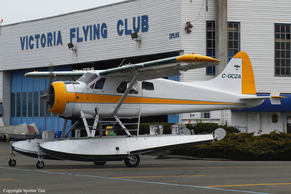
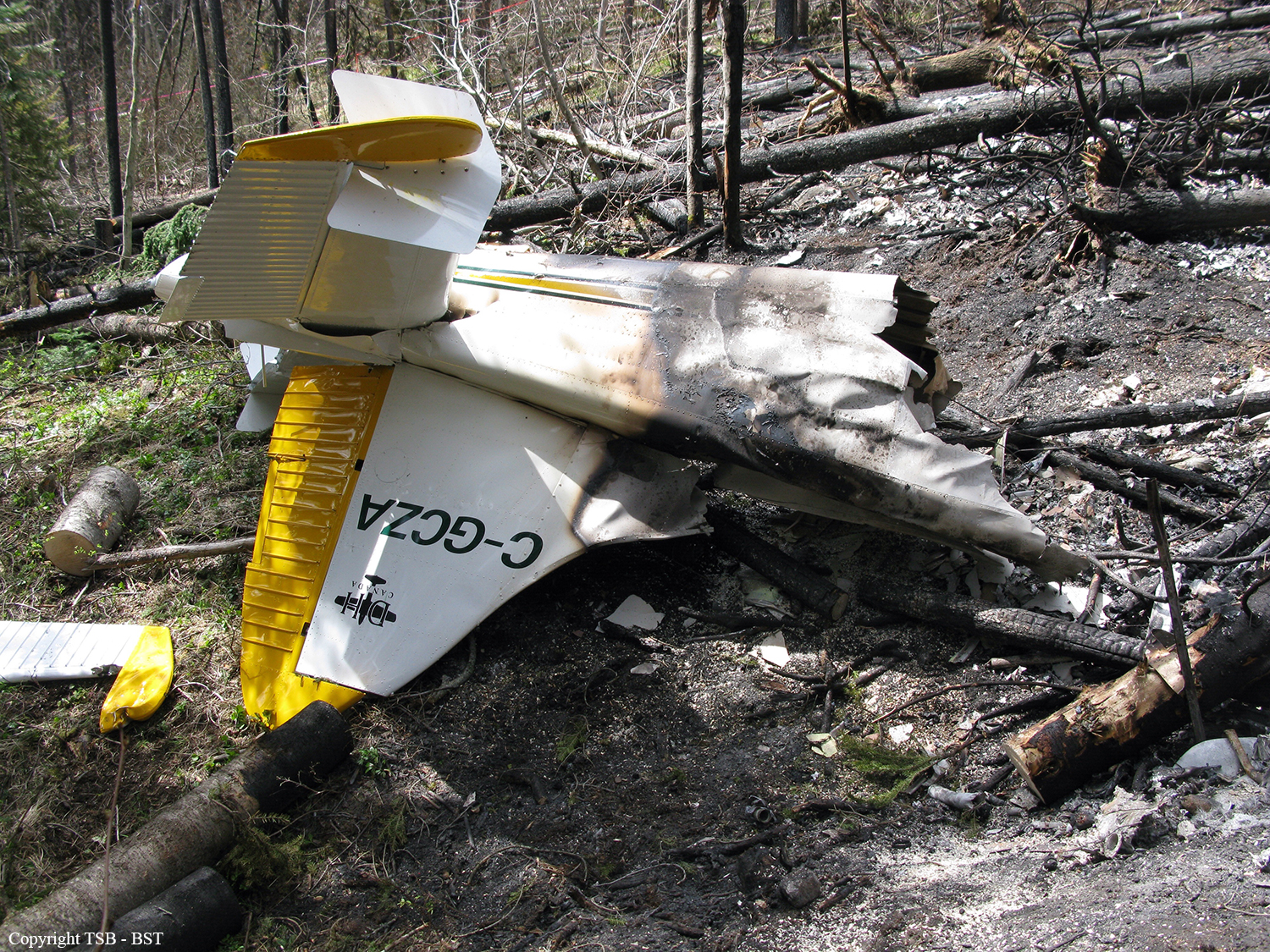
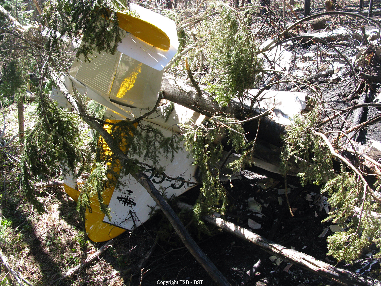
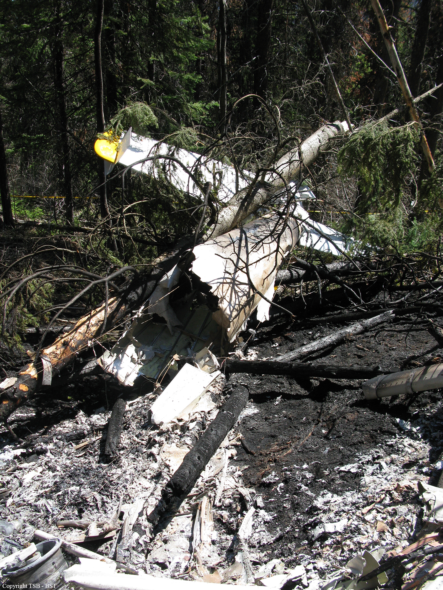
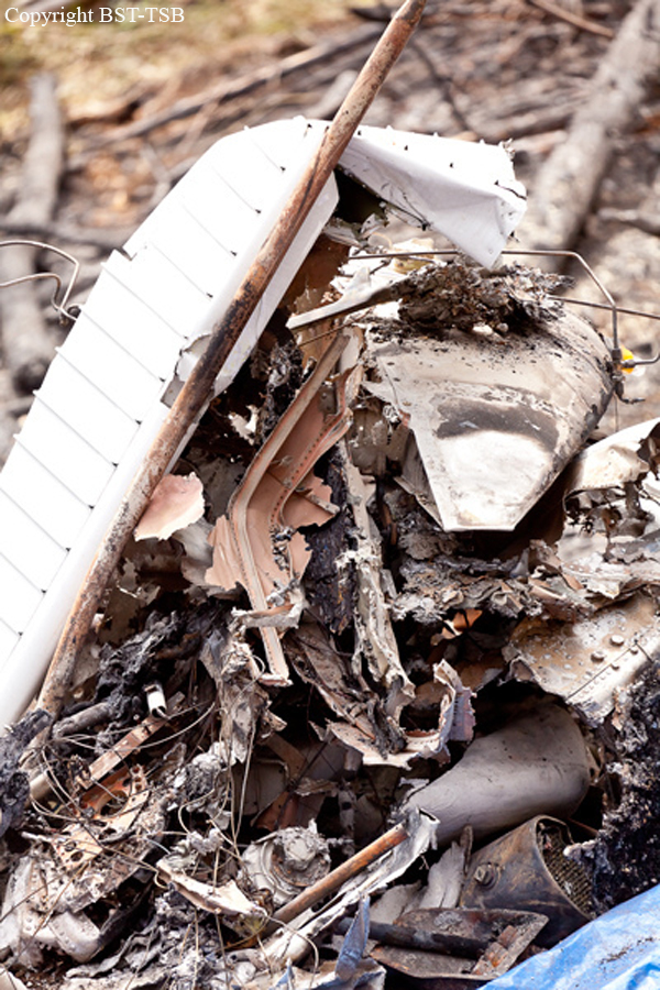
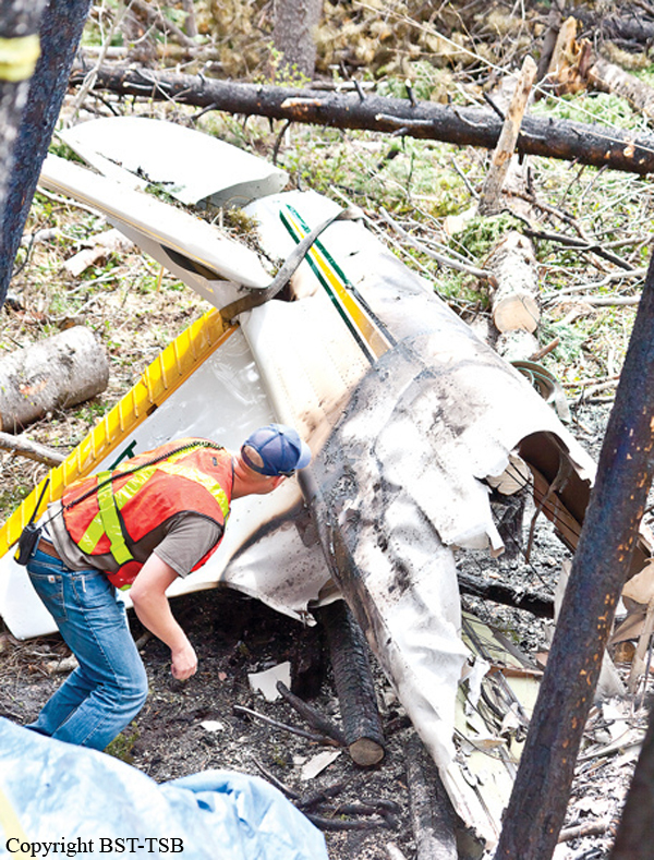
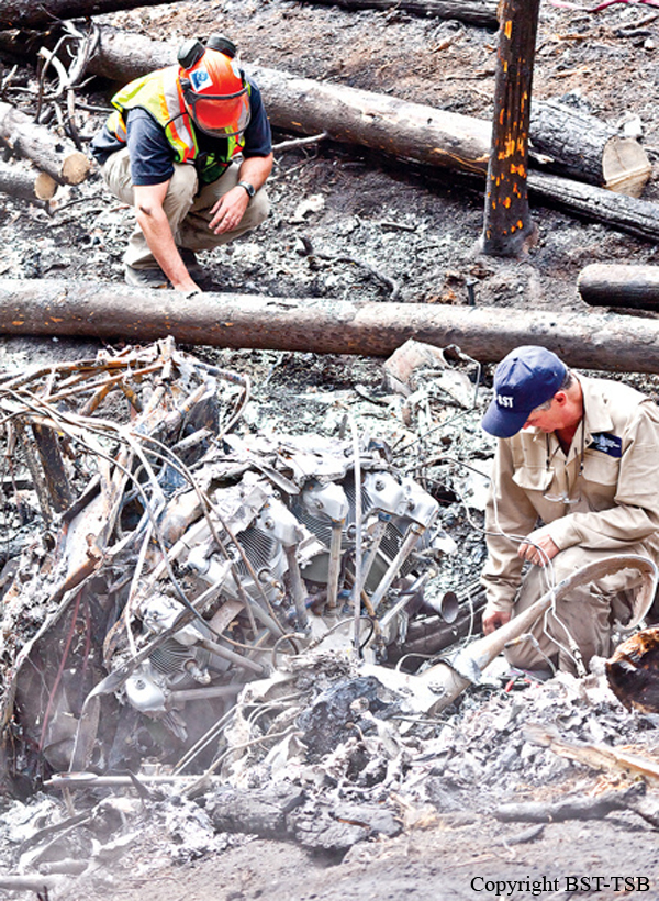
The privately operated de Havilland DHC-2 MK 1 amphibious floatplane (registration C-GCZA, serial number 1667) departed Okanagan Lake, near Kelowna, for a daytime flight under visual flight rules to Pitt Meadows, British Columbia, with the pilot and 2 passengers on board. While enroute, the aircraft struck trees and collided with terrain close to and 100 feet below the level of Highway 97C, near the Brenda Mines tailings hill. At 1850 Pacific Daylight Time, a brief 406-megahertz emergency-locator-transmitter signal was detected, which identified the aircraft; however, a location could not be determined. Most of the aircraft was consumed by a post-impact fire. The 3 occupants were fatally injured.
Probable cause:
There was no indication that an aircraft system malfunction contributed to this occurrence. There were no drastic changes in the aircraft’s flight path, and no emergency calls from the pilot to indicate that an in-flight emergency was experienced. The constant ground speed and flight path would also suggest that the aircraft was under the control of the pilot. As a result, this analysis will focus on the phenomenon of controlled flight into terrain (CFIT).
Findings as to Causes and Contributing Factors:
1. The combination of relatively high weight, effects of density altitude, and down-flowing air likely reduced the climb performance of the aircraft, resulting in the aircraft’s altitude being lower than anticipated at that stage in the flight.
2. The pilot’s vision was likely impaired by the sun, and the pilot may have been exposed to visual illusions; both were factors that contributed to the pilot not noticing the trees and the rising terrain, and colliding with them.
Findings as to Risk:
1. Visual illusions cause false impressions or misconceptions of actual conditions. Unrecognized and uncorrected spatial disorientation, caused by illusions, carries a high risk of incident or accident.
2. When there are no special departure procedures published for airports in mountainous regions surrounded by high terrain, there is a risk of pilots departing the valley at an altitude too low for terrain clearance.
Other Findings:
1. Information from the Wide Area Multilateration system was not preserved following the occurrence, as local NAV CANADA personnel were not aware that unfiltered data were only available for a limited time.
Final Report:

Crash of a Cessna 401 near Chanute: 4 killed

Date & Time: May 11, 2012 at 1630 LT
Type of aircraft:
Operator:
Registration:
N9DM
Flight Phase:
Flight Type:
Survivors:
Yes
Schedule:
Tulsa - Council Bluffs
MSN:
401-0123
YOM:
1991
Location:
Crew on board:
1
Crew fatalities:
Pax on board:
4
Pax fatalities:
Other fatalities:
Total fatalities:
4
Captain / Total flying hours:
613
Captain / Total hours on type:
13.00
Aircraft flight hours:
2455
Circumstances:
While en route to the destination airport, the pilot turned on the cabin heater and, afterward, an unusual smell was detected by the occupants and the ambient air temperature increased. When the pilot turned the heater off, dark smoke entered the cabin and obscured the occupants' vision. The smoke likely interfered with the pilot’s ability to identify a safe landing site. During the subsequent emergency landing attempt to a field, the airplane’s wing contacted the ground and the airplane cartwheeled. Examination of the airplane found several leaks around weld points on the combustion chamber of the heater unit. A review of logbook entries revealed that the heater was documented as inoperative during the most recent annual inspection. Although a work order indicated that maintenance work was completed at a later date, there was no logbook entry that returned the heater to service. There were no entries in the maintenance logbooks that documented any testing of the heater or tracking of the heater's hours of operation. A flight instructor who flew with the pilot previously stated that the pilot used the heater on the accident airplane at least once before the accident flight. The heater’s overheat warning light activated during that flight, and the heater shut down without incident. The flight instructor showed the pilot how to reset the overheat circuit breaker but did not follow up on its status during their instruction. There is no evidence that a mechanic examined the airplane before the accident flight. Regarding the overheat warning light, the airplane flight manual states that the heater “should be thoroughly checked to determine the reason for the malfunction” before the overheat switch is reset. The pilot’s use of the heater on the accident flight suggests that he did not understand its status and risk of its continued use without verifying that it had been thoroughly checked as outlined in the airplane flight manual. A review of applicable airworthiness directives found that, in comparison with similar combustion heater units, there is no calendar time limit that would require periodic inspection of the accident unit. In addition, there is no guidance or instruction to disable the heater such that it could no longer be activated in the airplane if the heater was not airworthy.
Probable cause:
The malfunction of the cabin heater, which resulted in an inflight fire and smoke in the airplane. Contributing to the accident was the pilot’s lack of understanding concerning the status of the airplane's heater system following and earlier overheat event and risk of its continued use. Also contributing were the inadequate inspection criteria for the cabin heater.
Final Report: