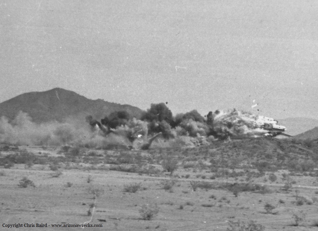
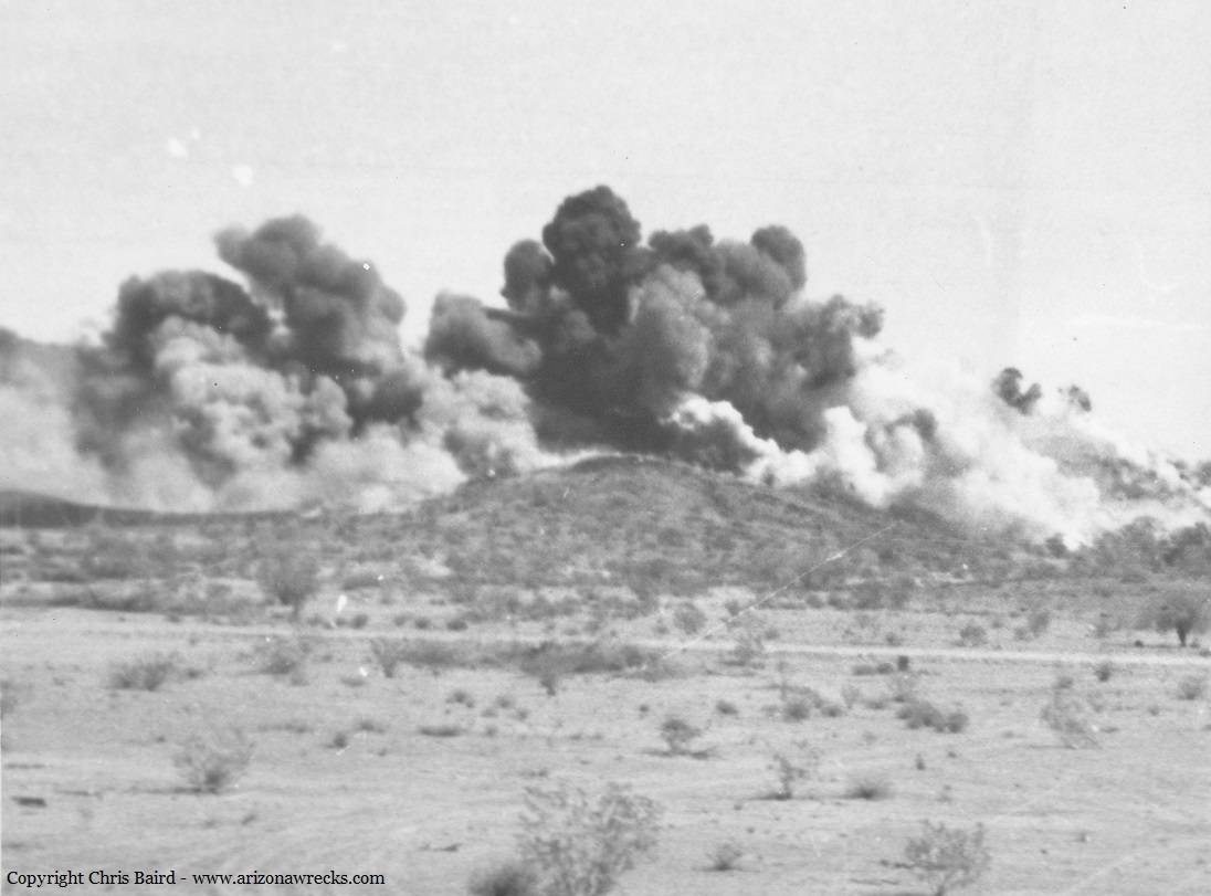
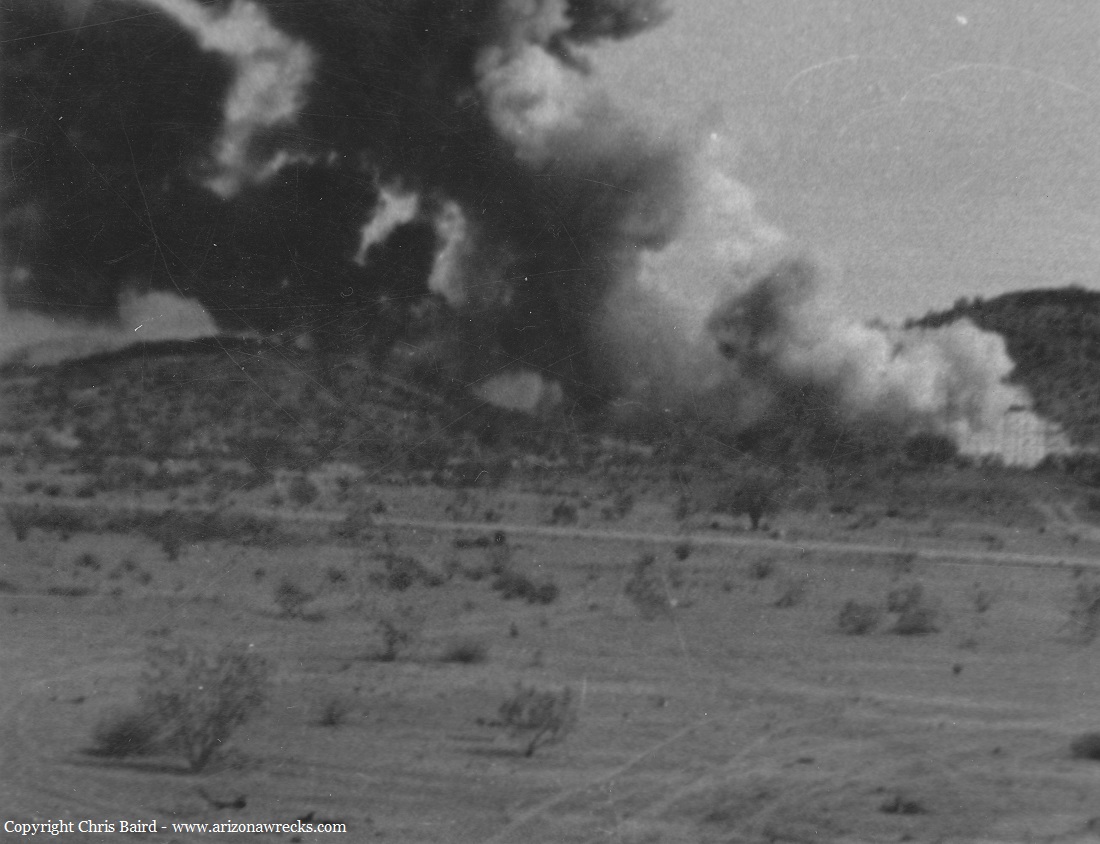
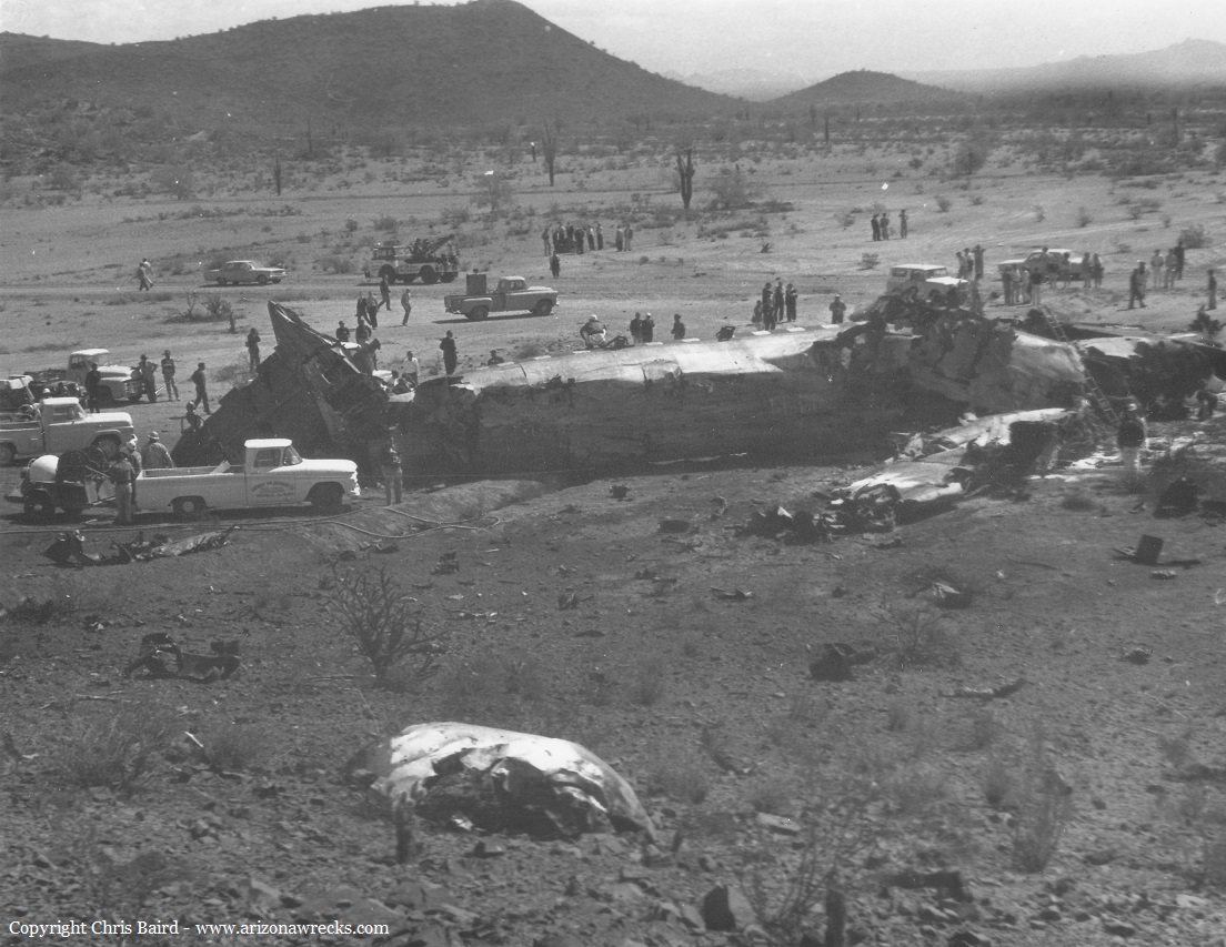
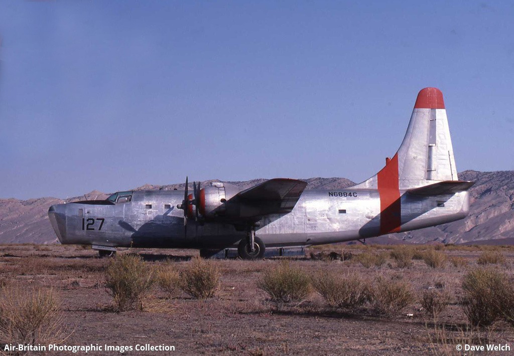
Crash of a Fairchild C-119C Flying Boxcar in Deer Valley
Date & Time:
Nov 16, 1966
Operator:

Crew on board:
0
Crew fatalities:
Pax on board:
0
Pax fatalities:
Other fatalities:
Total fatalities:
0
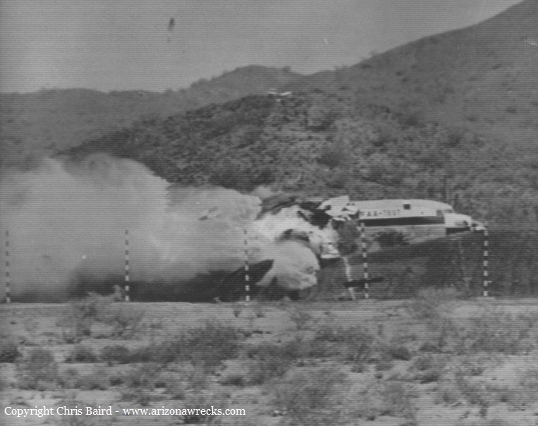
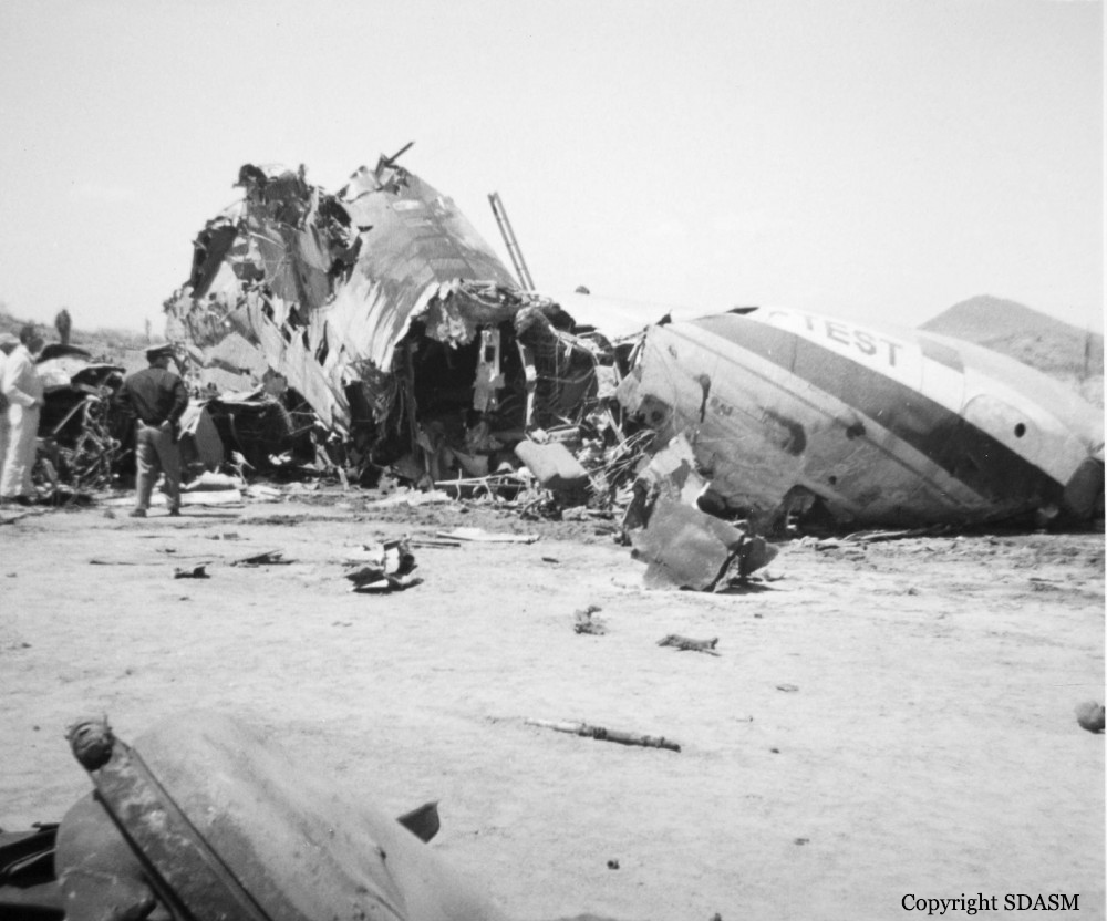
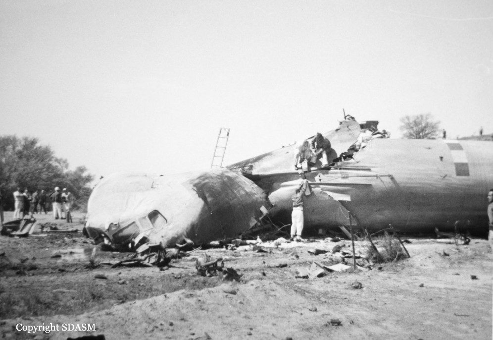
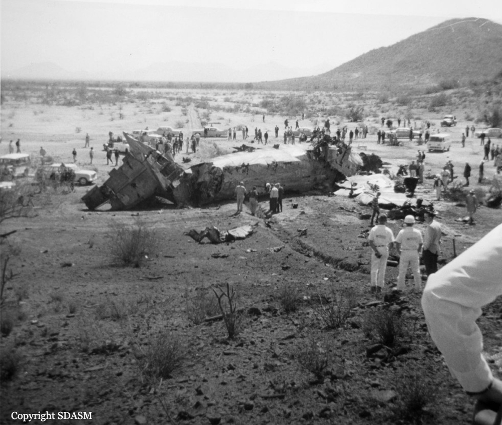
Circumstances:
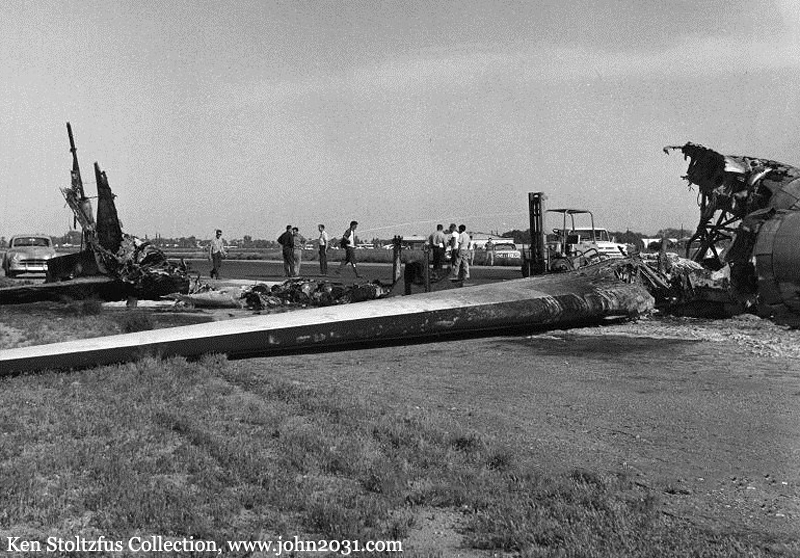
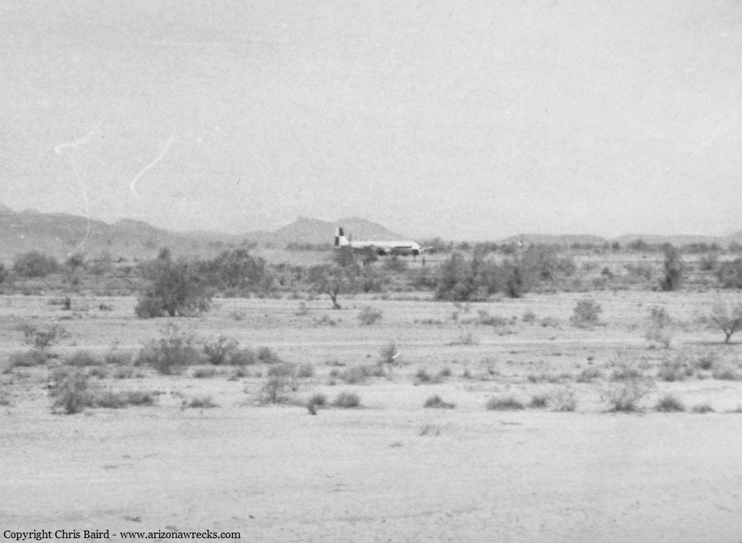
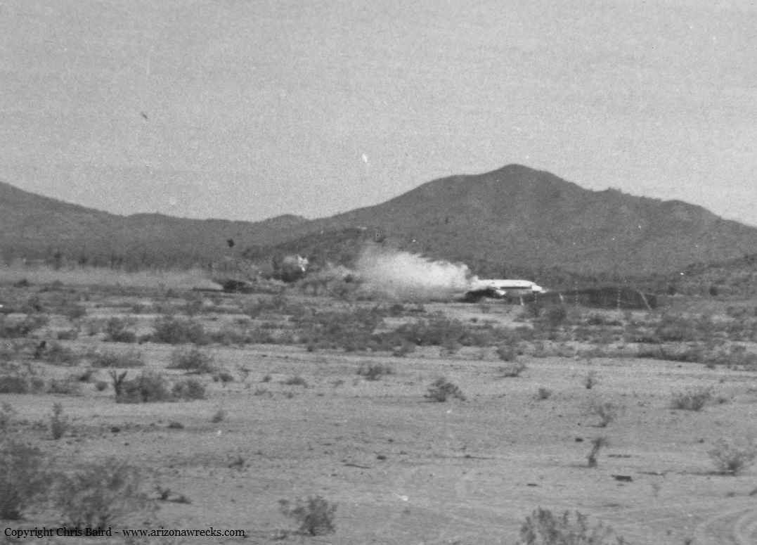
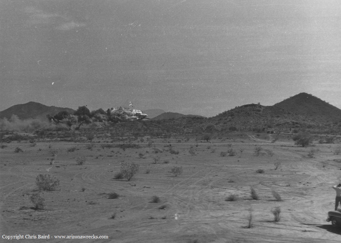
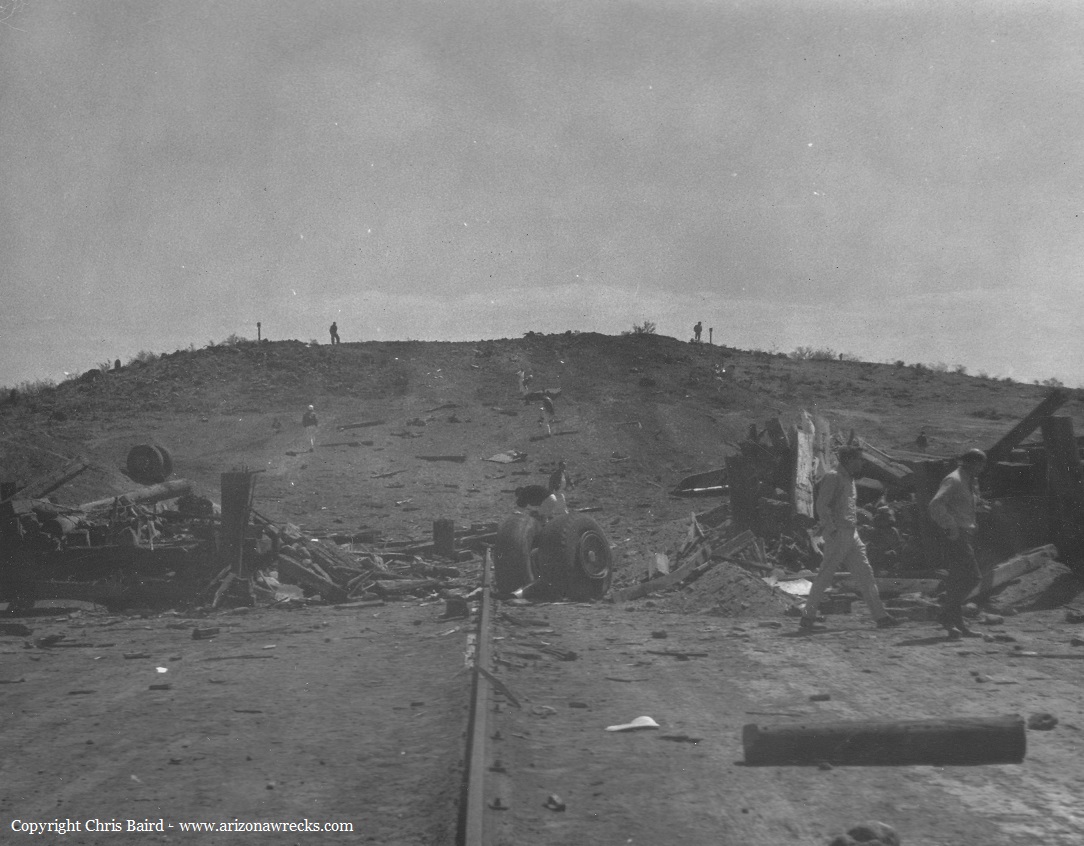
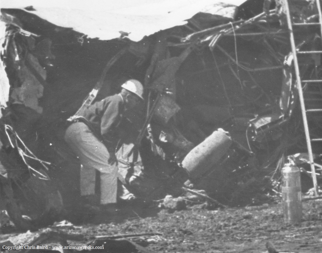
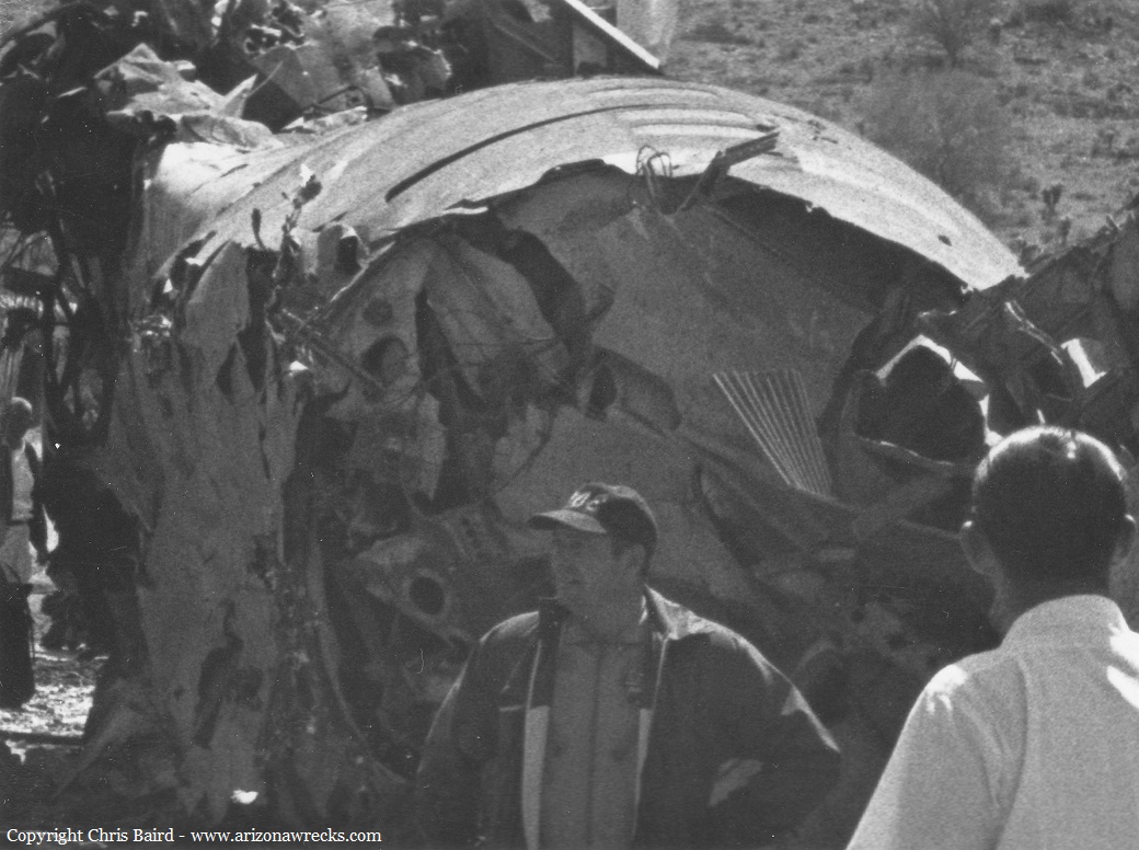
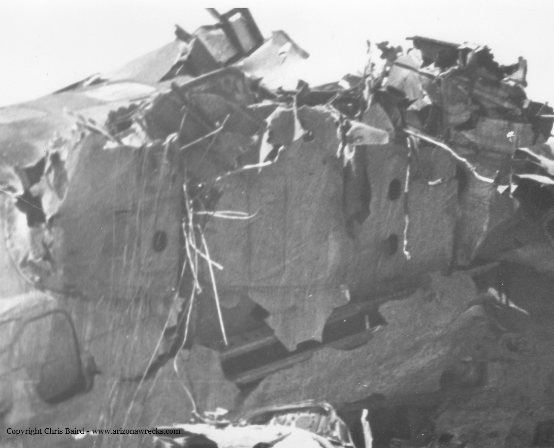
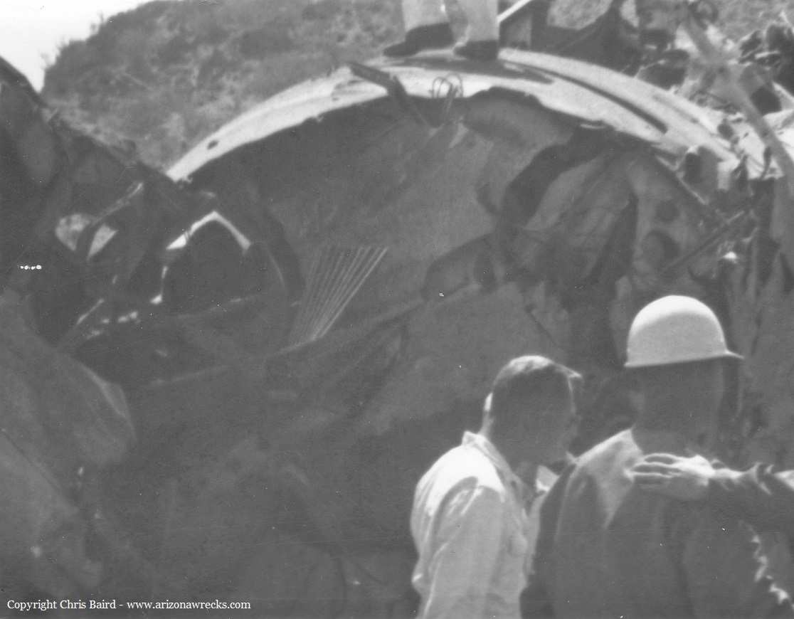
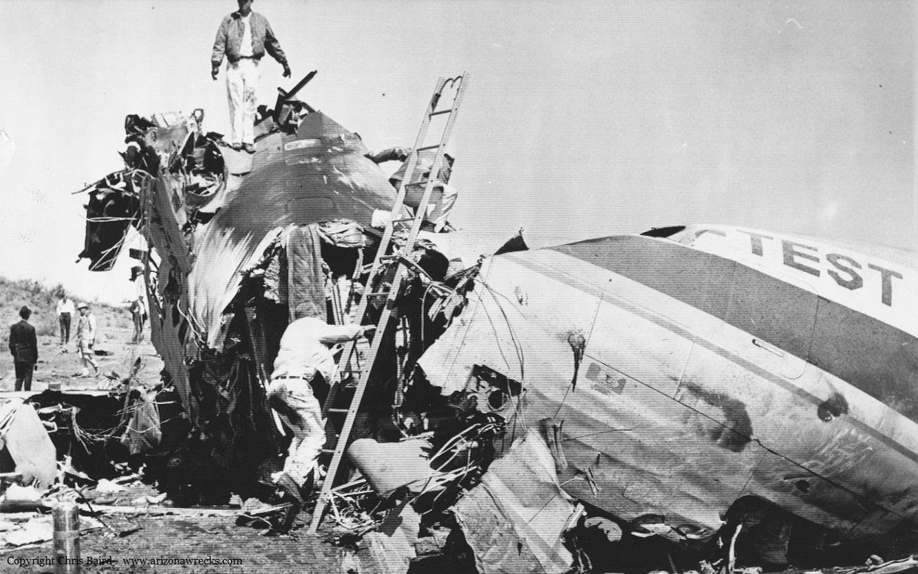
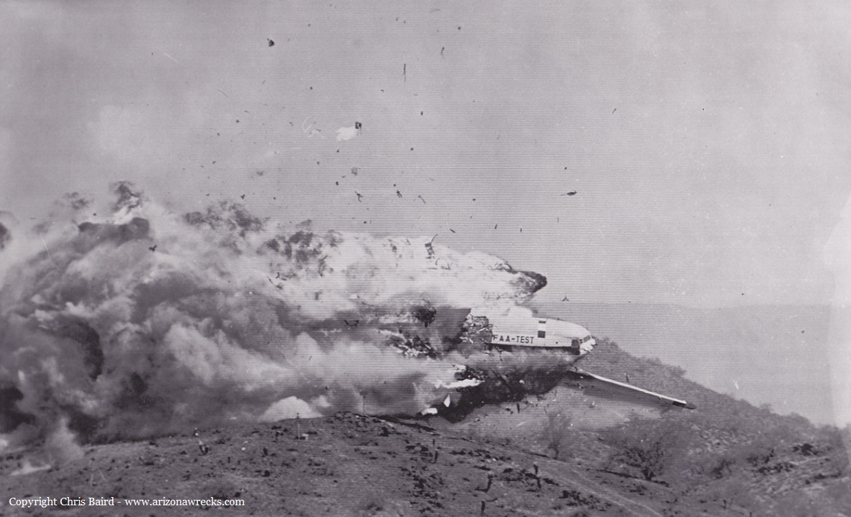
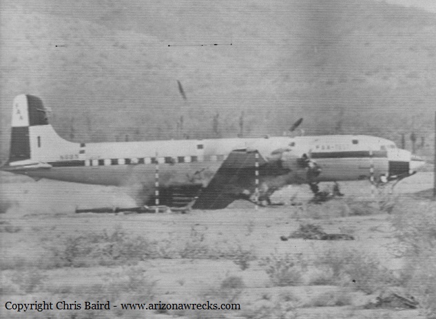
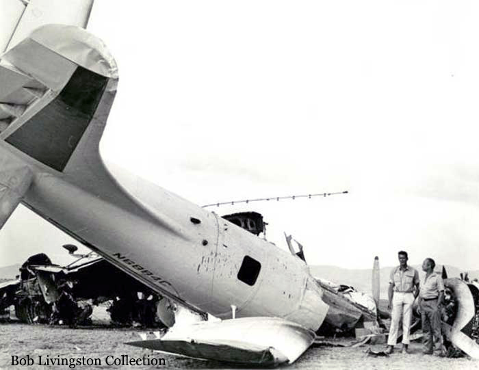
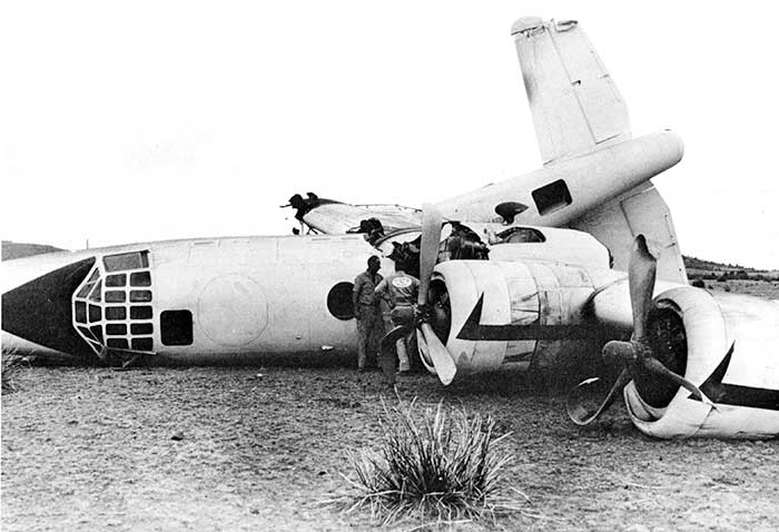
The aircraft was involved in a ground crash test on behalf of the Flight Safety Foundation and assistance of North American Aviation. With no one on board, the aircraft was crashed at a speed of 130 knots against a concrete wall and was completely destroyed. The weapon cylinder in the cargo bay remained intact.
Thanks to Chris Baird - www.arizonawrecks.com
Thanks to Chris Baird - www.arizonawrecks.com
Final Report: