Crash of a Cessna 340A off Freeport: 4 killed

Date & Time: Aug 18, 2014 at 1002 LT
Type of aircraft:
Registration:
N340MM
Flight Type:
Survivors:
No
Schedule:
Ormond Beach - Freeport
MSN:
340A-0635
YOM:
1978
Country:
Crew on board:
1
Crew fatalities:
Pax on board:
3
Pax fatalities:
Other fatalities:
Total fatalities:
4
Aircraft flight hours:
5572
Circumstances:
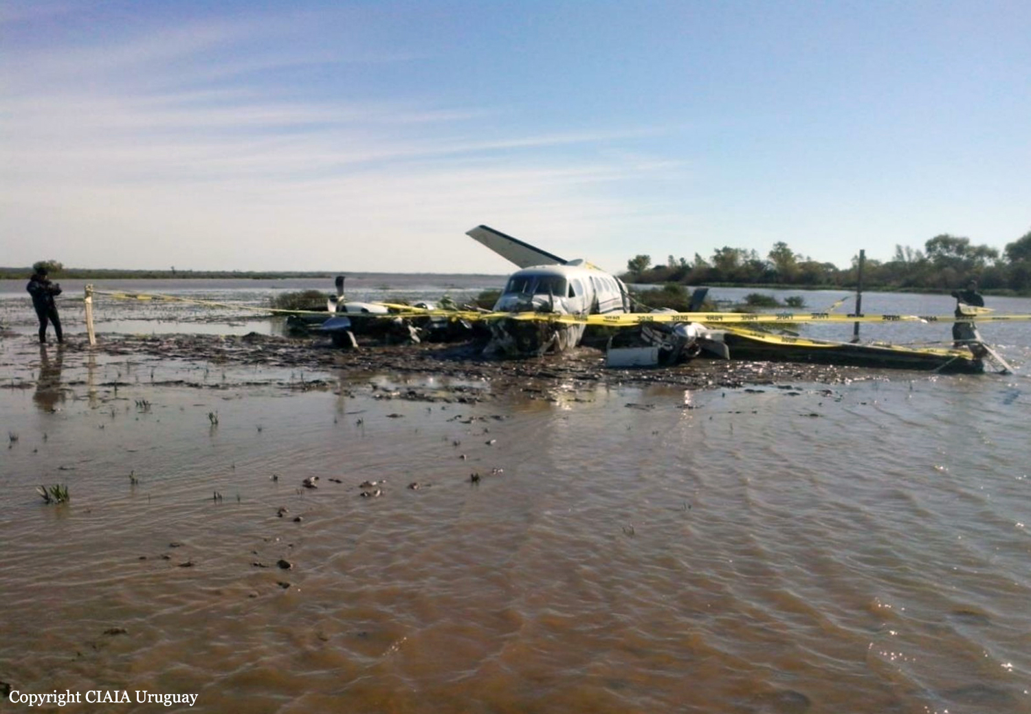
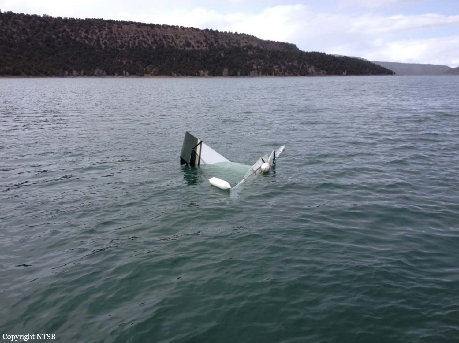
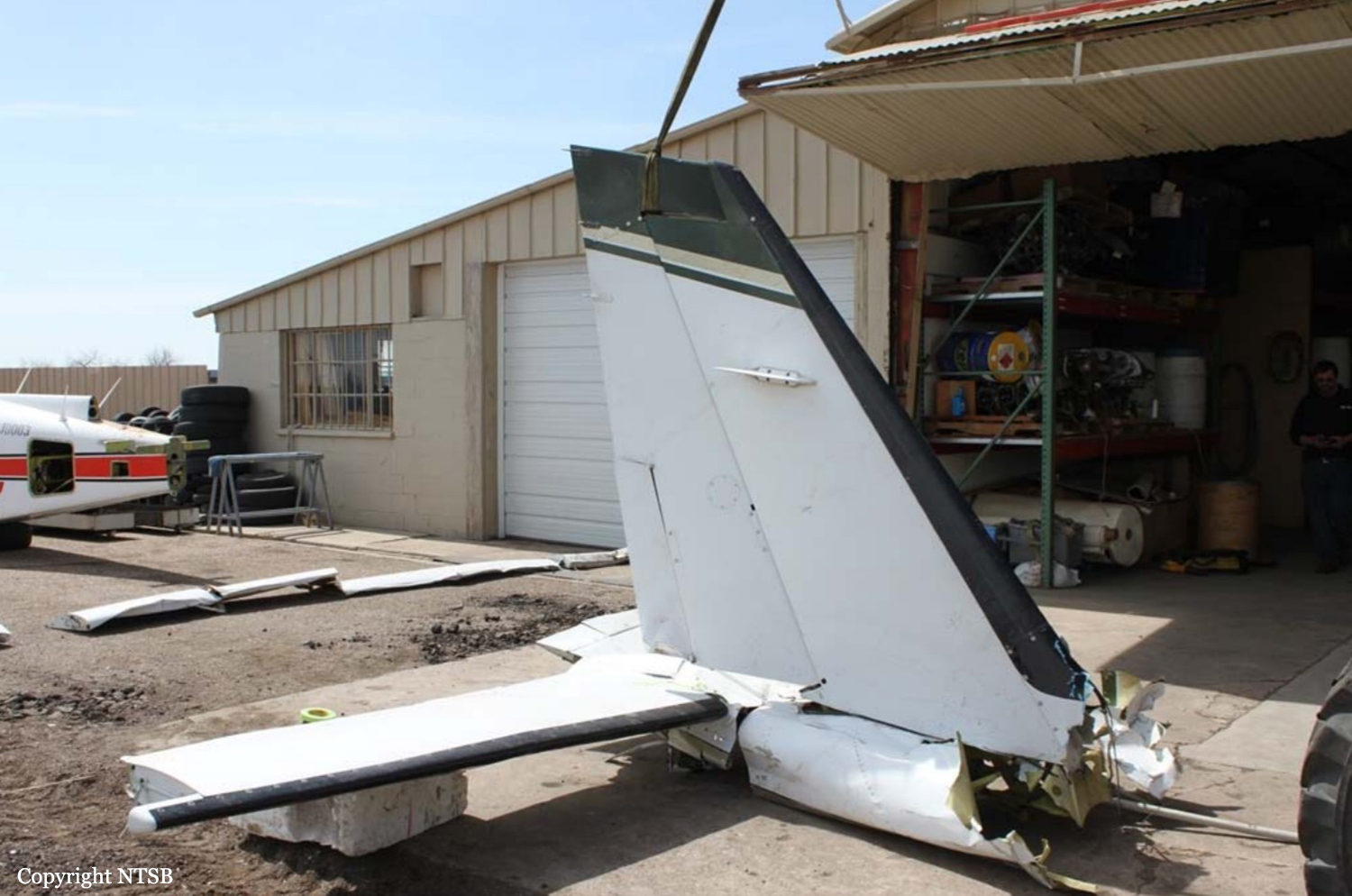
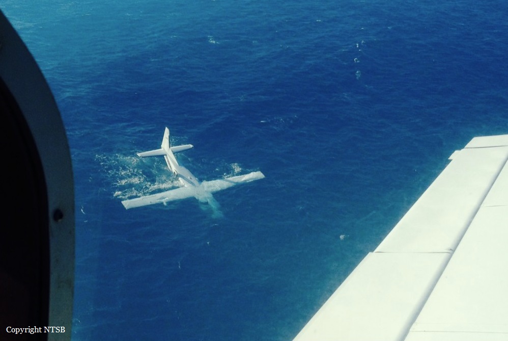
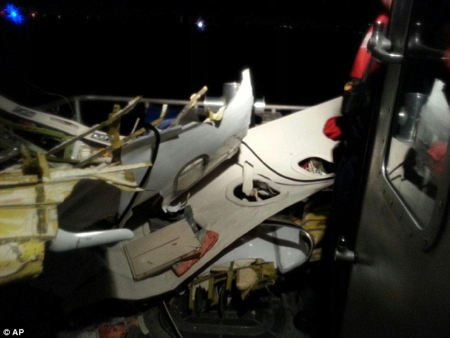
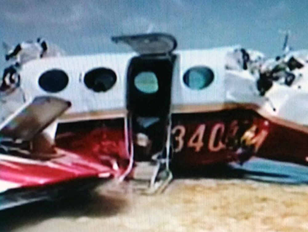
On 18 August, 2014 at 10:02am local time (1402Z) UTC a fixed wing, twin-engine, Cessna 3 4 0 A aircraft, United States registration N340MM, serial number 340A0635, crashed into waters while on a left base to runway 06 at Grand Bahama International Airport (MYGF) Freeport, Grand Bahama, Bahamas. The aircraft departed Ormond Beach Municipal Airport (KOMN) at 8:51am local time (1251Z) for Grand Bahama International Airport (MYGF) on an Instrument Flight Rules (IFR) flight plan with the pilot and three passengers aboard. Sometime after 9:00am (1300Z) an IFR inbound flight plan on N340MM was received by Freeport Approach Control from Miami Center. Upon initial contact with Freeport Approach Control the pilot was given weather advisory, re-cleared to Freeport VOR and told to maintain four thousand feet and report at JAKEL intersection. He was also advised to expect an RNAV runway six approach. After the pilot’s acknowledgement of the information he later acknowledged his position crossing JAKEL. Freeport Approach then instructed the aircraft to descend to two thousand feet and cleared him direct to JENIB intersection for the RNAV runway six (6) approach. After descending to two thousand feet the pilot indicated to Freeport Approach that he had the field in sight and was able to make a visual approach. Freeport Approach re-cleared the aircraft for a visual approach and instructed the pilot to contact Freeport Control Tower on frequency 118.5. At 9:57am (1357Z) N340MM established contact with Freeport Tower and was cleared for the visual approach to runway six; he was told to join the left base and report at five (5) DME. At 10:01am (1401Z) the pilot reported being out of fuel and his intention was to dead stick the aircraft into the airport from seven miles out at an altitude of one thousand five hundred feet. A minute later the pilot radioed ATC to indicate they “were going down and expected to be in the water about five miles north of the airport.” Freeport Tower tried to get confirmation of the last transmission but was unable to. Several more calls went out from Freeport Tower to N340MM but communication was never reestablished. Freeport Control Tower then made request of aircrafts departing and arriving to assist in locating the lost aircraft by over flying the vicinity of the last reported position to see if visual contact could be made. An inbound aircraft reported seeing an aircraft down five miles from the airport on the 300 degree radial of the ZFP VOR. Calls were made to all the relevant agencies and search and rescue initiated. The aircraft was located at GPS coordinates 26˚ 35.708’N and 078˚ 47. 431 W. The aircraft received substantial damage as a result of the impact and crash sequence. There were no survivors.
Probable cause:
The probable cause of this accident has been determined as a lack of situational awareness resulting in a stalled condition and loss of control while attempting to remedy a fuel exhaustion condition at a very low altitude.
Contributing factors:
- The pilot’s incorrect fuel calculations which resulted in fuel exhaustion to both engines.
- Stalled aircraft.
- Loss of situational awareness.
Final Report:

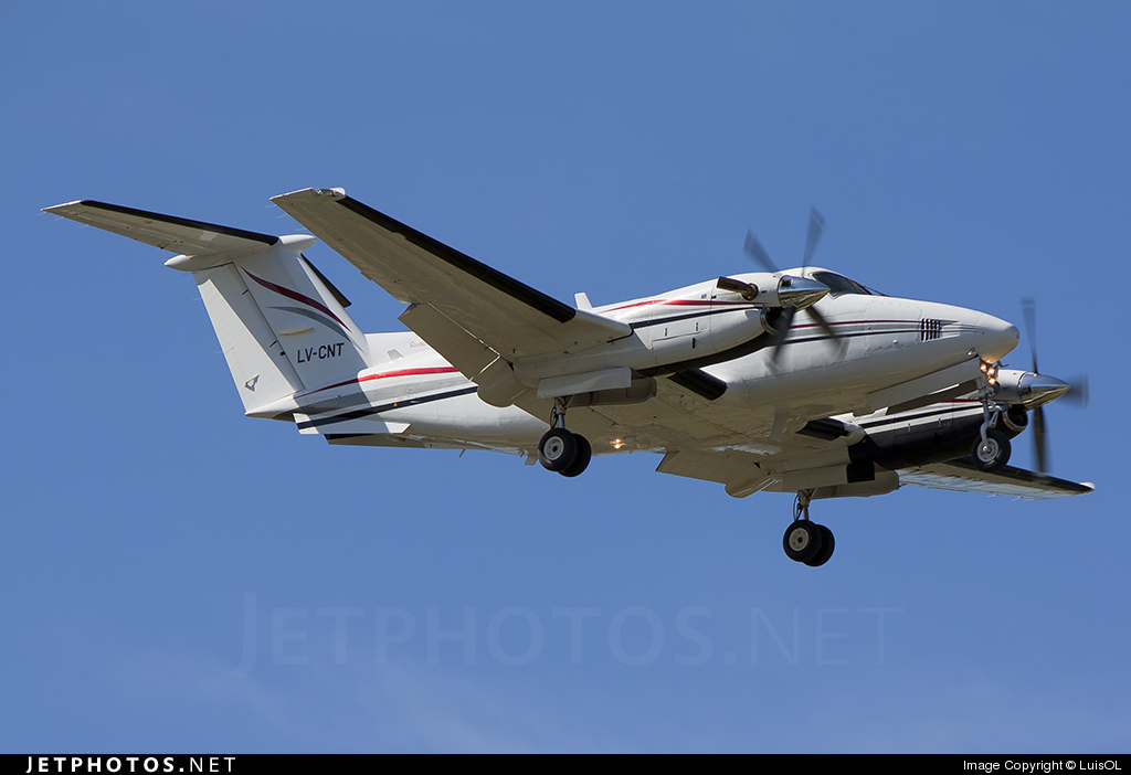
Crash of a Beechcraft B200 Super King Air near Carmelo: 5 killed

Date & Time: May 27, 2014 at 1240 LT
Operator:
Registration:
LV-CNT
Survivors:
Yes
Schedule:
San Fernando - Carmelo
MSN:
BB-1367
YOM:
1990
Location:
Country:
Crew on board:
1
Crew fatalities:
Pax on board:
8
Pax fatalities:
Other fatalities:
Total fatalities:
5
Captain / Total flying hours:
8039
Captain / Total hours on type:
478.00
Aircraft flight hours:
4616
Aircraft flight cycles:
4490
Circumstances:
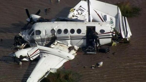
Owned by Grupo Kowzef (Federico Alejandro Bonomi), the twin engine aircraft departed San Fernando (Buenos Aires) at 1222LT on an executive flight to Carmelo, Uruguay. On approach to Carmelo-Zagarzazú Airport runway 35, the pilot encountered marginal weather conditions and initiated a go-around procedure. Few minutes later, he attempted a second approach under VFR mode. While completing a slight turn to the left in descent, the aircraft impacted the surface of the Río de la Plata and came to rest in shallow water some 10 km southwest of Carmelo Airport. The pilot and four passengers were killed and four other occupants were injured. The aircraft was destroyed.
Probable cause:
The accident was the consequence of a controlled flight into terrain after the pilot suffered a loss of situational awareness due to a poor evaluation of the flight conditions upon arrival. The following contributing factors were identified:
- The pilot failed to return to his departure airport or to divert to the alternate airport due to poor weather conditions at the destination airport,
- The pilot continued the approach under VFR mode in IMC conditions with visibility below minimums,
- Poor evaluation of the flight conditions at destination on part of the pilot due to the combination of psychological and physiological factors.
Final Report:

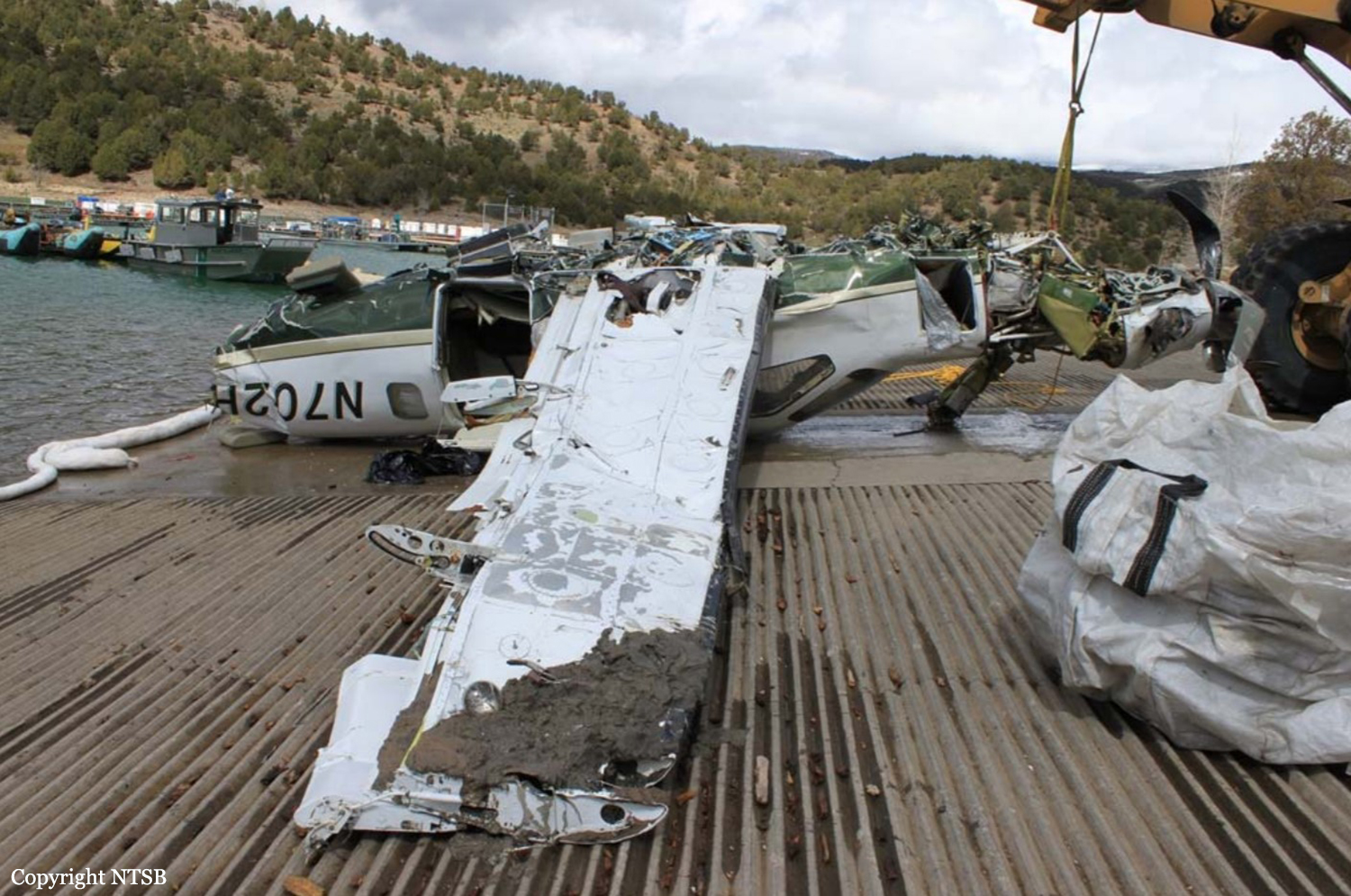
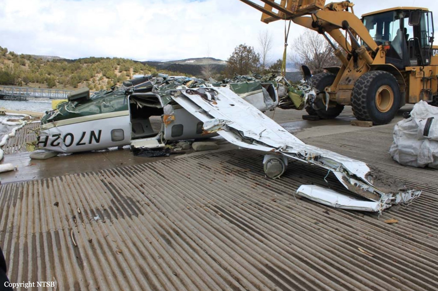
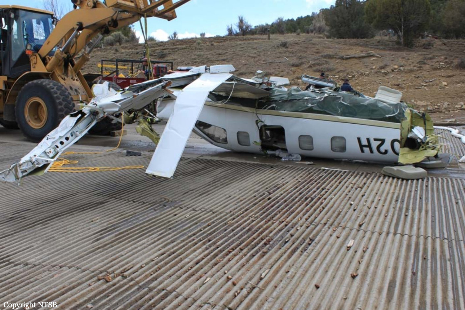
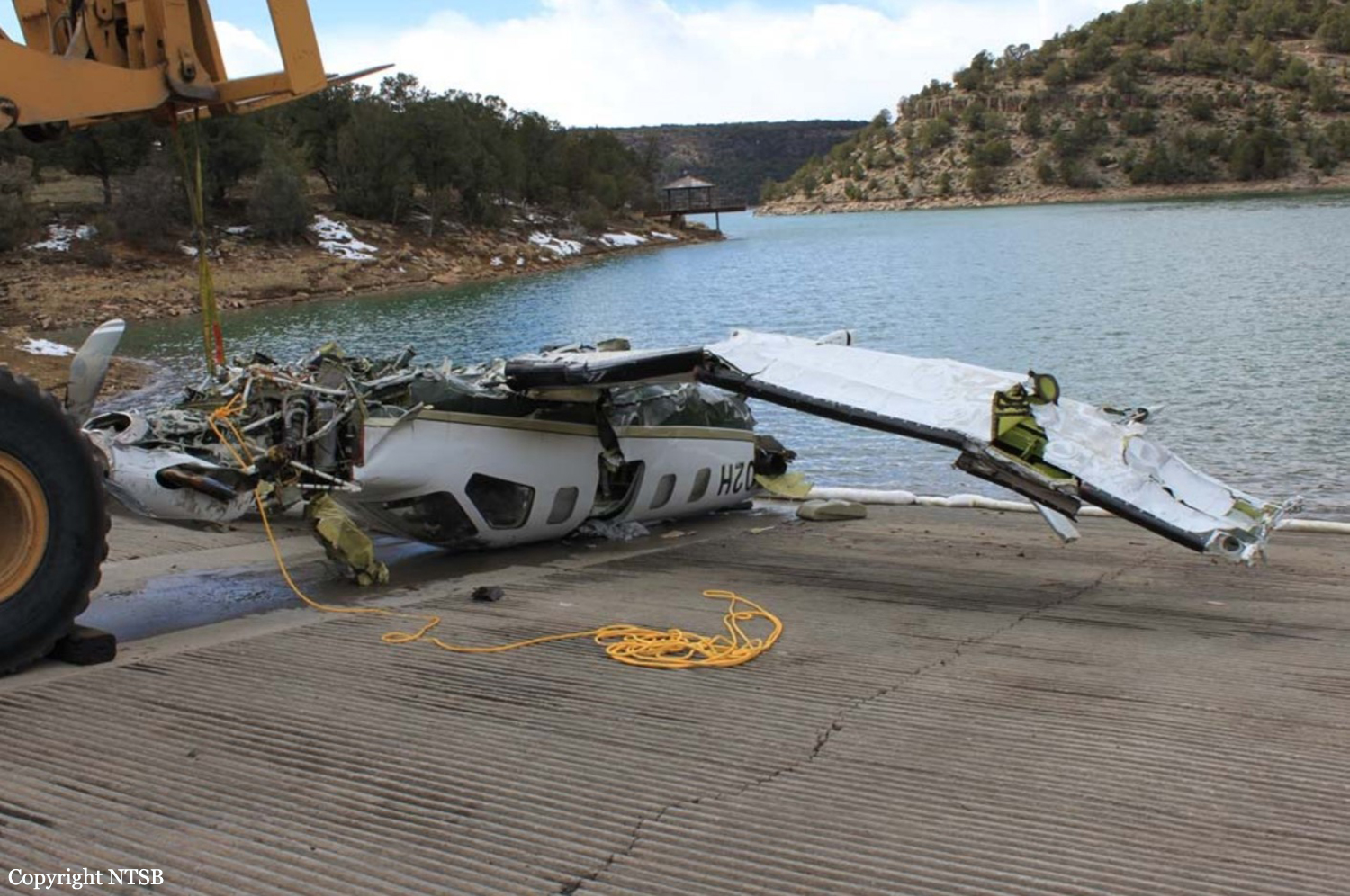
Crash of a Socata TBM-700 in the Ridgway Reservoir: 5 killed

Date & Time: Mar 22, 2014 at 1400 LT
Type of aircraft:
Operator:
Registration:
N702H
Flight Phase:
Flight Type:
Survivors:
No
Schedule:
Bartlesville – Montrose
MSN:
112
YOM:
1996
Crew on board:
1
Crew fatalities:
Pax on board:
4
Pax fatalities:
Other fatalities:
Total fatalities:
5
Captain / Total flying hours:
908
Captain / Total hours on type:
9.00
Aircraft flight hours:
4848
Circumstances:
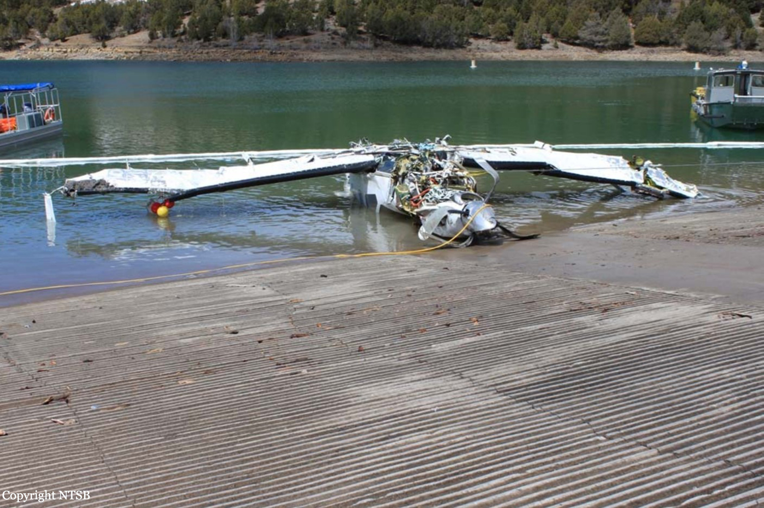
About 3 months before the accident, the pilot received about 9 hours of flight instruction, including completion of an instrument proficiency check, in the airplane. The accident flight was a personal cross-country flight operated under instrument flight rules (IFR). Radar track data depicted the flight proceeding on a west-southwest course at 15,800 ft mean sea level (msl) as it approached the destination airport. The flight was cleared by the air traffic controller for a GPS approach, passed the initial approach fix, and, shortly afterward, began a descent as permitted by the approach procedure. The track data indicated that the flight became established on the initial approach segment and remained above the designated minimum altitude of 12,000 ft msl. Average descent rates based on the available altitude data ranged from 500 feet per minute (fpm) to 1,000 fpm during this portion of the flight. At the intermediate navigation fix, the approach procedure required pilots to turn right and track a north-northwest course toward the airport. The track data indicated that the flight entered a right turn about 1 mile before reaching the intermediate fix. As the airplane entered the right turn, its average descent rate reached 4,000 fpm. The flight subsequently tracked northbound for nearly 1-1/2 miles. During this portion of the flight, the airplane initially descended at an average rate of 3,500 fpm then climbed at a rate of 1,800 fpm. The airplane subsequently entered a second right turn. The final three radar data points were each located within 505 ft laterally of each other and near the approximate accident site location. The average descent rate between the final two data points (altitudes of 10,100 ft msl and 8,700 ft msl) was 7,000 fpm. About the time that the final data point was recorded, the pilot informed the air traffic controller that the airplane was in a spin and that he was attempting to recover. No further communications were received from the pilot. The airplane subsequently impacted the surface of a reservoir at an elevation of about 6,780 ft and came to rest in 60 ft of water. A detailed postaccident examination of the airframe, engine and propeller assembly did not reveal any anomalies consistent with a preimpact failure or malfunction. The available meteorological data suggested that the airplane encountered clouds (tops about 16,000 ft msl or higher and bases about 10,000 ft msl) and was likely operating in IFR conditions during the final 15 minutes of the flight; however, no determination could be made regarding whether the clouds that the airplane descended through were solid or layered. In addition, the data suggested the possibility of both light icing and light turbulence between 12,000 ft msl and 16,000 ft msl along the flight path. Although the pilot appeared to be managing the flight appropriately during the initial descent, it could not be determined why he was unable to navigate to the approach fixes and maintain control of the airplane as he turned toward the airport and continued the descent.
Probable cause:
The pilot's loss of airplane control during an instrument approach procedure, which resulted in the airplane exceeding its critical angle of attack and entering an inadvertent aerodynamic stall and spin.
Final Report:
Crash of a Boeing 777-2H6ER in the Indian Ocean: 239 killed

Date & Time: Mar 8, 2014 at 0130 LT
Type of aircraft:
Operator:
Registration:
9M-MRO
Flight Phase:
Survivors:
No
Schedule:
Kuala Lumpur – Beijing
MSN:
28420/404
YOM:
2002
Flight number:
MH370
Country:
Region:
Crew on board:
12
Crew fatalities:
Pax on board:
227
Pax fatalities:
Other fatalities:
Total fatalities:
239
Captain / Total flying hours:
18423
Captain / Total hours on type:
8559.00
Copilot / Total flying hours:
2813
Copilot / Total hours on type:
39
Aircraft flight hours:
53471
Aircraft flight cycles:
7526
Circumstances:
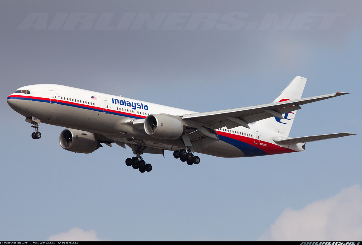
The Boeing 777-2H6ER took off from Kuala Lumpur Airport runway 32R at 0041LT bound for Beijing. Some 40 minutes later, while reaching FL350 over the Gulf of Thailand, radar contact was lost. At this time, the position of the aircraft was estimated 90 NM northeast of Kota Bharu, some 2 km from the IGARI waypoint. More than 4 days after the 'accident', no trace of the aircraft has been found. On the fifth day of operation, several countries were involved in the SAR operations, in the Gulf of Thailand, west of China Sea and on the Malacca Strait as well. All operations are performed in coordination with China, Thailand, Vietnam, Malaysia and Philippines. No distress call or any kind of message was sent by the crew. The last ACARS message was received at 0107LT and did not contain any error, failure or technical problems. At 0119LT was recorded the last radio transmission with the crew saying "All right, good night". At 0121LT, the transponder was switched off and the last radar contact was recorded at 0130LT. Several hypothesis are open and no trace of the aircraft nor the occupant have been found up to March 18, 2014. It is now understood the aircraft may flew several hours after it disappeared from radar screens, flying on an opposite direction from the prescribed flight plan, most probably to the south over the Indian Ocean. No such situation was ever noted by the B3A, so it is now capital to find both CVR & DFDR to explain the exact circumstances of this tragic event. Considering the actual situation, all scenarios are possible and all hypothesis are still open. On Mar 24, 2014, the Malaysian Prime Minister announced that according to new computations by the British AAIB based on new satellite data, there is no reasonable doubt that flight MH370 ended in the South Indian Ocean some 2,600 km west of Perth. Given the situation, the Malaysian Authorities believe that there is no chance to find any survivors among the 239 occupants.

***************************

According to the testimony of 6 Swiss Citizens making a cruise between Perth and Singapore via Jakarta, the following evidences were spotted on March 12 while approaching the Sunda Strait:
1430LT - latitude 6° S, longitude 105° E, speed 17,7 knots:
life jacket, food trays, papers, pieces of polystyrene, wallets,
1500LT:
a huge white piece of 6 meters long to 2,5 meters wide with other debris,
1530LT:
two masts one meter long with small flags on top, red and blue,
2030LT - latitude 5° S, longitude 107° E, speed 20,2 knots.

This testimony was submitted by these 6 Swiss Citizens to the Chinese and Australian Authorities.

On April 21, 2016, it was confirmed that this testimony was recorded by the Swiss Police and transmitted to the Swiss Transportation Safety Investigation Board (STSB), the State authority of the Swiss Confederation which has a mandate to investigate accidents and dangerous incidents involving trains, aircraft, inland navigation ships, and seagoing vessels. The link to the STSB is http://www.sust.admin.ch/en/index.html.

***************************

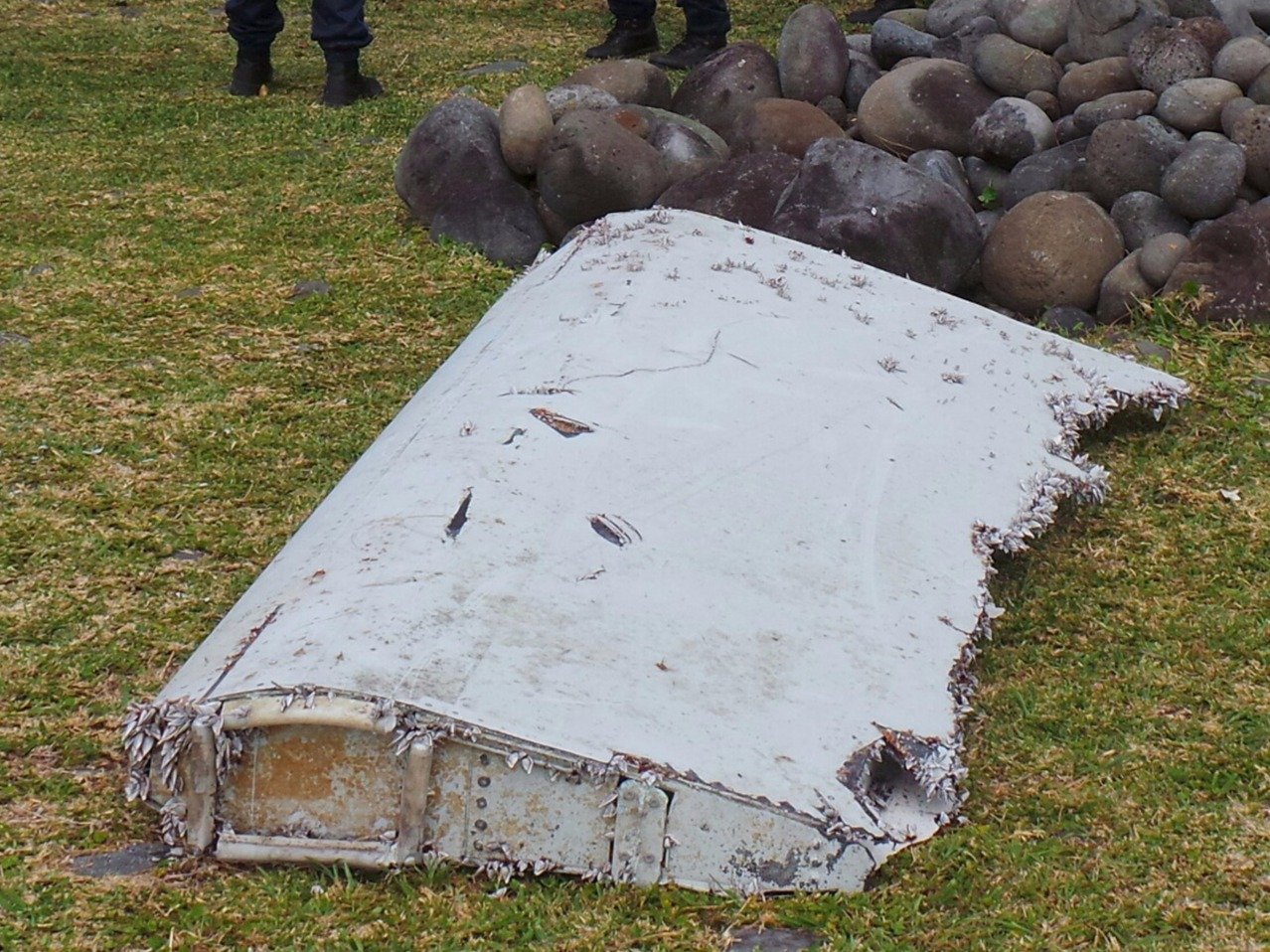
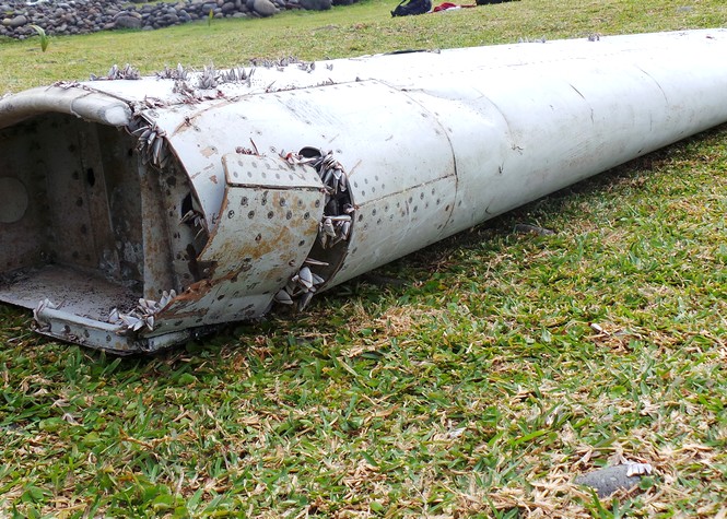
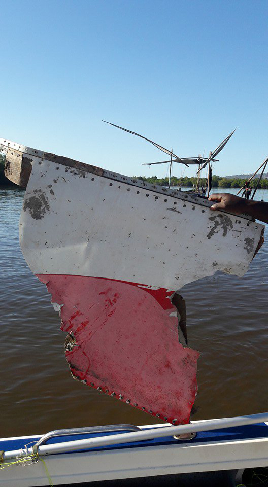
On July 29, 2015, a flaperon was found on a beach of the French Island of La Réunion, in the Indian Ocean. It was quickly confirmed by the French Authorities (BEA) that the debris was part of the Malaysian B777. Other debris have been found since, in Mozambique and South Africa.

On May 12, 2016, Australia's TSB reported that the part has been identified to be a "the decorative laminate as an interior panel from the main cabin. The location of a piano hinge on the part surface was consistent with a work-table support leg, utilised on the exterior of the MAB Door R1 (forward, right hand) closet panel". The ATSB reported that they were not able to identify any feature on the debris unique to MH-370, however, there is no record that such a laminate is being used by any other Boeing 777 customer.

***************************

On September 15, 2016, the experts from the Australian Transportation Safety Bureau (ATSB) have completed their examination of the large piece of debris discovered on the island of Pemba, off the coast of Tanzania, on June 20, 2016. Based on thorough examination and analysis, ATSB with the concurrence of the MH370 Safety Investigation Team have identified the following:
- Several part numbers, along with physical appearance, dimensions, and construction confirmed the piece to be an inboard section of a Boeing 777 outboard flap.
- A date stamp associated with one of the part numbers indicated manufacture on January 23, 2002, which was consistent with the May 31, 2002 delivery date for MH370,
- In addition to the Boeing part number, all identification stamps had a second 'OL' number that were unique identifiers relating to part construction,
- The Italian part manufacturer has confirmed that all numbers located on the said part relates to the same serial number outboard flap that was shipped to Boeing as line number 404,
- The manufacturer also confirmed that aircraft line number 404 was delivered to Malaysian Airlines and registered as 9M-MRO (MH370)

As such, the experts have concluded that the debris, an outboard flap originated from the aircraft 9M-MRO, also known as flight MH370. Further examination of the debris will continue, in hopes that further evidence may be uncovered which may provide new insight into the circumstances surrounding flight MH370.
Probable cause:
Due to lack of evidences the exact cause of the accident could not be determined.
Final Report:

Crash of a Dassault Falcon 20E off Kish Island: 4 killed

Date & Time: Mar 3, 2014 at 1845 LT
Type of aircraft:
Operator:
Registration:
EP-FIC
Flight Type:
Survivors:
No
Schedule:
Kish Island - Kish Island
MSN:
334
YOM:
1975
Country:
Region:
Crew on board:
2
Crew fatalities:
Pax on board:
2
Pax fatalities:
Other fatalities:
Total fatalities:
4
Circumstances:
The Aircraft mission was Calibration flight. The flight was planned for departure from Mehrabad airport, Tehran to Kish Island airport. Eight persons were onboard of the aircraft (3 Pilots, 4 Ground technicians, a Security guard member). The flight was under operation of Iran Aseman Airline with valid Air Operation Certificate (AOC No; FS-102). The aircraft has taken off from RWY 29L from THR airport at 15:03 Local time and reached to cruise level FL270.The aircraft has landed on RWY 09 L Kish island airports at 16:44 local time. Four ground technicians have got off from the aircraft and refueling was done. At time 17:44 LMT , the aircraft has taken off RWY 27R and requested to join Right downwind up to 1000 ft. and 8 miles from the airport. After successful performing 7 complete flight (approach & climbing) for Navigation – Aids inspection purposes; at the 8th cycle, just at turning to the final stage of approach before runway threshold the aircraft crashed into the sea and was destroyed at time 18:45 local time. All four occupants were killed.
Probable cause:
Regarding aforementioned analyses it seems that the fatigues of pilots have caused incapability to adopt themselves with flight conditions and their interactions are due to spatial disorientation
(illusion). This type of error prevented pilots to avoid from crash in to the sea.
Contributing Factors:
- Malfunction of aircraft radio altimeter.
- Flight crew fatigue.
- Lack of enough supervision on flight calibration operations.
Final Report:

Crash of a Cessna 208B Grand Caravan off Kalaupapa: 1 killed

Date & Time: Dec 11, 2013 at 1522 LT
Type of aircraft:
Operator:
Registration:
N687MA
Flight Phase:
Survivors:
Yes
Schedule:
Kalaupapa - Honolulu
MSN:
208B-1002
YOM:
2002
Crew on board:
1
Crew fatalities:
Pax on board:
8
Pax fatalities:
Other fatalities:
Total fatalities:
1
Captain / Total flying hours:
16000
Captain / Total hours on type:
250.00
Aircraft flight hours:
4881
Circumstances:
The airline transport pilot was conducting an air taxi commuter flight between two Hawaiian islands with eight passengers on board. Several passengers stated that the pilot did not provide a safety briefing before the flight. One passenger stated that the pilot asked how many of the passengers had flown over that morning and then said, “you know the procedures.” The pilot reported that, shortly after takeoff and passing through about 500 ft over the water, he heard a loud “bang,” followed by a total loss of engine power. The pilot attempted to return to the airport; however, he realized that the airplane would not be able to reach land, and he subsequently ditched the airplane in the ocean. All of the passengers and the pilot exited the airplane uneventfully. One passenger swam to shore, and rescue personnel recovered the pilot and the other seven passengers from the water about 80 minutes after the ditching. However, one of these passengers died before the rescue personnel arrived. Postaccident examination of the recovered engine revealed that multiple compressor turbine (CT) blades were fractured and exhibited thermal damage. In addition, the CT shroud exhibited evidence of high-energy impact marks consistent with the liberation of one or more of the CT blades. The thermal damage to the CT blades likely occurred secondary to the initial blade fractures and resulted from a rapid increase in fuel flow by the engine fuel control in response to the sudden loss of compressor speed due to the blade fractures. The extent of the secondary thermal damage to the CT blades precluded a determination of the cause of the initial fractures. Review of airframe and engine logbooks revealed that, about 1 1/2 years before the accident, the engine had reached its manufacturer-recommended time between overhaul (TBO) of 3,600 hours; however, the operator obtained a factory-authorized, 200-hour TBO increase. Subsequently, at an engine total time since new of 3,752.3 hours, the engine was placed under the Maintenance on Reliable Engines (MORE) Supplemental Type Certificate (STC) inspection program, which allowed an immediate increase in the manufacturer recommended TBO from 3,600 to 8,000 hours. The MORE STC inspection program documents stated that the MORE STC was meant to supplement, not replace, the engine manufacturer’s Instructions for Continued Airworthiness and its maintenance program. Although the MORE STC inspection program required more frequent borescope inspections of the hot section, periodic inspections of the compressor and exhaust duct areas, and periodic power plant adjustment/tests, it did not require a compressor blade metallurgical evaluation of two compressor turbine blades; however, this evaluation was contained in the engine maintenance manual and an engine manufacturer service bulletin (SB). The review of the airframe and engine maintenance logbooks revealed no evidence that a compressor turbine metallurgical evaluation of two blades had been conducted. The operator reported that the combined guidance documentation was confusing, and, as a result, the operator did not think that the compressor turbine blade evaluation was necessary. It is likely that, if the SB had been complied with or specifically required as part of the MORE STC inspection program, possible metal creep or abnormalities in the turbine compressor blades might have been discovered and the accident prevented. The passenger who died before the first responders arrived was found wearing a partially inflated infant life vest. The autopsy of the passenger did not reveal any significant traumatic injuries, and the autopsy report noted that her cause of death was “acute cardiac arrhythmia due to hyperventilation.” Another passenger reported that he also inadvertently used an infant life vest, which he said seemed “small or tight” but “worked fine.” If the pilot had provided a safety briefing, as required by Federal Aviation Administration regulations, to the passengers that included the ditching procedures and location and usage of floatation equipment, the passengers might have been able to find and use the correct size floatation device.
Probable cause:
The loss of engine power due to the fracture of multiple blades on the compressor turbine wheel, which resulted in a ditching. The reason for the blade failures could not be determined due to secondary thermal damage to the blades.
Final Report:

Crash of a Cessna 208B Grand Caravan in Kibeni: 3 killed

Date & Time: Nov 25, 2013 at 1340 LT
Type of aircraft:
Operator:
Registration:
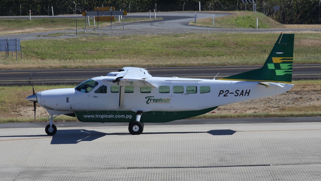
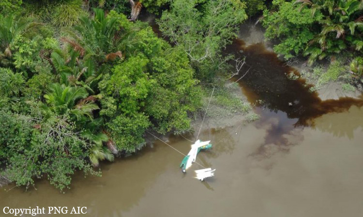
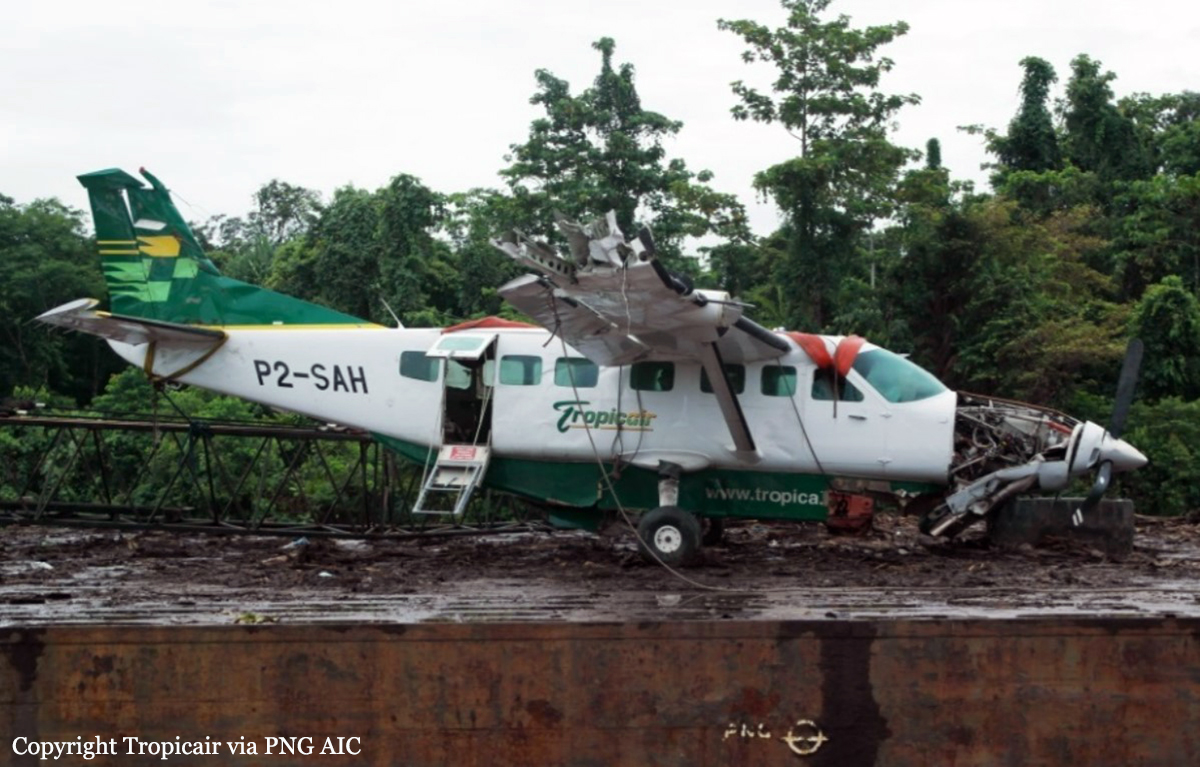
P2-SAH
Survivors:
Yes
Schedule:
Kamusi – Purari – Vailala – Port Moresby
MSN:
208B-1263
YOM:
2007
Location:
Region:
Crew on board:
1
Crew fatalities:
Pax on board:
9
Pax fatalities:
Other fatalities:
Total fatalities:
3
Captain / Total flying hours:
2200
Captain / Total hours on type:
800.00
Circumstances:
On 25 November 2013, a Cessna Aircraft Company C208B Grand Caravan, registered P2-SAH and operated by Tropicair, departed Kamusi, Western Province, for Purari River, Gulf Province, at 0312 UTC on a charter flight under the instrument flight rules (IFR). There were 10 persons on board; one pilot and nine passengers . Earlier in the day, the aircraft had departed Port Moresby for Kamusi from where it flew to Hivaro and back to Kamusi before the accident flight. SAH was due to continue from Purari River to Vailala and Port Moresby. The pilot reported that the takeoff and climb from Kamusi were normal and he levelled off at 9,000 ft and completed the top-of-climb checklist. Between Kamusi and Purari River the terrain is mostly flat and forest covered, with areas of swampland and slow-moving tidal rivers. Habitation is very sparse with occasional small villages along the rivers. The pilot recalled that the weather was generally good in the area with a cloud base of 3,000 ft and good visibility between build-ups. The pilot reported that approximately 2 minutes into the cruise there was a loud ‘pop’ sound followed by a complete loss of engine power. After configuring the aircraft for best glide speed at 95 kts, the pilot turned the aircraft right towards the coast and rivers to the south, and completed the Phase-1 memory recall items for engine failure in flight. He was assisted by the passenger in the right pilot seat who switched on the Emergency Locator Transmitter (ELT) and at 0332 broadcast MAYDAY due engine failure on the area frequency. Checking the database in the on-board Global Positioning System (GPS), the pilot found the airstrip at Kibeni on the eastern side of the Palbuna River. The pilot, assisted by the passenger next to him, tried unsuccessfully to restart the engine using the procedure in the aircraft’s Quick Reference Handbook (QRH). The passenger continued to give position reports and to communicate with other aircraft. At about 3,000 ft AMSL the pilot asked for radio silence on the area frequency so he could concentrate on the approach to Kibeni airstrip, flying a left hand circuit to land in a south westerly direction. He selected full flaps during the final stages of the approach, which arrested the aircraft’s rate of descent, but the higher than normal speed of the aircraft during the approach and landing flare caused it to float and touch down half way along the airstrip. The disused 430 metre long Kibeni airstrip was overgrown with grass and weeds. It was about 60 ft above the river and 120 ft above mean sea level, with trees and other vegetation on the slope down to the river. The aircraft bounced three times and, because the aircraft’s speed had not decayed sufficiently to stop in the available length, the pilot elected to pull back on the control column in order to clear the trees that were growing on the slope between the airstrip and the river. The aircraft became airborne, impacting the crown of a coconut palm (that was almost level with the airstrip) as it passed over the trees. The pilot banked the aircraft hard left in an attempt to land/ditch along the river and avoid trees on the opposite bank. He then pushed forward on the control column to avoid stalling the aircraft and levelled the wings before the aircraft impacted the water. The aircraft came to rest inverted with the cockpit and forward cabin submerged and immediately filled with water. After a short delay while he gained his bearings under water, the pilot was able to undo his harness and open the left cockpit door. He swam to the rear of the aircraft, opened the right rear cabin door, and helped the surviving passengers to safety on the river bank. He made several attempts to reach those still inside the aircraft. When he had determined there was nothing further he could do to reach them, he administered first aid to the survivors with materials from the aircraft’s first aid kit. After approximately 20 minutes, villagers arrived in a canoe and transported the pilot and surviving passengers to Kibeni village across the river. About 90 minutes after the accident, rescuers airlifted the survivors by helicopter to Kopi, located 44 km north east of Kibeni.
Probable cause:
The engine power loss was caused by the fracture of one CT blade in fatigue, which resulted in secondary damage to the remainder of the CT blades and downstream components. The fatigue originated from multiple origins on the pressure side of the blade trailing edge. The root cause for the fatigue initiation could not be determined with certainty. All other damages to the engine are considered secondary to the primary CT blades fracture.
Final Report:

Crash of a Learjet 35A off Fort Lauderdale: 4 killed

Date & Time: Nov 19, 2013 at 1956 LT
Type of aircraft:
Operator:
Registration:
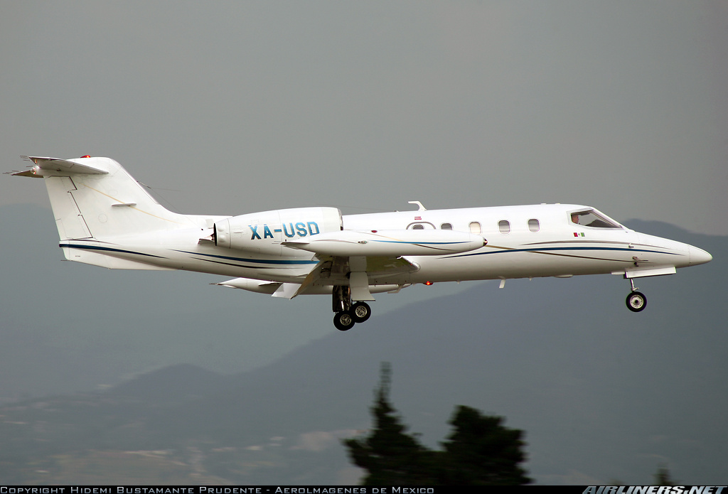
XA-USD
Flight Phase:
Flight Type:
Survivors:
No
Schedule:
Fort Lauderdale - Cozumel
MSN:
35A-255
YOM:
1979
Crew on board:
2
Crew fatalities:
Pax on board:
2
Pax fatalities:
Other fatalities:
Total fatalities:
4
Captain / Total flying hours:
10091
Captain / Total hours on type:
1400.00
Copilot / Total flying hours:
1235
Copilot / Total hours on type:
175
Aircraft flight hours:
6842
Circumstances:
During takeoff to the east over the ocean, after the twin-engine jet climbed straight ahead to about 2,200 ft and 200 knots groundspeed, the copilot requested radar vectors back to the departure airport due to an "engine failure." The controller assigned an altitude and heading, and the copilot replied, "not possible," and requested a 180-degree turn back to the airport, which the controller acknowledged and approved. However, the airplane continued a gradual left turn to the north as it slowed and descended. The copilot subsequently declared a "mayday" and again requested vectors back to the departure airport. During the next 3 minutes, the copilot requested, received, and acknowledged multiple instructions from the controller to turn left to the southwest to return to the airport. However, the airplane continued its slow left turn and descent to the north. The airplane slowed to 140 knots and descended to 900 ft as it flew northbound, parallel to the shoreline, and away from the airport. Eventually, the airplane tracked in the direction of the airport, but it continued to descend and impacted the ocean about 1 mile offshore. According to conversations recorded on the airplane's cockpit voice recorder (CVR), no checklists were called for, offered, or used by either flight crewmember during normal operations (before or during engine start, taxi, and takeoff) or following the announced in-flight emergency. After the "engine failure" was declared to the air traffic controller, the pilot asked the copilot for unspecified "help" because he did not "know what's going on," and he could not identify the emergency or direct the copilot in any way with regard to managing or responding to the emergency. At no time did the copilot identify or verify a specific emergency or malfunction, and he did not provide any guidance or assistance to the pilot. Examination of the recovered wreckage revealed damage to the left engine's thrust reverser components, including separation of the lower blocker door, and the stretched filament of the left engine's thrust reverser "UNLOCK" status light, which indicated that the light bulb was illuminated at the time of the airplane's impact. Such evidence demonstrated that the left engine's thrust reverser became unlocked and deployed (at least partially and possibly fully) in flight. Impact damage precluded testing for electrical, pneumatic, and mechanical continuity of the thrust reverser system, and the reason the left thrust reverser deployed in flight could not be determined. No previous instances of the inflight deployment of a thrust reverser on this make and model airplane have been documented. The airplane's flight manual supplement for the thrust reverser system contained emergency procedures for responding to the inadvertent deployment of a thrust reverser during takeoff. For a deployment occurring above V1 (takeoff safety speed), the procedure included maintaining control of the airplane, placing the thrust reverser rocker switch in the "EMER STOW" position, performing an engine shutdown, and then performing a single-engine landing. Based on the wreckage evidence and data recovered from the left engine's digital electronic engine control (DEEC), the thrust reverser rocker switch was not placed in the "EMER STOW" position, and the left engine was not shut down. The DEEC data showed a reduction in N1 about 100 seconds after takeoff followed by a rise in N1 about 35 seconds later. The data were consistent with the thrust reverser deploying in flight (resulting in the reduction in N1) followed by the inflight separation of the lower blocker door (resulting in the rise in N1 as some direct exhaust flow was restored). Further, the DEEC data revealed full engine power application throughout the flight. Although neither flight crewmember recognized that the problem was an inflight deployment of the left thrust reverser, certification flight test data indicated that the airplane would have been controllable as it was configured on the accident flight. If the crew had applied the "engine failure" emergency procedure (the perceived problem that the copilot reported to the air traffic controller), the airplane would have been more easily controlled and could have been successfully landed. The airplane required two fully-qualified flight crewmembers; however, the copilot was not qualified to act as second-in-command on the airplane, and he provided no meaningful assistance to the pilot in handling the emergency. Further, although the pilot's records indicated considerable experience in similar model airplanes, the pilot's performance during the flight was highly deficient. Based on the CVR transcript, the pilot did not adhere to industry best practices involving the execution of checklists during normal operations, was unprepared to identify and handle the emergency, did not refer to the appropriate procedures checklists to properly configure and control the airplane once a problem was detected, and did not direct the copilot to the appropriate checklists.
Probable cause:
The pilot's failure to maintain control of the airplane following an inflight deployment of the left engine thrust reverser. Contributing to the accident was the flight crew's failure to perform the appropriate emergency procedures, the copilot's lack of qualification and capability to act as a required flight crewmember for the flight, and the inflight deployment of the left engine thrust reverser for reasons that could not be determined through postaccident investigation.
Final Report:

Crash of a BAe 146-200 in Balesin

Date & Time: Oct 19, 2013 at 1149 LT
Type of aircraft:
Operator:
Registration:
RP-C5525
Survivors:
Yes
Schedule:
Manila - Balesin
MSN:
E2031
YOM:
1985
Location:
Country:
Region:
Crew on board:
7
Crew fatalities:
Pax on board:
68
Pax fatalities:
Other fatalities:
Total fatalities:
0
Circumstances:
The aircraft was performing a charter flight from Manila to Balesin, carrying tourists en route to the Balesin Island Club. The approach and landing were completed in poor weather conditions with heavy rain falls. After landing, the four engine aircraft was unable to stop within the remaining distance. It overran, lost its nose gear and came to rest in the Lamon Bay, few dozen metres offshore. All 75 occupants escaped uninjured while the aircraft was damaged beyond repair.

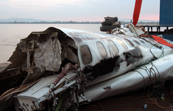
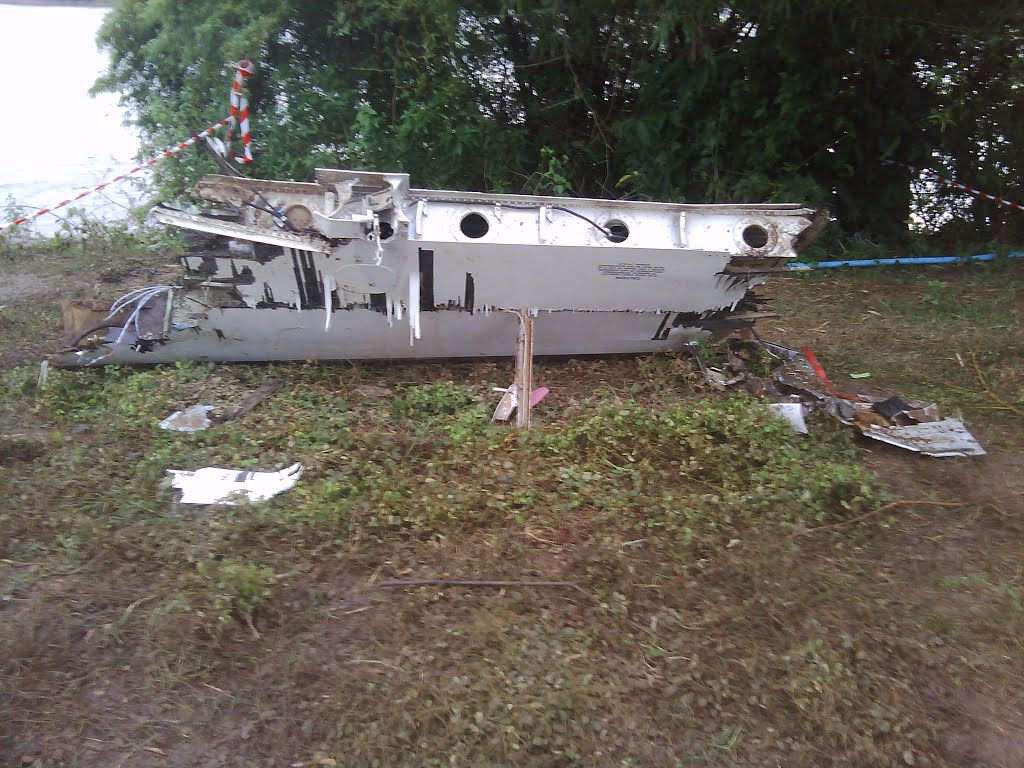
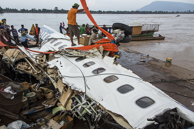
Crash of an ATR72-600 off Pakse: 49 killed

Date & Time: Oct 16, 2013 at 1555 LT
Type of aircraft:
Operator:
Registration:
RDPL-34233
Survivors:
No
Schedule:
Vientiane - Pakse
MSN:
1071
YOM:
2013
Flight number:
LAO301
Country:
Region:
Crew on board:
5
Crew fatalities:
Pax on board:
44
Pax fatalities:
Other fatalities:
Total fatalities:
49
Captain / Total flying hours:
5600
Captain / Total hours on type:
3200.00
Copilot / Total flying hours:
400
Aircraft flight hours:
758
Circumstances:
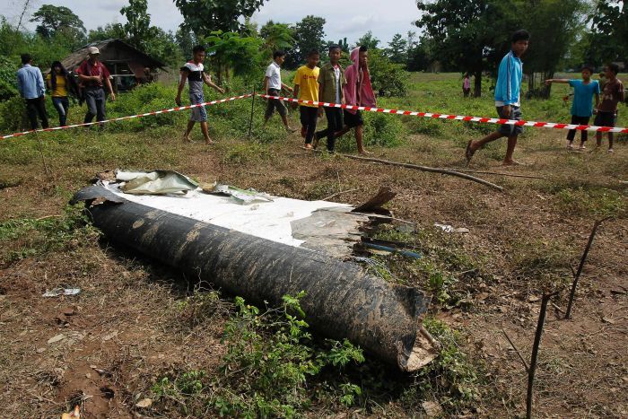
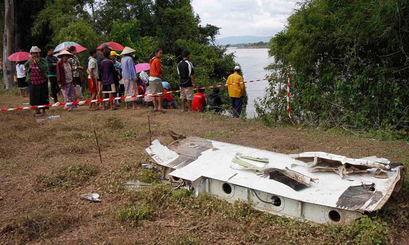
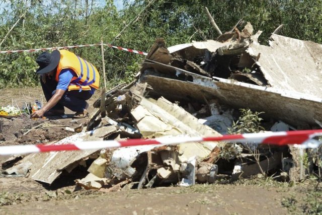
A first approach procedure to runway 15 was aborted by the crew due to insufficient visibility. On the circuit to complete a second approach in bad weather conditions, the ATR72-600 crashed some 8 km short of runway and was completely submerged in the Mekong River. None of the 49 occupants (44 pax and 5 crew) survived, among them 7 French citizens and 6 Australians. Aircraft left Vientiane at 1445LT and should arrive in Pakse one hour later. Aircraft was built and delivered to Lao Airlines in March this year. First crash involving an ATR72-600 series. Up to date, worst accident in Laos.
The Laotian Authorities released the following key sentences of analysis:
"Under IMC conditions, with no reference to the ground, the SOPs lead to conducting an instrument approach. In Pakse the VOR DME approach procedure is in force. There is no radar service. The flight crew has to fly to the initial approach fix or the intermediate fix at an altitude above 4600ft, then start the descent to 2300ft until final approach fix. Finally the flight crew descends to the minima (990ft), if visual references with the ground are available and sufficient the flight crew may continue until touchdown. If ground visual references are not available or not sufficient, the flight crew may level off up to the missed approach point and then must start the missed approach procedure. From the FOR data, the flight crew set 600 ft as the minima. This is contrary to the published minima of 990 ft. Even if the flight crew had used the incorrect height as published in the JEPPESEN Chart at that time the minima should have been set to 645 ft or above. The choice of minima lower than the published minima considerably reduces the safety margins. Following the chart would lead the flight crew to fly on a parallel path 345 ft lower than the desired indicated altitude. The recordings show that the flight crew initiated a right turn according to the lateral missed approach trajectory without succeeding in reaching the vertical trajectory. Specifically, the flight crew didn't follow the vertical profile of missed approach as the missed approach altitude was set at 600 ft and the aircraft system went into altitude capture mode. When the flight crew realized that the altitude was too close to the ground, the PF over-reacted, which led to a high pitch attitude of 33°. The aircraft was mostly flying in the clouds during the last part of flight."
Probable cause:
The probable cause of this accident were the sudden change of weather condition and the flight crew's failure to properly execute the published instrument approach, including the published missed approach procedure, which resulted in the aircraft impacting the terrain.
The following factors may have contributed to the accident:
- The flight crew's decision to continue the approach below the published minima
- The flight crew's selection of an altitude in the ALT SEL window below the minima, which led to misleading FD horizontal bar readings during the go-around
- Possible Somatogravic illusions suffered by the PF
- The automatic reappearance of the FD crossbars consistent with the operating logic of the aeroplane systems, but inappropriate for the go-around
- The inadequate monitoring of primary flight parameters during the go-around, which may have been worsened by the PM's attention all tunneling on the management of the aircraft flap configuration
- The flight crew's limited coordination that led to a mismatch of action plans between the PF and the PM during the final approach.
Final Report: