Crash of a Beechcraft 65-B80 Queen Air in Albuquerque: 9 killed

Date & Time: May 19, 1972 at 1229 LT
Type of aircraft:
Registration:
N841NS
Flight Phase:
Survivors:
No
Schedule:
Albuquerque - Santa Fe
MSN:
LD-346
YOM:
1967
Crew on board:
1
Crew fatalities:
Pax on board:
8
Pax fatalities:
Other fatalities:
Total fatalities:
9
Captain / Total flying hours:
6769
Captain / Total hours on type:
411.00
Circumstances:
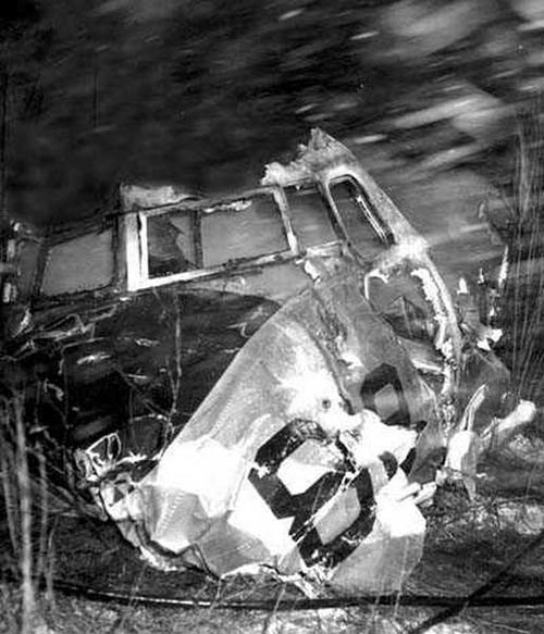
Shortly after takeoff from Albuquerque Airport, while in initial climb, the pilot declared an emergency and was cleared to return when control was lost. The airplane dove into the ground and crashed in flames in a field near the airport. The aircraft was totally destroyed and all nine occupants have been killed.
Probable cause:
Engine failure or malfunction during initial climb and uncontrolled descent. The following factors were reported:
- Inadequate preflight preparation,
- Inadequate maintenance and inspection,
- Deficiency of company maintained equipment, services and regulation by operational supervisory personnel,
- Left front cargo door improperly secured,
- Blades failure due to foreign object damage,
- Suspected or known aircraft damage,
- Forward cargo door not secured, opened in flight and damaged left prop, causing additional drag,
- Door unsafe system inoperative.
Final Report:

Crash of a Lockheed 18-08 LodeStar in Albuquerque: 11 killed

Date & Time: Dec 5, 1969 at 1500 LT
Type of aircraft:
Registration:
N410M
Flight Phase:
Flight Type:
Survivors:
No
Schedule:
Las Vegas - Dalhart
MSN:
2203
YOM:
1942
Crew on board:
2
Crew fatalities:
Pax on board:
9
Pax fatalities:
Other fatalities:
Total fatalities:
11
Captain / Total flying hours:
8030
Captain / Total hours on type:
30.00
Circumstances:
En route from Las Vegas to Dalhart, Texas, the crew encountered poor weather conditions with icing and turbulences. The VFR rated pilot preferred to continue in such conditions when few minutes later, a structural failure occurred on the left wing that detached. Out of control, the airplane dove into the ground and crashed in a huge explosion in an open field. All 11 occupants were killed.
Probable cause:
Airframe failure in flight and uncontrolled descent caused by the combination of the following factors:
- The pilot-in-command attempted operation with known deficiencies in equipment,
- The pilot-in-command continued VFR flight into adverse weather conditions,
- The pilot-in-command exceeded designed stress limits of aircraft,
- Overload failure of airframe, wings spars,
- Separation in flight,
- Icing conditions, including sleet and freezing rain,
- Airframe ice,
- The left wing failed and separated in flight,
- The pilot type rated for VFR flight only,
- The aircraft was not fitted with de-icing equipment.
Final Report:

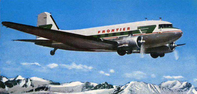
Crash of a Douglas C-47A-10-DK in Gallup

Date & Time: Jul 27, 1966 at 1453 LT
Operator:
Registration:
N4994E
Flight Phase:
Survivors:
Yes
Schedule:
Gallup – Albuquerque
MSN:
12442
YOM:
1944
Flight number:
FL188
Crew on board:
3
Crew fatalities:
Pax on board:
13
Pax fatalities:
Other fatalities:
Total fatalities:
0
Captain / Total flying hours:
8502
Captain / Total hours on type:
4160.00
Circumstances:
During the takeoff roll at Gallup-Senator Clark Airport, control was lost. The aircraft veered off runway and came to rest in flames in a ditch. Three passengers were injured while 13 other occupants were unhurt. The aircraft was written off.
Probable cause:
Improper operation of brakes and/or flight controls during takeoff on part of the PIC. Inadequate supervision of flight on part of the PIC who failed to maintain directional control and failed to abort takeoff.
Final Report:

Crash of a Douglas C-47 in the Sandia Mountains: 9 killed

Date & Time: Apr 26, 1963
Operator:
Flight Phase:
Flight Type:
Survivors:
No
Site:
Schedule:
Andrews - March
Crew on board:
4
Crew fatalities:
Pax on board:
5
Pax fatalities:
Other fatalities:
Total fatalities:
9
Circumstances:
The crew was performing a secret mission from Andrews AFB to March AFB. While overflying New Mexico, he encountered severe icing conditions. A wing fell off and the aircraft crashed in the Sandia Mountain Range located northeast of Albuquerque. All nine occupants were killed and the aircraft was destroyed. All USAF C-47's were grounded following this accident, until the struts had been replaced.
Probable cause:
Investigations revealed that a wing's guy broke in flight, probably when the airplane was flying in an area subject to severe icing.

Crash of a Douglas R5D-3 in Detroit: 1 killed

Date & Time: Jan 22, 1957 at 2133 LT
Type of aircraft:
Operator:
Registration:
50869
Flight Type:
Survivors:
Yes
Schedule:
Miramar – Albuquerque – Detroit
MSN:
10546
YOM:
1945
Crew on board:
7
Crew fatalities:
Pax on board:
0
Pax fatalities:
Other fatalities:
Total fatalities:
1
Circumstances:
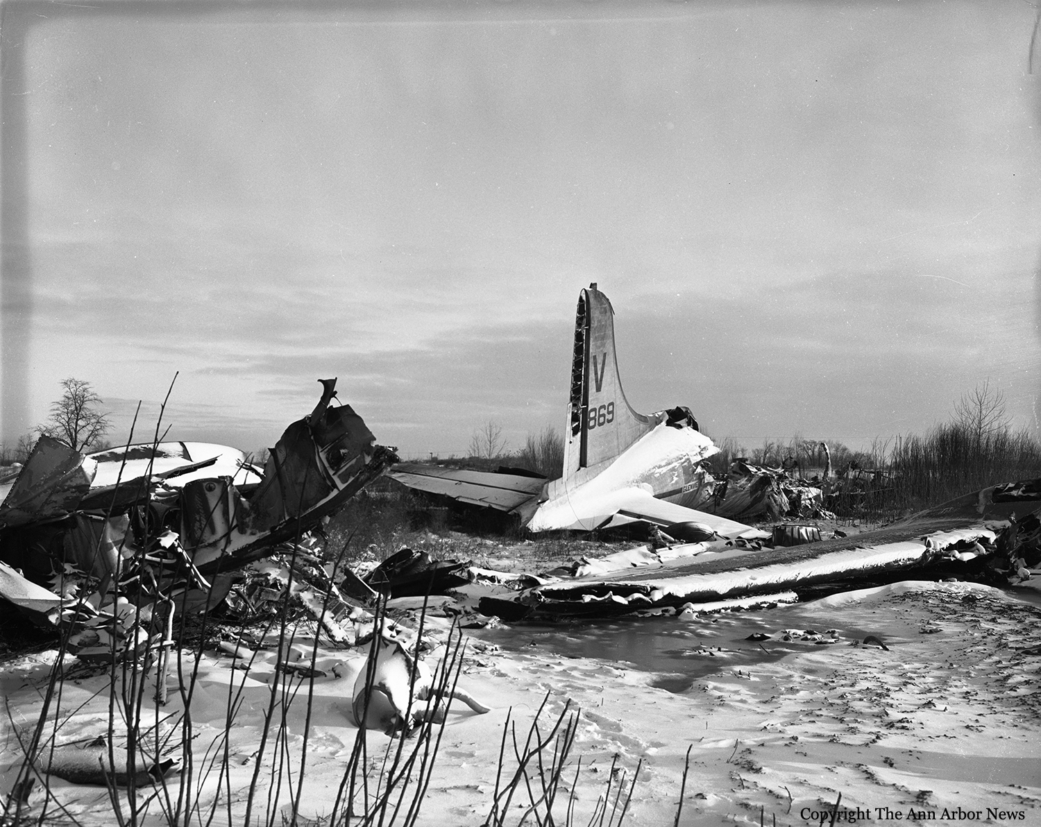
The aircraft was on its way from Miramar to Detroit, carrying a crew of seven. They made a stop at Albuquerque to carry the body of a USN pilot who was killed in an accident two days earlier. While descending to Willow Run Airport, the pilot briefed his crew about the minimums and confirmed that if runway was not in sight at 800 feet, they will divert to Grosse Isle NAS. The approach was completed in a low visibility due to snow falls and a ceiling at 550 feet when the airplane hit the ground near a pond, lost an engine and crashed in flames in an open field located about two miles short of runway 05. LCDR William E. Sale was killed while six others were injured. The aircraft was destroyed.
Probable cause:
The cause of the accident was attributed to a faulty altimeter reading caused by a frozen moisture drain on the Pitot Static System. As a result, it caused altimeter readings to lag as the plane descended.

Crash of a Martin 404 near Albuquerque: 16 killed

Date & Time: Feb 19, 1955 at 0713 LT
Type of aircraft:
Operator:
Registration:
N40416
Flight Phase:
Survivors:
No
Site:
Schedule:
Albuquerque – Santa Fe – Baltimore
MSN:
14120
YOM:
1952
Flight number:
TW260
Crew on board:
3
Crew fatalities:
Pax on board:
13
Pax fatalities:
Other fatalities:
Total fatalities:
16
Circumstances:
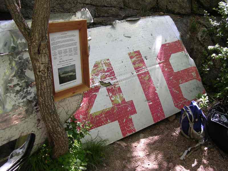
Flight 260 received an IFR clearance from the tower at 0703 hours: "ATC clears TWA260 for approach at the Santa Fe Airport via Victor 19 climb northbound on the back course of the ILS localiser". The flight departed Albuquerque at 0705 hours. The tower requested the flight to report over-the Weiler Intersection (formerly the Alameda Intersection), however, after taking off there were no further radio contacts with the flight. The aircraft was last seen at an estimated altitude of 3000 feet (8300 feet mean sea level) in a high speed shallow climb continuing its heading towards Sandia Ridge, the upper portion of which was obscured by clouds. The wreckage was sighted the following morning at 9243 feet mean sea level, just below the crest of Sandia Mountain, approximately 13 miles north-east of the Albuquerque Airport and almost directly on a straight line course of 30 degrees magnetic from that airport (elevation 5340 feet mean sea level) to the Santa Fe Airport (elevation 6 344 feet mean sea level). An investigation was initiated by the Civil Aeronautics Board immediately after the accident. This included examination of the wreckage at the crash site which was discontinued because of deep snow and dangerous footing in the mountainous terrain. On May 3, 1955, a second trip was made to the scene of the accident and study of the wreckage was continued. On October 12, 1955, the Board’s Accident Investigation Report was released. The probable cause was determined to have been lack of conformity with prescribed en route procedures and a deviation from airways at an altitude too low to clear obstructions ahead. Because of controversy over certain elements of the report of October 12, 1955, additional study was given to the facts and circumstances of the accident and an amended report thereon was issued by the Board on August 26, 1957. The probable cause of the accident in this report was identical to that of the first report although the analysis portion was altered to revise the statement that the direct course was intentional. On October 10, 1958, the Air Line Pilots Association presented to the Bureau of Safety certain factual information and theories concerning the cause of the accident. On November 24, 1958, a third trip to the accident site was made. While there a new determination was made of the airplane’s heading at the time of impact. Because of these developments since the August 26, 1957, accident report was issued, active investigation and study was resumed. Additional testimony and documentary material were received from representatives of the ALPA, TWA, CAB, Eclipse-Pioneer Division of the Bendix Aviation Corporation, and the Collins Radio Company at Kansas City, Missouri, on January 15 and 16, 1959. In addition, a later study and presentation of facts concerning the instrumentation of the airplane and an analysis of tests made of the fluxgate compass system by Eclipse-Pioneer and ALPA were considered.
Probable cause:
The Board determines that the probable cause of this accident was a deviation from the prescribed flight path for reasons unknown.
Final Report:

Crash of a Martin 202 in Tucumcari: 1 killed

Date & Time: Nov 5, 1951 at 0929 LT
Type of aircraft:
Operator:
Registration:
N93039
Survivors:
Yes
Schedule:
Oakland – Albuquerque – Indiantown Gap
MSN:
9160
YOM:
1947
Flight number:
TL5763
Crew on board:
3
Crew fatalities:
Pax on board:
26
Pax fatalities:
Other fatalities:
Total fatalities:
1
Captain / Total flying hours:
7963
Captain / Total hours on type:
261.00
Copilot / Total flying hours:
1300
Copilot / Total hours on type:
13
Aircraft flight hours:
6790
Circumstances:
Flight 5763, a military contract flight, originated in Oakland, California, with Indiantown Gap, Pennsylvania, as its destination. It was scheduled to depart Oakland, California, at 0200, November 5, 1951, but due to a mechanical delay, departure was not made until 0352. The crew consisted of Captain Alec S. Hamilton, Copilot Henry N. Ingram, and Stewardess Frances B. Reilly. There were 26 passengers on board. The IFR (Instrument Flight Rules) flight plan filed with the CAA prior to departure indicated that the first intended landing would be Albuquerque, New Mexico, with Tucumcari, New Mexico, as the alternate. It showed a cruising altitude of 500 on top and an estimated time of Albuquerque of four hours and five minutes, with six hours and fifteen minutes of fuel on board. At the time of departure the aircraft weighed 38,939 pounds, which was within the allowable gross takeoff weight of 39,900 pounds; the load was properly distributed. The company maintains a dispatching office at Oakland to assist crews in planning flights, but it has no communications facilities for maintaining flight supervision. Company pilots are authorized to act as their own dispatchers, utilizing the CAA Communications facilities for the purpose of flight control. Captain Hamilton stated that prior to departure he was briefed by the U. S. Weather Bureau forecaster at the Oakland Airport on the an route weather and forecasts. Weather information available to the captain at this time indicated that there would be VFR (Visual Flight Rules) flying weather between Oakland and Albuquerque, at a cruising altitude of 11,000 feet, and that helping winds averaging 15 to 20 knots could be expected along the entire route. The forecast for Tucumcari, the alternate airport, indicated clear weather until 0500, followed by an overcast, with a ceiling of 800 feet and surface winds from the northeast at 15 miles per hour. The flight was routine and on reaching Acomita, New Mexico, at 0755, reported that it was 500 on top at 12,000 feet and was estimating Albuquerque at 0811. Following this report the flight asked to change its flight plan to Tucumcari with Amarillo, Texas, the alternate, and requested the latest Tucumcari weather which was: 0728, overcast, 1500 feet, visibility 20 miles, wind northeast 20 mph; Amarillo, 0728, broken clouds 1700 feet, overcast at 3500 feet, visibility 8 miles, wind north-northeast, 17 mph. The flight passed over Albuquerque under broken clouds in the clear at 12,000 feet NSL at 0813, whereupon the following clearance was given: “ARTC (Air Route Traffic Control) Clears CAM 5763 to the Tucumcari Airport via Green Airway No. 4, to maintain 500 on top while in the control area.” This clearance was acknowledged. At 0831, the flight reported being over Anton Chico, New Mexico, at 13,000 feet, estimating Tucumcari at 0852. At this time the 0828 Tucumcari weather was given the flight as; coiling estimated 1,000 feet, overcast, visibility 3 miles, snow and fog. At approximately 0845, Tucumcari radio gave 5763 the following clearance: “ARTC clears 5763 to descend to 8,000 feet on the south course of Tucumcari range, maintain 11,000 feet until 2 minutes south, descend outbound, maintain 8,000, report leaving 9,000.” The following clearance was transmitted to the flight by Tucumcari radio at 0851: “ARTC clears 5763 to approach Tucumcari Airport en reaching 8,000 feet.” The flight next reported being over the Tucumcari range station at 0852, at 11,000 feet, descending to 8,000 feet, and at 0901 reported that it was at 9,000 feet outbound on the south leg of the Tucumcari range. At this time the special 0852 Tucumcari weather report was given the flight: “Ceiling 800 feet, overcast, visibility one mile, light snow and fog, wind north 20 miles per hour with strong gusts.” The reported surface visibility in this official weather report was loss than the CAA and company minimums of 11/2 miles for the Tucumcari Airport. At 0907 5763 was given the following clearance: “ARTC clears 5763 to make standard instrument approach.” The Amarillo weather was then given as: coiling estimated 1,000 feet, broken clouds, overcast 2,000 feet; visibility 5 miles, light snow and fog. The flight was asked if it wished to proceed to Amarillo and it replied that it had to land at Tucumcari. The flight continued its descent and at 0909 was advised by Tucumcari radio that the Tucumcari weather was then ceiling 800 feet, overcast, visibility 1/2 miles, light snow and fog, wind north 20 miles per hour. Two minutes later, at 0911, the flight reported it was outbound on the west leg at 8,000 feet, descending to 6,000 feet. Tucumcari radio again gave the flight the weather which had been given it at 0908. One minute after this transmission Tucumcari radio gave the flight the wind direction which was then north-northwest, variable to north-northeast, at 16 miles per hour, and advised that Runway 30 was the runway in use. 5763 immediately requested the bearing of this runway and this was corrected to 03, which was acknowledged by the flight. At 0915 5763 reported that it was at 6,000 feet and inbound on the west leg of the Tucumcari range. Immediately following this report, at 0916, Tucumcari radio asked the flight if it wanted ARTC to recommend an alternate airport closer than Amarillo. The flight acknowledged this and advised it would have to land at Tucumcari but asked where the alternate would be. The pilot was advised to stand by and, according to the communicator on duty, the aircraft was then seen to cross the field in a northwesterly direction at very low altitude. The pilot was quickly advised to pull up and answered that he was doing so. At 0925, the flight advised it was landing downwind. This was the last report received from the flight. After several passes over the airport at altitudes varying from 500 feet to as low as 50 feet, the aircraft crashed near the northeast end of Runway 21 at approximately 0929. A flash fire which occurred immediately after impact quickly subsided. Ten passengers were injured and another one was killed. The aircraft was destroyed.
Probable cause:
The Board determines that the probable cause of this accident was the captain’s attempt to land during less than minimum visibility, rather than proceed to his alternate. The following findings were pointed out:
- The flight was routine until it arrived in the vicinity of Acomita, New Mexico, where the captain elected to change the existing flight plan and land at Tucumcari, with Amarillo as the new alternate,
- The weather at Albuquerque at that time was CAVU, whereas the weather at Tucumcari at the estimated time of the flight’s arrival there was forecast to be marginal,
- Prior to the change in flight plan the captain did not ask for now terminal forecasts as required, nor were they volunteered by Flight Assistance Service,
- During the approach to Tucumcari the surface visibility was transmitted to the flight as one mile and eight minutes later, one-half mile, the company’s prescribed visibility minimum is 11/2 miles,
- The captain did not execute a missed-approach and proceed to the alternate, but continued his attempts to land,
- Control of the aircraft was lost during a steep turn, and the left wing struck the ground.
Final Report:

Crash of a Beechcraft D18 in West Mesa: 3 killed

Date & Time: Feb 11, 1950
Type of aircraft:
Operator:
Flight Type:
Survivors:
No
Schedule:
Dayton – Albuquerque
Crew on board:
1
Crew fatalities:
Pax on board:
2
Pax fatalities:
Other fatalities:
Total fatalities:
3
Circumstances:
The twin engine aircraft was performing a cargo flight from Dayton to Albuquerque with one pilot, two security guards from the Atomic Energy Commission (AEC) and a load of 22 boxes containing 792 classified HE detonator units. On approach to Albuquerque, the pilot encountered low clouds and poor visibility when the aircraft hit the slope of a hill located 6 miles west of West Mesa. All three occupants were killed and the aircraft was destroyed by impact forces and a post crash fire. The cargo was destroyed but salvaged from the wreckage.
Probable cause:
As there was no evidence of sabotage, and since none of the detonators appeared to be missing, the incident was not reported to the Federal Bureau of Investigation.

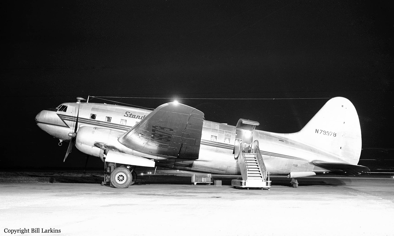
Crash of a Curtiss C-46E-1-CS Commando in Chatsworth: 35 killed

Date & Time: Jul 12, 1949 at 0743 LT
Type of aircraft:
Operator:
Registration:
N79978
Survivors:
Yes
Site:
Schedule:
New York – Chicago – Kansas City – Albuquerque – Hollywood – Long Beach
MSN:
2936
YOM:
1945
Flight number:
SD897R
Crew on board:
4
Crew fatalities:
Pax on board:
44
Pax fatalities:
Other fatalities:
Total fatalities:
35
Captain / Total flying hours:
6038
Captain / Total hours on type:
2760.00
Copilot / Total flying hours:
4445
Copilot / Total hours on type:
30
Aircraft flight hours:
1515
Circumstances:
Flight 897R originated at New York, New York, for Long Beach, California, with stops at Chicago, Illinois, Kansas City, Kansas, Albuquerque, New Mexico, and Burbank, California. A crew change was made at Kansas City. Departure from Kansas City was at 2321, July 11, and the flight proceeded through thunderstorm conditions to Albuquerque. Departure from Albuquerque, New Mexico, was at 0424, with 44 passengers, including two infants; 4 crew members, 875 gallons of gasoline, and 60 gallons of oil, and with a visual flight rules clearance. The total weight at time of departure was 39,746 pounds, which was within the certificated gross weight of the aircraft, and all disposable load was properly distributed so that the center of gravity of the aircraft was within the certificated limits. After leaving Albuquerque, considerable turbulence and thunderstorm conditions were encountered before clear weather was entered. At 0722 the flight contacted Riverside, California, INSAC, advised that at 0720 it was over Riverside at 9,000 feet, 500 on top, and requested a top report 2 for the vicinity of Burbank (about 67 miles to the west) which was given as 2,200 feet MSL. 3 The flight then filed an Instrument Flight Rules plan from its position direct to Burbank estimating arrival there at 0740. Clearance was issued by the Los Angeles Air Route Traffic Control Center as follows. "ATC clears N79978 from present position to Simi Intersection direct cruise 500 on top, maintain 500 on top until advised by Burbank Control on 248 Kes., no delay--contact Burbank Approach Control when approaching Burbank." The first radio contact with the Burbank Tower was at 0735, at which time the flight reported its position as west of Riverside, and upon request the latest (0725) Burbank weather observation was given the pilot as "measured ceiling 800 overcast, thin obscurement, visibility two miles, smoke." The tower advised the flight that another aircraft, a Cessna, was then over Chatsworth 4 inbound and that no delay was anticipated. At 0736 the Cessna reported that it was contact and was cleared to land. Immediately N79978 was contacted "cleared to make straight-in approach to the aerodrome, Runway 7, Burbank altimeter three zero zero two, time cheek three six." The pilot acknowledged and advised that his position was "approaching Burbank Range," but did not give his altitude. This was the last radio contact with the flight. No position report was made as actually over Burbank Range. At 0745, a California Central Airlines' DC-3, Flight 81, reported over the Burbank Range, and was directed to hold north-west of Simi, 500 on top, pending the landing of N79978. When N79978 failed to arrive, several calls were initiated to it by the tower but no response was heard. California Central's flight was then requested to search for the aircraft and sighted the burning wreckage about three miles west of the town of Chatsworth, California, in the Santa Susana Mountains at 0800. At that time, 17 minutes after the accident, the weather at the crash site was clear with a former cloud layer rapidly dissipating. The aircraft was destroyed by impact forces and a post crash fire and three crew members and 32 passengers were killed.
Probable cause:
The Board determines that the probable cause of this accident was the pilot's action in descending below the prescribed minimum altitude while executing an instrument approach to the Burbank Airport.
The following findings were pointed out:
- The passenger altercation had no direct effect on the safe operation of the aircraft,
- The flight descended below the prescribed minimum altitude just before starting, or during, a procedure turn preparatory to letting down to Burbank Airport,
- The aircraft struck terrain during the procedure turn while it was approximately 1,000 feet lower than it should have been under the prevailing weather conditions.
Final Report:

Crash of Douglas R4D-6 near Albuquerque: 11 killed

Date & Time: Apr 4, 1946
Type of aircraft:
Operator:
Registration:
50771
Flight Phase:
Flight Type:
Survivors:
No
Site:
Schedule:
Phoenix – Amarillo
MSN:
14881/26326
YOM:
1944
Crew on board:
3
Crew fatalities:
Pax on board:
8
Pax fatalities:
Other fatalities:
Total fatalities:
11
Circumstances:
While cruising by night, the aircraft hit the slope of a mountain located 21 km southeast of Albuquerque. All 11 occupants were killed.