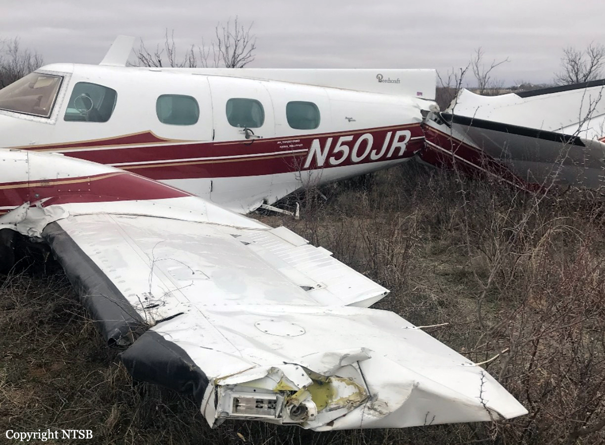
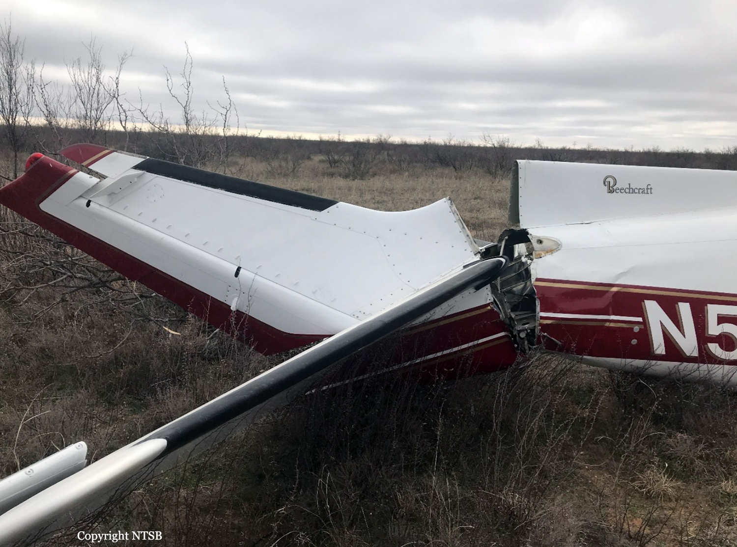
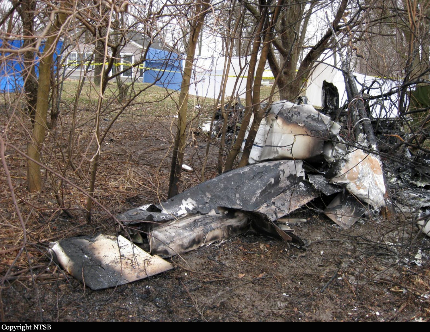
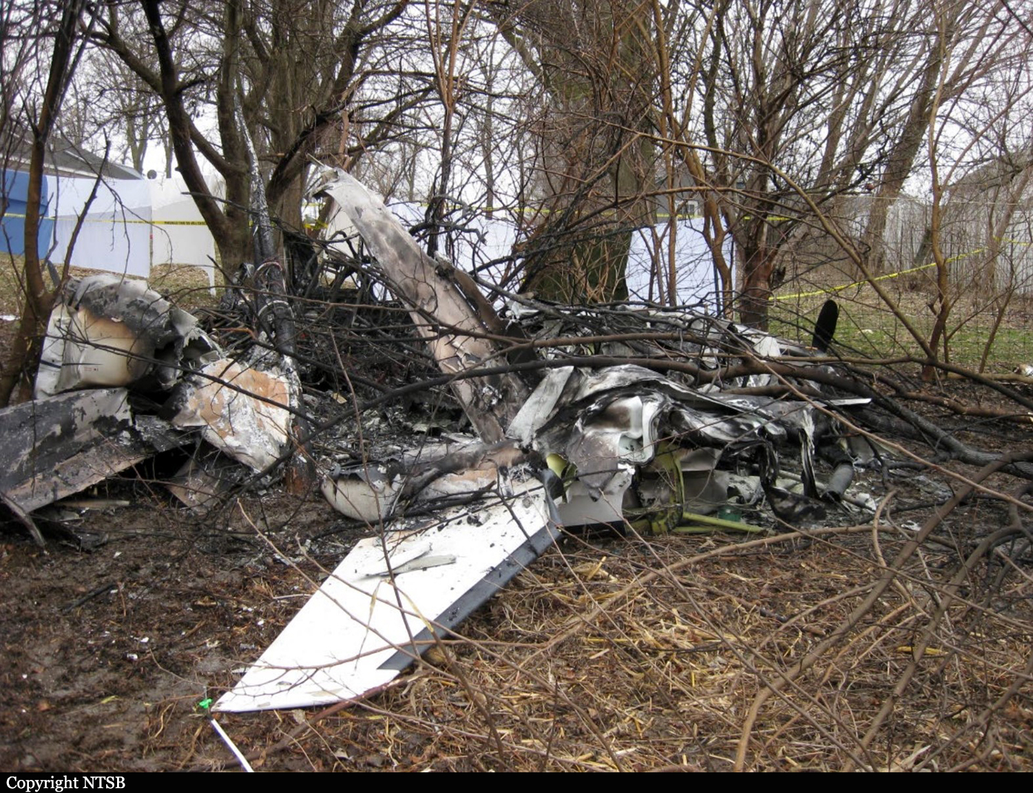
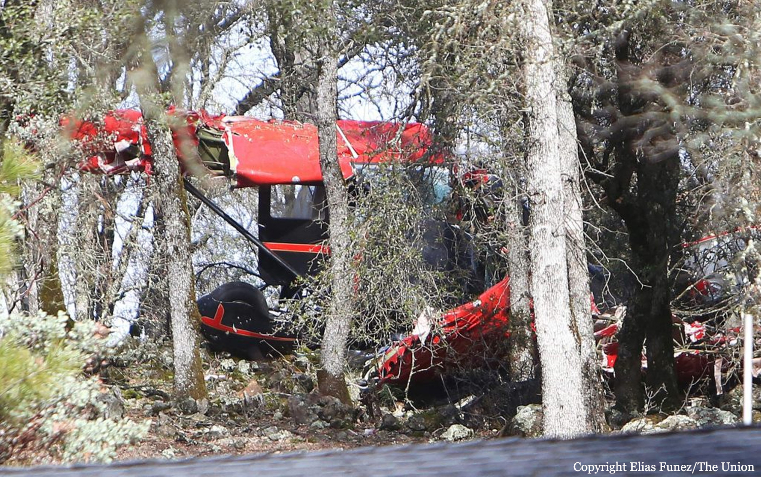
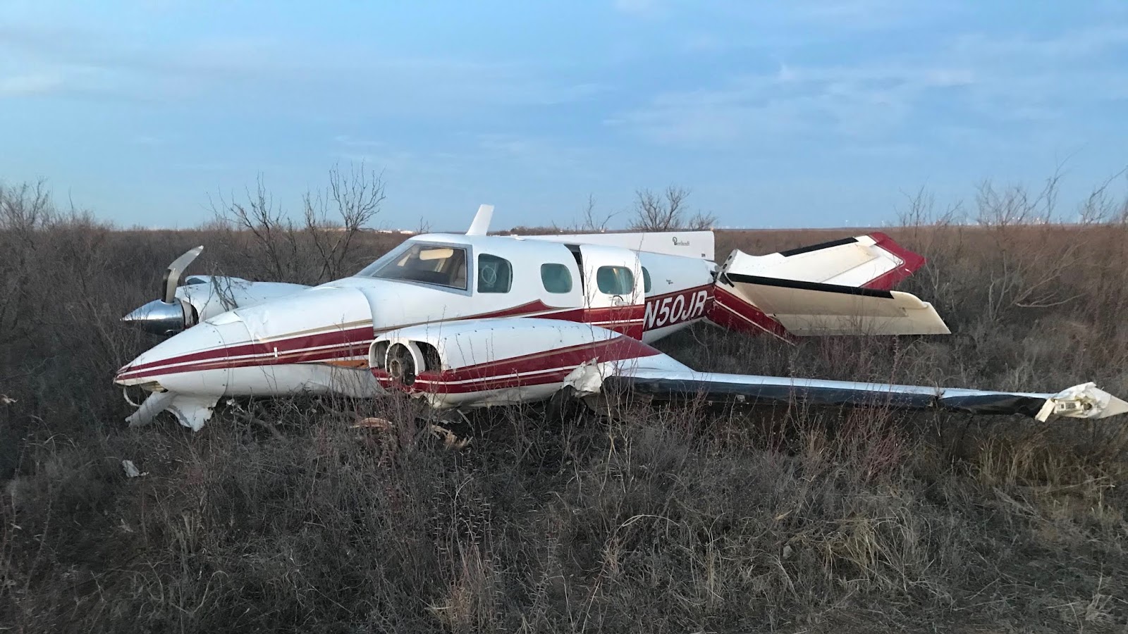
Crash of a Beechcraft B60 Duke in Big Spring

Date & Time: Jan 29, 2020 at 1710 LT
Type of aircraft:
Operator:
Registration:
N50JR
Flight Type:
Survivors:
Yes
Schedule:
Abilene – Midland
MSN:
P-303
YOM:
1974
Crew on board:
1
Crew fatalities:
Pax on board:
0
Pax fatalities:
Other fatalities:
Total fatalities:
0
Captain / Total flying hours:
25000
Captain / Total hours on type:
7.00
Circumstances:
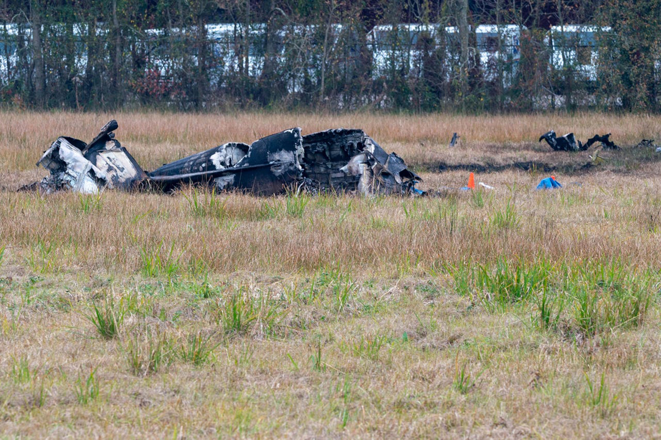
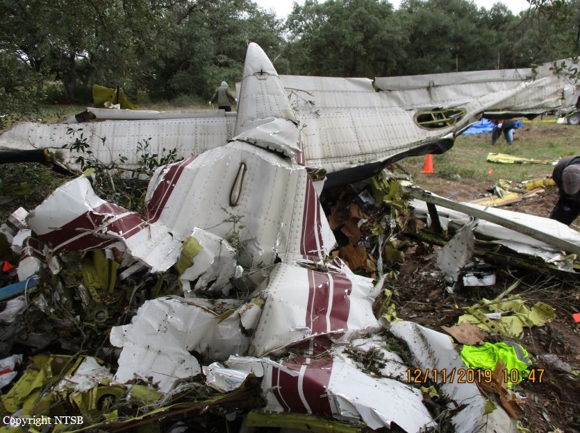
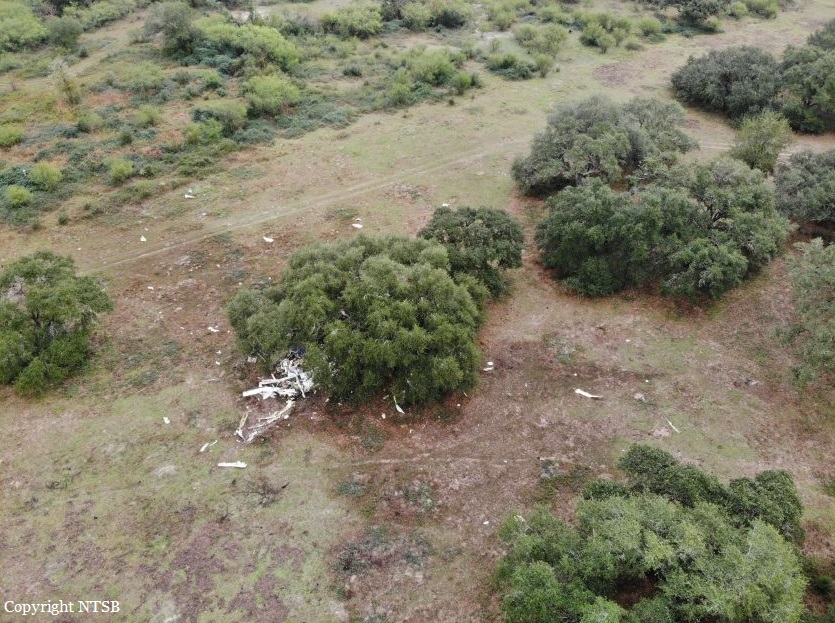
The pilot was conducting a cross-country flight at a cruise altitude of 10,500 ft mean sea level when the left engine lost all power. He secured the engine and elected to continue to his destination. Shortly thereafter, the right engine lost all power. After selecting an airport for a forced landing, he overflew the runway and entered the pattern. The pilot stated that on short final, after extending the landing gear, "the plane quit flying and the airspeed went to nothing." The airplane landed 200 to 300 yards short of the runway threshold, resulting in substantial damage to the wings and fuselage. During a postaccident examination, only tablespoons of fuel were drained from the left tank. Due to the position of the airplane, the right tank could not be drained; however, when power was applied to the airplane, both fuel quantity gauges indicated empty fuel tanks. Neither fuel tank was breached during the accident, and there was no discoloration present on either of the wings or engine nacelles to indicate a fuel leak; therefore, the loss of engine power is consistent with fuel exhaustion.
Probable cause:
A total loss of engine power in both engines due to fuel exhaustion, which resulted in a landing short of the runway.
Final Report:

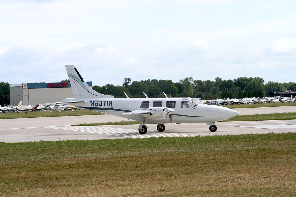
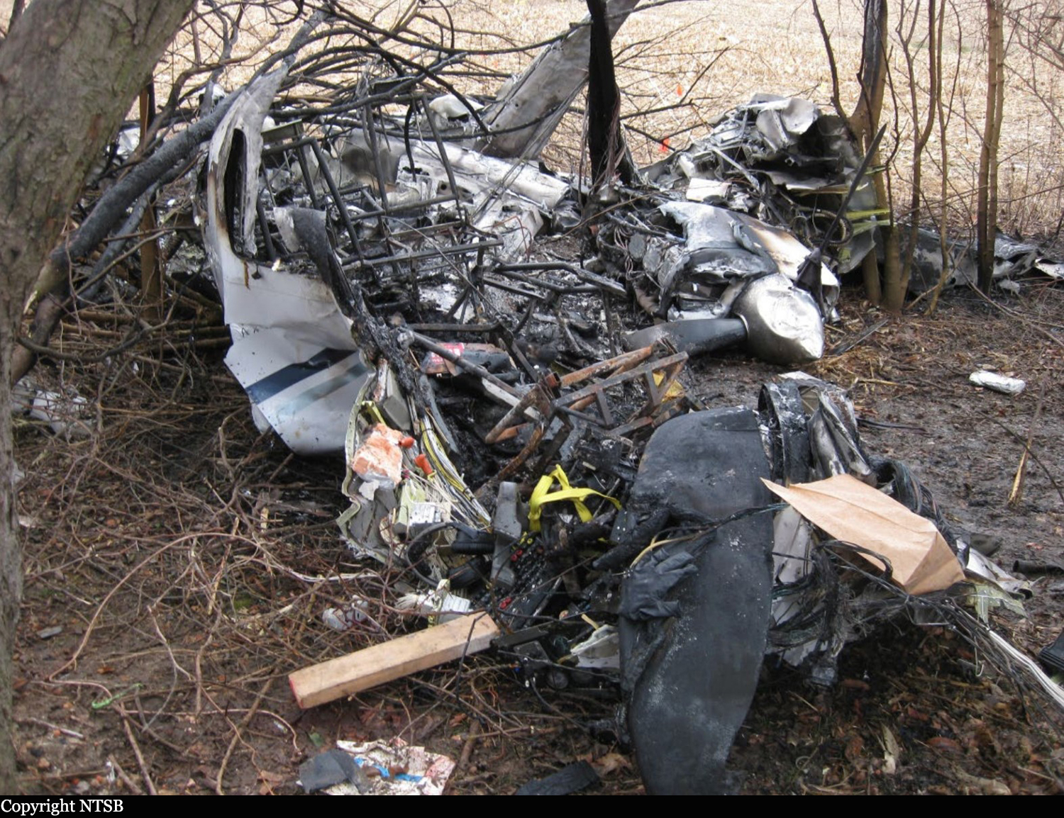
Crash of a Piper PA-61 Aerostar (Ted Smith 601P) in Springfield: 3 killed

Date & Time: Jan 28, 2020 at 1503 LT
Operator:
Registration:
N6071R
Flight Type:
Survivors:
No
Site:
Schedule:
Huntsville – Springfield
MSN:
61P-0686-7963324
YOM:
1979
Crew on board:
1
Crew fatalities:
Pax on board:
2
Pax fatalities:
Other fatalities:
Total fatalities:
3
Captain / Total flying hours:
5500
Aircraft flight hours:
3542
Circumstances:
The pilot was conducting an instrument landing system (ILS) approach in instrument meteorological conditions at the conclusion of a cross-country flight. The airplane had been cleared to land, but the tower controller canceled the landing clearance because the airplane appeared not to be established on the localizer as it approached the locator outer marker. The approach controller asked the pilot if he was having an issue with the airplane’s navigation indicator, and the pilot replied, “yup.” Rather than accept the controller’s suggestion to use approach surveillance radar (ASR) approach instead of the ILS approach, the pilot chose to fly the ILS approach again. The pilot was vectored again for the ILS approach, and the controller issued an approach clearance after he confirmed that the pilot was receiving localizer indications on the airplane’s navigation equipment. The airplane joined the localizer and proceeded toward the runway while descending. The pilot was instructed to contact the tower controller; shortly afterward, the airplane entered a left descending turn away from the localizer centerline. At that time, the airplane was about 3 nautical miles from the locator outer marker. The pilot then told the tower controller, “we’ve got a prob.” The tower controller told the pilot to climb and maintain 3,000 ft msl and to turn left to a heading of 180°. The pilot did not respond. During the final 5 seconds of recorded track data, the airplane’s descent rate increased rapidly from 1,500 to about 5,450 ft per minute. The airplane impacted terrain about 1 nm left of the localizer centerline in a left-wing-down and slightly nose down attitude at a groundspeed of about 90 knots. A postimpact fire ensued. Although the pilot was instrument rated, his recent instrument flight experience could not be determined with the available evidence for this investigation. Most of the fuselage, cockpit, and instrument panel was destroyed during the postimpact fire, but examination of the remaining wreckage revealed no anomalies. Acoustic analysis of audio sampled from doorbell security videos was consistent with the airplane's propellers rotating at a speed of 2,500 rpm before a sudden reduction in propeller speed to about 1,200 rpm about 2 seconds before impact. The airplane’s flightpath was consistent with the airplane’s avionics receiving a valid localizer signal during both instrument approaches. However, about 5 months before the accident, the pilot told the airplane’s current maintainer that the horizontal situation indicator (HSI) displayed erroneous heading indications. The maintainer reported that a replacement HSI was purchased and shipped directly to the pilot to be installed in the airplane; however, the available evidence for the investigation did not show whether the malfunctioning HSI was replaced before the flight. The HSI installed in the airplane at the time of the accident sustained significant thermal and fire damage, which prevented testing. During both ILS approaches, the pilot was cleared to maintain 3,000 ft mean sea level (msl) until the airplane was established on the localizer. During the second ILS approach, the airplane descended immediately, even though the airplane was below the lower limit of the glideslope. Although a descent to the glideslope intercept altitude (2,100 ft msl) would have been acceptable after joining the localizer, such a descent was not consistent with how the pilot flew the previous ILS approach, during which he maintained the assigned altitude of 3,000 ft msl until the airplane intercepted the glideslope. If the HSI provided erroneous heading information during the flight, it could have increased the pilot’s workload during the instrument approach and contributed to a breakdown in his instrument scan and his ability to recognize the airplane’s deviation left of course and descent below the glideslope; however, it is unknown if the pilot had replaced the HSI.
Probable cause:
The pilot’s failure to follow the instrument landing system (ILS) course guidance during the instrument approach.
Final Report:

Crash of a Stinson V-77 Reliant in Auburn: 2 killed

Date & Time: Jan 24, 2020 at 0956 LT
Type of aircraft:
Registration:
N50249
Flight Phase:
Flight Type:
Survivors:
Yes
Schedule:
Auburn - Auburn
MSN:
77-458
Crew on board:
1
Crew fatalities:
Pax on board:
2
Pax fatalities:
Other fatalities:
Total fatalities:
2
Captain / Total flying hours:
650
Circumstances:
The pilot departed on a local flight with two passengers. Several witnesses reported that they heard the airplane’s engine backfiring and sputtering and subsequently heard the engine quit. The surviving passenger, who was seated in the front right seat, stated that the engine lost power and there was nowhere to land. The airplane subsequently impacted heavily wooded terrain about 1 mile from the departure airport. Postaccident examination of the engine revealed that the No. 7 cylinder intake valve was stuck open. The No. 2 cylinder front spark plug was defective, and the Nos. 2- and 4-cylinders’ ignition wires were frayed, worn, and displayed arcing, which likely led to erratic operation or a lack of ignition in these two cylinders. The culmination of these issues most likely led to the engine running rough, backfiring, and subsequently losing total power. An annual inspection was accomplished on the airframe and engine about 2 months before the
accident. General maintenance practices and the inspection should have identified the anomalies that were found during the postaccident engine examination.
Probable cause:
A total loss of engine power due to a combination of mechanical engine anomalies. Contributing to the accident was inadequate maintenance that failed to identify the engine anomalies.
Final Report:

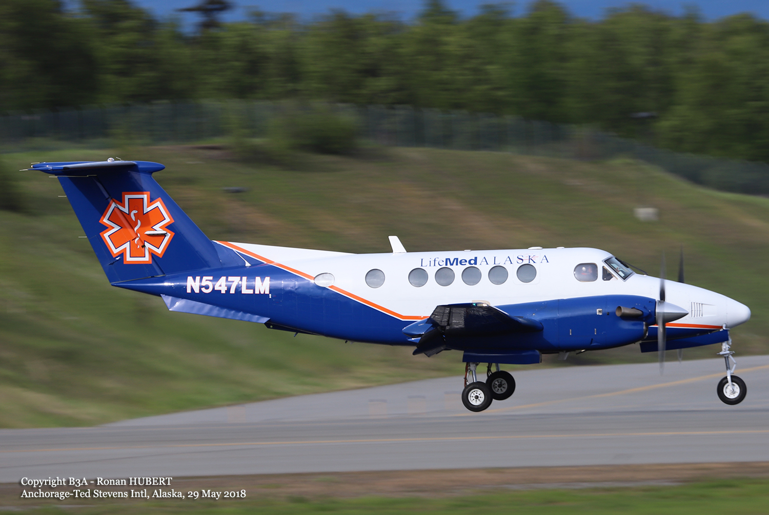
Crash of a Beechcraft B200 King Air off Dutch Harbor

Date & Time: Jan 16, 2020 at 0806 LT
Operator:
Registration:
N547LM
Flight Phase:
Flight Type:
Survivors:
Yes
Schedule:
Dutch Harbor - Adak
MSN:
BB-1642
YOM:
1998
Crew on board:
1
Crew fatalities:
Pax on board:
2
Pax fatalities:
Other fatalities:
Total fatalities:
0
Captain / Total flying hours:
6470
Captain / Total hours on type:
756.00
Aircraft flight hours:
7058
Circumstances:
According to the pilot, when the airplane’s airspeed reached about 90 knots during the takeoff roll, he applied back pressure to the control yoke to initiate the takeoff and noted a brief positive rate of climb followed by a sinking sensation. The airspeed rapidly decayed, and the stall warning horn sounded. To correct for the decaying airspeed, he lowered the nose then pulled back on the airplane’s control yoke and leveled the wings just before impacting the ocean. The pilot stated there were no pre accident mechanical malfunctions or anomalies that would have precluded normal operation. Wind about the time of the accident was recorded as 110º downwind of the airplane at 15 knots gusting to 28 knots. The passengers recalled that the pilot’s preflight briefing mentioned the downwind takeoff but included no discussion of the potential effect of the wind conditions on the takeoff. The airplane’s estimated gross weight at the time of the accident was about 769.6 pounds over its approved maximum gross weight, and the airplane’s estimated center of gravity was about 8.24 inches beyond the approved aft limit at its maximum gross weight. It is likely that the pilot’s decision to takeoff downwind and operate the airplane over the maximum gross weight with an aft center of gravity led to the aerodynamic stall during takeoff and loss of control. Downwind takeoffs result in higher groundspeeds and increase takeoff distance. While excessive aircraft weight increases the takeoff distance and stability, and an aft center of gravity decreases controllability. Several instances of the operator’s noncompliance with its operational procedures and risk mitigations were discovered during the investigation, including two overweight flights, inaccurate and missing information on aircraft flight logs, and the accident pilot’s failure to complete a flight risk assessment for the accident flight. The operator had a safety management system (SMS) in place at the time of the accident that required active monitoring of its systems and processes to ensure compliance with internal and external requirements. However, the discrepancies noted with several flights, including the accident flight, indicate that the operator’s SMS program was inadequate to actively monitor, identify, and mitigate hazards and deficiencies.
Probable cause:
The pilot’s improper decision to takeoff downwind and to load the airplane beyond its allowable gross weight and center of gravity limits, which resulted in an aerodynamic stall and loss of control. Contributing to the accident was the inadequacy of the operator’s safety management system to actively monitor, identify, and mitigate hazards and deficiencies.
Final Report:

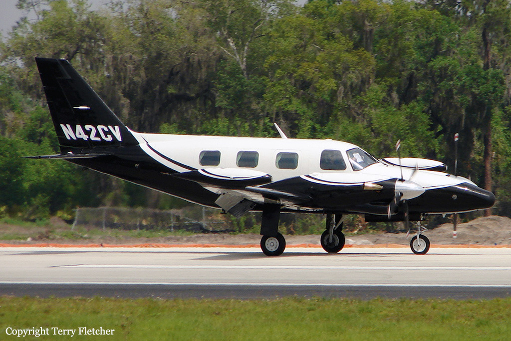
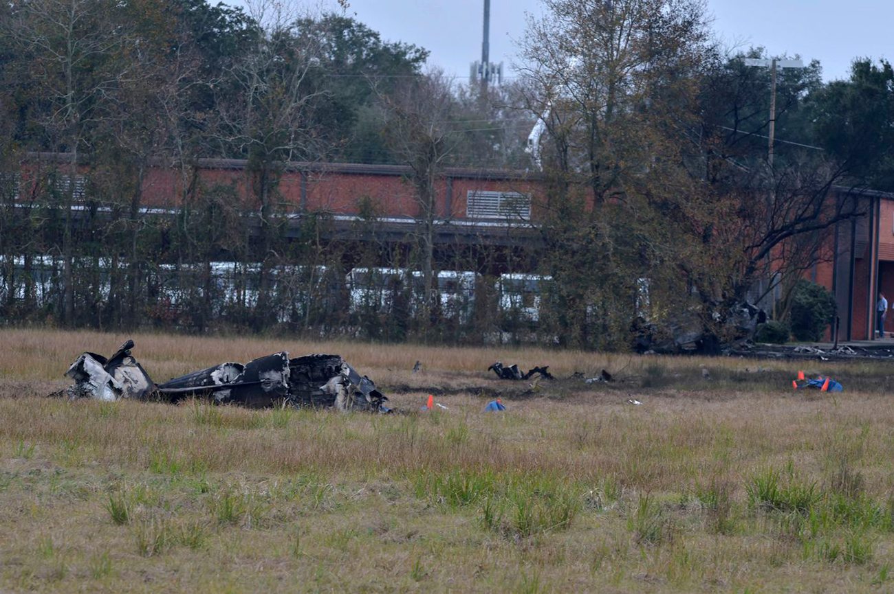
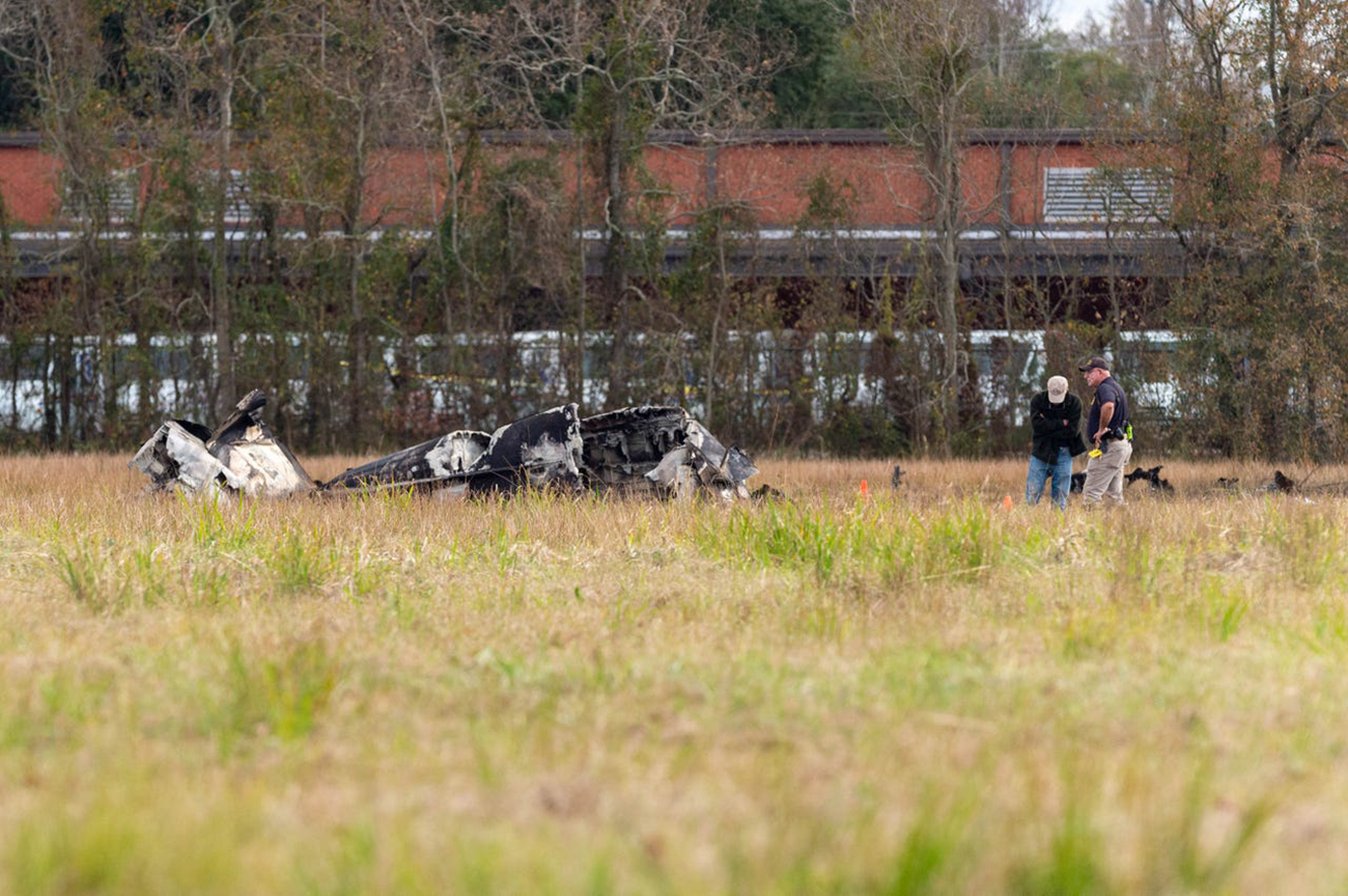
Crash of a Piper PA-31T Cheyenne II in Lafayette: 5 killed

Date & Time: Dec 28, 2019 at 0921 LT
Type of aircraft:
Registration:
N42CV
Flight Phase:
Survivors:
Yes
Site:
Schedule:
Lafayette - Atlanta
MSN:
31T-8020067
YOM:
1980
Crew on board:
1
Crew fatalities:
Pax on board:
5
Pax fatalities:
Other fatalities:
Total fatalities:
5
Captain / Total flying hours:
1531
Captain / Total hours on type:
730.00
Aircraft flight hours:
5954
Circumstances:
The personal flight departed from Lafayette Regional Airport/Paul Fournet Field (LFT), Lafayette, Louisiana, and entered the clouds when the airplane was at an altitude of about 200 ft above ground level. Before takeoff, the controller issued an instrument flight rules clearance to the pilot, instructing him to turn right onto a heading of 240° and climb to and maintain an altitude of 2,000 ft mean sea level (msl) after takeoff. Automatic dependent surveillance-broadcast (ADS-B) data for the accident flight started at 0920:05, and aircraft performance calculations showed that the airplane was climbing through an altitude of 150 ft msl at that time. The calculations also showed that the airplane then turned slightly to the right toward the assigned heading of 240° and climbed at a rate that varied between 1,000 and 2,400 ft per minute and an airspeed that increased from about 151 to 165 knots. At 0920:13, the airplane started rolling back toward wings level and, 7 seconds later, rolled through wings level and toward the left. At that time, the airplane was tracking 232° at an altitude of 474 ft and an airspeed of 165 knots. The airplane’s airspeed remained at 165 knots for about 10 seconds before it started increasing again, and the airplane continued to roll steadily to the left at an average roll rate of about 2° per second. The aircraft performance calculations further showed that, at 0920:40, the airplane reached a peak altitude of 925 ft msl. At that time, the airplane was tracking 200°, its bank angle was about 35° to the left, and its airspeed was about 169 knots. The airplane then started to descend while the left roll continued. At 0920:55, the airplane reached a peak airspeed of about 197 knots, which then started decreasing. At 0920:57, the airplane descended through 320 ft at a rate of descent of about 2,500 ft per minute and reached a bank angle of 75° to the left. At 0920:58, the controller issued a low altitude alert, stating that the pilot should “check [the airplane’s] altitude immediately” because the airplane appeared to be at an altitude of 300 ft msl. The pilot did not respond, and no mayday or emergency transmission was received from the airplane. The last ADS-B data point was recorded at 0920:59; aircraft performance calculations showed that, at that time, the airplane was descending through an altitude of 230 ft msl at a flightpath angle of about -7°, an airspeed of 176 knots, and a rate of descent of about 2,300 ft per minute. (The flightpath angle is in the vertical plane—that is, relative to the ground. The ground track, as discussed previously, is in the horizontal plane—that is, relative to north.) The airplane struck trees and power lines before striking the ground, traveled across a parking lot, and struck a car. The car rolled several times and came to rest inverted at the edge of the parking lot, and a postcrash fire ensued. The airplane continued to travel, shedding parts before coming to rest at the far end of an adjacent field. At the accident site, the surviving passenger told a local police officer that “the plane went straight up and then straight down.”
Probable cause:
The pilot’s loss of airplane control due to spatial disorientation during the initial climb in instrument meteorological conditions.
Final Report:

Ground accident of a Beechcraft 200 Super King Air in Fresno

Date & Time: Dec 18, 2019 at 0730 LT
Operator:
Registration:
N72MM
Flight Phase:
Flight Type:
Survivors:
Yes
MSN:
BB-497
YOM:
1979
Crew on board:
1
Crew fatalities:
Pax on board:
0
Pax fatalities:
Other fatalities:
Total fatalities:
0
Aircraft flight hours:
9838
Circumstances:
Parked at Fresno-Yosemite Airport, the twin engine airplane was stolen by a teenager aged 17. She lost control of the airplane that collided with a fence and a building. The only occupant was uninjured and arrested. The aircraft was damaged beyond repair.
Probable cause:
No investigations were conducted by the NTSB on this event.

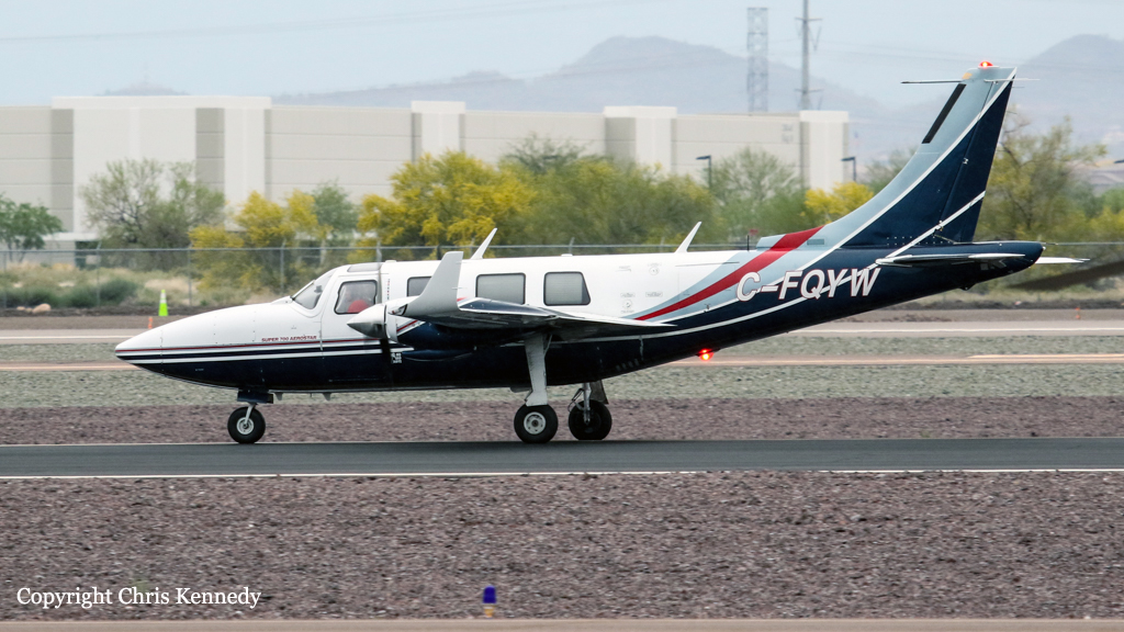
Crash of a Piper PA-60-602P Super 700 Aerostar on Gabriola Island: 3 killed

Date & Time: Dec 10, 2019 at 1805 LT
Operator:
Registration:
C-FQYW
Flight Type:
Survivors:
No
Schedule:
Cabo San Lucas – Chino – Bishop – Nanaimo
MSN:
60-8265-020
YOM:
1982
Country:
Crew on board:
1
Crew fatalities:
Pax on board:
2
Pax fatalities:
Other fatalities:
Total fatalities:
3
Captain / Total flying hours:
320
Aircraft flight hours:
5752
Circumstances:
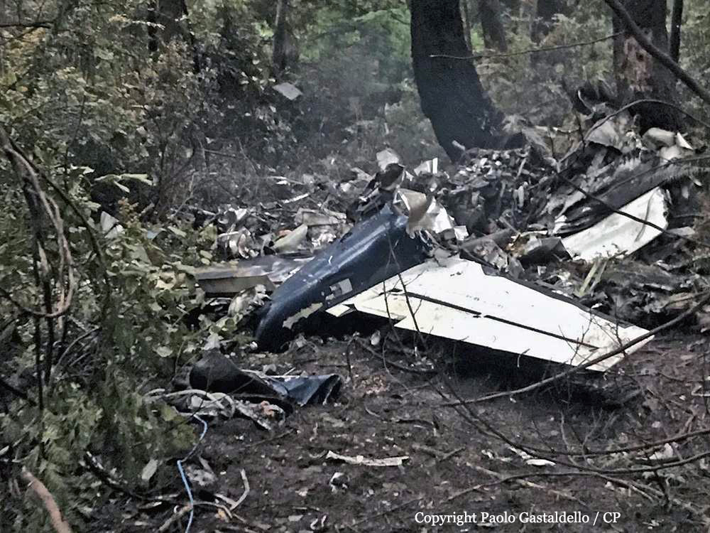
On 09 December 2019, a private Piper Aerostar PA-60-602P aircraft (registration C-FQYW, serial number 60-8265020), departed Cabo San Lucas International Airport (MMSL), Baja California Sur, Mexico, with 3 people on board, for a 2-day trip to Nanaimo Airport (CYCD), British Columbia (BC). As planned the aircraft stopped for an overnight rest at Chino Airport (KCNO), California, U.S. At 1142, on 10 December 2019, the aircraft departed KCNO on a visual flight rules (VFR) flight plan to Bishop Airport (KBIH), California, U.S., for a planned fuel stop. The aircraft departed KBIH at approximately 1425 on an instrument flight rules (IFR) flight plan to CYCD. On 10 December 2019, night started at 1654. At 1741, the Vancouver area control centre air traffic controller advised the pilot that an aerodrome special meteorological report (SPECI) had been issued for CYCD at 1731. The SPECI reported visibility as 2 ½ statute miles (SM) in light drizzle and mist, with an overcast ceiling of 400 feet above ground level (AGL). The pilot informed the controller that he would be conducting an instrument landing system (ILS) approach for Runway 16. At 1749, when the aircraft was approximately 32 nautical miles (NM) south of CYCD, the pilot contacted the controller to inquire about the weather conditions at Victoria International Airport (CYYJ), BC. The controller informed the pilot that a SPECI was issued for CYYJ at 1709 and it reported the visibility as 5 SM in mist, a broken ceiling at 600 feet AGL, and an overcast layer at 1200 feet AGL. The controller provided the occurrence flight with pilot observations from another aircraft that had landed at CYCD approximately 15 minutes before. That crew had reported being able to see the Runway 16 approach lights at minimums, i.e., at 373 feet AGL. Between 1753 and 1802, the controller provided vectors to the pilot in order to intercept the ILS localizer. At 1803, the controller observed that the aircraft had not intercepted the localizer for Runway 16. The aircraft had continued to the southwest, past the localizer, at an altitude of 2100 feet above sea level (ASL) and a ground speed of 140 knots. The controller queried the pilot to confirm that he was still planning to intercept the ILS for Runway 16. The pilot confirmed that he would be intercepting the ILS as planned. The aircraft made a heading correction and momentarily lined up with the localizer before beginning a turn to the west. At 1804:03, the pilot requested vectors from the controller and informed him that he “just had a fail.” The controller responded with instructions to “turn left heading zero nine zero, tight left turn.” The pilot asked the controller to repeat the heading. The controller responded with instructions to “…turn right heading three six zero.” The pilot acknowledged the heading; however, the aircraft continued turning right beyond the assigned heading while climbing to 2500 feet ASL and slowing to a ground speed of 80 knots. The aircraft then began to descend, picking up speed as it was losing altitude. At 1804:33, the aircraft descended to 1800 feet ASL and reached a ground speed of 160 knots. At 1804:40, the pilot informed the air traffic controller that the aircraft had lost its attitude indicator.Footnote6 At the same time, the aircraft was climbing into a 2nd right turn. At 1804:44, the air traffic controller asked the pilot what he needed from him; the pilot replied he needed a heading. The controller provided the pilot with a heading of three six zero. At 1804:47, the aircraft reached an altitude of 2700 feet ASL and a ground speed of 60 knots. The aircraft continued its right turn and began to lose altitude. The controller instructed the pilot to gain altitude if he was able to; however, the pilot did not acknowledge the instruction. The last encoded radar return for the aircraft was at 1805:26, when the aircraft was at 300 feet ASL and travelling at a ground speed of 120 knotsControl of the aircraft was lost. The aircraft collided with a power pole and trees in a wooded park area on Gabriola Island, BC, and then impacted the ground. The aircraft broke into pieces and caught fire. The 3 occupants on board received fatal injuries. As a result of being damaged in the accident, the emergency locator transmitter (Artex ME406, serial number 188-00293) did not activate.
Probable cause:
The occurrence aircraft was equipped with a BendixKing KI 825 electronic horizontal situation indicator (HSI) that was interfaced to the flight control system and GPS (global positioning system) Garmin GNS530W/430W. The HSI also supplies the autopilot system with heading information. The investigation determined that the HSI had failed briefly during operation on 22 November 2019 and a 2nd time, 3 days later, on 26 November 2019. The KI 825 HSI is electrically driven and therefore is either on and working, or off and dark with no display. The aircraft owner was in contact with an aircraft maintenance organization located at Boundary Bay Airport (CZBB), BC, and an appointment to bring the occurrence aircraft in for troubleshooting of the 2 brief HSI malfunctions had been made for 11 December 2019, i.e., the day after the accident. In total, 13 flights had been conducted after the 1st failure of the HSI. There were no journey log entries for defects with the HSI or evidence of maintenance completed. RegulationsFootnote9 require that defects that become apparent during flight operations be entered in the aircraft journey logbook, and advisory guidance in the regulatory standardsFootnote10 states that all equipment required for a particular flight or type of operation, such as the HSI in this case, be functioning correctly before flight. The HSI was destroyed in the accident and the investigation was unable to determine if it was operational on impact. Similarly, it could not be determined if the HSI was supplying the autopilot with heading information, or if the autopilot was engaged during the approach.
Final Report:

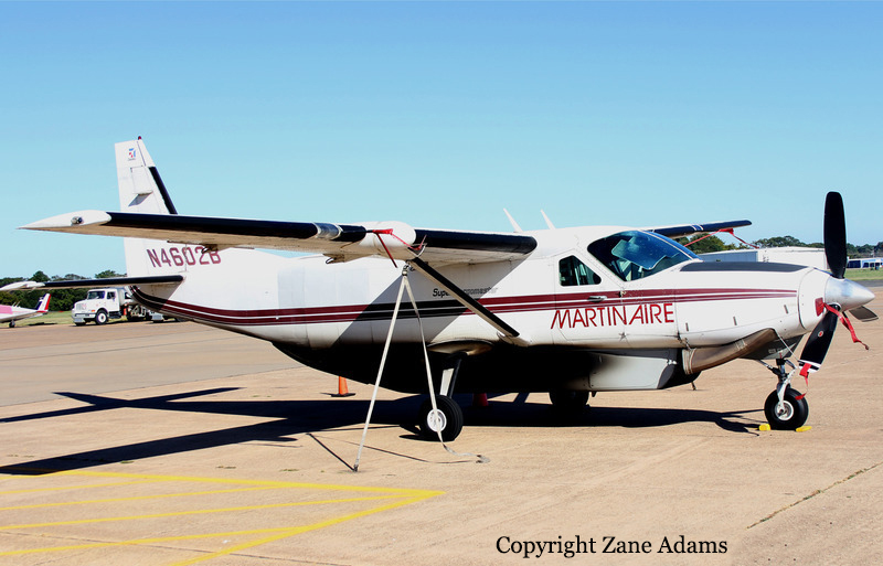
Crash of a Cessna 208B Grand Caravan in Victoria: 1 killed

Date & Time: Dec 9, 2019 at 2017 LT
Type of aircraft:
Operator:
Registration:
N4602B
Flight Phase:
Flight Type:
Survivors:
No
Schedule:
Victoria – Houston
MSN:
208B-0140
YOM:
1988
Flight number:
MRA679
Location:
Crew on board:
1
Crew fatalities:
Pax on board:
0
Pax fatalities:
Other fatalities:
Total fatalities:
1
Captain / Total flying hours:
12680
Captain / Total hours on type:
1310.00
Aircraft flight hours:
17284
Circumstances:
The airline transport pilot departed on a night cargo flight into conditions that included an overcast cloud ceiling and “hazy” visibility, as reported by another pilot. About one minute after takeoff, the pilot made a series of course changes and large altitude and airspeed deviations. Following several queries from the air traffic controller concerning the airplane’s erratic flight path, the pilot responded that he had “some instrument problems.” The pilot attempted to return to land at the departure airport, but the airplane impacted terrain after entering a near-vertical dive. The airplane was one of two in the operator’s fleet equipped with an inverter system that electrically powered the pilot’s (left side) flight instruments. Examination of the annunciator panel lighting filaments revealed that the inverter system was not powered when the airplane impacted the ground. Without electrical power from an inverter, the pilot’s side attitude indicator and horizontal situation indicator (HSI) would have been inoperative and warning flags would have been displayed over the respective instruments. The pilot had a history of poor procedural knowledge and weak flying skills. It is possible that he either failed to turn on an inverter during ground operations and did not respond to the accompanying warning flags, or he did not switch to the other inverter in the event that an inverter failed inflight. Due to impact damage, the operational status of the two inverters installed in the airplane could not be confirmed. However, the vacuum-powered flight instruments on the copilot’s (right side) were operational, and the pilot could have referenced these instruments to maintain orientation. Based on the available information, the pilot likely lost control of the airplane after experiencing spatial disorientation. The night marginal visual flight rules conditions and instrumentation problems would have been conducive to the development of spatial disorientation, and the airplane’s extensive fragmentation indicative of a high-energy impact was consistent with the known effects of spatial disorientation. Ethanol identified during toxicology testing may have come from postmortem production and based on the low levels recorded, was unlikely to have contributed to this accident. Morphine identified in the pilot’s liver could not be used to extrapolate to antemortem blood levels; therefore, whether or to what extent the pilot’s use of morphine contributed to the accident could not be determined.
Probable cause:
The pilot’s loss of control due to spatial disorientation. Contributing to the accident were the inoperative attitude indicator and horizontal situation indicator on the pilot’s side of the cockpit, and the pilot’s failure to reference the flight instruments that were operative.
Final Report:

Crash of a Pilatus PC-12/47E in Chamberlain: 9 killed

Date & Time: Nov 30, 2019 at 1233 LT
Type of aircraft:
Operator:
Registration:
N56KJ
Flight Phase:
Survivors:
Yes
Schedule:
Chamberlain – Idaho Falls
MSN:
1431
YOM:
2013
Crew on board:
1
Crew fatalities:
Pax on board:
11
Pax fatalities:
Other fatalities:
Total fatalities:
9
Captain / Total flying hours:
2314
Captain / Total hours on type:
1274.00
Aircraft flight hours:
1725
Circumstances:
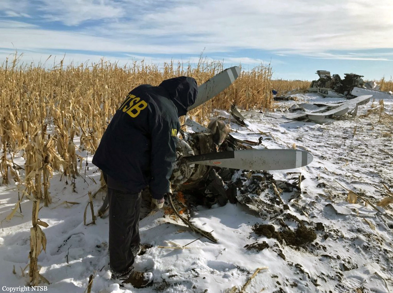
The pilot and passengers flew in the day before the accident and the airplane remained parked outside on the airport ramp overnight. Light to moderate snow and freezing drizzle persisted during the 12 to 24-hour period preceding the accident. In addition, low instrument meteorological conditions existed at the time of the accident takeoff. Before the flight, the pilot removed snow and ice from the airplane wings. However, the horizontal stabilizer was not accessible to the pilot and was not cleared of accumulated snow. In addition, the airplane was loaded over the maximum certificated gross weight and beyond the aft center-of-gravity limit. A total of 12 occupants were on board the airplane, though only 10 seats were available. None of the occupants qualified as lap children under regulations. The takeoff rotation was initiated about 88 kts which was about 4 kts slower than specified with the airplane configured for icing conditions. After takeoff, the airplane entered a left turn. Airspeed varied between 89 and 97 kts during the initial climb; however, it decayed to about 80 kts as the airplane altitude and bank angle peaked. The airplane ultimately reached a left bank angle of 64° at the peak altitude of about 380 ft above ground level. The airplane then entered a descent that continued until impact. The stall warning and stick shaker activated about 1 second after liftoff. The stick pusher became active about 15 seconds after liftoff. All three continued intermittently for the duration of the flight. A witness located about 1/2-mile northwest of the airport reported hearing the airplane takeoff. It was cloudy and snowing at the time. He was not able to see the airplane but noted that it entered a left turn based on the sound. He heard the airplane for about 4 or 5 seconds and the engine seemed to be “running good” until the sound stopped. The airplane impacted a dormant corn field about 3/4-mile west of the airport. A postaccident airframe examination did not reveal any anomalies consistent with a preimpact failure or malfunction. On board recorder data indicated that the engine was operating normally at the time of the accident. An airplane performance analysis indicated that the accumulated snow and ice on the empennage did not significantly degrade the airplane performance after takeoff. However, the effect of the snow and ice on the airplane center-of-gravity and the pitch (elevator) control forces could not be determined. Simulations indicated that the pitch oscillations recorded on the flight could be duplicated with control inputs, and that the flight control authority available to the pilot would have been sufficient to maintain control until the airplane entered an aerodynamic stall about 22 seconds after lifting off (the maximum bank angle of 64° occurred after the critical angle-of-attack was exceeded). In addition, similar but less extreme pitch oscillations recorded on the previous flight (during which the airplane was not contaminated with snow but was loaded to a similar center-of-gravity position) suggest that the pitch oscillations on both flights were the result of the improper loading and not the effects of accumulated snow and ice. Flight recorder data revealed that the accident pilot tended to rotate more rapidly and to a higher pitch angle during takeoff than a second pilot who flew the airplane regularly. Piloted simulations suggested that the accident pilot’s rotation technique, which involved a relatively abrupt and heavy pull on the control column, when combined with the extreme aft CG, heavy weight, and early rotation on the accident takeoff, contributed to the airplane’s high angle-of attack immediately after rotation, the triggering of the stick shaker and stick pusher, and the pilot’s pitch control difficulties after liftoff. The resulting pitch oscillations eventually resulted in a deep penetration into the aerodynamic stall region and subsequent loss of control. Although conditions were conducive to the development of spatial disorientation, the circumstances of this accident are more consistent with the pilot’s efforts to respond to the activation of the airplane stall protection system upon takeoff. These efforts were hindered by the heightened airplane pitch sensitivity resulting from the aft-CG condition. As a result, spatial disorientation is not considered to be a factor in this accident.
Probable cause:
The pilot’s loss of control shortly after takeoff, which resulted in an inadvertent, low-altitude aerodynamic stall. Contributing to the accident was the pilot’s improper loading of the airplane, which resulted in reduced static longitudinal stability and his decision to depart into low instrument meteorological conditions.
Final Report:

Crash of a Piper PA-31-350 Navajo Chieftain near Cooper Landing: 3 killed

Date & Time: Nov 29, 2019 at 1911 LT
Operator:
Registration:
N4087G
Flight Phase:
Flight Type:
Survivors:
No
Site:
Schedule:
Anchorage – Seward
MSN:
31-8152127
YOM:
1981
Flight number:
SVX36
Crew on board:
1
Crew fatalities:
Pax on board:
2
Pax fatalities:
Other fatalities:
Total fatalities:
3
Captain / Total flying hours:
35000
Captain / Total hours on type:
1200.00
Aircraft flight hours:
5502
Circumstances:
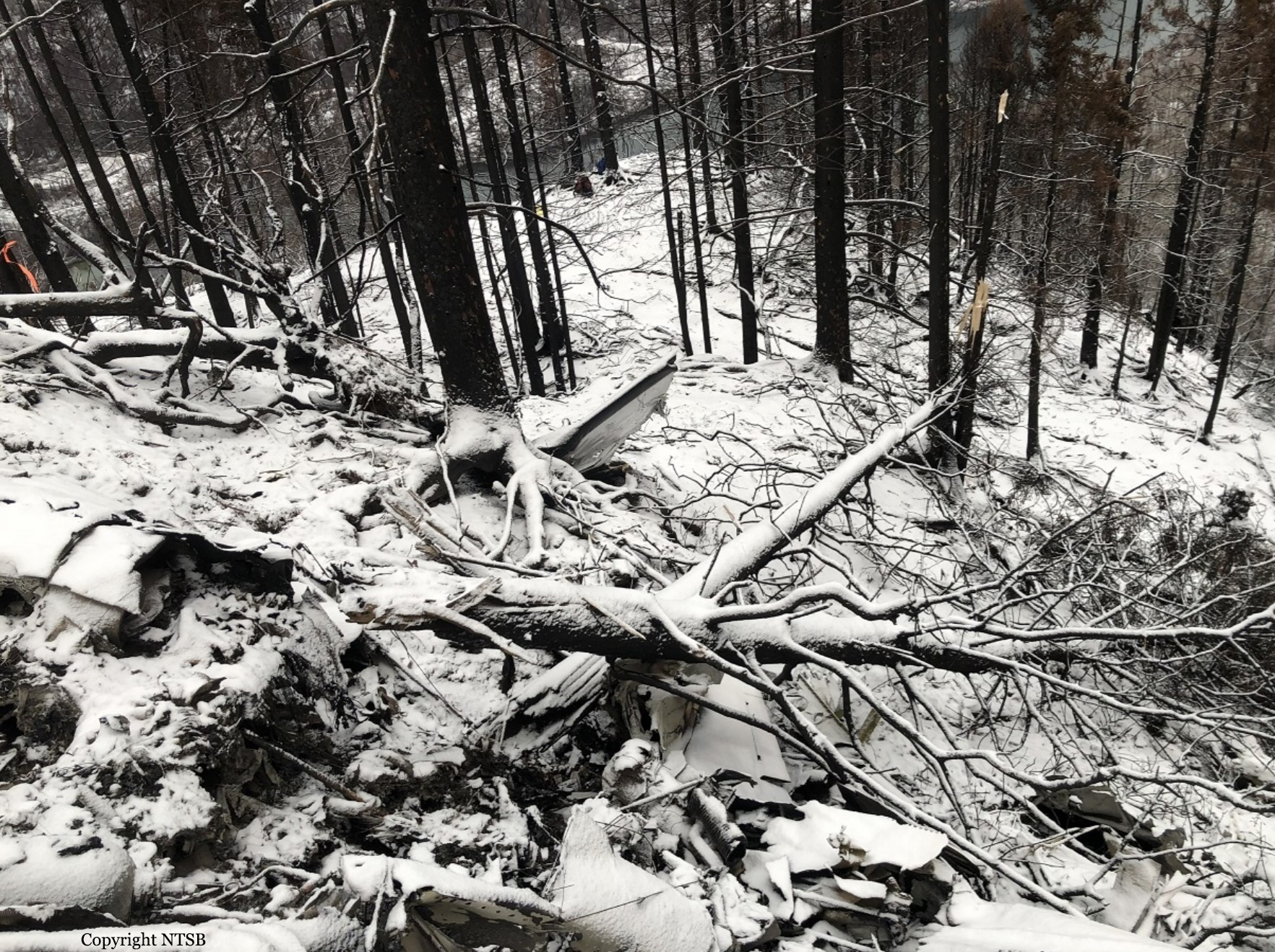
On November 29, 2019, about 1911 Alaska standard time, a Piper PA-31-350 airplane, N4087G, was destroyed by impact and postcrash fire when it collided with mountainous terrain about 15 miles west of Cooper Landing, Alaska. The three occupants; the airline transport pilot, a flight nurse, and the flight paramedic were fatally injured. The airplane was operated by Fly 4 You Inc., doing business as Security Aviation, as a Title 14 Code of Federal Regulations Part 135 visual flight rules air ambulance flight. Dark night visual meteorological conditions existed at the departure and destination locations and company flight following procedures were in effect. The flight departed Ted Stevens International Airport (PANC), Anchorage, Alaska, about 1848, destined for Seward Airport (PAWD), Seward, Alaska. Dispatch records indicated that, on November 29, Providence Seward Medical Center emergency clinic personnel contacted multiple air ambulance companies with a "weather check" for possible air ambulance transportation of a patient from Seward to Anchorage. The first company contacted was Guardian Flight, who declined the flight at 1624 due to limited daylight hours. The second company, LifeMed Alaska, declined the flight at 1637 due to weather. The third and final company contacted for the flight was Medevac Alaska. Their dispatch officer was not notified of the previous declined flight requests and forwarded the request to Security Aviation, who is their sole air charter provider. At 1731 Security Aviation accepted the flight, and Medevac Alaska flight SVX36 was staffed with a nurse and paramedic. A preliminary review of archived Federal Aviation Administration (FAA) radar and automatic dependent surveillance (ADS-B) data revealed that the accident airplane departed PANC and flew south about 3,000 ft mean sea level (msl) toward the Sterling Highway. The airplane was then observed descending to 2,200 ft msl while flying a right racetrack pattern before flying into the valley toward Cooper Landing. The last data point indicated that at 1911:14 the airplane was over the west end of Jean Lake at 2,100 ft msl, on a 127° course, and 122 kts groundspeed. Ground witnesses who were in vehicles on the Sterling Highway near milepost 63, reported that they saw the lights of the airplane flying over the highway that night. One witness stated that he saw the airplane west of the mountains turn in a circle as it descended and then entered the valley. He observed the wings rocking back and forth and while he was looking elsewhere, he heard an explosion and observed a large fire on the mountainside. Another witness reported seeing the airplane flying low and explode when it impacted the mountain. Witnesses to the fire called 911 and observed the wreckage high on the mountainside burning for a long time after impact. The airplane was reported overdue by the chief pilot for Security Aviation and the FAA issued an alert notice (ALNOT) at 2031. The Alaska Rescue Coordination Center dispatched an MH-60 helicopter to the last known position and located the burning wreckage that was inaccessible due to high winds in the area. On December 1, 2019, the Alaska State Troopers coordinated a mountain recovery mission with Alaska Mountain Rescue Group. The wreckage was observed on the mountain at an elevation of about 1,425 ft msl in an area of steep, heavily tree-covered terrain near the southeast end of Jean Lake in the Kenai National Wildlife Refuge. The airplane was highly fragmented and burned, however all major airplane components were accounted for. Multiple large trees around the wreckage were fractured and indicated an easterly heading prior to the initial impact.