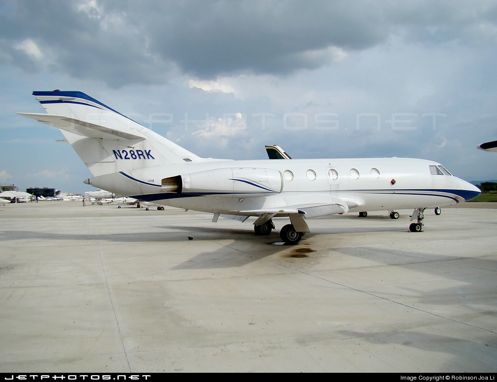
Crash of a Dassault Falcon 20D in Matthew Town: 2 killed

Date & Time: Dec 17, 2009 at 1930 LT
Type of aircraft:
Operator:
Registration:
N28RK
Flight Type:
Survivors:
No
Schedule:
Oranjestad – La Isabela – Fort Lauderdale
MSN:
206
YOM:
1969
Country:
Crew on board:
2
Crew fatalities:
Pax on board:
0
Pax fatalities:
Other fatalities:
Total fatalities:
2
Captain / Total flying hours:
26525
Copilot / Total flying hours:
4800
Circumstances:
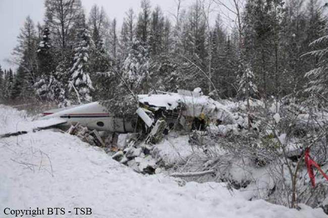
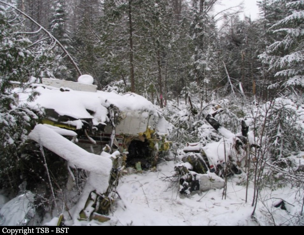
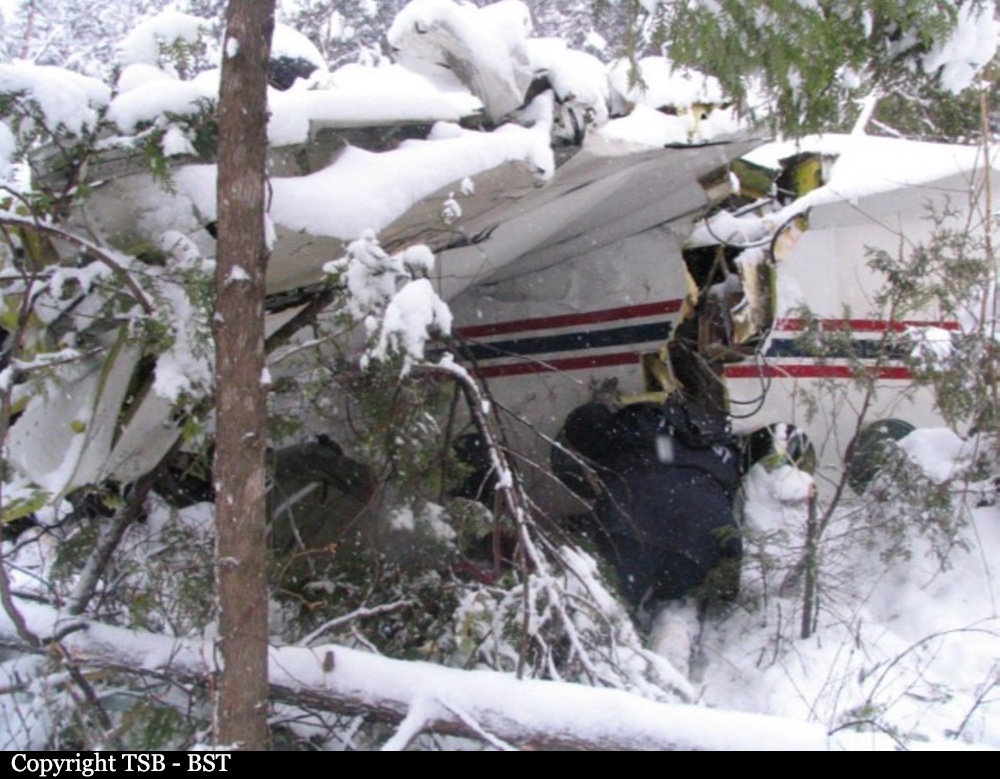
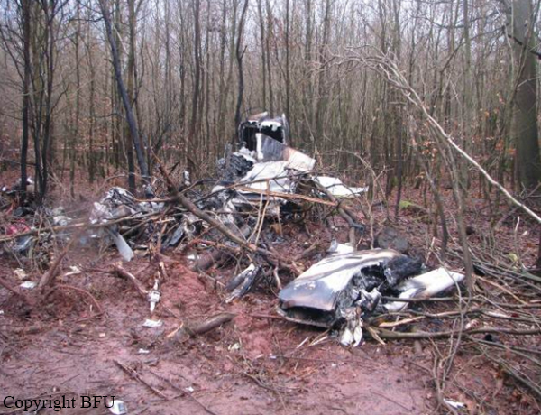
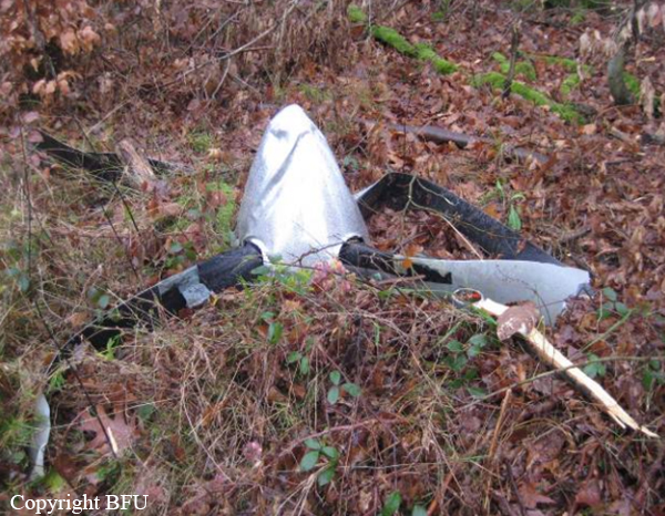
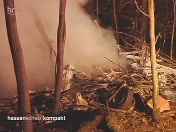
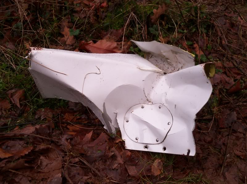
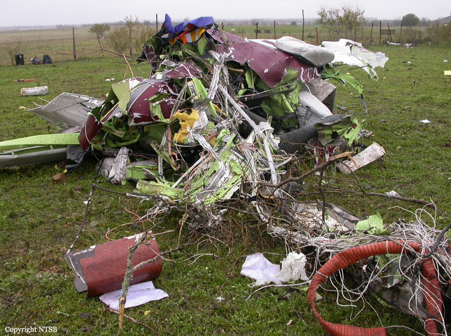
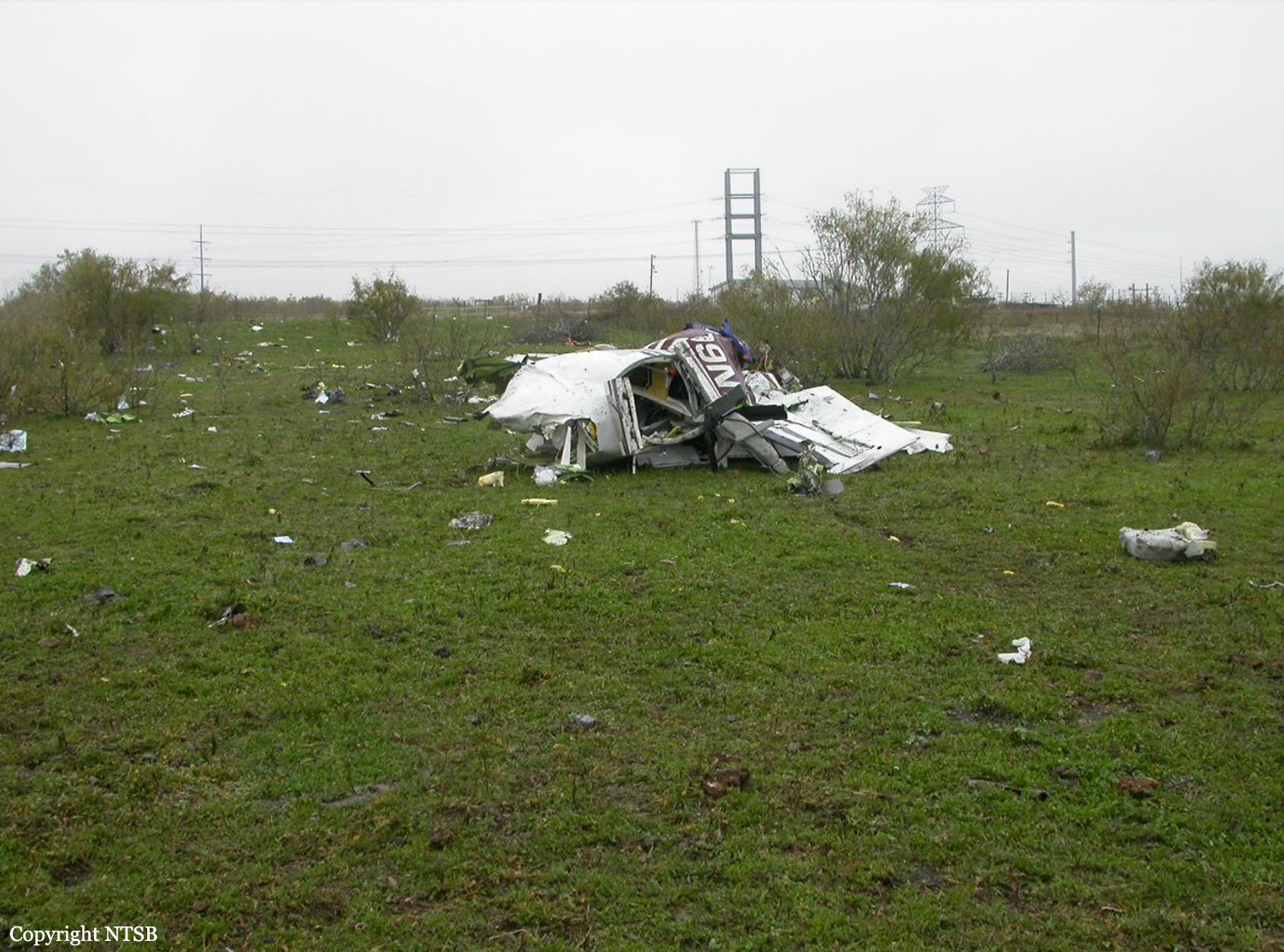
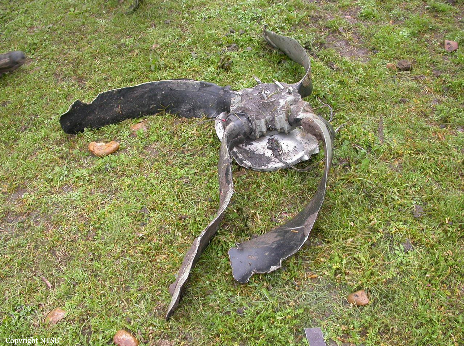
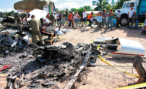
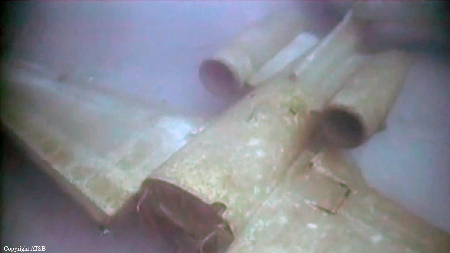
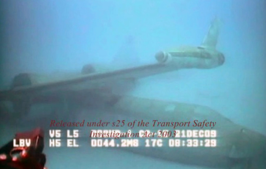
On December 17, 2009 at approximately 7:30 pm local (2330UTC), N28RK a Dassault Sud, Falcon Fan Jet, Mystere 20, Series D aircraft which departed Joaquin Balaguer Int’l Airport (MDJB) in the Dominican Republic, for Ft Lauderdale Executive Airport, (FXE) Ft Lauderdale, Florida, USA, crashed in a remote area of Matthew Town, Great Inagua, Bahamas. The accident occurred approximately 11.5 miles due east of Great Inagua International Airport at coordinates N 20˚ 58’ 30” latitude and W 073˚ 40’ 00.7” longitude. The aircraft made contact with the terrain on a heading of approximately 105 degrees magnetic. The accident occurred in area that was not accessible by land and the investigation team had to be airlifted by helicopter to the site. Witnesses on the island of Great Inagua reported hearing a loud bang that rattled doors and windows of their homes, but they did not report seeing the aircraft fall from the sky. The aircraft was under the command of Captain Harold Roy Mangels and First Office Freddy Castro. The aircraft reportedly departed Aruba, in the Netherland Antilles and made a fuel stop at Dr. Joaquin Balaguer Int’l Airport, Santo Domingo in the Dominican Republic. The final destination filed by the crew was Ft. Lauderdale Executive Airport, Ft Lauderdale Florida. The accident occurred approximately 6 mile off the filed flight path. ATC records and instructions were for the aircraft N28RK to maintain 28,000 ft (FL280). The aircraft transponder was reported as inoperative. It begun a rapid descent, with no report of an emergency declared or mayday call out. Investigation of the crash site indicates the airplane made contact with the terrain at a high rate of speed and approximately a 45 degree angle. The aircraft was destroyed on impact. The crew of a United States Coast Guard helicopter was on a training mission in the Great Inagua area at the time of the accident. They reported hearing a loud bang and noticed a huge explosion and fireball emanating from the ground in an area close to their location. The crew of the US Coast Guard helicopter reported that they did not see any in-flight fire prior to the fireball that they saw. The post impact fire engulfed approximately five (5) acres of trees and brush in the National Wildlife Refuge at Great Inagua. The coast guard helicopter crew stated that they discontinued their training mission and went to the site to investigate. Upon arrival at the site the crew reported that they lowered rescue personnel to the ground to investigate and search for survivors, but, due to the heat and extent of the fire on the ground, they had to discontinue the search. They reported the accident to authorities at Great Inagua. This information was further passed along to the National Transportation Safety Board who alerted the accident investigation unit of the Bahamas Civil Aviation Department. Night time conditions prevailed at the time of the accident. The crew of the aircraft received fatal injuries. A search of the area discovered no distinguishable human remains. Approximately less than 1% of what is believed to be possible human flesh / internal body parts were recovered. In addition clothing (piece of a pant with belt buckle fastened) was recovered, which possibly may have been worn by a member of the crew at the time of the accident. All recovered remains and clothing retrieved were gathered by officers of the Royal Bahamas Police Force that accompanied the investigation team and sent to the Forensic Science Laboratory at the Royal Bahamas Police Force, Nassau Bahamas for DNA analysis and possible identification. The aircraft broke into many pieces after contact with the terrain. Debris was spread over a large area of rough terrain. What remained of the aircraft post impact was either not found or possibly further destroyed by the post impact fire. The “four corners” of the airplane were confirmed in the area downstream of where the initial ground impact occurred. However, engine cowling parts were found prior to the point of initial ground impact. This may suggest an aircraft over-speed condition prior to ground impact. Less than 10% of the aircraft was recovered. An explosion occurred when N28RK made contact with the terrain. A post impact fire ensued. Approximately 5 acres of the national park was destroyed by the fire. Parts of the aircraft including personal effect, aircraft parts and furnishing, seat and seat cushions were also destroyed in the post impact fire.
Probable cause:
The probable cause of this accident has been determined as loss of control. Insufficient wreckage of the aircraft were recovered to make a conclusive determination as to the cause of the accident.
Final Report:

Crash of a Socata TBM-850 in Truckee

Date & Time: Dec 13, 2009 at 1738 LT
Type of aircraft:
Registration:
N850MT
Flight Type:
Survivors:
Yes
Schedule:
San Carlos – Truckee
MSN:
489
YOM:
2008
Crew on board:
1
Crew fatalities:
Pax on board:
1
Pax fatalities:
Other fatalities:
Total fatalities:
0
Captain / Total flying hours:
1738
Captain / Total hours on type:
1098.00
Aircraft flight hours:
196
Circumstances:
During the flight, the instrument-rated private pilot was monitoring the weather at his intended destination. He noted the weather and runway conditions and decided to conduct a global-positioning-system instrument approach to a known closed runway with the intention of circling to a different runway. As the airplane neared the missed approach point, the pilot established visual contact with the airport's runway environment and canceled his instrument flight rules clearance. As he entered the left downwind leg of the traffic pattern for his intended runway, the pilot noticed that the first part of the runway was covered in fog and that the visibility was 0.75 of a mile with light snow. With at least 5,000 feet of clear runway, he opted to land just beyond the fog. Prior to touchdown, the pilot concluded that there was not enough runway length left to make a landing and performed a go-around by applying power, pitching up, and retracting the landing gear. During the go-around, the pilot focused outside the airplane cockpit but had no horizon reference in the dark night conditions. He heard the stall warning and realized that the aircraft was not climbing. The pilot pitched the nose down and observed only snow and trees ahead. Not being able to climb over the trees, the airplane subsequently impacted trees and terrain, coming to rest upright in a wooded, snow-covered field. The pilot stated that there were no anomalies with the engine or airframe that would have precluded normal operation of the airplane.
Probable cause:
The pilot’s failure to maintain an adequate airspeed and clearance from terrain during an attempted go-around. Contributing to the accident was the pilot's decision to land on a partially obscured runway.
Final Report:

Crash of a Beechcraft A100 King Air in Chicoutimi: 2 killed

Date & Time: Dec 9, 2009 at 2250 LT
Type of aircraft:
Operator:
Registration:
C-GPBA
Survivors:
Yes
Schedule:
Val d'Or - Chicoutimi
MSN:
B-215
YOM:
1975
Flight number:
ET822
Country:
Crew on board:
2
Crew fatalities:
Pax on board:
2
Pax fatalities:
Other fatalities:
Total fatalities:
2
Captain / Total flying hours:
3500
Captain / Total hours on type:
1000.00
Copilot / Total flying hours:
1000
Copilot / Total hours on type:
150
Circumstances:
The Beechcraft was on an instrument flight rules flight between Val-d’Or and Chicoutimi/Saint-Honoré, Quebec, with 2 pilots and 2 passengers on board. At 2240 Eastern Standard Time, the aircraft was cleared for an RNAV (GNSS) Runway 12 approach and switched to the aerodrome traffic frequency. At 2250, the International satellite system for search and rescue detected the aircraft’s emergency locator transmitter signal. The aircraft was located at 0224 in a wooded area approximately 3 nautical miles from the threshold of Runway 12, on the approach centreline. Rescuers arrived on the scene at 0415. The 2 pilots were fatally injured, and the 2 passengers were seriously injured. The aircraft was destroyed on impact; there was no post-crash fire.
Probable cause:
Findings as to Causes and Contributing Factors:
For undetermined reasons, the crew continued its descent prematurely below the published approach minima, leading to a controlled flight into terrain (CFIT).
Findings as to Risk:
1. The use of the step-down descent technique rather than the stabilized constant descent angle (SCDA) technique for non-precision instrument approaches increases the risk of an approach and landing accident (ALA).
2. The depiction of the RNAV (GNSS) Runway 12 approach published in the Canada Air Pilot (CAP) does not incorporate recognized visual elements for reducing ALAs, as recommended in Annex 4 to the Convention, thereby reducing awareness of the terrain.
3. The installation of a terrain awareness warning system (TAWS) is not yet a requirement under the Canadian Aviation Regulations (CARs) for air taxi operators. Until the changes to regulations are put into effect, an important defense against ALAs is not available.
4. Most air taxi operators are unaware of and have not implemented the FSF ALAR task force recommendations, which increases the risk of a CFIT accident.
5. Approach design based primarily on obstacle clearance instead of the 3° optimum angle increases the risk of ALAs.
6. The lack of information on the SCDA technique in Transport Canada reference manuals means that crews are unfamiliar with this technique, thereby increasing the risk of ALAs.
7. Use of the step-down descent technique prolongs the time spent at minimum altitude, thereby increasing the risk of ALAs.
8. Pilots are not sufficiently educated on instrument approach procedure design criteria. Consequently, they tend to use the CAP published altitudes as targets, and place the aircraft at low altitude prematurely, thereby increasing the risk of an ALA.
9. Where pilots do not have up-to-date information on runway conditions needed to check runway contamination and landing distance performance, there is an increased risk of landing accidents.
10. Non-compliance with instrument flight rules (IFR) reporting procedures at uncontrolled airports increases the risk of collision with other aircraft or vehicles.
11. If altimeter corrections for low temperature and remote altimeter settings are not accurately applied, obstacle clearance will be reduced, thereby increasing the CFIT risk.
12. When cockpit recordings are not available to an investigation, this may preclude the identification and communication of safety deficiencies to advance transportation safety.
13. Task-induced fatigue has a negative effect on visual and cognitive performance which can diminish the ability to concentrate, operational memory, perception and visual acuity.
14. Where an emergency locator transmitter (ELT) is not registered with the Canadian Beacon Registry, the time needed to contact the owner or operator is increased which could affect occupant rescue and survival.
15. If the tracking of a call to 911 emergency services from a cell phone is not accurate, search and rescue efforts may be misdirected or delayed which could affect occupant rescue and survival.
Other Findings:
1. Weather conditions at the alternate airport did not meet CARs requirements, thereby reducing the probability of a successful approach and landing at the alternate airport if a diversion became necessary.
2. Following the accident, none of the aircraft exits were usable.
Final Report:

Crash of a Beechcraft F90 King Air in Egelsbach: 3 killed

Date & Time: Dec 7, 2009 at 1616 LT
Type of aircraft:
Operator:
Registration:
D-IDVK
Survivors:
No
Schedule:
Bremen - Egelsbach
MSN:
LA-96
YOM:
1981
Location:
Country:
Region:
Crew on board:
1
Crew fatalities:
Pax on board:
2
Pax fatalities:
Other fatalities:
Total fatalities:
3
Captain / Total flying hours:
2200
Aircraft flight hours:
6069
Aircraft flight cycles:
5353
Circumstances:
On a flight from Bremen (EDDW) to Frankfurt-Egelsbach (EDFE), a Beechcraft King Air (F90) changed from IFR to VFR rules prior to the final approach, during which it collided with trees, crashing in a wood and catching fire. On board were the pilot and two passengers. The right hand cockpit seat was occupied by a passenger who conducted radio communications. The approach to runway 27 at EDFE was chosen and executed via the so-called High Performance Aircraft Approach (HPA-approach) as published in the Aeronautical Information Publication (AIP). From 1558 hrs onwards the aircraft was under control by Langen Radar (120.8 MHz), and radar contact was confirmed by the controller. After about six minutes the controller issued the instruction: “[call sign], report if able to cancel IFR”. Subsequently, further instructions were issued to descend to altitude 5,000 ft on QNH 1,012 hPa and fly towards Egelsbach entry point Hotel 1. About four minutes later the controller gave instructions to descend to 4,000 ft, then 3,000 ft. Simultaneously, clearance was given to fly from entry point Hotel 1 to Hotel 2 and then Hotel 3. When overhead entry point Hotel 2 at 1613 hrs, the King Air reported flight conditions as ‘Victor Mike Charlie’ (VMC – Visual Meteorological Conditions) and the switch to VFR (Visual Flight Rules). At this time, the radar recorded the aircraft’s ground speed as about 180 kt. Langen Radar confirmed the report and gave an instruction to continue the descent and report passing 1,500 ft. About 42 seconds later the pilot was instructed to contact Egelsbach Info (130.9 MHz). The radar trace indicated that at this time the aircraft was at an altitude of about 1,800 ft and about 5.5 NM from the airfield. The ground speed was about 180 kt. The first radio call from the Beech to Egelsbach Info took place about 15 seconds later at 1615:06 hrs, at an altitude of about 1,500 ft and ground speed of about 190 kt. Egelsbach Info gave the information that the aircraft was north of the approach centreline and asked for a course correction to the left. They further reported the wind as Easterly at 4 knots with Runway 27 in use. After the response “[call sign], thank you” Egelsbach Info responded: “lights and flashes are on“. During the subsequent approach, the aircraft ground speed reduced over a distance of about 1.3 NM from about 190 kt to about 130 kt (distance to aerodrome about 3 NM). The radar trace indicates that from a position of 3.7 NM from the aerodrome to 2.5 NM from the aerodrome, the aircraft descended from 1,500 ft to 1,000 ft.At about 1616:03 hrs Egelsbach Info advised: “[…]coming up onto centreline”. This was acknowledged with “[call sign]”, following which Egelsbach Info advised: “you are now on centreline”. This was acknowledged with “thank you very much“. The radar trace indicates that at this time the aircraft descended from 900 ft to 800 ft. When Egelsbach Info advised “check your altitude”, the aircraft was at an altitude of about 800 ft. After a further two seconds, at 1616:18 hrs, the radar data indicated the aircraft height as about 700 ft; there was no more indication on the radar screen afterwards. In this area, the terrain is about 620 ft, with trees extending to about 700 ft AMSL. At 1616:24 hrs the aircraft was requested by Egelsbach Info to alter course slightly to the right. Neither a reply was received to this request nor to a subsequent transmission from Egelsbach Info about 22 seconds later. Egelsbach Info assumed there had been a crash and alerted the emergency services, the first of which arrived at the accident site at about 1638 hrs and found a burning wreck.
Probable cause:
The accident was caused by the descent during final approach which led into a fog layer and obstacles.
Contributing factors were:
- A too high descent rate
- An impaired performance and an insufficient situational awareness favored by the intake of alcohol
- That no visual contact with the PAPI or airfield was established
- That the on-board aids to navigation were not or not sufficiently used.
Final Report:

Crash of a Piper PA-46-500TP Malibu Meridian in Mendoza: 2 killed

Date & Time: Dec 7, 2009 at 1134 LT
Operator:
Registration:
N600YE
Flight Type:
Survivors:
No
Schedule:
Rockport – Austin
MSN:
46-97250
YOM:
2006
Location:
Crew on board:
1
Crew fatalities:
Pax on board:
1
Pax fatalities:
Other fatalities:
Total fatalities:
2
Captain / Total flying hours:
3513
Circumstances:
The pilot was established on the localizer portion of the instrument landing system approach outside the final approach fix in visual meteorological conditions above clouds. He was then given vectors away from the localizer course by an air traffic controller. The vectors were close together and included a left 90-degree turn, a descent, and a 180-degree right turn back toward the localizer course. During the right turn and descent, the airplane continued turning with increasing bank and subsequently impacted the ground. According to a pilot weather report and flight path data the pilot entered clouds as he was starting the right turn toward the localizer. The combination of descending turns while entering instrument conditions were conducive to spatial disorientation. Further, the heading changes issued by the air traffic controller were rapid, of large magnitude, and, in combination with a descent clearance, likely contributed to the pilot’s disorientation. Diphenhydramine, a drug that may impair mental and/or physical abilities, was found in the pilot’s toxicological test results. While the exact effect of the drug at the time of the accident could not be determined, it may have contributed to the development of spatial disorientation.
Probable cause:
The pilot’s spatial disorientation, which resulted in his loss of airplane control. Contributing to the pilot's spatial disorientation was the sequence and timing of the instructions issued by the air traffic controller. The pilot’s operation of the airplane after using impairing medication may also have contributed.
Final Report:

Crash of an Embraer 135 in George

Date & Time: Dec 7, 2009 at 1101 LT
Type of aircraft:
Operator:
Registration:
ZS-SJW
Survivors:
Yes
Schedule:
Cape Town - George
MSN:
145-423
YOM:
2001
Flight number:
SA8625
Country:
Region:
Crew on board:
3
Crew fatalities:
Pax on board:
32
Pax fatalities:
Other fatalities:
Total fatalities:
0
Captain / Total flying hours:
11973
Captain / Total hours on type:
2905.00
Copilot / Total flying hours:
2336
Copilot / Total hours on type:
864
Aircraft flight hours:
21291
Aircraft flight cycles:
17003
Circumstances:
Flight SA8625 departed from Cape Town International Airport on a domestic scheduled flight to George Airport (FAGG) with three crew members and 32 passengers on board. The weather at FAGG was overcast with light rain, and the aircraft was cleared for an instrument landing system approach for runway 11. It touched down between the third and fourth landing marker. According to the air traffic controller, the landing itself appeared normal, but the aircraft did not vacate the runway to the left as it should have. Instead, it veered to the right, overran the runway and rolled on past the ILS localiser. Realising that something was wrong, he activated the crash alarm. The cockpit crew did not broadcast any messages to indicate that they were experiencing a problem. The aircraft collided with eleven approach lights before bursting through the aerodrome perimeter fence and coming to rest in a nose-down attitude on the R404 public road. Several motorists stopped and helped the passengers, who evacuated the aircraft through the service door (right front) and left mid-fuselage emergency exit. The aerodrome fire and rescue personnel arrived within minutes and assisted with the evacuation of the cockpit crew, who were trapped in the cockpit. Ten occupants were admitted to a local hospital for a check-up and released after a few hours. No serious injuries were reported.
Probable cause:
The crew were unable to decelerate the aircraft to a safe stop due to ineffective braking of the aircraft on a wet runway surface, resulting in an overrun.
Contributory factors:
- The aircraft crossed the runway threshold at 50 ft AGL at 143 KIAS, which was 15 kt above the calculated VREF speed.
- Although the aircraft initially touched down within the touchdown zone the transition back into air mode of 1.5 seconds followed by a 4 second delay in applying the brakes after the aircraft remained in permanent ground mode should be considered as a significant contributory factor to this accident as it was imperative to decelerate the aircraft as soon as possible.
- Two of the four main tyres displayed limited to no tyre tread. This was considered to have degraded the displacement of water from the tyre footprint, which had a significant effect on the braking effectiveness of the aircraft during the landing rollout on the wet runway surface.
Several non-compliance procedures were not followed.
Final Report:

Crash of a Cessna T303 Crusader in Punta Ocote: 1 killed

Date & Time: Dec 5, 2009 at 1830 LT
Type of aircraft:
Operator:
Registration:
HK-4324-G
Flight Type:
Survivors:
Yes
MSN:
303-00019
YOM:
1981
Country:
Crew on board:
1
Crew fatalities:
Pax on board:
0
Pax fatalities:
Other fatalities:
Total fatalities:
1
Circumstances:
Sole on board, the pilot was performing an illegal flight with a bag containing 25 kg of cocaine. While trying to land on a private airstrip in Punta Ocote, the twin engine aircraft hit tree tops and crashed on a road, killing an 18 years old motorcyclist. The aircraft was destroyed by a post crash fire and the pilot escaped uninjured.

Crash of a Fokker 100 in Kupang

Date & Time: Dec 2, 2009 at 2215 LT
Type of aircraft:
Operator:
Registration:
PK-MJD
Survivors:
Yes
Schedule:
Ujung Pandang - Kupang
MSN:
11474
YOM:
1993
Flight number:
MZ5840
Country:
Region:
Crew on board:
7
Crew fatalities:
Pax on board:
88
Pax fatalities:
Other fatalities:
Total fatalities:
0
Captain / Total flying hours:
18776
Copilot / Total flying hours:
7074
Aircraft flight hours:
29637
Aircraft flight cycles:
29450
Circumstances:
PK-MJD was on passenger schedule flight from Sultan Hasanuddin Airport, Makassar with destination El Tari Airport, Kupang, East Nusa Tenggara. The flight number was Merpati 5840 and carried 94 person on board consist of 88 passengers including four children and four infants, two pilot and four flight attendant. A maintenance engineer was on-board in this flight. Acting as pilot flying was the Second in Command (SIC) while the Pilot in Command acted as Pilot Monitoring. On approach, the pilot selected landing gear to down position. The left main landing gear indicator light was showed red, its means that the left main landing gear was not in down position and unsafe for landing. The pilot reported to the Air Traffic Controller (ATC) for a go-around and requested an area for holding to solve the problem. The ATC gave a clearance to hold over Kupang bay. The pilot tried to solve the problem by conducting the procedure according to the emergency checklist, including selected the landing gear by alternate selector. The pilot then requested to the ATC to fly at low altitude over the airport and asked to the ATC to observe the landing gear condition. The pilot also asked through the company radio for an engineer on-ground to observe visually the landing gear condition. The pilot then returned to the holding area, repeated the procedure but unsuccessful. Both pilots and engineer had a discussion and decided to attempt un-procedural method to make the landing gear down. Prior making these efforts the pilot announced to the passengers about the problem and their attempts that might be unpleasant to the passengers. After all attempts to lower the landing gear had failed, the pilot decided to land with the left main landing gear in up position. The pilot also asked the flight attendant to prepare for an abnormal landing. The ATC were prepared the airport fire fighting and ambulance, and also contacted the local police, armed forces, and hospitals and asking for additional ambulances. The ATC then informed the pilot that the ground support was ready. On short final the pilot instructed ‘brace for impact’ and the FA repeated that instruction to all passengers. The aircraft touched down at the touch down zone on runway 07. The pilot flying held the left wing as long as possible and kept the aircraft on the centre line, and the pilot monitoring shut down both engines. The aircraft stopped at about 1,200 meters from the beginning of runway 07, on the left shoulder of the runway and the FA instructed to the passengers to keep calm and to evacuate the aircraft. The pilot continued the procedures for emergency. The evacuation was performed through all door and window exits. No one was injured on this serious incident.
Probable cause:
The debris trapped in the chamber between the orifice and the stopper of the restrictor check valve, it caused the orifice closed. This condition was resulted the hydraulic flow from the actuator blocked and caused the left main landing gear jammed at up position.
Final Report:

Crash of a McDonnell Douglas MD-82 in Goma

Date & Time: Nov 19, 2009 at 1100 LT
Type of aircraft:
Operator:
Registration:
9Q-CAB
Survivors:
Yes
Schedule:
Kinshasa - Goma
MSN:
49702/1479
YOM:
1988
Flight number:
E93711
Location:
Region:
Crew on board:
6
Crew fatalities:
Pax on board:
111
Pax fatalities:
Other fatalities:
Total fatalities:
0
Circumstances:
After landing on runway 36 at Goma Airport, the aircraft failed to stop within the remaining distance. It overran and came to rest in a rocky lava field. At least 20 passengers were injured while the aircraft was damaged beyond repair. At the time of the accident, the runway was wet.

Crash of an IAI-1124A Westwind II off Norfolk Island

Date & Time: Nov 18, 2009 at 2156 LT
Type of aircraft:
Operator:
Registration:
VH-NGA
Flight Type:
Survivors:
Yes
Schedule:
Apia - Norfolk Island - Melbourne
MSN:
387
YOM:
1983
Country:
Region:
Crew on board:
2
Crew fatalities:
Pax on board:
4
Pax fatalities:
Other fatalities:
Total fatalities:
0
Captain / Total flying hours:
3596
Captain / Total hours on type:
923.00
Copilot / Total flying hours:
1954
Copilot / Total hours on type:
649
Aircraft flight hours:
21528
Aircraft flight cycles:
11867
Circumstances:
On 18 November 2009, the flight crew of an Israel Aircraft Industries Westwind 1124A aircraft, registered VH-NGA, was attempting a night approach and landing at Norfolk Island on an aeromedical flight from Apia, Samoa. On board were the pilot in command and copilot, and a doctor, nurse, patient and one passenger. On arrival, weather conditions prevented the crew from seeing the runway or its visual aids and therefore from landing. The pilot in command elected to ditch the aircraft in the sea before the aircraft’s fuel was exhausted. The aircraft broke in two after ditching. All the occupants escaped from the aircraft and were rescued by boat.
Probable cause:
The pilot in command did not plan the flight in accordance with the existing regulatory and operator requirements, precluding a full understanding and management of the potential hazards affecting the flight. The flight crew did not source the most recent Norfolk Island Airport forecast, or seek and apply other relevant weather and other information at the most relevant stage of the flight to fully inform their decision of whether to continue the flight to the island, or to divert to another destination. The flight crew’s delayed awareness of the deteriorating weather at Norfolk Island combined with incomplete flight planning to influence the decision to continue to the island, rather than divert to a suitable alternate.
Final Report: