Crash of a Cessna 208B Grand Caravan in Victoria: 1 killed

Date & Time: Dec 9, 2019 at 2017 LT
Type of aircraft:
Operator:
Registration:
N4602B
Flight Phase:
Flight Type:
Survivors:
No
Schedule:
Victoria – Houston
MSN:
208B-0140
YOM:
1988
Flight number:
MRA679
Location:
Crew on board:
1
Crew fatalities:
Pax on board:
0
Pax fatalities:
Other fatalities:
Total fatalities:
1
Captain / Total flying hours:
12680
Captain / Total hours on type:
1310.00
Aircraft flight hours:
17284
Circumstances:
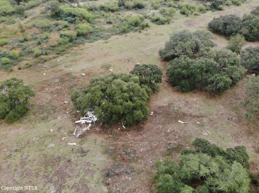
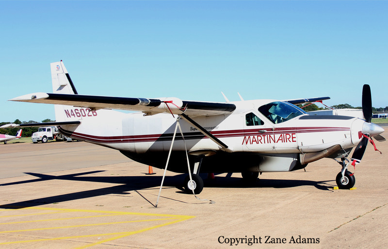
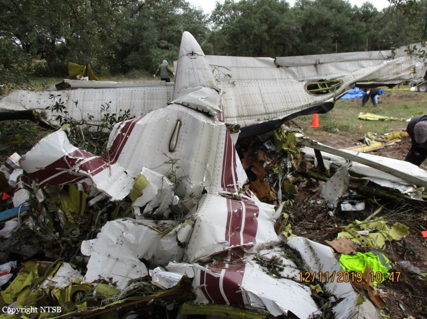
The airline transport pilot departed on a night cargo flight into conditions that included an overcast cloud ceiling and “hazy” visibility, as reported by another pilot. About one minute after takeoff, the pilot made a series of course changes and large altitude and airspeed deviations. Following several queries from the air traffic controller concerning the airplane’s erratic flight path, the pilot responded that he had “some instrument problems.” The pilot attempted to return to land at the departure airport, but the airplane impacted terrain after entering a near-vertical dive. The airplane was one of two in the operator’s fleet equipped with an inverter system that electrically powered the pilot’s (left side) flight instruments. Examination of the annunciator panel lighting filaments revealed that the inverter system was not powered when the airplane impacted the ground. Without electrical power from an inverter, the pilot’s side attitude indicator and horizontal situation indicator (HSI) would have been inoperative and warning flags would have been displayed over the respective instruments. The pilot had a history of poor procedural knowledge and weak flying skills. It is possible that he either failed to turn on an inverter during ground operations and did not respond to the accompanying warning flags, or he did not switch to the other inverter in the event that an inverter failed inflight. Due to impact damage, the operational status of the two inverters installed in the airplane could not be confirmed. However, the vacuum-powered flight instruments on the copilot’s (right side) were operational, and the pilot could have referenced these instruments to maintain orientation. Based on the available information, the pilot likely lost control of the airplane after experiencing spatial disorientation. The night marginal visual flight rules conditions and instrumentation problems would have been conducive to the development of spatial disorientation, and the airplane’s extensive fragmentation indicative of a high-energy impact was consistent with the known effects of spatial disorientation. Ethanol identified during toxicology testing may have come from postmortem production and based on the low levels recorded, was unlikely to have contributed to this accident. Morphine identified in the pilot’s liver could not be used to extrapolate to antemortem blood levels; therefore, whether or to what extent the pilot’s use of morphine contributed to the accident could not be determined.
Probable cause:
The pilot’s loss of control due to spatial disorientation. Contributing to the accident were the inoperative attitude indicator and horizontal situation indicator on the pilot’s side of the cockpit, and the pilot’s failure to reference the flight instruments that were operative.
Final Report:
Crash of a Let L-410UVP near Bor

Date & Time: Oct 27, 2019 at 1300 LT
Type of aircraft:
Registration:
YI-BYO
Flight Phase:
Flight Type:
Survivors:
Yes
Schedule:
Walgak - Juba
MSN:
79 02 05
YOM:
1979
Country:
Region:
Crew on board:
2
Crew fatalities:
Pax on board:
2
Pax fatalities:
Other fatalities:
Total fatalities:
0
Circumstances:
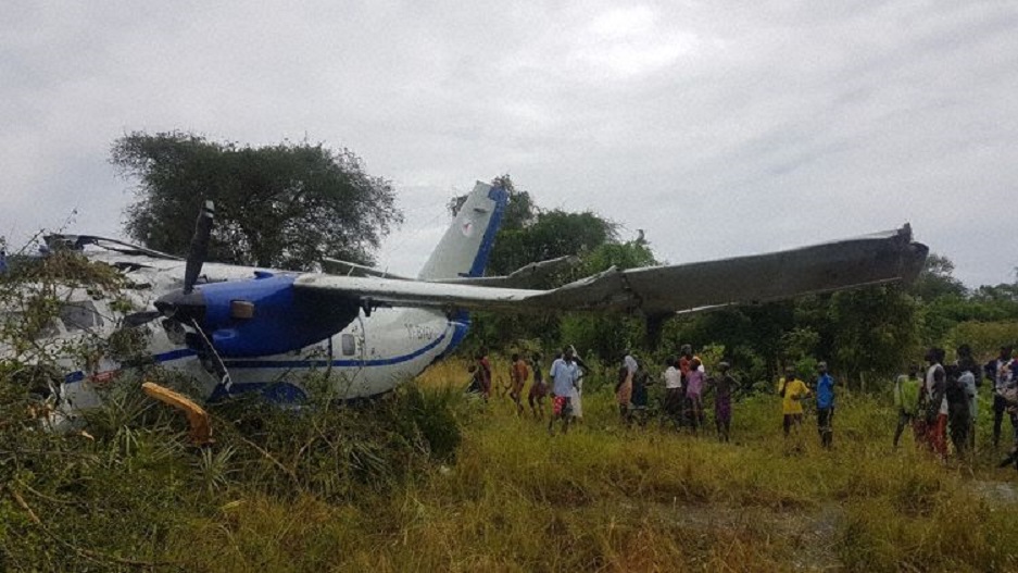
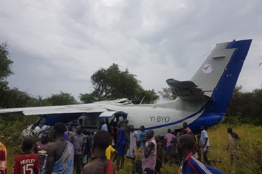
The twin engine airplane was returning from Walgak to Juba on a cargo flight, carrying two passengers and two crew members. En route, weather conditions worsened and the crew decided to perform an emergency landing. The aircraft crash landed in the bush about 12 km south from Bor Airport and came to rest with its right wing partially torn off and the cockpit severely damaged. All four occupants were injured and transferred to local hospital.

Crash of a Douglas DC-3C off Nassau

Date & Time: Oct 18, 2019 at 1630 LT
Type of aircraft:
Operator:
Registration:
N437GB
Flight Type:
Survivors:
Yes
Schedule:
Miami - Nassau
MSN:
19999
YOM:
1944
Country:
Crew on board:
2
Crew fatalities:
Pax on board:
0
Pax fatalities:
Other fatalities:
Total fatalities:
0
Circumstances:
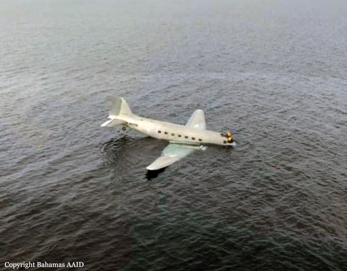
On the 18th October 2019, at approximately 4:30 PM local time, a Douglas DC-3C aircraft, registration N437GB crashed in the ocean; at coordinates 25°05.55N 077°30.29W, approximately 2.87miles from Runway 14 at the Lynden Pindling International Airport (MYNN) Nassau, Bahamas. There were 2 souls on board. The pilot reported that the left engine failed approximately 25-30 nautical miles from MYNN. The pilot further stated that during single engine operation, the aircraft performance was not optimal so the decision was made to land the aircraft in the ocean. The Air Traffic Control tower was notified by the crew of N437GB, that they will be performing a control water landing. The Royal Bahamas Defense Force was notified. Rescue efforts were then put into place. No injuries were received by the occupants of the aircraft. Aircraft could not be located for physical analysis to be carried out. The weather at the time of the accident was visual meteorological conditions and not a factor in this accident. A limited scope investigation was conducted, no safety message or recommendations were issued.
Probable cause:
Failure of the left engine on approach for unknown reasons.
Final Report:

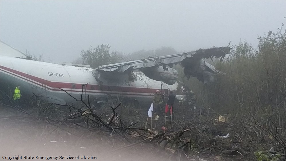
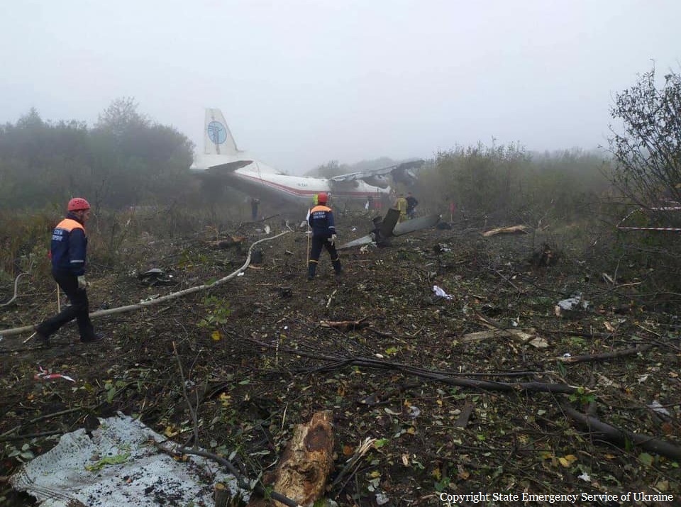
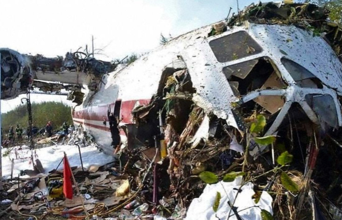
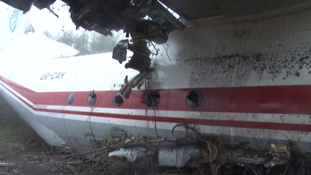
Crash of an Antonov AN-12BK in Lviv: 5 killed

Date & Time: Oct 4, 2019 at 0648 LT
Type of aircraft:
Operator:
Registration:
UR-CAH
Flight Type:
Survivors:
Yes
Schedule:
Vigo - Lviv - Bursa
MSN:
8345604
YOM:
1968
Flight number:
UKL4050
Country:
Region:
Crew on board:
5
Crew fatalities:
Pax on board:
3
Pax fatalities:
Other fatalities:
Total fatalities:
5
Captain / Total flying hours:
6750
Captain / Total hours on type:
6570.00
Copilot / Total flying hours:
14670
Copilot / Total hours on type:
9620
Aircraft flight hours:
12922
Aircraft flight cycles:
6616
Circumstances:
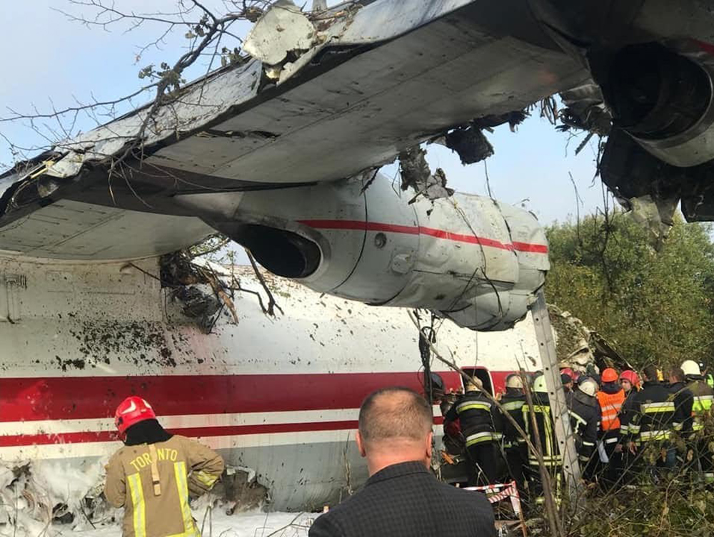
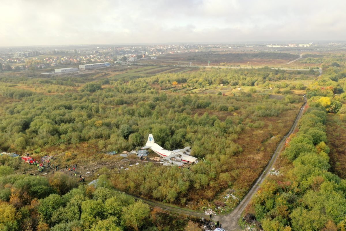
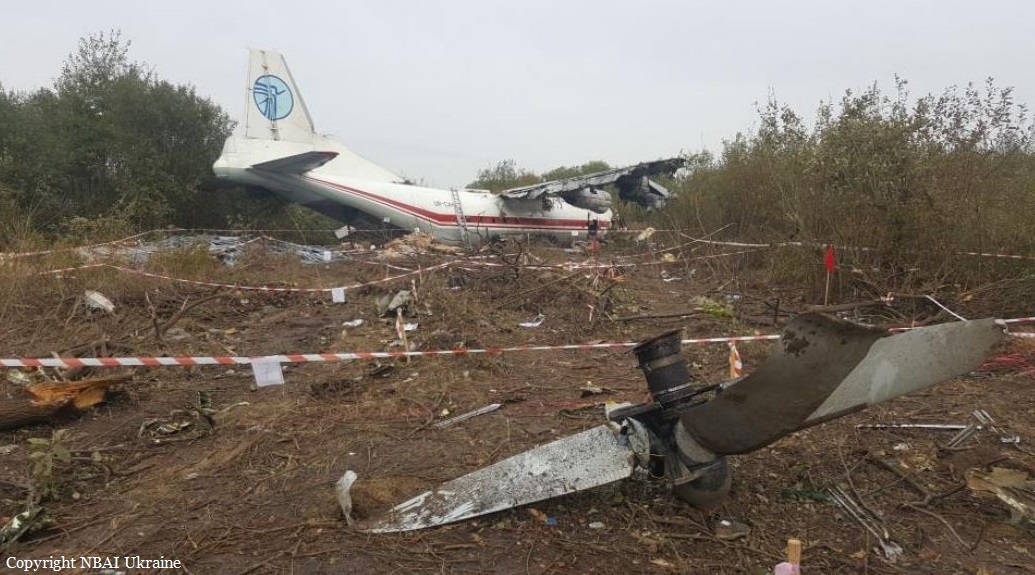
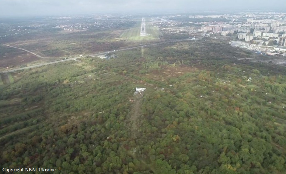
On 03.10.2019, the crew of An-12BK UR-CAH aircraft operated by PJSC «AIRLINE «UKRAINE-AIR ALLIANCE», consisting of flight crew members and two aircraft technicians, performed flight UKL4010 en-route Toronto (Canada) - Toulouse (France) and at 06:15 UTC, it landed at the Toulouse aerodrome (France). The plane delivered 1537 kg cargo to the Toulouse aerodrome (France). After the completion of post-flight procedures, the flight crew went to rest at the hotel, while the technicians remained on the aircraft to perform technical works. The next flight was scheduled from Toulouse to Birmingham airport (Great Britain). However, during the day, at the initiative of the operator, it was decided to change the route and perform the flight en-route Toulouse - Vigo (Spain) - Istanbul (Turkey). At the Toulouse aerodrome, the plane was filled with 6,000 liters of fuel. Also in Toulouse, a flight engineer was replaced. At 16:16 UTC, the plane took off from Toulouse to Vigo without cargo. Landing at the Vigo aerodrome (Spain) was performed on 03.10.2020 at 18:20 UTC. At the Vigo aerodrome, the plane was loaded with vehicle spare parts with a total weight of probably 14078 kg. From the Vigo aerodrome (Spain), the plane took off on 03.10.2019 at 22:20, flight UKL4050, with a delay of 2 h 20 minutes. On 04.10.2020, at 03:17:29 UTC, the plane approached the airspace border of the Lviv control area. The crew contacted the controller of the Lviv ACC of LVE + LVW sector and reported about the approach to waypoint MALBE at FL250. The controller informed the crew about the establishment of the radar identification of the aircraft and instructed to wait for the procedure for radar guidance to RW-31 using the ILS system. At 03:20:27, under instruction the ACC controller, the crew listened to the ATIS "Romeo" information as follows: “Lviv, ATIS “Romeo” for 03:20. The ILS approach at the aerodrome uses low visibility procedures. Runway in use is RW-31. Runway surface condition known at 19:53 - wet, clear. The measured friction coefficient is 0.55. Estimated surface friction assessed as good. Transition level - 110. Warning: large flocks of birds in the aerodrome area and on the landing final. There is no wind. Visibility - 150 meters; visibility range on the runway at the touchdown point - 550 meters, in the middle of the runway - 550 meters, at the end of the runway - 550 meters, fog. Vertical visibility - 50 meters. Temperature + 3ºС, dew point + 3ºС. Atmospheric pressure QNH - 1013 hectopascals, QFE - 974 hectopascals. Weather forecast for TREND landing: visibility sometimes is 400 meters, fog; vertical visibility - 60 meters. Attention: the frequency "Lviv-taxiing" does not work, while taxiing, get in touch with the "LvivTower" at a frequency of 128.0 MHz. Please acknowledge receipt of Romeo's information." ATIS information was transmitted in English. At 03:22:14, the crew informed the controller about the completion of listening to ATIS information and received clearance to descend to FL120. At 03:22:40, the aircraft began its descent from FL250 and at 03:28:35 switched to the frequency of the ACC controller of the LVT sector. After contacting the controller of the ACC of the LVT sector, the crew reported a descend to FL120 to KOKUP point. At 03:29:08, the ACC controller of the LVT sector instructed the crew to continue descending to an altitude of 10,000 feet at atmospheric pressure QNH-1013 hPa, reported the transition level, and instructed to wait for radar guidance for ILS approach on RW-31. The crew confirmed the instruction to descent to 10,000 feet, QNH, transition level and reported expectation for radar guidance. At 03:30:14, LVT sector ACC controller began radar guidance. At 03:32:49, the controller instructed the crew to descend to 4,000 feet. At 03:35:33, LVT sector ATC controller instructed to descend to an altitude of 3200 feet, taking into account the temperature correction. The procedure for temperature correction at determination of flight levels by an air traffic controller during the radar vectoring was published in the Aeronautical Information Publication of Ukraine, UKLL AD 2.24.7-1 dated 12.09.2019. At 03:38:33, the ATC controller of the LVT sector provided the crew with information about its location of 27 km from VOR/DME LIV, instructed by the left turn to take a 340º heading, cleared the ILS landing approach to runway 31 and gave the control instruction to inform of “the localizer beam capture.” At 03:40:01 (the height above the runway was 1170 m, descent rate: -4 ... -4.5 m/s, speed 352 km/h, distance from the runway threshold: 15.7 km), the crew reported of the localizer beam capture. At 03:40:09, ATC controller of LVT sector instructed the crew to continue the ILS approach to RWY 31. At 03:40:26, the controller informed the crew about the weather conditions at the aerodrome: RW-31 runway visual range (RVR) in the touchdown zone – 800 meters, in the middle of the runway – 800 meters, at the end of the runway – 750 meters, vertical visibility – 60 meters, fog. The crew confirmed receipt of the information. At 03:41:22, the ATC controller of LVT sector instructed to switch the communication to the ATC Lviv controller at a frequency of 128.0 MHz. There were no irregularities in air traffic servicing of the An-12 aircraft, flight UKL4050, during the flight in the area of responsibility of the TMA Lviv "LVT" sector. To enter the glide path, the PIC increased the vertical descent rate. At 03:41:47, the crew established communication with the Tower controller. The distance from the threshold was 11.3 km, the elevation over the glide path was 70 m, the vertical rate of descent was -5.5 ... -6 m/s. After communication with the air traffic controller, the crew reported an ILS approach to RW-31 and the atmospheric pressure QNH setting of 1013 hPa. At 03:41:58, the Tower controller informed the crew about the absence of wind on the surface of RW-31 and gave clearance to land. The crew confirmed the landing clearance. According to the recorders, at this time the distance to the touchdown point was 7.58 km, the plane was 11 m below the glide path, the vertical descent rate was -4.5-5.5 m/s, and the speed was 290 km/h, the flight heading – 315º. At a distance of 5.0 km to the touchdown point, the plane was 25 m below the glide path. At a distance of 3 km from the touchdown, the plane descended to an altitude of 105 meters and continued the flight with the constant descent. At an altitude of 60 meters, an audible alarm was triggered on board the aircraft, when the decision height had been reached, to which none of the crew members responded. At a distance of 1348 meters from the threshold of the RW-31, at an altitude of 5-7 meters, the aircraft collided with trees, fell to the ground and came to rest at a distance of 1117 meters from the runway threshold. All three passengers were seriously injured and all five crew members were killed.
Probable cause:
The most probable cause of the accident, collision of a serviceable aircraft with the ground during the landing approach in a dense fog, was the crew’s failure to perform the flight in the instrument conditions due to the probable physical excessive fatigue, which led to an unconscious descent of the aircraft below the glide path and ground impact (controlled flight into terrain).
Contributing Factors:
Probable exceeding the aircraft takeoff weight during departure from the Vigo Airport, which could result in increase in consumption of the fuel, the remainder of which did not allow to perform the flight to the alternate Boryspil aerodrome.
Final Report:
Crash of a Viking Air DHC-6 Twin Otter 400 near Kampung Mamontoga: 4 killed

Date & Time: Sep 18, 2019 at 1100 LT
Operator:
Registration:
PK-CDC
Flight Phase:
Flight Type:
Survivors:
No
Site:
Schedule:
Timika - Ilaga
MSN:
950
YOM:
2016
Country:
Region:
Crew on board:
3
Crew fatalities:
Pax on board:
1
Pax fatalities:
Other fatalities:
Total fatalities:
4
Circumstances:
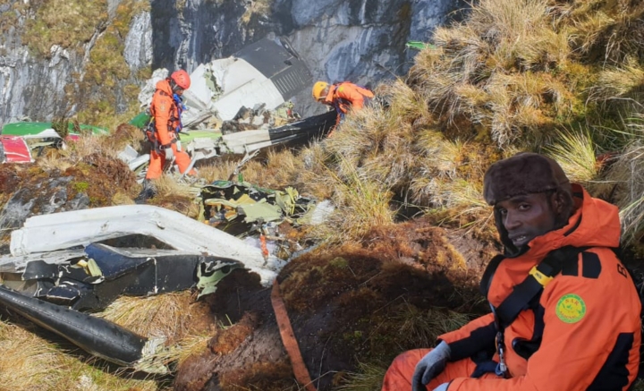
The twin engine airplane departed Timika Airport at 1036LT on a cargo flight to Ilaga, carrying one passenger, a crew of four and a load of 1,7 ton of rice. At 1054LT, the crew gave his ETA at Ilaga Airport when the contact was lost about six minutes later. As the airplane failed to arrive at destination, SAR operations were initiated. The wreckage was found four days later in a mountainous terrain, at an altitude of 4,115 meters, about 10 km from Kampung Mamontoga. The aircraft was totally destroyed and all four occupants were killed.

Crash of a Convair CV-440F in Toledo: 2 killed

Date & Time: Sep 11, 2019 at 0239 LT
Registration:
N24DR
Flight Type:
Survivors:
No
Schedule:
Millington-Memphis - Toledo
MSN:
393
YOM:
1957
Crew on board:
2
Crew fatalities:
Pax on board:
0
Pax fatalities:
Other fatalities:
Total fatalities:
2
Captain / Total flying hours:
8000
Copilot / Total flying hours:
11287
Aircraft flight hours:
47742
Circumstances:
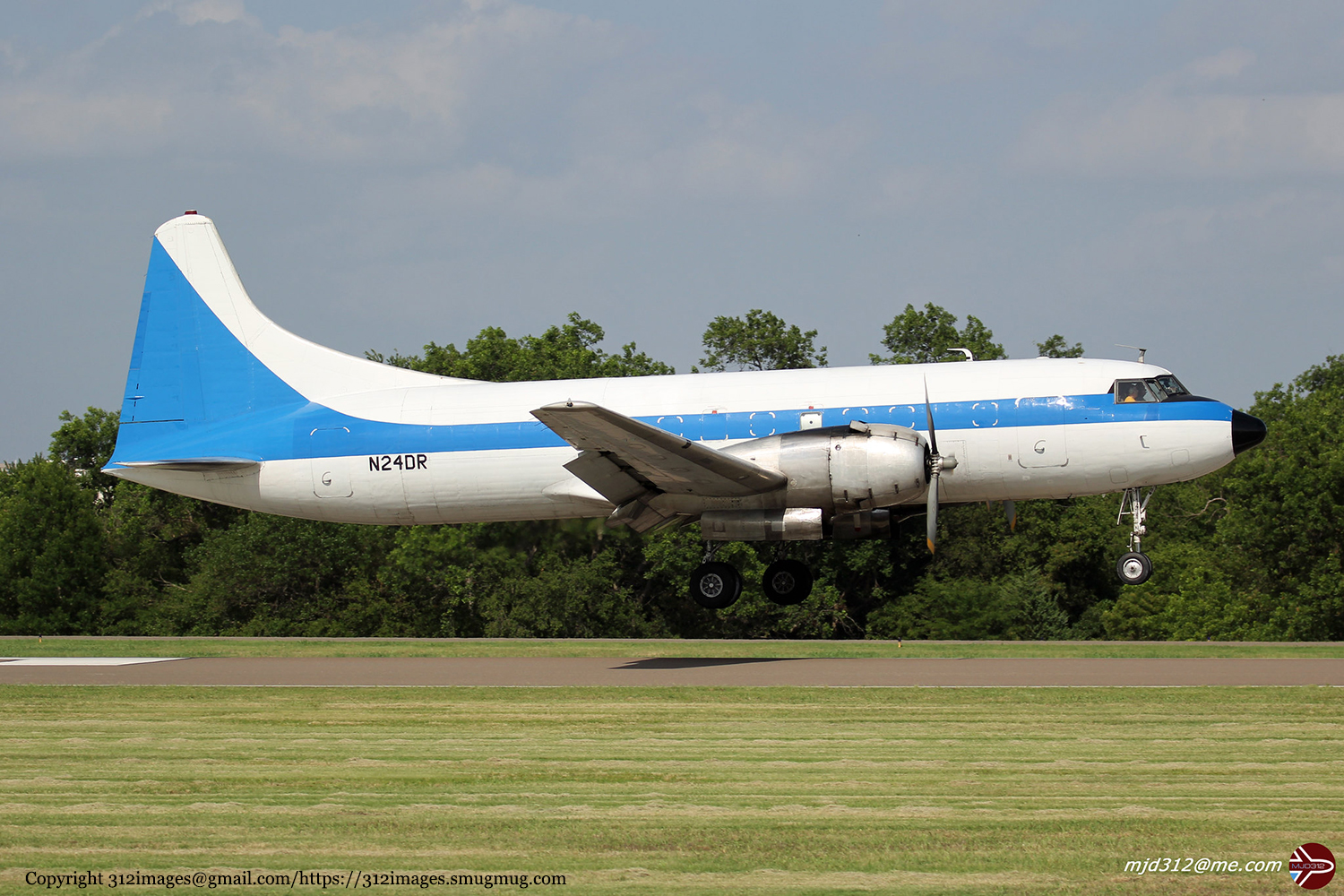
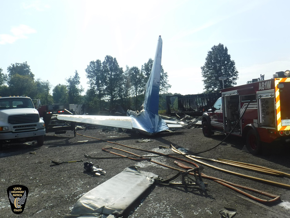
The accident occurred during the second of a two-leg nonscheduled cargo flight. The initial leg of the flight departed the preceding evening. The pilots landed about 3.5 hours later for fuel and departed on the accident flight an hour after refueling. The flight entered a cruise descent about 39 miles from the destination airport in preparation for approach and landing. The pilots reported to air traffic control that they were executing a wide base and were subsequently cleared for a visual approach and landing. The landing clearance was acknowledged, and no further communications were received. No problems or anomalies were reported during the flight. The airplane was briefly established on final approach before radar contact was lost. The airplane impacted trees and terrain about 0.5 mile short of the runway and came to rest in a trucking company parking lot. A postimpact fire ensued. Damage to the landing gear indicated that it was extended at the time of impact. The position of the wing flaps could not be determined. Disparities in the propeller blade angles at impact were likely due to the airplane’s encounter with the wooded area and the impact sequence. No evidence of mechanical anomalies related to the airframe, engines, or propellers was observed. A review of air traffic control radar data revealed that the airplane airspeed decayed to about 70 to 75 kts on final approach which was at or below the documented aerodynamic stall speed of the airplane in the landing configuration. Although there was limited information about the flight crew’s schedules, their performance was likely impaired by fatigue resulting from both the total duration of the overnight flights and the approach being conducted in the window of the circadian low. This likely resulted in the flight crew’s failure to maintain airspeed and recognize the impending aerodynamic stall conditions.
Probable cause:
The flight crew’s failure to maintain the proper airspeed on final approach, which resulted in an inadvertent aerodynamic stall and impact with trees, and terrain. Contributing to the accident was the flight crew’s fatigue due to the overnight flight schedule.
Final Report:
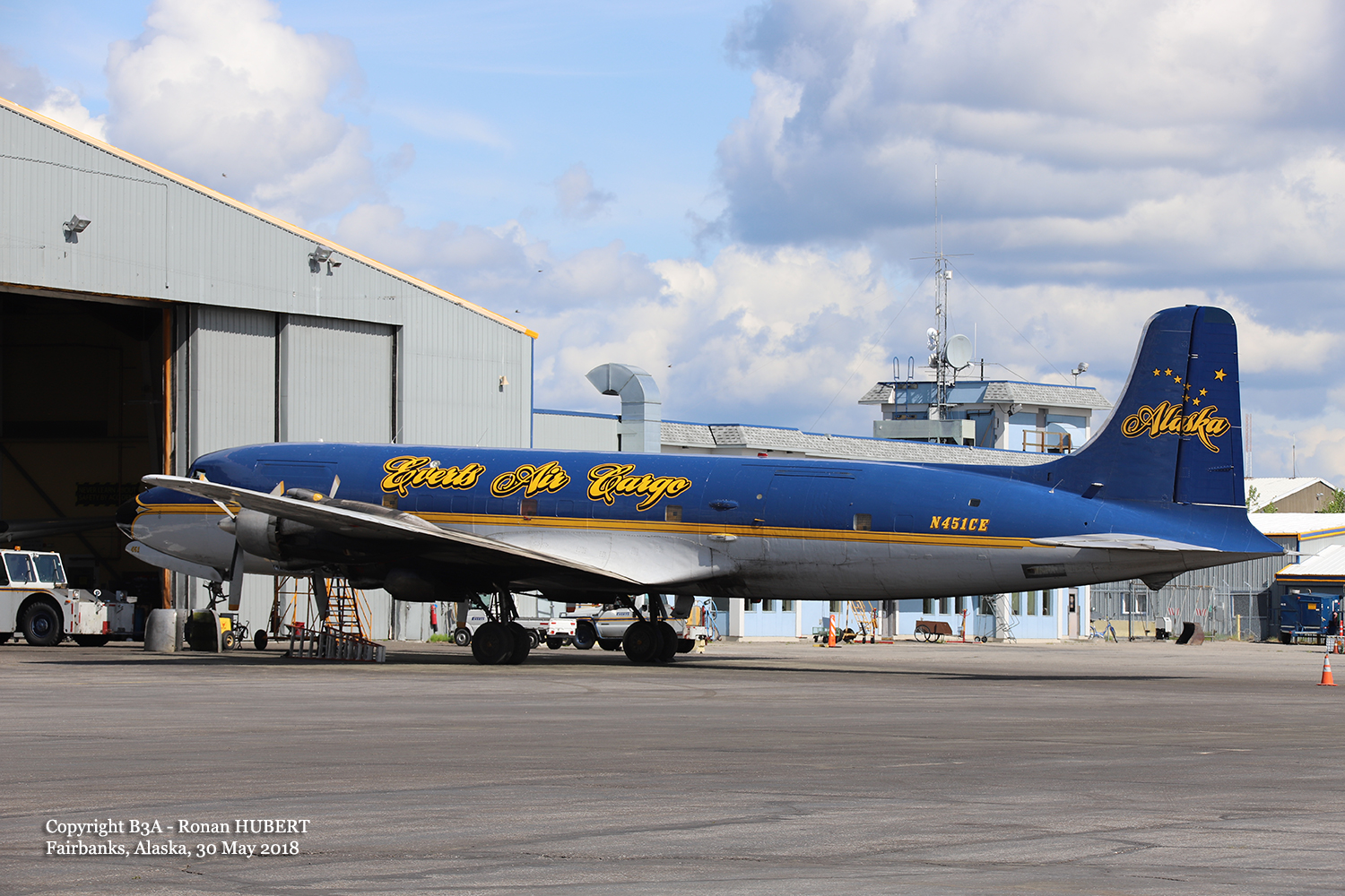
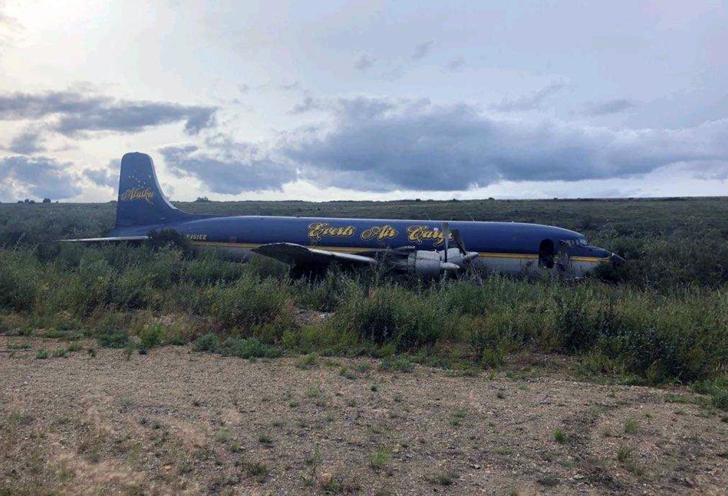
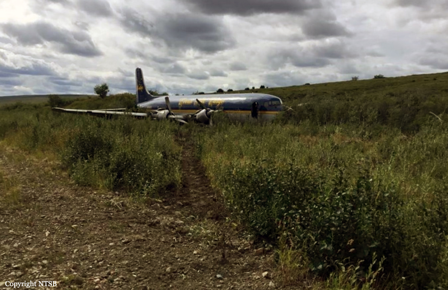
Crash of a Douglas C-118A Liftmaster in Candle

Date & Time: Aug 1, 2019 at 1400 LT
Type of aircraft:
Operator:
Registration:
N451CE
Flight Type:
Survivors:
Yes
Schedule:
Fairbanks – Candle
MSN:
43712/358
YOM:
1953
Location:
Crew on board:
3
Crew fatalities:
Pax on board:
0
Pax fatalities:
Other fatalities:
Total fatalities:
0
Captain / Total flying hours:
9910
Captain / Total hours on type:
147.00
Copilot / Total flying hours:
8316
Copilot / Total hours on type:
69
Aircraft flight hours:
42037
Circumstances:
The flight crew was landing the transport-category airplane at a remote, gravel-covered runway. According to the captain, the terrain on the approach to the runway sloped down toward the approach end, which positioned the airplane close to terrain during the final stages of the approach. A video recorded by a bystander showed that while the airplane was on short final approach, it flew low on the glidepath and dragged its landing gear through vegetation near the approach end of the runway. The video showed that, just before the main landing gear wheels reached the runway threshold, the right main landing wheel impacted a dirt and rock berm. The captain said that to keep the airplane from veering to the right, he placed the No. 1 and No. 2 engine propellers in reverse pitch. The flight engineer applied asymmetric reverse thrust to help correct for the right turning tendency, and the airplane tracked straight for about 2,000 ft. The video then showed that the right main landing gear assembly separated, and the airplane continued straight down the runway before veering to the right, exiting the runway, and spinning about 180°, resulting in substantial damage to the fuselage. On-site examination of the runway revealed several 4-ft piles of rocks and dirt at the runway threshold, which is likely what the right main landing wheel impacted. Given that the airplane landing gear struck vegetation and rocks on the approach to the runway, it is likely that they were below the proper glidepath for the approach. The crew stated there were no preaccident mechanical malfunctions or anomalies that would have precluded normal operation.
Probable cause:
The pilot's failure to maintain an adequate glidepath during the approach, which resulted in the airplane impacting rocks and dirt at the runway threshold, a separation of the right main landing gear, and a loss of directional control.
Final Report:

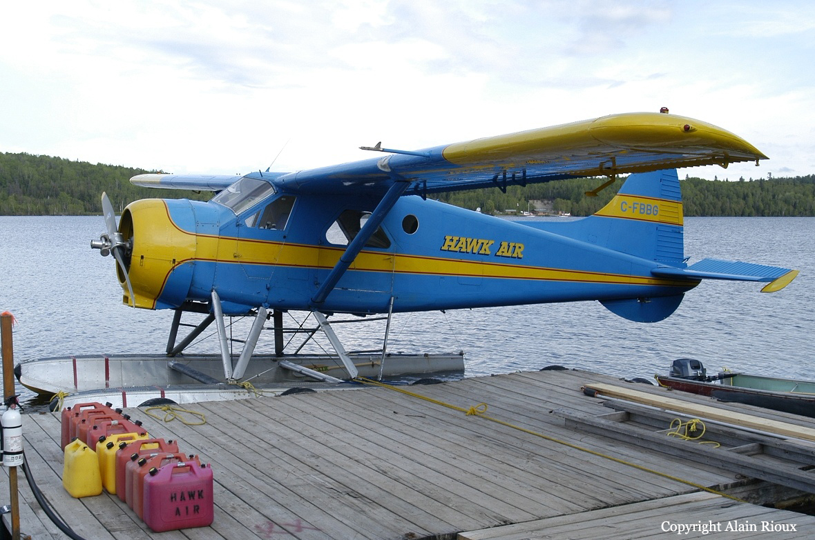
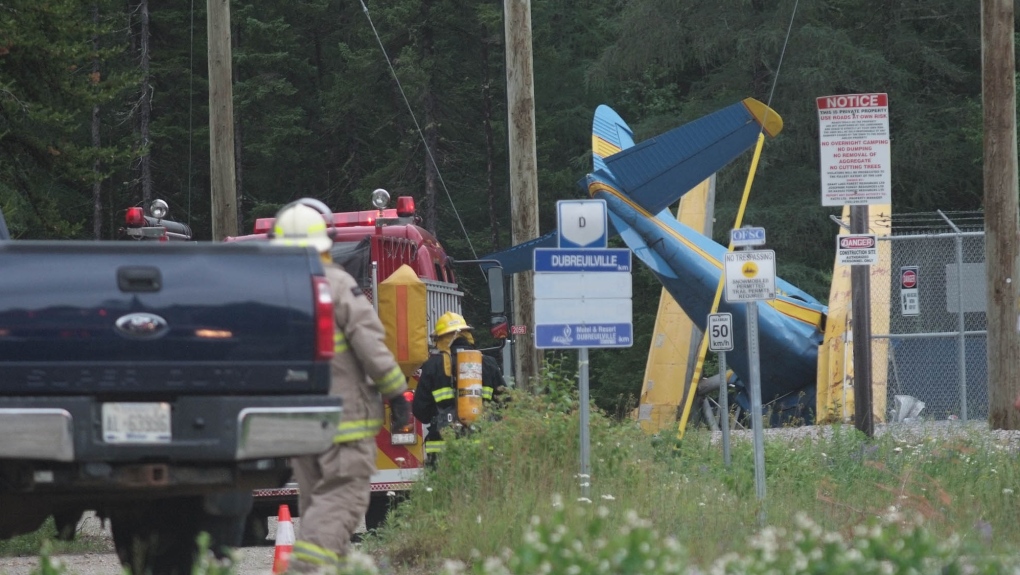
Crash of a De Havilland DHC-2 Beaver in Hawk Junction: 2 killed

Date & Time: Jul 11, 2019 at 0853 LT
Type of aircraft:
Operator:
Registration:
C-FBBG
Flight Phase:
Flight Type:
Survivors:
No
Schedule:
Hawk Junction - Oba Lake
MSN:
358
YOM:
1952
Country:
Crew on board:
1
Crew fatalities:
Pax on board:
1
Pax fatalities:
Other fatalities:
Total fatalities:
2
Captain / Total flying hours:
1231
Captain / Total hours on type:
409.00
Aircraft flight hours:
17804
Circumstances:
On 11 July 2019, at approximately 0852 Eastern Daylight Time, the float-equipped de Havilland DHC-2 Mk. I Beaver aircraft (registration C-FBBG, serial number 358), operated by Hawk Air, departed from the Hawk Junction Water Aerodrome, on Hawk Lake, Ontario. The aircraft, with the pilot and 1 passenger on board, was on a daytime visual flight rules charter flight. The aircraft was going to drop off supplies at an outpost camp on Oba Lake, Ontario, approximately 35 nautical miles north-northeast of the Hawk Junction Water Aerodrome. The aircraft departed heading northeast. Shortly after takeoff, during the initial climb out, just past the northeast end of Hawk Lake, the aircraft crashed in a steep nose-down attitude, severing a power line immediately before impact, and coming to rest next to a hydro substation. The pilot and the passenger received fatal injuries. The aircraft was destroyed as a result of the impact, but there was no post-impact fire.
Probable cause:
Findings as to causes and contributing factors:
These are conditions, acts or safety deficiencies that were found to have caused or contributed to this occurrence.
1. The aircraft likely departed with the fuel selector set to the rear tank position,which did not contain sufficient fuel for departure. As a result, the engine lost power due to fuel starvation shortly after takeoff during the initial climb.
2. After a loss of engine power at low altitude, a left turn was likely attempted in an effort to either return to the departure lake or head toward more desirable terrain for a forced landing. The aircraft stalled aerodynamically, entered an incipient spin, and subsequently crashed.

Findings as to risk:
These are conditions, unsafe acts or safety deficiencies that were found not to be a factor in this occurrence but could have adverse consequences in future occurrences.
1. If aircraft are not equipped with a stall warning system, pilots and passengers who travel on these aircraft will remain exposed to an elevated risk of injury or death as a result of a stall at low altitude.
2. If air-taxi training requirements do not address the various classes of aircraft and operations included in the sector, there is a risk that significant type-, class-, or operation-specific emergency procedures will not be required to be included in training programs.
3. If seasonal air operators conduct recurrent training at the end of the season rather than at the beginning, there is a risk that pilots will be less familiar with required emergency procedures.
4. If air operators do not tailor their airborne training programs to address emergency procedures that are relevant to their operation, there is a risk that pilots will be unprepared in a real emergency.
5. If pilots and passengers do not use available shoulder harnesses, there is an increased risk of injury in the event of an accident.
Final Report:

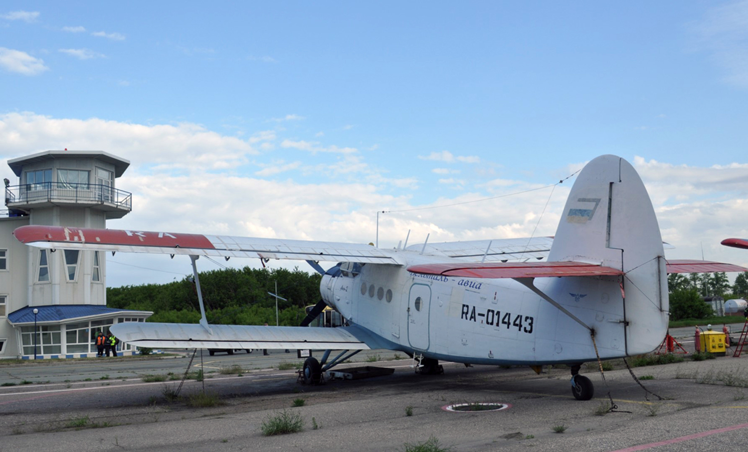
Crash of a PZL-Mielec AN-2R in Vyun

Date & Time: May 4, 2019 at 1335 LT
Type of aircraft:
Registration:
RA-01443
Flight Type:
Survivors:
Yes
Schedule:
Ust-Nera - Vyun
MSN:
1G231-24
YOM:
1988
Country:
Region:
Crew on board:
2
Crew fatalities:
Pax on board:
0
Pax fatalities:
Other fatalities:
Total fatalities:
0
Captain / Total flying hours:
9700
Aircraft flight hours:
6305
Circumstances:
The single engine airplane departed Ust-Nera on a cargo flight to Vyun, carrying two pilots and a load of various equipment destined for the employees of a local gold mine. Upon landing on an unprepared terrain, the undercarriage collapsed. The airplane slid on its belly and came to rest. Both pilots escaped uninjured and the aircraft was damaged beyond repair. The accident occurred at location N 65° 54' E 138° 20'.
Probable cause:
The accident was the result of the destruction of the right main landing gear strut upon landing.
The following contributing factors were identified:
- Unsatisfactory performance of the welded joint in the manufacture of the strut with the formation of welding cracks in one of the most stressed zones of the strut,
- Pilot errors, which led to an early landing of the aircraft, possibly rough, on an unprepared (uncleared) area with possible obstacles.
Final Report:
Crash of a Boeing 767-375ER off Anahuac: 3 killed

Date & Time: Feb 23, 2019 at 1239 LT
Type of aircraft:
Operator:
Registration:
N1217A
Flight Phase:
Flight Type:
Survivors:
No
Schedule:
Miami - Houston
MSN:
25685/430
YOM:
1992
Flight number:
5Y3591
Location:
Crew on board:
3
Crew fatalities:
Pax on board:
0
Pax fatalities:
Other fatalities:
Total fatalities:
3
Captain / Total flying hours:
11172
Captain / Total hours on type:
1252.00
Copilot / Total flying hours:
5073
Copilot / Total hours on type:
520
Aircraft flight hours:
91063
Aircraft flight cycles:
23316
Circumstances:
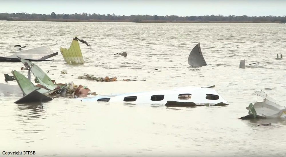
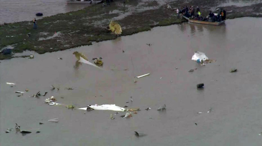
On February 23, 2019, at 1239 central standard time, Atlas Air Inc. (Atlas) flight 3591, a Boeing 767-375BCF, N1217A, was destroyed after it rapidly descended from an altitude of about 6,000 ft mean sea level (msl) and crashed into a shallow, muddy marsh area of Trinity Bay, Texas, about 41 miles east-southeast of George Bush Intercontinental/Houston Airport (IAH), Houston, Texas. The captain, first officer (FO), and a nonrevenue pilot riding in the jumpseat died. Atlas operated the airplane as a Title 14 Code of Federal Regulations Part 121 domestic cargo flight for Amazon.com Services LLC, and an instrument flight rules flight plan was filed. The flight departed from Miami International Airport (MIA), Miami, Florida, about 1033 (1133 eastern standard time) and was destined for IAH. The accident flight’s departure from MIA, en route cruise, and initial descent toward IAH were uneventful. As the flight descended toward the airport, the flight crew extended the speedbrakes, lowered the slats, and began setting up the flight management computer for the approach. The FO was the pilot flying, the captain was the pilot monitoring, and the autopilot and autothrottle were engaged and remained engaged for the remainder of the flight. Analysis of the available weather information determined that, about 1238:25, the airplane was beginning to penetrate the leading edge of a cold front, within which associated windshear and instrument meteorological conditions (as the flight continued) were likely. Flight data recorder data indicated that, during the time, aircraft load factors consistent with the airplane encountering light turbulence were recorded and, at 1238:31, the airplane’s go-around mode was activated. At the time, the accident flight was about 40 miles from IAH and descending through about 6,300 ft msl toward the target altitude of 3,000 ft msl. This location and phase of flight were inconsistent with any scenario in which a pilot would intentionally select go-around mode, and neither pilot made a go-around callout to indicate intentional activation. Within seconds of go-around mode activation, manual elevator control inputs overrode the autopilot and eventually forced the airplane into a steep dive from which the crew did not recover. Only 32 seconds elapsed between the go-around mode activation and the airplane’s ground impact.
Probable cause:
The NTSB determines that the probable cause of this accident was the inappropriate response by the first officer as the pilot flying to an inadvertent activation of the go-around mode, which led to his spatial disorientation and nose-down control inputs that placed the airplane in a steep descent from which the crew did not recover. Contributing to the accident was the captain’s failure to adequately monitor the airplane’s flightpath and assume positive control of the airplane to effectively intervene. Also contributing were systemic deficiencies in the aviation industry’s selection and performance measurement practices, which failed to address the first officer’s aptitude-related deficiencies and maladaptive stress response. Also contributing to the accident was the Federal Aviation Administration’s failure to implement the pilot records database in a sufficiently robust and timely manner.
Final Report: