Crash of a Piper PA-46-500TP Malibu Meridian in Albuquerque: 3 killed

Date & Time: Mar 7, 2003 at 1918 LT
Registration:
N522RF
Flight Type:
Survivors:
No
Schedule:
Scottsdale – Albuquerque
MSN:
46-97119
YOM:
2001
Crew on board:
1
Crew fatalities:
Pax on board:
2
Pax fatalities:
Other fatalities:
Total fatalities:
3
Captain / Total flying hours:
1200
Aircraft flight hours:
365
Circumstances:
The pilot was performing a night, VFR traffic pattern, to a full stop at a non-towered airport in a turboprop aircraft. He entered the traffic pattern (6,800 feet; 1,000 feet AGL) on an extended downwind; radar data indicated that his ground-speed was 205 knots. Over the next 3 nautical miles on down wind, radar data indicated that he slowed to a ground-speed of 171 knots, lost approximately 500 feet of altitude, and reduced his parallel distance from the runway from 4,775 feet to 2,775 feet. Witnesses said that his radio transmissions on CTAF appeared normal. The two witnesses observed a bright blue flash, followed by a loss of contact with the airplane. Rescue personnel found a broken and downed static wire from a system of three sets of power transmission wires. The dark night precluded ground rescue personnel from locating the downed aircraft; a police helicopter found the airplane approximately 2 hours after the accident. The pilot had recently completed his factory approved annual flight training. His flight instructor said that the pilot was taught to fly a VFR traffic pattern at 1,500 feet AGL (or 500 feet above piston powered aircraft), enter the downwind leg from a 45 degree leg, and fly parallel to the downwind approximately 1 to 1.5 nautical miles separation from it. His speed on downwind should have been 145 to 150 knots indicated, with 90 to 95 knots on final for a stabilized approach. The flight instructor said that the base turn should be at a maximum bank angle of 30 degrees. Radar data indicates that the pilot was in a maximum descent, while turning base to final, of 1,800 to 1,900 feet per minute with an airspeed on final of 145 to 150 knots. His maximum bank angle during this turn was calculated to have been more than 70 degrees. The separated static wire was located 8,266.5 feet from the runway threshold, and was approximately 30 feet higher than the threshold. Post-accident examinations of the airplane and its engine revealed no anomalies which would have precluded normal operations prior to impact.
Probable cause:
The pilot's unstabilized approach and his failure to maintain obstacle clearance. Contributing factors were the dark night light condition, and the static wires.
Final Report:

Crash of a Cessna 208B Grand Caravan in Kotzebue

Date & Time: Mar 2, 2003 at 1504 LT
Type of aircraft:
Operator:
Registration:
N205BA
Flight Type:
Survivors:
Yes
Schedule:
Shungnak - Kotzebue
MSN:
208B-0890
YOM:
2001
Crew on board:
1
Crew fatalities:
Pax on board:
0
Pax fatalities:
Other fatalities:
Total fatalities:
0
Captain / Total flying hours:
25600
Captain / Total hours on type:
4200.00
Aircraft flight hours:
2082
Circumstances:
Prior to departing on an air taxi flight, the airline transport certificated pilot obtained a weather briefing and filed a VFR flight plan for a trip from his home base, to several remote villages, and return. The area forecast contained an AIRMET for IFR conditions and mountain obscuration due to clouds and light snow. The terminal forecast contained expected conditions that included visibilities ranging from 3 to 3/4 mile in blowing snow, a vertical visibility of 500 feet, and wind speeds from 14 to 22 knots. During the filling of the flight plan, an FAA flight service station specialist advised that VFR flight was not recommended. The pilot acknowledged the weather information and departed. When the pilot took off on the return flight from an airport 128 miles east of his home base, the pilot reported that the visibility at his base was greater than 6 miles. As he neared his home base, the visibility had decreased and other pilots in the area were requesting special VFR clearances into the Class E surface area. The pilot requested a special VFR clearance at 1441, but had to hold outside the surface area for other VFR and IFR traffic. At 1453, a METAR at the airport included a wind 080 of 26 knots, and a visibility of 1 mile in blowing snow. While holding about 7 miles north of the airport, the pilot provided a pilot report that included deteriorating weather conditions east of the airport. Once the pilot was cleared to enter the surface area at 1458, he was provided with an airport advisory that included wind conditions of 25 knots, gusting to 33 knots. While the pilot was maneuvering for the approach, a special aviation weather observation at 1501 included a wind condition of 26 knots, and a visibility of 3/4 mile in blowing snow. The pilot said he established a GPS waypoint 4 miles from the runway and descended to 1,000 feet. He continued inbound and descended to 300 feet. At 1 mile from the airport, the pilot said he looked up from the instrument panel but could not see the airport. He also stated that he was in a whiteout condition. The airplane collided with the snow-covered sea ice, about 1 mile from the approach end of the runway threshold at 1504.
Probable cause:
The pilot's continued VFR flight into instrument meteorological conditions, and his failure to maintain altitude/clearance above the ground, resulting in a collision with snow and ice covered terrain during the final approach phase of a VFR landing. Factors in the accident were whiteout conditions and snow-covered terrain.
Final Report:

Crash of a Socata TBM-700 in Leesburg: 3 killed

Date & Time: Mar 1, 2003 at 1445 LT
Type of aircraft:
Registration:
N700PP
Survivors:
No
Schedule:
Greenville - Leesburg
MSN:
059
YOM:
1992
Crew on board:
2
Crew fatalities:
Pax on board:
1
Pax fatalities:
Other fatalities:
Total fatalities:
3
Captain / Total flying hours:
730
Copilot / Total flying hours:
8375
Aircraft flight hours:
1049
Circumstances:
The private pilot, who sat in the left seat, was executing the LOC RWY 17 instrument approach in actual instrument meteorological conditions, when the airplane decelerated, lost altitude, and began a left turn about 2 miles from the airport. Subsequently, the airplane collided with terrain and came to rest on residential property. The radar data also indicated that the airplane was never stabilized on the approach. A witness, a private pilot, said the airplane "appeared" out of the fog about 300-400 feet above the ground. It was in a left bank, with the nose pointed down, and was traveling fast. The airplane then "simultaneously and suddenly level[ed] out," pitched up, and the engine power increased. The witness thought that the pilot realized he was low and was trying to "get out of there." The airplane descended in a nose-high attitude, about 65 degrees, toward the trees. Radar data indicates that the airplane slowed to 80 knots about 3 miles from the airplane, and then to 68 knots 18 seconds later as the airplane began to turn to the left. Examination of the airplane and engine revealed no mechanical deficiencies. Weather reported at the airport 25 minutes before the accident included wind from 140 degrees at 5 knots, visibility 1 statute mile, and ceiling 500 foot overcast. Weather 5 minutes before the accident included wind from 140 degrees at 5 knots, visibility 1 statute miles, and ceiling 300 foot overcast.
Probable cause:
The pilot's failure to fly a stabilized, published instrument approach procedure, and his failure to maintain adequate airspeed which led to an aerodynamic stall.
Final Report:

Crash of a Cessna 402B off Marathon

Date & Time: Feb 20, 2003 at 1220 LT
Type of aircraft:
Registration:
N554AE
Flight Type:
Survivors:
Yes
Schedule:
Havana – Marathon – Miami
MSN:
402B-1308
YOM:
1977
Crew on board:
1
Crew fatalities:
Pax on board:
0
Pax fatalities:
Other fatalities:
Total fatalities:
0
Captain / Total flying hours:
4000
Captain / Total hours on type:
817.00
Aircraft flight hours:
11303
Circumstances:
The fuel tanks were filled the day before the accident date, and on the day of the accident, the airplane was flown from that airport to the Miami International Airport, where the pilot picked up 2 passengers and flew uneventfully to Cuba. He performed a preflight inspection of the airplane in Cuba and noted both auxiliary fuel tanks were more than half full and both main tanks were half full. The flight departed, climbed to 8,000 feet; and was normal while in Cuban airspace. When the flight arrived at TADPO intersection, he smelled strong/fumes of fuel in the cabin. The engine instruments were OK at that time. The flight continued and when it was 10-12 miles from Marathon, he smelled something burning in the cabin like plastic material/paper; engine indications at that time were normal. He declared "PAN" three times with the controller, and shortly thereafter the right engine began missing and surging. He then observed fire on top of the right engine cowling near the louvers. He secured the right engine however the odor of fuel and fumes got worse to the point of irritating his eyes. He declared an emergency with the controller, began descending at blue line airspeed, and the fumes/odor got worse. Approximately 5 minutes after the right engine began missing and surging, the left engine began acting the same way. He secured the left engine but the propeller did not completely feather. At 400 feet he lowered full flaps and (contrary to the Pilot's Operating Handbook and FAA Approved Airplane Flight Manual) the landing gear in preparation for ditching. He intentionally stalled the airplane when it was 5-7 feet above the water, evacuated the airplane with a life vest, donned then inflated it. The airplane sank within seconds and he was rescued approximately 20 minutes later. The pilot first reported 4 months and 19 days after the accident that his passport which was in the airplane at the time of the accident had burned pages. He was repeatedly asked for a signed, dated statement that explained where it was specifically located in the airplane, and that it was not burned before the accident flight; he did not provide a statement. Examination of the airplane by FAA and NTSB revealed no evidence of an in-flight fire to any portion of the airplane, including the right engine or engine compartment area, or upper right engine cowling. Examination of the left engine revealed no evidence of preimpact failure or malfunction. The left magneto operated satisfactorily on a test bench, while the right magneto had a broken distributor block; and the electrode tang which fits in a hole of the distributor gear; no determination was made as to when the distributor block fractured or the electrode tang became bent. The left propeller blades were in the feathered position. Examination of the right engine revealed no evidence or preimpact failure or malfunction. The right hand stack assembly was fractured due to overload; no fatigue or through wall thickness erosion was noted. Both magnetos operated satisfactorily on a test bench. The right propeller was in the feathered position. An aluminum fuel line that was located in the cockpit that had been replaced the day before the accident was examined with no evidence or failure or malfunction; no fuel leakage was noted.
Probable cause:
The loss of engine power to both engines for undetermined reasons.
Final Report:

Crash of a Cessna 421A Golden Eagle I in Somerset: 3 killed

Date & Time: Feb 16, 2003 at 2002 LT
Type of aircraft:
Registration:
N421TJ
Survivors:
Yes
Schedule:
Griffith - Somerset
MSN:
421A-0051
YOM:
1968
Crew on board:
1
Crew fatalities:
Pax on board:
6
Pax fatalities:
Other fatalities:
Total fatalities:
3
Captain / Total flying hours:
11732
Captain / Total hours on type:
518.00
Aircraft flight hours:
4129
Circumstances:
The airplane joined the inbound course for the GPS instrument approach between the intermediate approach fix and the final approach fix, and maintained an altitude about 200 feet below the sector minimum. The last radar return revealed the airplane to be about 3/4 nautical miles beyond the final approach fix, approximately 1,000 feet left of course centerline. An initial tree strike was found about 1 nautical mile before the missed approach point, about 700 feet left of course centerline, at an elevation about 480 feet below the minimum descent altitude. Witnesses reported seeing the airplane flying at a "very low altitude" just prior to its impact with hilly terrain, and also described the sound of the airplane's engines as "really loud" and "a constant roar." Night instrument meteorological conditions prevailed at the time of the accident. There was no evidence of mechanical malfunction.
Probable cause:
The pilot's failure to follow the instrument approach procedure, which resulted in an early descent into trees and terrain. Factors included the low ceiling and the night lighting conditions.
Final Report:

Crash of a Piper PA-31-350 Navajo Chieftain in Taylor Mill

Date & Time: Feb 16, 2003 at 1520 LT
Registration:
N130CM
Flight Phase:
Flight Type:
Survivors:
Yes
Schedule:
Manhattan – Cincinnati
MSN:
31-7652142
YOM:
1976
Crew on board:
1
Crew fatalities:
Pax on board:
0
Pax fatalities:
Other fatalities:
Total fatalities:
0
Captain / Total flying hours:
3050
Captain / Total hours on type:
240.00
Aircraft flight hours:
8337
Circumstances:
According to the pilot, he planned the estimated the 726 statute mile flight would take approximately 3 hours and 46 minutes, with one stop to pick up cargo. The available fuel for the flight was 182 gallons, which equaled an approximate 4 hour and 55 minutes endurance, assuming a 40 gallon per hour fuel burn. The flight proceeded uneventfully to the first stop; the airplane was not fueled, and it departed. As the flight neared the destination airport, the pilot began to get nervous because the main tanks were "going fast." He switched to the auxiliary fuel tanks, to "get all of the fuel out of them," and switched back to the main tanks. While executing an approach to the airport, the pilot advised the approach controller that he had lost power to the right engine, and then shortly thereafter, reported losing power to the left engine. The pilot elected to perform a forced landing to a railroad yard. After touching down, the left wing struck a four-foot high dirt mound, and separated from the main fuselage. The airplane came to rest upright on a railroad track. The pilot additionally stated that the loss of power to both engines was due to fuel exhaustion, and poor fuel planning.
Probable cause:
The pilot's inaccurate in-flight planning and fuel consumption calculations, and his improper decision not to land and refuel.
Final Report:

Crash of a Piper PA-61 Aerostar (Ted Smith 601) in Scottsdale: 2 killed

Date & Time: Jan 26, 2003 at 2023 LT
Registration:
N3636Q
Flight Phase:
Flight Type:
Survivors:
No
Schedule:
Scottsdale – Santa Fe
MSN:
61-0785-8063398
YOM:
1980
Crew on board:
1
Crew fatalities:
Pax on board:
1
Pax fatalities:
Other fatalities:
Total fatalities:
2
Captain / Total flying hours:
1450
Captain / Total hours on type:
160.00
Aircraft flight hours:
2574
Circumstances:
The airplane collided with mountainous terrain 5 miles from the departure airport during a dark night takeoff. Review of recorded radar data found a secondary beacon code 7267 (the code assigned to the airplane's earlier inbound arrival ) on the runway at 2021:08, with a mode C report consistent with the airport elevation. Two more secondary beacon returns were noted on/over the runway at 2021:12 and 2021:19, reporting mode C altitudes of 1,600 and 1,700 feet, respectively. Between 2021:08 and 2021:38, the secondary beacon target (still on code 7267) proceeded on a northeasterly heading of 035 degrees (runway heading) as the mode C reported altitude climbed to 2,000 feet and the computed ground speed increased to 120 knots. Between 2021:38 and 2021:52, the heading changed from an average 035 to 055 degrees as the mode C reports continued to climb at a mathematically derived 1,300 feet per minute and the ground speed increased to average of 170 knots. At 2022:23, the code 7267 target disappeared and was replaced by a 1200 code target. The mode C reports continued to climb at a mathematically derived rate of 1,200 feet per minute as the ground speed increased to the 180- knot average range. The computed average heading of 055 degrees was maintained until the last target return at 2022:53, which showed a mode C reported altitude of 3,500 feet. The accident site elevation was 3,710 feet and was 0.1 miles from the last target return. The direct point to point magnetic course between Scottsdale and Santa Fe was found to be 055 degrees. Numerous ground witnesses living at the base of the mountain where the accident occurred reported hearing the airplane and observing the aircraft's lights. The witnesses reported observations consistent with the airplane beginning a right turn when a large fireball erupted coincident with the airplane's collision with the mountain. No preimpact mechanical malfunctions or failures were found during an examination of the wreckage. The radar data establishes that the pilot changed the transponder code from his arrival IFR assignment to the VFR code 30 seconds before impact and this may have been a distraction.
Probable cause:
The pilot's failure to maintain an adequate altitude clearance from mountainous terrain. Contributing factors were dark night conditions, mountainous terrain, and the pilot's diverted attention.
Final Report:

Crash of a Piper PA-31T Cheyenne II in Denver: 2 killed

Date & Time: Jan 24, 2003 at 1721 LT
Type of aircraft:
Registration:
N360LL
Flight Phase:
Flight Type:
Survivors:
No
Site:
Schedule:
Broomfield – Denver
MSN:
31-7520036
YOM:
1975
Location:
Crew on board:
2
Crew fatalities:
Pax on board:
0
Pax fatalities:
Other fatalities:
Total fatalities:
2
Captain / Total flying hours:
9365
Copilot / Total flying hours:
1944
Aircraft flight hours:
6478
Circumstances:
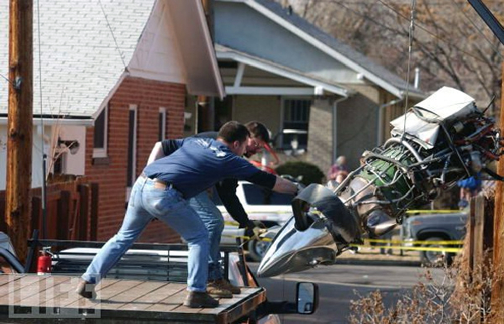
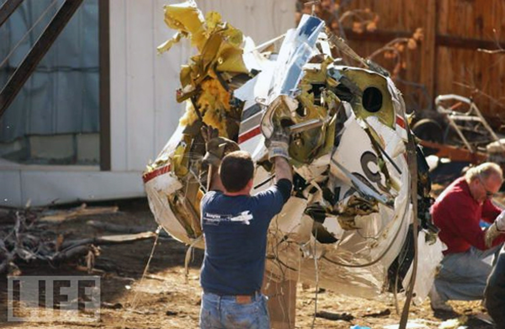
A Piper PA-31T "Cheyenne" and a Cessna 172P "Skyhawk" collided in midair during cruise flight at dusk and in visual meteorological conditions. The Cheyenne departed under visual flight rules (VFR) from a local airport northwest of Denver, and was proceeding direct at 7,800 feet to another local airport south of Denver. Radar indicated its ground speed was 230 knots. Its altitude encoder was transmitting intermittently. The Skyhawk departed VFR from the south airport and was en route to Cheyenne, Wyoming, at 7,300 feet. The pilot requested and was cleared to climb to 8,500 feet and penetrate class B airspace. Radar indicated its ground speed was 110 knots. The Skyhawk was flying in the suggested "VFR flyway"; the Cheyenne was not. When the controller observed the two airplanes converging, he asked the pilot of the Cheyenne for his altitude. He replied he was at 7,600 feet. The controller immediately issued a traffic advisory, but the pilot did not acknowledge. Both airplanes departed controlled flight: the Skyhawk struck a house, and the Cheyenne fell inverted into the backyard of a residence. Wreckage was scattered over a 24 square block area in west Denver. At the time of the accident, the controller was handling low altitude en route, arrival and departure traffic for both airports. Wreckage examination disclosed four slashes, consistent with propeller strikes, on top of the Cheyenne's right engine nacelle, the cabin above the right wing trailing edge, the empennage at the root of the dorsal fin, and at the tail cone. The Cheyenne was on a similar flight three days before the collision when the pilot was informed by air traffic control that the transponder was operating intermittently. According to recorded radar and voice communications from that flight, the transponder/encoder operated intermittently and the pilot was so advised. Examination of the Cheyenne's altimeter/encoder revealed a cold solder connection on pin 8 of the 15-pin altimeter connector. When the wire was resoldered to the pin, the information from the altimeters, encoder, and altitude serializer was normal.
Probable cause:
Both pilots' inadequate visual lookout. A contributing factor was the Cheyenne pilot operating the airplane with a known transponder deficiency.
Final Report:

Crash of a Cessna 208B Super Cargomaster in San Angelo

Date & Time: Jan 24, 2003 at 1015 LT
Type of aircraft:
Operator:
Registration:
N944FE
Flight Type:
Survivors:
Yes
Schedule:
San Angelo - San Angelo
MSN:
208B-0044
YOM:
1987
Crew on board:
2
Crew fatalities:
Pax on board:
0
Pax fatalities:
Other fatalities:
Total fatalities:
0
Captain / Total flying hours:
4356
Copilot / Total flying hours:
13884
Aircraft flight hours:
7503
Circumstances:
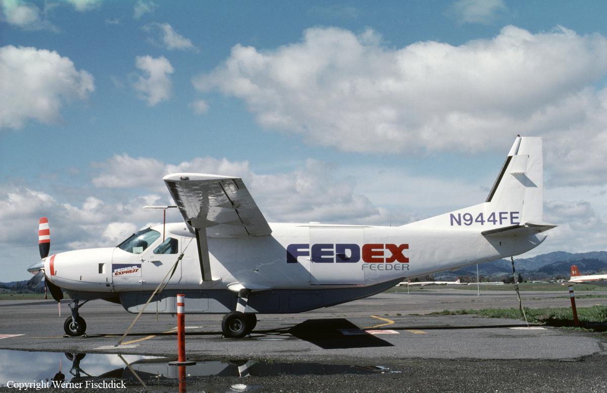
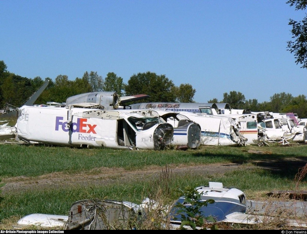
The airplane impacted a dirt field and a power line following a loss of control during a simulated engine failure while on a Part 135 proficiency check flight. Both pilots were seriously injured and could not recall any details of the flight after the simulated engine failure. Witnesses observed the airplane flying on a westerly heading at an altitude of 100 to 200 feet, and descending. They heard the sound of an engine “surging” and observed the airplane’s wings bank left and right. The airplane continued to descend and impacted the ground and power lines before becoming inverted. A pilot-rated witness reported that he observed about ¼ inch of clear and rime ice on the airplane’s protected surfaces (deice boots) and about ½ inch of ice on the airplane’s unprotected surfaces. An NTSB performance study of the accident flight based on radar data indicated that the airplane entered a descent rate of 1,300 feet per minute (fpm) about 1,100 feet above the ground. This rate of descent was associated with a decrease in airspeed from 130 knots to 92 knots over a span of 30 seconds. The airplane’s rate of descent leveled off at the 1,300 fpm rate for 45 seconds before increasing to a 2,000 fpm descent rate. The true airspeed fluctuated between a low of 88 knots to 102 knots during the last 45 seconds of flight. According to the aircraft manufacturer, the clean, wing flaps up stall speed was 78 knots. However, after a light rime encounter, the Pilot’s Operating Handbook (POH) instructed pilots to maintain additional airspeed (10 to 20 KIAS) on approach “to compensate for the increased pre-stall buffet associated with ice on the unprotected areas and the increased weight.” With flaps up, a minimum approach speed of 105 KIAS was recommended. The POH also stated that a significantly higher airspeed should be maintained if ½ inch of clear ice had accumulated on the wings.
Probable cause:
The flight crew's failure to cycle the deice boots prior to conducting a simulated forced landing and their failure to maintain adequate airspeed during the maneuver, which resulted in an inadvertent stall and subsequent loss of control. A contributing factor was the ice accumulation on the leading edges of the airfoils.
Final Report:

Crash of a Cessna 402C in Sacramento

Date & Time: Jan 23, 2003 at 2030 LT
Type of aircraft:
Operator:
Registration:
N6814A
Survivors:
Yes
Schedule:
Ukiah – Sacramento
MSN:
402C-0645
YOM:
1982
Crew on board:
1
Crew fatalities:
Pax on board:
0
Pax fatalities:
Other fatalities:
Total fatalities:
0
Captain / Total flying hours:
3400
Captain / Total hours on type:
350.00
Aircraft flight hours:
13817
Circumstances:
The airplane collided with obstructions following a loss of power in one engine during a missed approach. Following the collision sequence the airplane came to rest upright about 500 feet from the approach end of the runway and was destroyed in a post-impact ground fire. The pilot told a responding sheriff's deputy and a Federal Aviation Administration (FAA) inspector that he made the ILS approach to land and initiated a missed approach. When he added power, the left engine sputtered and the airplane veered to the left. He activated the fuel boost pump, but the airplane contacted obstructions and crashed. The responding sheriff's deputy also observed the accident. He heard an engine of an airplane making unusual sounds. The engine "seemed to get quiet and then revved higher as if to climb." He looked in the direction of the sound and saw a series of blue flashes and then an orange fireball. The deputy reported that there was a dense fog in the area at the time. At the time of the accident, the airport's weather conditions were reported as 100 feet overcast and 1/4-mile visibility in fog. The landing minimums for the ILS approach are 200 feet and 1/2-mile. According to the operator's records, when the airplane departed from Ukiah, its gross takeoff weight was about 5,909 pounds. The pilot operating handbook (POH) for the airplane lists the following items in the single engine go around checklist: 1) Throttle full forward; 2) wing flaps up; 3) when positive climb rate achieved, gear up; 4) ensure the inoperative engine is feathered. For a gross weight of 5,900 pounds, and the existing atmospheric conditions, the single engine climb performance chart shows an expected positive rate of climb of 500 feet per minute if the airplane was configured correctly. The chart also lists the following subtractions from that performance for the listed condition: 1) -400 fpm for wind milling inoperative engine; 2) -350 feet for landing gear down; 3) -200 fpm for flaps extended to 15 degrees. Examination of the wreckage disclosed that neither engine's propeller was feathered, the landing gear was down and the flaps were extended to 10 degrees. Without the airplane configured correctly for the single engine missed approach, the net climb performance would be a negative 400 feet per minute. There were no discrepancies noted with the airframe examination. The engine examination revealed no mechanical anomalies with either engine that would have precluded normal operation. 14 CFR 135.224 states that a pilot cannot initiate an approach if the weather conditions are below landing minimums if the approach is started outside of the final approach fix. The pilot can continue the landing if they are already established on the approach and the airport goes below landing minimums. According to the operator's FAA approved operating specifications, the operator had not been approved for lower than standard landing minimums.
Probable cause:
Loss of engine power in the left engine for undetermined reasons. Also causal was the pilot's failure to correctly configure the airplane for a single engine missed approach, which resulted in a negative climb performance. A factor was the pilot's decision to initiate the approach when the weather conditions were below the published approach minimums.
Final Report: