Crash of a Piper PA-46-310P Malibu in Kamsack: 2 killed

Date & Time: Jul 19, 2009 at 2124 LT
Registration:
C-GUZZ
Flight Phase:
Flight Type:
Survivors:
Yes
Schedule:
Kamsack – Saskatoon
MSN:
46-8508108
YOM:
1985
Country:
Crew on board:
1
Crew fatalities:
Pax on board:
3
Pax fatalities:
Other fatalities:
Total fatalities:
2
Captain / Total flying hours:
1000
Captain / Total hours on type:
300.00
Circumstances:
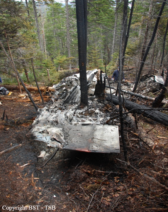
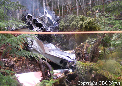
The aircraft departed Kamsack, on an instrument flight rules flight to Saskatoon, Saskatchewan. The pilot and three passengers were on board. At takeoff from runway 34, the aircraft began rolling to the left. The aircraft initially climbed, then descended in a steep left bank and collided with terrain 200 feet to the left of the runway. A post-impact fire ignited immediately. Two passengers survived the impact with serious injuries and evacuated from the burning wreckage. The pilot and third passenger were fatally injured. The aircraft was destroyed by impact forces and the post-impact fire. The accident occurred during evening civil twilight at 2124 Central Standard Time.
Probable cause:
Finding as to Causes and Contributing Factors:
1. The pilot was unable to maintain aircraft control after takeoff for undetermined reasons and the aircraft rolled to the left and collided with terrain.
Finding as to Risk:
1. The manufacturer issued a service bulletin to regularly inspect and lubricate the stainless steel cables. Due to the fact that the bulletin was not part of an airworthiness directive and was not considered mandatory, it was not carried out on an ongoing basis. It is likely that the recommended maintenance action has not been carried out on other affected aircraft at the 100-hour or annual frequency recommended in FAA SAIB CE-01-30.
Other Findings:
1. Due to the complete destruction of the surrounding structure, restriction to aileron cable movement prior to impact could not be determined.
2. The use of the available three-point restraint systems likely prevented the two survivors from being incapacitated, enabling them to evacuate from the burning wreckage.
Final Report:

Crash of a Piper PA-31-350 Navajo Chieftain in Vancouver: 2 killed

Date & Time: Jul 9, 2009 at 2208 LT
Operator:
Registration:
C-GNAF
Flight Type:
Survivors:
No
Schedule:
Vancouver – Nanaimo – Victoria – Vancouver
MSN:
31-8052130
YOM:
1980
Flight number:
APEX511
Country:
Crew on board:
2
Crew fatalities:
Pax on board:
0
Pax fatalities:
Other fatalities:
Total fatalities:
2
Captain / Total flying hours:
2300
Copilot / Total flying hours:
400
Circumstances:
The Canadian Air Charters Piper PA-31-350 Chieftain (registration C-GNAF, serial number 31-8052130) was operating under visual flight rules as APEX 511 on the final leg of a multi-leg cargo flight from Vancouver to Nanaimo and Victoria, British Columbia, with a return to Vancouver. The weather was visual meteorological conditions and the last 9 minutes of the flight took place during official darkness. The flight was third for landing and turned onto the final approach course 1.5 nautical miles behind and 700 feet below the flight path of a heavier Airbus A321, approaching Runway 26 Right at the Vancouver International Airport. At 2208, Pacific Daylight Time, the target for APEX 511 disappeared from tower radar. The aircraft impacted the ground in an industrial area of Richmond, British Columbia, 3 nautical miles short of the runway. There was a post-impact explosion and fire. The 2 crew members on board were fatally injured. There was property damage, but no injuries on the ground. The onboard emergency locator transmitter was destroyed in the accident and no signal was detected.
Probable cause:
Findings as to Causes and Contributing Factors:
1. APEX 511 turned onto the final approach course within the wake turbulence area behind and below the heavier aircraft and encountered its wake, resulting in an upset and loss of control at an altitude that precluded recovery.
2. The proximity of the faster trailing traffic limited the space available for APEX 511 to join the final approach course, requiring APEX 511 not to lag too far behind the preceding aircraft.
Findings as to Risk:
1. The current wake turbulence separation standards may be inadequate. As air traffic volume continues to grow, there is a risk that wake turbulence encounters will increase.
2. Visual separation may not be an adequate defence to ensure that appropriate spacing for wake turbulence can be established or maintained, particularly in darkness.
3. Neither the pilots nor Canadian Air Charters (CAC) were required by regulation to account for employee duty time acquired at other non-aviation related places of employment. As a result, there was increased risk that pilots were operating while fatigued.
4. Not maintaining engine accessories in accordance with manufacturers’ recommendations can lead to failure of systems critical to safety.
Other Finding:
1. APEX 511 was not equipped with any type of cockpit recording devices, nor was it required to be. As a result, the level of collaboration and decision making discussion between the 2 pilots remains unknown.
Final Report:

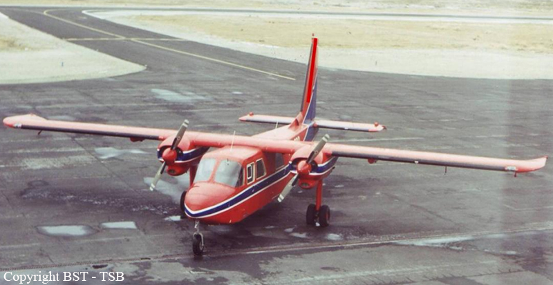
Crash of a Britten-Norman BN-2A-27 Islander in Port Hope Simpson: 1 killed

Date & Time: Jun 7, 2009 at 0830 LT
Type of aircraft:
Operator:
Registration:
C-FJJR
Flight Type:
Survivors:
No
Schedule:
Lourdes-de-Blanc-Sablon - Port Hope Simpson
MSN:
424
YOM:
1975
Country:
Crew on board:
1
Crew fatalities:
Pax on board:
0
Pax fatalities:
Other fatalities:
Total fatalities:
1
Captain / Total flying hours:
13500
Captain / Total hours on type:
600.00
Circumstances:
The pilot was tasked with a medical evacuation flight to take a patient from Port Hope Simpson to St. Anthony, Newfoundland and Labrador. The aircraft departed the company’s base of operations at Forteau, Newfoundland and Labrador, at approximately 0620 Newfoundland and Labrador daylight time. At approximately 0650, he made radio contact with the airfield attendant at the Port Hope Simpson Airport, advising that he was four nautical miles from the airport for landing. The weather in Port Hope Simpson was reported to be foggy. There were no further transmissions from the aircraft. Although the aircraft could not be seen, it could be heard west of the field. An application of power was heard, followed shortly thereafter by the sound of an impact. Once the fog cleared about 30 minutes later, smoke was visible in the hills approximately four nautical miles to the west of the Port Hope Simpson Airport. A ground search team was dispatched from Port Hope Simpson and the wreckage was found at approximately 1100. The sole occupant of the aircraft was fatally injured. The aircraft was destroyed by impact forces and a severe post-crash fire. There was no emergency locator transmitter signal.
Probable cause:
Finding as to Causes and Contributing Factors:
1. The aircraft departed controlled flight, likely in an aerodynamic stall, and impacted terrain for undetermined reasons.
Other Finding:
1. The lack of onboard recording devices prevented the investigation from determining the reasons why the aircraft departed controlled flight.
Final Report:

Crash of a De Havilland DHC-6 Twin Otter 100 in La Ronge

Date & Time: Feb 4, 2009 at 0915 LT
Operator:
Registration:
C-FCCE
Flight Phase:
Survivors:
Yes
Schedule:
La Ronge – Deschambeault Lake
MSN:
8
YOM:
1966
Country:
Crew on board:
2
Crew fatalities:
Pax on board:
5
Pax fatalities:
Other fatalities:
Total fatalities:
0
Captain / Total flying hours:
14000
Captain / Total hours on type:
11000.00
Copilot / Total flying hours:
625
Copilot / Total hours on type:
425
Circumstances:
The aircraft was taking off from a ski strip east of and parallel to Runway 36 at La Ronge. After the nose ski cleared the snow, the left wing rose and the aircraft veered to the right and the captain, who was the pilot flying, continued the take-off. The right ski, however, was still in contact with the snow. The aircraft became airborne briefly as it cleared a deep gully to the right of the runway. The aircraft remained in a steep right bank and the right wing contacted the snow-covered ground. The aircraft flew through a chain link fence and crashed into trees surrounding the airport. The five passengers and two crewmembers evacuated the aircraft with minor injuries. There was a small fire near the right engine exhaust that was immediately extinguished by the crew.
Probable cause:
Findings as to Causes and Contributing Factors:
1. Contamination on the wings of the aircraft was not fully removed before take-off. It is likely that asymmetric contamination of the wings created a lift differential and a loss of lateral control.
2. Although the operator was not authorized for short take-off and landing (STOL) take-off on this aircraft, the crew conducted a STOL take-off, which reduced the aircraft’s safety margin relative to its stalling speed and minimum control speed.
3. As a result of the loss of lateral control, the slow STOL take-off speed, and the manipulation of the flaps, the aircraft did not remain airborne and veered right, colliding with obstacles beside the ski strip.
Findings as to Risk:
1. The out of phase task requirements regarding the engine vibration isolator assembly, as listed in the operator’s maintenance schedule approval, results in a less than thorough inspection requirement, increasing the likelihood of fatigue cracks remaining undetected.
2. The right engine inboard and top engine mounts had pre-existing fatigue cracks, increasing the risk of catastrophic failure.
Other Findings:
1. The cockpit voice recorder (CVR) contained audio of a previous flight and was not in operation during the occurrence flight. Minimum equipment list (MEL) procedures for logbook entries and placarding were not followed.
2. The Transwest Air Limited safety management system (SMS) did not identify deviations from standard operating procedures.
Final Report:

Crash of a Beechcraft 100 King Air in Island Lake

Date & Time: Jan 16, 2009 at 2110 LT
Type of aircraft:
Operator:
Registration:
C-GNAA
Flight Type:
Survivors:
Yes
Schedule:
Thompson - Island Lake
MSN:
B-24
YOM:
1969
Country:
Crew on board:
2
Crew fatalities:
Pax on board:
0
Pax fatalities:
Other fatalities:
Total fatalities:
0
Captain / Total flying hours:
3200
Captain / Total hours on type:
500.00
Copilot / Total flying hours:
1200
Copilot / Total hours on type:
620
Circumstances:
The crew was on a re-positioning flight from Thompson to Island Lake, Manitoba. On arrival in the Island Lake area, the crew commenced an instrument approach to Runway 12. On the final approach segment, the aircraft descended below the minimum descent altitude and the crew initiated a missed approach. During the missed approach, the aircraft struck trees. The crew was able to return for a landing on Runway 12 at Island Lake without further incident. The two crew members were not injured; the aircraft sustained damage to its right wing and landing gear doors. The accident occurred during hours of darkness at approximately 2110 Central Standard Time.
Probable cause:
Findings as to Causes and Contributing Factors:
1. The crew conducted an Area Navigation (RNAV) approach for which they were not trained, with an aircraft that was not properly equipped nor approved for such purpose.
2. The aircraft descended 300 feet below the minimum descent altitude (MDA) as a result of a number of lapses, errors and adaptations which, when combined, resulted in the mismanaged approach.
3. The aural warning on the aircraft’s altitude alerter had been silenced prior to the approach, which precluded it from alerting the crew when the aircraft descended below minimum descent altitude.
4. The SkyNorth standard operating procedures for conducting a non-precision approach were not followed, which resulted in the aircraft descending below the minimum descent altitude. During the ensuing missed approach, the aircraft struck trees.
Findings as to Risk:
1. The lack of a more-structured training environment and the type of supervisory flying provided increased the risk that deviations from standard operating procedures (SOPs) would not be identified.
2. There are several instrument approach procedures in Canada that contain step-down fixes that are not displayed on global positioning system (GPS) units. This may increase the risk of collision with obstacles during step-downs on approaches.
Final Report:

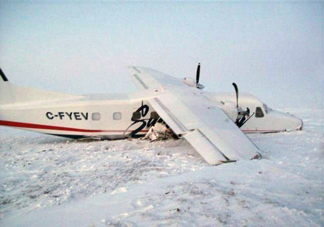
Crash of a Dornier DO228-202 in Cambridge Bay

Date & Time: Dec 13, 2008 at 0143 LT
Type of aircraft:
Operator:
Registration:
C-FYEV
Survivors:
Yes
Schedule:
Resolute Bay - Cambridge Bay
MSN:
8133
YOM:
1987
Country:
Crew on board:
2
Crew fatalities:
Pax on board:
12
Pax fatalities:
Other fatalities:
Total fatalities:
0
Captain / Total flying hours:
13400
Captain / Total hours on type:
802.00
Copilot / Total flying hours:
850
Copilot / Total hours on type:
470
Circumstances:
The Summit Air Charters Dornier 228-202 was on a charter flight from Resolute Bay to Cambridge Bay, Nunavut, under instrument flight rules. While on final approach to Runway 31 True, the aircraft collided with the ground approximately 1.5 nautical miles from the threshold at 0143 mountain standard time. Of the 2 pilots and 12 passengers on board, 2 persons received serious injuries. The aircraft was substantially damaged. The emergency locator transmitter activated, and the crew notified the Cambridge Bay Airport radio operator of the accident via the aircraft radio. Local ground search efforts found the aircraft within 30 minutes, and all occupants were removed from the site within two hours.
Probable cause:
Findings as to Causes and Contributing Factors:
1. An abbreviated visual approach was conducted at night in instrument meteorological conditions, which resulted in the flight crew’s inability to obtain sufficient visual reference to judge their height above the ground.
2. The flight crew did not monitor pressure altimeter readings or reference the minimum altitude requirements in relation to aircraft position on the approach, resulting in controlled flight into terrain.
3. The pilots had not received training and performance checks for the installed global positioning system (GPS) equipment, and were not fully competent in its use. The attempts at adjusting the settings likely distracted the pilots from maintaining the required track and ground clearance during the final approach.
Findings as to Risk:
1. The precision approach path indicator systems (PAPI) at Cambridge Bay had not been inspected in accordance with the Airport Safety Program Manual. Although calibration of the equipment did not have a bearing on this occurrence, there was an increased risk of aircraft misalignment from the proper glide path, especially during night and reduced visibility conditions.
2. The flight crew’s cross-check of barometric altimeter performance was not sufficient to detect which instrument was inaccurate. As a result, reference was made to a defective altimeter, which increased the risk of controlled flight into terrain.
3. Operators’ maintenance organizations normally do not have access to the troubleshooting information contained in Component Maintenance Instruction Manuals for the Intercontinental Dynamics Corporation altimeters. Therefore, aircraft could be dispatched with damaged instruments with the potential for developing a loss of calibration during flight.
4. The flight was conducted during a period in which the crew’s circadian rhythm cycle could result in cognitive and physical performance degradation unless recognized and managed.
Final Report:

Crash of a BAe 3112 Jetstream 31 in Fort Smith

Date & Time: Nov 27, 2008 at 1515 LT
Type of aircraft:
Operator:
Registration:
C-FNAY
Survivors:
Yes
Schedule:
Hay River - Fort Smith
MSN:
768
YOM:
1987
Flight number:
PLR734
Country:
Crew on board:
2
Crew fatalities:
Pax on board:
3
Pax fatalities:
Other fatalities:
Total fatalities:
0
Circumstances:
The Northwestern Air BAe Jetstream 31 was operating as PLR734 on an instrument flight rules (IFR) flight from Hay River to Fort Smith, Northwest Territories. After conducting an IFR approach to Runway 11, PLR734 executed a missed approach and flew a full procedure approach for Runway 29. At approximately 0.2 nautical miles from the threshold, the crew sighted the approach strobe lights and continued for a landing. Prior to touchdown, the aircraft entered an aerodynamic stall and landed hard on the runway at 1515 mountain standard time. The aircraft remained on the runway despite the left main landing gear collapsing. The two flight crew members and three passengers were uninjured and evacuated the aircraft through the left main cabin door. There was no post-impact fire.
Probable cause:
Findings as to Causes and Contributing Factors:
1. Though icing conditions were encountered, the airframe de-icing boots were not cycled nor was the Vref speed increased to offset the effects of aircraft icing.
2. An abrupt change in aircraft configuration, which included a reduction in power to flight idle and the addition of 35° flap, caused the aircraft’s speed to rapidly decrease.
3. The aircraft entered an aerodynamic stall due to the decreased performance caused by the icing. There was insufficient altitude to recover the aircraft prior to impact with the runway.
Finding as to Risk:
1. The company had not incorporated the British Aerospace Notice to Aircrew into its standard operating procedures (SOP) at the time of the occurrence. Therefore, crews were still required to make configuration changes late in the approach sequence, increasing the risk of an unstabilised approach.
Final Report:

Crash of a Beechcraft A100 King Air in Gods Lake Narrows

Date & Time: Nov 22, 2008 at 2140 LT
Type of aircraft:
Operator:
Registration:
C-FSNA
Flight Phase:
Flight Type:
Survivors:
Yes
Schedule:
Gods Lake Narrows – Thompson
MSN:
B-227
YOM:
1976
Flight number:
SNA683
Country:
Crew on board:
2
Crew fatalities:
Pax on board:
3
Pax fatalities:
Other fatalities:
Total fatalities:
0
Captain / Total flying hours:
3200
Captain / Total hours on type:
1850.00
Copilot / Total flying hours:
1000
Copilot / Total hours on type:
500
Circumstances:
The Sky North Air Ltd. Beechcraft A100 (registration C-FSNA, serial number B-227) operating as SN683 departed Runway 32 at Gods Lake Narrows, Manitoba, for Thompson, Manitoba with two pilots, a flight nurse, and two patients on board. Shortly after takeoff, while in a climbing left turn, smoke and then fire emanated from the pedestal area in the cockpit. The crew continued the turn, intending to return to Runway 14 at Gods Lake Narrows. The aircraft contacted trees and came to rest in a wooded area about one-half nautical mile northwest of the airport. The accident occurred at 2140 central standard time. All five persons onboard evacuated the aircraft; two received minor injuries. At approximately 0250, the accident site was located and the occupants were evacuated. The aircraft was destroyed by impact forces and a post-crash fire. The emergency locator transmitter was consumed by the fire and whether or not it transmitted a signal is unknown.
Probable cause:
Findings as to Causes and Contributing Factors:
1. An electrical short circuit in the cockpit pedestal area produced flames and smoke, which induced the crew to take emergency action.
2. The detrimental effects of aging on the wires involved may have been a factor in this electrical arc event.
3. The crew elected to return to the airport at low level in an environment with inadequate visual references. As a result, control of the aircraft was lost at an altitude from which a recovery was not possible.
Findings as to Risk:
1. The actions specified in the standard operating procedures (SOP) do not include procedures for an electrical fire encountered at low altitude at night, which could lead to a loss of control.
2. Visual inspection procedures in accordance with normal phase inspection requirements may be inadequate to detect defects progressing within wiring bundles, increasing the risk of electrical fires.
3. In the event of an in-flight cockpit pedestal fire, the first officer does not have ready access to available fire extinguishers, reducing the likelihood of successfully fighting a fire of this nature.
4. Sealed in plastic containers and stored behind each pilot seat, the oxygen masks and goggles are time consuming to access and cumbersome to apply and activate. This could increase the probability of injury or incapacitation through extended exposure to smoke or fumes, or could deter crews from using them, especially during periods of high cockpit workload.
Other Finding:
1. A failure of the hot-mic recording function of the cockpit voice recorder (CVR) had gone undetected and information that would have been helpful to the investigation was not available.
Final Report:

Crash of a Grumman G-21A Goose on Thormanby Island: 7 killed

Date & Time: Nov 16, 2008 at 1032 LT
Type of aircraft:
Operator:
Registration:
C-FPCK
Flight Phase:
Survivors:
Yes
Site:
Schedule:
Vancouver - Powell River
MSN:
1187
YOM:
1942
Country:
Crew on board:
1
Crew fatalities:
Pax on board:
7
Pax fatalities:
Other fatalities:
Total fatalities:
7
Captain / Total flying hours:
12000
Captain / Total hours on type:
8000.00
Circumstances:
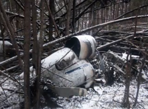
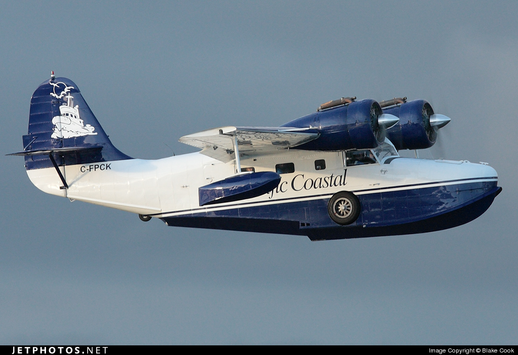
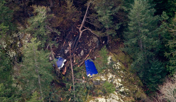
At about 1013 Pacific Standard Time, the amphibious Grumman G-21A (registration C-FPCK, serial number 1187), operated by Pacific Coastal Airlines, departed from the water aerodrome at the south terminal of the Vancouver International Airport, British Columbia, with one pilot and seven passengers for a flight to Powell River, British Columbia. Approximately 19 minutes later, the aircraft crashed in dense fog on South Thormanby Island, about halfway between Vancouver and Powell River. Local searchers located a seriously injured passenger on the eastern shoreline of the island at about 1400. The aircraft was located about 30 minutes later, on a peak near Spyglass Hill, British Columbia. The pilot and the six other passengers were fatally injured, and the aircraft was destroyed by impact and post-crash fire. The emergency locator transmitter was destroyed and did not transmit.
Probable cause:
Findings as to Causes and Contributing Factors
1. The pilot likely departed and continued flight in conditions that were below visual
flight rules (VFR) weather minima.
2. The pilot continued his VFR flight into instrument meteorological conditions (IMC),
and did not recognize his proximity to terrain until seconds before colliding with
Thormanby Island, British Columbia.
3. The indication of a marginal weather improvement at Powell River, British Columbia,
and incorrect information from Merry Island, British Columbia, may have
contributed to the pilot’s conclusion that weather along the route would be sufficient
for a low-level flight.
Findings as to Risk:
1. The reliance on a single VHF-AM radio for commercial operations, particularly in congested airspace, increases the risk that important information is not received.
2. Flights conducted at low altitude greatly decrease VHF radio reception range, making it difficult to obtain route-related information that could affect safety.
3. The lack of pilot decision making (PDM) training for VFR air taxi operators exposes pilots and passengers to increased risk when faced with adverse weather conditions.
4. Some operators and pilots intentionally skirt VFR weather minima, which increases risk to passengers and pilots travelling on air taxi aircraft in adverse weather conditions.
5. Customers who apply pressure to complete flights despite adverse weather can negatively influence pilot and operator decisions.
6. Incremental growth in Pacific Coastal’s support to Kiewit did not trigger further risk analysis by either company. As a result, pilots and passengers were exposed to increased risks that went undetected.
7. Transport Canada’s guidance on risk assessment does not address incremental growth for air operators. As a result, there is increased risk that operators will not conduct the appropriate risk analysis as their operation grows.
8. Previous discussions between Pacific Coastal and the pilot about his weather decision making were not documented under the company’s safety management system (SMS). If hazards are not documented, a formal risk analysis may not be prompted to define and mitigate the risk.
9. There were no company procedures or decision aids (that is, decision tree, second pilot input, dispatcher co-authority) in place to augment a pilot’s decision to depart.
10. Because the aircraft’s emergency locator transmitter (ELT) failed to operate after the crash, determining that a crash had occurred and locating the aircraft were delayed.
11. On a number of flights, pilots on the Vancouver–Toba Inlet route, British Columbia, departed over maximum gross weight due to incorrectly calculated weight and balances. Risks to pilots and passengers are increased when the aircraft is operating outside approved limits.
12. The over-reliance on global positioning system (GPS) in conditions of low visibility and ceilings presents a significant safety risk to pilots and passengers.
Other Finding:
1. The SPOT Satellite Messenger data transmitted before the crash helped to narrow the search area and reduce the search time to find the aircraft. The fact that the wrong data were consulted caused an initial delay in reporting the missing aircraft.
Final Report:

Crash of a Beechcraft 100 King Air in Stony Rapids

Date & Time: Nov 11, 2008 at 1817 LT
Type of aircraft:
Registration:
C-GWWQ
Flight Type:
Survivors:
Yes
Schedule:
Uranium City – Stony Rapids
MSN:
B-76
YOM:
1971
Country:
Crew on board:
2
Crew fatalities:
Pax on board:
0
Pax fatalities:
Other fatalities:
Total fatalities:
0
Circumstances:
For unknown reasons, the aircraft made a wheels up landing and skidded on runway at Stony Rapids Airport before coming to rest. Both pilots were uninjured while the aircraft was damaged beyond repair.
Probable cause:
Gear up landing for undetermined reason.