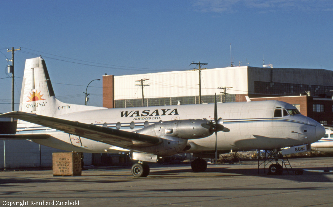
Ground fire of an Avro 748-264-2A in Sandy Lake

Date & Time: Jun 12, 2012 at 1343 LT
Type of aircraft:
Operator:
Registration:
C-FTTW
Flight Phase:
Flight Type:
Survivors:
Yes
Schedule:
Pickle Lake – Sandy Lake
MSN:
1681
YOM:
1970
Country:
Crew on board:
2
Crew fatalities:
Pax on board:
0
Pax fatalities:
Other fatalities:
Total fatalities:
0
Circumstances:
The aircraft was parked on the ramp at Sandy Lake Airport. The flight crew had disembarked and were off-loading the cargo (JET A-1 jet fuel drums) from the aircraft to fuel tanks adjacent to the ramp. A fire broke out and the flight crew used the available fire extinguishers but the fire spread and consumed most of the aircraft that was totally destroyed. There were no injuries.
Probable cause:
A leak occurred in a hose downstream of the pumps (located on the ground beside the aircraft). The ambient wind blew vapors toward the pumps and a fire broke out. No official investigation was conducted by the TSB on this event.

Crash of a De Havilland DHC-2 Beaver in Lillabelle Lake: 2 killed

Date & Time: May 25, 2012 at 1408 LT
Type of aircraft:
Operator:
Registration:
C-FGBF
Survivors:
Yes
Schedule:
Edgar Lake - Lillabelle Lake
MSN:
168
YOM:
1952
Country:
Crew on board:
1
Crew fatalities:
Pax on board:
2
Pax fatalities:
Other fatalities:
Total fatalities:
2
Captain / Total flying hours:
1100
Captain / Total hours on type:
300.00
Aircraft flight hours:
22000
Circumstances:
The Cochrane Air Service de Havilland DHC-2 Mk.1 Beaver floatplane (registration C-FGBF, serial number 168) departed Edgar Lake, Ontario, with 2 passengers and 300 pounds of cargo on board. The aircraft was destined for the company’s main base located on Lillabelle Lake, Ontario, approximately 77 miles to the south. On arrival, a southwest-bound landing was attempted across the narrow width of the lake, as the winds favoured this direction. The pilot was unable to land the aircraft in the distance available and executed a go-around. At 1408, Eastern Daylight Time, shortly after full power application, the aircraft rolled quickly to the left and struck the water in a partially inverted attitude. The aircraft came to rest on the muddy lake bottom, partially suspended by the undamaged floats. The passenger in the front seat was able to exit the aircraft and was subsequently rescued. The pilot and rear-seat passenger were not able to exit and drowned. The emergency locator transmitter activated on impact.
Probable cause:
Findings as to Causes and Contributing Factors:
1. On the windward side of the landing surface, there was significant mechanical turbulence and associated wind shear caused by the passage of strong gusty winds over surface obstructions.
2. During the attempted overshoot, the rapid application of full power caused the aircraft to yaw to the left, and a left roll quickly developed. This movement, in combination with a high angle of attack and low airspeed, likely caused the aircraft to stall. The altitude available to regain control before striking the water was insufficient.
3. The pilot survived the impact, but was unable to exit the aircraft, possibly due to difficulties finding or opening an exit. The pilot subsequently drowned.
4. The rear-seat passenger did not have a shoulder harness and was critically injured. The passenger’s head struck the pilot’s seat in front; this passenger did not exit the aircraft and drowned.
Findings as to Risk:
1. Without a full passenger safety briefing, there is increased risk that passengers may not use the available safety equipment or be able to perform necessary emergency functions in a timely manner to avoid injury or death.
2. Not wearing a shoulder harness can increase the risk of injury or death in an accident.
3. Not having a stall warning system increases the risk that the pilot may not be aware of an impending aerodynamic stall.
4. Commercial seaplane pilots who do not receive underwater egress training are at increased risk of being unable to exit the aircraft following a survivable impact with water.
Final Report:

Crash of a De Havilland DHC-2 Beaver near Peachland: 3 killed

Date & Time: May 13, 2012 at 1845 LT
Type of aircraft:
Operator:
Registration:
C-GCZA
Flight Phase:
Flight Type:
Survivors:
No
Site:
Schedule:
Okanagan Lake - Pitt Meadows
MSN:
1667
YOM:
1966
Country:
Crew on board:
1
Crew fatalities:
Pax on board:
2
Pax fatalities:
Other fatalities:
Total fatalities:
3
Captain / Total flying hours:
420
Captain / Total hours on type:
50.00
Circumstances:
The privately operated de Havilland DHC-2 MK 1 amphibious floatplane (registration C-GCZA, serial number 1667) departed Okanagan Lake, near Kelowna, for a daytime flight under visual flight rules to Pitt Meadows, British Columbia, with the pilot and 2 passengers on board. While enroute, the aircraft struck trees and collided with terrain close to and 100 feet below the level of Highway 97C, near the Brenda Mines tailings hill. At 1850 Pacific Daylight Time, a brief 406-megahertz emergency-locator-transmitter signal was detected, which identified the aircraft; however, a location could not be determined. Most of the aircraft was consumed by a post-impact fire. The 3 occupants were fatally injured.
Probable cause:
There was no indication that an aircraft system malfunction contributed to this occurrence. There were no drastic changes in the aircraft’s flight path, and no emergency calls from the pilot to indicate that an in-flight emergency was experienced. The constant ground speed and flight path would also suggest that the aircraft was under the control of the pilot. As a result, this analysis will focus on the phenomenon of controlled flight into terrain (CFIT).
Findings as to Causes and Contributing Factors:
1. The combination of relatively high weight, effects of density altitude, and down-flowing air likely reduced the climb performance of the aircraft, resulting in the aircraft’s altitude being lower than anticipated at that stage in the flight.
2. The pilot’s vision was likely impaired by the sun, and the pilot may have been exposed to visual illusions; both were factors that contributed to the pilot not noticing the trees and the rising terrain, and colliding with them.
Findings as to Risk:
1. Visual illusions cause false impressions or misconceptions of actual conditions. Unrecognized and uncorrected spatial disorientation, caused by illusions, carries a high risk of incident or accident.
2. When there are no special departure procedures published for airports in mountainous regions surrounded by high terrain, there is a risk of pilots departing the valley at an altitude too low for terrain clearance.
Other Findings:
1. Information from the Wide Area Multilateration system was not preserved following the occurrence, as local NAV CANADA personnel were not aware that unfiltered data were only available for a limited time.
Final Report:

Crash of a Piper PA-31-350 Navajo Chieftain in North Spirit Lake: 4 killed

Date & Time: Jan 10, 2012 at 0957 LT
Operator:
Registration:
C-GOSU
Survivors:
Yes
Schedule:
Winnipeg - North Spirit Lake
MSN:
31-7752148
YOM:
1977
Flight number:
KEE213
Country:
Crew on board:
1
Crew fatalities:
Pax on board:
4
Pax fatalities:
Other fatalities:
Total fatalities:
4
Captain / Total flying hours:
2400
Captain / Total hours on type:
95.00
Circumstances:
The Piper PA31-350 Navajo Chieftain (registration C-GOSU, serial number 31-7752148), operating as Keystone Air Service Limited Flight 213, departed Winnipeg/James Armstrong Richardson International Airport, Manitoba, enroute to North Spirit Lake, Ontario, with 1 pilot and 4 passengers on board. At 0957 Central Standard Time, on approach to Runway 13 at North Spirit Lake, the aircraft struck the frozen lake surface 1.1 nautical miles from the threshold of Runway 13. The pilot and 3 passengers sustained fatal injuries. One passenger sustained serious injuries. The aircraft was destroyed by impact forces and a post-impact fire. After a short period of operation, the emergency locator transmitter stopped transmitting when the antenna wire was consumed by the fire.
Probable cause:
Findings as to causes and contributing factors:
1. The pilot's decision to conduct an approach to an aerodrome not serviced by an instrument flight rules approach in adverse weather conditions was likely the result of the pilot's inexperience, and may have been influenced by the pilot's desire to successfully complete the flight.
2. The pilot's decision to descend into cloud and continue in icing conditions was likely the result of inadequate awareness of the Piper PA31-350 aircraft's performance in icing conditions and of its de-icing capabilities.
3. While waiting for the runway to be cleared of snow, the aircraft held near North Spirit Lake (CKQ3) in icing conditions. The resulting ice accumulation on the aircraft's critical surfaces would have led to an increase in the aircraft's aerodynamic drag and stall speed, causing the aircraft to stall during final approach at an altitude from which recovery was not possible.
Findings as to risk:
1. Terminology contained in aircraft flight manuals and regulatory material regarding “known icing conditions,” “light to moderate icing conditions,” “flight in,” and “flight into” is inconsistent, and this inconsistency increases the risk of confusion as to the aircraft’s certification and capability in icing conditions.
2. If confusion and uncertainty exist as to the aircraft’s certification and capability in icing conditions, then there is increased risk that flights will dispatch into icing conditions that exceed the capability of the aircraft.
3. The lack of procedures and tools to assist pilots in the decision to self-dispatch leaves them at increased risk of dispatching into conditions beyond the capability of the aircraft.
4. When management involvement in the dispatch process results in pilots feeling pressure to complete flights in challenging conditions, there is increased risk that pilots may attempt flights beyond their competence.
5. Under current regulations, Canadian Aviation Regulations (CARs) 703 and 704 operators are not required to provide training in crew resource management / pilot decision-making or threat- and error-management. A breakdown in crew resource management / pilot decision-making may result in an increased risk when pilots are faced with adverse weather conditions.
6. Descending below the area minimum altitude while in instrument meteorological conditions without a published approach procedure increases the risk of collision with terrain.
7. If onboard flight recorders are not available to an investigation, this unavailability may preclude the identification and communication of safety deficiencies to advance transportation safety.
Final Report:

Crash of a Beechcraft A100 King Air in Vancouver: 2 killed

Date & Time: Oct 27, 2011 at 1612 LT
Type of aircraft:
Operator:
Registration:
C-GXRX
Survivors:
Yes
Schedule:
Vancouver - Kelowna
MSN:
B-36
YOM:
1970
Flight number:
NTA204
Country:
Crew on board:
2
Crew fatalities:
Pax on board:
7
Pax fatalities:
Other fatalities:
Total fatalities:
2
Captain / Total flying hours:
13876
Captain / Total hours on type:
978.00
Copilot / Total flying hours:
1316
Copilot / Total hours on type:
85
Aircraft flight hours:
26993
Circumstances:
The Northern Thunderbird Air Incorporated Beechcraft King Air 100 (serial number B-36, registration C‑GXRX) departed Vancouver International Airport for Kelowna, British Columbia, with 7 passengers and 2 pilots on board. About 15 minutes after take-off, the flight diverted back to Vancouver because of an oil leak. No emergency was declared. At 1611 Pacific Daylight Time, when the aircraft was about 300 feet above ground level and about 0.5 statute miles from the runway, it suddenly banked left and pitched nose-down. The aircraft collided with the ground and caught fire before coming to rest on a roadway just outside of the airport fence. Passersby helped to evacuate 6 passengers; fire and rescue personnel rescued the remaining passenger and the pilots. The aircraft was destroyed, and all of the passengers were seriously injured. Both pilots succumbed to their injuries in hospital. The aircraft’s emergency locator transmitter had been removed.
Probable cause:
Findings as to causes and contributing factors:
During routine aircraft maintenance, it is likely that the left-engine oil-reservoir cap was left unsecured.
There was no complete preflight inspection of the aircraft, resulting in the unsecured engine oil-reservoir cap not being detected, and the left engine venting significant oil during operation.
A non-mandatory modification, designed to limit oil loss when the engine oil cap is left unsecure, had not been made to the engines.
Oil that leaked from the left engine while the aircraft was repositioned was pointed out to the crew, who did not determine its source before the flight departure.
On final approach, the aircraft slowed to below VREF speed. When power was applied, likely only to the right engine, the aircraft speed was below that required to maintain directional control, and it yawed and rolled left, and pitched down.
A partially effective recovery was likely initiated by reducing the right engine’s power; however, there was insufficient altitude to complete the recovery, and the aircraft collided with the ground.
Impact damage compromised the fuel system. Ignition sources resulting from metal friction, and possibly from the aircraft’s electrical system, started fires.
The damaged electrical system remained powered by the battery, resulting in arcing that may have ignited fires, including in the cockpit area.
Impact-related injuries sustained by the pilots and most of the passengers limited their ability to extricate themselves from the aircraft.
Findings as to risk:
Multi-engine−aircraft flight manuals and training programs do not include cautions and minimum control speeds for use of asymmetrical thrust in situations when an engine is at low power or the propeller is not feathered. There is a risk that pilots will not anticipate aircraft behavior when using asymmetrical thrust near or below unpublished critical speeds, and will lose control of the aircraft.
The company’s standard operating procedures lacked clear directions for how the aircraft was to be configured for the last 500 feet, or what to do if an approach is still unstable when 500 feet is reached, specifically in an abnormal situation. There is a demonstrated risk of accidents occurring as a result of unstabilized approaches below 500 feet above ground level.
Without isolation of the aircraft batteries following aircraft damage, there is a risk that an energized battery may ignite fires by electrical arcing.
Erroneous data used for weight-and-balance calculations can cause crews to inadvertently fly aircraft outside of the allowable center-of-gravity envelope.
Final Report:

Crash of a Cessna 208B Grand Caravan near Lutsel K'e: 2 killed

Date & Time: Oct 4, 2011 at 1140 LT
Type of aircraft:
Operator:
Registration:
C-GATV
Flight Phase:
Survivors:
Yes
Schedule:
Yellowknife - Lutsel K'e
MSN:
208B-0308
YOM:
1992
Flight number:
8T200
Country:
Crew on board:
1
Crew fatalities:
Pax on board:
3
Pax fatalities:
Other fatalities:
Total fatalities:
2
Captain / Total flying hours:
1950
Circumstances:
The Air Tindi Ltd. Cessna 208B Caravan departed Yellowknife, Northwest Territories, at 1103 Mountain Daylight Time under visual flight rules as regularly scheduled flight Air Tindi 200 (8T200) to Lutsel K'e, Northwest Territories. When the aircraft did not arrive at its scheduled time, a search was initiated, and the aircraft was found 26 nautical miles west of Lutsel K'e, near the crest of Pehtei Peninsula. The pilot and one passenger were fatally injured, and two passengers were seriously injured. There was no post-impact fire, and no emergency locator transmitter signal was received by the Joint Rescue Coordination Centre or search aircraft.
Probable cause:
Findings as to causes and contributing factors:
The aircraft was flown at low altitude into an area of low forward visibility during a day VFR flight, which prevented the pilot from seeing and avoiding terrain.
The concentrations of cannabinoids were sufficient to have caused impairment in pilot performance and decision-making on the accident flight.
Findings as to risk:
Installation instructions for the ELT did not provide a means of determining the necessary degree of strap tightness to prevent the ELT from being ejected from its mount during an accident. Resultant damages to the ELT and antenna connections could preclude transmission of an effective signal, affecting search and rescue of the aircraft and occupants.
Flying beyond gliding distance of land without personal floatation devices on board exposes the occupants to hypothermia and/or drowning in the event of a ditching.
Other findings:
Earlier on the day of the accident, the pilot flew the route from Fort Simpson to Yellowknife in cloud on a visual flight rules flight plan in controlled airspace.
With the ELT unable to transmit a useable signal, the SkyTrac system in C GATV was instrumental in locating the accident site. This reduced the search time, and allowed for timely rescue of the seriously injured survivors.
Final Report:

Crash of a De Havilland DHC-6 Twin Otter 300 in Yellowknife: 2 killed

Date & Time: Sep 22, 2011 at 1318 LT
Operator:
Registration:
C-GARW
Survivors:
Yes
Site:
Schedule:
Thor Lake - Yellowknife
MSN:
367
YOM:
1973
Country:
Crew on board:
2
Crew fatalities:
Pax on board:
7
Pax fatalities:
Other fatalities:
Total fatalities:
2
Captain / Total flying hours:
5817
Captain / Total hours on type:
1037.00
Copilot / Total flying hours:
570
Copilot / Total hours on type:
323
Aircraft flight hours:
33355
Circumstances:
The float-equipped de Havilland DHC-6-300 Twin Otter (registration C-GARW, serial number 367) was landing at the float-plane base (CEN9) located in Yellowknife, Northwest Territories, along the western shore of Great Slave Lake, beside the area known as Old Town. There were 2 crew members and 7 passengers on board, and the first officer was the pilot flying. On touchdown, the aircraft bounced, porpoised and landed hard on the right float. The flight crew initiated a go-around; the aircraft lifted off at low speed in a nose-high, right-wing-low attitude, and it continued in a right turn towards the shore. As the turn continued, the aircraft’s right wing contacted power lines and cables before the float bottoms impacted the side of an office building. The aircraft then dropped to the ground on its nose and cart-wheeled into an adjacent parking lot. Both crew members were fatally injured, 4 passengers were seriously injured, and 3 passengers sustained minor injuries. The aircraft was substantially damaged. The 406-megahertz emergency locator transmitter activated. There was no fire. The accident occurred at 1318 Mountain Daylight Time.
Probable cause:
Findings as to Causes and Contributing Factors:
1. Airspeed fluctuations at touchdown, coupled with gusty wind conditions, caused a bounced landing.
2. Improper go-around techniques during the recovery from the bounced landing resulted in a loss of control.
3. It is possible that confused crew coordination during the attempted go-around contributed to the loss of control.
Final Report:

Crash of an Embraer ERJ-145LR in Ottawa

Date & Time: Sep 4, 2011 at 1529 LT
Type of aircraft:
Operator:
Registration:
N840HK
Survivors:
Yes
Schedule:
Chicago - Ottawa
MSN:
145-341
YOM:
2001
Flight number:
UA3363
Country:
Crew on board:
3
Crew fatalities:
Pax on board:
44
Pax fatalities:
Other fatalities:
Total fatalities:
0
Captain / Total flying hours:
8000
Captain / Total hours on type:
4000.00
Copilot / Total flying hours:
4800
Copilot / Total hours on type:
3800
Aircraft flight hours:
25655
Aircraft flight cycles:
23335
Circumstances:
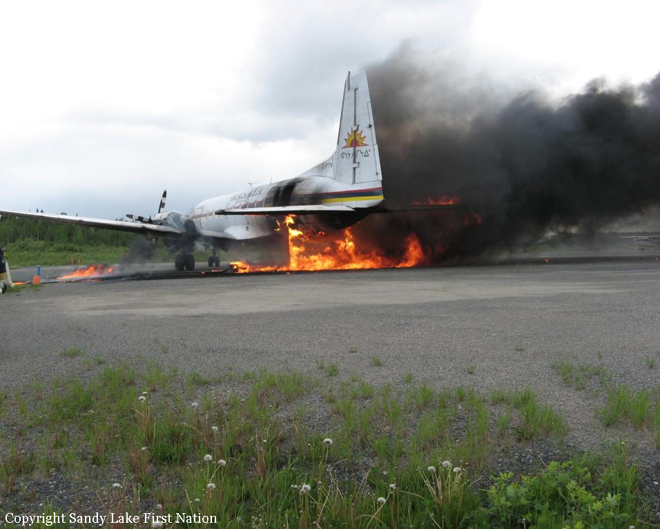
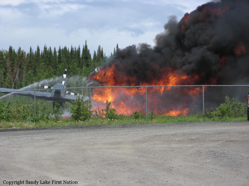
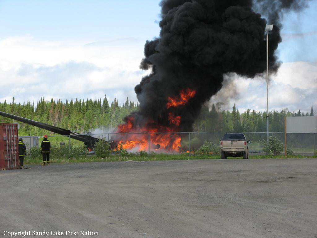
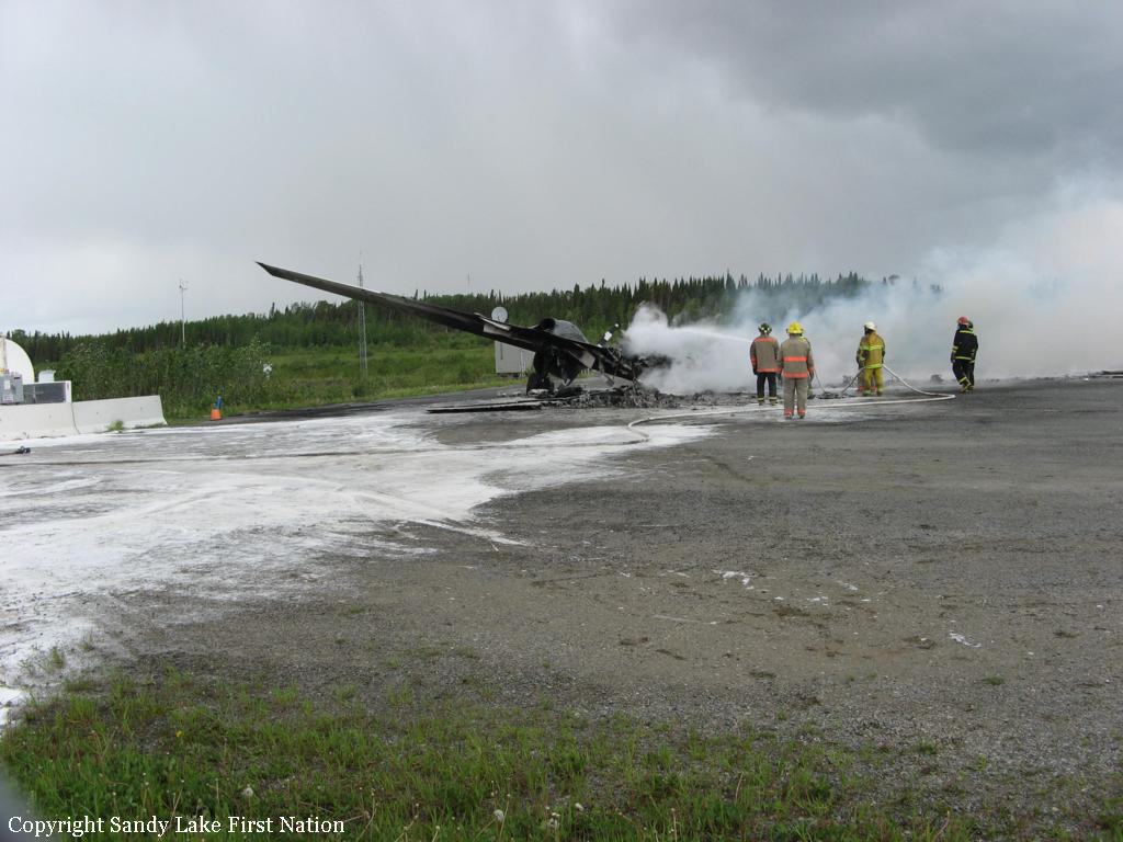
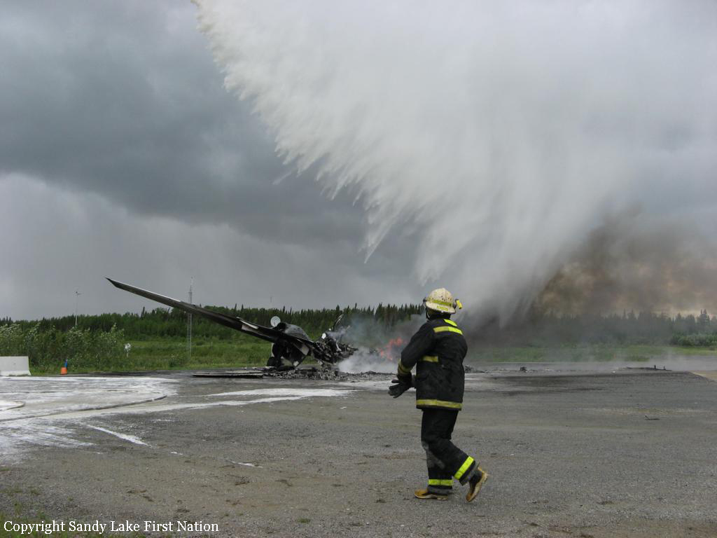
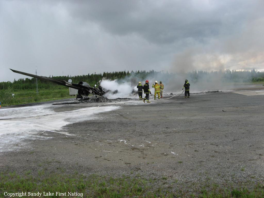
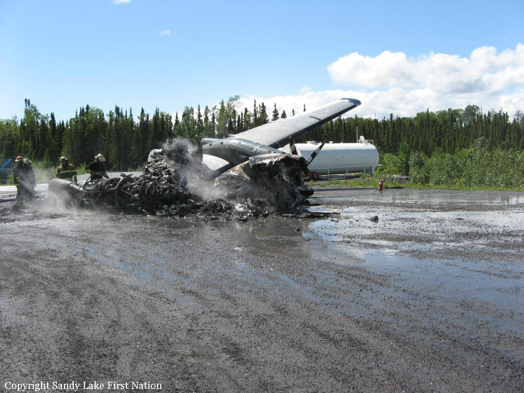
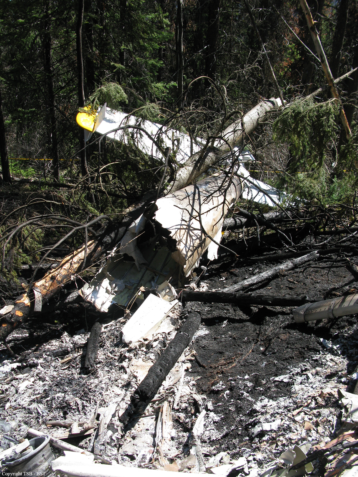
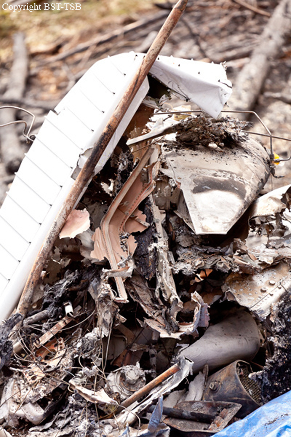
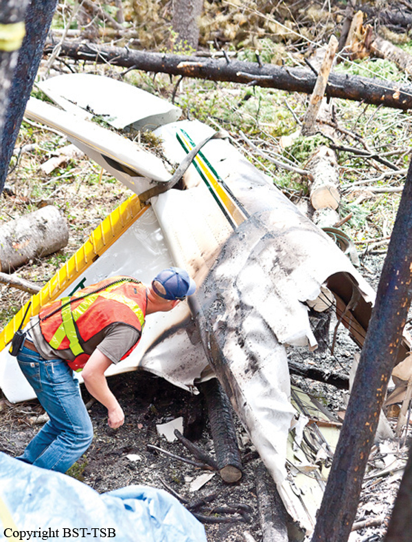
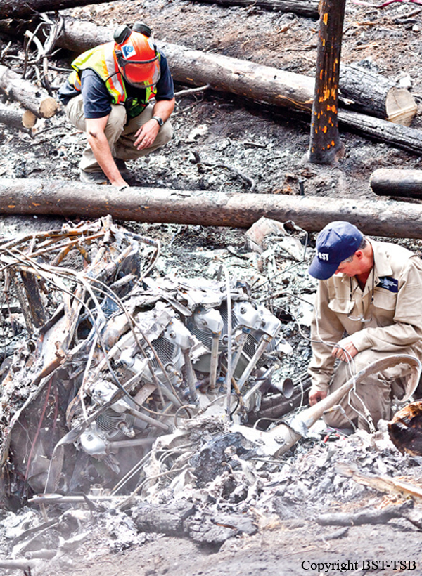
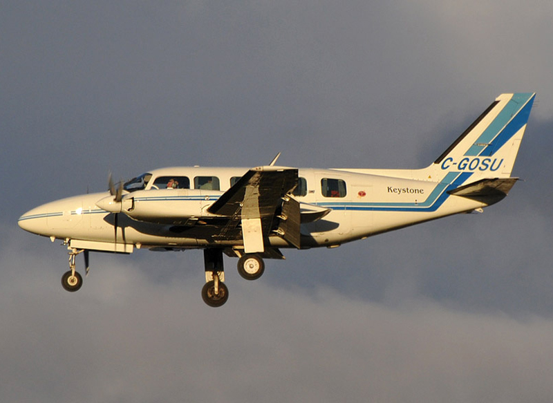
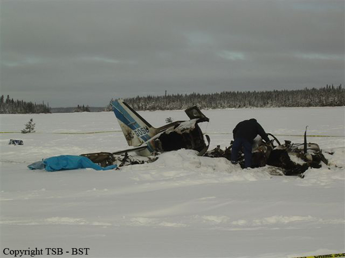
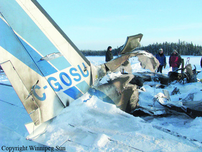
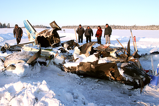
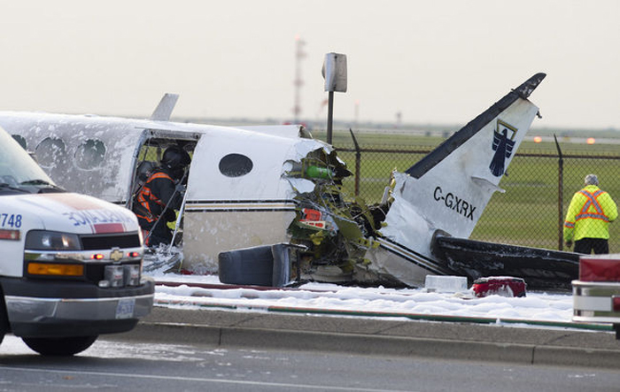
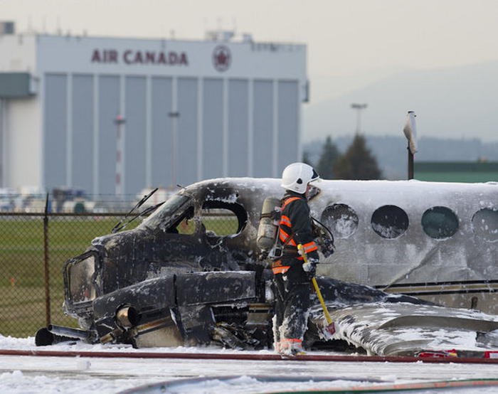
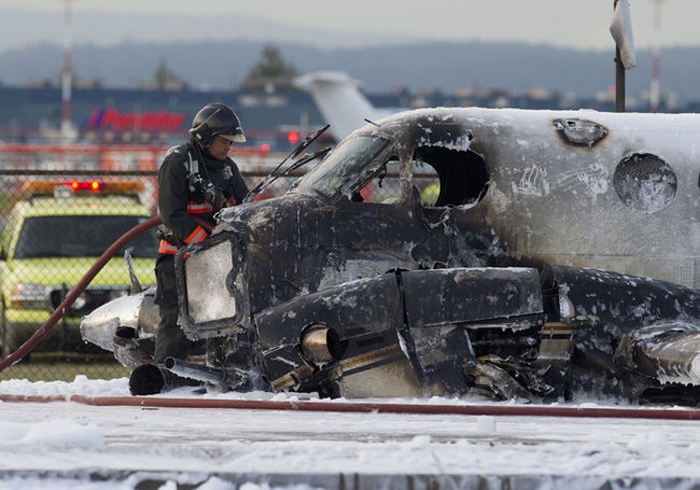
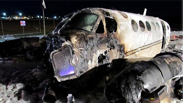
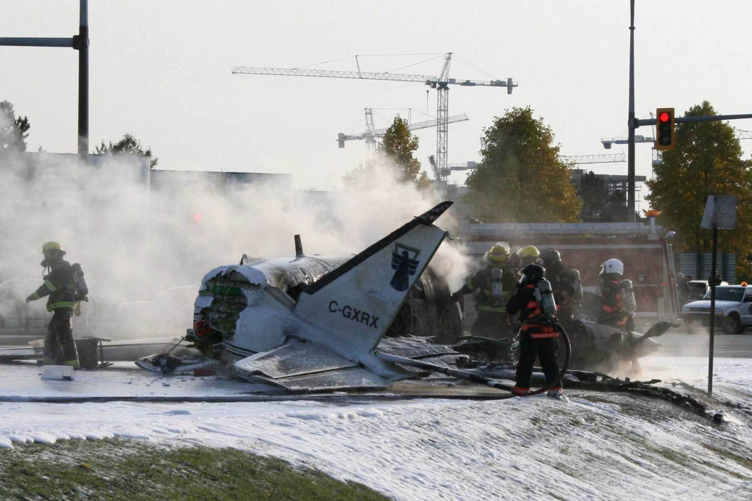
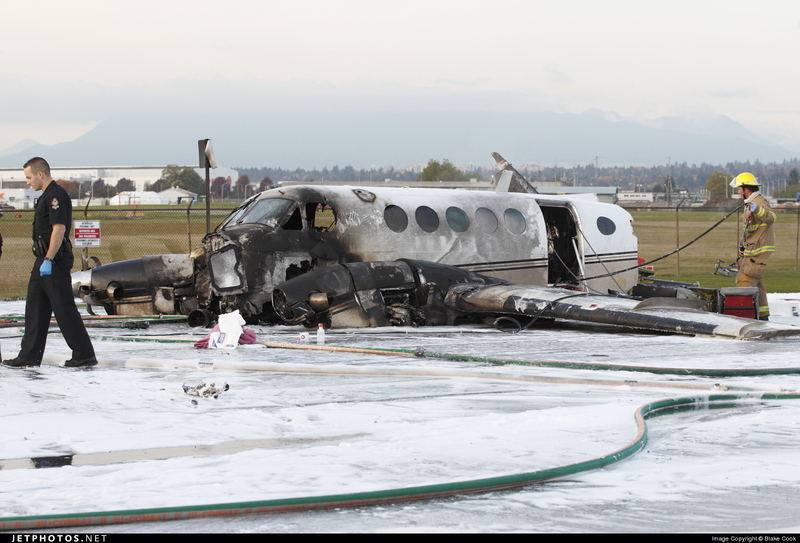
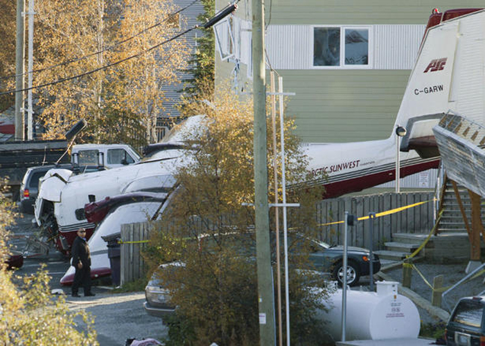
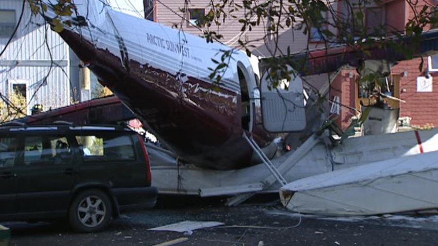
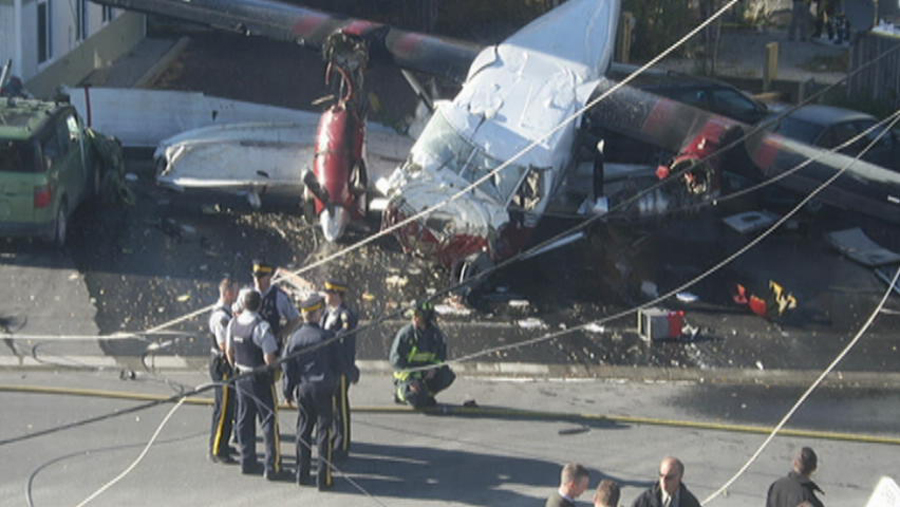
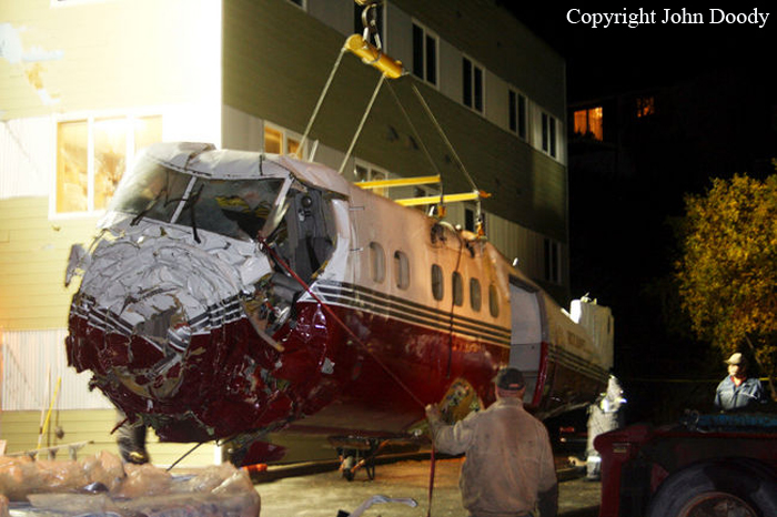
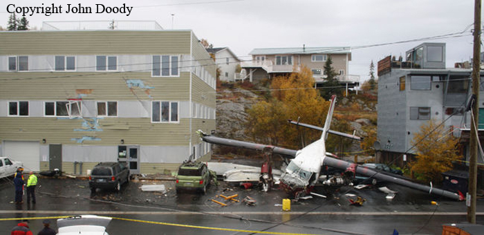
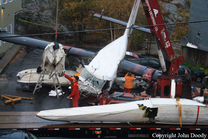
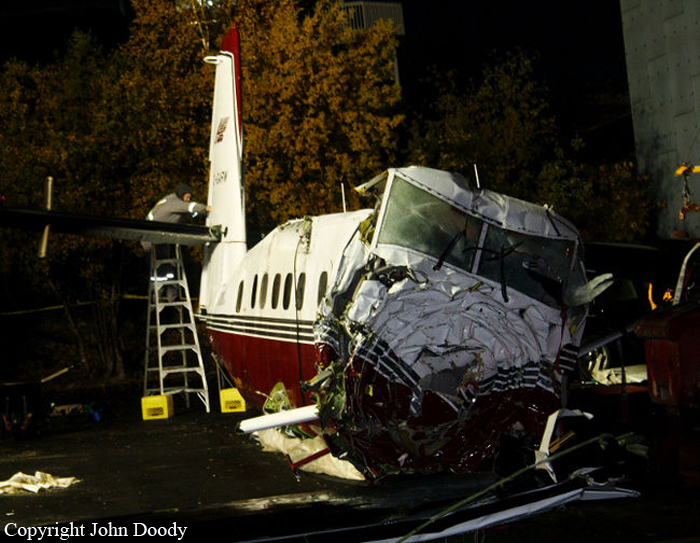
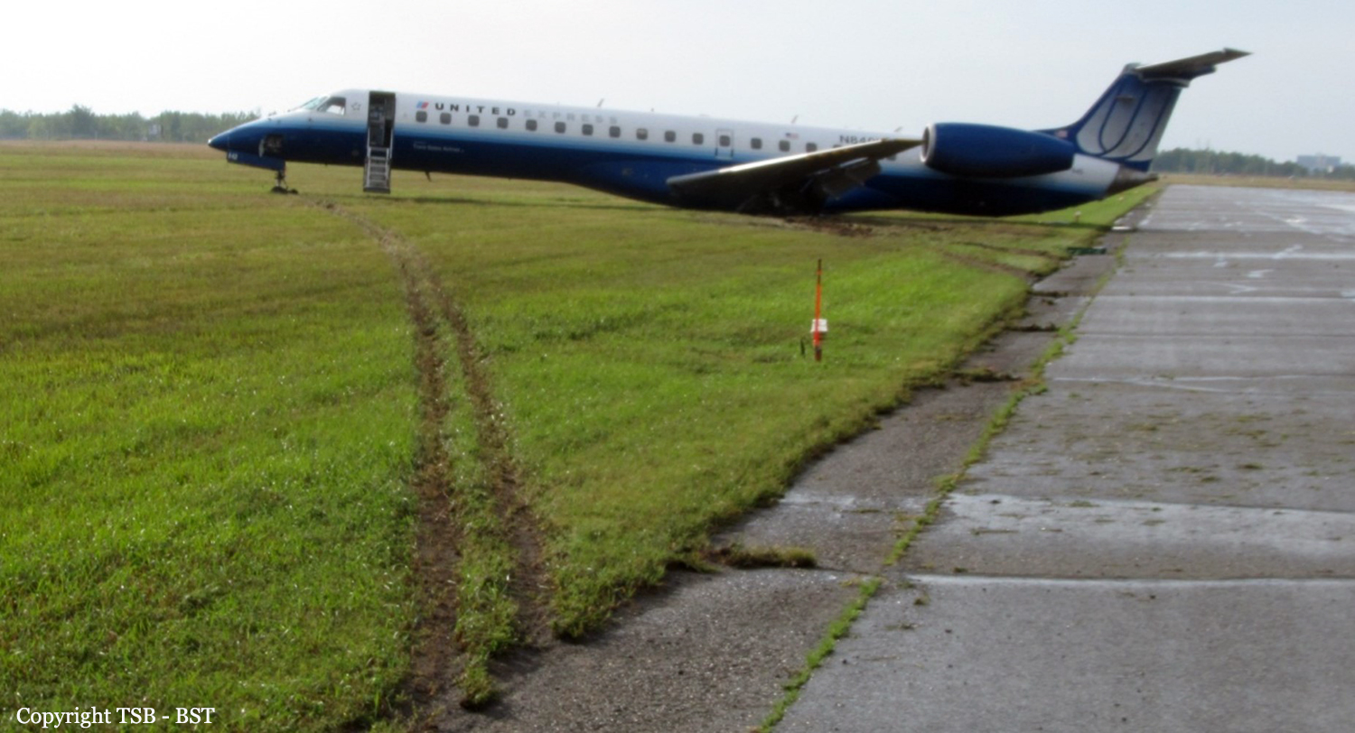
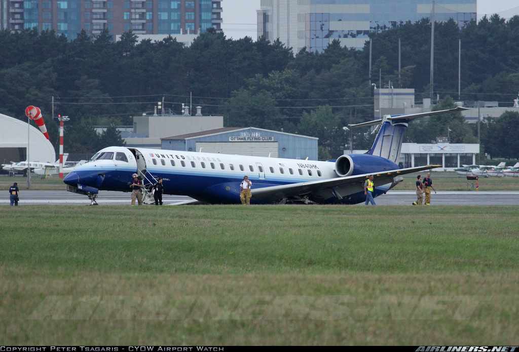
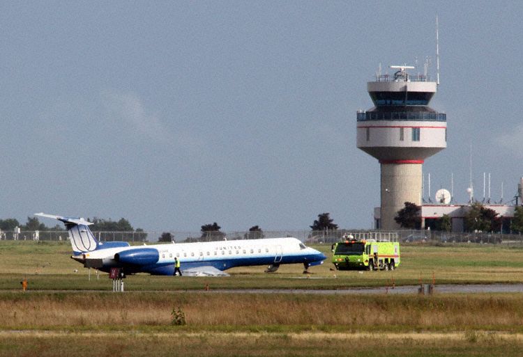
At 1406, United Express Flight 3363 (LOF3363), operated by Trans States Airlines LLC (TSA), departed Chicago O’Hare International Airport, Chicago, United States. Before commencing the descent into Ottawa/Macdonald-Cartier International Airport (CYOW), Ontario, the flight crew obtained the automatic terminal information service (ATIS) information Yankee for CYOW issued at 1411. Based on the reported wind speed and direction, the flight crew calculated the approach speed (VAPP) to be 133 knots indicated airspeed (KIAS). Runway 25 was identified in ATIS information Yankee as the active runway. However, as a result of a previous overrun on Runway 07/25 in August 2010, TSA prohibited its flight crews from landing or taking off on Runway 07/25 when the surface is reported as damp or wet. Because rain showers were forecast for CYOW and Runway 32 was the longest runway, the flight crew decided at 1506 to carry out an instrument landing system (ILS) approach to Runway 32. At 1524, the CYOW terminal air traffic controller (ATC) advised the flight crew that it was starting to rain heavily at CYOW. About 2 minutes later, the aircraft intercepted the glideslope for the ILS to Runway 32. Final descent was initiated, the landing gear was extended, and the flaps were selected to 22°. Upon contacting the CYOW tower controller, the flight crew was advised that moderate rain had just started at the airport and the wind was reported as 310° magnetic (M) at 10 knots. The aircraft crossed the GREELY (YYR) final approach fix at 4.3 nautical miles (nm), slightly above the glideslope at 174 KIAS. About 1528, the aircraft passed through 1000 feet above ground level (agl) at 155 knots. Moments later, the flaps were selected to 45°. The airspeed at the time was approximately 145 KIAS. The tower controller advised the flight crew that the wind had changed to 320°M at 13 knots gusting to 20 knots. To compensate for the increased wind speed, the flight crew increased the VAPP to 140 KIAS. About 1 minute later, at 1529, the aircraft crossed the threshold of Runway 32 at about 45 feet agl, at an airspeed of 139 KIAS. As the aircraft crossed the runway threshold, the intensity of the rain increased, so the flight crew selected the windshield wipers to high. When the aircraft was about 20 feet agl, engine power was reduced and a flare was commenced. Just before touchdown, the aircraft encountered a downpour sufficient to obscure the crew’s view of the runway. Perceiving a sudden increase in descent rate, at approximately 5 feet agl, the captain applied maximum thrust on both engines. The master caution light illuminated, and a voice warning stated that the flaps were not in a take-off configuration. Maximum thrust was maintained for 7 seconds. The aircraft touched down smoothly 2700 feet beyond the threshold at 119 KIAS; the airspeed was increasing, and the aircraft became airborne again. The aircraft touched down a second time at 3037 feet beyond the threshold, with the airspeed increasing through 125 KIAS. Airspeed on touchdown peaked at 128 KIAS as the nosewheel was lowered to the ground, and then the thrust levers were retarded to flight idle. The outboard spoilers almost immediately deployed, and about 8 seconds later, the inboard spoilers deployed. The aircraft was about 20 feet right of the runway centreline when it touched down for the second time. Once the nosewheel was on the ground, the captain applied maximum brakes. The flight crew almost immediately noted that the aircraft began skidding. The captain then requested the first officer to apply maximum brakes as well. The aircraft continued to skid, and no significant brake pressure was recorded until about 14 seconds after the outboard spoilers deployed, when brake pressure suddenly increased to its maximum. During this time, the captain attempted to steer the aircraft back to the runway centreline. As the aircraft skidded down the runway, it began to yaw to the left. Full right rudder was applied, but was ineffective in correcting the left yaw. Sufficient water was present on the runway surface to cause the aircraft tires to send a spray of water, commonly known as a rooster tail, to a height of over 22 feet, trailing over 300 feet behind the aircraft. At some point during the landing roll, the captain partially applied the emergency/parking brake (EPB), and when no braking action was felt, the EPB was engaged further. With no perceivable deceleration being felt, the EPB was stowed. The aircraft continued to skid down the runway until about 7500 feet from the threshold, at which point it started skidding sideways along the runway. At 1530, the nosewheel exited the paved surface, 8120 feet from the threshold, at approximately 53 knots, on a heading of 271°M. The aircraft came to rest on a heading of 211°M, just off the left side of the paved surface. After coming to a stop, the flight crew carried out the emergency shutdown procedure as per the company Quick Reference Handbook (QRH), and consulted with the flight attendant on the status of everyone in the passenger cabin. The flight crew determined that there was no immediate threat and decided to hold the passengers on board. When the aircraft exited the runway surface, the tower activated the crash alarm. The CYOW airport rescue and firefighting (ARFF) services responded, and were on scene approximately 3 minutes after the activation of the crash alarm. Once ARFF personnel had conducted a thorough exterior check of the aircraft, they informed the flight crew that there was a fuel leak. The captain then called for an immediate evacuation of the aircraft. The passengers evacuated through the main cabin door, and moved to the runway as directed by the flight crew and ARFF personnel. The evacuation was initiated approximately 12 minutes after the aircraft came to a final stop. After the evacuation was complete, the firefighters sprayed foam around the aircraft where the fuel had leaked.
Probable cause:
Findings as to causes and contributing factors:
1. Heavy rainfall before and during the landing resulted in a 4–6 mm layer of water contaminating the runway.
2. The occurrence aircraft’s airspeed during final approach exceeded the company prescribed limits for stabilized approach criteria. As a result, the aircraft crossed the runway threshold at a higher than recommended VREF airspeed.
3. A go-around was not performed, as per standard operating procedures, when the aircraft’s speed was greater than 5 knots above the appropriate approach speed during the stabilized portion of the approach.
4. The application of engine thrust just before touchdown caused the aircraft to touch down 3037 feet from the threshold at a higher than recommended airspeed.
5. The combination of a less than firm landing and underinflated tires contributed to the aircraft hydroplaning.
6. The emergency/parking brake was applied during the landing roll, which disabled the anti-skid braking system and prolonged the skid.
7. The aircraft lost directional control as a result of hydroplaning and veered off the runway.

Findings as to risk:
1. The typical and frequently used technique for differential braking that pilots are trained to use may not be effective when anti-skid systems require different techniques.
2. If aircraft electrical power is applied with an active fuel leak, there is a risk that an electrical spark could ignite the fuel and start a fire.
3. The use of non-grooved runways increases the risk of hydroplaning, which may result in runway excursions.
4. If there is an absence of information and training about non-grooved runways, there is a risk that crews will not carry out the appropriate landing techniques when these runways are wet.
5. The use of thrust reversers reduces the risk of runway excursions when landing on wet runways.
6. If pilots do not comply with standard operating procedures, and companies do not assure compliance, then there is a risk that occurrences resulting from such deviations will persist.

Other findings:
1. The central maintenance computer was downloaded successfully; however, there were no data present in the memory unit.
2. Although the Transportation Safety Board was able to download high-quality data from the flight data recorder, the parameters that were not recorded due to the model type and input to the flight data recorder made it more difficult to determine the sequence of events.
Final Report:

Crash of a Boeing 737-210C in Resolute Bay: 12 killed

Date & Time: Aug 20, 2011 at 1142 LT
Type of aircraft:
Operator:
Registration:
C-GNWN
Survivors:
Yes
Schedule:
Yellowknife - Resolute Bay - Grise Fiord
MSN:
21067/414
YOM:
1975
Flight number:
FAB6550
Country:
Crew on board:
4
Crew fatalities:
Pax on board:
11
Pax fatalities:
Other fatalities:
Total fatalities:
12
Captain / Total flying hours:
12910
Captain / Total hours on type:
5200.00
Copilot / Total flying hours:
4848
Copilot / Total hours on type:
103
Aircraft flight hours:
86190
Circumstances:
The First Air Boeing 737-210C combi aircraft departed Yellowknife (CYZF), Northwest Territories, at 1440 as First Air flight 6560 (FAB6560) on a charter flight to Resolute Bay (CYRB), Nunavut, with 11 passengers, 4 crew members, and freight on board. The instrument flight rules (IFR) flight from CYZF was flight-planned to take 2 hours and 05 minutes at 426 knots true airspeed and a cruise altitude of flight level (FL) 310. Air traffic control (ATC) cleared FAB6560 to destination via the flight-planned route: CYZF direct to the BOTER intersection, then direct to the Cambridge Bay (CB) non-directional beacon (NDB), then direct to 72° N, 100°45' W, and then direct to CYRB (Figure 1). The planned alternate airport was Hall Beach (CYUX), Nunavut. The estimated time of arrival (ETA) at CYRB was 1645. The captain occupied the left seat and was designated as the pilot flying (PF). The first officer (FO) occupied the right seat and was designated as the pilot not flying (PNF). Before departure, First Air dispatch provided the crew with an operational flight plan (OFP) that included forecast and observed weather information for CYZF, CYRB, and CYUX, as well as NOTAM (notice to airmen) information. Radar data show that FAB6560 entered the Northern Domestic Airspace (NDA) 50 nautical miles (nm) northeast of CYZF, approximately at RIBUN waypoint (63°11.4' N, 113°32.9' W) at 1450. During the climb and after leveling at FL310, the crew received CYRB weather updates from a company dispatcher (Appendix A). The crew and dispatcher discussed deteriorating weather conditions at CYRB and whether the flight should return to CYZF, proceed to the alternate CYUX, or continue to CYRB. The crew and dispatcher jointly agreed that the flight would continue to CYRB. At 1616, the crew programmed the global positioning systems (GPS) to proceed from their current en-route position direct to the MUSAT intermediate waypoint on the RNAV (GNSS) Runway (RWY) 35 TRUE approach at CYRB (Appendix B), which had previously been loaded into the GPS units by the crew. The crew were planning to transition to an ILS/DME RWY 35 TRUE approach (Appendix C) via the MUSAT waypoint. A temporary military terminal control area (MTCA) had been planned, in order to support an increase in air traffic at CYRB resulting from a military exercise, Operation NANOOK. A military terminal control unit at CYRB was to handle airspace from 700 feet above ground level (agl) up to FL200 within 80 nm of CYRB. Commencing at 1622:16, the FO made 3 transmissions before establishing contact with the NAV CANADA Edmonton Area Control Centre (ACC) controller. At 1623:29, the NAV CANADA Edmonton ACC controller cleared FAB6560 to descend out of controlled airspace and to advise when leaving FL270. The crew were also advised to anticipate calling the CYRB terminal control unit after leaving FL270, and that there would be a layer of uncontrolled airspace between FL270 and FL200. The FO acknowledged the information. FAB6560 commenced descent from FL310 at 1623:40 at 101 nm from CYRB. The crew initiated the pre-descent checklist at 1624 and completed it at 1625. At 1626, the crew advised the NAV CANADA Edmonton ACC controller that they were leaving FL260. At 1627:09, the FO subsequently called the CYRB terminal controller and provided an ETA of 1643 and communicated intentions to conduct a Runway 35 approach. Radio readability between FAB6560 and the CYRB terminal controller was poor, and the CYRB terminal controller advised the crew to try again when a few miles closer. At 1629, the crew contacted the First Air agent at CYRB on the company frequency. The crew advised the agent of their estimated arrival time and fuel request. The crew then contacted the CYRB terminal controller again, and were advised that communications were now better. The CYRB terminal controller advised that the MTCA was not yet operational, and provided the altimeter setting and traffic information for another inbound flight. The CYRB terminal controller then instructed the crew to contact the CYRB tower controller at their discretion. The FO acknowledged the traffic and the instruction to contact CYRB tower. At 1631, the crew contacted the CYRB tower controller, who advised them of the altimeter setting (29.81 inches of mercury [in. Hg]) and winds (estimated 160° true [T] at 10 knots), and instructed them to report 10 nm final for Runway 35T. The crew asked the tower controller for a runway condition report, and was advised that the runway was a little wet and that no aircraft had used it during the morning. The FO acknowledged this information. The crew initiated the in-range checklist at 1632 and completed it at 1637. At 1637, they began configuring the aircraft for approach and landing, and initiated the landing checklist. At 1638:21, FAB6560 commenced a left turn just before reaching MUSAT waypoint. At the time of the turn, the aircraft was about 600 feet above the ILS glideslope at 184 knots indicated airspeed (KIAS). The track from MUSAT waypoint to the threshold of Runway 35T is 347°T, which coincides with the localizer track for the ILS/DME RWY 35 TRUE approach. After rolling out of the left turn, FAB6560 proceeded on a track of approximately 350°T. At 1638:32, the crew reported 10 nm final for Runway 35T. The captain called for the gear to be lowered at 1638:38 and for flaps 15 at 1638:42. Airspeed at the time of both of these calls was 177 KIAS. At 1638:39, the CYRB tower controller acknowledged the crew’s report and instructed them to report 3 nm final. At 1638:46, the FO requested that the tower repeat the last transmission. At 1638:49, the tower repeated the request to call 3 nm final; the FO acknowledged the call. At this point in the approach, the crew had a lengthy discussion about aircraft navigation. At 1640:36, FAB6560 descended through 1000 feet above field elevation. Between 1640:41 and 1641:11, the captain issued instructions to complete the configuration for landing, and the FO made several statements regarding aircraft navigation and corrective action. At 1641:30, the crew reported 3 nm final for Runway 35T. The CYRB tower controller advised that the wind was now estimated to be 150°T at 7 knots, cleared FAB6560 to land Runway 35T, and added the term “check gear down” as required by the NAV CANADA Air Traffic Control Manual of Operations (ATC MANOPS) Canadian Forces Supplement (CF ATC Sup) Article 344.3. FAB6560’s response to the tower (1641:39) was cut off, and the tower requested the crew to say again. There was no further communication with the flight. The tower controller did not have visual contact with FAB6560 at any time. At 1641:51.8, as the crew were initiating a go-around, FAB6560 collided with terrain about 1 nm east of the midpoint of the CYRB runway. The accident occurred during daylight hours and was located at 74°42'57.3" N, 94°55'4.0" W, at 396 feet above mean sea level. The 4 crew members and 8 passengers were fatally injured. Three passengers survived the accident and were rescued from the site by Canadian military personnel, who were in CYRB participating in Operation NANOOK. The survivors were subsequently evacuated from CYRB on a Canadian Forces CC-177 aircraft.
Probable cause:
Findings as to causes and contributing factors:
1. The late initiation and subsequent management of the descent resulted in the aircraft turning onto final approach 600 feet above the glideslope, increasing the crew’s workload and reducing their capacity to assess and resolve the navigational issues during the remainder of the approach.
2. When the heading reference from the compass systems was set during initial descent, there was an error of −8°. For undetermined reasons, further compass drift during the arrival and approach resulted in compass errors of at least −17° on final approach.
3. As the aircraft rolled out of the turn onto final approach to the right of the localizer, the captain likely made a control wheel roll input that caused the autopilot to revert from VOR/LOC capture to MAN and HDG HOLD mode. The mode change was not detected by the crew.
4. On rolling out of the turn, the captain’s horizontal situation indicator displayed a heading of 330°, providing a perceived initial intercept angle of 17° to the inbound localizer track of 347°. However, due to the compass error, the aircraft’s true heading was 346°. With 3° of wind drift to the right, the aircraft diverged further right of the localizer.
5. The crew’s workload increased as they attempted to understand and resolve the ambiguity of the track divergence, which was incongruent with the perceived intercept angle and expected results.
6. Undetected by the pilots, the flight directors likely reverted to AUTO APP intercept mode as the aircraft passed through 2.5° right of the localizer, providing roll guidance to the selected heading (wings-level command) rather than to the localizer (left-turn command).
7. A divergence in mental models degraded the crew’s ability to resolve the navigational issues. The wings-level command on the flight director likely assured the captain that the intercept angle was sufficient to return the aircraft to the selected course; however, the first officer likely put more weight on the positional information of the track bar and GPS.
8. The crew’s attention was devoted to solving the navigational problem, which delayed the configuration of the aircraft for landing. This problem solving was an additional task, not normally associated with this critical phase of flight, which escalated the workload.
9. The first officer indicated to the captain that they had full localizer deflection. In the absence of standard phraseology applicable to his current situation, he had to improvise the go-around suggestion. Although full deflection is an undesired aircraft state requiring a go-around, the captain continued the approach.
10. The crew did not maintain a shared situational awareness. As the approach continued, the pilots did not effectively communicate their respective perception, understanding, and future projection of the aircraft state.
11. Although the company had a policy that required an immediate go-around in the event that an approach was unstable below 1000 feet above field elevation, no go-around was initiated. This policy had not been operationalized with any procedural guidance in the standard operating procedures.
12. The captain did not interpret the first officer’s statement of “3 mile and not configured” as guidance to initiate a go-around. The captain continued the approach and called for additional steps to configure the aircraft.
13. The first officer was task-saturated, and he thus had less time and cognitive capacity to develop and execute a communication strategy that would result in the captain changing his course of action.
14. Due to attentional narrowing and task saturation, the captain likely did not have a high- level overview of the situation. This lack of overview compromised his ability to identify and manage risk.
15. The crew initiated a go-around after the ground proximity warning system “sink rate” alert occurred, but there was insufficient altitude and time to execute the manoeuvre and avoid collision with terrain.
16. The first officer made many attempts to communicate his concerns and suggest a go-around. Outside of the two-communication rule, there was no guidance provided to address a situation in which the pilot flying is responsive but is not changing an unsafe course of action. In the absence of clear policies or procedures allowing a first officer to escalate from an advisory role to taking control, this first officer likely felt inhibited from doing so.
17. The crew’s crew resource management was ineffective. First Air’s initial and recurrent crew resource management training did not provide the crew with sufficient practical strategies to assist with decision making and problem solving, communication, and workload management.
18. Standard operating procedure adaptations on FAB6560 resulted in ineffective crew communication, escalated workload leading to task saturation, and breakdown in shared situational awareness. First Air’s supervisory activities did not detect the standard operating procedure adaptations within the Yellowknife B737 crew base.

Findings as to risk:
1. If standard operating procedures do not include specific guidance regarding where and how the transition from en route to final approach navigation occurs, pilots will adopt non-standard practices, which may introduce a hazard to safe completion of the approach.
2. Adaptations of standard operating procedures can impair shared situational awareness and crew resource management effectiveness.
3. Without policies and procedures clearly authorizing escalation of intervention to the point of taking aircraft control, some first officers may feel inhibited from doing so.
4. If hazardous situations are not reported, they are unlikely to be identified or investigated by a company’s safety management system; consequently, corrective action may not be taken.
5. Current Transport Canada crew resource management training standards and guidance material have not been updated to reflect advances in crew resource management training, and there is no requirement for accreditation of crew resource management facilitators/instructors in Canada. This situation increases the risk that flight crews will not receive effective crew resource management training.
6. If initial crew resource management training does not develop effective crew resource management skills, and if there is inadequate reinforcement of these skills during recurrent training, flight crews may not adequately manage risk on the flight deck.
7. If operators do not take steps to ensure that flight crews routinely apply effective crew resource management practices during flight operations, risk to aviation safety will persist.
8. Transport Canada’s flight data recorder maintenance guidance (CAR Standard 625, Appendix C) does not refer to the current flight recorder maintenance specification, and therefore provides insufficient guidance to ensure the serviceability of flight data recorders. This insufficiency increases the risk that information needed to identify and communicate safety deficiencies will not be available.
9. If aircraft are not equipped with newer-generation terrain awareness and warning systems, there is a risk that a warning will not alert crews in time to avoid terrain.
10. If air carriers do not monitor flight data to identify and correct problems, there is a risk that adaptations of standard operating procedures will not be detected.
11. Unless further action is taken to reduce the incidence of unstable approaches that continue to a landing, the risk of controlled flight into terrain and of approach and landing accidents will persist.

Other findings:
1. It is likely that both pilots switched from GPS to VHF NAV during the final portion of the in-range check before the turn at MUSAT.
2. The flight crew of FAB6560 were not navigating using the YRB VOR or intentionally tracking toward the VOR.
3. There was no interference with the normal functionality of the instrument landing system for Runway 35T at CYRB.
4. Neither the military tower nor the military terminal controller at CYRB had sufficient valid information available to cause them to issue a position advisory to FAB6560.
5. The temporary Class D control zone established by the military at CYRB was operating without any capability to provide instrument flight rules separation.
6. The delay in notification of the joint rescue coordination centre did not delay the emergency response to the crash site.
7. The NOTAMs issued concerning the establishment of the military terminal control area did not succeed in communicating the information needed by the airspace users.
8. The ceiling at the airport at the time of the accident could not be determined. The visibility at the airport at the time of the accident likely did not decrease below approach minimums at any time during the arrival of FAB6560. The cloud layer at the crash site was surface-based less than 200 feet above the airport elevation.
Final Report:

Crash of a Convair CV-580 in Kasba Lake

Date & Time: Aug 3, 2011 at 1100 LT
Type of aircraft:
Operator:
Registration:
C-GKFP
Survivors:
Yes
Schedule:
Winnipeg – Kasba Lake
MSN:
446
YOM:
1956
Country:
Crew on board:
0
Crew fatalities:
Pax on board:
0
Pax fatalities:
Other fatalities:
Total fatalities:
0
Circumstances:
Following an uneventful flight from Winnipeg, the crew completed the landing on runway 02/20, a 1,876 metres long clay/gravel runway. During the landing roll, the nose gear collapsed. The aircraft slid on its nose for few dozen metres before coming to rest. All occupants evacuated safely and the aircraft was damaged beyond repair. At the time of the accident, the runway surface was irregular with potholes and water gouges due to the recent rains.