Crash of a Piper PA-46-350P Malibu Mirage on Mt Lakit: 1 killed

Date & Time: Oct 17, 1999 at 2025 LT
Registration:
N90D
Flight Phase:
Flight Type:
Survivors:
No
Site:
Schedule:
Lynn Lake – Cranbrook – Spokane
MSN:
46-22086
YOM:
1989
Country:
Crew on board:
1
Crew fatalities:
Pax on board:
0
Pax fatalities:
Other fatalities:
Total fatalities:
1
Circumstances:
On October 17, 1999, about 20:25 Mountain Daylight Time, a Piper PA-46-350P, N90D, was substantially damaged while descending to the Cranbrook Airport (CYXC), Cranbrook, British Columbia. The certificated airline transport pilot was fatally injured. Night visual meteorological conditions prevailed, and an instrument flight rules (IFR) flight plan was filed for the flight that originated near Lynn Lake (CYYL), Manitoba. The ferry flight was conducted under Canadian flight rules. According to a Transportation Safety Board of Canada Investigator, the airplane was being ferried from England to Spokane, Washington. At the last departure point, CYYL, the airplane was refueled and the pilot filed an IFR flight plan. During the flight, the pilot was in contact with Vancouver Area Control Center. While approaching CYXC, the pilot contacted Cranbrook Flight Service Station (FSS) and was provided the latest airport information. The pilot did not report any difficulties with the airplane or flight at that time. The pilot's last transmission with the FSS was about 10 miles from the airport. After attempting to contact the airplane, FSS contacted the Rescue Coordination Center, and notified them that the airplane was overdue. An emergency locator transmitter signal was received about 21:55, but the airplane was not found until the following morning. The airplane was located on the eastern side of Lakit Mountain at the 6,500-foot level, 9 miles northeast of CYXC. The weather reported by CYXC, at 20:00 was, wind from 300 degrees at 4 knots, scattered clouds at 10,000 feet, and a broken cloud layer at 24,000 feet. The pilot (sole person on board) was killed.
Probable cause:
Controlled flight into terrain.

Crash of a Douglas DC-3C in Mayne Island: 2 killed

Date & Time: Jan 13, 1999 at 0633 LT
Type of aircraft:
Operator:
Registration:
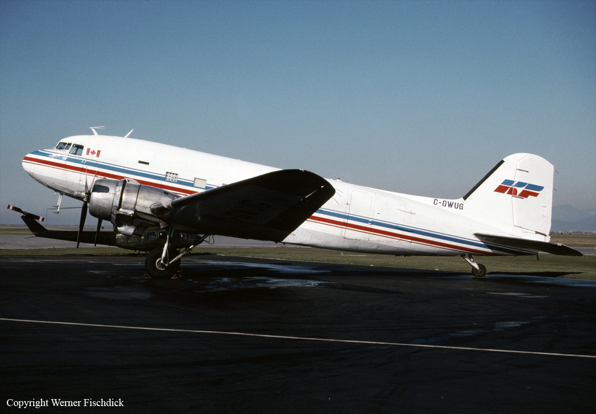
C-GWUG
Flight Phase:
Flight Type:
Survivors:
No
Site:
Schedule:
Vancouver - Victoria
MSN:
16215/32963
YOM:
1945
Flight number:
KFA301
Country:
Crew on board:
2
Crew fatalities:
Pax on board:
0
Pax fatalities:
Other fatalities:
Total fatalities:
2
Captain / Total flying hours:
18000
Captain / Total hours on type:
9500.00
Copilot / Total flying hours:
9000
Copilot / Total hours on type:
430
Aircraft flight hours:
20123
Circumstances:
The accident aircraft, a Douglas DC-3C, C-GWUG, was owned and operated by Kelowna Flightcraft Air Charter Ltd. (Kelowna Flightcraft) and was under charter to Purolator Courier Ltd. (Purolator). Since April 1998, the aircraft had been dedicated to transporting cargo on a route between Vancouver and Nanaimo, British Columbia. On occasion, it was also used for flights to Victoria to meet Purolator=s scheduling or cargo-loading contingencies. On the day of the accident, the aircraft, operating as KFA300, was rerouted and tasked to fly from Vancouver to Victoria and then proceed to Nanaimo. This change was precipitated by the delayed arrival of Purolator=s Boeing 727 at Vancouver because of inclement weather in the Toronto/Hamilton, Ontario, area. Warning of this route change was passed to the crew members with their pre-flight planning package, which included filed instrument flight rules (IFR) flight plans for the Vancouver-to-Victoria and Victoria-to-Nanaimo legs of the trip. The captain of the occurrence flight cancelled his IFR flight plan and refiled visual flight rules (VFR) on first contact with air traffic control. Vancouver tower cleared KFA300 for take-off at 0622 Pacific standard time (PST) from runway 26L. After take-off, the aircraft turned left on a track toward Active Pass, as seen in Figure 1. During the departure climb, the captain requested an altitude of 1000 feet above sea level (asl); the tower controller approved this request. Recorded radar data indicate that the aircraft climbed to and levelled at 1000 feet asl and then accelerated to a steady en route ground speed of 130 knots. The aircraft left the Vancouver control zone at 0626 and entered Class E (controlled) airspace. There are no special requirements for VFR aircraft operating within this class of airspace, nor are any specific services required of the air traffic control system. As the aircraft approached the Gulf Islands, it descended slightly and remained level at 900 feet asl. It crossed about 0.25 nautical mile (nm) west of the Active Pass non-directional beacon (NDB) at 0632 while remaining steady at 130 knots (ground speed) and level at 900 feet asl. At 0633:04, the aircraft descended to 800 feet asl for about nine seconds. The last radar data show the aircraft at 900 feet asl and 130 knots. The last radar-depicted position of the aircraft is on a bearing of 189 degrees (true) and 21.8 nm from the Sea Island radar source, coincident with the crash location.
Probable cause:
Findings as to Causes and Contributing Factors:
1. The accident flight was not conducted in accordance with the night obstacle clearance requirements of Canadian Aviation Regulation (CAR) 705.32.
2. The Kelowna Flightcraft company operations manual did not reflect the restrictive conditions imposed on night visual flight rules (VFR) flight by CAR 705.32. Such information might have
prevented the accident by ensuring the crew's awareness of those night obstacle clearance standards.
3. As the aircraft approached Mayne Island, it encountered a low cloud ceiling that was based about 800 feet and that reduced visual reference with the surface.
4. When the aircraft struck trees, it was being flown in controlled, level flight at an altitude below the surrounding terrain.
5. The aircraft was not equipped with a ground proximity warning system or any other similar system that could warn the crew of an impending collision with terrain. Such systems were not required by regulation.
Findings as to Risk:
1. Kelowna Flightcraft flight operations personnel were not aware that most of the DC-3 flights were being conducted under VFR.
2. First responders were not aware of the presence of the dangerous goods and were therefore at increased risk during their response activities on the site.
Other Findings:
1. Transport Canada officials responsible for monitoring this operation were not aware that most of the DC-3 flights were being conducted under VFR at night and below the required obstacle
clearance altitudes.
Final Report:

Crash of a Cessna 208B Super Cargomaster in Victoria: 2 killed

Date & Time: Nov 23, 1998 at 0030 LT
Type of aircraft:
Operator:
Registration:
N9352B
Flight Type:
Survivors:
No
Schedule:
Vancouver - Victoria
MSN:
208-0061
YOM:
1987
Flight number:
RXX434
Country:
Crew on board:
2
Crew fatalities:
Pax on board:
0
Pax fatalities:
Other fatalities:
Total fatalities:
2
Captain / Total flying hours:
1653
Captain / Total hours on type:
400.00
Copilot / Total flying hours:
120
Aircraft flight hours:
6717
Circumstances:
Regency Express Air Operations Flight 434, a Cessna 208 Caravan (serial number 208B0061), was en route from Vancouver International Airport to Victoria International Airport, British Columbia, on a night visual flight rules (VFR) flight when it collided with trees on Saltspring Island, about five nautical miles (nm) north of the Victoria International Airport. The aircraft broke apart on impact and a post-crash fire occurred. The two pilots, who were the sole occupants of the aircraft, sustained fatal injuries, and the aircraft was destroyed. The accident occurred at 0030 Pacific standard time (PST).
Probable cause:
Findings as to Causes and Contributing Factors:
A. Although weather information was available by radio from the Vancouver FSS specialists or from the Victoria Terminal controllers, there is no indication that the pilots requested weather updates from either of these units.
B. The crew of RXX434 would have encountered the lower ceiling in the vicinity of Beaver Point. This lower layer of cloud would have restricted the crew's view of the ground lighting and reduced the ambient lighting available to navigate by visual means.
C. With the loss of ground references, it is unlikely that the crew would have been able to perceive the divergence of the aircraft's flight path away from its intended track by visual means.
D. The crew was unable to maintain separation between the aircraft and the terrain by visual means.
E. The published VFR arrival and departure routes for Victoria were not consistent with obstacle clearance requirements for commercial operators.
F. Regency Express Air Operations' crew manual suggested an en route altitude of 1,500 feet for this particular flight. That route and altitude combination is not consistent with published obstacle clearance requirements.
Other Findings:
1. At the time the crew completed their flight planning, the weather at the departure airport of Vancouver and the arrival airport of Victoria was suitable for a night VFR flight.
2. An amended terminal forecast for Victoria indicating the presence of a temporary ceiling at 2,000 feet asl was issued after the crew had completed their preflight planning activities.
3. The regulation requiring GPWS equipment does not apply to air taxi operations because the aircraft used in those operations do not meet weight or propulsion criteria.
Final Report:

Crash of a De Havilland DHC-2 Beaver near Kincolith: 5 killed

Date & Time: Aug 4, 1998 at 1758 LT
Type of aircraft:
Operator:
Registration:
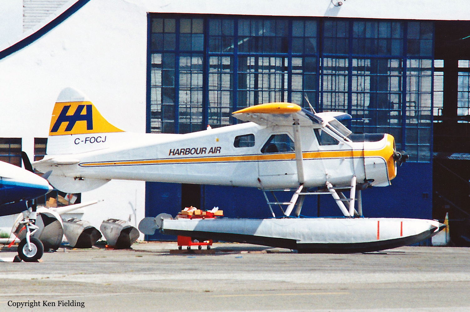
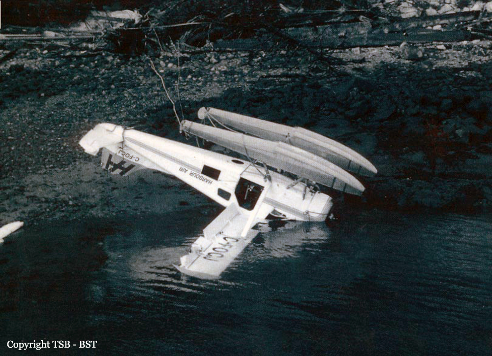
C-FOCJ
Survivors:
No
Schedule:
Prince Rupert - Kincolith
MSN:
39
YOM:
1949
Flight number:
H3709
Country:
Crew on board:
1
Crew fatalities:
Pax on board:
4
Pax fatalities:
Other fatalities:
Total fatalities:
5
Captain / Total flying hours:
1700
Captain / Total hours on type:
1250.00
Aircraft flight hours:
22369
Circumstances:
The float-equipped de Havilland DHC-2 Beaver, serial number 0039, departed Prince Rupert, British Columbia, at 1719 Pacific daylight time on a visual flight rules flight to Kincolith, British Columbia, with the pilot and four passengers on board. When the aircraft arrived at Kincolith at about 1750, witnesses watched it carry out three low approaches to the water landing area, each time descending to a few feet above the water before climbing away. On the fourth approach, at about 1758, the aircraft touched down, apparently in a controlled manner, and skipped on the water surface. The floats then dug into the water followed by the right wing, which was severed from the fuselage on water impact. The aircraft quickly overturned and came to rest inverted with only the bottom of the floats visible. Several members of the village community, who had been waiting for the aircraft on the Government Dock, rushed to the sunken aircraft in small boats but were unable to rescue the pilot or passengers inside the submerged cabin. The five occupants drowned in the accident, and the aircraft was substantially damaged.
Probable cause:
On touchdown, the float(s) struck the water and caused a flying attitude that the pilot could not control before the right wing dug in and the aircraft overturned. Contributing to the accident were conflicting wind and water conditions at the time of the occurrence.
Final Report:

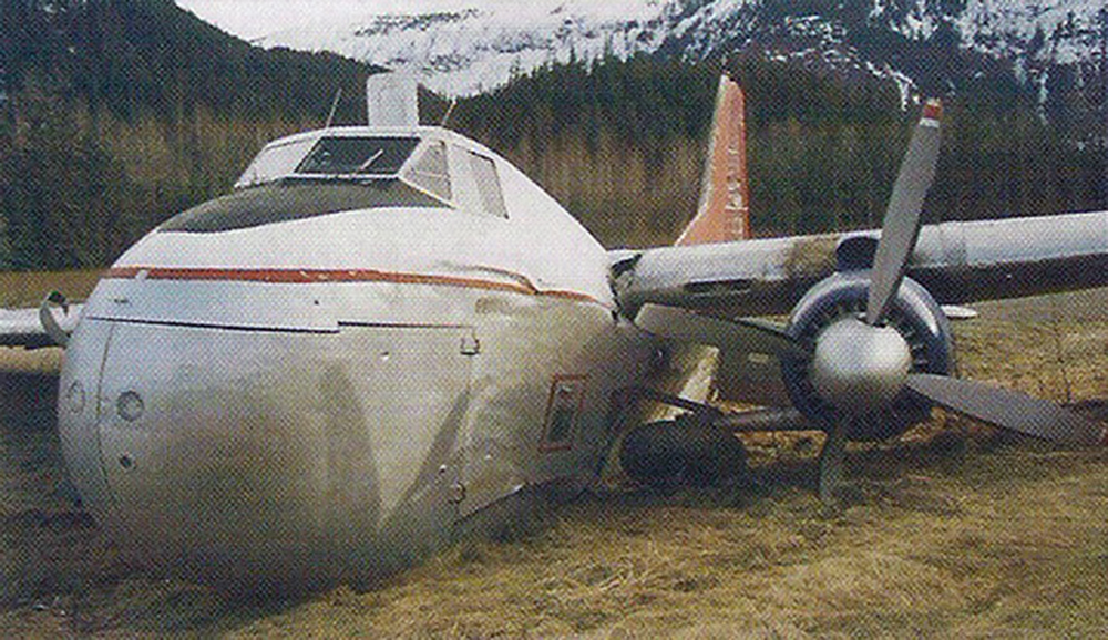
Crash of a Bristol 170 Freighter 31A in Bronson Creek

Date & Time: Apr 24, 1997 at 1710 LT
Type of aircraft:
Operator:
Registration:
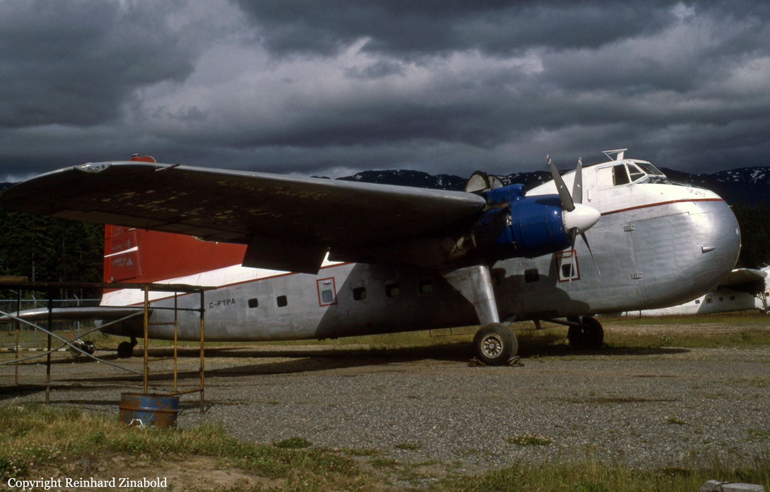
C-FTPA
Flight Type:
Survivors:
Yes
Schedule:
Wrangell - Bronson Creek
MSN:
13157
YOM:
1953
Country:
Crew on board:
3
Crew fatalities:
Pax on board:
0
Pax fatalities:
Other fatalities:
Total fatalities:
0
Circumstances:
Upon touchdown at Bronson Creek Airport, the right main gear collapsed. The right wing struck the runway surface and out of control, the aircraft veered off runway and came to rest in a grassy area. All three occupants escaped with minor injuries while the aircraft was damaged beyond repair.
Probable cause:
It is believed that the bolts attaching the right horizontal gear support to the main wheel failed upon landing.

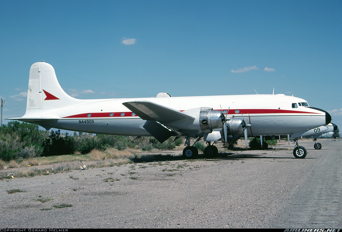
Crash of a Douglas C-54E-DO Skymaster in Bronson Creek

Date & Time: Feb 1, 1997 at 1330 LT
Type of aircraft:
Operator:
Registration:
N44909
Flight Type:
Survivors:
Yes
MSN:
27371
YOM:
1944
Country:
Crew on board:
4
Crew fatalities:
Pax on board:
0
Pax fatalities:
Other fatalities:
Total fatalities:
0
Circumstances:
After landing at Bronson Creek Airport, one of the main landing gear struck a snow wall. The aircraft went out of control and came to rest. All four crew members escaped uninjured while the aircraft was damaged beyond repair.

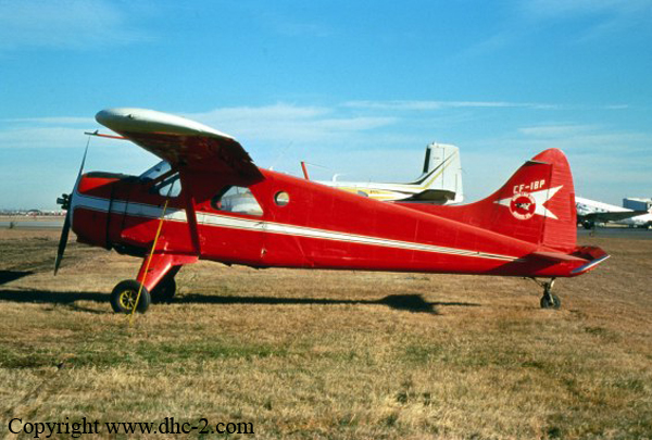
Crash of a De Havilland DHC-2 Beaver near Cassiar: 1 killed

Date & Time: Sep 22, 1996 at 2024 LT
Type of aircraft:
Operator:
Registration:
C-FIBP
Flight Phase:
Flight Type:
Survivors:
No
Site:
Schedule:
Watson Lake - Desolation Lake
MSN:
787
YOM:
1955
Country:
Crew on board:
1
Crew fatalities:
Pax on board:
0
Pax fatalities:
Other fatalities:
Total fatalities:
1
Circumstances:
The pilot, sole on board, was completing a positioning flight from Watson Lake to Desolation Lake. While cruising at an altitude of 5,000 feet, the single engine aircraft struck trees and crashed in a wooded area located in hilly terrain, about 114 km southwest from Watson Lake. The wreckage was found a day later and the pilot was killed.

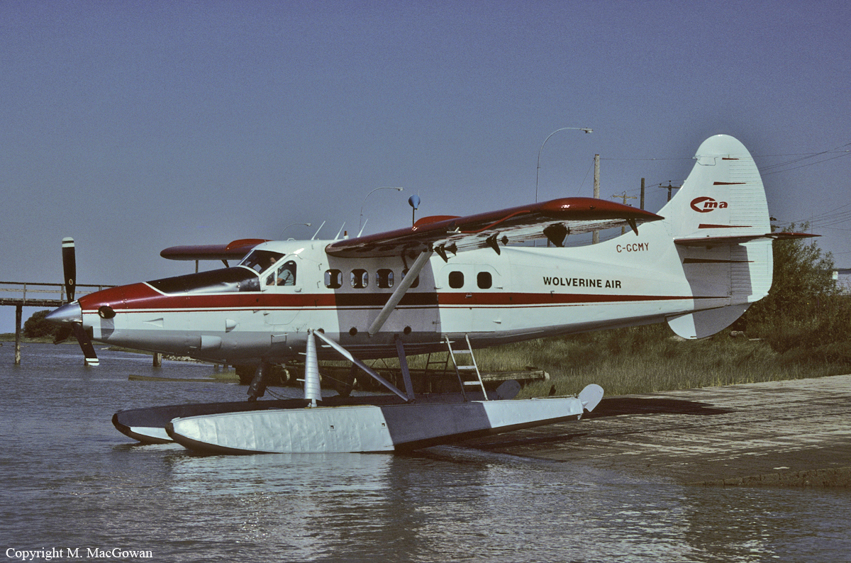
Crash of a De Havilland DHC-3 Otter near Alliford Bay: 3 killed

Date & Time: Aug 18, 1996 at 1950 LT
Type of aircraft:
Operator:
Registration:
C-GCMY
Flight Phase:
Survivors:
No
Site:
Schedule:
Tasu - Alliford Bay
MSN:
22
YOM:
1953
Country:
Crew on board:
1
Crew fatalities:
Pax on board:
2
Pax fatalities:
Other fatalities:
Total fatalities:
3
Circumstances:
The float-equipped, turbine-engine, DHC-3 Otter departed from Tasu, British Columbia, at about 1940 Pacific daylight saving time (PDT), with the pilot and two passengers on board, on a charter, visual flight rules (VFR) flight to Alliford Bay, 26 nautical miles to the north. When the aircraft did not arrive at destination, the operator initiated a search. The aircraft wreckage was located the following day, 18 nautical miles (nm) south of Alliford Bay, in rugged terrain at an elevation of 1,700 feet above sea level (asl). The aircraft was destroyed, and there were no survivors.
Probable cause:
The pilot probably made a navigational error because of restricted visibility in fog and light drizzle and entered the wrong valley, and he delayed his decision to reverse course until he was unable to avoid the weather.
Final Report:

Crash of a Douglas C-54A-15-DC Skymaster near Bronson Creek: 1 killed

Date & Time: Aug 14, 1996 at 1200 LT
Type of aircraft:
Operator:
Registration:
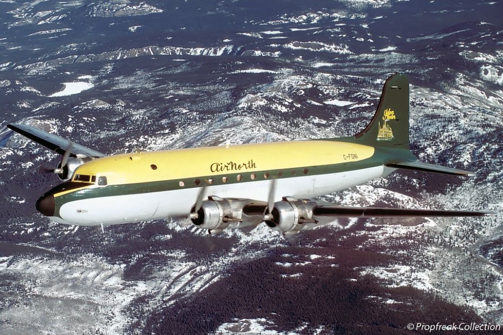
C-FGNI
Flight Phase:
Flight Type:
Survivors:
Yes
Schedule:
Bronson Creek - Whitehorse - Wrangell
MSN:
10389
YOM:
1944
Country:
Crew on board:
3
Crew fatalities:
Pax on board:
0
Pax fatalities:
Other fatalities:
Total fatalities:
1
Captain / Total flying hours:
12500
Captain / Total hours on type:
1500.00
Copilot / Total flying hours:
2900
Copilot / Total hours on type:
420
Aircraft flight hours:
50754
Circumstances:
The DC-4 aircraft (serial number 10389) was on a visual flight rules flight from Bronson Creek, British Columbia, to Wrangell, Alaska, with a crew of three and about 16,600 pounds of cargo on board. The departure from the remote mining strip was uneventful until the aircraft approached 1,500 feet above sea level, when the crew heard a whining noise in their headsets. Believing that the whining was caused by an inverter problem, they switched inverters, but the problem persisted. Electrical instrument indications in the cockpit then became erratic, and the number 2 engine, on the left wing, began to misfire; its fire warning light in the cockpit illuminated briefly, but without the accompanying bell. The captain confirmed visually that the number 2 engine was on fire and the crew carried out the engine fire drill; however, the fire did not extinguish. The captain commenced a right-hand turn to return to the Bronson Creek airstrip, and announced to the crew that the number 2 engine had separated from the wing. The captain applied maximum power to the three remaining engines; however, the aircraft began to lose altitude. Both pilots held the rudder and aileron controls at full right deflection in an attempt to prevent the aircraft from yawing or rolling to the left. The aircraft was shaking violently at that time, and the crew members were unable to read any of the engine or flight instruments. At about 50 feet above ground level, just short of the Iskut River, the pilots closed the throttles. The aircraft descended rapidly, and the burning left wing struck a tree just as the fuselage contacted the surface of the river. The three occupants escaped the burning aircraft, and the first officer and load master swam to safety. The captain is missing and is presumed to have drowned. The aircraft was destroyed.
Probable cause:
The n°2 engine separated from the aircraft as a result of an intense fire in the wing. The loss of the engine rendered the aircraft uncontrollable, and the pilots were forced to land in the river
Final Report:

Crash of a De Havilland DHC-3 Otter near Terrace: 2 killed

Date & Time: May 9, 1996 at 1430 LT
Type of aircraft:
Registration:
C-GDOB
Flight Phase:
Flight Type:
Survivors:
No
Site:
Schedule:
Ketchikan – Prince Rupert – Dawson Creek – Buffalo Narrows
MSN:
194
YOM:
1957
Country:
Crew on board:
2
Crew fatalities:
Pax on board:
0
Pax fatalities:
Other fatalities:
Total fatalities:
2
Captain / Total flying hours:
10000
Copilot / Total flying hours:
5000
Circumstances:
The single-engine, float-equipped DHC-3 Otter departed Ketchikan, Alaska, at 0905 Pacific daylight time (PDT) on 09 May 1996 with a pilot and co-pilot on board. They were on a visual flight rules (VFR) ferry flight to Dawson Creek, British Columbia, en route to Buffalo Narrows, Saskatchewan. After a refuelling stop and weather briefing at Prince Rupert, British Columbia, the aircraft departed eastbound along the published Telkwa Pass VFR route. When the aircraft did not arrive at Dawson Creek, it was reported overdue. The next day, an extensive search for the missing Otter was commenced and wreckage was located by search and rescue aircraft at 1930 PDT, 30 miles east of Terrace, in the Telkwa Pass. The aircraft had struck mountainous terrain and was destroyed. Both occupants were fatally injured.
Probable cause:
The absence of aircraft wreckage and documentation precludes an analysis of the technical aspects of this accident. This analysis, therefore, concentrates solely on the operational aspects. The high impact speed is indicative of either a loss of control followed by a rapid descent into terrain or controlled flight into unseen terrain. Given that the pilot reported encountering snow showers within 15 miles of the accident site, it is possible that the weather continued to deteriorate and may have adversely affected the pilot's ability to maintain visual contact with the terrain.
Findings:
1. The weight and centre of gravity of the aircraft at the last take-off were estimated to have been within the prescribed limits.
2. The pilot was certified, trained, and qualified for the flight in accordance with existing regulations.
3. Marginal visual weather conditions existed in the vicinity of the accident site.
4. It is possible that deteriorating weather affected the pilot's ability to maintain visual contact with the terrain.
Causes and Contributing Factors:
It was not determined why the aircraft struck terrain; however, it is likely that the contact occurred during conditions of reduced visibility.
Final Report: