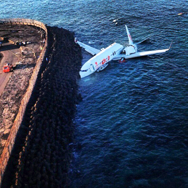
Crash of a Boeing 737-8GP off Denpasar

Date & Time: Apr 13, 2013 at 1510 LT
Type of aircraft:
Operator:
Registration:
PK-LKS
Survivors:
Yes
Schedule:
Bandung - Denpasar
MSN:
38728/4350
YOM:
2013
Flight number:
LNI904
Country:
Region:
Crew on board:
7
Crew fatalities:
Pax on board:
101
Pax fatalities:
Other fatalities:
Total fatalities:
0
Captain / Total flying hours:
15000
Captain / Total hours on type:
6173.00
Copilot / Total flying hours:
1200
Copilot / Total hours on type:
923
Aircraft flight hours:
142
Aircraft flight cycles:
104
Circumstances:
On 13 April 2013, a Boeing 737-800 aircraft, registered PK-LKS, was being operated by PT. Lion Mentari Airlines (Lion Air) on a scheduled passenger flight as LNI 904. The aircraft departed from Husein Sastranegara International Airport (WICC) Bandung at 0545 UTC to Ngurah Rai International Airport (WADD), Bali, Indonesia. The flight was the last sector of four legs scheduled for the crew on that day which were Palu (WAML) - Balikpapan (WALL) - Banjarmasin (WAOO) - Bandung (WICC) - Bali (WADD). The aircraft flew at FL 390, while the Second in Command (SIC) was the Pilot Flying (PF) and the Pilot in Command (PIC) was the Pilot Monitoring (PM). There were 2 pilots, 5 flight attendants and 101 passengers comprising 95 adults, 5 children and 1 infant making a total of 108 persons on board. The flight from the departure until start of the approach into Bali was uneventful. At 0648 UTC, the pilot made first communications with the Bali Approach controller (Bali Director) when the aircraft was located 80 Nm from BLI VOR. The pilot received clearance to proceed direct to the TALOT IFR waypoint and descend to 17,000 feet. At 0652 UTC, the Bali Director issued a further clearance for the pilot direct to KUTA point and descent to 8,000 feet. At 0659 UTC, the aircraft was vectored for a VOR DME approach for runway 09 and descent to 3,000 feet. At 0703 UTC, while the aircraft was over KUTA point, the Bali Director transferred communications with the aircraft to Bali Control Tower (Ngurah Tower). At 0704 UTC, the pilot contacted Ngurah Tower controller and advised that the aircraft was leaving KUTA point. The Ngurah Tower controller instructed the pilot to continue the approach and to reduce the aircraft speed to provide sufficient separation distance with another aircraft. At 0707 UTC, the Ngurah Tower issued take-off clearance for a departing aircraft on runway 09. At 0708 UTC, with LKS at approximately 1,600 feet AGL, the Ngurah Tower controller saw the aircraft on final approach and gave a landing clearance with additional information that the wind was from 120° at 05 knots. At 0708:47 UTC, the aircraft Enhance Ground Proximity Warning System (EGPWS) aural alert called “ONE THOUSAND”, the SIC said one thousand, stabilized, continue, prepare for go-around missed approach three thousand. The FDR showed that the pilot flown using LNAV (Lateral Navigation) and VNAV (Vertical Navigation) during the approach until disengagement of the Auto Pilot. The sequence of events during the final approach is based on the recorded CVR and FDR data, and information from crew interviews as follows: At 0708:56 UTC, while the aircraft altitude was approximately 900 feet AGL, the SIC commented that the runway was not in sight, whereas the PIC commented “OK. Approach light in sight, continue”. At 0709:33 UTC, after the EGPWS aural alert “MINIMUM” sounded at an aircraft altitude of approximately 550 feet AGL, the SIC disengaged the autopilot and the auto-throttle and then continued the approach. At 0709:43 UTC, the EGPWS called “THREE HUNDRED”. At 0709:47 UTC, the CVR recorded a sound similar to rain hitting the windshield. At 0709:49 UTC, the EGPWS called “TWO HUNDRED”. At 0709:53 UTC, while the aircraft altitude was approximately 150 feet AGL, the PIC took over control of the aircraft. The SIC handed control to the PIC and stated that he could not see the runway. At 0710:01 UTC, after the EGPWS called “TWENTY”, the PIC commanded for go-around. At 0710:02 UTC, the aircraft impacted the water, short of the runway. The aircraft stopped facing to the north at about 20 meters from the shore or approximately 300 meters south-west of the beginning of runway 09. Between 0724 UTC to 0745 UTC, three other aircraft took-off and six aircraft landed using runway 09. At 0750 UTC, the airport was closed until 0850 UTC. At 0755 UTC, all occupants were completely evacuated, the injured passengers were taken to the nearest hospitals and uninjured occupants to the airport crisis centre.
Probable cause:
The National Transportation Safety Committee initial findings on the accident flight are as follows:
- The aircraft was airworthy prior to impact and has an item on the DMI (deferred maintenance item) category C (right engine oil filter).
- All crew has valid licenses and medical certificates.
- The Second in Command (SIC) acted as Pilot Flying (PF).
- The flight performed a VOR DME approach runway 09, and the published Minimum Descent Altitude (MDA) was 465 ft AGL.
- The approach configuration used was flap 40.
- At 900 ft AGL the PF did not have the runway in sight.
- Upon reaching the MDA the flight profile indicated a constant path.
- The PIC took over control of the aircraft at about 150 ft radio altitude.
- The SIC handed over control to the PIC at about 150 ft and stated that he could not see the runway.
- The final approach phase of the flight profile was outside the envelope of the EGPWS warning, therefore no EGPWS warning was recorded on the CVR.
The NTSC concluded in its final report that the accident was caused by the following factors:
- The aircraft flight path became unstable below minimum descends altitude (MDA) with the rate of descend exceeding 1000 feet per minute and this situation was recognized by both pilots.
- The flight crew loss of situational awareness in regards of visual references once the aircraft entered a rain cloud during the final approach below minimum descends altitude (MDA).
- The PIC decision and execution to go-around was conducted at an altitude which was insufficient for the go-around to be executed successfully.
- The pilots of accident aircraft was not provided with timely and accurate weather condition despite the weather around the airport and particularly on final approach to the airport was changing rapidly.
Final Report:


Crash of a Beechcraft 1900C-1 off São Tomé: 1 killed

Date & Time: Apr 7, 2013 at 1613 LT
Type of aircraft:
Operator:
Registration:
ZS-PHL
Flight Type:
Survivors:
No
Schedule:
Johannesburg – Ondangwa – São Tomé – Accra – Bamako
MSN:
UC-74
YOM:
1989
Region:
Crew on board:
1
Crew fatalities:
Pax on board:
0
Pax fatalities:
Other fatalities:
Total fatalities:
1
Captain / Total flying hours:
10756
Aircraft flight hours:
23388
Aircraft flight cycles:
29117
Circumstances:
The aircraft was planned to fly from Lanseria airport (FALA) in Republic of South Africa to Bamako airport (GABS) in Mali with a stopover in Ondangwa airport (FYOA) in Namibia, São Tomé International airport (FPST) in São Tomé and Príncipe and Accra airport (DGAA) in Ghana, with a rough estimating time of approximately 15hrs flying, not including the ground time at airports of stopover. The aircraft had been in Lanseria airport (FALA) in Republic of South Africa (RSA) for maintenance check (including but not limited to engine work and interior refurbishing). Prior to the planned flight, the aircraft underwent flight check for 45 minutes after completed planned maintenance on Saturday, April 6th, flown by the Captain and another SAS company pilot. The aircraft departed FALA to FYOA for its first stop over whose flight time was 03:35h. The planned departure from FYOA was delayed due to trouble in starting the right engine. The aircraft took off at 1021hrs contrary to planned 0830hrs. For the second leg of the flight, the aircraft departed FYOA to FPST with filed flight plan of 05 hours and 20 minutes (flight time) having FYOA as alternate. Leaving the Namibian airspace the pilot only contacted Luanda ATC and São Tomé Tower as destination, and at no time did he contact Brazzaville or Libreville for any further clearance within Brazzaville FIR: It is important to emphasize that on that day, the west coast of Africa in the vicinity of Gulf of Guinea had widespread moderate to severe thunderstorm activity with lighting and heavy rain. When initiating descent to São Tomé from FL 200 to 4000 feet as instructed by São Tomé ATC, the pilot was advised that weather was gradually deteriorating at airport vicinity. At 1610hrs the pilot had last transmission with Control Tower informing them about his position which was 9 nm inbound to São Tomé VOR at 4000 feet and also informed the ATC that he was encountering heavy rain. Having lost contact with aircraft at 1613hrs, the São Tomé ATC tried several times to contact the airplane by VHF118.9, 127.5, 121.5 and HF 8903 without success. Facing this situation the ATC sent messages to FIRs of Brazzaville and Accra and Libreville Control as well, some airlines flying within São Tomean an adjacent airspace were contacted for any information but all responses were negative. A Search and Rescue operation started on 7 April 2013 the same day the accident occurred and was conducted on the sea and on the island; no trace of aircraft or its debris, pilot or any cargo were found. The search was terminated on 20 April at 1730hrs.
Probable cause:
By the fact that there is no evidence of the crash, the cause of the accident cannot be conclusively decided, however the investigation discovered series of discrepancies and noncompliance which includes:
Pilot:
- Planned long flight as solo pilot from Lanseria to Bamako is excessive for pilot fatigue perspective (over 15 hours flying).
- The First Class FAA (USA) medical Certificate issued on April 23rd 2012 had expired on October 31st 2012.
Meteorological Conditions:
- Adverse weather conditions enroute and on arrival on that day, the west coast of Africa in the vicinity of Gulf of Guinea had widespread moderate to severe thunderstorm activity with lighting and heavy rain. When initiating descent to Sao Tome, the pilot was advised that weather was gradually deteriorating at airport vicinity.
Final Report:

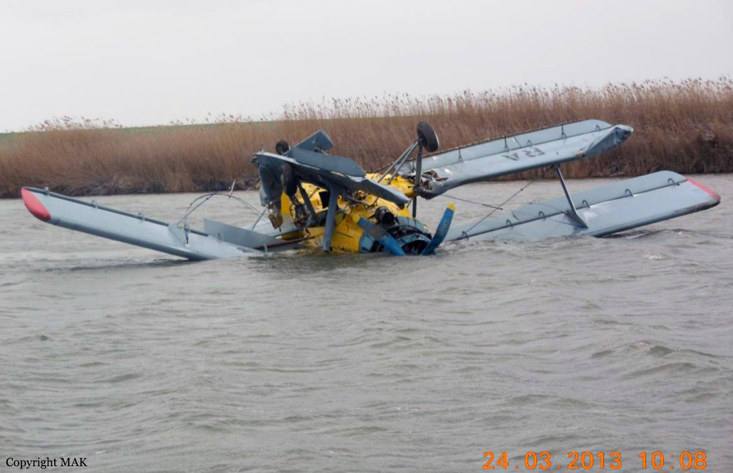
Crash of a PZL-Mielec AN-2R in Vostochnaya: 1 killed

Date & Time: Mar 23, 2013 at 1503 LT
Type of aircraft:
Operator:
Registration:
RA-02203
Flight Phase:
Survivors:
Yes
Schedule:
Vostochnaya - Vostochnaya
MSN:
1G234-34
YOM:
1989
Country:
Region:
Crew on board:
2
Crew fatalities:
Pax on board:
0
Pax fatalities:
Other fatalities:
Total fatalities:
1
Captain / Total flying hours:
5536
Captain / Total hours on type:
2710.00
Copilot / Total flying hours:
61
Copilot / Total hours on type:
61
Aircraft flight hours:
3612
Aircraft flight cycles:
16267
Circumstances:
The crew was engaged in a crop spraying flight on agricultural field in Vostochnaya, about 70 km northeast of Krasnodar. The day prior to the accident, the engine failed in flight and the crew made a forced landing in a field. As the carburetor was broken, it was replaced and an engine test run was performed. On 23 March, one minute after takeoff, while climbing to a height of 30 metres, the engine failed again. The crew attempted an emergency landing when the aircraft stalled and crashed in the Bakhotinski Lake, coming to rest upside down. The copilot escaped with minor injuries while the captain was killed. The wreckage was recovered three days later.
Probable cause:
The accident was caused by its nosing during the emergency landing on water surface. The emergency landing was caused by the engine power loss and flameout in the air due to the destruction of the exhaust collector can type combustor and burn through of the carburetor intake valve followed by high temperature burnt gases ingestion into the engine carburetor intake. The destruction of the exhaust collector can type combustor most probably occurred on the corrosion mechanism energized in conditions of the material heat during the engine operation using motor petrol. Power factor resulted in initial crack formation most probably was caused by residual tenses in the material of manufacture origine caused during can type combustor manufacture. In accordance with the passport the latest can type combustor overhaul was performed on January 27, 2009 in "Shakhtinsky ARZ DOSSAAF" CJSC. The commission didn't find the actual confirmation of the can type combustor overhaul as the marking at the single remained label indicates that the specified section had overhaul at the plant n° 420GA in October 1983.
Final Report:

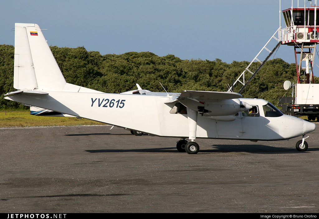
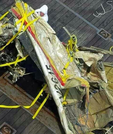
Crash of a Britten-Norman BN-2A-27 off Los Roques: 6 killed

Date & Time: Jan 4, 2013 at 1145 LT
Type of aircraft:
Operator:
Registration:
YV2615
Flight Phase:
Survivors:
No
Schedule:
Los Roques - Caracas
MSN:
20
YOM:
1968
Country:
Crew on board:
2
Crew fatalities:
Pax on board:
4
Pax fatalities:
Other fatalities:
Total fatalities:
6
Circumstances:
The twin engine aircraft departed Los Roques Island Airport Runway 07 at 1132LT on a charter flight to Caracas, carrying four passengers and two pilots. During initial climb, the crew was cleared to climb to 6,500 feet. Seven minutes later, the crew informed ATC he was climbing to 5,000 feet and reported his position some 10 NM from Gran Roque VOR. While cruising at 5,400 feet at a speed of 120 knots, the aircraft entered an uncontrolled descent and crashed in the sea. SAR operations did not find any trace of the aircraft nor the six occupants and all operations were abandoned after one week. The Italian couturier Vittorio Missoni was among the passenger. In June 2013, some debris were localized at a depth of 75 meters and five bodies were found on 17OCT2013. Eventually, the wreckage was recovered on 25NOV2013.

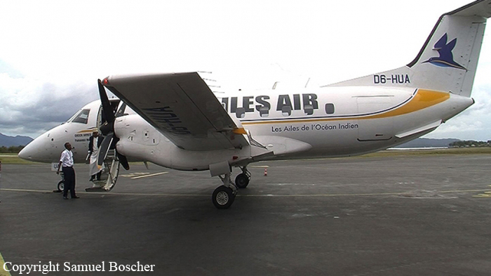
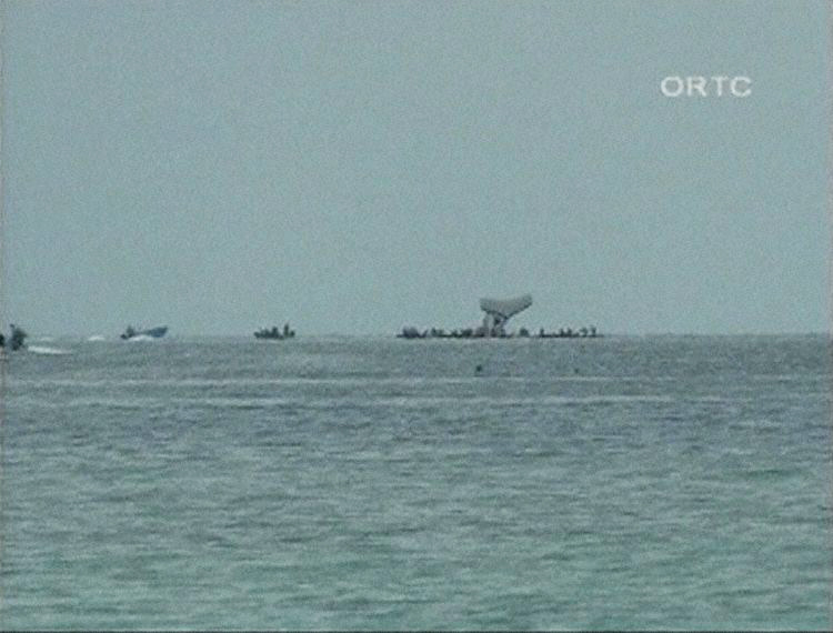
Crash of an Embraer EMB-120ER Brasília off Moroni

Date & Time: Nov 27, 2012 at 1329 LT
Type of aircraft:
Operator:
Registration:
D6-HUA
Flight Phase:
Survivors:
Yes
Schedule:
Moroni - Ouani
MSN:
120-149
YOM:
1989
Flight number:
INZ170
Region:
Crew on board:
4
Crew fatalities:
Pax on board:
25
Pax fatalities:
Other fatalities:
Total fatalities:
0
Captain / Total flying hours:
5000
Captain / Total hours on type:
2000.00
Copilot / Total flying hours:
5000
Circumstances:
The aircraft was on its way from Moroni-Hahaya-Iconi-Prince Saïd Ibrahim Airport to the Ouani Airport located on the neighboring island of Anjouan. Shortly after take off from runway 20, while in initial climb, the captain informed ATC about technical problem and elected to return. He realized he could not make it so he attempted to ditch the aircraft some 200 metres off shore, about 5 km from the airport. All 29 occupants were rescued, among them five were slightly injured.

Crash of a Piper PA-46R-350T Matrix off Jacarepaguá: 2 killed

Date & Time: Aug 21, 2012 at 1935 LT
Registration:
PT-FEM
Flight Phase:
Flight Type:
Survivors:
No
Schedule:
Jacarepaguá – Campo de Marte
MSN:
46-92158
YOM:
2010
Country:
Crew on board:
2
Crew fatalities:
Pax on board:
0
Pax fatalities:
Other fatalities:
Total fatalities:
2
Circumstances:
Shortly after a night takeoff from Jacarepaguá Airport, the single engine aircraft entered an uncontrolled descent and crashed in the sea. Few debris were found several days later. The pilot's body was found on September 4 on a beach in Barra de Tijuca. The wreckage and the copilot's body were never found. It was reported that the crew did not activate the transponder after takeoff and did not contact ATC for unknown reasons.

Crash of a Pilatus PC-6/B2-H2 Turbo Porter off Granville

Date & Time: Aug 18, 2012 at 1855 LT
Operator:
Registration:
F-GMJG
Survivors:
Yes
Schedule:
Granville - Granville
MSN:
659
YOM:
1967
Country:
Region:
Crew on board:
1
Crew fatalities:
Pax on board:
0
Pax fatalities:
Other fatalities:
Total fatalities:
0
Aircraft flight hours:
13300
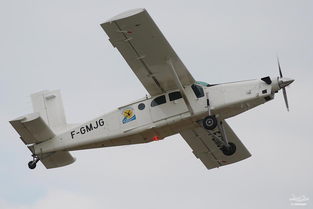
Circumstances:
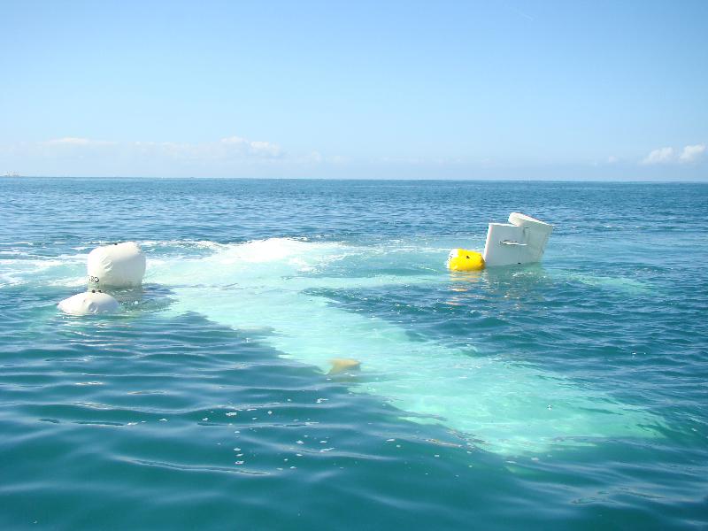
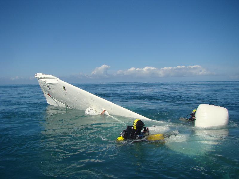
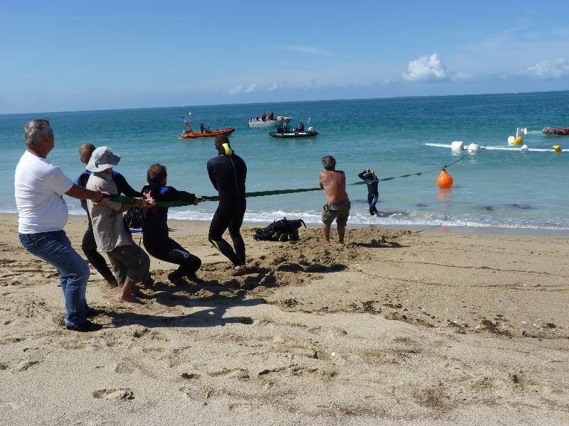
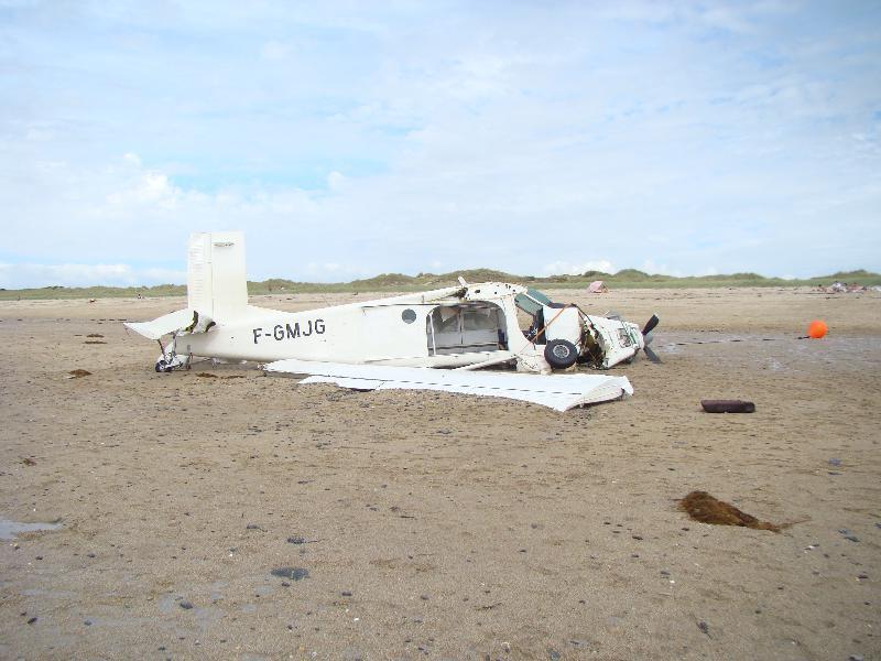
The single engine aircraft departed Granville-Bréville Aerodrome on a local skydiving mission. After all skydivers left the aircraft, the pilot reduced his altitude to return to his base. On final approach to runway 07, the aircraft went out of control and crashed in the sea, few dozen metres offshore. A sailor went quickly to the scene and evacuated the pilot who was slightly injured while the aircraft sank by a depth of 5-6 metres. The wreckage was recovered and pulled on the beach a day later. The aircraft was damaged beyond repair.

Crash of a Piper PA-31-310 Navajo C off Jacarepaguá

Date & Time: Jul 24, 2012 at 1610 LT
Type of aircraft:
Operator:
Registration:
PT-WOT
Survivors:
Yes
Schedule:
Jacarepaguá - Jacarepaguá
MSN:
31-7912021
YOM:
1979
Country:
Crew on board:
1
Crew fatalities:
Pax on board:
2
Pax fatalities:
Other fatalities:
Total fatalities:
0
Circumstances:
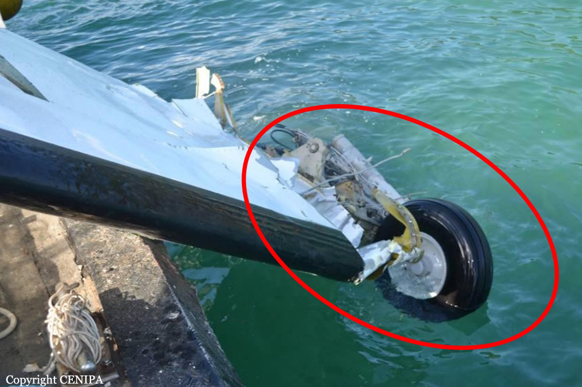
The twin engine aircraft was engaged in a survey flight off the State of Rio de Janeiro and departed Jacarepaguá-Roberto Marinho Airport in the afternoon. While returning to his base, the pilot encountered problems and decided to ditch the aircraft. The airplane came to rest few hundred metres offshore. All three occupants were rescued and the aircraft sank.

Crash of an Embraer EMB-121A1 Xingu II off Angra dos Reis: 3 killed

Date & Time: Jul 12, 2012 at 1715 LT
Type of aircraft:
Registration:
PT-MAB
Survivors:
No
Schedule:
Belo Horizonte - Angra dos Reis
MSN:
121-007
YOM:
1979
Country:
Crew on board:
2
Crew fatalities:
Pax on board:
1
Pax fatalities:
Other fatalities:
Total fatalities:
3
Captain / Total flying hours:
2735
Captain / Total hours on type:
2065.00
Copilot / Total flying hours:
1820
Copilot / Total hours on type:
1283
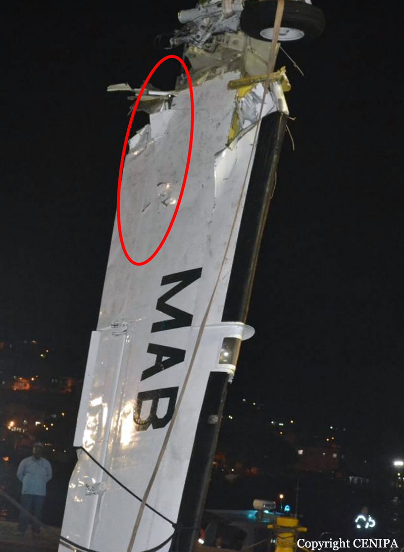
Circumstances:
The twin engine aircraft departed Belo Horizonte-Pampulha Airport on a charter flight to Angra dos Reis, carrying one passenger and two pilots. On approach to Angra dos Reis, the crew encountered poor weather conditions with a cold front approaching the area. On short final, while completing a right turn at low height, the right wing struck the water surface and the aircraft crashed in the sea, some 500 metres offshore. The wreckage was found 3 km from the airport. All three occupants were killed and aircraft was destroyed. Visibility was low at the time of the accident with heavy rain falls, low clouds and turbulences. The passenger was the local representative of the Mercedes Benz Group.
Probable cause:
The collision with water and the subsequent accident was the consequence of the decision of the crew to continue the approach at low altitude to maintain a visual contact with the ground. At the time of the accident, the visibility was limited and weather conditions were marginal.
Final Report:
Crash of a Piper PA-31-325 Navajo C/R near Two Harbors: 1 killed

Date & Time: Jun 8, 2012 at 1427 LT
Type of aircraft:
Registration:
N174BH
Flight Phase:
Flight Type:
Survivors:
No
Schedule:
South Saint Paul - South Saint Paul
MSN:
31-7612038
YOM:
1976
Crew on board:
1
Crew fatalities:
Pax on board:
0
Pax fatalities:
Other fatalities:
Total fatalities:
1
Circumstances:
On June 8, 2012, about 1307 central daylight time, a Piper PA-31-325, N174BH, departed from the South St Paul Municipal Airport-Richard E Fleming Field (SGS), South St Paul, Minnesota for a maintenance test flight. The airplane reportedly had one of its two engines replaced and the pilot was to fly for about 4 hours to break-in the engine. The airplane did not return from the flight and was reported overdue. The airplane is missing and is presumed to have crashed. The airline transport pilot has not been located. The airplane was registered to Family Celebrations LLC, and was operated as a 14 Code of Federal Regulations Part 91 personal flight. Visual meteorological conditions prevailed and no flight plan was filed. The flight departed SGS with the intention of returning to SGS at the conclusion of the flight. The airplane was reported missing and an alert notification issued about 2225. The last reported contact with the airplane and pilot was about 1300 when the fixed base operator at SGS towed the airplane to the fuel pumps. When he returned about 15 minutes later, the airplane was no longer there. Aircraft radar track data from various ground based sources indicated that the airplane departed SGS about 1307. The airplane maneuvered east of SGS before turning toward the north. The airplane's track continued north toward Duluth, Minnesota. Once the airplane reached Duluth, it followed the west shoreline of Lake Superior. Radar track data indicated that the airplane was at a pressure altitude of 2,800 feet when it reached the shoreline. The airplane continued along the west shoreline toward Two Harbors, Minnesota, flying over the water while maintaining a distance of about 0.5 miles from the shore. As the airplane approached Two Harbors, it descended. The airplane's last recorded position at 1427 was about 30 miles northeast of Duluth, Minnesota, at an uncorrected pressure altitude of 1,600 feet. The Air Force Rescue Coordination Center coordinated a search for the missing airplane. The Civil Air Patrol, United States Coast Guard, and other entities participated in the search efforts. Search efforts were suspended on July 4, 2012.
Probable cause:
Undetermined because the airplane was not found
Final Report: