Crash of a Lockheed EC-130Q Hercules near Peak View: 3 killed

Date & Time: Jan 23, 2020 at 1315 LT
Type of aircraft:
Operator:
Registration:
N134CG
Flight Phase:
Flight Type:
Survivors:
No
Schedule:
Richmond - Richmond
MSN:
4904
YOM:
1981
Flight number:
Bomber 134
Country:
Region:
Crew on board:
3
Crew fatalities:
Pax on board:
0
Pax fatalities:
Other fatalities:
Total fatalities:
3
Captain / Total flying hours:
4010
Captain / Total hours on type:
3010.00
Copilot / Total flying hours:
1744
Copilot / Total hours on type:
1364
Aircraft flight hours:
11888
Circumstances:
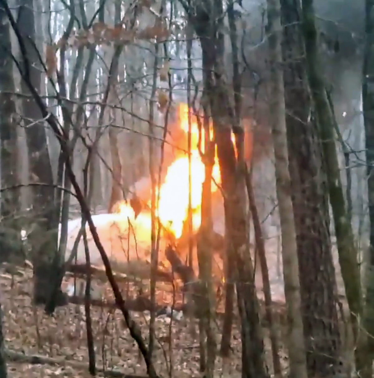
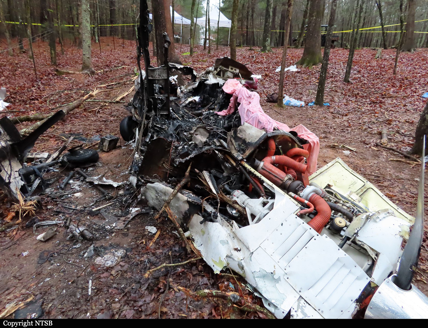
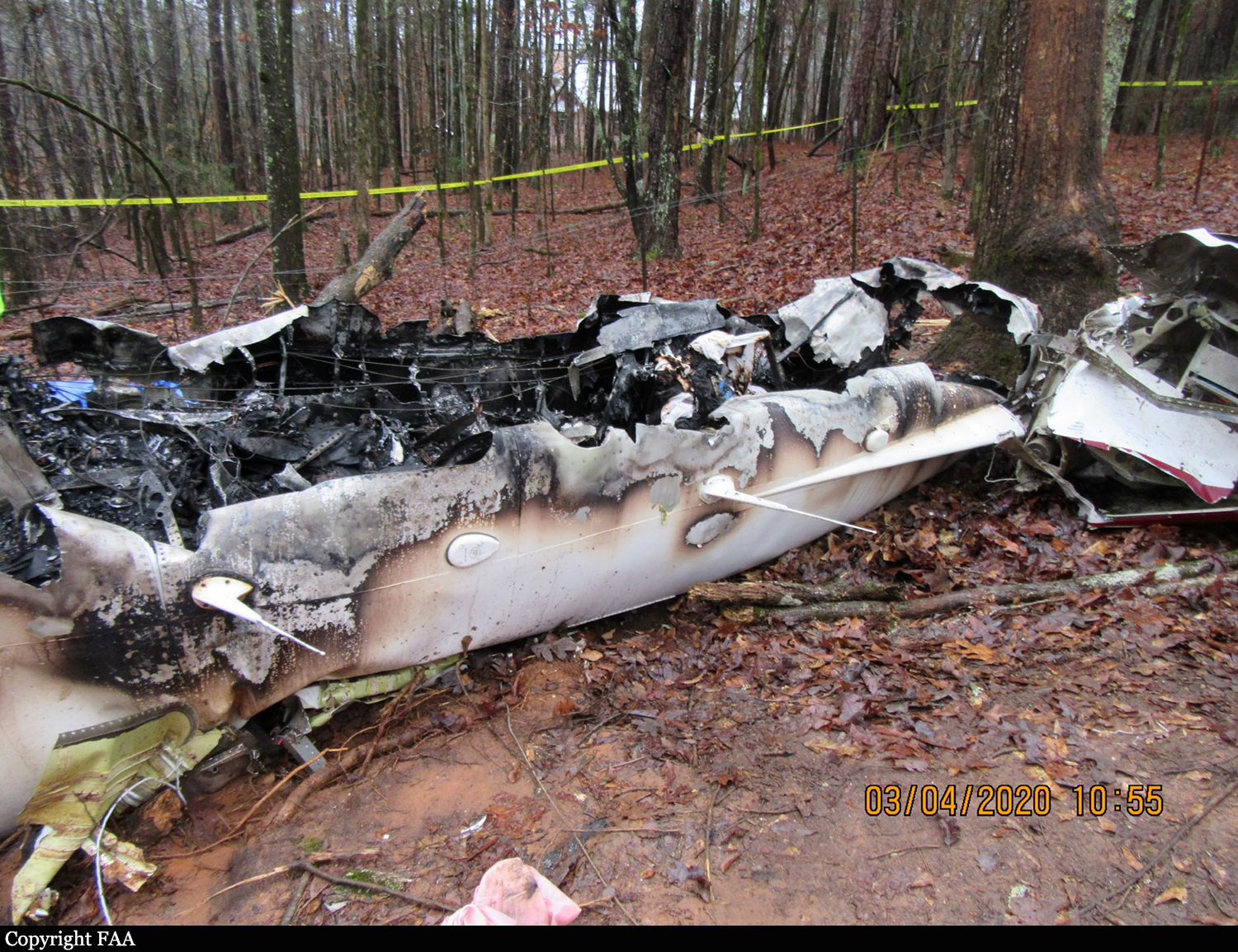
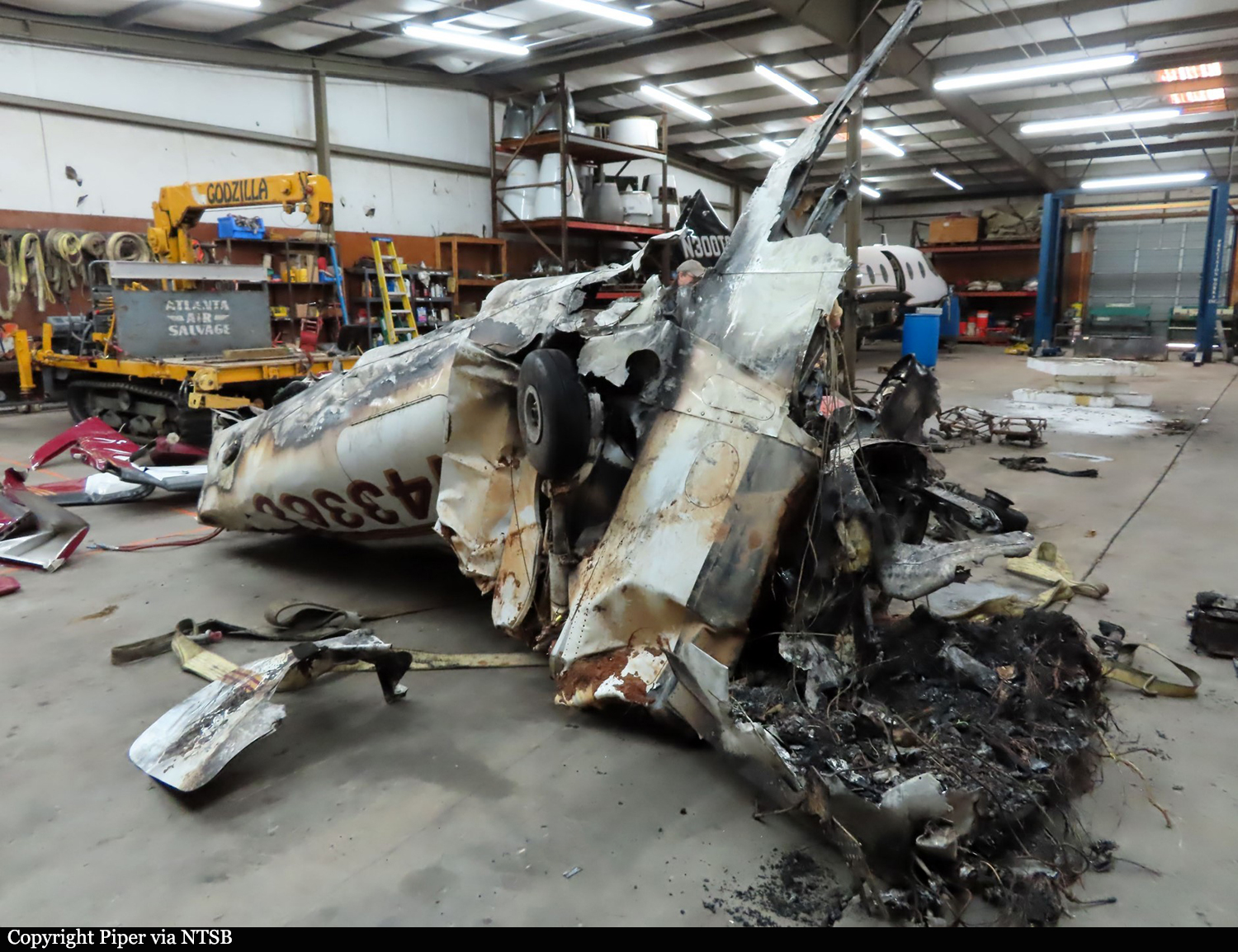
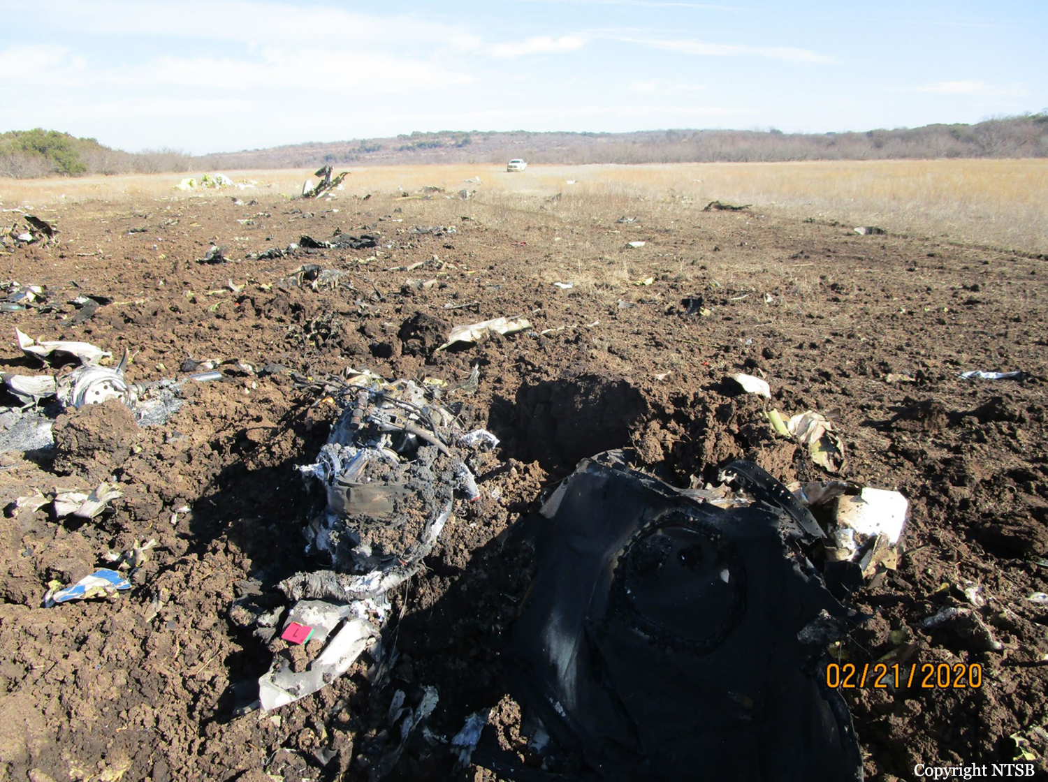
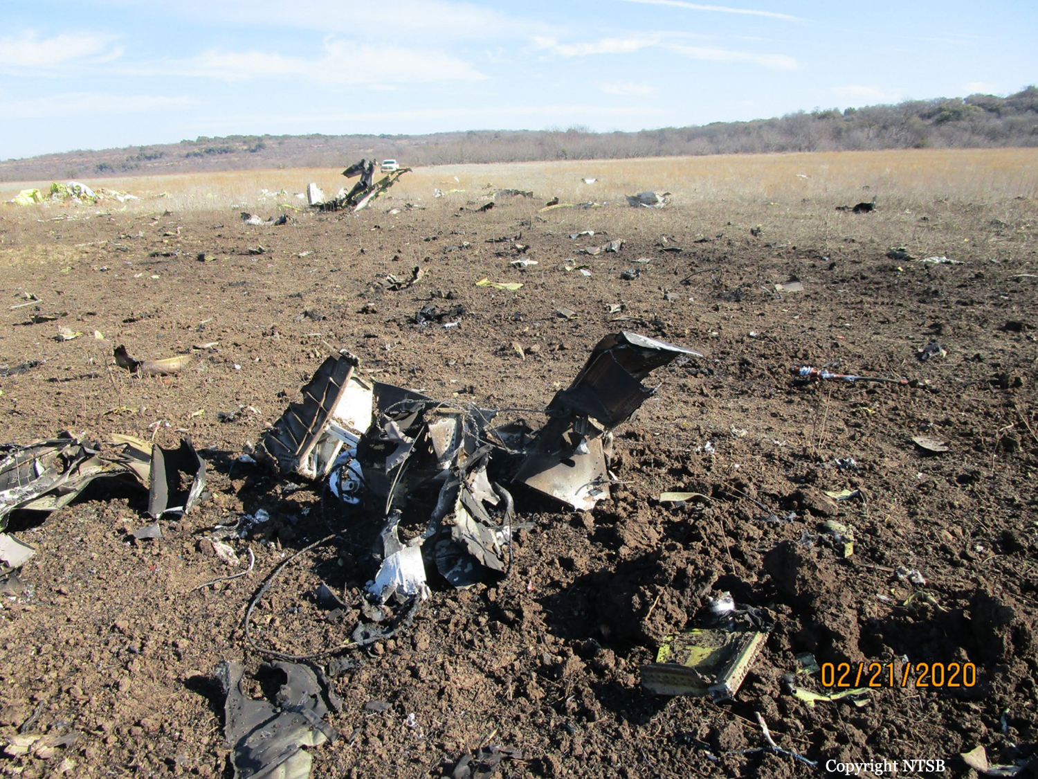
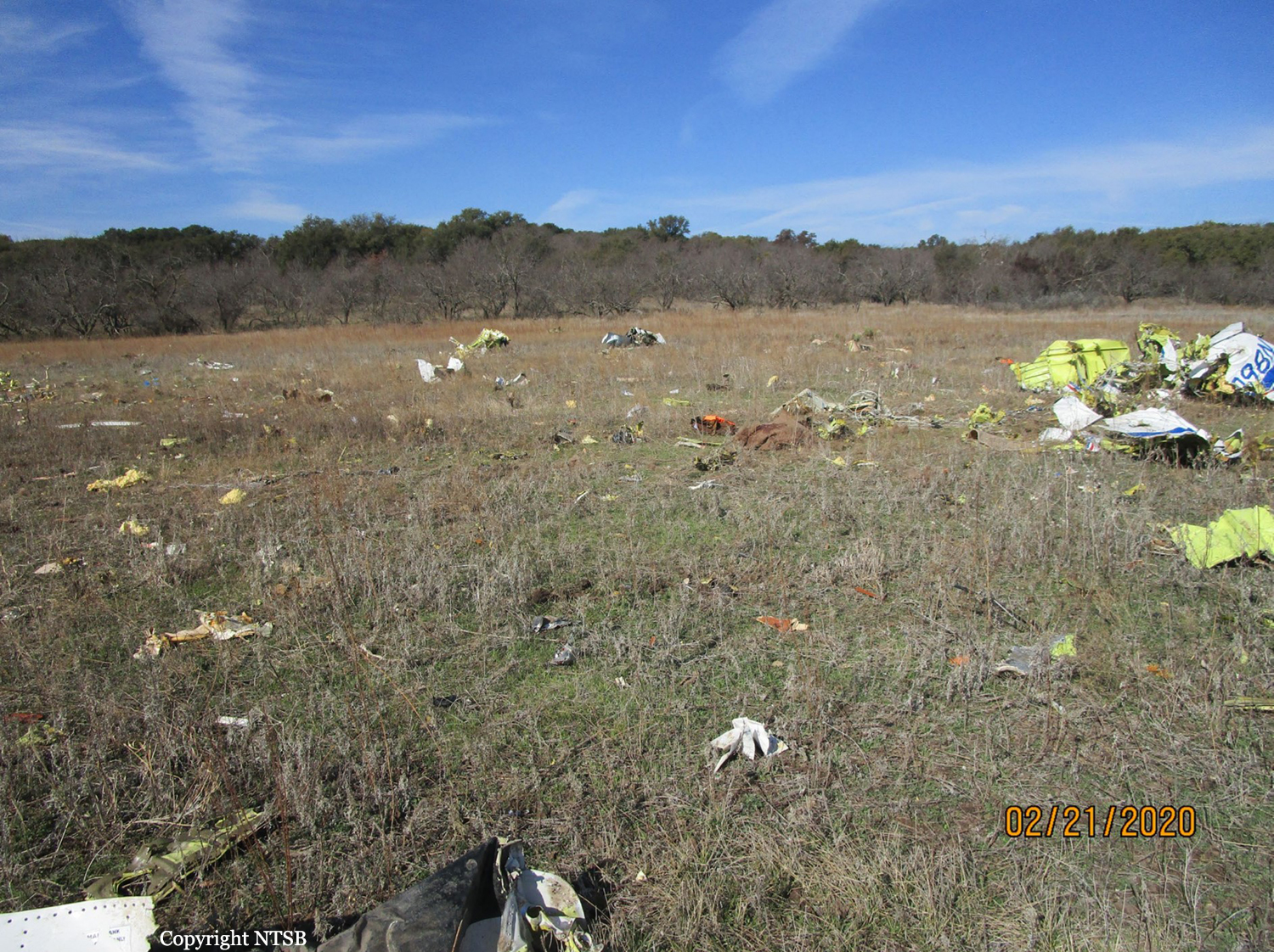
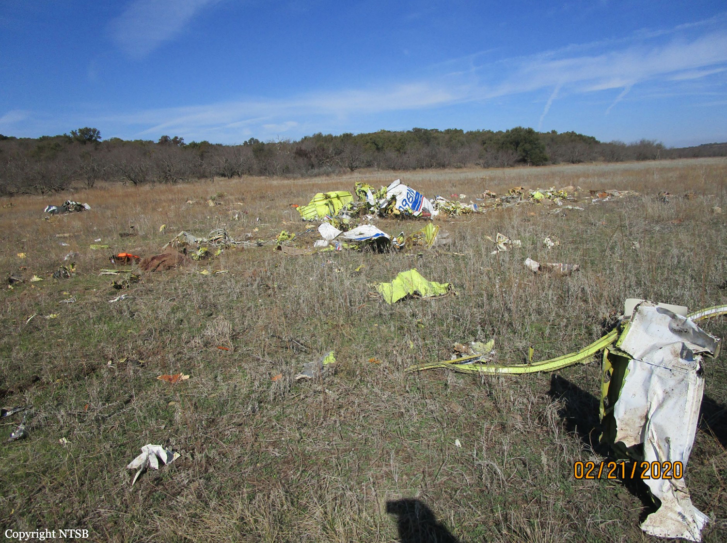
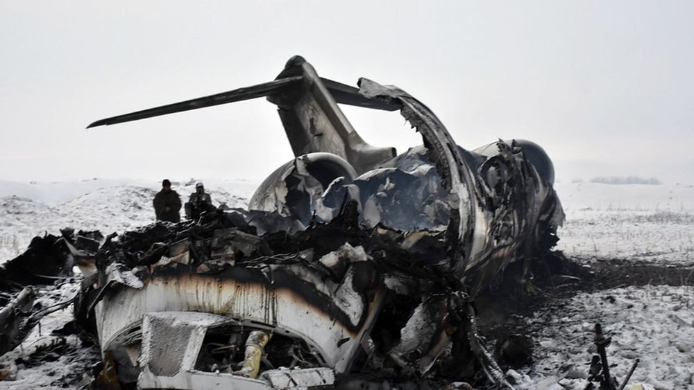
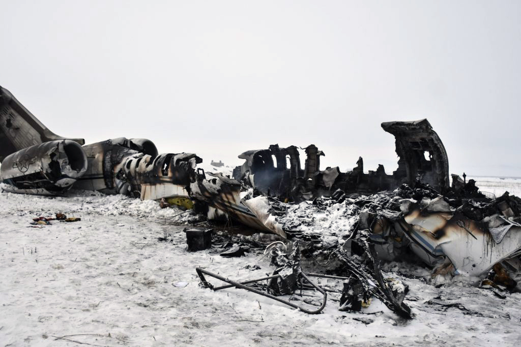
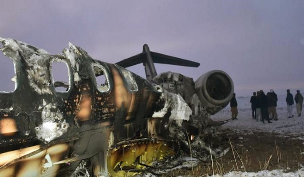
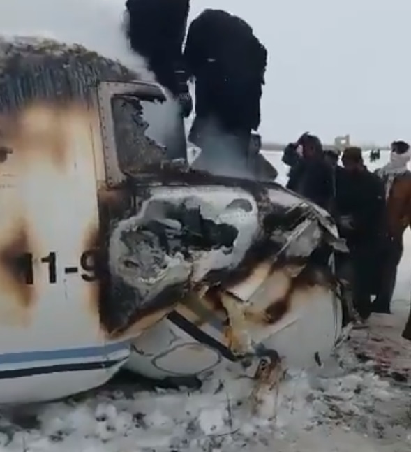
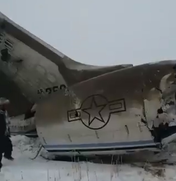
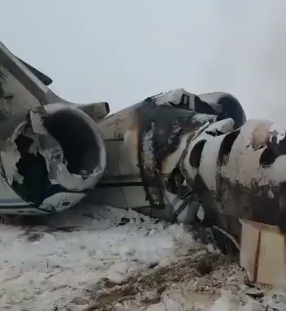
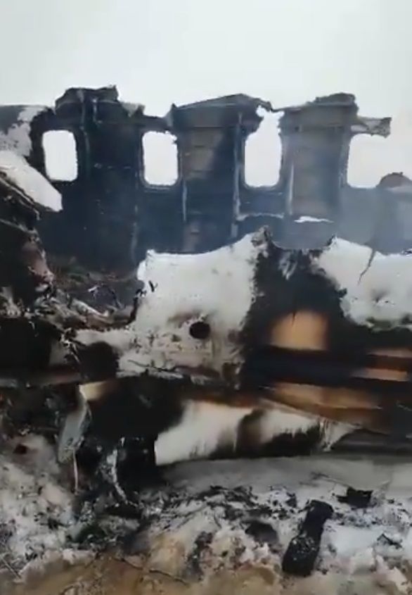
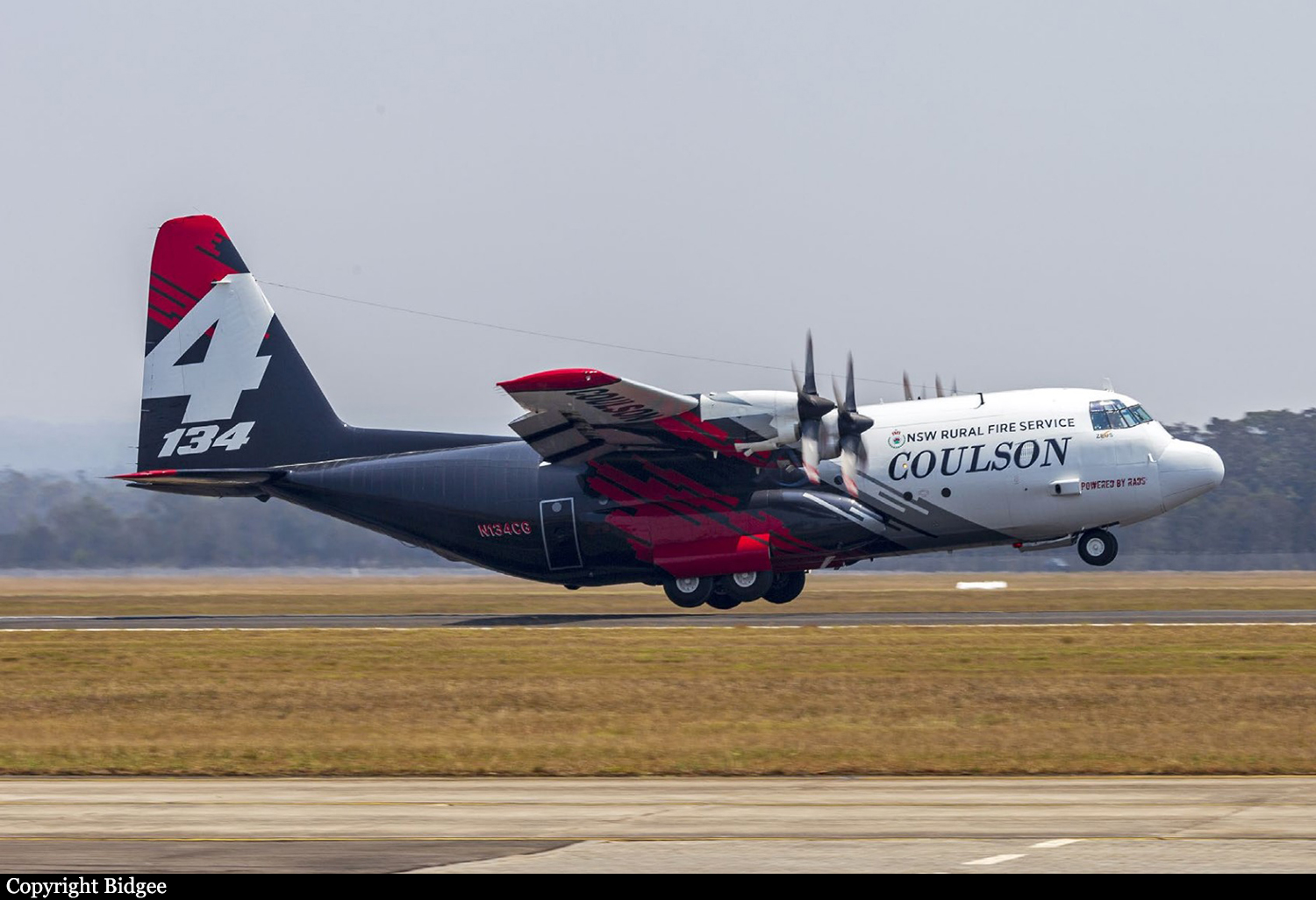
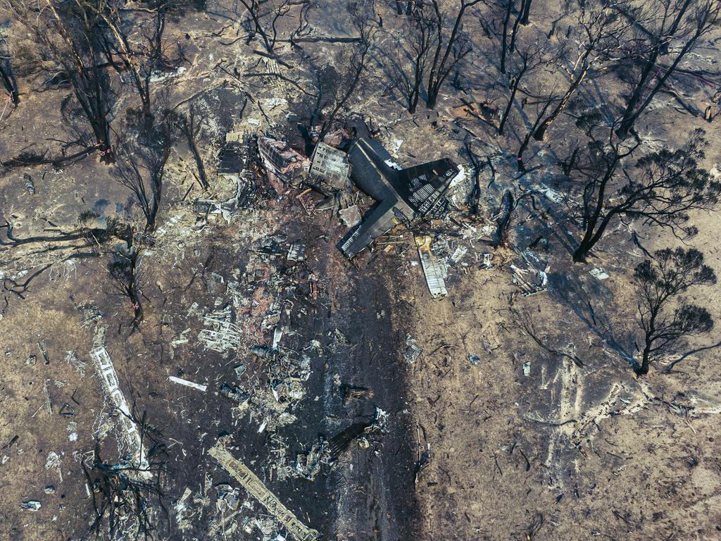
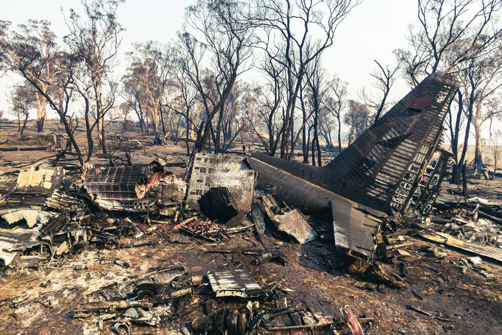
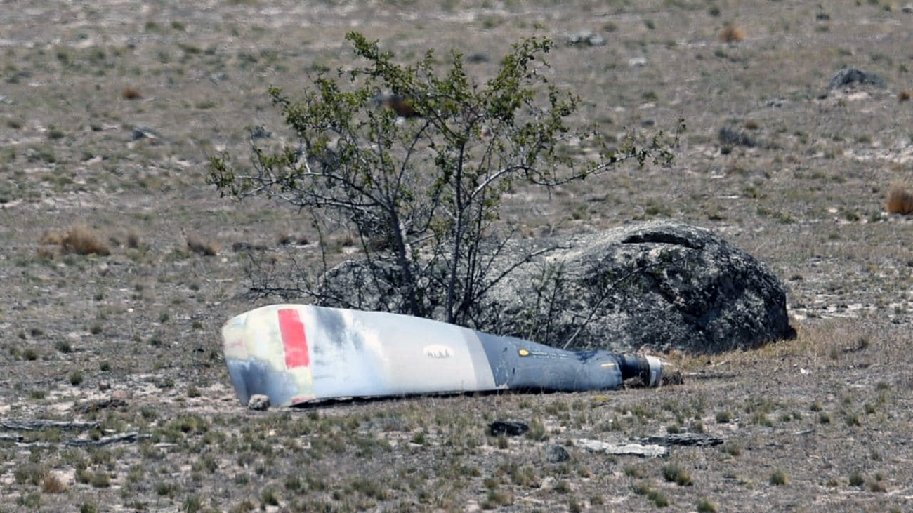
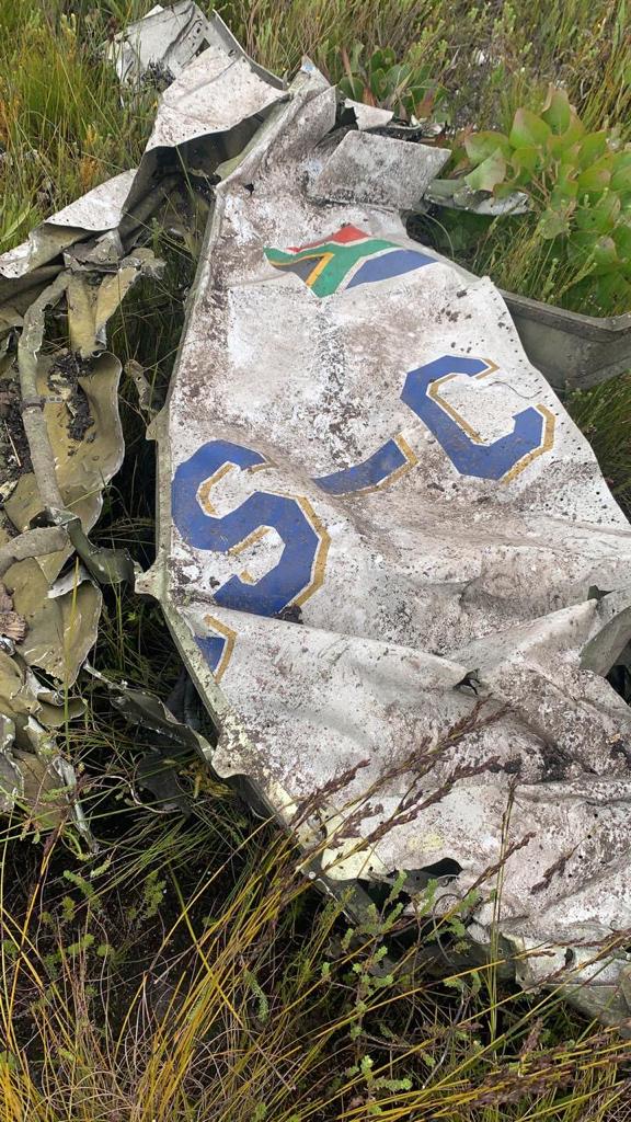
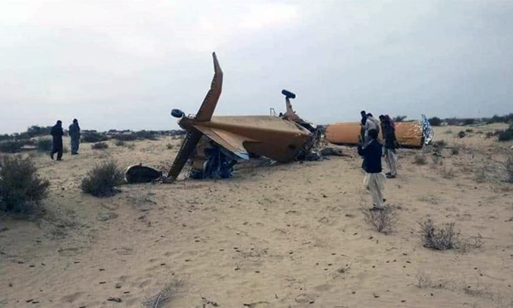
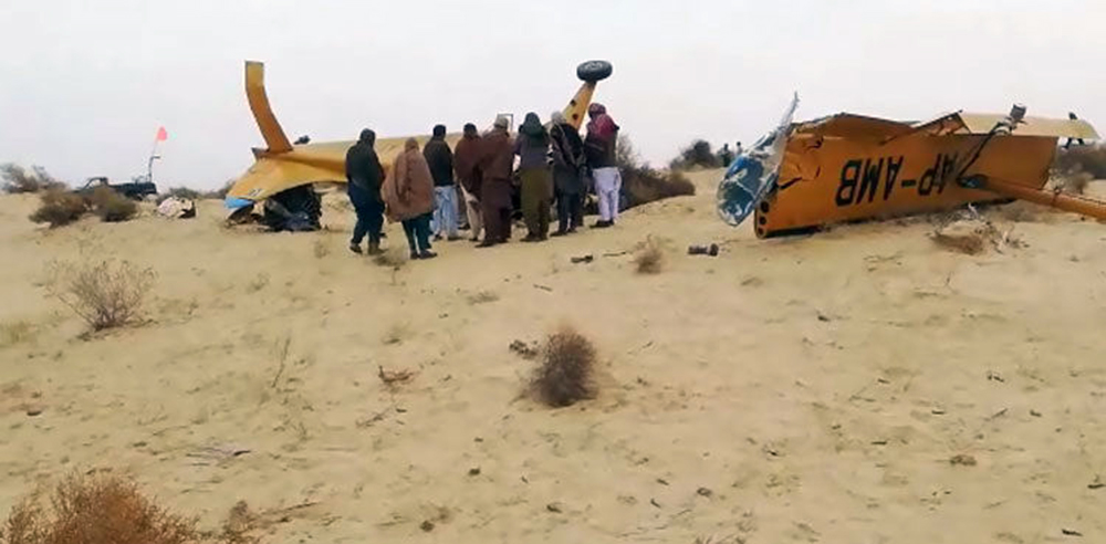
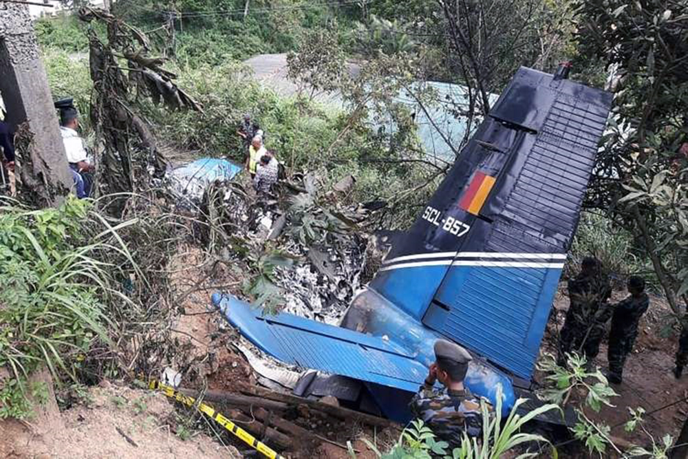
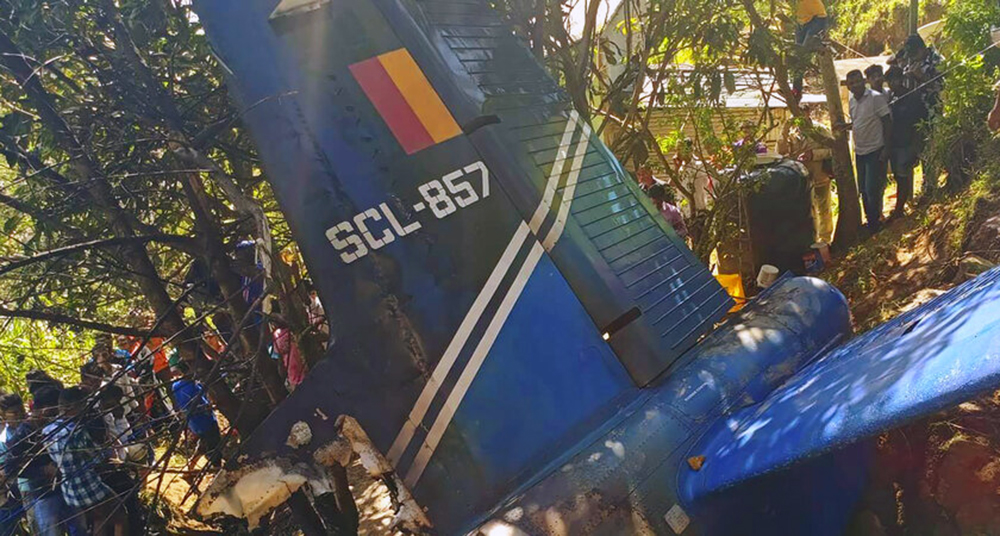
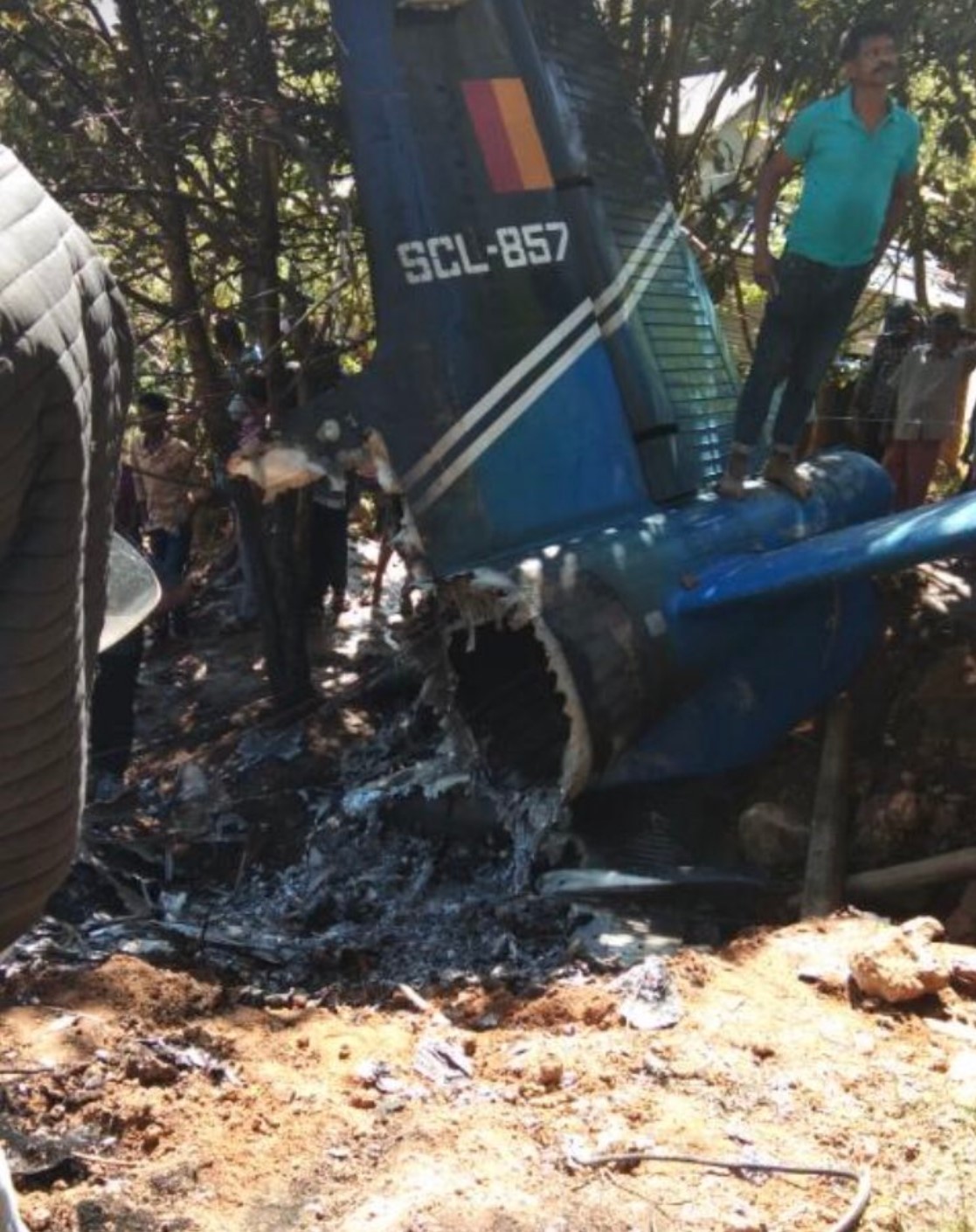
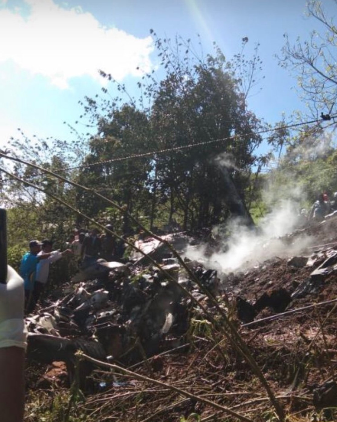
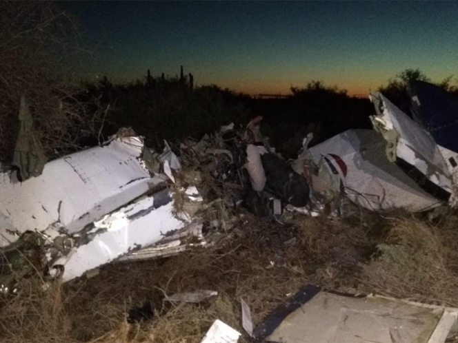
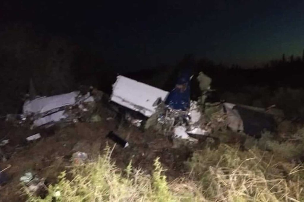
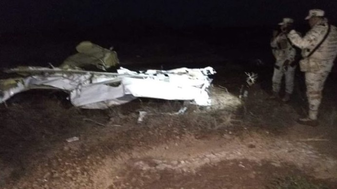
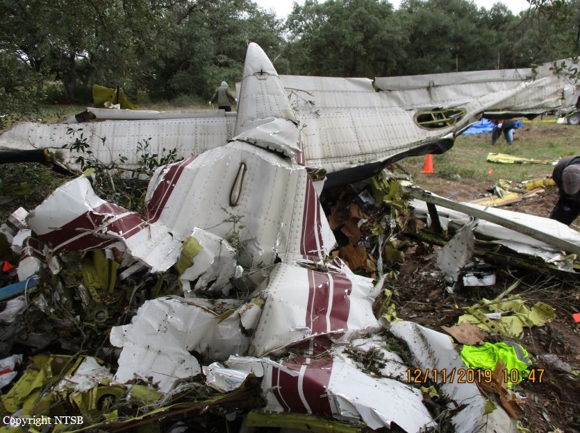
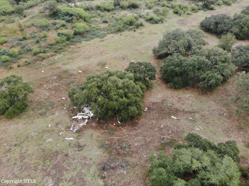
At about 1205, while B137 was overhead the Adaminaby fire-ground, and about the same time the SAD logged the birddog rejection, B134 departed Richmond as initial attack. On board were the PIC, the copilot and flight engineer. In response to the draft report, the RFS provided excerpts from the state operations controller (SOC) log. An entry was written in the log by the SOC following the accident. The SOC noted having been advised that the birddog had indicated it was ‘not safe to fly’ and that B137 was not returning to the area until the conditions had eased. However, B134 would continue with the PIC to make the ‘decision of safety of bombing operations’. The RFS advised the ATSB that the SOC had the authority to cancel B134’s tasking, but instead allowed it to proceed, with the intention of gathering additional intelligence to assist in determining whether further aerial operations would proceed. The RFS further reported that this indicated an ongoing intelligence gathering and assessment process by the SOC. At about 1235, while returning to Richmond, the PIC of B137 heard the PIC of B134 on the Canberra approach frequency, and contacted them via their designated operating frequency. At that time, B134 was about 112 km north-east of Adaminaby, en route to the fire-ground. In this conversation, the PIC of B137 informed them of the actual conditions and that they would not be returning to Adaminaby. The PIC of B137 reported that they could not recall the specific details of the call, but that the conversation included that they were ‘getting crazy winds’ and ‘you can go take a look’ ’but I am not going back’. It was also noted that the PIC of B134 had asked several questions. It was reported by the majority of the operator’s pilots that, despite receiving information from another pilot, they would have also continued with the tasking under these circumstances, to assess the conditions themselves. At about 1242, the crew of B134 contacted air traffic control to advise them of the coordinates they would be working at, provide an ‘ops normal’ call time, and confirm there was no reported instrument flight rules aircraft in the area. About 5 minutes later, the Richmond ABM also attempted to contact the crew of B134 to confirm ‘ops normal’, firstly by radio, and then by text to the PIC’s mobile phone, but did not receive a response. The automatic dependent surveillance broadcast (ADS-B) data showed that, after arriving at the Adaminaby fire-ground at about 1251, the crew of B134 completed several circuits at about 2,000 ft AGL. At about 1255, the crew advised the Cooma ARO that it was too smoky and windy to complete a retardant drop at that location. The Cooma ARO then provided the crew with the approximate coordinates of the Good Good fire, about 58 km to the east of Adaminaby. The ARO further indicated that they had no specific requirements, but they could look for targets of opportunity, with the objective of conducting structure and property protection near Peak View. At about 1259, the crew of B134 contacted air traffic control to advise that they had been re-tasked to the Good Good fire-ground, and provided updated coordinates. At about the same time, the RFS ground firefighters at the Good Good fire-ground, near Feeney’s Road in Peak View, contacted the Cooma FCC and requested additional assets for property protection. They were advised that a LAT would be passing overhead in about 10 minutes. The firefighters acknowledged the intention of a LAT retardant drop and advised the Cooma FCC they would wait in open country on Feeney’s Road, clear of any properties targeted for protection. At about 1307, B134 arrived overhead the drop area. The drop area was located to the east of a ridgeline, with the fire on the western side of the ridgeline. The aircraft’s recorded track data (SkyTrac) showed that the crew conducted 3 left circuits, at about 1,500 ft, 500 ft and 1,000 ft AGL respectively, prior to commencing the drop circuit. At about 1312, after conducting about 2 circuits, they advised the Cooma ARO of their intention to complete multiple drops on the eastern side of the Good Good fire, and that they would advise the coordinates after the first delivery. At 1315:15, a partial retardant drop was conducted on a heading of about 190°, at about 190 ft AGL (3,600 ft above mean sea level). During the drop, about 1,200 US gallons (4,500 L) of fire retardant was released over a period of about 2 seconds. A ground speed of 144 kt was recorded at the time of the drop. A witness video taken by ground fire-fighters captured the drop and showed the aircraft immediately after the drop in an initial left turn with a positive rate of climb, before it became obscured by smoke. While being intermittently obscured by smoke, the aircraft climbed to about 330 ft AGL (3,770 ft above mean sea level). At about this time, ATSB analysis of the video showed that the aircraft was rolling from about 18° left angle of bank to about a 6° right angle of bank. Following this, the aircraft descended and about 17 seconds after the completion of the partial retardant drop, it was seen at a very low height above the ground, in a slight left bank. Video analysis and accident site examination showed there was no further (emergency) drop of retardant. Throughout this period, the recorded groundspeed increased slightly to a maximum of 151 kt. Shortly after, there was a significant left roll just prior to ground impact. At about 1315:37, the aircraft collided with terrain and a post-impact fuel-fed fire ensued. The 3 crew were fatally injured and the aircraft was destroyed. A review of the Airservices Australia audio recording of the applicable air traffic control frequency found no distress calls were received by controllers prior to the impact.
Probable cause:
The following contributing factors were identified:
- Hazardous weather conditions were forecast and present at the drop site near Peak View, which included strong gusting winds and mountain wave activity, producing turbulence. These
conditions were likely exacerbated by the fire and local terrain.
- The Rural Fire Service continued the B134 tasking to Adaminaby when they learned that no other aircraft would continue to operate due to the environmental conditions. In addition, they relied on the pilot in command to assess the appropriateness of the tasking to Adaminaby without providing them all the available information to make an informed decision on flight safety.
- The pilot in command of B134 accepted the Adaminaby fire-ground tasking, which was in an area of forecast mountain wave activity and severe turbulence. After assessing the conditions as unsuitable, the crew accepted an alternate tasking to continue to the Good Good (Peak View) fire-ground, which was subject to the same weather conditions. The acceptance of these taskings were consistent with company practices.
- Following the partial retardant drop and left turn, the aircraft was very likely subjected to hazardous environmental conditions including low-level windshear and an increased tailwind component, which degraded the aircraft’s climb performance.
- While at a low height and airspeed, it was likely the aircraft aerodynamically stalled, leading to a collision with terrain.
- Coulson Aviation's safety risk management processes did not adequately manage the risks associated with large air tanker operations. There were no operational risk assessments conducted or a risk register maintained. Further, as safety incident reports submitted were mainly related to maintenance issues, operational risks were less likely to be considered or monitored. Overall, this limited their ability to identify and implement mitigations to manage the risks associated with their aerial firefighting operations. (Safety issue)
- Coulson Aviation did not provide a pre-flight risk assessment for their firefighting large air tanker crews. This would provide predefined criteria to ensure consistent and objective decision-making with accepting or rejecting tasks, including factors relating to crew, environment, aircraft and external pressures. (Safety issue)
- The New South Wales Rural Fire Service had limited large air tanker policies and procedures for aerial supervision requirements and no procedures for deployment without aerial supervision.(Safety issue)
- The New South Wales Rural Fire Service did not have a policy or procedures in place to manage task rejections, nor to communicate this information internally or to other pilots working in the same area of operation. (Safety issue)

Other factors that increased risk:
- The B134 crew were very likely not aware that the 'birddog' pilot had declined the tasking to Adaminaby fire-ground, and the smaller fire-control aircraft had ceased operations in the area, due to the hazardous environmental conditions
- In the limited time available, the remainder of the fire-retardant load was not jettisoned prior to the aircraft stalling.
- Coulson Aviation did not include a windshear recovery procedure or scenario in their C-130 Airplane Flight Manual and annual simulator training respectively, to ensure that crews consistently and correctly responded to a windshear encounter with minimal delay. (Safety issue)
- Coulson Aviation fleet of C-130 aircraft were not fitted with a windshear detection system, which increased the risk of a windshear encounter and/or delayed response to a windshear encounter during low level operations. (Safety issue)
- The New South Wales Rural Fire Service procedures allowed operators to determine when pilots were initial attack capable. However, they intended for the pilot in command to be certified by the United States Department of Agriculture Forest Service certification process. (Safety issue)

Other findings:
- The aircraft's cockpit voice recorder did not record the accident flight, which resulted in a valuable source of safety information not being available. This limited the extent to which potential factors contributing to the accident could be identified.
Final Report:

Crash of a Cessna S550 Citation S/II in Friemersheim: 3 killed

Date & Time: Jan 23, 2020 at 1050 LT
Type of aircraft:
Operator:
Registration:
ZS-CAR
Flight Phase:
Flight Type:
Survivors:
No
Site:
Schedule:
George - George
MSN:
S550-0078
YOM:
1985
Country:
Region:
Crew on board:
3
Crew fatalities:
Pax on board:
0
Pax fatalities:
Other fatalities:
Total fatalities:
3
Captain / Total flying hours:
5215
Captain / Total hours on type:
1315.00
Copilot / Total flying hours:
1061
Copilot / Total hours on type:
265
Aircraft flight hours:
10106
Circumstances:
A Cessna S550 Citation S/II of the South African Civil Aviation Authority crashed into the Outeniqua mountains, near the town of Friemersheim. The three occupants were killed and the aircraft was destroyed. The Citation departed Port Elizabeth Airport (FAPE) on a positioning flight to George Airport (FAGG). On approach to FAGG, the flying crew requested to carry out a calibration flight for the very high frequency omnidirectional range (VOR) beacon at FAGG. Due to inclement weather conditions at the time, they were not cleared to conduct VOR calibration. As a result, they decided to land and refuel the aircraft before commencing with the calibration of the Instrument Landing System (ILS) on runway 11 at FAGG. The flying crew requested take-off from runway 11 and an early right turn to intercept radial 250°, 17 nautical miles (nm) DME arc to radial 330° at 3000 feet (ft) climbing to 4,000 feet. The air traffic control (ATC) granted their request. Radar data indicated that at 10:42, the aircraft took off from runway 11 and, once airborne, made a right-hand turn to intercept radial 250° using the George VOR (GRV VOR). The aircraft climbed to 3000ft. Once the aircraft reached 17 nm on the DME from the GRV VOR (DME is co-located with the VOR), it commenced with a right-hand turn to intercept radial 330° while maintaining 17nm DME arc. At 10:46, the ATC at FAGG advised the flying crew that they were now exiting controlled airspace and were advised to broadcast on the special rules frequency. The crew acknowledged the advisory to change frequency and there was no further communication. The aircraft was still being monitored by ATC using secondary surveillance radar. At 10:50, radar data showed the aircraft crossing radial 310° and entered a climb from 3000ft, reaching 3,900 feet. As the aircraft levelled off at 3,900 feet, a rapid descent occurred, and the aircraft lost 1500ft in approximately 9 seconds. Three seconds prior to impact, the aircraft nose pitched up before impacting a ridge at 2,192 feet. The aircraft was destroyed and all three occupants were killed.
Probable cause:
The crew lost control of the aircraft which resulted in significant loss of altitude; as they attempted to recover, they collided with the mountain. According to the SAWS report, there was significant cloud coverage below 1,500 feet above ground level at the time of the accident as observed in the METARs. Mountain tops were obscured as seen on the webcam. The aircraft route which is 17 NM arc passes over the obscured mountains. From the limited FDR reading the aircraft attitude drastically changed into an unusual attitude when approaching the mountain area. This indicates that most probably, the pilot has entered an unusual attitude during transition from VFR to IFR flight without preparation. The accident flight plan was VFR.
The following contributing factor were identified:
- The presence of low clouds at about 1,500 feet above ground and obscured mountains with clouds,
- The incapability of the crew to recover from unusual attitude,
- Lack of supervision and disregard of the Civil Aviation Regulations requirements by the FIU (operator),
- Overbanked and steep dive maneuver, unable to gain the required altitude before impact,
- Lack of upset prevention and recovery technique (UPRT).
Final Report:

Crash of a De Havilland DHC-2 Beaver in Sadiqabad: 2 killed

Date & Time: Jan 12, 2020
Type of aircraft:
Registration:
AP-AMB
Flight Phase:
Survivors:
No
Schedule:
Rahim Yar Khan - Rahim Yar Khan
MSN:
1415
YOM:
1960
Country:
Region:
Crew on board:
2
Crew fatalities:
Pax on board:
0
Pax fatalities:
Other fatalities:
Total fatalities:
2
Circumstances:
The airplane departed Rahim Yar Khan-Sheikh Zayed Airport and was spraying pesticide in the area to tackle another wave of locust attacks, which began in December 2019, on the request of the district administration. In unknown circumstances, the single engine airplane went out of control and crashed in a sandy area located in Sadiqabad, killing both crew members, a pilot and a flight engineer. They were completing a mission on behalf of the Department of Agriculture of Pakistan. Initial investigations suggest the plane crashed due to a technical fault.

Crash of a Harbin Yunsunji Y-12-II in Haputale: 4 killed

Date & Time: Jan 3, 2020
Type of aircraft:
Operator:
Registration:
SCL-857
Flight Phase:
Survivors:
No
Schedule:
Wirawila - Colombo
MSN:
0021
YOM:
1990
Country:
Region:
Crew on board:
4
Crew fatalities:
Pax on board:
0
Pax fatalities:
Other fatalities:
Total fatalities:
4
Circumstances:
Crashed in unknown circumstances in Haputale while completing a survey flight from Wirawila to Colombo-Ratmalana Airport. The aircraft was destroyed by a post crash fire and all four crew members were killed.

Crash of a Cessna 208B Grand Caravan near Tastiota: 2 killed

Date & Time: Dec 24, 2019 at 0730 LT
Type of aircraft:
Operator:
Registration:
XA-TWN
Flight Phase:
Survivors:
No
Schedule:
Hermosillo - Guerrero Negro
MSN:
208B-0931
YOM:
2003
Flight number:
CFV872
Location:
Country:
Crew on board:
1
Crew fatalities:
Pax on board:
1
Pax fatalities:
Other fatalities:
Total fatalities:
2
Circumstances:
The single engine airplane departed Hermosillo-General Ignacio Pesqueira García Airport at 0700LT on a schedule service (CFV872) to Guerrero Negro, Baja California del Sur, with one passenger and one pilot on board. About half an hour into the flight, radio and radar contact were lost with the airplane. Debris were found two days later in an uninhabited area located in the region of Tastiota, about 30 km southwest of Miguel Alemán. The aircraft was totally destroyed upon impact and both occupants were killed.

Crash of a Cessna 208B Grand Caravan in Victoria: 1 killed

Date & Time: Dec 9, 2019 at 2017 LT
Type of aircraft:
Operator:
Registration:
N4602B
Flight Phase:
Flight Type:
Survivors:
No
Schedule:
Victoria – Houston
MSN:
208B-0140
YOM:
1988
Flight number:
MRA679
Location:
Crew on board:
1
Crew fatalities:
Pax on board:
0
Pax fatalities:
Other fatalities:
Total fatalities:
1
Captain / Total flying hours:
12680
Captain / Total hours on type:
1310.00
Aircraft flight hours:
17284
Circumstances:
The airline transport pilot departed on a night cargo flight into conditions that included an overcast cloud ceiling and “hazy” visibility, as reported by another pilot. About one minute after takeoff, the pilot made a series of course changes and large altitude and airspeed deviations. Following several queries from the air traffic controller concerning the airplane’s erratic flight path, the pilot responded that he had “some instrument problems.” The pilot attempted to return to land at the departure airport, but the airplane impacted terrain after entering a near-vertical dive. The airplane was one of two in the operator’s fleet equipped with an inverter system that electrically powered the pilot’s (left side) flight instruments. Examination of the annunciator panel lighting filaments revealed that the inverter system was not powered when the airplane impacted the ground. Without electrical power from an inverter, the pilot’s side attitude indicator and horizontal situation indicator (HSI) would have been inoperative and warning flags would have been displayed over the respective instruments. The pilot had a history of poor procedural knowledge and weak flying skills. It is possible that he either failed to turn on an inverter during ground operations and did not respond to the accompanying warning flags, or he did not switch to the other inverter in the event that an inverter failed inflight. Due to impact damage, the operational status of the two inverters installed in the airplane could not be confirmed. However, the vacuum-powered flight instruments on the copilot’s (right side) were operational, and the pilot could have referenced these instruments to maintain orientation. Based on the available information, the pilot likely lost control of the airplane after experiencing spatial disorientation. The night marginal visual flight rules conditions and instrumentation problems would have been conducive to the development of spatial disorientation, and the airplane’s extensive fragmentation indicative of a high-energy impact was consistent with the known effects of spatial disorientation. Ethanol identified during toxicology testing may have come from postmortem production and based on the low levels recorded, was unlikely to have contributed to this accident. Morphine identified in the pilot’s liver could not be used to extrapolate to antemortem blood levels; therefore, whether or to what extent the pilot’s use of morphine contributed to the accident could not be determined.
Probable cause:
The pilot’s loss of control due to spatial disorientation. Contributing to the accident were the inoperative attitude indicator and horizontal situation indicator on the pilot’s side of the cockpit, and the pilot’s failure to reference the flight instruments that were operative.
Final Report:

Crash of a Lockheed C-130H Hercules in the Drake Passage: 38 killed

Date & Time: Dec 9, 2019 at 1813 LT
Type of aircraft:
Operator:
Registration:
990
Flight Phase:
Flight Type:
Survivors:
No
Schedule:
Punta Arenas - Teniente Marsh
MSN:
4776
YOM:
1978
Country:
Region:
Crew on board:
17
Crew fatalities:
Pax on board:
21
Pax fatalities:
Other fatalities:
Total fatalities:
38
Circumstances:
The four engine airplane departed Santiago de Chile at 1021LT and landed at Punta Arenas for a technical stop at 1444LT. It took off at 1653LT on a leg to Teniente Rodolfo Marsh-Presidente Eduardo Frei Montalva Airport located on King George Island, Antarctica, carrying 21 passengers and 17 crew members. After flying a distance of about 390 NM, while in cruising altitude, the radar contact was lost, vertical to the Drake Passage. SAR operations were initiated jointly by the Chilean, Uruguay and Argentine Air Forces which dispatched several aircraft over the area. Two days later, debris were found floating on water. It seems that none of the 38 occupants survived the crash.

Crash of a Beechcraft C90GT King Air near Caieiras: 1 killed

Date & Time: Dec 2, 2019 at 0602 LT
Type of aircraft:
Registration:
PP-BSS
Flight Phase:
Flight Type:
Survivors:
No
Site:
Schedule:
Jundiaí – Campo de Marte
MSN:
LJ-1839
YOM:
2008
Country:
Crew on board:
1
Crew fatalities:
Pax on board:
0
Pax fatalities:
Other fatalities:
Total fatalities:
1
Captain / Total flying hours:
6000
Captain / Total hours on type:
211.00
Circumstances:
The pilot departed Jundiaí-Comandante Rolim Adolfo Amaro Airport at 0550LT on a short transfer flight to Campo de Marte, São Paulo. While descending to Campo de Marte Airport, he encountered poor weather conditions and was instructed by ATC to return to Jundiaí. Few minutes later, while flying in limited visibility, the twin engine airplane impacted trees and crashed in a wooded area located in Mt Cantareira, near Caieiras. The aircraft was destroyed by impact forces and a post crash fire and the pilot, sole on board, was killed.
Probable cause:
The accident was the consequence of the combination of the following factors:
- Attention – undetermined.
It is likely that the pilot has experienced a lowering of his attention in relation to the available information and the stimuli of that operational context in face of the adverse conditions faced.
- Attitude – a contributor.
It was concluded that there was no reaction to the warnings of proximity to the ground (Caution Terrain) and evasive action to avoid collision (Pull Up), a fact that revealed difficulties in thinking and acting in the face of an imminent collision condition, in which the aircraft was found.
- Adverse meteorological conditions – a contributor.
The clouds height and visibility conditions did not allow the flight to be conducted, up to SBMT, under VFR rules.
- Piloting judgment – a contributor.
The attempt to continue with the visual flight, without the minimum conditions for such, revealed an inadequate assessment, by the pilot, of parameters related to the operation of the aircraft, even though he was qualified to operate it.
- Perception – a contributor
The ability to recognize and project hazards related to continuing flight under visual rules, in marginal ceiling conditions and forward visibility, was impaired, resulting in reduced pilot situational awareness, probable geographic disorientation, and the phenomenon known as " tunnel vision''.
- Decision-making process – a contributor.
The impairment of the pilot's perception in relation to the risks related to the continuation of the flight in marginal safety conditions negatively affected his ability to perceive, analyze, choose alternatives and act appropriately due to inadequate judgments and the apparent fixation on keeping the flight under visual rules, which also contributed to this occurrence.
Final Report:

Crash of a Piper PA-31-350 Navajo Chieftain near Cooper Landing: 3 killed

Date & Time: Nov 29, 2019 at 1911 LT
Operator:
Registration:
N4087G
Flight Phase:
Flight Type:
Survivors:
No
Site:
Schedule:
Anchorage – Seward
MSN:
31-8152127
YOM:
1981
Flight number:
SVX36
Crew on board:
1
Crew fatalities:
Pax on board:
2
Pax fatalities:
Other fatalities:
Total fatalities:
3
Captain / Total flying hours:
35000
Captain / Total hours on type:
1200.00
Aircraft flight hours:
5502
Circumstances:
On November 29, 2019, about 1911 Alaska standard time, a Piper PA-31-350 airplane, N4087G, was destroyed by impact and postcrash fire when it collided with mountainous terrain about 15 miles west of Cooper Landing, Alaska. The three occupants; the airline transport pilot, a flight nurse, and the flight paramedic were fatally injured. The airplane was operated by Fly 4 You Inc., doing business as Security Aviation, as a Title 14 Code of Federal Regulations Part 135 visual flight rules air ambulance flight. Dark night visual meteorological conditions existed at the departure and destination locations and company flight following procedures were in effect. The flight departed Ted Stevens International Airport (PANC), Anchorage, Alaska, about 1848, destined for Seward Airport (PAWD), Seward, Alaska. Dispatch records indicated that, on November 29, Providence Seward Medical Center emergency clinic personnel contacted multiple air ambulance companies with a "weather check" for possible air ambulance transportation of a patient from Seward to Anchorage. The first company contacted was Guardian Flight, who declined the flight at 1624 due to limited daylight hours. The second company, LifeMed Alaska, declined the flight at 1637 due to weather. The third and final company contacted for the flight was Medevac Alaska. Their dispatch officer was not notified of the previous declined flight requests and forwarded the request to Security Aviation, who is their sole air charter provider. At 1731 Security Aviation accepted the flight, and Medevac Alaska flight SVX36 was staffed with a nurse and paramedic. A preliminary review of archived Federal Aviation Administration (FAA) radar and automatic dependent surveillance (ADS-B) data revealed that the accident airplane departed PANC and flew south about 3,000 ft mean sea level (msl) toward the Sterling Highway. The airplane was then observed descending to 2,200 ft msl while flying a right racetrack pattern before flying into the valley toward Cooper Landing. The last data point indicated that at 1911:14 the airplane was over the west end of Jean Lake at 2,100 ft msl, on a 127° course, and 122 kts groundspeed. Ground witnesses who were in vehicles on the Sterling Highway near milepost 63, reported that they saw the lights of the airplane flying over the highway that night. One witness stated that he saw the airplane west of the mountains turn in a circle as it descended and then entered the valley. He observed the wings rocking back and forth and while he was looking elsewhere, he heard an explosion and observed a large fire on the mountainside. Another witness reported seeing the airplane flying low and explode when it impacted the mountain. Witnesses to the fire called 911 and observed the wreckage high on the mountainside burning for a long time after impact. The airplane was reported overdue by the chief pilot for Security Aviation and the FAA issued an alert notice (ALNOT) at 2031. The Alaska Rescue Coordination Center dispatched an MH-60 helicopter to the last known position and located the burning wreckage that was inaccessible due to high winds in the area. On December 1, 2019, the Alaska State Troopers coordinated a mountain recovery mission with Alaska Mountain Rescue Group. The wreckage was observed on the mountain at an elevation of about 1,425 ft msl in an area of steep, heavily tree-covered terrain near the southeast end of Jean Lake in the Kenai National Wildlife Refuge. The airplane was highly fragmented and burned, however all major airplane components were accounted for. Multiple large trees around the wreckage were fractured and indicated an easterly heading prior to the initial impact.

Crash of a Let L-410UVP near Bor

Date & Time: Oct 27, 2019 at 1300 LT
Type of aircraft:
Registration:
YI-BYO
Flight Phase:
Flight Type:
Survivors:
Yes
Schedule:
Walgak - Juba
MSN:
79 02 05
YOM:
1979
Country:
Region:
Crew on board:
2
Crew fatalities:
Pax on board:
2
Pax fatalities:
Other fatalities:
Total fatalities:
0
Circumstances:
The twin engine airplane was returning from Walgak to Juba on a cargo flight, carrying two passengers and two crew members. En route, weather conditions worsened and the crew decided to perform an emergency landing. The aircraft crash landed in the bush about 12 km south from Bor Airport and came to rest with its right wing partially torn off and the cockpit severely damaged. All four occupants were injured and transferred to local hospital.