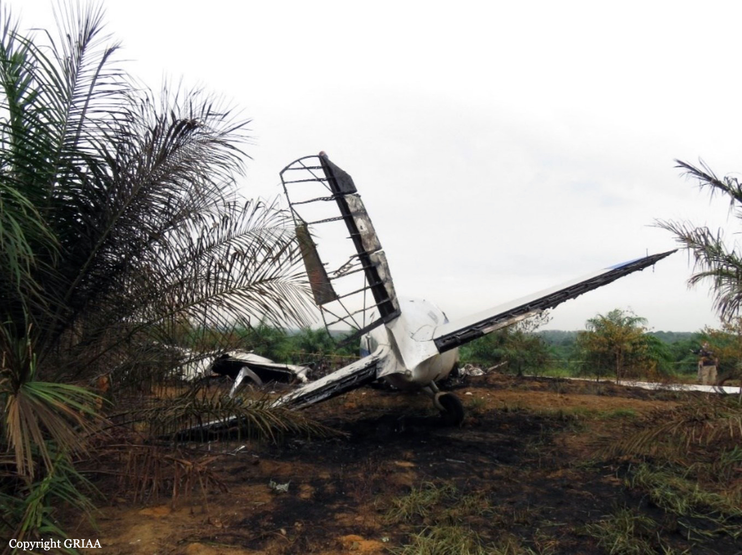
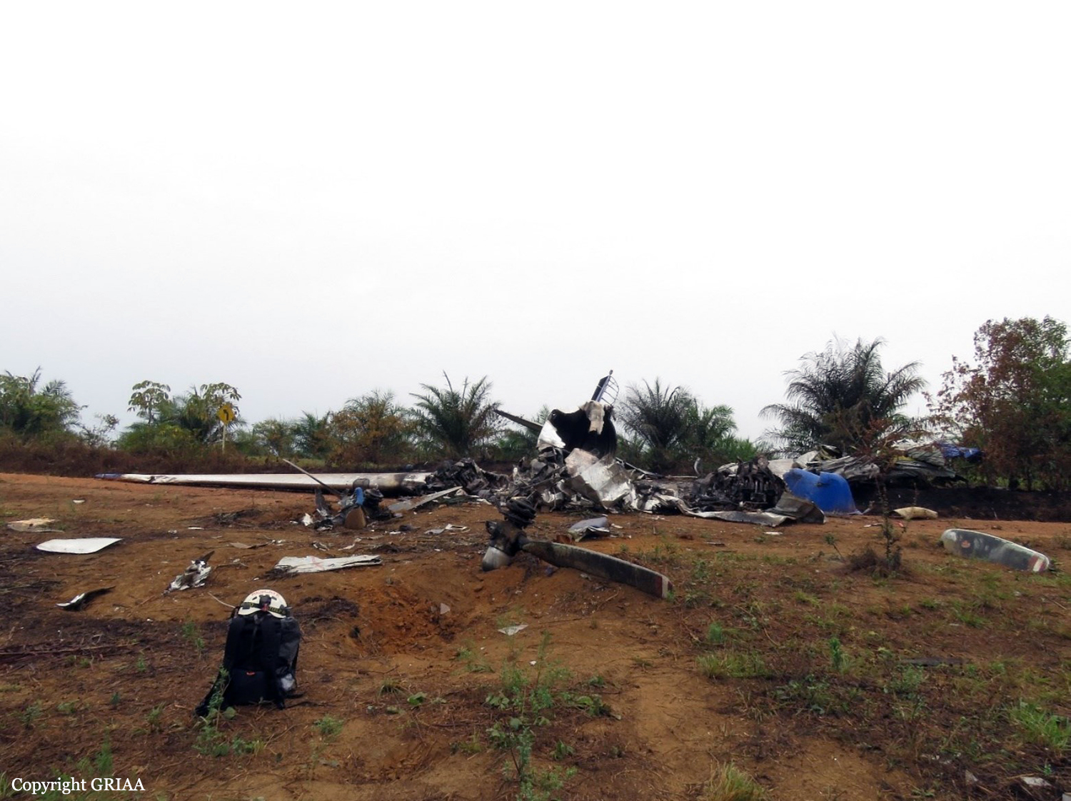
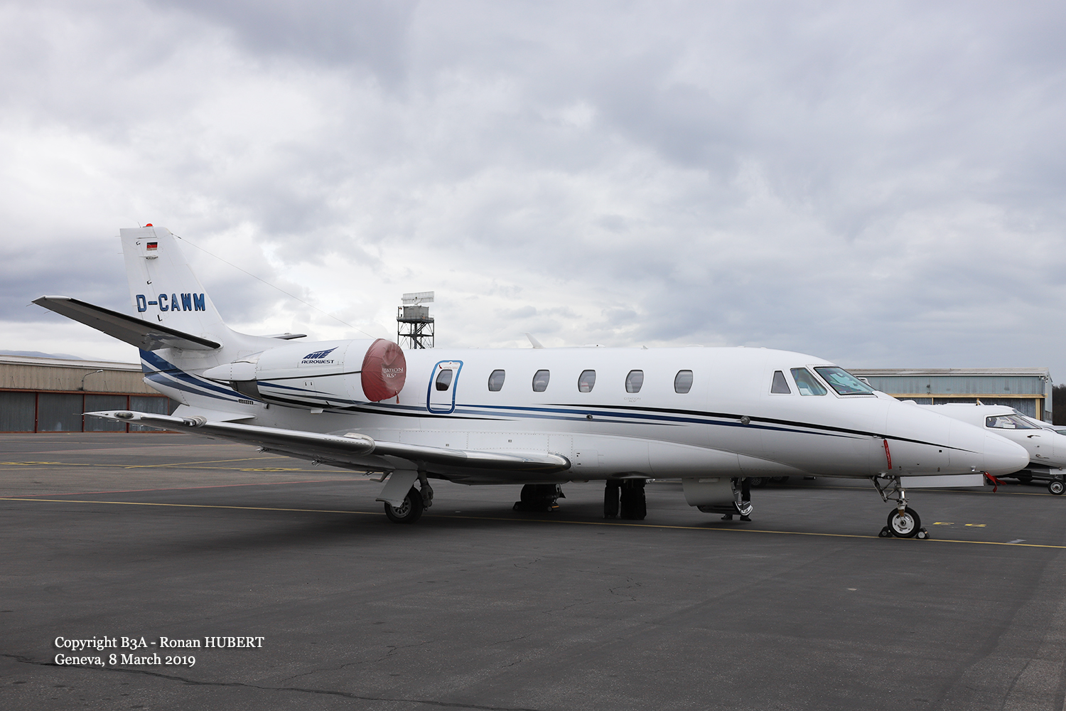
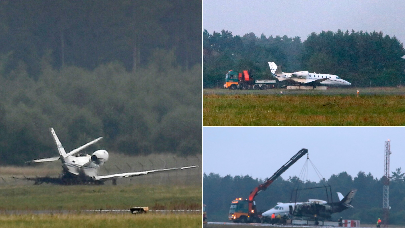
Crash of a Cessna 560XLS+ Citation Excel in Aarhus

Date & Time: Aug 6, 2019 at 0036 LT
Operator:
Registration:
D-CAWM
Survivors:
Yes
Schedule:
Oslo - Aarhus
MSN:
560-6002
YOM:
2008
Country:
Region:
Crew on board:
3
Crew fatalities:
Pax on board:
7
Pax fatalities:
Other fatalities:
Total fatalities:
0
Circumstances:
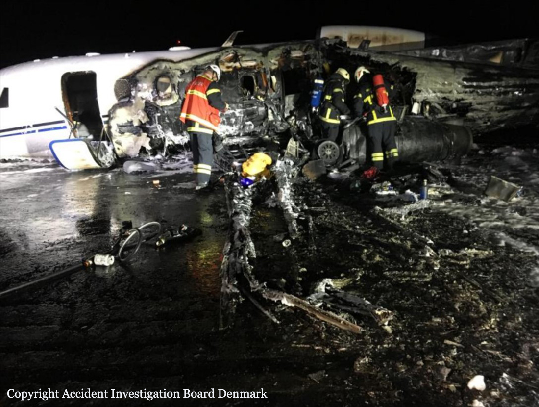
The accident occurred during an IFR air taxi flight from Oslo (ENGM) to Aarhus (EKAH). The flight was uneventful until the landing phase. The commander was the pilot flying, and the first officer was the pilot monitoring. En route, the flight crew set the Vapp 15° to 123 knots (kt) and the Vref 35° to 116 kt and agreed upon, if foggy at EKAH, to pull the curtains between the cockpit and the passenger cabin in order to avoid blinding from lights in the passenger cabin. During the descent, the flight crew decided not to descend below Flight Level (FL) 170, if the weather did not allow an approach and landing in EKAH. Instead they would continue to a pre-planned destination alternate. The pre-planned and nearest useable destination alternate was Billund (EKBI) at a great circle distance of 60 nautical miles southwest of EKAH. At 22:09 hrs, the first officer established preliminary radio contact with Aarhus Tower (118.525 MegaHertz (MHz)) in order to obtain the latest weather report for EKAH. The air traffic controller at Aarhus Tower communicated the following landing details:
- Expected landing on runway 10R.
- Wind conditions to be 140° 2 kt.
- Meteorological visibility to be 250 meters (m).
- Runway Visual Range (RVR) at landing to be 900 m, 750 m, and 400 m in fog patches.
- Few clouds at 200 feet (ft), few clouds at 6500 ft.
- Temperature 16° Celcius (C) and Dewpoint 15° C.
- QNH 1008 Hectopascal (hPa).
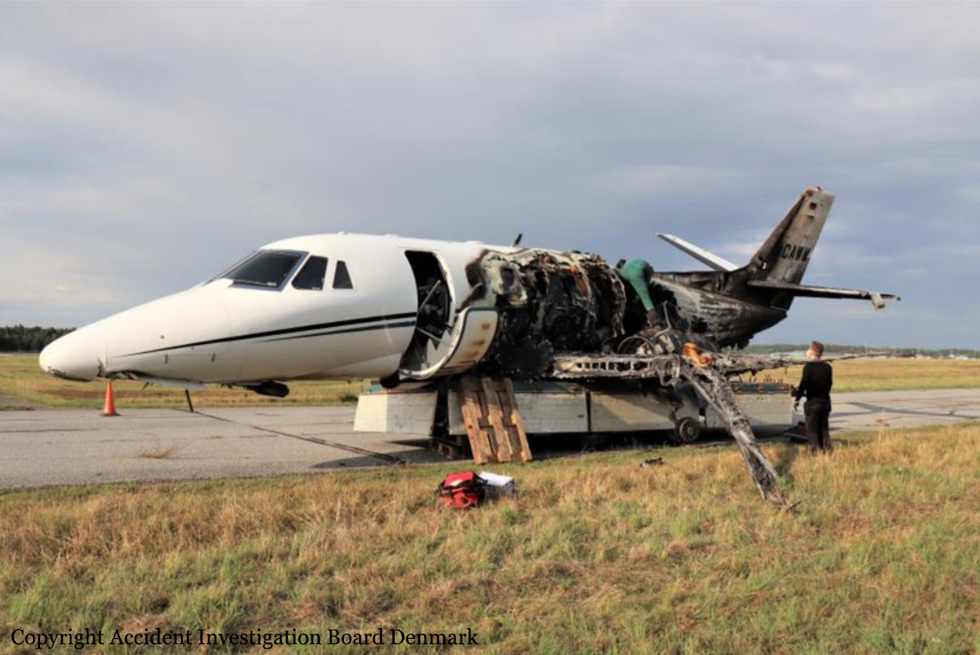
The first officer read back a meteorological visibility of 2500 m to the commander. The flight crew discussed the reported RVR values and agreed that runway 10R would be the preferable landing runway. The commander made an approach briefing for the Instrument Landing System (ILS) for runway 10R including a summary of SOP in case of a missed approach. The first officer pulled the curtain between the cockpit and the passenger cabin. At established radio contact with Aarhus Approach (119.275 MHz) at 22:20 hrs, the air traffic controller instructed the flight crew to descend to altitude 3000 feet on QNH 1008 hPa and to expect radar vectors for an ILS approach to runway 10R. The flight crew performed the approach checklist. The flight crew discussed the weather situation at EKAH with expected shallow fog and fog patches at landing. At 22:28 hrs, the air traffic controller instructed the flight crew to turn right by 10°, descend to 2000 ft on QNH 1008 hPa, and informed that Low Visibility Procedures (LVP) were in operation at EKAH. Due the weather conditions, the air traffic controller radar vectored the aircraft for a long final allowing the flight crew to be properly established before the final approach. The commander called out the instrument presentation of an operative radio altimeter. At 22:31 hrs, the air traffic controller instructed the flight crew to turn left on heading 130° and cleared the flight crew to perform an ILS approach to runway 10R. The commander armed the approach mode of the aircraft Automatic Flight Control System and ordered a flap setting of 15°. When established on the LLZ for runway 10R and shortly before leaving 2000 ft on the GS, the commander through shallow fog obtained and called visual contact with the approach and runway lighting system. At that point, the first officer as well noted the approach and runway lighting system including the position of the green threshold identification lights. The commander ordered a landing gear down selection. The flight crew observed that a fog layer was situated above the middle of the runway. Though visual contact with the approach and runway lighting system, the commander requested altitude call-outs on approach. The commander ordered a flap setting of 35°. The aircraft was established on the ILS (LLZ and GS) for runway 10R in landing configuration. At 22:32 hrs, the first officer reported to Aarhus Approach that the aircraft was established on the ILS for runway 10R. The air traffic controller reported the wind conditions to be 150° 2 kt and cleared the aircraft to land on runway 10R. The flight crew initiated the final checklist. The landing lights were on. The first officer noted two white and two red lights of the Precision Approach Path Indicator (PAPI) to the left of runway 10R. Passing approximately 1500 ft Radio Height (RH), the first officer reported to the commander visual contact with the approach and runway lighting system, fog above the middle of the runway, and that the touchdown zone and the runway end were both visible. The commander confirmed. At approximately 900 ft RH, the commander disengaged the autopilot, and the flight crew completed the final checklist. The aircraft was established on the ILS (LLZ and GS) for runway 10R in landing configuration at a recorded computed airspeed of approximately 128 kt. The first officer called: 500 to minimum (passing approximately 800 ft RH), and the commander called: Runway in sight. The commander confirmed that the intensity of the approach and runway lighting system was okay. The commander informed the first officer that the intention was to touch down at the beginning of the runway. In order to avoid entering fog patches during the landing roll, the commander planned flying one dot below the GS, performing a towed approach, and touching down on the threshold. However, the commander did not communicate this plan of action to the first officer. The aircraft started descending below the GS for runway 10R. The first officer asked the commander whether to cancel potential Enhanced Ground Proximity Warning System (EGPWS) GS warnings. The commander confirmed. At approximately 500 ft RH, the Solid State Flight Data Recorder (SSFDR) recorded cancellation of potential EGPWS GS warnings. The aircraft aural alert warning system announced passing 500 feet RH. The recorded computed airspeed was 125 kt, the recorded vertical speed was approximately 700 ft/minute, and the GS deviation approached one dot below the GS. The commander noted the PAPI indicating the aircraft flying below the GS (one white and three red lights). The first officer called: Approaching minimum. Shortly after, the aircraft aural alert warning system announced: Minimums Minimums. The SSFDR recorded a beginning thrust reduction towards flight idle and a full scale GS deviation (flying below). The commander called: Continue. The commander had visual contact with the approach and runway lighting system. It was the perception of the first officer that the commander had sufficient visual cues to continue the approach and landing. The first officer as pilot monitoring neither made callouts on altitude nor deviation from GS. The commander noticed passing a white crossbar, a second white crossbar and then red lights. To the commander, the red lights indicated the beginning of runway 10R, and the commander initiated the flare. The aircraft collided with the antenna mast system of the LLZ for runway 28L, touched down in the grass RESA for runway 28L, and the nose landing gear collided with a near field antenna (LLZ for runway 28L) and collapsed. The aircraft ended up on runway 10R. Throughout the sequence of events and due to fog, the air traffic controller in the control tower (Aarhus Approach) had neither visual contact with the approach sector, the threshold for runway 10R nor the aircraft on ground, when it came to a full stop. Upon full stop on runway 10R, the first officer with a calm voice reported to Aarhus Approach: Aarhus Tower, Delta Whiskey Mike, we had a crash landing. The air traffic controller did not quite perceive the reporting and was uncertain on the content of the reporting and replied: Say again. The cabin crewmember without instructions from the flight crew initiated the evacuation of the passengers via the cabin entry door. The aircraft caught fire. Aarhus Approach and the Aerodrome Office in cooperation activated the aerodrome firefighting services and the area emergency dispatch centre. Upon completion of the on ground emergency procedure and the evacuation of the aircraft, the flight crew met the cabin crewmember and the passengers at a safe distance in front of the aircraft.
Probable cause:
The following factors were identified:
1. Deviations from SOP in dark night and low visibility combined with the cancellation of a hardware safety barrier compromised flight safety.
2. The commander started flying below the GS.
3. Both pilots accepted and instituted a deactivation of a hardware safety barrier by cancelling potential EGPWS GS alerts for excessive GS deviations.
4. Both pilots accepted and instituted a deviation from SOP by not maintaining the GS upon runway visual references in sight.
5. At low altitude, the first officer made no corrective call-outs on altitude, GS deviation or unstabilized approach.
6. The confusion over and misinterpretation of the CAT 1 approach and runway lighting system resulted in a too early flare and consequently a CFIT.
Final Report:
Crash of a Cessna 208 Caravan 675 on Addenbroke Island: 4 killed

Date & Time: Jul 26, 2019 at 1104 LT
Type of aircraft:
Operator:
Registration:
C-GURL
Flight Phase:
Survivors:
Yes
Site:
MSN:
208-0501
YOM:
2008
Country:
Crew on board:
1
Crew fatalities:
Pax on board:
8
Pax fatalities:
Other fatalities:
Total fatalities:
4
Captain / Total flying hours:
8500
Captain / Total hours on type:
504.00
Aircraft flight hours:
4576
Circumstances:
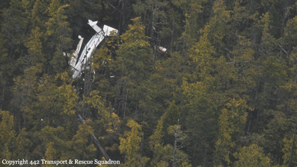
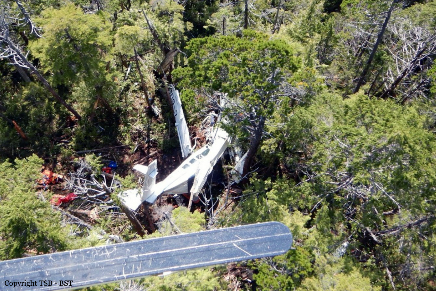
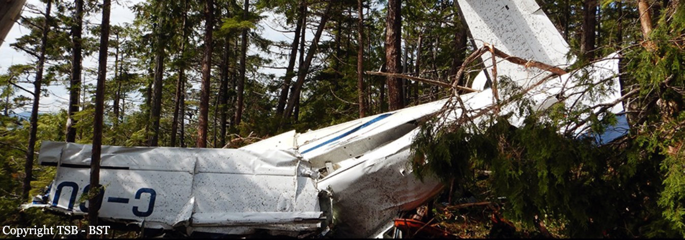
Seair Seaplanes (Seair) was contracted by a remote fishing lodge on the central coast of British Columbia (BC) (Figure 1) to provide seasonal transport of guests and supplies between Vancouver International Water Aerodrome (CAM9), BC, and the lodge, which is located about 66 nautical miles (NM) north-northwest of Port Hardy Airport (CYZT), BC, and about 29 NM southeast of Bella Bella (Campbell Island) Airport (CBBC), BC. On 26 July 2019, the occurrence pilot arrived at Seair’s CAM9 base at approximately 0630. Over the next hour, the pilot completed a daily inspection of the Cessna 208 Caravan aircraft (registration C-GURL, serial number 20800501), added 300 L of fuel to the aircraft, and began flight planning activities, which included gathering and interpreting weather information. On the morning of the occurrence, 4 Seair visual flight rules (VFR) flights were scheduled to fly to the central coast of BC, all on Caravan aircraft: C-GURL (the occurrence aircraft) was to depart CAM9 at 0730, C-GSAS at 0745, C-FLAC at 0800, and C-GUUS at 0900. The first 3 flights were direct flights to the fishing lodge, while the 4th flight had an intermediate stop at the Campbell River Water Aerodrome (CAE3), BC, to pick up passengers before heading to a research institute located approximately 4 NM southwest of the fishing lodge. Because of poor weather conditions in the central coast region, however, all of the flights were delayed. After the crews referred to weather cameras along the central coast region, the flights began to depart, but in a different order than originally scheduled. It is not uncommon for the order of departure to change when groups of aircraft are going to the same general location. One of Seair’s senior operational staff (operations manager) departed CAM9 at 0850 aboard C-FLAC. C-GUUS, bound for the research institute, departed CAM9 next at 0906, and then the occurrence aircraft departed at 0932 (Table 1). The pilot originally scheduled to fly C-GSAS declined the flight. This pilot had recently upgraded to the Caravan, had never flown to this destination before, and was concerned about the weather at the destination. When Seair’s chief pilot returned to CAM9 at 0953 after a series of scheduled flights on a different type of aircraft, he assumed the last remaining flight to the lodge and C-GSAS departed CAM9 at 1024.After departing the Vancouver terminal control area, the occurrence aircraft climbed to 4500 feet above sea level (ASL) and remained at this altitude until 1023, when a slow descent was initiated. The aircraft levelled off at approximately 1300 feet ASL at 1044, when it was approximately 18 NM northeast of Port Hardy Airport (CYZT), BC, and 57 NM southeast of the destination. At 1050, the occurrence aircraft slowly descended again as the flight continued northbound. During this descent, the aircraft’s flaps were extended to the 10° position. At this point, the occurrence aircraft was 37 NM south-southeast of the fishing lodge. The aircraft continued to descend until it reached an altitude of approximately 330 feet ASL, at 1056. By this point, the occurrence aircraft was being operated along the coastline, but over the ocean. C-FLAC departed from the fishing lodge at 1056 on the return flight to CAM9. C-FLAC flew into the Fitz Hugh Sound and proceeded southbound along the western shoreline. At approximately 1100, it flew through an area of heavy rain where visibility was reduced to about 1 statute mile (SM). C-FLAC descended to about 170 feet ASL and maintained this altitude for the next 5 minutes before climbing to about 300 feet ASL. As the southbound C-FLAC entered Fitz Hugh Sound from the north at Hecate Island, the occurrence aircraft entered Fitz Hugh Sound from the south, near the southern tip of Calvert Island. The occurrence aircraft then changed course from the western to the eastern shoreline, and descended again to about 230 feet ASL (Figure 2), while maintaining an airspeed of approximately 125 knots. The 2 aircraft established 2-way radio contact. The pilot of C-FLAC indicated that Addenbroke Island was visible when he flew past it, and described the weather conditions in the Fitz Hugh Sound to the occurrence pilot as heavy rain showers and visibility of approximately 1 SM around Kelpie Point. The occurrence pilot then indicated that he would maintain a course along the eastern shoreline of the sound. At 1103, the 2 aircraft were separated by 2 NM and passed each other on reciprocal tracks, approximately 4 NM south of the accident site. The occurrence aircraft maintained a consistent track and altitude for the next 54 seconds, then slowly began a 25° change in track to the west (0.35 NM from the Addenbroke Island shoreline). Seven seconds after the turn started (0.12 NM from the island’s shoreline), the aircraft entered a shallow climb averaging 665 fpm. At 1104:55, the occurrence aircraft struck trees on Addenbroke Island at an altitude of approximately 490 feet ASL, at an airspeed of 114 knots, and in a relatively straight and level attitude. The aircraft then continued through the heavily forested hillside for approximately 450 feet, coming to rest at an elevation of 425 feet ASL, 9.7 NM east-southeast of the destination fishing lodge. The pilot and three passengers were killed and five other occupants were injured, four seriously.
Probable cause:
Findings as to causes and contributing factors:
These are conditions, acts or safety deficiencies that were found to have caused or contributed to this occurrence.
1. The flight departed Vancouver International Water Aerodrome even though the reported and forecast weather conditions in the vicinity of the destination were below visual flight rules minima; the decision to depart may have been influenced by the group dynamics of Seair pilots and senior staff at the flight planning stage.
2. The pilot continued flight in reduced visibility, without recognizing the proximity to terrain, and subsequently impacted the rising terrain of Addenbroke Island.
3. The configuration of the visual and aural alerting systems and the colouration ambiguity in the primary flight display of the Garmin G1000 was ineffective at alerting the occurrence pilot to the rising terrain ahead.
4. The occurrence pilot’s attention, vigilance, and general cognitive function were most likely influenced to some degree by fatigue.

Findings as to risk:
These are conditions, unsafe acts or safety deficiencies that were found not to be a factor in this occurrence but could have adverse consequences in future occurrences.
1. If pilots do not receive specialized training that addresses the hazards of their flying environment, there is a risk that they will not be proficient in the specific skills necessary to maintain safety margins.
2. If aircraft are operated in excess of the maximum allowable take-off weight, there is a risk of performance degradation and adverse flight characteristics, which could jeopardize the safety of the flight.
3. If cargo is stowed in front of emergency exits, there is a risk that egress may be impeded in an emergency situation, potentially increasing evacuation time and risk of injuries.
4. If air operators do not employ a methodology to accurately assess threats inherent to daily operations, then there is a risk that unsafe practices will become routine and operators will be unaware of the increased risk.
5. If air operators that have flight data monitoring capabilities do not actively monitor their flight operations, they may not be able to identify drift toward unsafe practices that increase the risk to flight crew and passengers.
6. If Transport Canada’s oversight of operators is insufficient, there is a risk that air operators will be non-compliant with regulations or drift toward unsafe practices, thereby reducing safety margins.
7. If Transport Canada does not make safety management systems mandatory, and does not assess and monitor these systems, there is an increased risk that companies will be unable to effectively identify and mitigate the hazards associated within their operations.

Other findings:
These items could enhance safety, resolve an issue of controversy, or provide a data point for future safety studies.
1. The pilot was actively using a cellphone throughout the flight; the operator provided no guidance or limitations on approved cellphone use in flight.
Final Report:
Crash of a De Havilland DHC-2 Beaver off Seldovia: 1 killed

Date & Time: Jul 19, 2019 at 1010 LT
Type of aircraft:
Operator:
Registration:
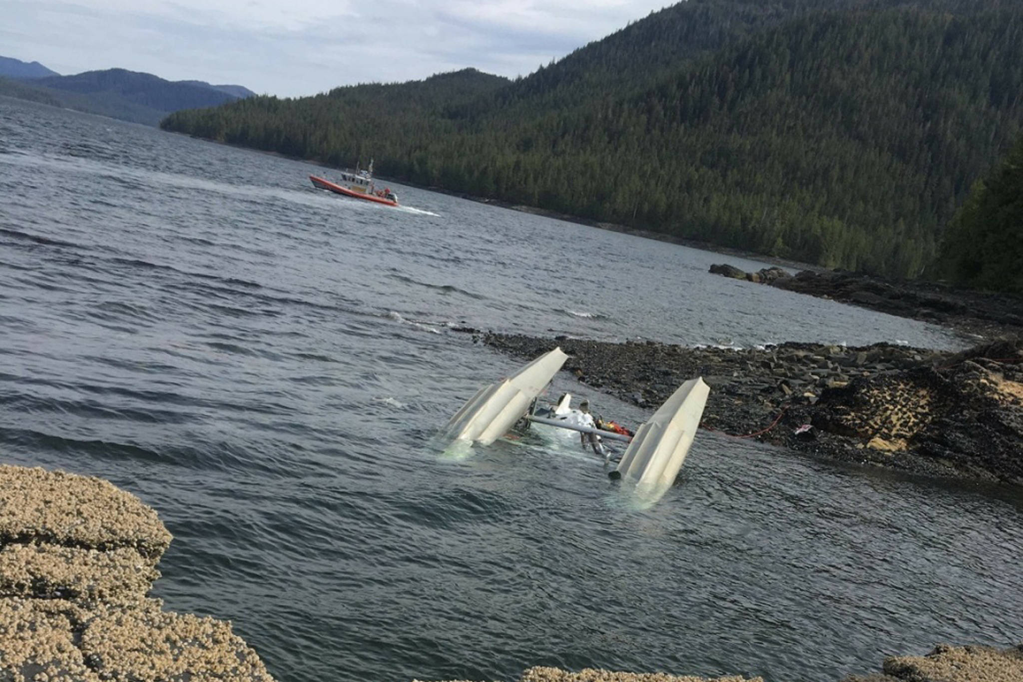
N68083
Flight Phase:
Survivors:
Yes
Schedule:
Seldovia – Anchorage
MSN:
1254
YOM:
1958
Location:
Crew on board:
1
Crew fatalities:
Pax on board:
6
Pax fatalities:
Other fatalities:
Total fatalities:
1
Captain / Total flying hours:
2689
Captain / Total hours on type:
150.00
Aircraft flight hours:
29448
Circumstances:
The pilot stated that, during takeoff in the float-equipped airplane, he saw the left float begin to move into his peripheral vision from the left cockpit window and the airplane began to yaw to the left. The left wing subsequently impacted the water and the airplane nosed over, separating the right wing from the fuselage. The passengers consistently reported choppy water conditions at the time of the accident; one passenger reported that white caps were visible on the ocean waves in the distance. The passengers said that, during the takeoff, the airplane impacted a swell or wave and nosed over abruptly, and the cabin rapidly filled with water. Examination of the float assembly revealed fractures in the left front flying wire attachment fitting and the right rear flying wire attachment strap and hole elongation in the left rear flying wire attachment fitting. Additionally, the bolts attaching the two left flying wire attachment fittings to the left float were bent, and the two flying wires that had been attached to the fractured attachment fitting and attachment strap were buckled. While some areas of corrosion were observed on the fractured left forward fitting, the total area of corrosion was a small percentage of the total cross-section, and the remainder of the fracture and associated deformation of the lug was consistent with ductile overstress fracture. Similar areas of corrosion were also observed on each of the intact flying wire attachment fittings. Post-accident testing completed by the float manufacturer revealed that buckling of flying wires similar to that observed on the accident airplane was only reproduced at strap and fitting failure loads above 9,000 pounds force; the design specification load was 3,453 pounds of force. This indicates that the small amount of corrosion present on the fractured flying wire attachment fitting did not reduce its loadcarrying capability below the design specification load of 3,453 pounds of force, and that both the flying wire attachment fitting and flying wire attachment strap fractured due to overload. Therefore, it is likely that the accident airplane floats were subject to forces that exceeded their design limitations, resulting in overload of the flying wires attached to the left float. It is also likely that, given the lack of damage on either float, the force was due to impact with an ocean wave or swell and not by striking an object.
Probable cause:
The airplane's floats impact with an ocean wave or swell, which exceeded the design load specifications of the flying wire assemblies and resulted in a partial separation of the float assemblies.
Final Report:
Crash of a De Havilland DHC-2 Beaver into Mistastin Lake: 7 killed

Date & Time: Jul 15, 2019
Type of aircraft:
Operator:
Registration:
C-FJKI
Survivors:
No
Schedule:
Crossroads Lake - Mistastin Lake
MSN:
992
YOM:
1956
Country:
Crew on board:
1
Crew fatalities:
Pax on board:
6
Pax fatalities:
Other fatalities:
Total fatalities:
7
Captain / Total flying hours:
18800
Captain / Total hours on type:
16000.00
Circumstances:
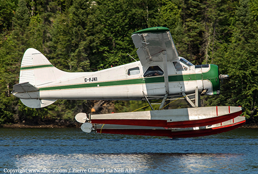
The single engine airplane was chartered by a provider based in Crossroads Lake (near Churchill Falls reservoir) to fly four fisherman and two guides to Mistastin Lake, Labrador. The aircraft was supposed to leave Crossroads Lake at 0700LT but the departure was postponed to 1000LT due to low ceiling. Several attempts to contact the pilot failed during the day and the SAR center based in Trenton was alerted. SAR operations were initiated and four days later, the location of the accident was reached but only four bodies were found. The body of the pilot and two passengers were never recovered as well as the wreckage.
Probable cause:
The aircraft had been seen floating in Mistastin Lake and later sank. To date, the wreckage has not been found. There is no radar coverage at low altitudes in the area, and the aircraft was flying in uncontrolled airspace and not in communication with air traffic services. Without any witnesses and without key pieces of the aircraft, the TSB is unable to conduct a full investigation into this accident. If the aircraft is found, the TSB will assess the feasibility of investigating the accident further.
Final Report:
Crash of a BAe 3212 Jetstream 31 in Canaima

Date & Time: Jun 27, 2019 at 1130 LT
Type of aircraft:
Operator:
Registration:
YV2536
Survivors:
Yes
Schedule:
Puerto Ordaz - Canaima
MSN:
9966
YOM:
1992
Country:
Crew on board:
0
Crew fatalities:
Pax on board:
0
Pax fatalities:
Other fatalities:
Total fatalities:
0
Circumstances:
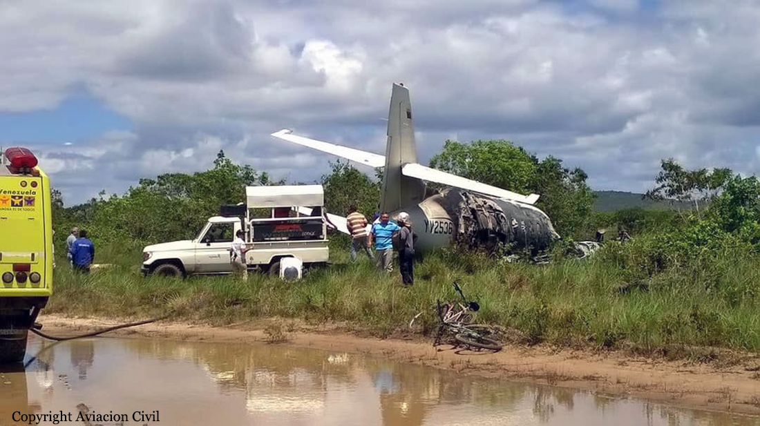
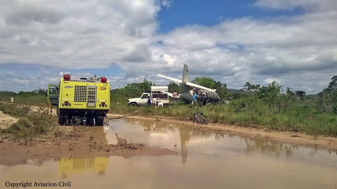
After touchdown on runway 18/36 at Canaima Airport, the twin engine airplane went out of control, veered off runway and came to rest in the bush, bursting into flames. All occupants evacuated safely while the aircraft was partially destroyed by fire. It was reported that a tire burst upon landing.

Crash of a De Havilland DHC-3T Otter in the George Inlet: 1 killed

Date & Time: May 13, 2019 at 1221 LT
Type of aircraft:
Operator:
Registration:
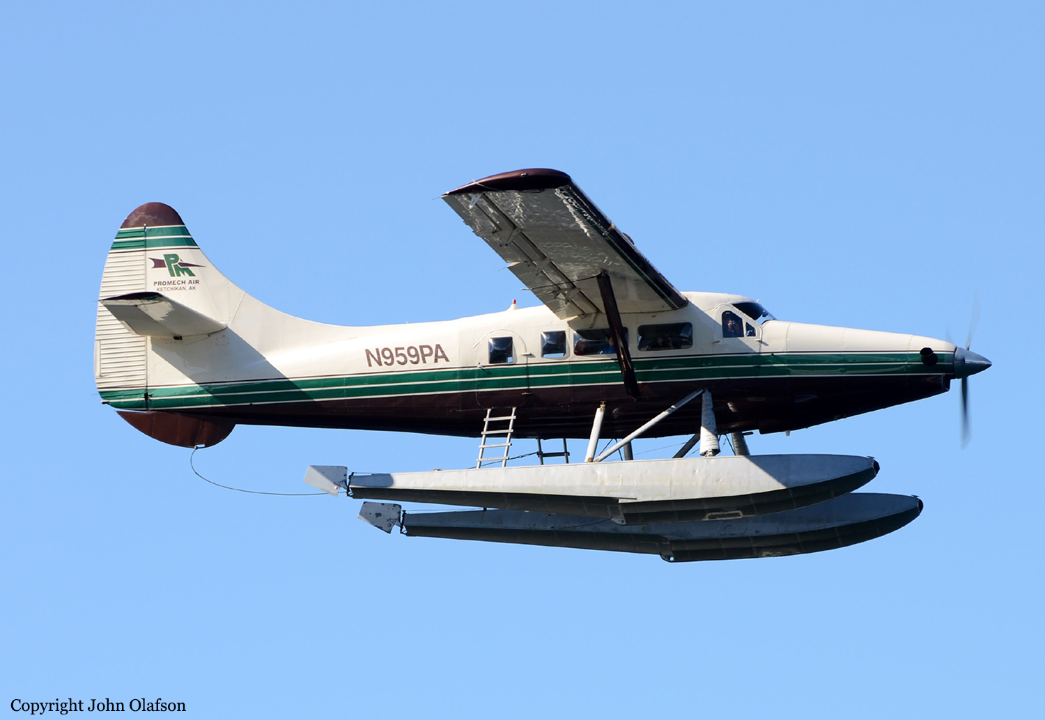
N959PA
Flight Phase:
Survivors:
Yes
Schedule:
Ketchikan - Ketchikan
MSN:
159
YOM:
1956
Crew on board:
1
Crew fatalities:
Pax on board:
10
Pax fatalities:
Other fatalities:
Total fatalities:
1
Captain / Total flying hours:
25000
Aircraft flight hours:
30296
Circumstances:
On May 13, 2019, about 1221 Alaska daylight time, a float-equipped de Havilland DHC-2 (Beaver) airplane, N952DB, and a float-equipped de Havilland DHC-3 (Otter) airplane, N959PA, collided in midair about 8 miles northeast of Ketchikan, Alaska. The DHC-2 pilot and four passengers sustained fatal injuries. The DHC-3 pilot sustained minor injuries, nine passengers sustained serious injuries, and one passenger sustained fatal injuries. The DHC-2 was destroyed, and the DHC-3 sustained substantial damage. The DHC-2 was registered to and operated by Mountain Air Service LLC, Ketchikan, Alaska, under the provisions of Title 14 Code of Federal Regulations (CFR) Part 135 as an on-demand sightseeing flight. The DHC-3 was registered to Pantechnicon Aviation LTD, Minden, Nevada, and operated by Venture Travel, LLC, dba Taquan Air, Ketchikan, Alaska, under the provisions of Part 135 as an on-demand sightseeing flight. Visual meteorological conditions prevailed in the area at the time of the accident. According to information provided by the operators, both airplanes had been conducting sightseeing flights to the Misty Fjords National Monument area. They were both converging on a scenic waterfall in the Mahoney Lakes area on Revillagigedo Island before returning to the Ketchikan Harbor Seaplane Base (5KE), Ketchikan, Alaska, when the accident occurred. According to recorded avionics data recovered from the DHC-3, it departed from an inlet (Rudyerd Bay) in the Misty Fjords National Monument area about 1203 and followed the inlet westward toward Point Eva and Manzanita Island. At 1209, at an altitude between 1,900 and 2,200 ft, the DHC-3 crossed the Behm Canal then turned to the southwest about 1212 in the vicinity of Lake Grace. Automatic dependent surveillance-broadcast (ADS-B) tracking data for both airplanes, which were provided by the Federal Aviation Administration (FAA), began at 1213:08 for the DHC-3, and at 1213:55 for the DHC-2. At 1217:15, the DHC-3 was about level at 4,000 ft mean sea level (msl) over Carroll Inlet on a track of 225°. The DHC-2 was 4.2 nautical miles (nm) south of the DHC-3, climbing through 2,800 ft, on a track of 255°. The DHC-3 pilot stated that, about this time, he checked his traffic display and “there were two groups of blue triangles, but not on my line. They were to the left of where I was going.” He stated that he did not observe the DHC-2 on his traffic display before the collision. The ADS-B data indicated that, about 1219, the DHC-3 started a descent from 4,000 ft, and the DHC-2 was climbing from 3,175 ft. During the next 1 minute 21 seconds, the DHC-3 continued to descend on a track between 224° and 237°, and the DHC-2 leveled out at 3,350 ft on a track of about 255°. Between 1220:21 and 1221:14, the DHC-3 made a shallow left turn to a track of 210°, then a shallow right turn back to a track of 226°. The airplanes collided at 1221:14 at an altitude of 3,350 ft, 7.4 nm northeast of 5KE. The ADS-B data for both airplanes end about the time of the collision. The DHC-2 was fractured into multiple pieces and impacted the water and terrain northeast of Mahoney Lake. Recorded avionics data for the DHC-3 indicate that at 1221:14, the DHC-3 experienced a brief upset in vertical load factor and soon after entered a right bank, reaching an attitude about 50° right wing down at 1221:19 and 27° nose down at 1221:22. The DHC-3 began descending and completed a 180° turn before impacting George Inlet at 1222:15 along a northeast track.
Probable cause:
The NTSB determines that the probable cause of this accident was the inherent limitations of the see-and-avoid concept, which prevented the two pilots from seeing the other airplane before the collision, and the absence of visual and aural alerts from both airplanes’ traffic display systems, while operating in a geographic area with a high concentration of air tour activity.
Contributing to the accident were
1) the Federal Aviation Administration’s provision of new transceivers that lacked alerting capability to Capstone Program operators without adequately mitigating the increased risk associated with the consequent loss of the previously available alerting capability and
2) the absence of a requirement for airborne traffic advisory systems with aural alerting among operators who carry passengers for hire.
Final Report:
Crash of De Havilland DHC-2 Beaver in the Goerge Inlet: 5 killed

Date & Time: May 13, 2019 at 1221 LT
Type of aircraft:
Operator:
Registration:
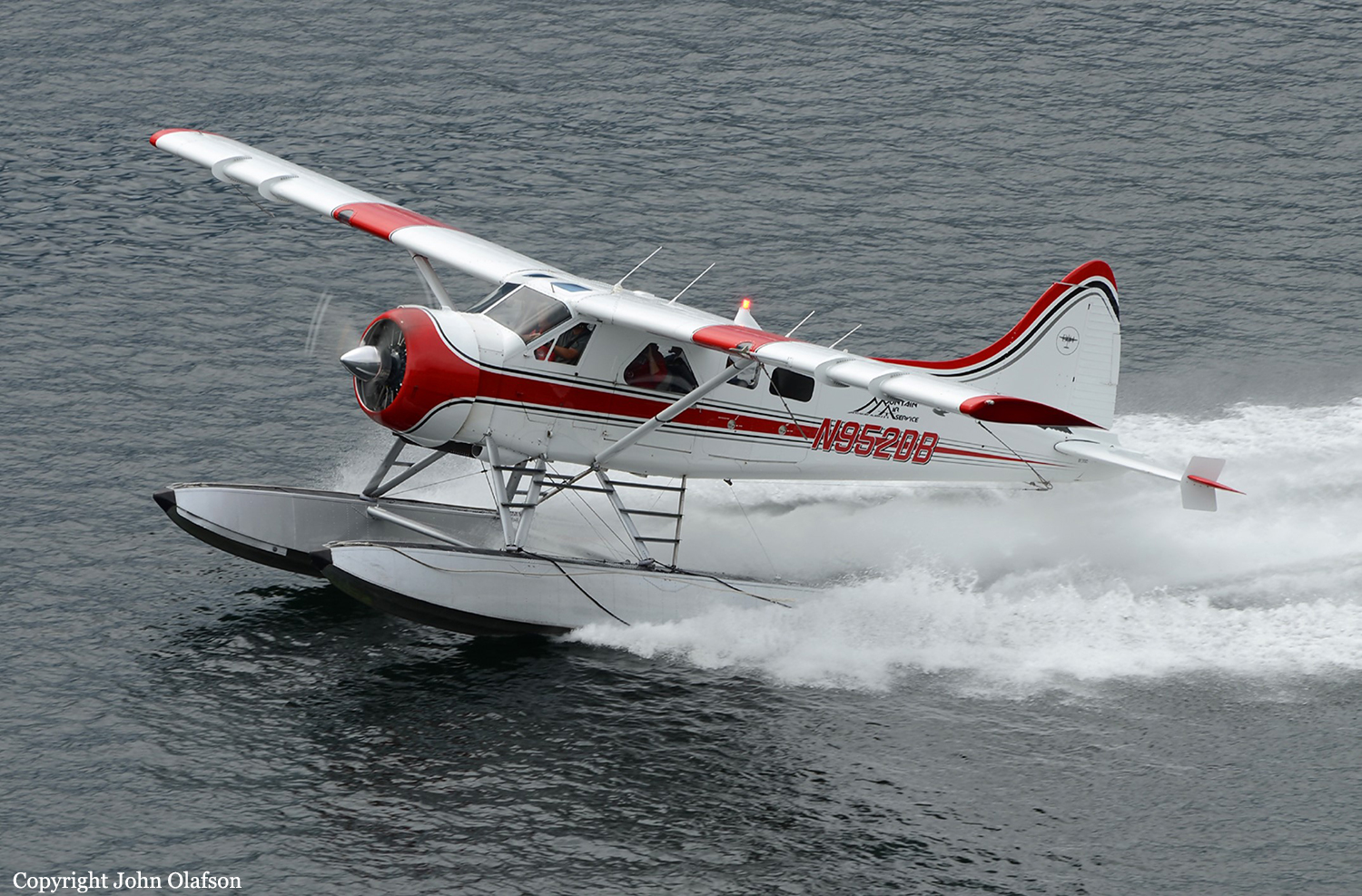
N952DB
Flight Phase:
Survivors:
No
Schedule:
Ketchikan - Ketchikan
MSN:
237
YOM:
1952
Crew on board:
1
Crew fatalities:
Pax on board:
4
Pax fatalities:
Other fatalities:
Total fatalities:
5
Captain / Total flying hours:
11000
Aircraft flight hours:
16452
Circumstances:
On May 13, 2019, about 1221 Alaska daylight time, a float-equipped de Havilland DHC-2 (Beaver) airplane, N952DB, and a float-equipped de Havilland DHC-3 (Otter) airplane, N959PA, collided in midair about 8 miles northeast of Ketchikan, Alaska. The DHC-2 pilot and four passengers sustained fatal injuries. The DHC-3 pilot sustained minor injuries, nine passengers sustained serious injuries, and one passenger sustained fatal injuries. The DHC-2 was destroyed, and the DHC-3 sustained substantial damage. The DHC-2 was registered to and operated by Mountain Air Service LLC, Ketchikan, Alaska, under the provisions of Title 14 Code of Federal Regulations (CFR) Part 135 as an on-demand sightseeing flight. The DHC-3 was registered to Pantechnicon Aviation LTD, Minden, Nevada, and operated by Venture Travel, LLC, dba Taquan Air, Ketchikan, Alaska, under the provisions of Part 135 as an on-demand sightseeing flight. Visual meteorological conditions prevailed in the area at the time of the accident. According to information provided by the operators, both airplanes had been conducting sightseeing flights to the Misty Fjords National Monument area. They were both converging on a scenic waterfall in the Mahoney Lakes area on Revillagigedo Island before returning to the Ketchikan Harbor Seaplane Base (5KE), Ketchikan, Alaska, when the accident occurred. According to recorded avionics data recovered from the DHC-3, it departed from an inlet (Rudyerd Bay) in the Misty Fjords National Monument area about 1203 and followed the inlet westward toward Point Eva and Manzanita Island. At 1209, at an altitude between 1,900 and 2,200 ft, the DHC-3 crossed the Behm Canal then turned to the southwest about 1212 in the vicinity of Lake Grace. Automatic dependent surveillance-broadcast (ADS-B) tracking data for both airplanes, which were provided by the Federal Aviation Administration (FAA), began at 1213:08 for the DHC-3, and at 1213:55 for the DHC-2. At 1217:15, the DHC-3 was about level at 4,000 ft mean sea level (msl) over Carroll Inlet on a track of 225°. The DHC-2 was 4.2 nautical miles (nm) south of the DHC-3, climbing through 2,800 ft, on a track of 255°. The DHC-3 pilot stated that, about this time, he checked his traffic display and “there were two groups of blue triangles, but not on my line. They were to the left of where I was going.” He stated that he did not observe the DHC-2 on his traffic display before the collision. The ADS-B data indicated that, about 1219, the DHC-3 started a descent from 4,000 ft, and the DHC-2 was climbing from 3,175 ft. During the next 1 minute 21 seconds, the DHC-3 continued to descend on a track between 224° and 237°, and the DHC-2 leveled out at 3,350 ft on a track of about 255°. Between 1220:21 and 1221:14, the DHC-3 made a shallow left turn to a track of 210°, then a shallow right turn back to a track of 226°. The airplanes collided at 1221:14 at an altitude of 3,350 ft, 7.4 nm northeast of 5KE. The ADS-B data for both airplanes end about the time of the collision. The DHC-2 was fractured into multiple pieces and impacted the water and terrain northeast of Mahoney Lake. Recorded avionics data for the DHC-3 indicate that at 1221:14, the DHC-3 experienced a brief upset in vertical load factor and soon after entered a right bank, reaching an attitude about 50° right wing down at 1221:19 and 27° nose down at 1221:22. The DHC-3 began descending and completed a 180° turn before impacting George Inlet at 1222:15 along a northeast track.
Probable cause:
The NTSB determines that the probable cause of this accident was the inherent limitations of the see-and-avoid concept, which prevented the two pilots from seeing the other airplane before the collision, and the absence of visual and aural alerts from both airplanes’ traffic display systems, while operating in a geographic area with a high concentration of air tour activity.
Contributing to the accident were
1) the Federal Aviation Administration’s provision of new transceivers that lacked alerting capability to Capstone Program operators without adequately mitigating the increased risk associated with the consequent loss of the previously available alerting capability and
2) the absence of a requirement for airborne traffic advisory systems with aural alerting among operators who carry passengers for hire.
Final Report:
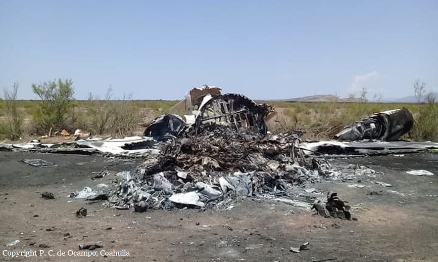
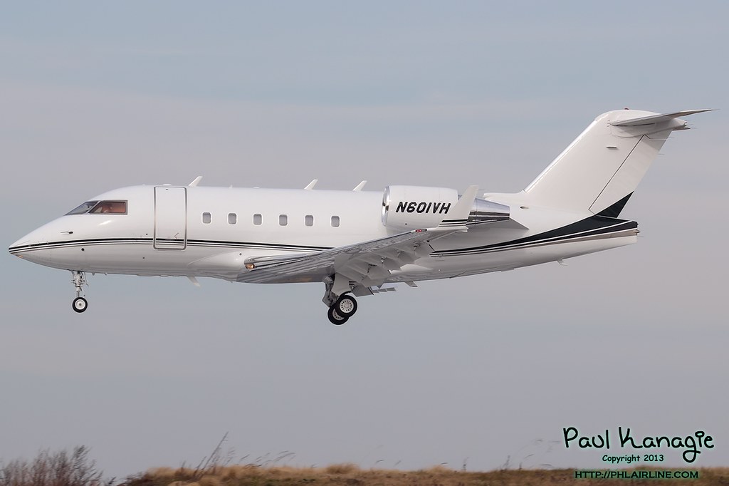
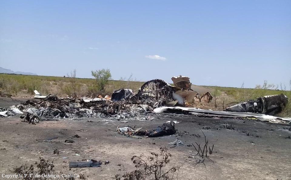
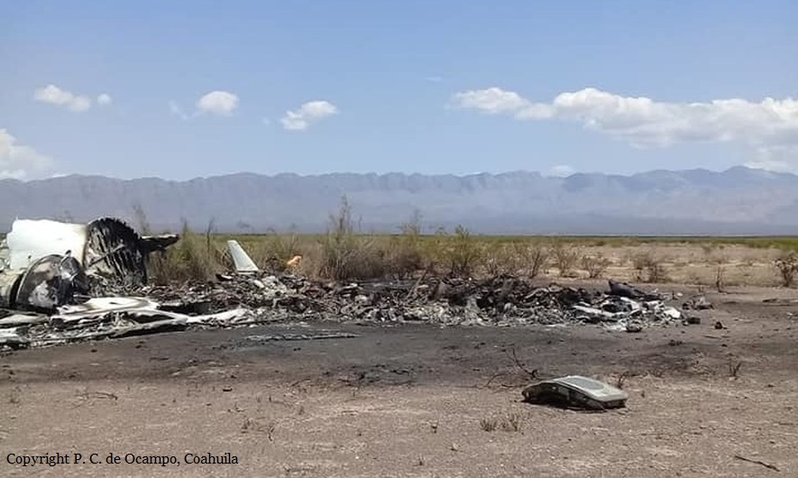
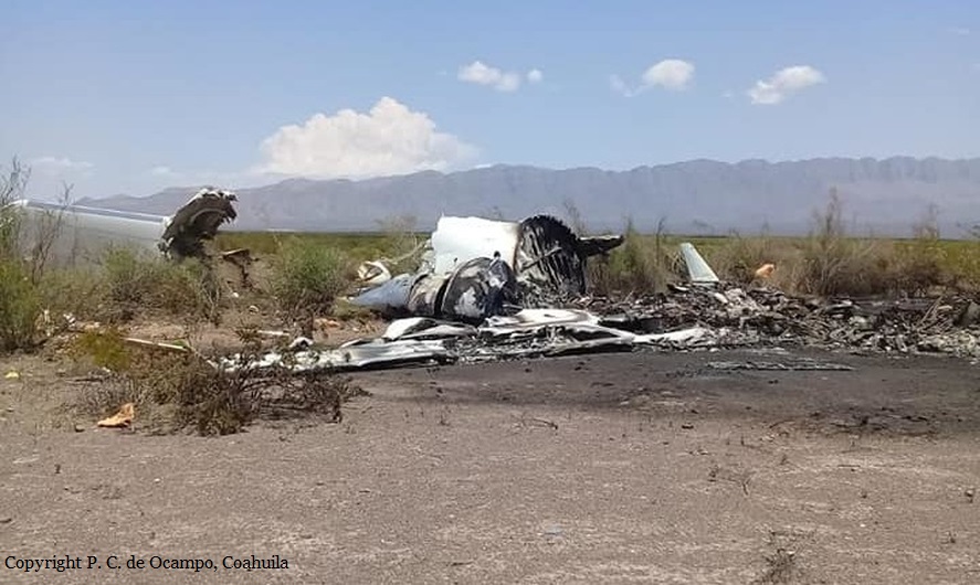
Crash of a Canadair CL-601-3A Challenger near La Rosita: 13 killed

Date & Time: May 5, 2019 at 1740 LT
Type of aircraft:
Registration:
N601VH
Flight Phase:
Survivors:
No
Site:
Schedule:
Las Vegas - Monterrey
MSN:
5043
YOM:
1989
Country:
Crew on board:
2
Crew fatalities:
Pax on board:
11
Pax fatalities:
Other fatalities:
Total fatalities:
13
Captain / Total flying hours:
3337
Captain / Total hours on type:
329.00
Copilot / Total flying hours:
1541
Copilot / Total hours on type:
147
Aircraft flight hours:
7637
Aircraft flight cycles:
4122
Circumstances:
The airplane departed Las Vegas-McCarran Airport at 1452LT on a charter flight to Monterrey, carrying two pilots and 11 passengers who were returning to Mexico after taking part to a boxing match in Las Vegas. The flight was completed at FL370 until the crew was cleared to climb to FL390 for five minutes then to FL410. Suddenly, the airplane entered an uncontrolled descent and eventually crashed in an almost flat attitude in a desert area located near La Rosita, Coahuila. The aircraft was destroyed by impact forces and a post crash fire and all 13 occupants were killed. The wreckage was found the following day.
Probable cause:
A loss of control at high altitude after the airplane encountered severe atmospheric turbulences coming from an unstable weather area. The crew were unable to detect the presence of this atmospheric phenomenon due to the malfunction of the onboard weather radar system for reasons that could not be determined.
Final Report:

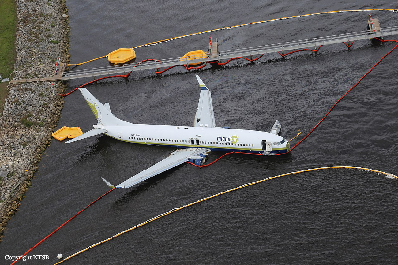
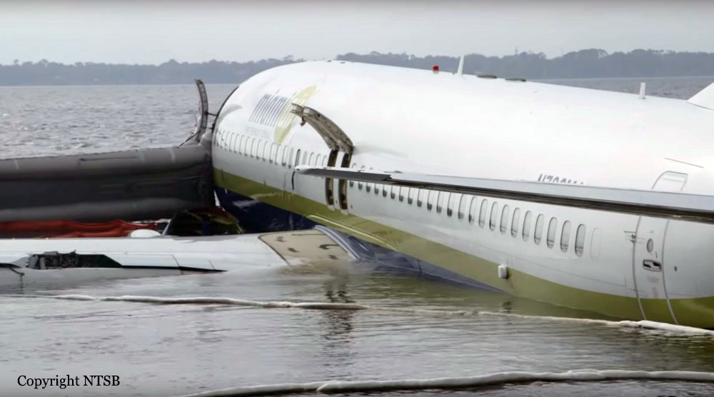
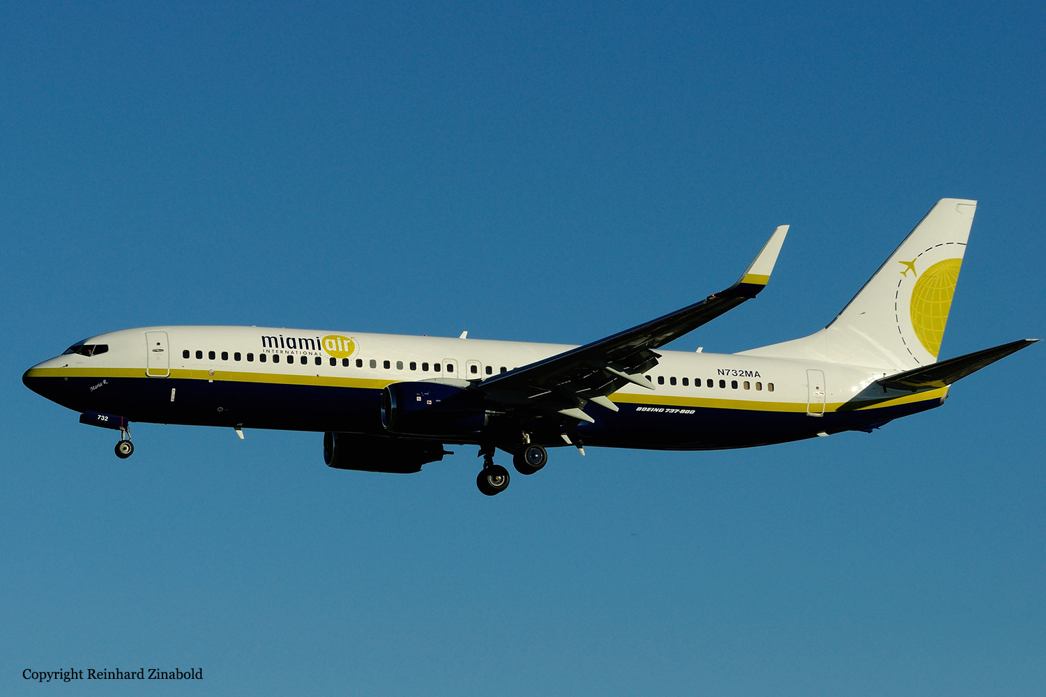
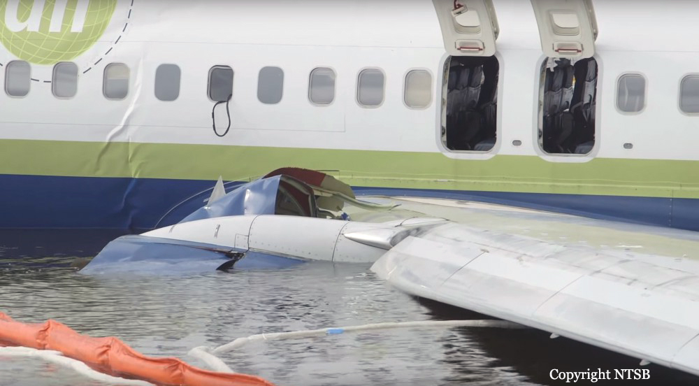
Crash of a Boeing 737-81Q at Jacksonville NAS

Date & Time: May 3, 2019 at 2142 LT
Type of aircraft:
Operator:
Registration:
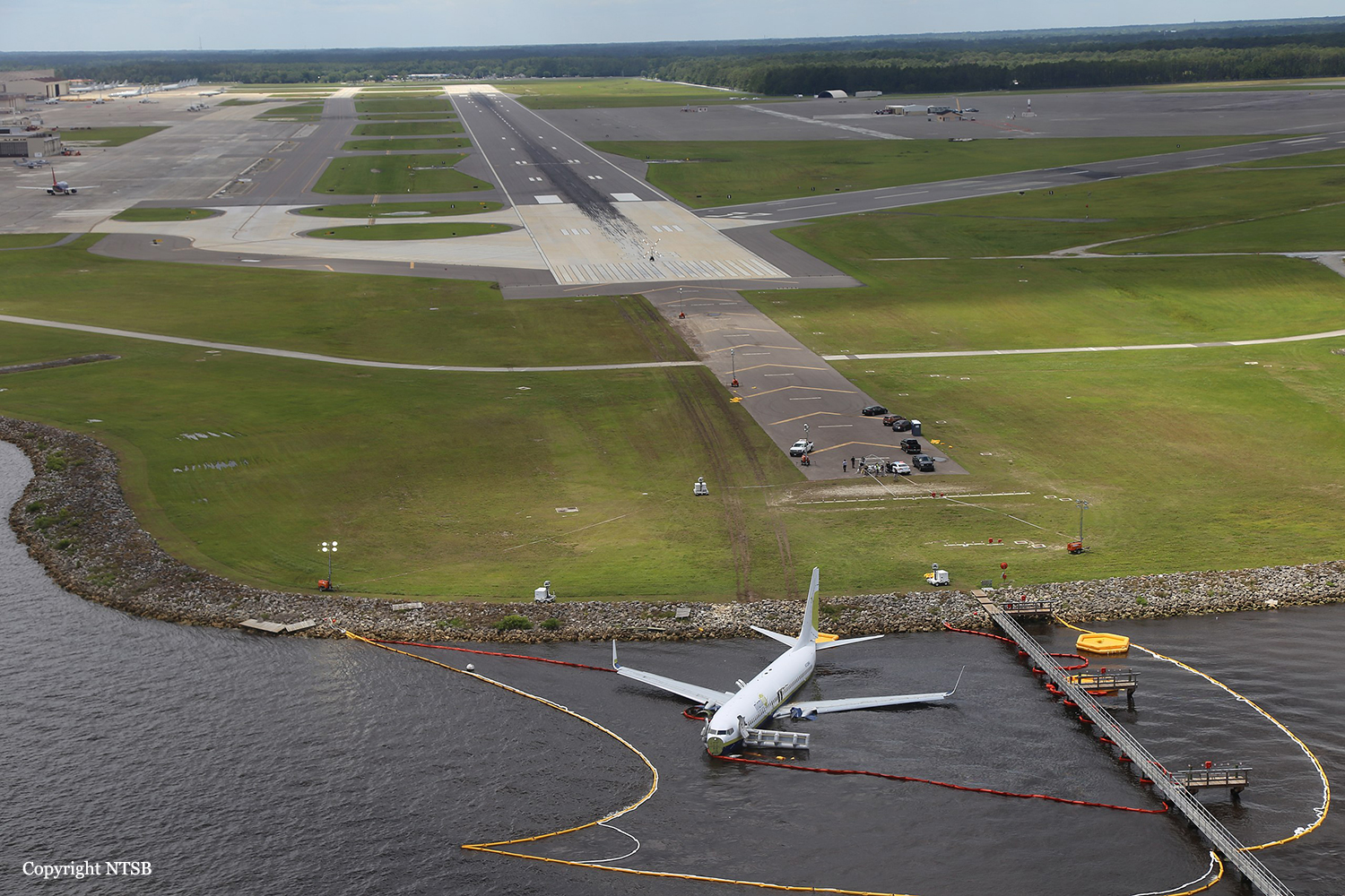
N732MA
Survivors:
Yes
Schedule:
Guantánamo Bay - Jacksonville
MSN:
30618/830
YOM:
2001
Flight number:
LL293
Crew on board:
7
Crew fatalities:
Pax on board:
136
Pax fatalities:
Other fatalities:
Total fatalities:
0
Captain / Total flying hours:
7500
Captain / Total hours on type:
2204.00
Copilot / Total flying hours:
7500
Copilot / Total hours on type:
18
Aircraft flight hours:
38928
Aircraft flight cycles:
15610
Circumstances:
According to both pilots, the takeoff, climb, and cruise portions of the flight were uneventful. The No. 1 (left) thrust reverser was not operational and deferred for the flight in accordance with the airplane’s minimum equipment list. The captain was the pilot flying for the accident flight, and the first officer was the pilot monitoring. The captain was also performing check airman duties for the first officer who was in the process of completing operating experience training. During the approach to Jacksonville Naval Air Station (NIP), the flight crew had two runway change discussions with air traffic controllers due to reported weather conditions (moderate to heavy precipitation) near the field; the pilots ultimately executed the area navigation GPS approach to runway 10, which was ungrooved and had a displaced threshold 997 ft from the threshold, leaving an available landing distance of 8,006 ft. As the airplane descended through 1,390 ft mean sea level (msl), the pilots configured it for landing with the flaps set at 30º and the landing gear extended; however, the speedbrake handle was not placed in the armed position as specified in the Landing checklist. At an altitude of about 1,100 ft msl and 2.8 nm from the runway, the airplane was slightly above the glidepath, and its airspeed was on target. Over the next minute, the indicated airspeed increased to 170 knots (17 knots above the target approach speed), and groundspeed reached 180 knots, including an estimated 7-knot tailwind. At an altitude of about 680 ft msl and 1.6 nm from the threshold, the airplane deviated further above the 3° glidepath such that the precision approach path indicator (PAPI) lights would have appeared to the flight crew as four white lights and would retain that appearance throughout the rest of the approach. Eight seconds before touchdown, multiple enhanced ground proximity warning system alerts announced “sink rate” as the airplane’s descent rate peaked at 1,580 fpm. The airplane crossed the displaced threshold 120 ft above the runway (the PAPI glidepath crosses the displaced threshold about 54 ft above the runway) and 17 knots above the target approach speed, with a groundspeed of 180 knots and a rate of descent about 1,450 ft per minute (fpm). The airplane touched down about 1,580 ft beyond the displaced threshold, which was 80 ft beyond the designated touchdown zone as specified in the operator’s standard operating procedures (SOP). After touchdown, the captain deployed the No. 2 engine thrust reverser and began braking; he later reported, however, that he did not feel the aircraft decelerate and increased the brake pressure. The speedbrakes deployed about 4 seconds after touchdown, most likely triggered by the movement of the right throttle into the idle reverse thrust detent after main gear tire spinup. The automatic deployment of the speedbrakes was likely delayed by about 3 seconds compared to the automatic deployment that could have been obtained by arming the speedbrakes before landing. The airplane crossed the end of the runway about 55 ft right of the centerline and impacted a seawall 90 ft to the right of the centerline, 9,170 ft beyond the displaced threshold, and 1,164 ft beyond the departure end of runway 10. After the airplane came to rest in St. Johns River, the flight crew began an emergency evacuation.
Probable cause:
An extreme loss of braking friction due to heavy rain and the water depth on the ungrooved runway, which resulted in viscous hydroplaning. Contributing to the accident was the operator’s inadequate guidance for evaluating runway braking conditions and conducting en route landing distance assessments.
Contributing to the continuation of an unstabilized approach were
1) the captain’s plan continuation bias and increased workload due to the weather and performing check airman duties and
2) the first officer’s lack of experience.
Final Report:
Crash of a Douglas DC-3 in Finca La Bendición: 14 killed

Date & Time: Mar 9, 2019 at 1036 LT
Type of aircraft:
Operator:
Registration:
HK-2494
Flight Phase:
Survivors:
No
Schedule:
San Jose del Guaviare – Villavicencio
MSN:
33105/16357
YOM:
1945
Country:
Crew on board:
3
Crew fatalities:
Pax on board:
11
Pax fatalities:
Other fatalities:
Total fatalities:
14
Captain / Total flying hours:
12710
Captain / Total hours on type:
7044.00
Copilot / Total flying hours:
12710
Copilot / Total hours on type:
7044
Aircraft flight hours:
23000
Circumstances:
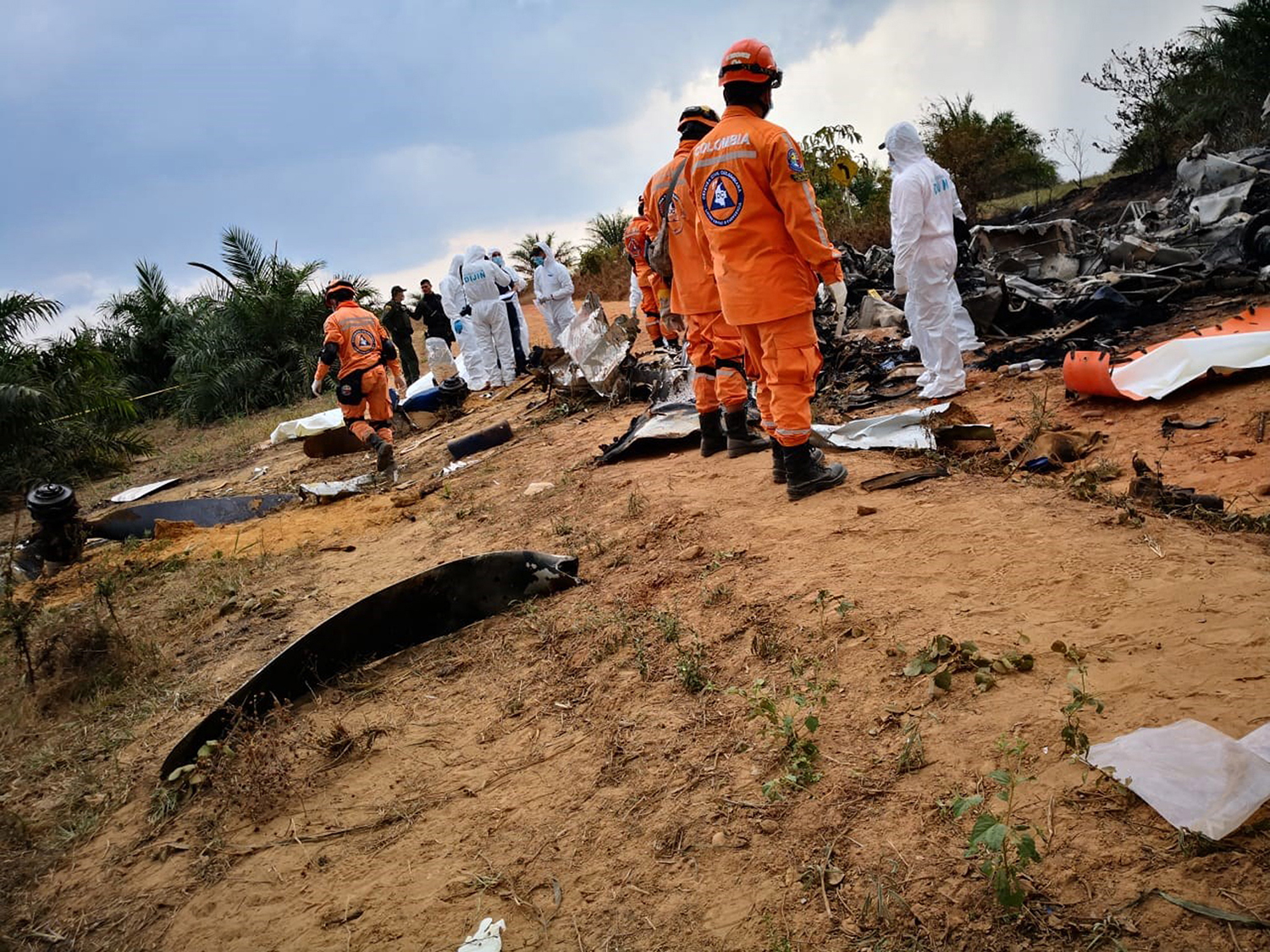
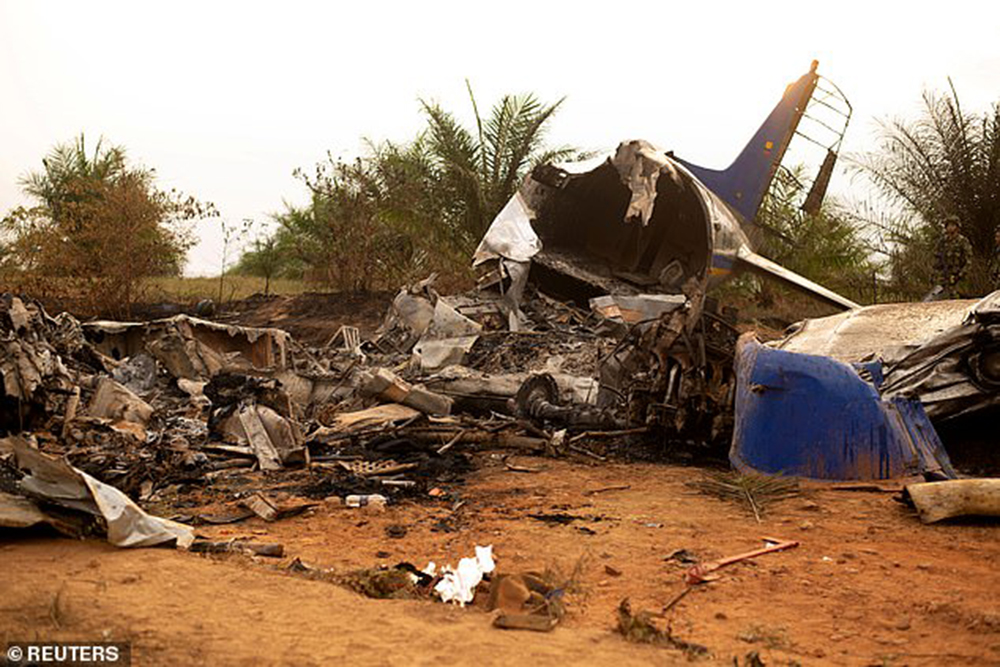
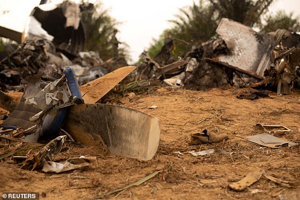
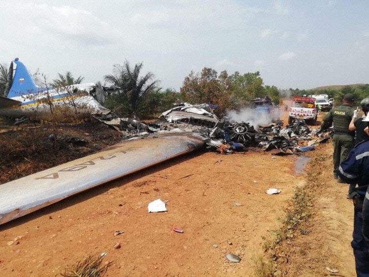
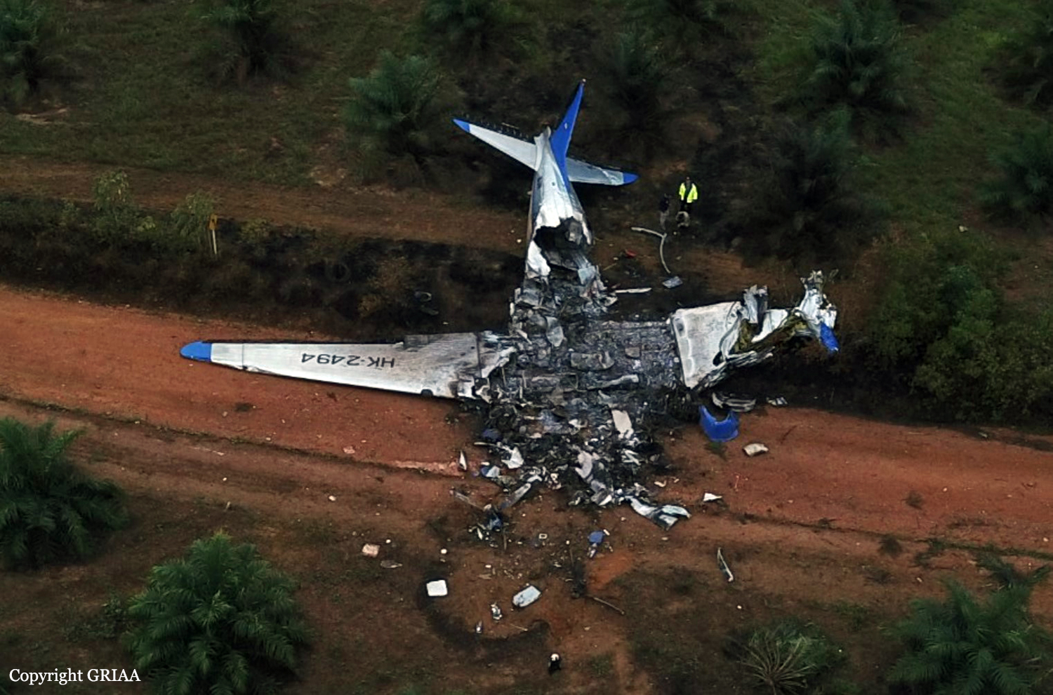
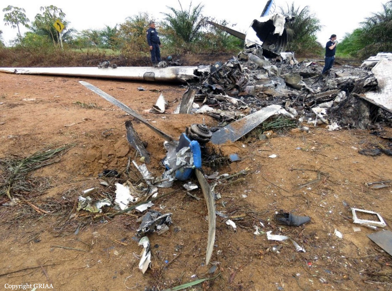
The twin engine airplane departed San José del Guaviare on a charter flight to Villavicencio, carrying 11 passengers and three crew members. While cruising at an altitude of 8,500 feet in good weather conditions, the left engine failed due to an important fuel leak. The crew elected to secure the engine but was unable to feather the propeller. The airplane lost speed and height, and while attempting an emergency landing, the crew lost control of the airplane that stalled and crashed in a palm plantation, bursting into flames. The aircraft was totally destroyed by a post crash fire and all 14 occupants were killed.
Probable cause:
The investigation determined that the accident was caused by the following probable causes:
- Loss of control in-flight as a consequence of the decrease in minimum in-flight control speed and drag generated by the impossibility of performing the No. 1 engine propeller feathering in the face of engine failure.
- Malfunction of the lubrication system of engine No. 1, evident in the abundant oil leakage from the engine, in flight, and in the governor of the left propeller; although discrepancies were found in the maintenance of the propeller feathering pressure line, it was not possible to determine the origin of the oil leakage.
- Weaknesses in the aircraft Operator's operational procedures, lacking a standard that would facilitate a crew's decision making to act in the event of critical failures, in matters such as making an emergency landing on unprepared field or the selection of an alternate airfield.

Contributing Factors:
- Deficiencies in standard maintenance practices during repairs performed on the No. 1 engine's propeller propeller feathering oil pressure line.
- Non-compliance with an effective and reliable maintenance program, which did not verify the operating conditions of the aircraft components; it was not possible to determine compliance with the last 50-hour service, Phase A, to engine No. 1 according to the company's maintenance program, since there are no records of that service in the Flight Log.
- Inefficient safety management system of the Operator for not detecting errors in the maintenance processes and in the conduct and control of operations.
Final Report: