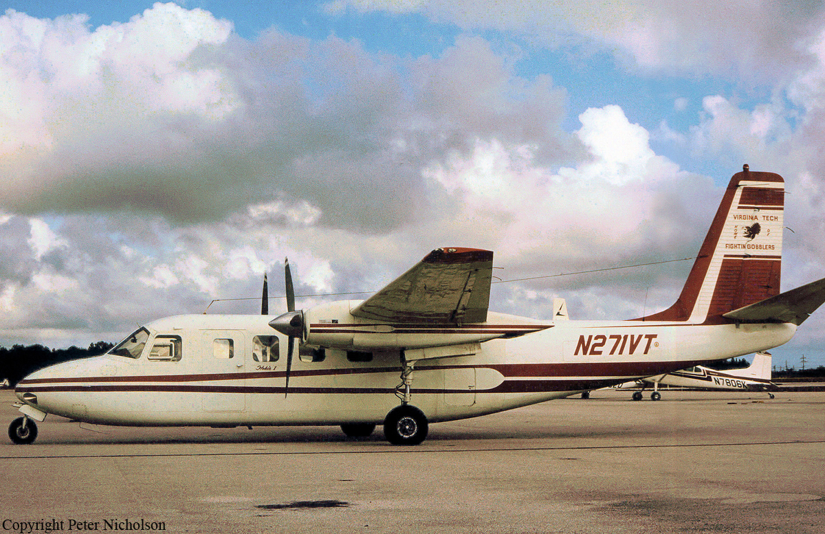
Crash of a Cessna 402B near Oakley: 2 killed

Date & Time: Mar 2, 1993 at 0528 LT
Type of aircraft:
Registration:
N3103P
Flight Phase:
Survivors:
No
Site:
Schedule:
Salt Lake City - Rawlins
MSN:
402B-0821
YOM:
1975
Location:
Crew on board:
1
Crew fatalities:
Pax on board:
1
Pax fatalities:
Other fatalities:
Total fatalities:
2
Captain / Total flying hours:
5521
Captain / Total hours on type:
502.00
Aircraft flight hours:
8436
Circumstances:
The flight took off at 0500 hours in dark visual meteorological conditions. Radar data indicates that the flight was heading in an easterly direction, towards its destination and had climbed to and leveled off at 12,500 feet. Three minutes prior to the last identified radar target, the pilot obtained a partial weather briefing, for the destination airports, from the flight service station. The wreckage was located in an area of high mountainous terrain. Evidence indicated that the flight collided with a ridge line at the 12,400 foot level. The main wreckage was located on the east side of the ridge at 11,400 feet. During the post crash investigation, there was no evidence of a mechanical failure or malfunction. Both occupants were killed.
Probable cause:
Poor inflight planning/decision. Factors to the accident were: dark night condition and terrain clearance was not maintained.
Final Report:

Crash of a Piper PA-31-325 Navajo C/R near Cedar City: 4 killed

Date & Time: Apr 25, 1990 at 2230 LT
Type of aircraft:
Operator:
Registration:
N18PP
Flight Phase:
Flight Type:
Survivors:
No
Site:
Schedule:
Denver - Reno
MSN:
31-7512046
YOM:
1975
Location:
Crew on board:
1
Crew fatalities:
Pax on board:
3
Pax fatalities:
Other fatalities:
Total fatalities:
4
Captain / Total flying hours:
2000
Aircraft flight hours:
2260
Circumstances:
The pilot reported to ATC that he intended to make an unscheduled fuel stop. ATC advised that Cedar City Airport was 15 minutes away. Radar vectors were requested and were issued. Although dark night conditions existed and the pilot controlled airport lighting was never activated, the pilot reported the airport in sight and was cleared for a visual approach. Three minutes later radar contact was lost. Impact occurred in mountainous terrain at 9,100 feet elevation about six miles east of the 5,622 foot elevation airport. Minimum safe altitude was 12,400 feet. All four occupants were killed.
Probable cause:
The pilot failed to maintain a minimum safe altitude over mountainous terrain during a night VFR approach for landing.
Final Report:

Crash of a Cessna 421B Golden Eagle II near Tooele: 2 killed

Date & Time: Nov 16, 1988 at 0110 LT
Operator:
Registration:
N222BL
Flight Phase:
Survivors:
No
Site:
Schedule:
Saint George - Salt Lake City
MSN:
421B-0824
YOM:
1974
Crew on board:
1
Crew fatalities:
Pax on board:
1
Pax fatalities:
Other fatalities:
Total fatalities:
2
Captain / Total flying hours:
6375
Aircraft flight hours:
2774
Circumstances:
The flight departed St. George, UT, at 0100 mst enroute to Salt Lake City (SLC). A flight plan was not filed. The weather forecast was for IMC with mountain tops obscured. The pilot requested flight following from SLC center and proceeded on the airways until about 40 miles south of SLC where radar contact was lost. Upon loss of radar contact, the controller asked the pilot what his altitude was. The pilot replied that he was at 10,500 feet. That was the last contact with the flight. After repeated attempts to reestablish contact, it was determined that the aircraft had gone down. A search was begun and the wreckage was found 30 miles southwest of SLC at the 9,500 feet level of a mountain. Both occupants were killed.
Probable cause:
Occurrence #1: in flight collision with terrain/water
Phase of operation: cruise - normal
Findings
1. (f) light condition - dark night
2. (f) weather condition - snow
3. (f) weather condition - low ceiling
4. (f) terrain condition - mountainous/hilly
5. (c) in-flight planning/decision - improper - pilot in command
6. (c) became lost/disoriented - inadvertent - pilot in command
7. (c) proper altitude - not maintained - pilot in command
8. (c) flight into known adverse weather - attempted - pilot in command
Final Report:

Crash of a Piper PA-61P Aerostar (Ted Smith 601) in Bear Lake: 1 killed

Date & Time: Oct 20, 1988 at 1530 LT
Registration:
N6069U
Flight Phase:
Flight Type:
Survivors:
No
Schedule:
Salt Lake City - Salt Lake City
MSN:
61-0675-7963317
YOM:
1979
Location:
Crew on board:
1
Crew fatalities:
Pax on board:
0
Pax fatalities:
Other fatalities:
Total fatalities:
1
Captain / Total flying hours:
12150
Circumstances:
The pilot departed Salt Lake City on a pleasure flight to Bear Lake to overfly a home that he owned. Witnesses near the accident site stated they saw the aircraft circle over the house and then depart the area over a ridge of mountains. The aircraft turned out over the lake and was in straight and level flight shortly before it descended at a steep angle into the water. The autopsy performed on the pilot revealed coronary arteriosclerosis. The assistant medical examiner stated in the autopsy report the pilot 'may have been rendered incapacitated by an acute cardiac arrhythmia.'
Probable cause:
Occurrence #1: loss of control - in flight
Phase of operation: cruise
Findings
1. (c) incapacitation (other cardiovascular) - pilot in command
----------
Occurrence #2: in flight collision with terrain/water
Phase of operation: descent - uncontrolled
Final Report:

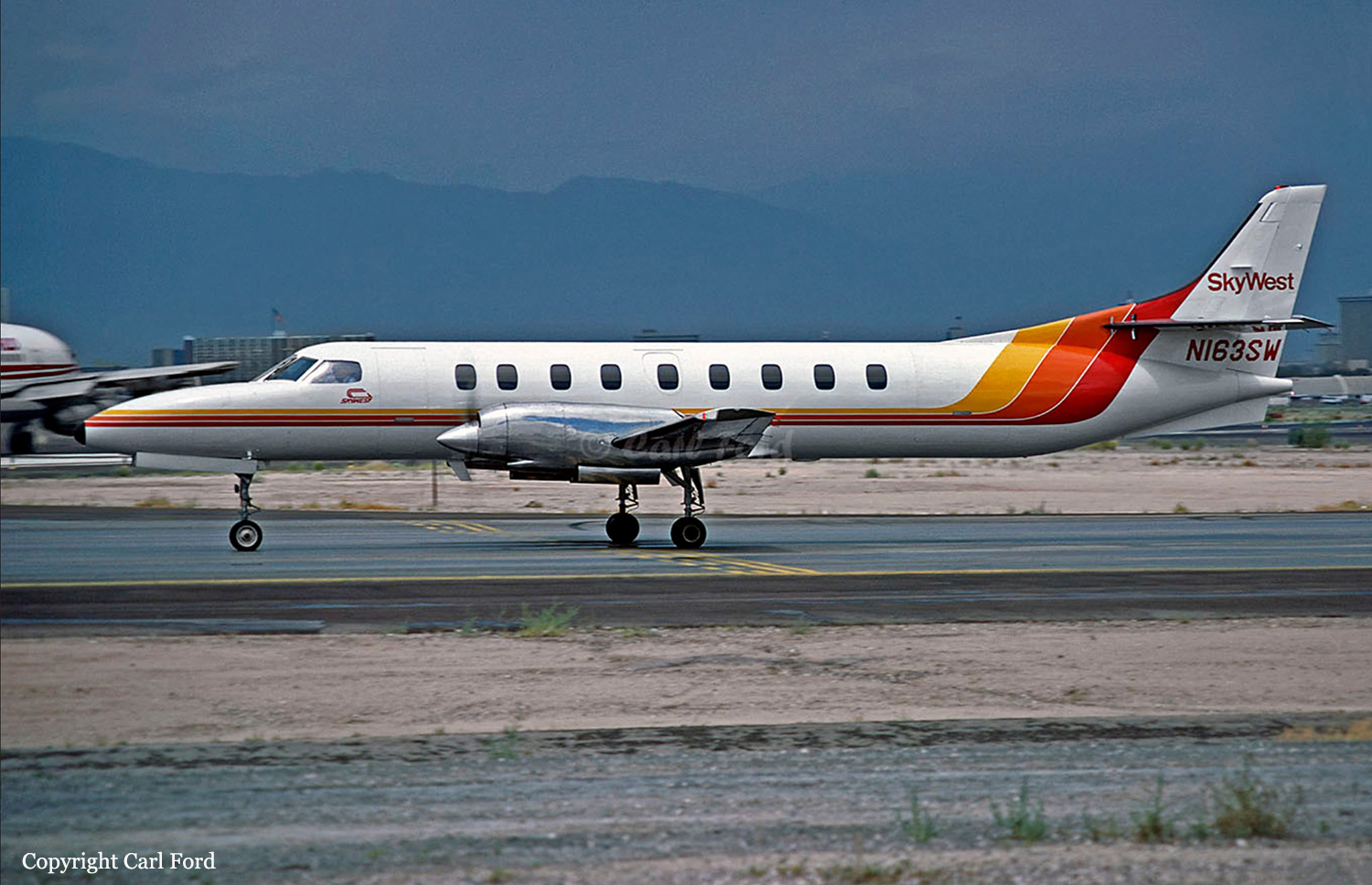
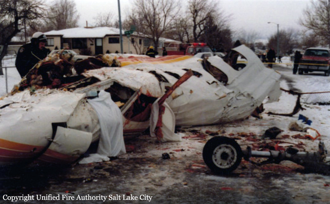
Crash of a Swearingen SA226TC Metro II in Salt Lake City: 8 killed

Date & Time: Jan 15, 1987 at 1252 LT
Type of aircraft:
Operator:
Registration:
N163SW
Survivors:
No
Site:
Schedule:
Pocatello - Salt Lake City
MSN:
TC-327
YOM:
1980
Flight number:
OO1834
Crew on board:
2
Crew fatalities:
Pax on board:
6
Pax fatalities:
Other fatalities:
Total fatalities:
8
Captain / Total flying hours:
3885
Captain / Total hours on type:
1863.00
Copilot / Total flying hours:
4555
Copilot / Total hours on type:
1205
Aircraft flight hours:
15116
Circumstances:
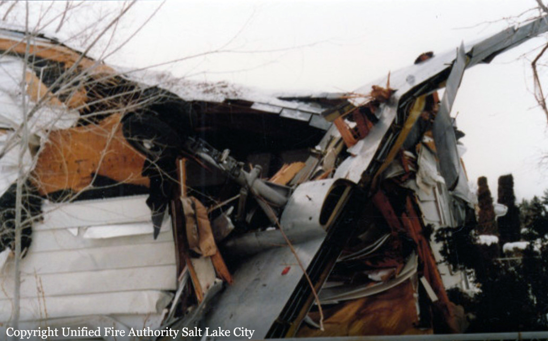
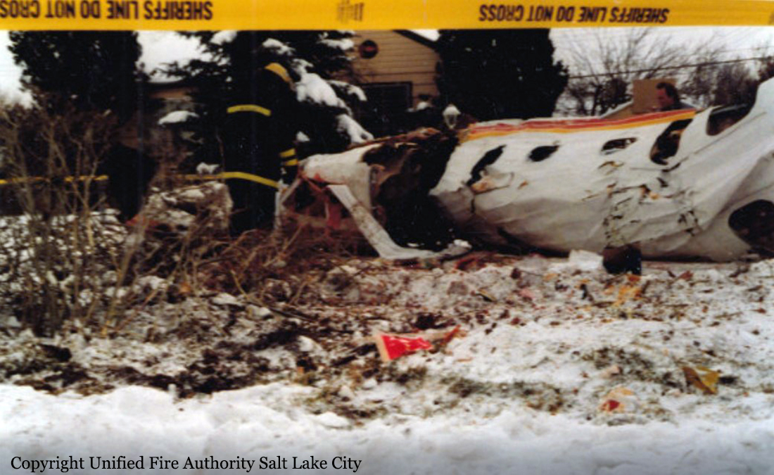
On January 15, 1987, at 1216 mountain standard time, SkyWest flight 1834, a Fairchild Swearingen SA-226TC (METRO II), registration Nl635W, departed Pocatello, Idaho, on a regularly scheduled passenger flight to Salt Lake City, Utah (SLC). The flight was operating under the provisions of Title 14 Code of Federal Regulations Part 121 with two pilots and six passengers aboard. Flight 1834 was handed off from the SLC Air Route Traffic Control Center to the Bear Sector controller at the SLC Terminal Radar Approach Control (TRACON) for a left downwind arrival to SLC International Airport. At 1237:49, the Bear sector controller issued a heading of 100” to flight 1834 and advised the flight to expect vectors for a visual approach to runway 34L. (See Air Traffic Control Transcript in appendix C). During the next few minutes, flight 1834 was given further vectors and descent clearances, and at 1247:21, it was given a frequency change to the TRACON Final controller. At 1250:28, after being cleared to descend to 7,000 feet mean sea level (msl), the Final controller advised, “SkyWest eight thirty four, traffic ten to nine o’clock, four miles, six thousand, Boeing seven, ah, thirty seven three hundred.” Flight 1834 acknowledged, “SkyWest eight thirty four has the traffic.” At 1250:35, the Final controller advised, “SkyWest eight thirty four, plan to follow that traffic, there’s traffic south of him eleven o’clock, six miles north bound, [a] seven thirty seven out of seven thousand five hundred, for the right.” Flight 1834 responded, “OK, we’ll follow the first one, SkyWest eight thirty four.” At 1250:44, the Final controller advised, “SkyWest eight thirty four, wait a minute, report the other one in sight.” Flight 1834 responded, “We’re looking for him.” At 1251:02, the Final controller transmitted, “SkyWest eight thirty four, ten o’clock four miles, seven thousand four hundred.” Flight 1834 replied, “Eight thirty four, we’re looking.” The Final controller then issued instructions at 1251: 15 for flight 1834 to make a left turn to 070”, and the flight acknowledged. At 1251:32, the Final controller transmitted, “SkyWest eight thirty four, traffic’s ten to eleven o’clock, three miles.” Flight 1834 did not acknowledge that transmission, and at 1251:43, the Final controller advised, “SkyWest eight thirty four, turn left heading zero five zero.” The flight acknowledged and reported, “Still have no contact on that traffic.” At 1251:50, the Final controller transmitted, “SkyWest eight thirty four, roger, turn further left heading three six zero.” Flight 1834 acknowledged and at 1251:58, an expletive was transmitted over the TRACON Final control frequency during a transmission from SkyWest flight 575. There were no further transmissions from flight 1834. According to the UNICOM I/ operator at SLC Municipal 2 Airport (SLC 2) about 1115 or 1120, a pilot in Mooney M20C, registration N6485U, operating under 14 CFR Part 91, called to inquire if the runway was clear. The Mooney was occupied by a private pilot in the left seat and an instructor pilot in the right seat. The UNICOM operator advised that the runway was clear, and a few minutes later, a pilot in the Mooney called for and was given an airport advisory. The UNICOM operator observed the Mooney taxi to runway 34 and take off about 1125 or 1130. The Mooney remained in the traffic pattern at SLC 2 performing touch-and-go landings. There were no other aircraft in the traffic pattern at the time. The UNICOM operator stated that she last talked to the Mooney about 1145 to 1150 when a pilot called, “Final for 34.” The UNICOM operator said that she observed the airplane perform a touch-and: go landing, but she did not observe the direction of departure of the airplane. There were no further known communications with the Mooney regarding departing the traffic pattern or any additional aspects of the flight. According to recorded air traffic control (ATC) radar data, after the Mooney departed the SLC 2 traffic pattern at 1235, y the airplane flew south and maneuvered about 25 miles south southeast of SLC International Airport before beginning a turn to the northwest. The airplane continued in a northwesterly direction until it was about 9 miles south of SLC International Airport where it began a gradual left turn until its target merged with the target of SkyWest flight 1834. The targets merged at 1257 :58--the time the expletive was recorded on the ATC tape at the SLC TRACON. The Final approach controller stated that he did observe a visual flight rules (VFR) target about 3 to 4 miles southwest of SLC 2 moving north to northwest when flight 1834 was on downwind. He said he had no more than normal cause to monitor the target. He also stated that it was not unusual to observe VFR targets in the pattern near SLC 2 during visual meteorological conditions. Other controllers at SLC TRACON also stated that it was not uncommon to observe numerous targets operating in the traffic pattern at SLC 2. The Final controller and other controllers added that they normally would observe the VFR targets near SLC 2 disappear from the radarscope and then reappear during practice touch-and-go landings. The Final controller said that he did not recall seeing any VFR targets in the vicinity of SkyWest 1834 as it was turning toward final just before the collision. The Fin.al controller stated that his workload was moderate, and all of his equipment was operating normally before the accident. In addition, the Local controller in the SLC tower stated that he did not observe the target of the Mooney on the tower Bright Radar Indicator Tower Equipment display. There was no evidence that the Mooney pilots were in radio contact with any ATC facility at the time of the accident. Several eyewitnesses were interviewed who observed the airplanes before and after the collision. Some of the witnesses stated that the nose of the METRO II pitched up just before impact. The witnesses stated that the METRO II was headed northeasterly and the Mooney was headed northwesterly just before impact. They stated that the METRO II had made a few left turns as it turned toward the northeast. In general, the eyewitnesses agreed that the two airplanes collided with the Mooney striking the METRO II’s right forward fuselage area with its nose. After the collision, both airplanes fell to the ground with wreckage scattered over 2 square miles in a residential section of Kearns, Utah. There was no fire. The collision occurred at 7,000 feet msl in daylight visual meteorological conditions. All 10 occupants in both aircraft were killed. There were no casualties on the ground.
Probable cause:
Lack of navigational vigilance by the Mooney instructor pilot which led to the authorized intrusion into the Salt Lake City airport radar service area. Contributing to the accident were the absence of a Mode-C transponder on the Mooney airplane and the limitations of the air traffic control system to provide collision protection under the circumstances of this accident.
Final Report:

Crash of a Rockwell Gulfstream 690D Jetprop 900 in Price: 6 killed

Date & Time: May 7, 1986 at 1106 LT
Operator:
Registration:
N200PR
Flight Phase:
Survivors:
No
Site:
Schedule:
Colorado Springs - Price
MSN:
690-15029
YOM:
1983
Location:
Crew on board:
2
Crew fatalities:
Pax on board:
4
Pax fatalities:
Other fatalities:
Total fatalities:
6
Captain / Total flying hours:
6578
Captain / Total hours on type:
421.00
Aircraft flight hours:
1560
Circumstances:
At 1042 mdt, the flight reported moderate turbulences at FL240, but elected to remain at that altitude. At 1055, they were cleared to descend at pilot's discretion to maintain 12,000 feet. Approximately 8 minutes later, shortly after beginning a descent, the flight was instructed to change frequency; but 21 seconds later, they replied 'standby please,' then radio and radar contact were lost. Wreckage was found approximately 26 miles east of the destination airport in mountains. An examination revealed the empennage had separated in flight; pieces of it were found up to one mile away with indication of overload failure. There was evidence that: engines were not operating at ground impact, ignition switches were engaged; left engine start switch was in the 'air' start position and right switch was beyond the 'ground' start position; right propeller was feathered; pax oxygen masks were deployed, indicating cabin had depressurized above 15,000 feet. Weather info indicated cloud bases at 10,000 feet with IMC and turbulences to 25,000 feet, mixed icing from 20,000 feet to 25,000 feet, light rain/snow showers, widely scattered thunderstorms; approximately 15 miles south, 4 inches to 5 inches of hail fellat approximately that time. TPE331 engines had history of flameouts due to ice ingestion caused by impossible use of anti-ice/ignition. All six occupants were killed.
Probable cause:
Occurrence #1: in flight encounter with weather
Phase of operation: descent - normal
Findings
1. (f) weather condition - clouds
2. (f) weather condition - low ceiling
3. (f) weather condition - turbulence in clouds
4. (f) weather condition - icing conditions
----------
Occurrence #2: loss of engine power (total) - nonmechanical
Phase of operation: descent - normal
Findings
5. (c) in-flight planning/decision - improper - pilot in command
6. (c) procedures/directives - not followed - pilot in command
7. (c) anti-ice/deice system - improper use of - pilot in command
8. (f) aircraft performance, two or more engines - inoperative
9. Fuselage, cabin - decompression
----------
Occurrence #3: loss of control - in flight
Phase of operation: descent - emergency
Findings
10. (c) aircraft handling - not maintained - pilot in command
11. (c) spatial disorientation - pilot in command
12. Remedial action - attempted
----------
Occurrence #4: airframe/component/system failure/malfunction
Phase of operation: descent - uncontrolled
Findings
13. (c) design stress limits of aircraft - exceeded
14. Horizontal stabilizer attachment - overload
15. Vertical stabilizer attachment - overload
16. Stabilizer - separation
----------
Occurrence #5: in flight collision with terrain/water
Phase of operation: descent - uncontrolled
Findings
17. Terrain condition - mountainous/hilly
Final Report:

Crash of a Piper PA-31-310 Navajo B in Vernal

Date & Time: Aug 21, 1985 at 0651 LT
Type of aircraft:
Registration:
N7497L
Flight Type:
Survivors:
Yes
Schedule:
Salt Lake City - Vernal
MSN:
31-7300928
YOM:
1973
Location:
Crew on board:
1
Crew fatalities:
Pax on board:
0
Pax fatalities:
Other fatalities:
Total fatalities:
0
Captain / Total flying hours:
1556
Captain / Total hours on type:
207.00
Aircraft flight hours:
7946
Circumstances:
The pilot cancelled his IFR plan and began descent from 13,000 feet in preparation for landing at Vernal, UT. The aircraft impacted ground in wings level attitude under power. Pilot was seriously burned by postcrash ground fire. Investigation revealed no evidence of flight control failure prior to impact. It was learned pilot had flown small aircraft from Salt Lake City to Price, UT, and to Pierre, SD, the day before the accident. Pilot returned to Salt Lake City at 0200 on day of accident. Accident flight departed Salt Lake City at 0600. FAA physician opined that pilot was asleep at impact. Aircraft was flying into rising sun.
Probable cause:
Occurrence #1: in flight collision with terrain/water
Phase of operation: descent - normal
Findings
1. (f) terrain condition - ground
2. (f) judgment - poor - pilot in command
3. (c) fatigue (chronic) - pilot in command
4. (f) terrain condition - open field
5. (c) fatigue (lack of sleep) - pilot in command
6. (f) light condition – dawn
Final Report:

Crash of a Cessna 421A Golden Eagle I in West Jordan: 1 killed

Date & Time: Aug 20, 1983 at 0855 LT
Type of aircraft:
Operator:
Registration:
N2239Q
Flight Phase:
Survivors:
Yes
Schedule:
West Jordan - Spanish Fork
MSN:
421A-0039
YOM:
1967
Crew on board:
1
Crew fatalities:
Pax on board:
2
Pax fatalities:
Other fatalities:
Total fatalities:
1
Captain / Total flying hours:
4156
Captain / Total hours on type:
132.00
Aircraft flight hours:
4180
Circumstances:
Investigation revealed that the pilot aborted two takeoff attempts due to a 'roughness' in one engine. Not able to duplicate the roughness during subsequent ground checks, the pilot departed. At an altitude of 300 feet agl the left engine began to surge and the right engine, according to the pilot, 'seemed to be delivering no power either and I could feel the plane decelerating.' The pilot stated he turned the aircraft to miss a housing development. A witness stated that the left wing dropped and the aircraft dove into the ground at about 45° angle. Investigation failed to reveal any reason for loss of engine power. Both passengers were seriously injured and the pilot was killed.
Probable cause:
Occurrence #1: loss of engine power
Phase of operation: climb - to cruise
Findings
1. (c) reason for occurrence undetermined
----------
Occurrence #2: in flight collision with terrain/water
Phase of operation: climb - to cruise
Final Report:

Crash of a Rockwell Grand Commander 680FL in Monticello: 2 killed

Date & Time: Jun 2, 1983 at 1723 LT
Registration:
N271VT
Flight Phase:
Survivors:
No
Schedule:
Cortez - Monticello
MSN:
680-1435-74
YOM:
1964
Location:
Crew on board:
2
Crew fatalities:
Pax on board:
0
Pax fatalities:
Other fatalities:
Total fatalities:
2
Captain / Total flying hours:
12200
Circumstances:
The aircraft crashed while doing magnetometer surveys at low altitude. The right engine had lost power then regained it for a short period and lost it again. A videotape in the aircraft recorded the pilot saying, 'I changed that # just in time.' the aircraft yawed and the propeller slowed at the same time. The fuel selector valves were found on the center tanks. The boost pump switches were found in the off position. When changing from outboard to center tanks the boost pumps must be on or fuel starvation will occur. As the aircraft slowed the tape revealed that the copilot called out 'down to 90'. 90 mph is VMC. The aircraft stalled, shortly after the asymmetrical thrust rolled the aircraft to the right and into the ground. Both occupants were killed.
Probable cause:
Occurrence #1: loss of engine power (total) - nonmechanical
Phase of operation: cruise - normal
Findings
1. (f) fluid,fuel - starvation
2. (c) fuel tank selector position - delayed - pilot in command
3. (c) inattentive - pilot in command
4. (c) fuel boost pump selector position - not selected - pilot in command
5. (c) diverted attention - pilot in command
6. (c) in-flight planning/decision - improper - pilot in command
----------
Occurrence #2: loss of control - in flight
Phase of operation: cruise - normal
Findings
7. (c) airspeed (VMC) - not maintained - pilot in command
8. (c) stall - inadvertent - pilot in command
----------
Occurrence #3: in flight collision with terrain/water
Phase of operation: descent - uncontrolled
Final Report:

Crash of a Boeing B-52G-95-BW Stratofortress near St George: 7 killed

Date & Time: Apr 11, 1983
Type of aircraft:
Operator:
Registration:
58-0161
Flight Phase:
Flight Type:
Survivors:
No
Site:
MSN:
464229
YOM:
1958
Flight number:
Lure 75
Crew on board:
7
Crew fatalities:
Pax on board:
0
Pax fatalities:
Other fatalities:
Total fatalities:
7
Circumstances:
The airplane departed Robins AFB on an exercise (Red Flag mission) bound for California. En route, it deviated from the prescribed flight path several times and was assisted and reoriented by an AWACS crew. While cruising over Utah in poor visibility, the crew failed to realize his altitude was insufficient when the airplane struck the slope of a mountain located 20 miles north of St George. The aircraft disintegrated on impact and all seven crew members were killed.
Crew:
Cpt Donald W. Hiebert, pilot,
1st Lt Thomas C. Lennep Jr., copilot,
Cpt Jonathan M. Bishop, radio navigator,
1st Lt Matthew W. Cervenak, navigator,
1st Lt Bernard S. Russell, EWO,
Col Caroll D. Gunther, pilot observer,
S/Sgt Major Carter, air gunner.
Probable cause:
Navigation error on part of the crew.