Crash of a Mitsubishi MU-2B-60 Marquise in Sturt Meadows Station: 10 killed

Date & Time: Dec 16, 1988 at 1015 LT
Type of aircraft:
Registration:
VH-BBA
Flight Phase:
Survivors:
No
Schedule:
Perth – Bellevue Mine – Kalgoorlie – Leinster – Nevoria Mine
MSN:
782
YOM:
1980
Country:
Region:
Crew on board:
1
Crew fatalities:
Pax on board:
9
Pax fatalities:
Other fatalities:
Total fatalities:
20
Captain / Total flying hours:
6249
Captain / Total hours on type:
134.00
Aircraft flight hours:
2827
Circumstances:
The aircraft had been chartered for a return flight from Perth to Bellevue Mine, Kalgoorlie and Nevoria Mine. The aircraft departed Perth on 15 December and arrived at Bellevue Mine after an uneventful flight. The following morning the pilot telephoned Kalgoorlie Flight Service Unit (FSU) and obtained brief details of expected winds for the flight to Kalgoorlie, as well as a forecast of the weather for the aircraft's arrival. He then submitted details of the flight to the flight service officer (FSO), at the same time commenting that there was some adverse weather in the Bellevue Mine area. The flight plan indicated that the pilot intended to climb to flight level (FL) 195 after take-off, with a time interval of 27 min to pass Leonora and a further 22 min to reach Kalgoorlie. The flight plan was amended after take-off to include a brief stop at Leinster. At 0940 hours the aircraft departed for Leinster, 5 km from Bellevue Mine. (This short flight was conducted to pick up passenger baggage.) At 0957 hours the pilot reported to the Kalgoorlie FSU that the aircraft had departed Leinster at 0955 hours and was climbing to FL 195. At 1008 hours he requested traffic information for a climb to FL 210 and, after being advised that there was no traffic, replied that he was climbing to that level. He also remarked that there were some big clouds in the area. No further communications were received from the aircraft. At approximately 1015 hours the aircraft crashed on Sturt Meadows Station. The crash site was approximately 1200 ft above sea level. All 10 occupants were killed.
Probable cause:
It is probable that the pilot did not have an adequate understanding of the operations of the MU-2B-60 aircraft at high altitude. The meteorological conditions were conducive to the formation of ice on aircraft flying in cloud above the freezing level. It is probable that loss of control occurred above the freezing level on climb to an amended altitude of FL 210.
Final Report:

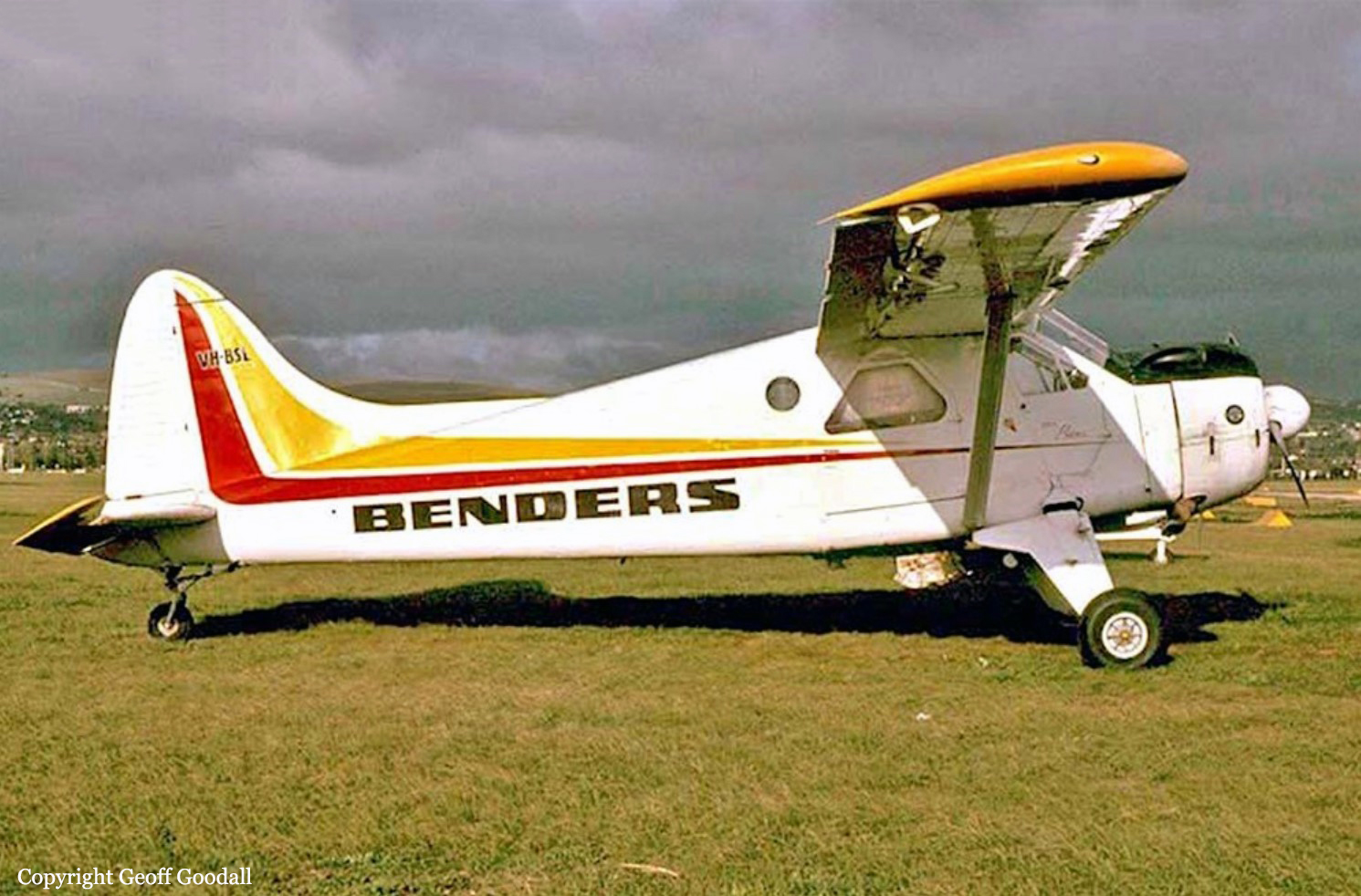
Crash of a De Havilland DHC-2 Beaver in Lake Monduran: 3 killed

Date & Time: Dec 5, 1988 at 1200 LT
Type of aircraft:
Operator:
Registration:
VH-BSL
Flight Phase:
Flight Type:
Survivors:
No
Schedule:
Bundaberg - Bundaberg
MSN:
1618
YOM:
1966
Country:
Region:
Crew on board:
2
Crew fatalities:
Pax on board:
1
Pax fatalities:
Other fatalities:
Total fatalities:
3
Circumstances:
The aircraft reported departing Bundaberg for Monduran Dam on a no SAR flight at 1135 hrs EST with three persons on board and an endurance of 270 minutes. The purpose of the flight was to complete the endorsement of the pilot under check and to assess the suitability of an area of water on the coast to where the passenger, who was the regular pilot of the aircraft, was to fly the aircraft the following day. The pilot in command had flown 27 hours in the previous three months, of which 9 were on type. The pilot under check had flown only one hour in the last three months. This flight had been in VH-BSL. At approximately 1200 hrs, the aircraft was observed in the Lake Monduran area. It flew two left hand circuits, landing into wind towards the dam wall each time. After the second takeoff, it turned left and was seen heading north from the lake. Nothing further was heard or seen of the aircraft. Following an extensive search, the wreckage was located six days later lying inverted in 15 metres of water approximately 2 km WNW of the dam wall in the area of the junction of the main east-west channel and a northsouth channel of the lake. Both floats had separated from the aircraft and the right float was severely torn for about half its length. There was substantial water impact damage to the windshield frame/cockpit roof area and to the upper leading edge surfaces of both wings.
Probable cause:
No fault was found with the aircraft or its systems which might have contributed to the accident. It could not be determined who was manipulating the controls of the aircraft at the time of the accident. Evidence was obtained that it was the habit of the check pilot to have pilots undergoing endorsement or check to fly two circuits landing into wind and then to carry out crosswind landings. The check pilot and the pilot under check had previously operated at the dam and alighted on to both the east/west and the north/south channels. Having been observed to fly two into wind circuits and then head north and not be sighted again, it is possible that the aircraft then commenced crosswind operations onto the north/south arm of the lake, landing in a southerly direction with a crosswind from the left. Information from the Bureau of Meteorology indicated that the surface wind in the area at the time of the accident was 090` magnetic at 15 knots. This information was confirmed by witnesses at the dam wall who observed white caps on the surface of the dam. The north/south channel of the lake was bounded on its east side by steep hills rising to 70 metres above water level. The effect of this high ground was to partially blanket the north/south channel from the easterly wind. The position of the wreckage was in the area where the wind shadow effect would have ended and where the wind would have blown at full strength along the main east/west channel of the lake. The crosswind limitation for the aircraft as stated in the flight manual was 8.7 knots. Commenting in early 1988 on an enquiry regarding the raising of this limit, the aircraft manufacturer emphasised the 8.7 knot limit and advised that any test work to raise the limit should proceed cautiously starting at or below the current (8.7 knot) limit. If the aircraft was conducting crosswind operations in the north/south channel, and suddenly encountered a 15 knot crosswind on exiting the wind shadow area, the control difficulties confronting the pilot could have been significant. The aircraft wreckage was intact except for the floats which had been torn off by water impact forces. The right float was severely damaged while the left was intact. The forward tip of the right float had been severed by the propeller. The remaining forward section had then been forced upwards and outboard and had broken off. This weakened the float support structure, causing it to fail, and allowing the remaining section of the right float to strike the right side of the fuselage just aft of the cabin. Damage of this type an magnitude was most probably caused by the nose of the right float digging into the surface of the lake at relatively high speed. For this to occur, the aircraft was banked to the right at float impact - a possible consequence of encountering a strong crosswind from the left. There was no evidence that the aircraft had hit a submerged object. The factors associated with the development of this accident could not be determined.
Final Report:

Crash of a Beechcraft 65-B80 Queen Air in Matei

Date & Time: Nov 10, 1988
Type of aircraft:
Operator:
Registration:
DQ-FER
Survivors:
Yes
MSN:
LD-402
YOM:
1968
Country:
Region:
Crew on board:
2
Crew fatalities:
Pax on board:
8
Pax fatalities:
Other fatalities:
Total fatalities:
0
Circumstances:
On final approach to Matei Airport, the crew initiated a go-around procedure when the twin engine aircraft struck a tree and crashed, bursting into flames. All 10 occupants were injured.

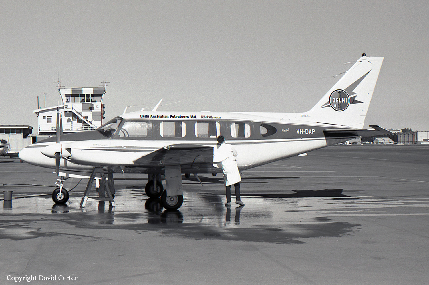
Crash of a Piper PA-31-310 Navajo off Stanwell Park: 3 killed

Date & Time: Nov 1, 1988 at 1740 LT
Type of aircraft:
Registration:
VH-DAP
Flight Phase:
Flight Type:
Survivors:
No
Schedule:
Nowra - Nowra
MSN:
31-364
YOM:
1968
Country:
Region:
Crew on board:
3
Crew fatalities:
Pax on board:
0
Pax fatalities:
Other fatalities:
Total fatalities:
3
Circumstances:
The aircraft had been modified by the installation of an air driven winch for the purpose of towing gunnery targets and was operating in conjunction with a warship for scheduled sea/air gunnery practise. Weather conditions in the area were reported as overcast at 4000 feet, wind 060 degrees / 15-20 knots and visibility of 15-20 kilometres. At about 1717 hours the aircraft was instructed to commence carrying out gunnery tracking runs at an altitude of 1000 feet with the sleeve target not deployed. Between 1720 and 1735 hours the aircraft carried out two such runs from the west and east. The aircraft then tracked to the south, away from the ship, to a distance of about 10 kilometres. At about 1738 the aircraft was instructed to turn inbound for a run from astern. At about 1739 hours the pilot reported engine problems and about one minute later advised "I've got problems, Mayday, I'm going in". Crewmen stationed near the stern of the ship, reported seeing the aircraft dive into the sea. The warship was immediately turned back towards the crash position. Other warships and aircraft were also ordered to the crash position. The only wreckage sighted was at the crash datum and was believed to have been a section of wing. This wreckage was located about two metres below the surface and sank before it could be recovered. The approximate depth of water at the crash position is 450 fathoms. No trace of the aircraft or its occupants has been discovered to date.
Probable cause:
The subsequent investigation established that the flight crew were properly qualified to conduct the flight, and that the aircraft was appropriately certified and maintained. The flight was conducted in accordance with the conditions of the operating contract. At the time of the occurrence the aircraft had not deployed the sleeve target and no firing was being carried out. No evidence was found to suggest an in-flight structural failure or fire. The installation of the target towing equipment was not considered to have been a factor in the development of the accident. There was a loss of control of the aircraft following an apparent engine malfunction. The precise reasons for the accident have not been established.
The following factors were considered relevant to the development of the accident:
1. Apparent engine failure or malfunction.
2. Control of the aircraft was lost for reasons which have not been determined.
Final Report:

Crash of a De Havilland DHC-2 Beaver in Nandawar: 1 killed

Date & Time: Oct 31, 1988 at 0824 LT
Type of aircraft:
Registration:
VH-AAK
Flight Phase:
Survivors:
No
Schedule:
Nandawar - Nandawar
MSN:
137
YOM:
1951
Country:
Region:
Crew on board:
1
Crew fatalities:
Pax on board:
0
Pax fatalities:
Other fatalities:
Total fatalities:
1
Circumstances:
The pilot had been conducting superphosphate spreading operations in the area two days prior to the accident and had completed approximately 60 trips during that operation. On the morning of the accident, he had just completed the sixth load when the outboard section of the right wing struck powerlines. The right wing was torn from its attachment points and separated from the aircraft. The aircraft then impacted the ground in a steep nose down attitude and came to rest 169 metres from the powerlines.
Probable cause:
A detailed examination of the aircraft and its systems failed to reveal any defect which could have contributed to the accident. The engine was operating at high power at the time of the impact. It is probable that the pilot forgot about the presence of the powerlines. It was noted that the pilot was not wearing a shoulder harness and that an unapproved modification had been made to the lap harness. The toggle fitted to the lap harness was a type approved for 9 to 12g applications only and therefore was not suitable for agricultural operations, which require equipment capable of withstanding 25g loads.
The following factor was considered relevant to the development of the accident:
1. The pilot did not see or avoid the powerline.
Final Report:

Crash of a Partenavia P.68B Victor in Kolane

Date & Time: Oct 14, 1988 at 1845 LT
Type of aircraft:
Operator:
Registration:
VH-PFQ
Flight Type:
Survivors:
Yes
Schedule:
Kolane - Taroom - Kolane
MSN:
95
YOM:
1977
Country:
Region:
Crew on board:
1
Crew fatalities:
Pax on board:
0
Pax fatalities:
Other fatalities:
Total fatalities:
0
Circumstances:
The Taroom aerodrome had recently been equipped with a pilot activated lighting (PAL) system which was due to be commissioned on the evening of 15 October 1988. The pilot, who is a local Council member had flown from his property "Kolane" to Taroom late in the afternoon, to check that the PAL system was functional. He had intended to fly to Taroom the following evening to activate the lights for the official opening celebration, which was planned to be held at the aerodrome. After checking that the system was working the pilot decided to take the opportunity to practice some night circuits and landings before returning to his property. Before departing Taroom he arranged to have two vehicles positioned at his property landing area to illuminate the strip which is 850 metres long, aligned 235/055 degrees magnetic, and 1000 feet above sea level. He apparently intended to check the suitability of the strip for a night landing on his return. The aircraft was observed to fly over the strip in a north-easterly direction and then make a left turn. The aircraft was then seen to descend and the sound of impact was heard by the occupant of a vehicle near the strip. The aircraft had impacted the ground whilst in a descending left turn at a ground speed of approximately 125 knots. Initial impact was in a clearing near trees. The aircraft slid 91 metres before the left wing struck a large tree and was torn off. The aircraft slid another 45 metres before coming to rest and catching fire. The pilot was thrown from the aircraft while still strapped to his seat and was able to move himself away from the immediate vicinity of the fire before help arrived.
Probable cause:
The pilot has no recollection of events immediately prior to the accident. There is no indication that the aircraft was not functioning normally at the time of the accident. The weather was fine, there was a light northerly breeze, and there was no moonlight. Indications are that the pilot may have become disorientated whilst attempting to carry out a visual circuit when there was no visual horizon. The landing area did not meet the requirements for night operations published in the Visual Flight Guide.
The following factor was considered relevant to the development of the accident:
The pilot was attempting to carry out a night visual circuit when there was no visual horizon.
Final Report:

Crash of a Britten-Norman BN-2A-26 Islander in Sangafa-Siwo

Date & Time: Sep 13, 1988
Type of aircraft:
Operator:
Registration:
YJ-RV20
Survivors:
Yes
MSN:
585
YOM:
1977
Country:
Region:
Crew on board:
0
Crew fatalities:
Pax on board:
0
Pax fatalities:
Other fatalities:
Total fatalities:
0
Circumstances:
Suffered an accident at Sangafa-Siwo Airport, Emae Island. No casualties.

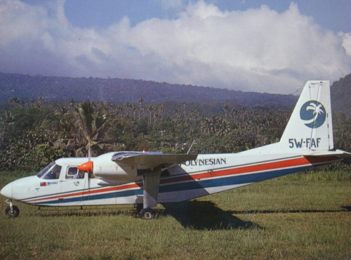
Crash of a Britten-Norman BN-2A Islander in Asau

Date & Time: Aug 20, 1988
Type of aircraft:
Operator:
Registration:
5W-FAF
Survivors:
Yes
MSN:
109
YOM:
1969
Region:
Crew on board:
0
Crew fatalities:
Pax on board:
0
Pax fatalities:
Other fatalities:
Total fatalities:
0
Circumstances:
After landing at Asau Airport, the Islander was unable to stop within the remaining distance, overran and plunged in a lagoon. There were no casualties.

Crash of a Fletcher FU-24-950 near Werris Creek: 1 killed

Date & Time: Jul 19, 1988 at 1045 LT
Type of aircraft:
Operator:
Registration:
VH-HPP
Flight Phase:
Survivors:
No
Schedule:
Werris Creek - Werris Creek
MSN:
162
YOM:
1970
Country:
Region:
Crew on board:
1
Crew fatalities:
Pax on board:
0
Pax fatalities:
Other fatalities:
Total fatalities:
1
Circumstances:
The pilot was conducting superphosphate spreading operations in fine and clear weather conditions. The paddock being treated sloped uphill, and there were heavily timbered peaks beyond the paddock. The pilot had spread the paddock the previous day under similar conditions. On this occasion the aircraft was apparently performing normally as the first swath run was completed, but the aircraft did not appear to gain any appreciable height as it approached the hills. It was then seen to adopt a steep nose-up attitude and commence a wingover type manoeuvre. During this manoeuvre the aircraft struck trees and then impacted the ground. A fierce fire broke out and engulfed the wreckage. The pilot, sole on board, was killed.
Probable cause:
Although the investigation was hampered by the extensive fire damage, no defect or malfunction was discovered which might have contributed to the accident. The reason the pilot, who had extensive agricultural experience, chose to conduct swath runs towards steeply rising ground was not determined. The wind direction had changed since the previous day, and the aircraft was likely to have been affected by downdrafts on the lee side of the hills. When the pilot realised the aircraft was not performing as expected, he evidently attempted to dump the remaining load and reverse the direction. However, there was insufficient aircraft performance available to successfully complete this manoeuvre.
Significant Factors:
The following factors were considered to be relevant to the development of the accident:
1. The pilot elected to conduct spreading runs towards steeply rising ground, when safer alternatives were available.
2. It was likely that downdraft conditions existed on the lee side of the hills.
3. The pilot evidently misjudged the climb performance of the aircraft.
4. The pilot delayed attempting a reversal of direction beyond the point where such a manoeuvre could be safely accomplished.
Final Report:

Crash of a Rockwell Grand Commander 680E in King Island

Date & Time: Jul 14, 1988 at 2017 LT
Operator:
Registration:
VH-CAY
Flight Type:
Survivors:
Yes
Schedule:
Melbourne – King Island
MSN:
680-0855-76
YOM:
1959
Country:
Region:
Crew on board:
1
Crew fatalities:
Pax on board:
1
Pax fatalities:
Other fatalities:
Total fatalities:
0
Circumstances:
The King Island aerodrome weather was forecast to include temporary periods of moderate to heavy rain showers, six eighths of cloud cover base 800 feet and visibility reduced to 3000 metres. The forecast surface wind was 340 degrees at 20-30 knots. The pilot's qualifications required a minimum visibility of 5000 metres for operation at night in Visual Meteorological Conditions, (NGT VMC). It was planned that another pilot, qualified for Instrument Flight Rules (IFR) operations, would act as pilot in command, but he became unavailable. The flight plan submitted by the pilot indicated he would be operating under the IFR category and when queried on taxiing he confirmed that this was so. Shortly after DEPARTURE, the pilot requested a weather report from an IFR pilot who had just landed at King Island. This gave a cloud base of 2000 feet, heavy rain showers and visibility of 2000 metres. Flares had been laid to allow the other pilot to use Runway 35 because of the strong northerly wind. The pilot of VH-CAY activated the electric lighting for Runway 28. He reported that the weather was satisfactory enroute and he could see lights ahead on the island. On crossing the coast flight conditions became rough in moderate to severe turbulence. The pilot advised he arrived over the aerodrome at 1500 feet above mean sea level and observed the lighted wind sock was horizontal, with the direction fluctuating rapidly between north and west. He turned to the south and broadcast his intention to land on Runway 28. Neither the pilot nor the passenger had any further recall of the events leading to the accident. VH-CAY was heard passing over the aerodrome and the engine sound was very loud, suggesting to the listener that the aircraft was low. It had been raining continuously for more than an hour, sometimes very heavily, and it was still raining at the time. The aircraft was subsequently seen flying at a very low height some six kilometres south of the aerodrome, tracking approximately north. It was raining very heavily in that area and the wind was very strong. Soon afterwards there was a sound of impact and a flash of light. The aircraft had struck the tops of trees 30 feet high, then descended to the ground. After the aircraft came to rest it was destroyed by a fire. Both occupants were seriously injured.
Probable cause:
Examination of the wreckage was severely hampered by the extreme fire damage sustained, but no evidence was found of any defects that might have contributed to the accident. The aircraft had evidently been under control at the time it collided with the trees. A post analysis of the conditions by the Bureau of Meteorology indicated the possible presence of strong up and down drafts, horizontal wind shear, turbulence, and estimated visibility as 2-3000 metres in rain. The evidence suggested that the pilot may have been lower than he believed as the aircraft overflew the
aerodrome. Having passed overhead, there there would have been few external visual references under the existing conditions to alert him that the aircraft was inadvertently being descended into the ground.
Significant Factors:
The following factors were considered relevant to the development of the accident:
1. The pilot attempted to conduct an operation for which he was not qualified.
2. Severe weather conditions in the destination aerodrome area with strong winds, turbulence, heavy rain and poor visibility.
3. The pilot continued flight into adverse weather conditions.
4. The pilot may have misread his altimeter and been lower than intended.
5. The pilot may have unintentionally descended the aircraft into the ground in conditions of poor visibility.
Final Report: