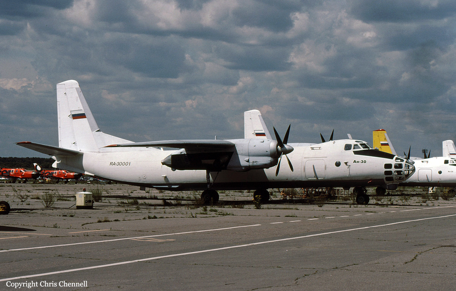
Crash of a Piper PA-46-310P Malibu near Seligman: 2 killed
Date & Time:
Sep 13, 2022 at 1100 LT
Registration:
N43605
Survivors:
No
Schedule:
Albuquerque – Henderson
MSN:
46-8408052
YOM:
1984
Crew on board:
1
Crew fatalities:
Pax on board:
1
Pax fatalities:
Other fatalities:
Total fatalities:
2
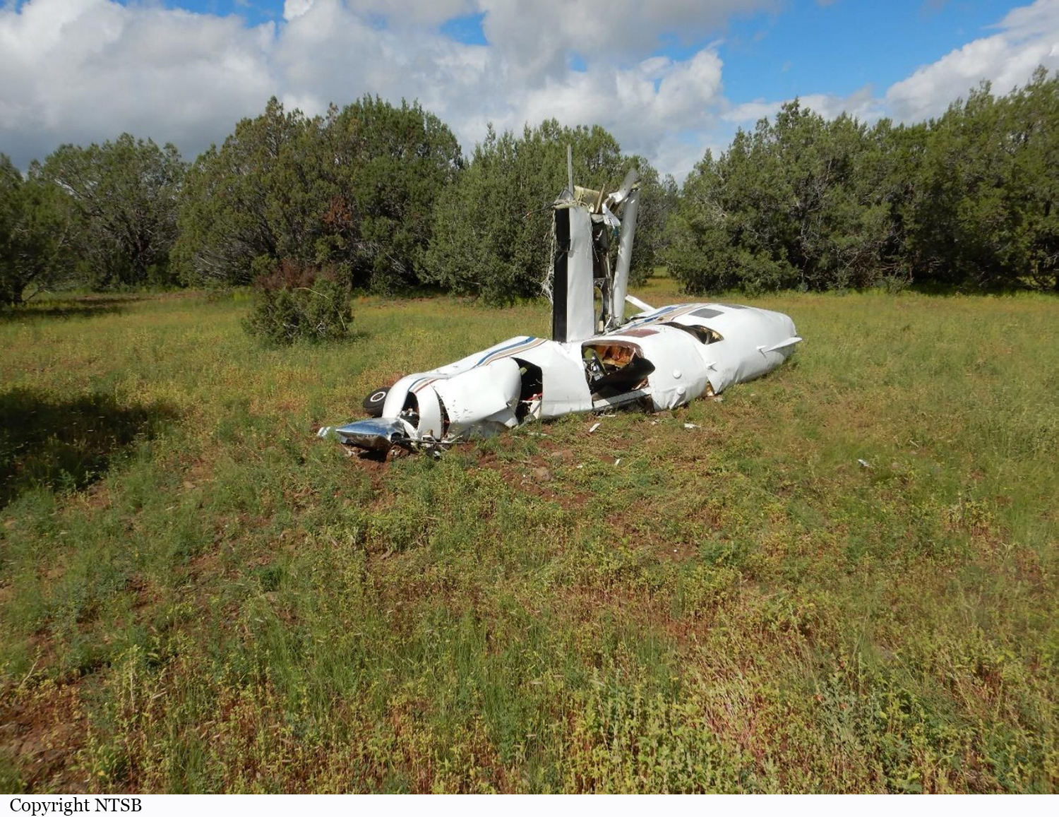
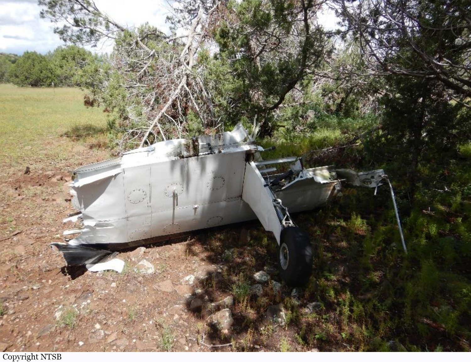
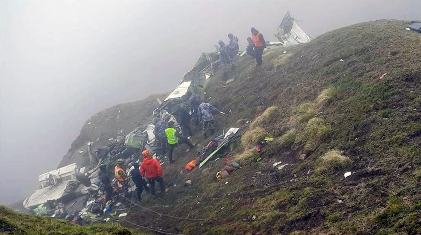
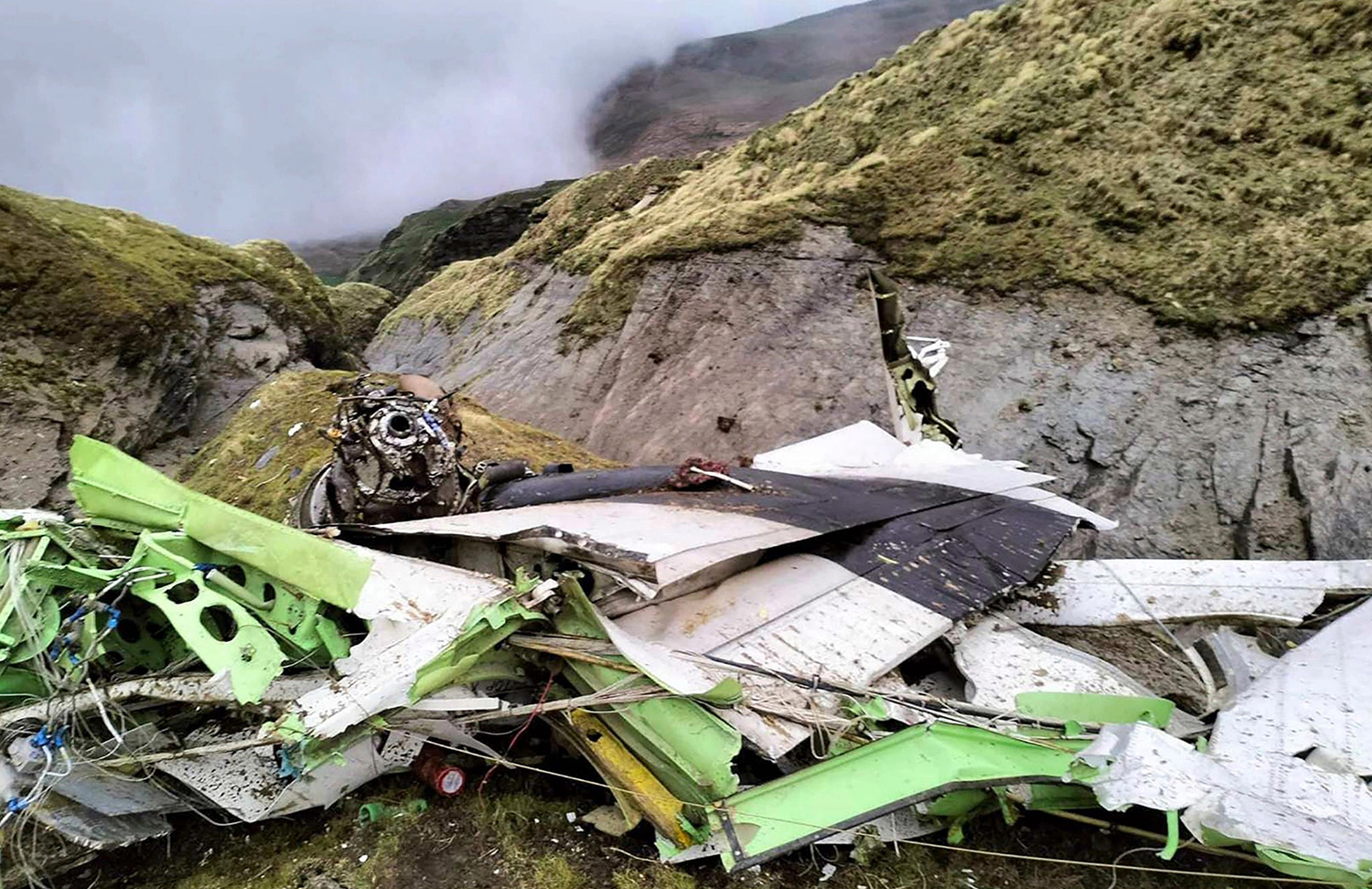
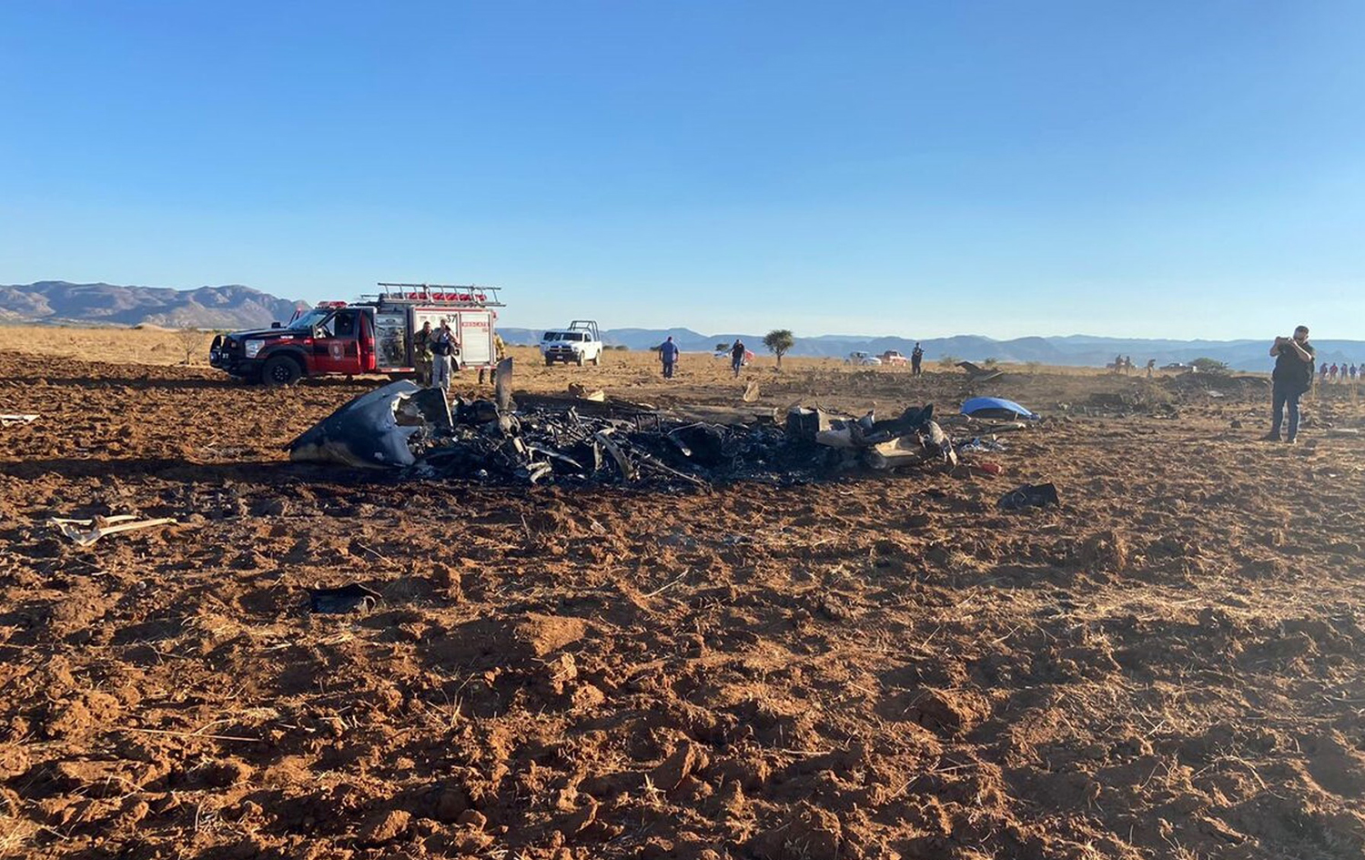
Circumstances:
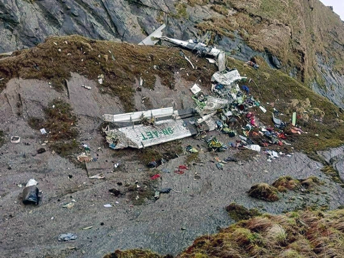
The student pilot was enroute at an altitude about 17,700 ft mean sea level (msl) on a crosscountry flight with a passenger in his high-performance airplane. The pilot was receiving visual flight rules flight following services from air traffic control, who advised him of an area of moderate to heavy precipitation at the airplane’s 12 o’clock position. The pilot replied that he had been able to “dodge” the areas of precipitation, but that they were getting bigger. There were no further communications from the pilot. Shortly thereafter, the airplane entered a left turn that continued through 180° before the airplane began a descent from its cruise altitude. The flight track ended in an area of moderate to extreme reflectivity as depicted on weather radar and indicated that the airplane was in a rapidly descending right turn at 13,900 ft when tracking information was lost. The wreckage was scattered across a debris field about 2 miles long. Examination of the wreckage revealed lateral crushing along the left side of the fuselage and the separation of both wings and the empennage. Wing spar signatures and empennage and wing impact marks suggested positive wing loading before the wing separation and in-flight breakup. The area of the accident site was included in a Convective SIGMET advisory for thunderstorms, hail, and wind gusts of up to 50 kts. A model atmospheric sounding near the accident site indicated clouds between about 15,000 ft and 27,000 ft, as well as the potential for light rime icing from 15,500 ft to 23,000 ft. Review of the pilot’s logbook revealed that he had about 47 total hours of flight experience, with about 4 hours of instruction in simulated instrument conditions. A previous flight instructor reported that the pilot displayed attitudes of “anti-authority” and “impulsivity.” Ethanol was detected in two postmortem tissue specimens; however, based on the distribution and amount detected, the ethanol may have been from postmortem production, and it is unlikely to have contributed to the crash. Fluoxetine, trazodone, and phentermine were also detected in the pilot’s postmortem toxicology specimens. The pilot had reported his use of fluoxetine for anger and irritability. Anger and irritability are nonspecific symptoms that may or may not be associated with mental health conditions, including depression, certain personality disorders, and bipolar disorder. These conditions may be associated with impulsive behavior, increased risk taking, lack of planning, not appreciating consequences of actions, and substance use disorders. Both trazodone and phentermine have the potential for impairing effects; however, an unimpaired pilot with the pilot’s relative inexperience would have been likely to lose aircraft control during an encounter with instrument meteorological conditions (IMC). It is therefore unlikely that the pilot’s use of trazodone and phentermine affected his handling of the airplane in a way that contributed to the crash. Based on review of the pilot’s Federal Aviation Administration (FAA) medical certification file, no specific conclusion can be drawn regarding any underlying psychiatric condition that may have contributed to his decision to attempt and continue the flight into IMC, as that decision was consistent with his previous pattern of risk-tolerant behavior. The pilot had not formally been diagnosed with a mental health disorder in his personal medical records reviewed other than substance use disorders. The psychological and psychiatric evaluations reviewed were not for diagnostic and treatment purposes, but for evaluation for FAA medical certification, and therefore did not generate diagnoses. There is evidence that the pilot had a pattern of poor decision-making, high-risk tolerance, and impulsive behavior. The circumstances of the accident are consistent with the student pilot’s decision to continue into an area of deteriorating weather conditions, his encounter with instrument meteorological conditions and convective activity, and loss of visual references, which resulted in spatial disorientation and a loss of aircraft control. During the descent, the airplane exceeded its design limitations, resulting in structural failure and an in-flight breakup.
Probable cause:
The student pilot’s continued visual flight into instrument meteorological conditions, which resulted in spatial disorientation, a loss of control, exceedance of the airplane’s design limitations, and in-flight breakup.
Final Report: