Crash of a Piper PA-46-350P Malibu Mirage off Boothville

Date & Time: Sep 15, 2019 at 1146 LT
Operator:
Registration:
N218MW
Flight Phase:
Flight Type:
Survivors:
Yes
Schedule:
Titusville – Ozona – Santee
MSN:
46-36470
YOM:
2010
Crew on board:
1
Crew fatalities:
Pax on board:
0
Pax fatalities:
Other fatalities:
Total fatalities:
0
Captain / Total flying hours:
3500
Captain / Total hours on type:
2000.00
Aircraft flight hours:
1116
Circumstances:
On September 15, 2019, at 1146 central daylight time, a Piper PA-46-350P, N218MW, lost engine power while maneuvering over the Gulf of Mexico, and the pilot was forced to ditch. The private pilot was not injured. The airplane was registered to and operated by Mailworks, Inc., Spring Valley, California, under Title 14 Code of Federal Regulations Part 91 as a personal flight. Visual meteorological conditions existed near the accident site at the time of the accident, and the flight was operated on a visual flight rules flight plan. The flight originated at 0830 eastern daylight time from Space Coast Regional Airport (TIX), Titusville, Florida, and was en route to Ozona Municipal Airport (OZA), Ozona, Texas. His final destination was Gillespie Field Airport (SEE), El Cajon, California. According to the pilot's accident report, he departed TIX with 140 gallons of fuel. After crossing Gulfport (GPT), Mississippi's Terminal Radar Service Area (TRSA) at 10,500 ft, he initiated a slow descent over Boothville, Louisiana, and proceeded southbound towards the mouth of the Mississippi River, descending to 1,500 ft. He then configured the airplane for climb. The engine did not respond to the application of power and the airplane began losing altitude. After going through the emergency checklist, he was unable to restore engine power, and declared an emergency to Houston air route traffic control center (ARTCC) and on frequency 121.5 mHz. He also activated the emergency locator transmitter (ELT) prior to ditching. After ditching, the pilot put on his life jacket, exited the airplane, and remained on its wing until it sank. About an hour later, a U.S. Coast Guard helicopter rescued the pilot and transported him to a hospital in New Orleans, Louisiana. He was discharged a few hours later. The airplane has not been recovered.
Probable cause:
A loss of engine power for undetermined reasons.
Final Report:

Crash of a BAe 125-700A near Champerico: 2 killed

Date & Time: Sep 2, 2019
Type of aircraft:
Operator:
Registration:
XB-PTW
Flight Phase:
Flight Type:
Survivors:
No
Schedule:
Zihuatanejo - Chetumal
MSN:
257083
YOM:
1979
Country:
Crew on board:
2
Crew fatalities:
Pax on board:
0
Pax fatalities:
Other fatalities:
Total fatalities:
2
Circumstances:
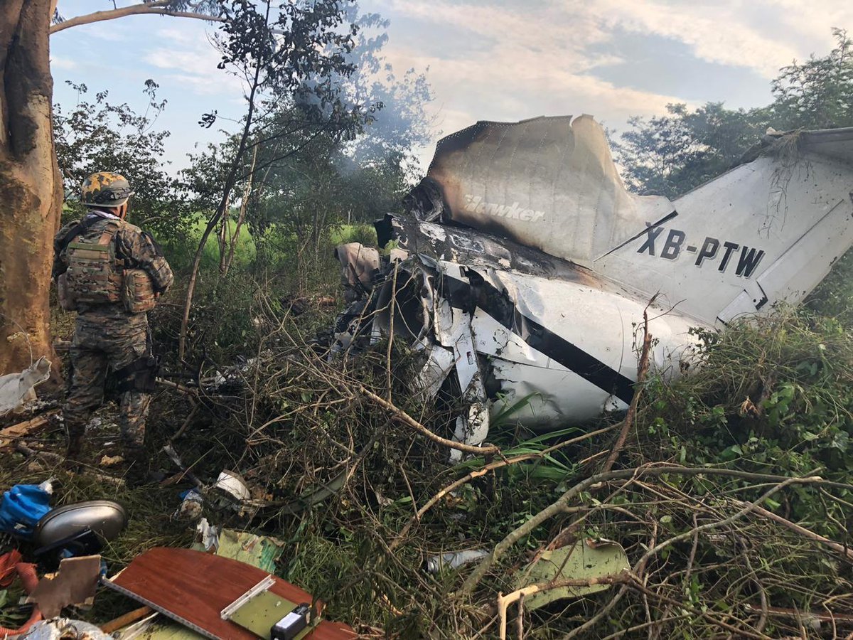
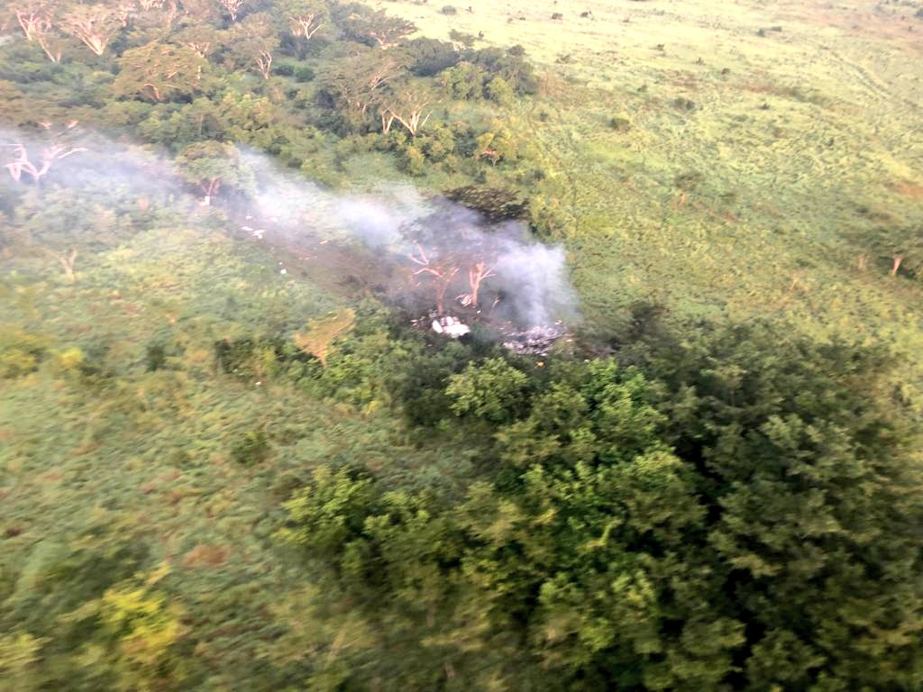
The airplane was apparently engaged in an illegal flight, carrying a crew of two. It crashed in unknown circumstances near Champerico, Guatemala, and was totally destroyed by impact forces and a post crash fire. According to the flight plan, the aircraft was supposed to fly from Zihuatanejo to Chetumal with one passenger and two crew members. Guatemalan authorities reported that the flight was illegal and that the aircraft was presumed transporting a load of cocaine.

Crash of a Beechcraft 350 Super King Air in Pansol: 9 killed

Date & Time: Sep 1, 2019 at 1510 LT
Operator:
Registration:
RP-C2296
Flight Phase:
Flight Type:
Survivors:
No
Site:
Schedule:
Dipolog - Manila
MSN:
FL-196
YOM:
1998
Location:
Country:
Region:
Crew on board:
2
Crew fatalities:
Pax on board:
7
Pax fatalities:
Other fatalities:
Total fatalities:
9
Circumstances:
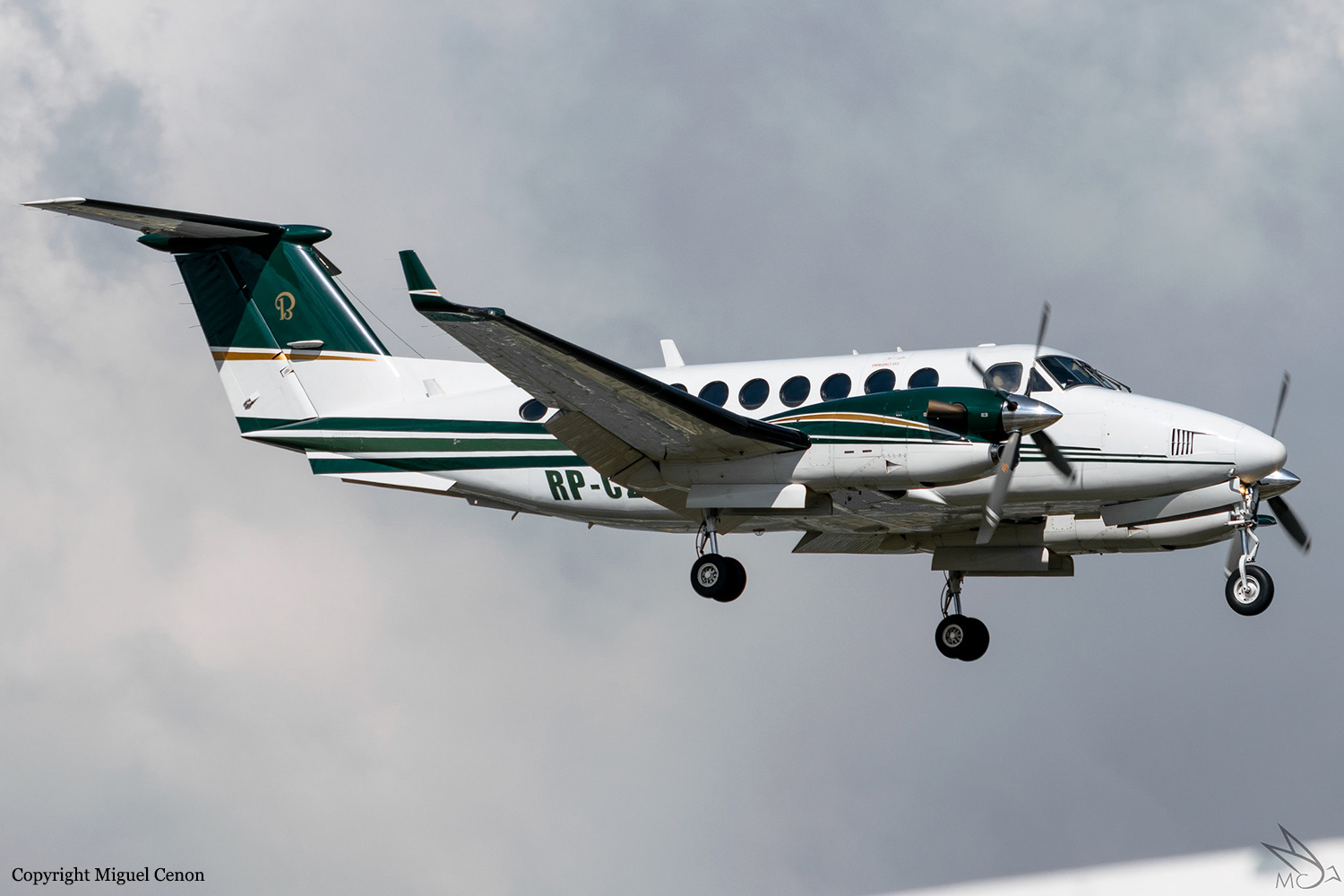
The airplane encountered a loss of control in flight while approaching Manila and crashed into a private resort located in Barangay Pansol, Calamba, Laguna, Philippines. It lost radar contact with Manila Approach after being cleared to descent from 9,000 feet for 5,000 feet tracking-in radial 170, 25 DME to Ninoy Aquino International Airport (RPLL). The aircraft wreckage was found in a private resort with coordinates of 14°10’33.62” N and 121°11’34” E and heading approximately 228° with most its fuselage totally burned. All the nine (9) occupants were fatally injured and two (2) other persons on the ground sustained serious injuries. The aircraft took off from Dipolog Principal Airport (RPMG), Dipolog City, Zamboanga del Norte bound for Manila (RPLL) on a MEDEVAC flight. Instrument Metrological Condition (lMC) prevailed at the time of the accident.
Probable cause:
The aircraft experienced a loss of control in flight (LOC-I) after encountering adverse and hazardous atmospheric turbulent weather conditions which led to an inflight breakup.
The following contributing factors were identified:
- The presence of adverse and potentially hazardous atmospheric conditions on route of the flight.
- Failure of the flight crew to maintain situational awareness.
- Break-down of CRM to apply appropriate emergency procedures to recover the aircraft from the unusual situation they encountered.
Final Report:

Crash of a PZL-Mielec AN-2R near Lake Siljan-Kuel: 2 killed

Date & Time: Aug 30, 2019 at 0730 LT
Type of aircraft:
Operator:
Registration:
RA-33061
Flight Phase:
Flight Type:
Survivors:
Yes
Site:
Schedule:
Us-Khatyn – Suordakh
MSN:
1G218-48
YOM:
1986
Country:
Region:
Crew on board:
2
Crew fatalities:
Pax on board:
5
Pax fatalities:
Other fatalities:
Total fatalities:
2
Captain / Total flying hours:
12500
Captain / Total hours on type:
3806.00
Aircraft flight hours:
3848
Circumstances:
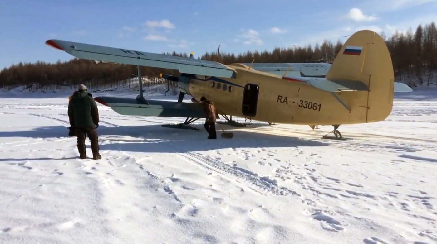
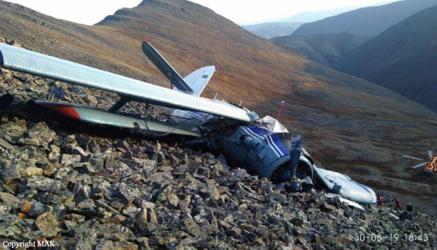
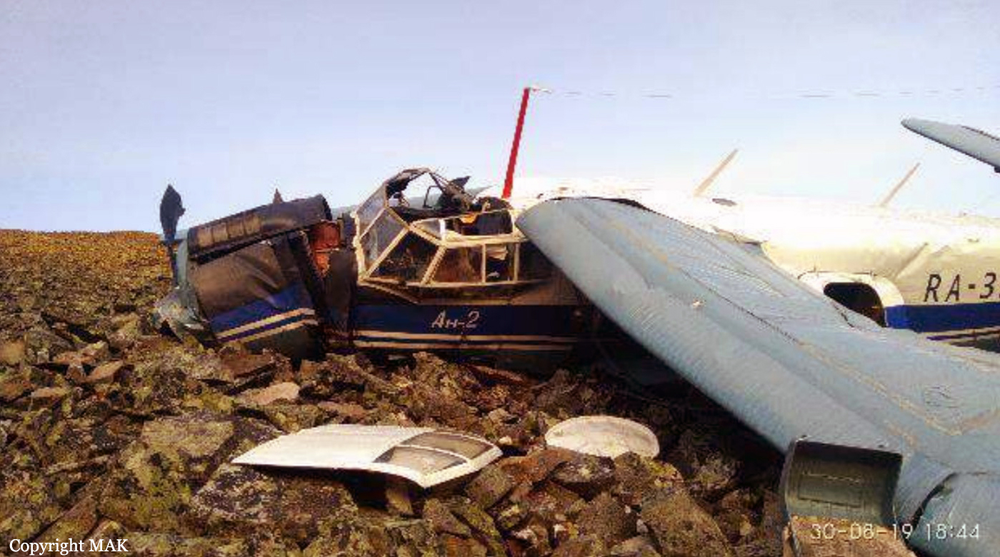
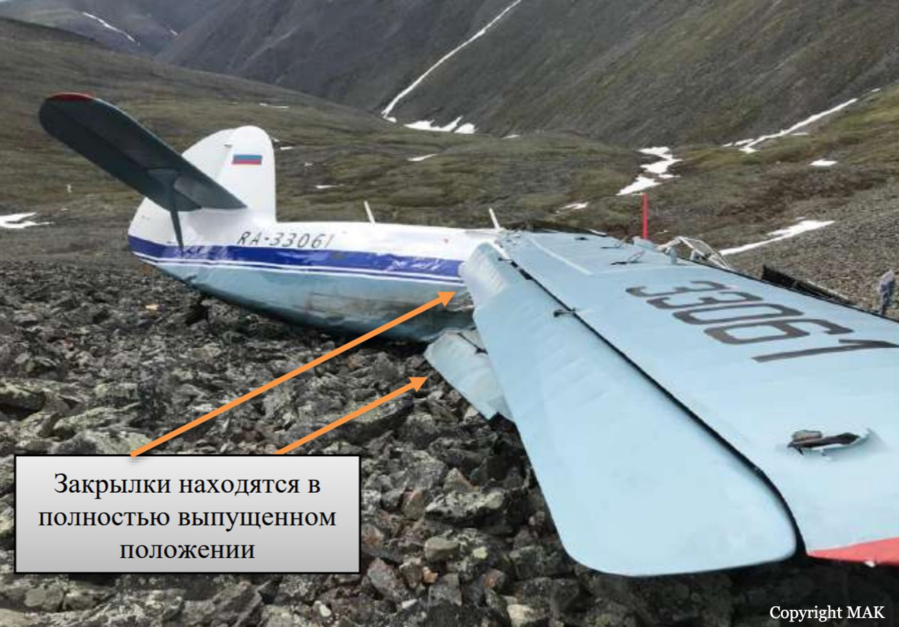
The single engine airplane departed Us-Khatyn on a flight to Suordakh, carrying five passengers, two pilots and a load consisting of 600 kilos of various goods. While cruising at an altitude of about 1,450 metres, the crew encountered moderate atmospheric turbulences and was unable to maintain the altitude. The aircraft lost height and crashed on the rocky slope of amountain located 15 km southeast from the Lake Siljan-Kuel, some 250 km from the destination. Two passengers were killed while five others occupants were injured. The aircraft was destroyed.
Probable cause:
The accident was caused by the fact that the PIC did not maintain a safe flight altitude in mountainous terrain, which led to the aircraft getting into strong downdrafts while flying over the leeward side of the ridge, uncontrolled descent and collision with the top of the mountain.
The contributing factors of AP, most likely, were:
- insufficient analysis of meteorological conditions and the possibility of the formation of strong ascending and descending air currents in the mountains;
- Failure of the PIC to take safety measures when flying in the mountains and to act in case of falling into downward air currents when crossing a mountain ridge;
- the use of motor gasoline with an octane rating of less than 95, which led to a decrease in engine power;
- performing a mission on the An-2 aircraft without the procedure for restoring skills and admission to flights on this type after a significant break in flights (about 15 years).
Final Report:

Crash of a Cessna 208B Grand Caravan near Mayo: 2 killed

Date & Time: Aug 6, 2019 at 1113 LT
Type of aircraft:
Operator:
Registration:
C-FSKF
Flight Phase:
Survivors:
No
Site:
Schedule:
Rackla - Mayo
MSN:
208B-0673
YOM:
1998
Location:
Country:
Crew on board:
1
Crew fatalities:
Pax on board:
1
Pax fatalities:
Other fatalities:
Total fatalities:
2
Captain / Total flying hours:
1694
Captain / Total hours on type:
212.00
Aircraft flight hours:
19060
Circumstances:
At 1101 Pacific Daylight Time on 06 August 2019, the Alkan Air Ltd. Cessna 208B Grand Caravan aircraft (registration C‐FSKF, serial number 208B0673) departed Rau Strip, Yukon, on a visual flight rules company flight itinerary to Mayo Airport, Yukon. The aircraft had 1 pilot, 1 passenger, and cargo on board. At 1113, the aircraft entered instrument meteorological conditions and struck rising terrain in a box canyon shortly after. The crash occurred approximately 25 nautical miles east‐northeast of Mayo Airport, at an elevation of 5500 feet above sea level. The Canadian Mission Control Centre did not receive a signal from the aircraft’s 406 MHz emergency locator transmitter. Eyewitnesses from a nearby exploration camp arrived at the site after approximately 1 hour. Royal Canadian Mounted Police and emergency medical services arrived on site approximately 90 minutes after the accident. The pilot and passenger received fatal injuries. The aircraft was destroyed; there was a brief post‐impact fire.
Probable cause:
Findings as to causes and contributing factors:
These are conditions, acts or safety deficiencies that were found to have caused or contributed to this occurrence.
1. The pilot’s decision making was influenced by several biases and, as a result, the flight departed and subsequently continued into poor weather conditions in mountainous terrain.
2. The high speed at low altitude and low forward visibility reduced the opportunities for the pilot to take alternative action to avoid terrain.
3. Within the box canyon, the canyon floor elevation increased abruptly within less than 1 NM and the low visibility prevented the pilot from detecting this and taking sufficient actions to prevent collision with terrain.
4. When the pilot turned into the box canyon, the terrain awareness and warning system aural alerts were ineffective in warning the pilot about the rising terrain either because he had already heard multiple similar alerts in the preceding minutes, or because he had silenced the alerts.

Findings as to risk:
These are conditions, unsafe acts, or safety deficiencies that were found not to be a factor in this occurrence but could have adverse consequences in future occurrences.
1. If administrative safety defences are not used as intended, it increases the risk that the hazards associated with the flight will not be identified and mitigated.

Other findings:
These items could enhance safety, resolve an issue of controversy, or provide a data point for future safety studies.
1. The pilot held a valid instrument rating and the aircraft was equipped to fly in instrument meteorological conditions. However, there were no scenarios in the pilot’s flying history on the Cessna 208B Grand Caravan or in his training where a transition from visual flight rules to a flight under instrument flight rules in an emergency was performed.
Final Report:

Crash of a Grumman S-2 Tracker in Générac: 1 killed

Date & Time: Aug 2, 2019 at 1718 LT
Type of aircraft:
Operator:
Registration:
F-ZBAA
Flight Phase:
Flight Type:
Survivors:
No
Schedule:
Nîmes - Nîmes
MSN:
456
YOM:
1958
Flight number:
Pélican 22
Location:
Country:
Region:
Crew on board:
1
Crew fatalities:
Pax on board:
0
Pax fatalities:
Other fatalities:
Total fatalities:
1
Captain / Total flying hours:
4854
Captain / Total hours on type:
830.00
Aircraft flight hours:
15050
Circumstances:
The pilot, sole on board, departed Nîmes-Garons Airport at 1648LT on a fire fighting mission over Générac, a village located about 5 km southwest of the airbase. While approaching the zone to be treated, the twin engine airplane struck trees and crashed, bursting into flames. The aircraft was destroyed by impact forces and a post crash fire and the pilot was killed. At the time of the accident, the visibility was reduced due to thick smoke.
Probable cause:
The following findings were identified:
- GASC (Groupement d’avions de la sécurité civile) has a small resource of Tracker pilots;
- Without a co-pilot, the pilot is deprived of the usual cross-checking of piloting decisions and actions;
- The pilot has little experience on established firefighting missions. He has never carried out a mission of this nature in a single-pilot aircraft;
- Certain limitations of the flight envelope are unknown to pilots, particularly at high weight and in steep turns;
- Pilots have little knowledge of the aerological phenomena associated with certain fires, and the associated turbulence;
- With the implementation of the Tracker withdrawal, pilots are concerned about their future within the GASC;
- Fatigued from sustained activity, the pilot had a false understanding of the situation;
- The pilot suffered from overconfidence;
- The pilot did not perceive the terrain. He flew a little low as he approached the hill ;
- He adopted a trajectory very close to the flame front and did not anticipate the risk of turbulence;
- Focused on a dwelling to protect, he did not detect the inappropriate altitude of his plane and maintained a strong bank;
- The left wing underwent a local stall causing a steep left bank, which caused the pilot to recover the aircraft too low in relation to the height of the trees, which he had a false idea of.
Final Report:

Crash of a Beechcraft 350i Super King Air in Islamabad: 19 killed

Date & Time: Jul 30, 2019 at 1400 LT
Operator:
Registration:
766
Flight Phase:
Flight Type:
Survivors:
No
Site:
Schedule:
Chaklala - Chaklala
MSN:
FL-766
YOM:
2011
Country:
Region:
Crew on board:
5
Crew fatalities:
Pax on board:
0
Pax fatalities:
Other fatalities:
Total fatalities:
19
Circumstances:
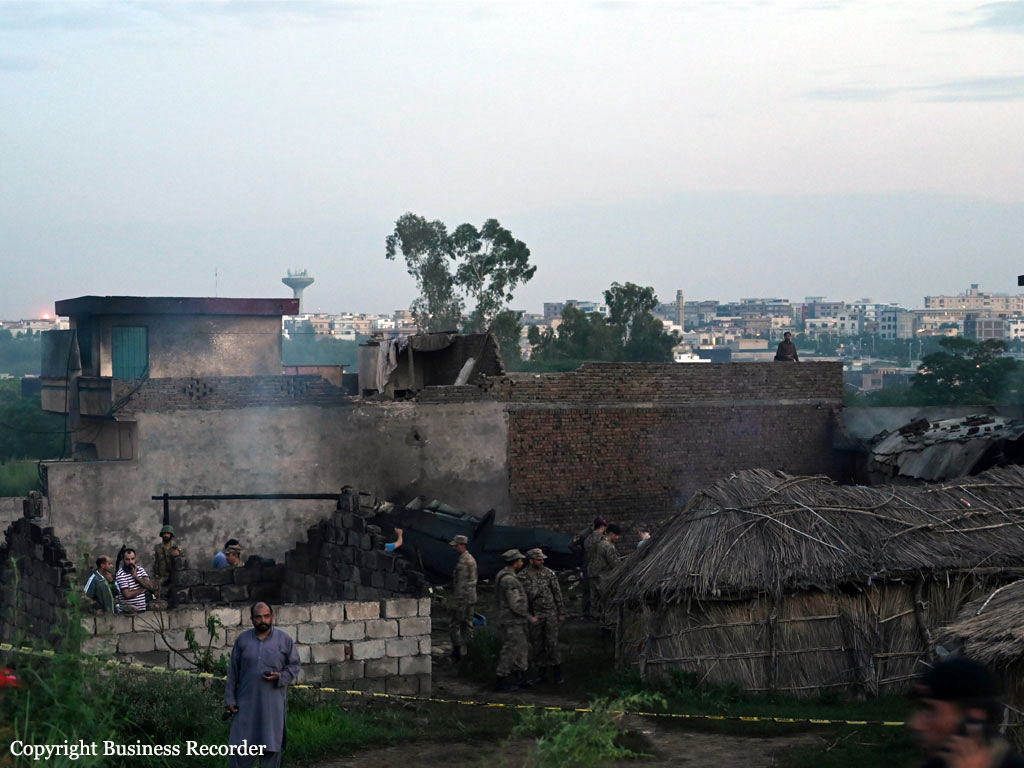
The twin engine airplane departed Chaklala-Nur Khan AFB with five crew members on board for a local training flight. In flight, it went out of control and crashed onto several houses located in the suburb of Mora Kalu, about 10 km south of Chaklala-Nur Khan AFB, Islamabad, bursting into flames. The aircraft and several houses were destroyed. All five crew members as well as 14 people on the ground were killed.

Crash of a De Havilland DHC-2 Beaver off Sechelt

Date & Time: Jul 30, 2019 at 1248 LT
Type of aircraft:
Registration:
C-GPZP
Flight Phase:
Flight Type:
Survivors:
Yes
Schedule:
Vancouver - Pender Harbour
MSN:
722
YOM:
1954
Country:
Crew on board:
1
Crew fatalities:
Pax on board:
2
Pax fatalities:
Other fatalities:
Total fatalities:
0
Circumstances:
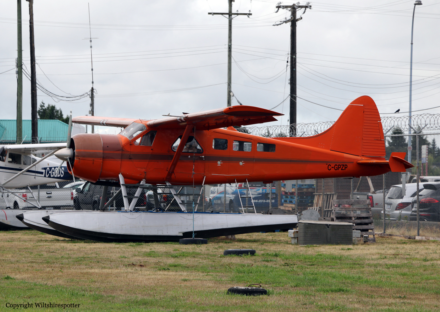
En route from Vancouver to Pender Harbour, the pilot encountered engine problems and elected to ditch the aircraft about three miles off Sechelt. All three occupants were able to evacuate the cabin before the aircraft sank and was lost. All three occupants were rescued.

Crash of an Antonov AN-72P off Kribi

Date & Time: Jul 30, 2019
Type of aircraft:
Registration:
032
Flight Phase:
Flight Type:
Survivors:
Yes
Schedule:
Malabo – Bata
MSN:
36576096926
YOM:
1992
Location:
Country:
Region:
Crew on board:
7
Crew fatalities:
Pax on board:
0
Pax fatalities:
Other fatalities:
Total fatalities:
0
Circumstances:
En route from Malabo to Bata, the crew encountered poor weather conditions when the airplane crashed in unknown circumstances into the sea few km off Kribi, South Cameroon. All seven occupants were rescued while the aircraft sank and was lost.

Crash of a Cessna 208 Caravan 675 on Addenbroke Island: 4 killed

Date & Time: Jul 26, 2019 at 1104 LT
Type of aircraft:
Operator:
Registration:
C-GURL
Flight Phase:
Survivors:
Yes
Site:
MSN:
208-0501
YOM:
2008
Country:
Crew on board:
1
Crew fatalities:
Pax on board:
8
Pax fatalities:
Other fatalities:
Total fatalities:
4
Captain / Total flying hours:
8500
Captain / Total hours on type:
504.00
Aircraft flight hours:
4576
Circumstances:
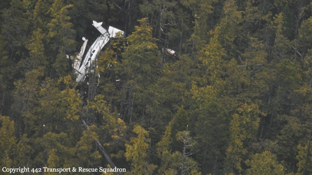
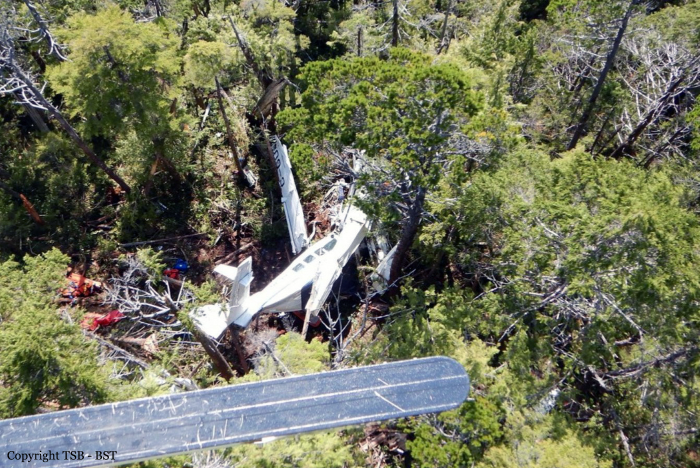
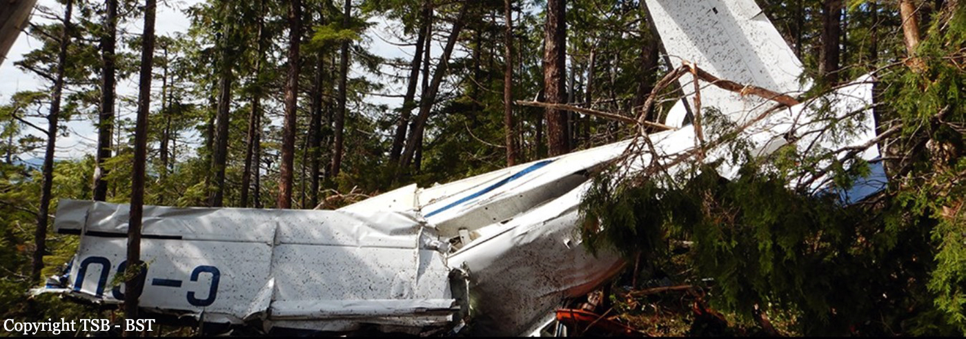
Seair Seaplanes (Seair) was contracted by a remote fishing lodge on the central coast of British Columbia (BC) (Figure 1) to provide seasonal transport of guests and supplies between Vancouver International Water Aerodrome (CAM9), BC, and the lodge, which is located about 66 nautical miles (NM) north-northwest of Port Hardy Airport (CYZT), BC, and about 29 NM southeast of Bella Bella (Campbell Island) Airport (CBBC), BC. On 26 July 2019, the occurrence pilot arrived at Seair’s CAM9 base at approximately 0630. Over the next hour, the pilot completed a daily inspection of the Cessna 208 Caravan aircraft (registration C-GURL, serial number 20800501), added 300 L of fuel to the aircraft, and began flight planning activities, which included gathering and interpreting weather information. On the morning of the occurrence, 4 Seair visual flight rules (VFR) flights were scheduled to fly to the central coast of BC, all on Caravan aircraft: C-GURL (the occurrence aircraft) was to depart CAM9 at 0730, C-GSAS at 0745, C-FLAC at 0800, and C-GUUS at 0900. The first 3 flights were direct flights to the fishing lodge, while the 4th flight had an intermediate stop at the Campbell River Water Aerodrome (CAE3), BC, to pick up passengers before heading to a research institute located approximately 4 NM southwest of the fishing lodge. Because of poor weather conditions in the central coast region, however, all of the flights were delayed. After the crews referred to weather cameras along the central coast region, the flights began to depart, but in a different order than originally scheduled. It is not uncommon for the order of departure to change when groups of aircraft are going to the same general location. One of Seair’s senior operational staff (operations manager) departed CAM9 at 0850 aboard C-FLAC. C-GUUS, bound for the research institute, departed CAM9 next at 0906, and then the occurrence aircraft departed at 0932 (Table 1). The pilot originally scheduled to fly C-GSAS declined the flight. This pilot had recently upgraded to the Caravan, had never flown to this destination before, and was concerned about the weather at the destination. When Seair’s chief pilot returned to CAM9 at 0953 after a series of scheduled flights on a different type of aircraft, he assumed the last remaining flight to the lodge and C-GSAS departed CAM9 at 1024.After departing the Vancouver terminal control area, the occurrence aircraft climbed to 4500 feet above sea level (ASL) and remained at this altitude until 1023, when a slow descent was initiated. The aircraft levelled off at approximately 1300 feet ASL at 1044, when it was approximately 18 NM northeast of Port Hardy Airport (CYZT), BC, and 57 NM southeast of the destination. At 1050, the occurrence aircraft slowly descended again as the flight continued northbound. During this descent, the aircraft’s flaps were extended to the 10° position. At this point, the occurrence aircraft was 37 NM south-southeast of the fishing lodge. The aircraft continued to descend until it reached an altitude of approximately 330 feet ASL, at 1056. By this point, the occurrence aircraft was being operated along the coastline, but over the ocean. C-FLAC departed from the fishing lodge at 1056 on the return flight to CAM9. C-FLAC flew into the Fitz Hugh Sound and proceeded southbound along the western shoreline. At approximately 1100, it flew through an area of heavy rain where visibility was reduced to about 1 statute mile (SM). C-FLAC descended to about 170 feet ASL and maintained this altitude for the next 5 minutes before climbing to about 300 feet ASL. As the southbound C-FLAC entered Fitz Hugh Sound from the north at Hecate Island, the occurrence aircraft entered Fitz Hugh Sound from the south, near the southern tip of Calvert Island. The occurrence aircraft then changed course from the western to the eastern shoreline, and descended again to about 230 feet ASL (Figure 2), while maintaining an airspeed of approximately 125 knots. The 2 aircraft established 2-way radio contact. The pilot of C-FLAC indicated that Addenbroke Island was visible when he flew past it, and described the weather conditions in the Fitz Hugh Sound to the occurrence pilot as heavy rain showers and visibility of approximately 1 SM around Kelpie Point. The occurrence pilot then indicated that he would maintain a course along the eastern shoreline of the sound. At 1103, the 2 aircraft were separated by 2 NM and passed each other on reciprocal tracks, approximately 4 NM south of the accident site. The occurrence aircraft maintained a consistent track and altitude for the next 54 seconds, then slowly began a 25° change in track to the west (0.35 NM from the Addenbroke Island shoreline). Seven seconds after the turn started (0.12 NM from the island’s shoreline), the aircraft entered a shallow climb averaging 665 fpm. At 1104:55, the occurrence aircraft struck trees on Addenbroke Island at an altitude of approximately 490 feet ASL, at an airspeed of 114 knots, and in a relatively straight and level attitude. The aircraft then continued through the heavily forested hillside for approximately 450 feet, coming to rest at an elevation of 425 feet ASL, 9.7 NM east-southeast of the destination fishing lodge. The pilot and three passengers were killed and five other occupants were injured, four seriously.
Probable cause:
Findings as to causes and contributing factors:
These are conditions, acts or safety deficiencies that were found to have caused or contributed to this occurrence.
1. The flight departed Vancouver International Water Aerodrome even though the reported and forecast weather conditions in the vicinity of the destination were below visual flight rules minima; the decision to depart may have been influenced by the group dynamics of Seair pilots and senior staff at the flight planning stage.
2. The pilot continued flight in reduced visibility, without recognizing the proximity to terrain, and subsequently impacted the rising terrain of Addenbroke Island.
3. The configuration of the visual and aural alerting systems and the colouration ambiguity in the primary flight display of the Garmin G1000 was ineffective at alerting the occurrence pilot to the rising terrain ahead.
4. The occurrence pilot’s attention, vigilance, and general cognitive function were most likely influenced to some degree by fatigue.

Findings as to risk:
These are conditions, unsafe acts or safety deficiencies that were found not to be a factor in this occurrence but could have adverse consequences in future occurrences.
1. If pilots do not receive specialized training that addresses the hazards of their flying environment, there is a risk that they will not be proficient in the specific skills necessary to maintain safety margins.
2. If aircraft are operated in excess of the maximum allowable take-off weight, there is a risk of performance degradation and adverse flight characteristics, which could jeopardize the safety of the flight.
3. If cargo is stowed in front of emergency exits, there is a risk that egress may be impeded in an emergency situation, potentially increasing evacuation time and risk of injuries.
4. If air operators do not employ a methodology to accurately assess threats inherent to daily operations, then there is a risk that unsafe practices will become routine and operators will be unaware of the increased risk.
5. If air operators that have flight data monitoring capabilities do not actively monitor their flight operations, they may not be able to identify drift toward unsafe practices that increase the risk to flight crew and passengers.
6. If Transport Canada’s oversight of operators is insufficient, there is a risk that air operators will be non-compliant with regulations or drift toward unsafe practices, thereby reducing safety margins.
7. If Transport Canada does not make safety management systems mandatory, and does not assess and monitor these systems, there is an increased risk that companies will be unable to effectively identify and mitigate the hazards associated within their operations.

Other findings:
These items could enhance safety, resolve an issue of controversy, or provide a data point for future safety studies.
1. The pilot was actively using a cellphone throughout the flight; the operator provided no guidance or limitations on approved cellphone use in flight.
Final Report: