Operator Image

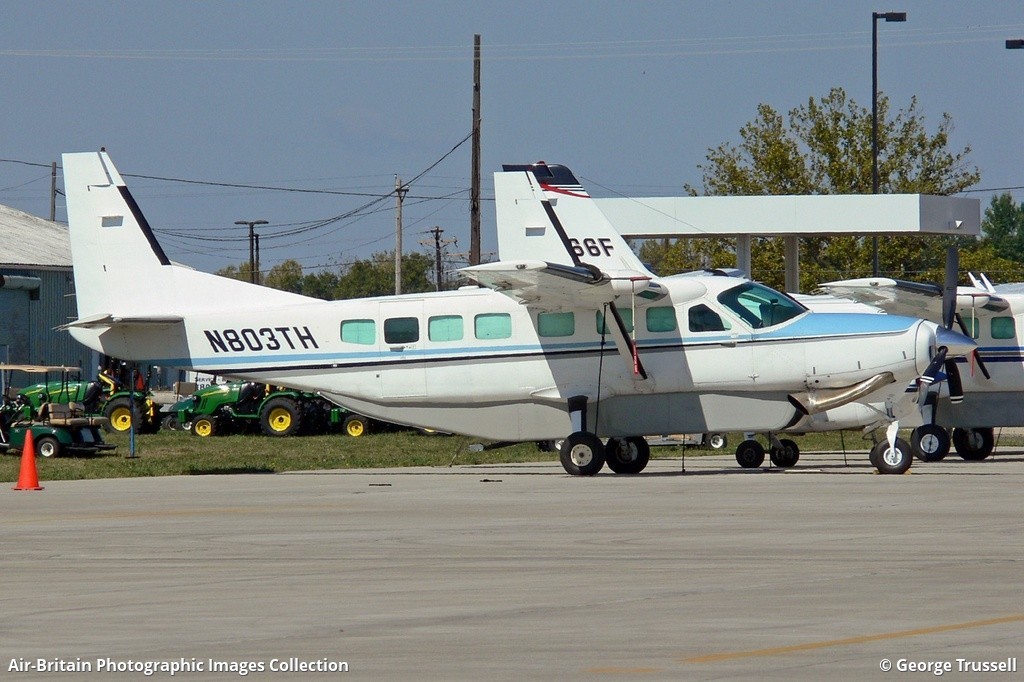
Crash of a Cessna 208B Grand Caravan near Chignik: 1 killed

Date & Time: May 1, 2017 at 1350 LT
Type of aircraft:
Operator:
Registration:
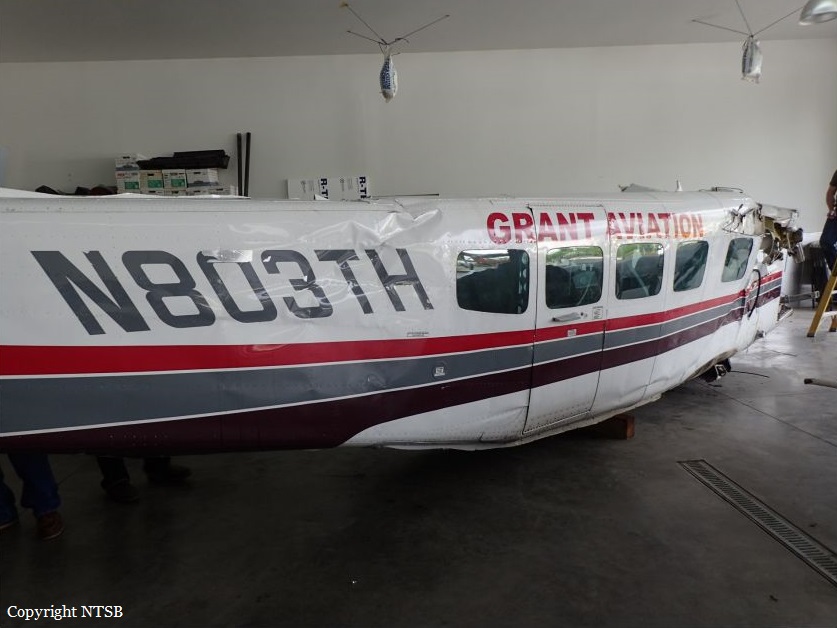
N803TH
Flight Phase:
Flight Type:
Survivors:
No
Site:
Schedule:
Port Heiden - Perryville
MSN:
208B-0321
YOM:
1992
Flight number:
GV341
Location:
Crew on board:
1
Crew fatalities:
Pax on board:
0
Pax fatalities:
Other fatalities:
Total fatalities:
1
Captain / Total flying hours:
4989
Captain / Total hours on type:
904.00
Aircraft flight hours:
17990
Circumstances:
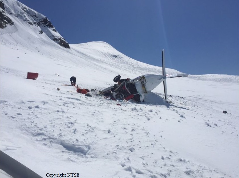
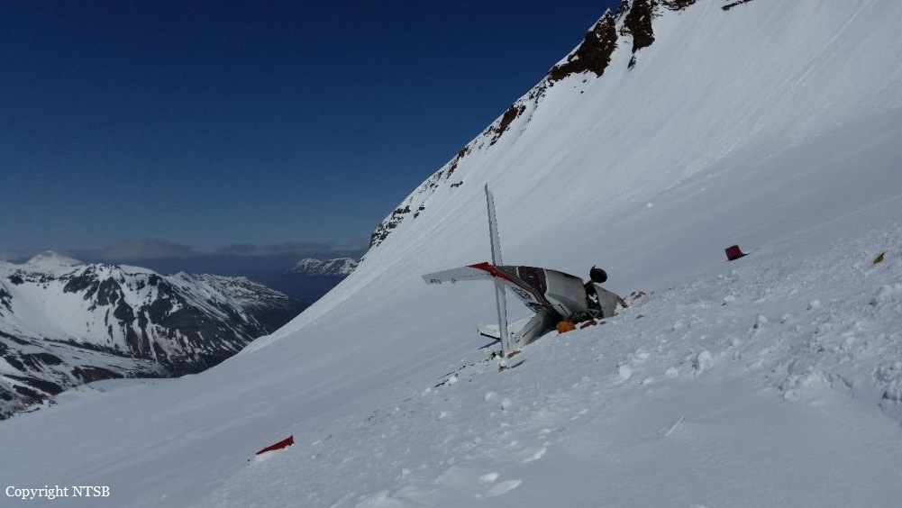
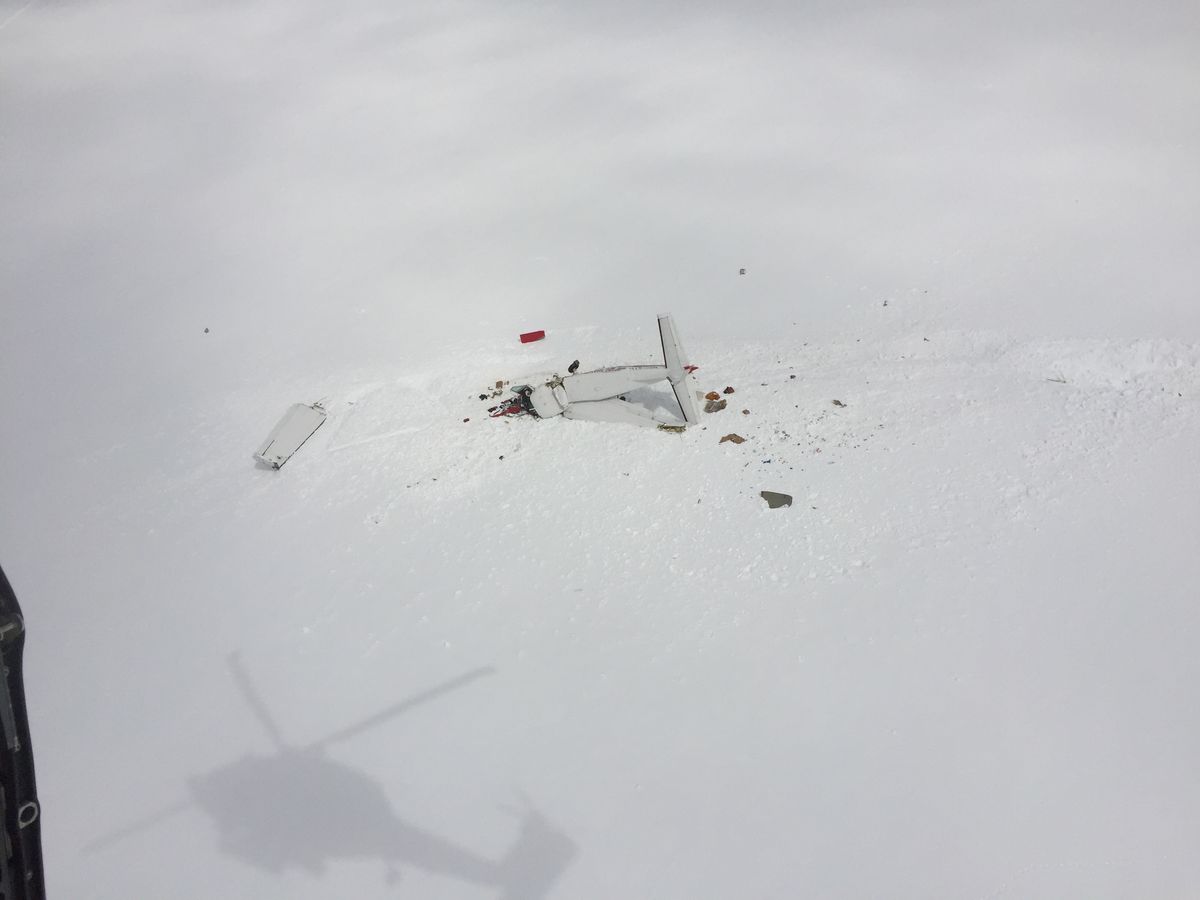
The airline transport pilot was conducting a commercial visual flight rules (VFR) flight. A passenger who was on the first segment stated that the pilot flew the airplane lower than usual for that route, and that the airplane flew through clouds during the flight. The passenger disembarked and the pilot departed on the second segment of the flight with a load of mail. The route included flight across a peninsula of mountainous terrain to a remote coastal airport that lacked official weather reporting or instrument approach procedures. About 28 minutes after departure, an emergency locator transmitter (ELT) signal from the airplane was received and a search and rescue operation was initiated. The wreckage was located about 24 miles from the destination in deep snow on the side of a steep, featureless mountain at an elevation about 3,000 ft mean sea level. The accident site displayed signatures consistent with impact during a left turn. Examination of the airplane revealed no evidence of mechanical malfunctions or anomalies that would have precluded normal operation. The airplane was not equipped with any recording or flight tracking devices, nor was it required to be; therefore, the airplane's flight track before the accident could not be determined. The airplane was certified for instrument flight and flight in icing conditions and was equipped with a terrain avoidance warning system (TAWS) which was not inhibited during the accident. Although the TAWS should have provided the pilot with alerts as the airplane neared the terrain, it could not be determined if this occurred or if the pilot heeded the alerts. A review of nearby weather camera images revealed complete mountain obscuration conditions with likely rain shower activity in the vicinity of the accident site. Visible and infrared satellite imagery indicated overcast cloud cover over the accident site at the time of the accident. The graphical forecast products that were available to the pilot before the flight indicated marginal VFR conditions for the entire route. There was no evidence that the pilot obtained an official weather briefing, and what weather information he may have accessed before the flight could not be determined. Additionally, the cloud conditions and snow-covered terrain present in the area likely resulted in flat light conditions, which would have hindered the pilot's ability to perceive terrain features and closure rates. Based on the weather camera, surface, and upper air observations, it is likely that the pilot encountered instrument meteorological conditions inflight, after which he performed a left turn to return to visual meteorological conditions and did not recognize his proximity to the mountain due to the flat light conditions. The pilot and the dispatch agent signed a company flight risk assessment form before the flight, which showed that the weather conditions for the flight were within the company's acceptable risk parameters. Although the village agents at the departure and destination airports stated that the weather at those coastal locations was good, the weather assessment for the accident flight was based on hours-old observations provided by a village agent who was not trained in weather observation and did not include en route weather information, the area forecast, or the AIRMET for mountain obscuration effective during the dispatch time and at the time of the accident. Since acquiring the accident route from another operator years earlier, the company had not performed a risk assessment of the route and its associated hazards. Multiple company pilots described the accident route of flight as hazardous and considered it an undesirable route due to the terrain, rapidly changing weather, and lack of weather reporting infrastructure; however, the company did not address or attempt to mitigate these known hazards through its risk assessment processes. The company's controlled-flight-into-terrain (CFIT)-avoidance program stated that each pilot shall have one classroom training session and one CFIT-avoidance training session in an aviation training device (ATD) each year; however, the pilot's training records indicated that his most recent ATD session was 15 months prior. More recent CFIT avoidance training may have resulted in the pilot recognizing and responding to the reduced visibility and flat light conditions sooner.
Probable cause:
The pilot's continued visual flight rules flight into an area of mountainous terrain and instrument meteorological conditions, which resulted in controlled flight into terrain (CFIT). Contributing to the accident was the company's failure to provide the pilot with CFIT-avoidance recurrent simulator training as required by their CFIT avoidance program and the company's inadequate flight risk assessment processes, which did not account for the known weather hazards relevant to the accident route of flight.
Final Report:
Crash of a Beechcraft B200 Super King Air in Unalaska

Date & Time: Feb 14, 2017 at 1323 LT
Operator:
Registration:
N313HS
Survivors:
Yes
MSN:
BB-1300
YOM:
1988
Crew on board:
2
Crew fatalities:
Pax on board:
1
Pax fatalities:
Other fatalities:
Total fatalities:
0
Circumstances:
Following an uneventful flight, the aircraft belly landed at Unalaska-Tom Madsen Airport runway 13/31. The airplane slid for few dozen metres before coming to rest and was damaged beyond repair. All three occupants evacuated safely.
Probable cause:
There were no investigations about this event. Nevertheless, it was reported that the pilot was distracted and forgot to lower the landing gear on final approach.

Crash of a Cessna 208B Grand Caravan near Nightmute: 1 killed

Date & Time: Sep 2, 2011 at 1335 LT
Type of aircraft:
Operator:
Registration:
N207DR
Flight Phase:
Flight Type:
Survivors:
No
Schedule:
Toksook Bay - Bethel
MSN:
208B-0859
YOM:
2000
Crew on board:
1
Crew fatalities:
Pax on board:
0
Pax fatalities:
Other fatalities:
Total fatalities:
1
Captain / Total flying hours:
3719
Captain / Total hours on type:
875.00
Aircraft flight hours:
8483
Circumstances:
A Cessna 208B and a Cessna 207 collided in flight in daylight visual meteorological conditions. The Cessna 208B and the Cessna 207 were both traveling in an easterly direction. According to the Cessna 207 pilot, the airplanes departed from two neighboring remote Alaskan villages about the same time, and both airplanes were flying along similar flight routes. While en route, the Cessna 207 pilot talked with the Cessna 208B pilot on a prearranged, discreet radio frequency, and the two agreed to meet up in flight for the return to their home airport. The Cessna 207 pilot said that the pilot of the Cessna 208B flew his airplane along the left side of her airplane while she was in level cruise flight at 1,200 feet mean sea level and that they continued to talk via the radio. Then, unexpectedly and unannounced, the pilot of the Cessna 208B maneuvered his airplane above and over the top of her airplane. She said that she immediately told the Cessna 208B pilot that she could not see him and that she was concerned about where he was. She said that the Cessna 208B pilot then said, in part: "Whatever you do, don't pitch up." The next thing she recalled was seeing the wings and cockpit of the descending Cessna 208B pass by the right side of her airplane, which was instantly followed by an impact with her airplane's right wing. She said that after the collision, the Cessna 208B passed underneath her airplane from right-to-left before beginning a gradual descent that steepened as the airplane continued to the left. It then entered a steep, vertical, nose-down descent before colliding with the tundra-covered terrain below followed by a postcrash fire. Unable to maintain level cruise flight, the Cessna 207 pilot selected an area of rolling, tundra-covered terrain as a forced landing site. An examination of both airplanes revealed impact signatures consistent with the Cessna 208B's vertical stabilizer impacting the Cessna 207's right wing. A portion of crushed and distorted wreckage, identified as part of the Cessna 208B's vertical stabilizer assembly, was found embedded in the Cessna 207's right wing. The Cessna 208B's severed vertical stabilizer and rudder were found about 1,000 feet west of the Cessna 208B's crash site.
Probable cause:
The pilot's failure to maintain adequate clearance while performing an unexpected and unannounced abrupt maneuver, resulting in a midair collision between the two airplanes.
Final Report:

Crash of a Cessna 207A Skywagon in Tuluksak

Date & Time: Sep 3, 2010 at 1830 LT
Operator:
Registration:
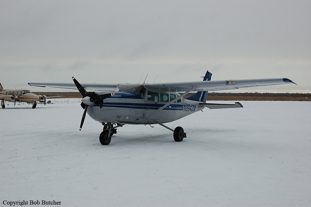
N9942M
Flight Phase:
Survivors:
Yes
Schedule:
Tuluksak - Bethel
MSN:
207-0756
YOM:
1983
Location:
Crew on board:
1
Crew fatalities:
Pax on board:
2
Pax fatalities:
Other fatalities:
Total fatalities:
0
Captain / Total flying hours:
4545
Captain / Total hours on type:
245.00
Aircraft flight hours:
29550
Circumstances:
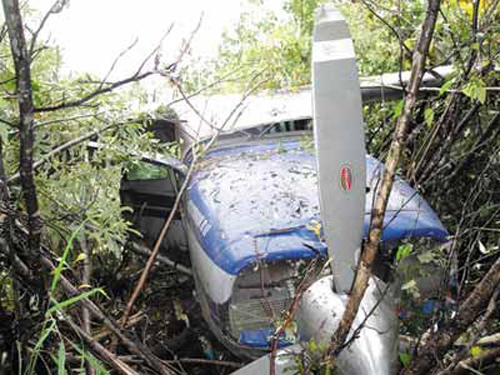
Shortly after take off from runway 20, aircraft hit tree tops, stalled and crashed in a wooded area near the airport. Both passenger were slightly injured while the pilot was seriously injured. Aircraft was damaged beyond repair. The director of operations for the operator stated that soft field conditions and standing water on the runway slowed the airplane during the takeoff roll. The airplane did not lift off in time to clear trees at the end of the runway and sustained substantial damage to both wings and the fuselage when it collided with the trees. The pilot reported that he used partial power at the beginning of the takeoff roll to avoid hitting standing water on the runway with full power. After passing most of the water, he applied full power, but the airplane did not accelerate like he thought it would. He recalled the airplane being in a nose-high attitude and the main wheels bouncing several times before the airplane impacted the trees at the end of the runway.
Probable cause:
The pilot's delayed application of full power during a soft/wet field takeoff, resulting in a collision with trees during takeoff.
Final Report:

Crash of a Cessna 207 Skywagon in Marshall

Date & Time: Oct 28, 2002 at 2000 LT
Operator:
Registration:
N91090
Flight Phase:
Flight Type:
Survivors:
Yes
Site:
Schedule:
Marshall - Bethel
MSN:
207-0069
YOM:
1969
Location:
Crew on board:
1
Crew fatalities:
Pax on board:
0
Pax fatalities:
Other fatalities:
Total fatalities:
0
Captain / Total flying hours:
1745
Captain / Total hours on type:
115.00
Aircraft flight hours:
14551
Circumstances:
The commercial pilot was positioning the airplane from the departure airport to another airport. The flight took place on a dark night with overcast skies, and no discernible horizon. The pilot departed and climbed to a cruise altitude between 1,200 and 1,400 feet msl. About 4 miles south of the departure airport, the airplane collided with an east-west ridge at 1,200 feet msl. The ridgeline is perpendicular to the direct route of flight between the departure and destination airports, and rises from west to east with a summit elevation of 1,714 feet msl. The departure airport was a newly commissioned airport 3 miles east-northeast of the old airport. The accident flight was the pilot's second trip to the new airport, and his first night departure from either the old or new airport. Direct flight from the new airport to the destination airport requires a higher altitude to clear the ridgeline than does a direct flight from the old airport. A direct flight from the old airport crosses the same ridgeline farther to the west, where the elevation of the ridge is less than 500 feet msl.
Probable cause:
The pilot's failure to maintain clearance from terrain, which resulted in an in-flight collision with a ridgeline. Factors contributing to the accident were the high terrain, the pilot's inadequate preflight planning, and the dark night light conditions.
Final Report:

Crash of a Cessna T207A Skywagon in Bethel

Date & Time: Dec 24, 1999 at 1045 LT
Operator:
Registration:
N1864
Flight Phase:
Survivors:
Yes
Schedule:
Bethel – Chefornak
MSN:
207-0526
YOM:
1979
Location:
Crew on board:
1
Crew fatalities:
Pax on board:
5
Pax fatalities:
Other fatalities:
Total fatalities:
0
Captain / Total flying hours:
2507
Captain / Total hours on type:
1080.00
Aircraft flight hours:
9809
Circumstances:
The certificated commercial pilot, with five passengers aboard, was departing runway 18 on a scheduled commuter flight. The pilot stated that the flight's original departure time was delayed for two hours due to ice fog, and low visibility. He said that just after takeoff, the engine surged followed by a loss of power. The airplane collided with snow-covered terrain during an off-airport emergency landing, and sustained substantial damage to the propeller, fuselage, and wings. Following retrieval of the airplane, an FAA airworthiness inspector examined the airplane, and found no mechanical anomalies. While still attached to the airplane, the engine was started and run at idle. The engine later produced full power on an engine test stand. A pilot-rated Alaska State Trooper, with extensive experience in the accident airplane make and model, examined the airplane soon after the accident. He said the wings, horizontal stabilizer, and elevators had an accumulation of frost.
Probable cause:
The pilot's failure to remove frost from the airplane prior to flight, and an inadvertent stall/mush.
Final Report:

Crash of a Cessna 207 Skywagon near Bethel: 6 killed

Date & Time: Dec 7, 1999 at 1300 LT
Operator:
Registration:
N1747U
Flight Phase:
Survivors:
No
Schedule:
Bethel - Nightmute
MSN:
207-0347
YOM:
1976
Location:
Crew on board:
1
Crew fatalities:
Pax on board:
5
Pax fatalities:
Other fatalities:
Total fatalities:
6
Captain / Total flying hours:
2255
Captain / Total hours on type:
390.00
Aircraft flight hours:
10363
Circumstances:
The airline transport pilot departed on a CFR Part 135 scheduled passenger flight to a remote coastal village. When the flight did not return, an aerial search was initiated. The wreckage was located the following day along the pilot's intended route, about 49 miles from the departure airport. The airplane had collided with flat, featureless, snow-covered, terrain. A pilot that departed about one minute after the accident airplane's departure, had a similar route of flight. He characterized the weather conditions along the accident airplane's route as overcast, with ceilings ranging between 2,500 and 4,500 feet. He said that as he approached the area of the accident, he encountered 'a wall of weather' starting from the ground, with tops at 1,500 feet. He added that visibility was low, with fog and varied layers of cloud cover. The pilot stated that he changed his route in order to avoid the worsening weather conditions. He added that with satisfactory weather conditions, and given the intended destination of the accident airplane, the standard route of flight would be directly over the location of the accident site. No pre accident anomalies were noted with the accident airplane.
Probable cause:
The pilot's continued VFR flight into instrument meteorological conditions. Factors associated with the accident were low ceilings, fog, and snow-covered terrain.
Final Report:

Crash of a Cessna 207A Skywagon in Nunapitchuk: 1 killed

Date & Time: Mar 25, 1997 at 1123 LT
Operator:
Registration:
N800GA
Flight Phase:
Flight Type:
Survivors:
No
Schedule:
Scammon Bay - Bethel
MSN:
207-0495
YOM:
1979
Crew on board:
1
Crew fatalities:
Pax on board:
0
Pax fatalities:
Other fatalities:
Total fatalities:
1
Captain / Total flying hours:
2437
Captain / Total hours on type:
1136.00
Aircraft flight hours:
10193
Circumstances:
The pilot of Cessna 207A, N800GA, was returning to his company base, passing about 2 miles north of a remote airstrip that was along the route of flight. The airstrip did not have any control tower. [Communications around an uncontrolled airport are conducted on a common traffic advisory frequency (CTAF)]. The pilot of a Short SC7, N451SA, announced his departure from the same airstrip on the CTAF, and took off in a northerly direction. He then began a climbing right turn toward the same destination as the Cessna 207A was proceeding. The two airplanes collided in mid-air, about 1.49 nautical miles east-northeast of the airstrip, which was about 18.3 miles west of their destination. They were observed spiraling downward from about 800 ft above the ground. Both airplanes were found lying flat and upright on a frozen lake, entangled together at the accident site. The Cessna's burned wreckage was lying on top of (and positioned toward the aft third of) the burned wreckage of the Short SC7.
Probable cause:
Inadequate visual look-out by the pilots of both airplanes, which resulted in their failure to see-and-avoid each other's airplanes.
Final Report: