Crash of a Cessna 208B Super Cargomaster in Lorain

Date & Time: May 15, 2003 at 1710 LT
Type of aircraft:
Operator:
Registration:
N208AD
Flight Phase:
Flight Type:
Survivors:
Yes
Schedule:
Lorain - Anderson
MSN:
208B-0063
YOM:
1987
Location:
Crew on board:
1
Crew fatalities:
Pax on board:
0
Pax fatalities:
Other fatalities:
Total fatalities:
0
Captain / Total flying hours:
3500
Captain / Total hours on type:
1500.00
Aircraft flight hours:
12059
Circumstances:
The pilot departed in a Cessna 208B, and shortly after takeoff, he experienced a power loss. He set up for a forced landing and during the ground roll, the nose wheel sunk into the soft terrain and the airplane nosed over. Fuel was found in both wings; however, the fuel line between the fuel selector and the engine contained only trace amounts of fuel. One fuel selector was found in the OFF position, and the other fuel selector was mid-range between the OFF and ON positions. The airplane was equipped with an annunciator warning light and horn to warn if either fuel selector was turned off. The annunciator was popped out and did not make contact with the annunciator panel. The warning horn was checked and found to be inoperative, and the electrical circuitry leading to the horn was checked and found to be operative. The engine was test run with no problems noted. According to the Pilot's Operating Handbook, the position of the fuel selectors are to be checked three times before takeoff: including cabin preflight, before engine start, and before takeoff. The pilot reported that he departed with both fuel selectors on and had not touched them when the power loss occurred. A representative of Cessna Aircraft Company reported that there was sufficient fuel forward of the fuel selector valves to takeoff and fly for a few miles prior to experiencing fuel exhaustion.
Probable cause:
The pilot's failure to verify the position of the fuel selectors prior to takeoff, which resulted in a power loss due to fuel starvation. A factor was the failure of the fuel selector warning horn.
Final Report:

Crash of a Cessna 208B Caravan near El Paujil: 3 killed

Date & Time: Mar 25, 2003 at 1920 LT
Type of aircraft:
Operator:
Registration:
N5512B
Flight Phase:
Survivors:
No
Site:
Schedule:
Larandia - Larandia
MSN:
208B-0299
YOM:
1992
Country:
Crew on board:
2
Crew fatalities:
Pax on board:
1
Pax fatalities:
Other fatalities:
Total fatalities:
3
Circumstances:
The single engine aircraft departed Bogotá on a flight to Larandia AFB where it was refueled. On board were one passenger and two pilots who were taking part to an anti-narcotic program on behalf of the US and Colombian Governments. The aircraft departed Larandia AFB at 1906LT on a reconnaissance flight to find three Americans who were taken hostage by FARC rebels after the crash of a first Cessna 208 operated by One Leasing last February 13. About 14 minutes into the flight, while cruising by night at an altitude of 4,500 feet in limited visibility, the aircraft struck a tree and crashed, bursting into flames. The wreckage was found on the slope of Mt La Sonora and all three occupants were killed.

Crash of a Cessna 208B Grand Caravan in Kotzebue

Date & Time: Mar 2, 2003 at 1504 LT
Type of aircraft:
Operator:
Registration:
N205BA
Flight Type:
Survivors:
Yes
Schedule:
Shungnak - Kotzebue
MSN:
208B-0890
YOM:
2001
Crew on board:
1
Crew fatalities:
Pax on board:
0
Pax fatalities:
Other fatalities:
Total fatalities:
0
Captain / Total flying hours:
25600
Captain / Total hours on type:
4200.00
Aircraft flight hours:
2082
Circumstances:
Prior to departing on an air taxi flight, the airline transport certificated pilot obtained a weather briefing and filed a VFR flight plan for a trip from his home base, to several remote villages, and return. The area forecast contained an AIRMET for IFR conditions and mountain obscuration due to clouds and light snow. The terminal forecast contained expected conditions that included visibilities ranging from 3 to 3/4 mile in blowing snow, a vertical visibility of 500 feet, and wind speeds from 14 to 22 knots. During the filling of the flight plan, an FAA flight service station specialist advised that VFR flight was not recommended. The pilot acknowledged the weather information and departed. When the pilot took off on the return flight from an airport 128 miles east of his home base, the pilot reported that the visibility at his base was greater than 6 miles. As he neared his home base, the visibility had decreased and other pilots in the area were requesting special VFR clearances into the Class E surface area. The pilot requested a special VFR clearance at 1441, but had to hold outside the surface area for other VFR and IFR traffic. At 1453, a METAR at the airport included a wind 080 of 26 knots, and a visibility of 1 mile in blowing snow. While holding about 7 miles north of the airport, the pilot provided a pilot report that included deteriorating weather conditions east of the airport. Once the pilot was cleared to enter the surface area at 1458, he was provided with an airport advisory that included wind conditions of 25 knots, gusting to 33 knots. While the pilot was maneuvering for the approach, a special aviation weather observation at 1501 included a wind condition of 26 knots, and a visibility of 3/4 mile in blowing snow. The pilot said he established a GPS waypoint 4 miles from the runway and descended to 1,000 feet. He continued inbound and descended to 300 feet. At 1 mile from the airport, the pilot said he looked up from the instrument panel but could not see the airport. He also stated that he was in a whiteout condition. The airplane collided with the snow-covered sea ice, about 1 mile from the approach end of the runway threshold at 1504.
Probable cause:
The pilot's continued VFR flight into instrument meteorological conditions, and his failure to maintain altitude/clearance above the ground, resulting in a collision with snow and ice covered terrain during the final approach phase of a VFR landing. Factors in the accident were whiteout conditions and snow-covered terrain.
Final Report:

Crash of a Cessna 208B Grand Caravan in El Para: 2 killed

Date & Time: Feb 13, 2003 at 0843 LT
Type of aircraft:
Operator:
Registration:
N1116G
Flight Phase:
Survivors:
Yes
Site:
Schedule:
Bogotá - Florencia
MSN:
208B-0402
YOM:
1994
Country:
Crew on board:
2
Crew fatalities:
Pax on board:
3
Pax fatalities:
Other fatalities:
Total fatalities:
2
Circumstances:
The single engine aircraft was completing a survey flight over the Florencia area on behalf of the US Government, carrying four US citizens and one Colombian taking part to an anti-narcotic program. Eight minutes prior to its arrival in Floriencia, while cruising at an altitude of 5,000 feet, the aircraft suffered an engine failure. The crew attempted an emergency landing when the aircraft crashed on the slope of a mountain located near El Para, bursting into flames. All five occupants survived the accident but when FARC soldiers arrived on the scene, they shot down both pilots and captured all three other occupants. The bodies of both pilots were repatriated to the US few days later while the three hostages were released more than five years later in July 2008.
Probable cause:
It was determined that the engine failed after the turbine overheated in flight.

Crash of a Cessna 208B Super Cargomaster in San Angelo

Date & Time: Jan 24, 2003 at 1015 LT
Type of aircraft:
Operator:
Registration:
N944FE
Flight Type:
Survivors:
Yes
Schedule:
San Angelo - San Angelo
MSN:
208B-0044
YOM:
1987
Crew on board:
2
Crew fatalities:
Pax on board:
0
Pax fatalities:
Other fatalities:
Total fatalities:
0
Captain / Total flying hours:
4356
Copilot / Total flying hours:
13884
Aircraft flight hours:
7503
Circumstances:
The airplane impacted a dirt field and a power line following a loss of control during a simulated engine failure while on a Part 135 proficiency check flight. Both pilots were seriously injured and could not recall any details of the flight after the simulated engine failure. Witnesses observed the airplane flying on a westerly heading at an altitude of 100 to 200 feet, and descending. They heard the sound of an engine “surging” and observed the airplane’s wings bank left and right. The airplane continued to descend and impacted the ground and power lines before becoming inverted. A pilot-rated witness reported that he observed about ¼ inch of clear and rime ice on the airplane’s protected surfaces (deice boots) and about ½ inch of ice on the airplane’s unprotected surfaces. An NTSB performance study of the accident flight based on radar data indicated that the airplane entered a descent rate of 1,300 feet per minute (fpm) about 1,100 feet above the ground. This rate of descent was associated with a decrease in airspeed from 130 knots to 92 knots over a span of 30 seconds. The airplane’s rate of descent leveled off at the 1,300 fpm rate for 45 seconds before increasing to a 2,000 fpm descent rate. The true airspeed fluctuated between a low of 88 knots to 102 knots during the last 45 seconds of flight. According to the aircraft manufacturer, the clean, wing flaps up stall speed was 78 knots. However, after a light rime encounter, the Pilot’s Operating Handbook (POH) instructed pilots to maintain additional airspeed (10 to 20 KIAS) on approach “to compensate for the increased pre-stall buffet associated with ice on the unprotected areas and the increased weight.” With flaps up, a minimum approach speed of 105 KIAS was recommended. The POH also stated that a significantly higher airspeed should be maintained if ½ inch of clear ice had accumulated on the wings.
Probable cause:
The flight crew's failure to cycle the deice boots prior to conducting a simulated forced landing and their failure to maintain adequate airspeed during the maneuver, which resulted in an inadvertent stall and subsequent loss of control. A contributing factor was the ice accumulation on the leading edges of the airfoils.
Final Report:

Crash of a Cessna 208B Super Cargomaster in Manteo: 1 killed

Date & Time: Dec 25, 2002 at 0100 LT
Type of aircraft:
Operator:
Registration:
N1122Y
Flight Type:
Survivors:
No
Schedule:
Elizabeth City - Manteo
MSN:
208B-0392
YOM:
1994
Crew on board:
1
Crew fatalities:
Pax on board:
0
Pax fatalities:
Other fatalities:
Total fatalities:
1
Captain / Total flying hours:
19091
Captain / Total hours on type:
500.00
Aircraft flight hours:
5229
Circumstances:
At 0029, the pilot contacted Norfolk Approach and stated he was ready for takeoff on runway 01 at Elizabeth City. The controller instructed the pilot to fly runway heading and climb to 3,000 feet. At 0032, the controller advised the pilot that the flight was radar contact and for the pilot to fly heading 160 degrees. At 0034, the Norfolk Approach controller instructed the pilot to contact the FAA Washington Air Route Traffic Control Center. At 0034, the pilot of N1122Y contacted the controller at Washington Center, stating he was coming up on 3,000 feet. The controller acknowledged, and the pilot requested the non-directional beacon (NDB) approach to runway 5 at Dare County Airport, Manteo. At 0036, the controller instructed the pilot to fly heading 145 degrees for Manteo and fly direct to the NDB when he receives the signal. The pilot acknowledged and the controller also asked the pilot if he had the current weather for Manteo. The pilot responded that he did have the current weather. At 0043, the controller cleared the pilot for the NDB runway 5 approach at Manteo and to maintain 2,000 feet until the flight crossed the beacon outbound. The pilot acknowledged. At 0046, the controller informed the pilot that radar contact with the flight was lost and for the pilot to report a cancellation or a downtime on his radio frequency. The pilot acknowledged. At 0057:21, the controller called the pilot and the pilot responded by reporting the flight was procedure turn inbound. No further transmissions were received from the pilot. When the pilot did not report that he was on the ground, and further radio contact could not be established, controllers initiated search and rescue efforts. The wreckage of the airplane was located in the waters of Croatan Sound, about 1.5 miles west of the Dare County Regional Airport about 1000. The pilot was not located in the airplane. The body of the pilot was located in the waters of Croatan Sound on February 11, 2003. Post crash examination of the airplane, flight controls, and engine showed no evidence of precrash failure or malfunction. The propeller separated from the airplane and was not located after the accident. Damage to the mounting bolts for the propeller was consistent with the propeller separating due to impact with the water. Postmortem examination of the pilot showed no findings which could be considered causal to the accident.
Probable cause:
The pilot's continued descent below the minimum descent altitude, for undetermined reasons, while performing a NDB approach, resulting in the airplane crashing into water 1.5 miles from the airport. A factor in the accident was a cloud ceiling below the minimum descent altitude and low visibility.
Final Report:

Crash of a Cessna 208B Super Cargomaster in Rockford: 1 killed

Date & Time: Dec 17, 2002 at 2251 LT
Type of aircraft:
Operator:
Registration:
N277PM
Flight Type:
Survivors:
No
Schedule:
Decatur – Rockford
MSN:
208B-0143
YOM:
1988
Flight number:
PMS1627
Crew on board:
1
Crew fatalities:
Pax on board:
0
Pax fatalities:
Other fatalities:
Total fatalities:
1
Captain / Total flying hours:
1872
Captain / Total hours on type:
1525.00
Aircraft flight hours:
10120
Circumstances:
The airplane collided with trees and terrain following a loss of control during an Instrument Landing System (ILS) approach at night. The impact occurred approximately 2.1 miles from the approach end of the runway. A witness reported hearing the airplane at "mid-throttle" as it flew over. He then heard the power increase followed by the impact. The witness stated there was no precipitation at the time of the accident and there were "severe winds, mostly from the south, shifting volatile directly from the east." He also stated the visibility was "extremely poor." Statements were received from five pilots who landed in transport category airplanes around the time of the accident. Three of these pilots reported experiencing a crosswind that varied from 15 to 50 knots during the approach. Four of the pilots reported airspeed fluctuations that varied between +/- 8 knots to +/- 10 knots during the approach. Three of the pilots reported breaking out of the clouds between 200 and 300 feet agl. Radar data indicates the airplane was high on the glideslope until it entered a rapid descent from an altitude of about 2,300 feet. Examination of the airframe, engine, and propeller governors failed to reveal any failures/malfunctions that would have resulted in the loss of control.
Probable cause:
The pilot's failure to maintain control of the airplane during the ILS approach. Factors associated with the accident were the low ceilings, high winds, crosswind, and wind shear conditions that existed.
Final Report:

Crash of a Cessna 208B Grand Caravan in Parks: 4 killed

Date & Time: Nov 8, 2002 at 1020 LT
Type of aircraft:
Registration:
N514DB
Flight Phase:
Flight Type:
Survivors:
No
Schedule:
Las Vegas - Midland
MSN:
208B-0971
YOM:
2002
Location:
Crew on board:
2
Crew fatalities:
Pax on board:
2
Pax fatalities:
Other fatalities:
Total fatalities:
4
Captain / Total flying hours:
1880
Captain / Total hours on type:
77.00
Copilot / Total flying hours:
638
Circumstances:
The airplane departed Las Vegas, Nevada, approximately 0919, on an IFR flight plan to Midland, Texas. The pilot climbed to an initial cruising altitude of 13,000 feet. At 1005, the pilot contacted Albuquerque ARTCC (ZAB) and reported that he was level at 13,000 feet. At 1009, the pilot requested to climb to 15,000 and the ZAB controller approved the request. At 1013:55, the pilot contacted Albuquerque Flight Watch and reported that he was approximately 23 miles west of Flagstaff, Arizona at 15,000 feet, and that about 20 miles west of his position, at 13,000 feet, he encountered "light mixed icing." The pilot requested any PIREP's. Flight Watch reported that a PIREP for "a trace of rime icing at 12,000," was reported by an airplane climbing westbound out of Albuquerque. The pilot acknowledged and asked for the weather across New Mexico. Flight Watch advised the pilot to stand by while he gathered the reports. At 1015:15, the pilot contacted ZAB. He reported, "getting...mixed...right...now," and requested to climb to 17,000 feet. At 1015:57 the controller cleared the airplane to 17,000 feet. At 1016:35, the FW specialist repeated the report of trace icing near Albuquerque. The pilot did not reply. ZAB radar indicated the airplane climbed to 15,200 feet then entered a rapid descent. At 1017:08, a broken transmission was received. No further communications were received from the airplane. Radar contact was lost with the airplane at 1017:20. An examination of the airplane wreckage showed no anomalies.
Probable cause:
The pilot's improper in flight planning/decision making, his flight into known icing conditions, and his failure to maintain adequate airspeed which resulted in the inadvertent stall/spin and impact with terrain. Factors contributing to the accident were the pilot's improper pre-flight planning/preparation, the icing conditions, and the inadvertent stall/spin.
Final Report:

Crash of a Cessna 208B Super Cargomaster off Mobile: 1 killed

Date & Time: Oct 23, 2002 at 1945 LT
Type of aircraft:
Registration:
N76U
Flight Phase:
Flight Type:
Survivors:
No
Schedule:
Mobile - Montgomery
MSN:
208B-0775
YOM:
1999
Flight number:
BDC282
Location:
Crew on board:
1
Crew fatalities:
Pax on board:
0
Pax fatalities:
Other fatalities:
Total fatalities:
1
Captain / Total flying hours:
4584
Captain / Total hours on type:
838.00
Aircraft flight hours:
4001
Circumstances:
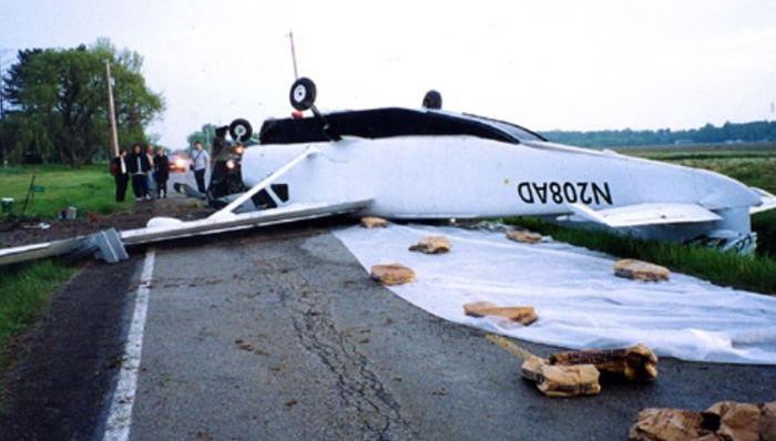
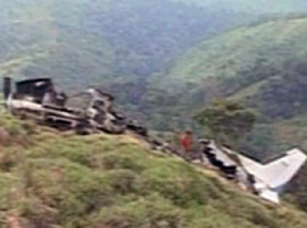
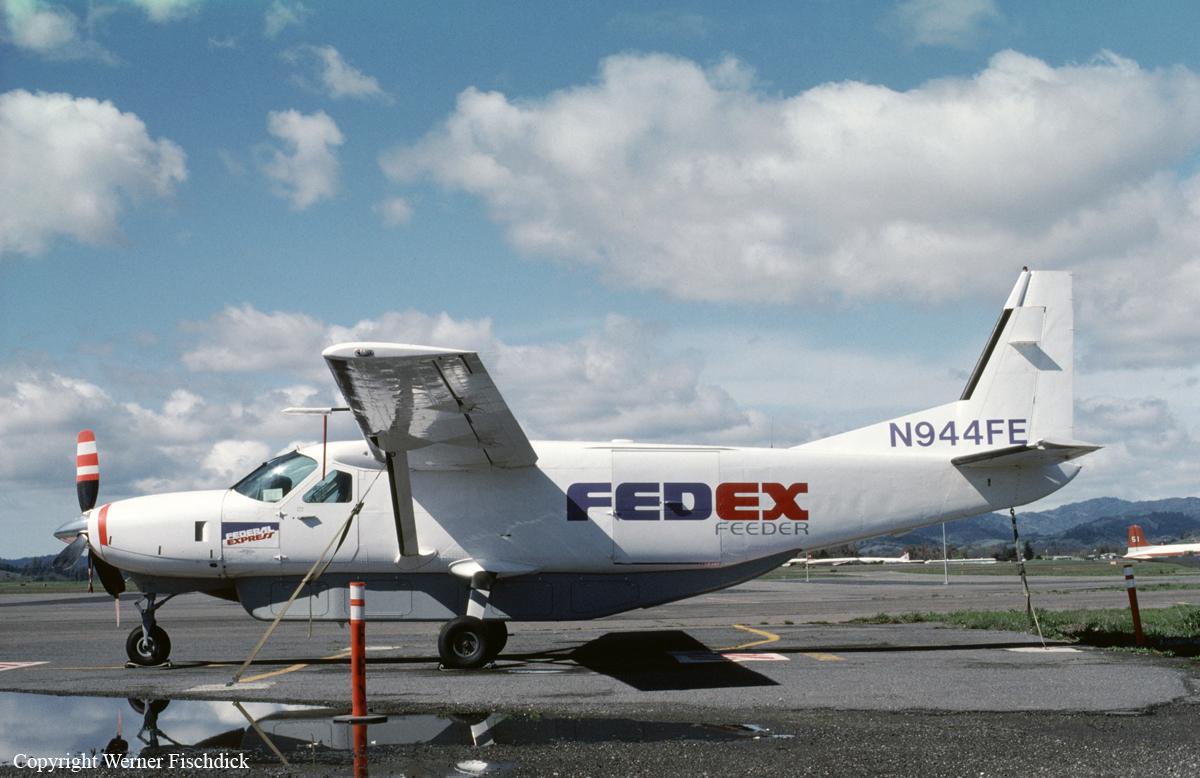
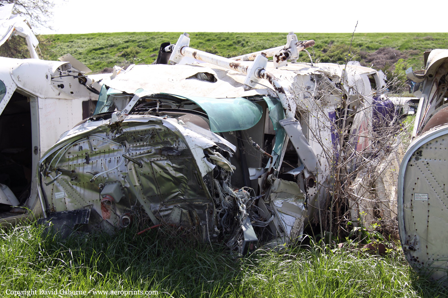
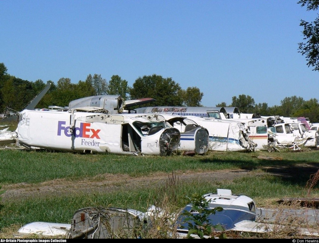
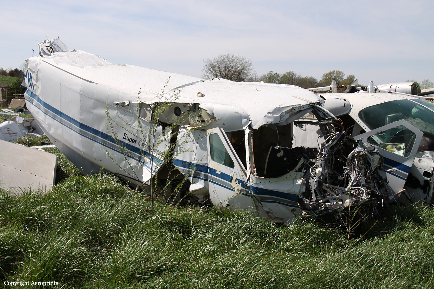
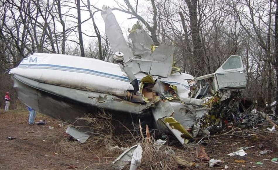
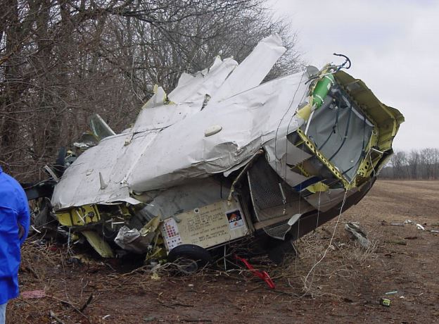
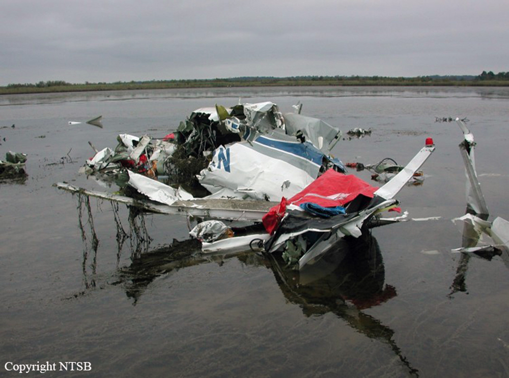
The airplane was destroyed by impact forces. There was no evidence of fire. Wreckage examinations and all recovered wreckage from the impact area revealed no evidence of an inflight collisionor breakup, or of external contact by a foreign object. An examination of the engine and the propeller indicated that the engine was producing power at impact. The recovered components showed no evidence of preexisting powerplant, system, or structural failures. Wreckage examinations showed crushing and bending consistent with a moderate angle of descent and a moderate right-wing-down attitude at impact. The amount of wreckage recovered indicates that all parts of the airplane were at the crash site. The wreckage was scattered over an area of about 600 feet. An examination of radar and airplane performance data indicated that the accident airplane initiated a descent from 3,000 feet immediately after the accident pilot was given a second traffic advisory by air traffic control. The pilot reported that the traffic was above him. At the time the pilot stated that he needed to deviate, data indicate that the accident airplane was in or entering an uncontrolled descent. Radar data indicated that, after departure from the airport, the closest identified airplane to the accident airplane was a DC-10, which was at an altitude of about 4,000 feet. The horizontal distance between the two airplanes was about 1.1 nautical miles, and the vertical distance between the airplanes was about 1,600 feet. The accident airplane was never in a location at which wake turbulence from the DC-10 would have intersected the Cessna's flightpath (behind and below the DC-10's flightpath). Given the relative positions of the accident airplane and the DC-10, wake turbulence was determined to not be a factor in this accident. Although the DC-10 was left of the position given to the pilot by Mobile Terminal Radar Approach Control, air traffic controllers do not have strict angular limits when providing traffic guidance. The Safety Board's airplane performance simulation showed that, beginning about 15 seconds before the time of the pilot's last transmission ("I needed to deviate, I needed to deviate"), his view of the DC-10 moved diagonally across the windscreen from his left to straight in front of the Cessna while tripling in size. The airplane performance simulation also indicated that the airplane experienced high bank and pitch angles shortly after the pilot stated, "I needed to deviate" (about 13 seconds after the transmission, the simulation showed the airplane rolling through 90° and continuing to roll to a peak of about 150° 3 seconds later) and that the airplane appeared to have nearly recovered from these extreme attitudes at impact. Performance data indicated that the airplane would had to have been structurally/aerodynamically intact to reach the point of ground impact from the point of inflight upset. There was no evidence of any other aircraft near the accident airplane or the DC-10 at the time of the accident. Soon after the accident, U.S. Coast Guard aircraft arrived at the accident scene. The meaning of the pilot's statement that he needed to deviate could not be determined. A review of air traffic control radar and transcripts revealed no evidence of pilot impairment or incapacitation before the onset of the descent and loss of control. A sound spectrum study conducted by the Safety Board found no evidence of loud noises during the pilot's last three radio transmissions but found that background noise increased, indicating that the cockpit area was still intact and that the airspeed was increasing. The study further determined that the overspeed warning had activated, which was consistent with the performance study and extreme fragmentation of the wreckage. Radar transponder data from the accident airplane were lost below 2,400 feet. The signal loss was likely caused by unusual attitudes, which can mask transponder antenna transmissions. A garbled transponder return recorded near the DC-10 was likely caused by the accident airplane's transponder returns masking the DC-10's returns (since the accident airplane was projected to be in line between the DC-10 and the ground radar) or by other environmental phenomena. Red transfer or scuff marks were observed on many pieces of the airplane wreckage, and these marks were concentrated on the lower airframe skin forward of the main landing gear and the nose landing gear area. The Safety Board and four laboratories compared the red-marked airplane pieces to samples of red-colored items found in the wreckage. These examinations determined that most of the red marks were caused by parts of the airplane, cargo, and items encountered during the wreckage recovery. The marks exhibited random directions of motion, and none of the marks exhibited evidence of an in-flight collision with another aircraft. A small piece of black, anodized aluminum found embedded in the left wing was subsequently identified as a fragment from a cockpit lighting dimmer. The accident occurred at night, with the moon obscured by low clouds. Instrument meteorological conditions prevailed, although visual conditions were reported between cloud layers. The terminal aerodrome forecast reported a possible cloud layer at 3,000 feet. Weather data and observations by the DC-10 pilot indicated that, after flying about 100 to 500 feet above the cloud layer and soon after sighting the DC-10, the accident airplane would have entered clouds. A number of conditions were present on the night of the accident that would have been conducive to spatial disorientation. For example, no visible horizon references existed between the cloud layers in which the pilot was flying because of the night conditions. In addition, to initiate a visual search and visually acquire the DC-10, varying degrees of eye and head movements would have accompanied the pilot's shifting of attention outside the cockpit. Once the DC-10 was visually acquired by the pilot, it would have existed as a light source moving against an otherwise featureless background, and its relative motion across and rising in the Cessna's windscreen could have been disorienting, especially if the pilot had fixated on it for any length of time. Maneuvering the airplane during this search would likely have compounded the pilot's resultant disorientation.
Probable cause:
The pilot's spatial disorientation, which resulted in loss of airplane control. Contributing to the accident was the night instrument meteorological conditions with variable cloud layers.
Final Report:

Crash of a Cessna 208B Super Cargomaster in Alma: 1 killed

Date & Time: Mar 15, 2002 at 0200 LT
Type of aircraft:
Operator:
Registration:
N228PA
Flight Phase:
Flight Type:
Survivors:
No
Schedule:
Minneapolis - Detroit
MSN:
208B-0049
YOM:
1987
Location:
Crew on board:
1
Crew fatalities:
Pax on board:
0
Pax fatalities:
Other fatalities:
Total fatalities:
1
Captain / Total flying hours:
3800
Captain / Total hours on type:
1500.00
Aircraft flight hours:
9942
Circumstances:
The pilot departed with the airplane contaminated with ice, into known severe icing conditions, and was unable to maintain altitude, subsequently impacting trees and terrain. Witnesses reported the accident airplane arrived at the departure airport contaminated with ice. Several witnesses stated they asked the pilot if he needed the airplane deiced prior to his next departure and the pilot stated he did not need any deice service. Several witnesses said they noticed the pilot chipping-off ice from the airplane prior to his departure. While en route the pilot reported the airplane had encountered icing conditions and he was unable to maintain altitude. Several thick pieces of ice were recovered around the accident site and one of the recovered ice pieces had a semicircular shaped edge that was consistent with a leading edge of an airfoil. No pre-impact anomalies were found with the leading edge de-ice boots that were installed on both wings, vertical and horizontal stabilizers, and wing struts. Federal Aviation Regulations state that all ice contamination shall be removed prior to flight. The Cessna 208B Pilot Operating Handbook indicates that continued flight into known icing conditions must be avoided.
Probable cause:
The pilot not removing the ice contamination from the airplane prior to departure and the pilot intentionally flying into known severe icing conditions, resulting in the aircraft not being able to maintain altitude/clearance from the terrain. Factors to the accident included the icing conditions and the trees encountered during the forced landing.
Final Report: