Country
code

Albay

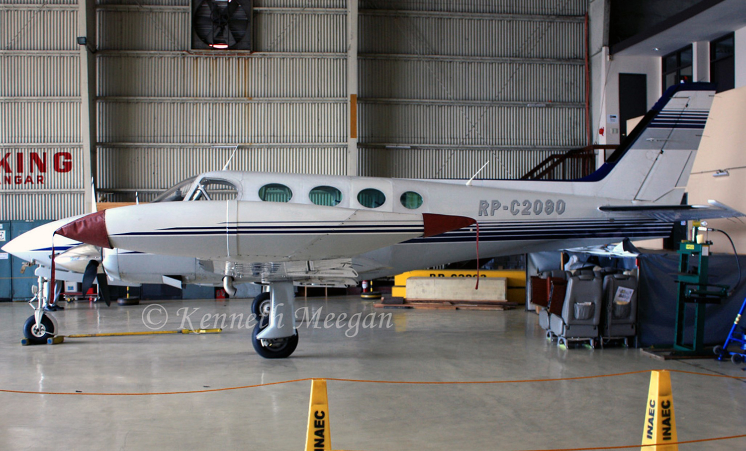
Crash of a Cessna 340A on Mt Mayon: 4 killed

Date & Time: Feb 18, 2023 at 0650 LT
Type of aircraft:
Operator:
Registration:
RP-C2080
Flight Phase:
Survivors:
No
Site:
Schedule:
Legazpi - Manila
MSN:
340A-0917
YOM:
1979
Location:
Country:
Region:
Crew on board:
2
Crew fatalities:
Pax on board:
2
Pax fatalities:
Other fatalities:
Total fatalities:
4
Circumstances:
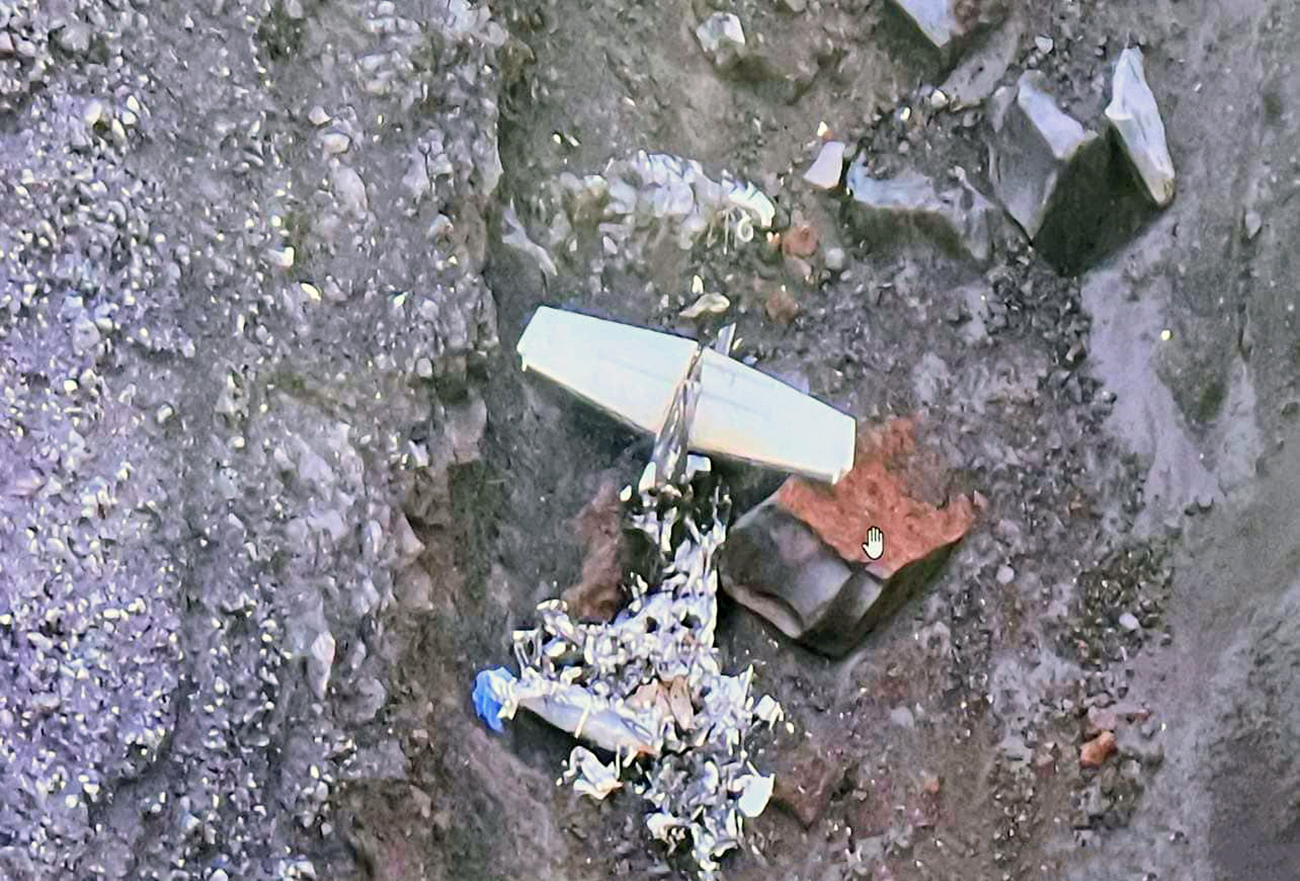
The flight was bound for Manila with one pilot, one aircraft mechanic, and two passengers on board. The aircraft was reported missing after it took off from Bicol International Airport (RPLK) at Daraga, Albay. The aircraft is being operated by the Energy Development Corporation (EDC) and was on a routine general aviation flight. All aircraft occupants were fatally injured in this accident. The pilot submitted a VFR to IRF flight plan that will utilize standard departure on RWY 05 of RPLK. According to the flight plan, it will be transitioning to IFR and intercepting NAGA VOR. It will further continue W9 airway and proceed to ALABAT for the arrival procedure in Manila. The flight departed from RWY 05, made a procedural right upwind turn, and crossed the final approach of RWY 05. At 0647LT, ATC established contact with the aircraft while passing 2,600 ft. The ATC inquired if the flight had already passed Camalig by-pass, and the pilot responded "We're passing Camalig by-pass now". The pilot was instructed by ATC to continue climbing and report twenty nautical miles out of RPLK, which was acknowledged by the pilot. At 0650LT, no position report was received from the aircraft. The ATC initiated contact with the aircraft several times, but no response was received. The duty ATC contacted the Manila Area Control Center (MACC) for any signatures of the aircraft that they might have picked up. The MACC informed the ATC that there was an initial signature contact that later disappeared on the radar monitor. At about 0900LT, the Philippine Aeronautical Rescue Coordinating Center (PARCC) elevated the alert to a DETRESFA on the missing aircraft. On the next day, February 19, 2023, the operator launched their own search operation using an AW139 helicopter, which was able to locate the missing aircraft at about 6,300 feet on the south-west slope of Mt Mayon Volcano with grid coordinates of 13°14'56.45 N and 123°40'57.79 E. An aerial reconnaissance by CAAP-AAIIB investigators and EDC using a helicopter was conducted on 20 February 2023. The general impact area shows the scattered wreckage of aircraft debris and signs of post-impact fire. All four occupants were killed.
Probable cause:
The pilot failed to follow the flight plan and made an unauthorized deviation. The pilot lack of situational awareness was considered as a contributing factor.
Final Report:
Crash of a Douglas DC-3A in Legazpi: 2 killed

Date & Time: Dec 16, 1965 at 1722 LT
Type of aircraft:
Operator:
Registration:
PI-C856
Survivors:
Yes
Schedule:
Manila – Legazpi
Flight number:
AM101
Location:
Country:
Region:
Crew on board:
3
Crew fatalities:
Pax on board:
18
Pax fatalities:
Other fatalities:
Total fatalities:
2
Captain / Total flying hours:
1957
Captain / Total hours on type:
1256.00
Copilot / Total flying hours:
2596
Copilot / Total hours on type:
709
Circumstances:
Flight AM101 was a scheduled domestic flight from Manila to Legaspi. It took off from Manila International Airport at 1505 hours. At 1640 hours it established initial contact with Legaspi Radio, reported 7 minutes north-west of the field and requested weather and landing information. Legaspi Radio transmitted the following information: 1600H surface wind 0400/8 kt, visibility 5 km clouds 6 oktas 450 metres, 8 oktas 2,100 metres; temperature 24°, dewpoint 24°, runway in use 06 QNH 29.81 inches. At 1707 hours the flight requested information regarding the traffic in the circuit and was informed that there was none. At 1715 hours the sound of an aircraft, presumably AM101, was heard south of the airport but the aircraft was hardly visible. At 1716 hours the flight inquired again about the present weather and the 1700 hours weather observation was passed to the aircraft. Subsequent inquiry about present visibility, wind direction and speed was made by the flight which was advised that the wind was 040 18 kt and the visibility approximately 4 km. At 1718 hours the flight was seen turning for a landing on Runway 24. The landing roll was described by witnesses as unusually fast after the aircraft made a two-wheel touchdown, tail wheel high approximately 300 m after the threshold of Runway 24. Before the tail wheel came into contact with the runway full power was applied and the aircraft was observed airborne. At approximately 200 ft altitude, it initiated a tight left turn, collided with the top of a tree and then hit a building located two miles southwest of Legaspi Airport. Both pilots were killed while all other occupants were injured.
Probable cause:
The Board determined that the probable cause of this accident was a power stall during a tight turn manoeuvre at too low an altitude from which successful recovery was impossible.
Final Report:

Crash of a Douglas OA-3 Dolphin off Legazpi

Date & Time: Jan 11, 1934
Type of aircraft:
Operator:
Registration:
32-286
Flight Phase:
Flight Type:
Survivors:
Yes
MSN:
1082
YOM:
1932
Location:
Country:
Region:
Crew on board:
0
Crew fatalities:
Pax on board:
0
Pax fatalities:
Other fatalities:
Total fatalities:
0
Circumstances:
The float plane crashed in unknown circumstances while taking off from the Legazpi harbor. There were no casualties.