code

AK

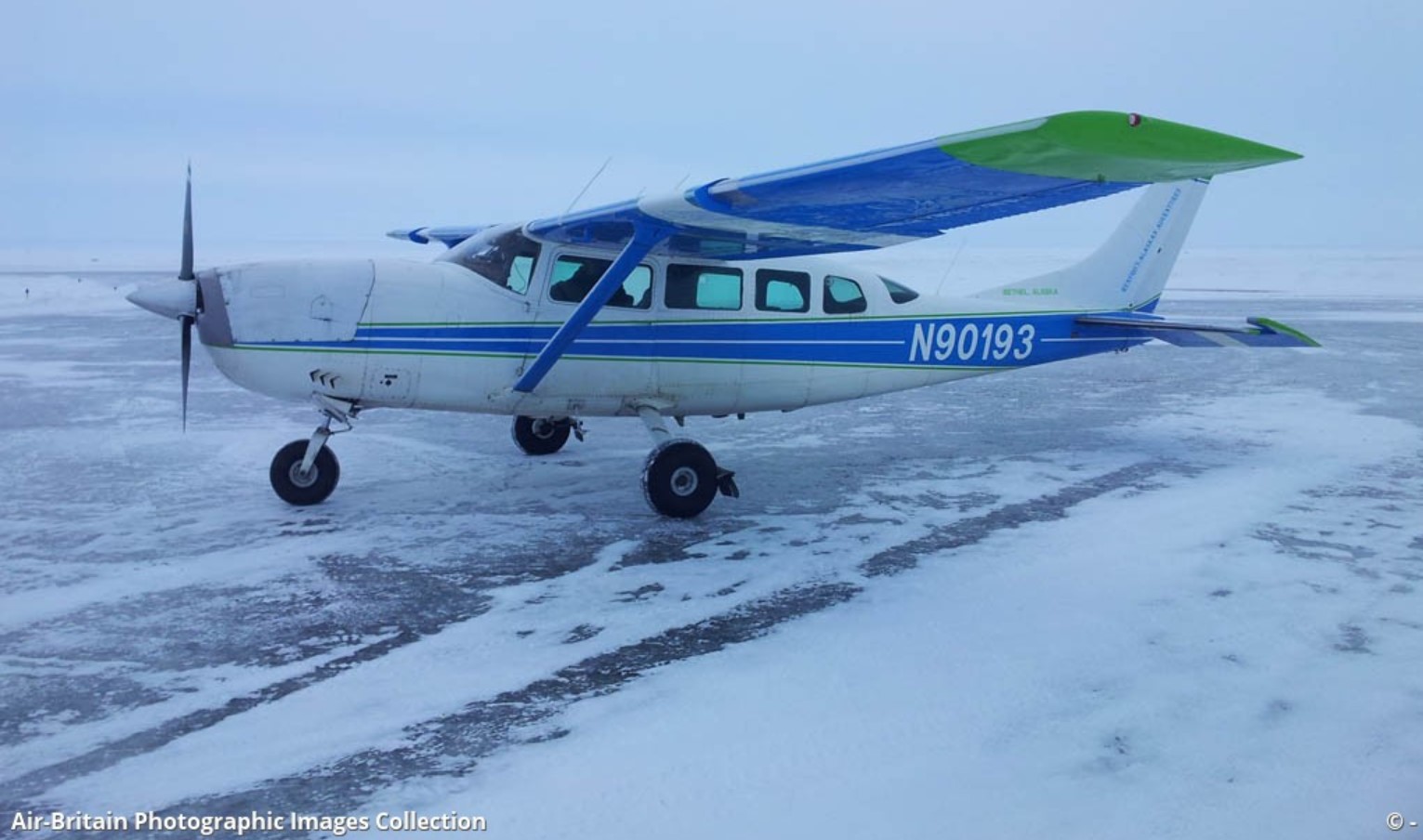
Crash of a Cessna 207 Skywagon in Saint Mary's: 4 killed

Date & Time: Sep 15, 2024 at 2200 LT
Operator:
Registration:
N90193
Survivors:
No
Schedule:
Bethel - Saint Mary's
MSN:
207-0007
YOM:
1969
Crew on board:
1
Crew fatalities:
Pax on board:
3
Pax fatalities:
Other fatalities:
Total fatalities:
4
Circumstances:
The approach to Saint Mary's Airport was initiated in marginal weather conditions. On short final, the single engine airplane crashed about 800 metres short of runway and was destroyed. All four occupants were killed. The airplane was completing a taxi flight from Bethel.

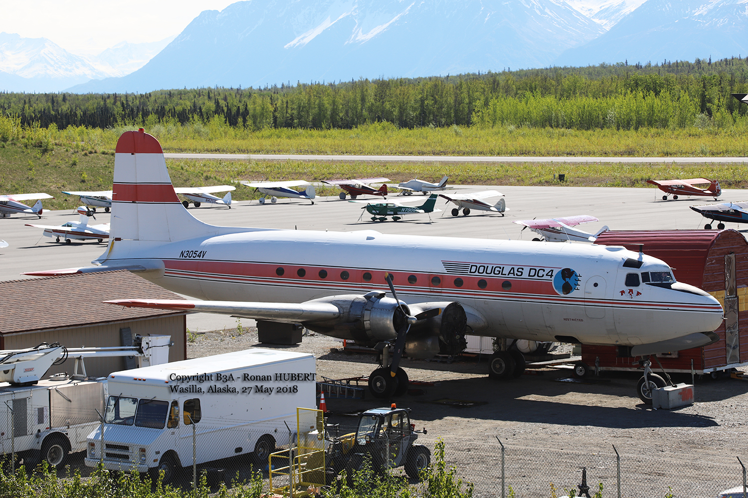
Crash of a Douglas C-54D-DC Skymaster in Fairbanks: 2 killed

Date & Time: Apr 23, 2024 at 1001 LT
Type of aircraft:
Operator:
Registration:
N3054V
Flight Phase:
Flight Type:
Survivors:
No
MSN:
10547
YOM:
1945
Crew on board:
2
Crew fatalities:
Pax on board:
0
Pax fatalities:
Other fatalities:
Total fatalities:
2
Circumstances:
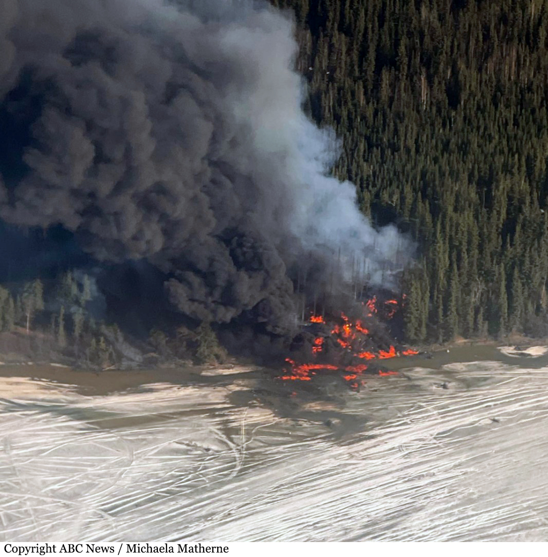
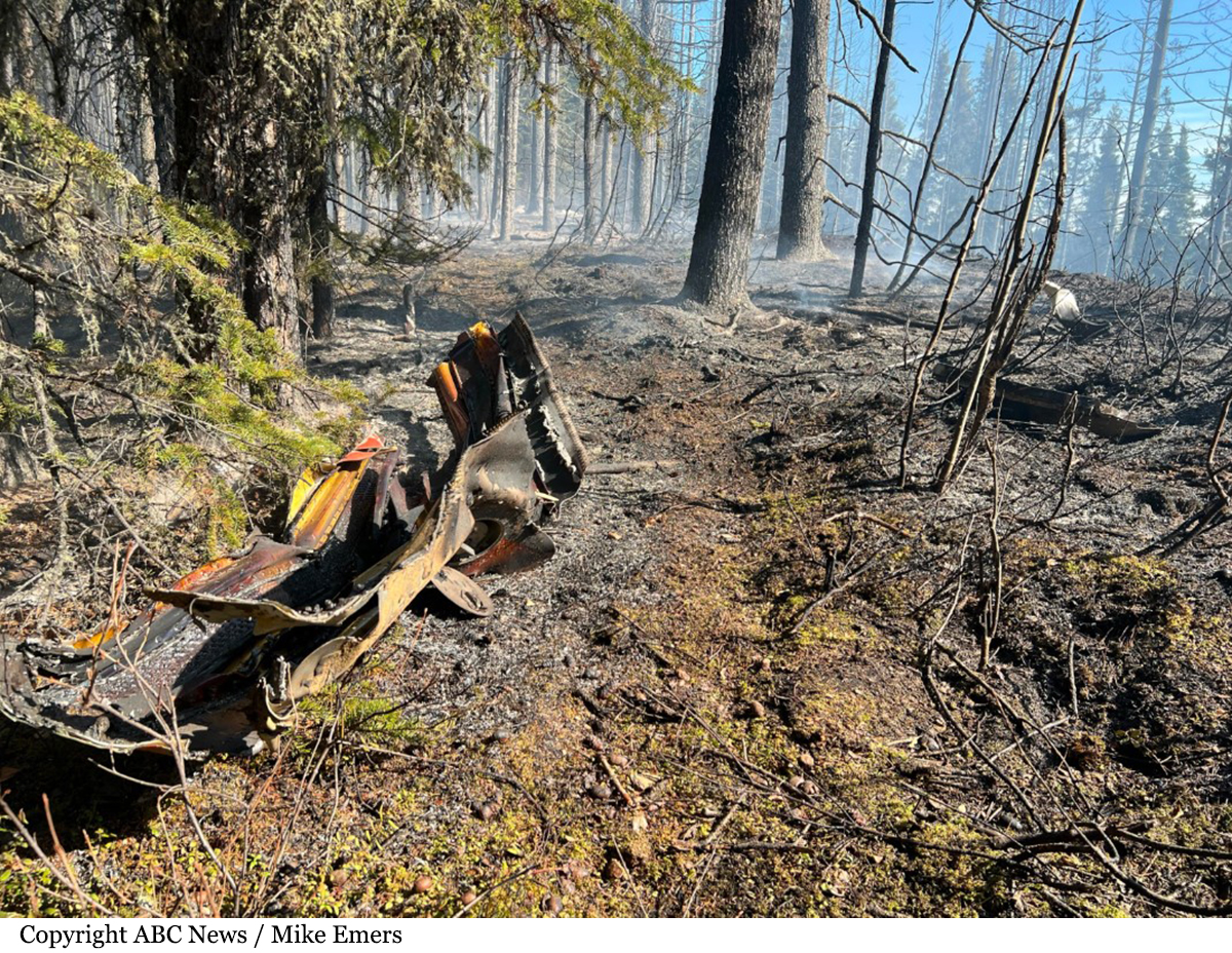
After takeoff from runway 20R at Fairbanks Airport, the airplane climbed to the altitude of about 1,700 feet when it rolled to the left. It entered an uncontrolled descent until it crashed in a huge explosion on the south bank of the Tanana River. The airplane was destroyed by impact forces and a post crash fire and both crew members were killed. The accident occurred about six minutes after takeoff, apparently following the explosion of one of both left engines.

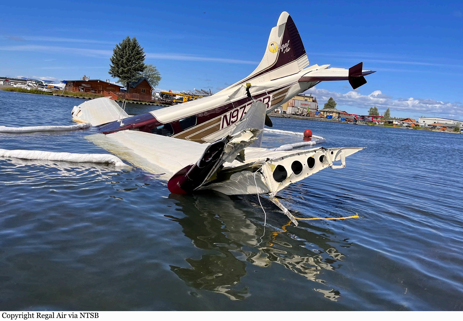
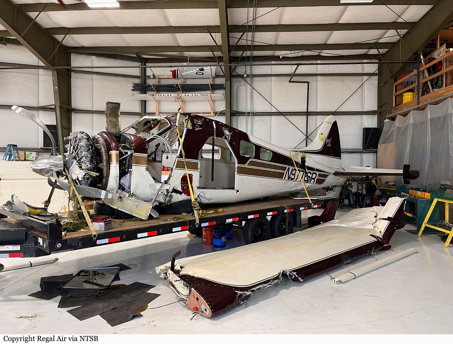
Crash of a De Havilland DHC-2 Beaver I in Anchorage

Date & Time: Jul 26, 2022 at 0915 LT
Type of aircraft:
Operator:
Registration:
N9776R
Flight Phase:
Survivors:
Yes
Schedule:
Anchorage - King Salmon
MSN:
1126
YOM:
1957
Crew on board:
1
Crew fatalities:
Pax on board:
6
Pax fatalities:
Other fatalities:
Total fatalities:
0
Captain / Total flying hours:
1709
Captain / Total hours on type:
142.00
Aircraft flight hours:
16072
Circumstances:
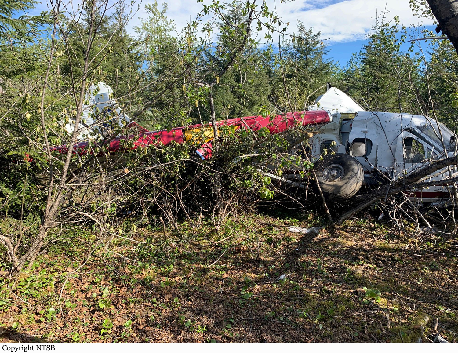
The pilot reported that, he was departing in the float-equipped airplane in strong gusty wind conditions. After accelerating on the water for about 3 seconds, the airplane suddenly became airborne and crabbed into the wind about 60° to 90° from the intended takeoff path and started to climb as it continued to track away from the intended flight path. As the climb continued, the airplane stalled and impacted the water in a nose low attitude which resulted in substantial damage to the wings and fuselage. The pilot reported that there were no preaccident mechanical malfunctions or anomalies that would have precluded normal operation.
Probable cause:
The pilot’s failure to maintain directional control during takeoff in gusting wind conditions which resulted in the wing exceeding its critical angle of attack, a loss of control and impact with the water.
Final Report:

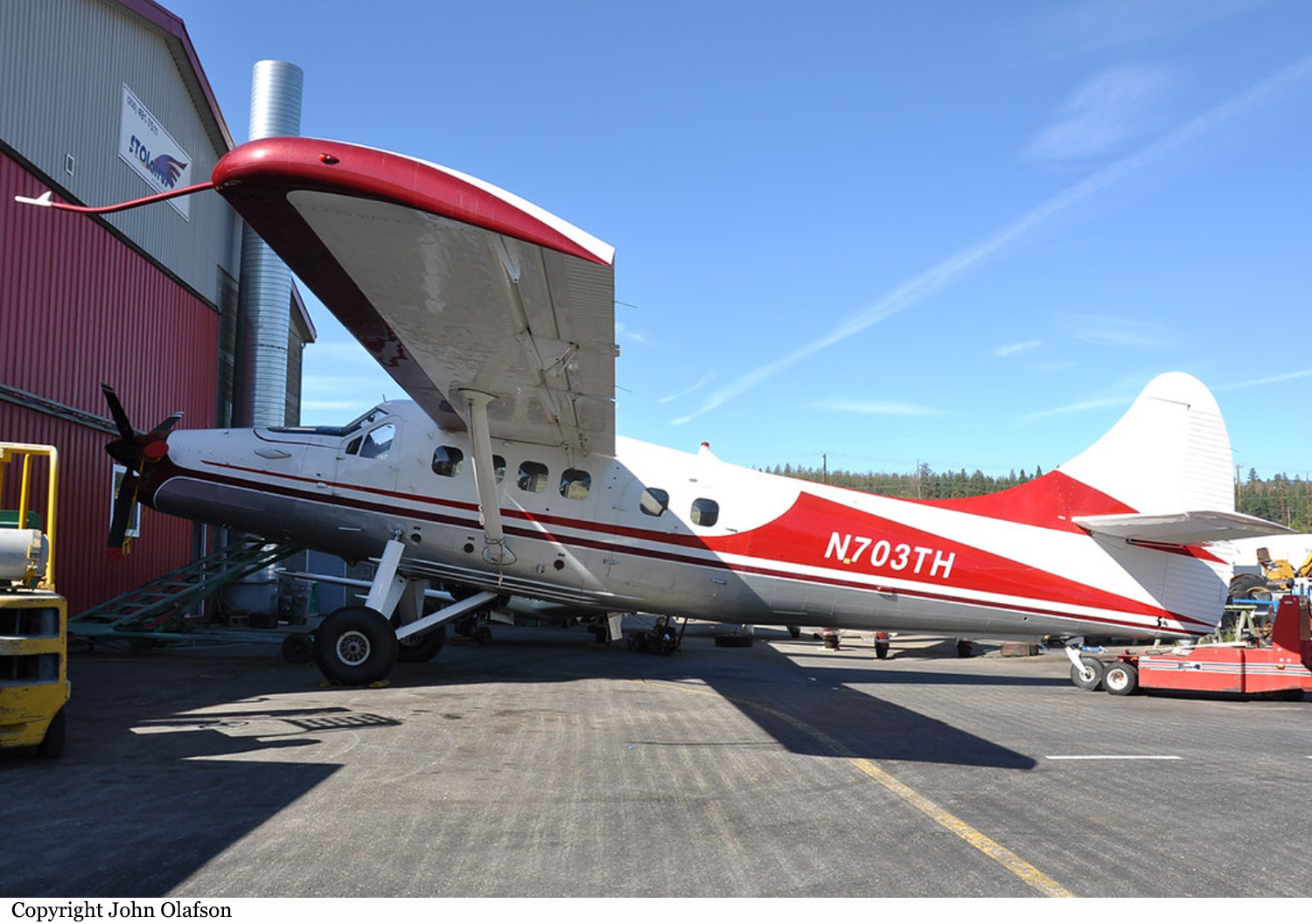
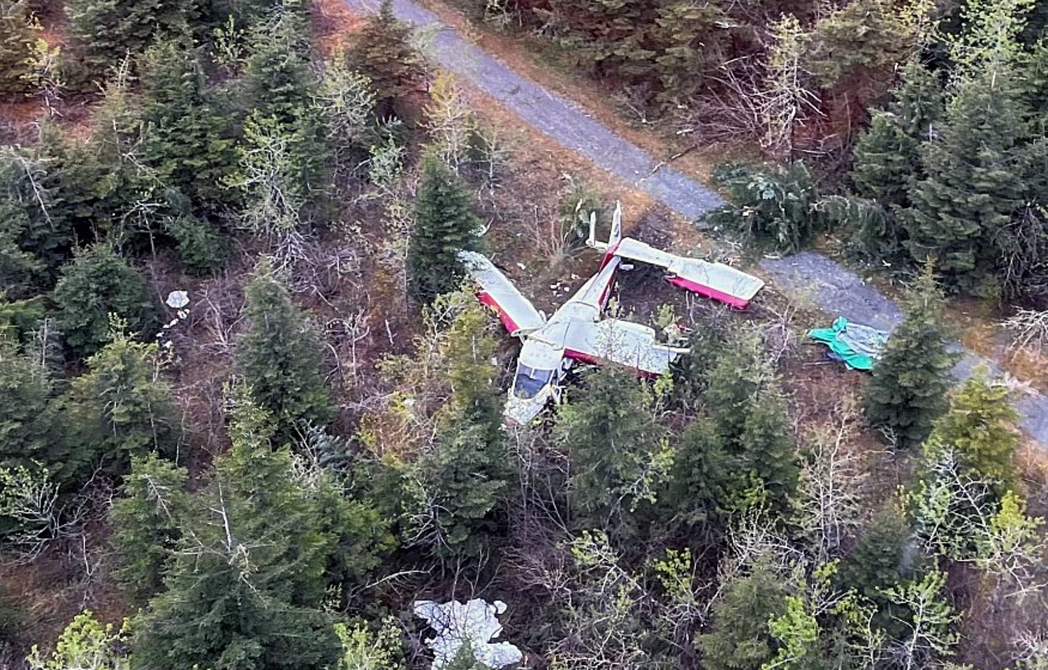
Crash of a De Havilland DHC-3 Otter in Dry Bay

Date & Time: May 24, 2022 at 1510 LT
Type of aircraft:
Operator:
Registration:
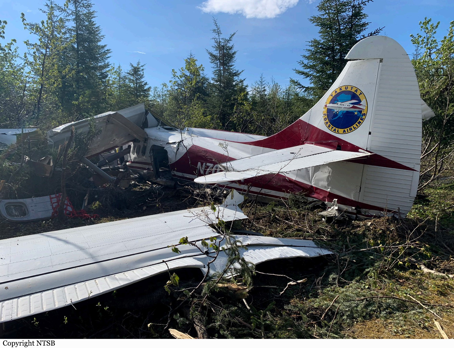
N703TH
Survivors:
Yes
Schedule:
Yakutat – Dry Bay
MSN:
456
YOM:
1965
Location:
Crew on board:
1
Crew fatalities:
Pax on board:
3
Pax fatalities:
Other fatalities:
Total fatalities:
0
Captain / Total flying hours:
24000
Captain / Total hours on type:
6100.00
Circumstances:
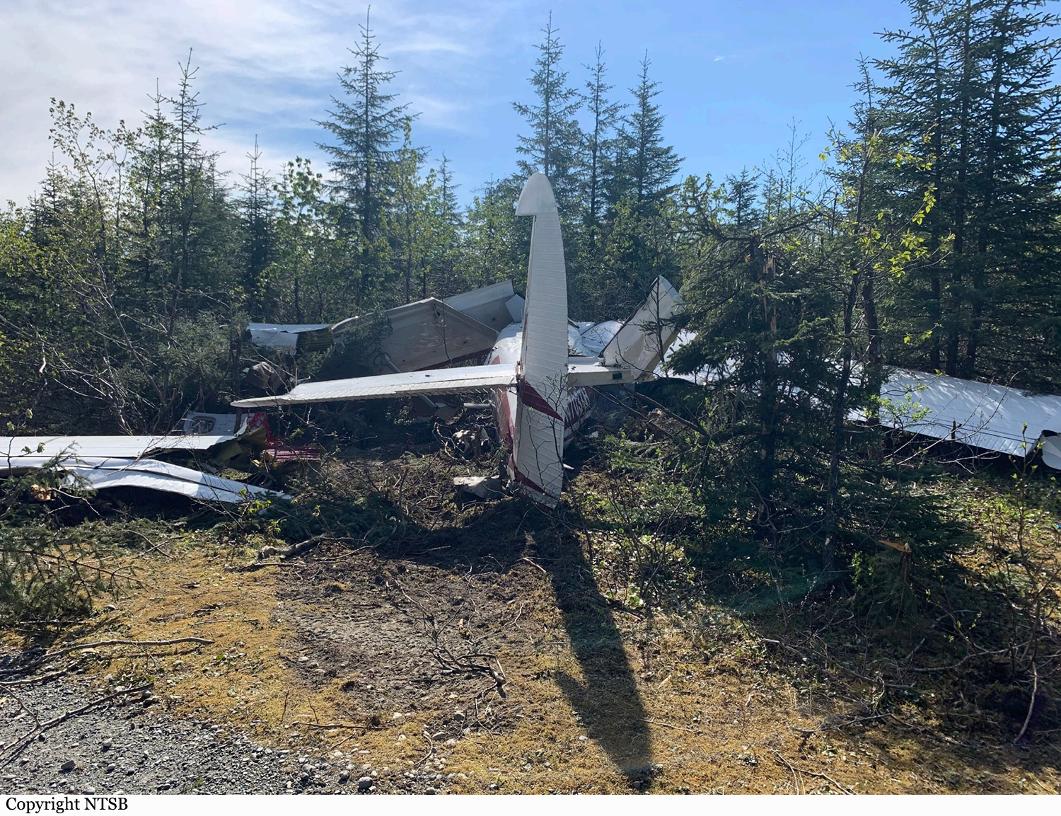
The purpose of the flight was to transport three passengers and cargo. The pilot reported that, during takeoff, the airplane’s tail came up slightly lowered to the runway when he attempted to raise the tail by applying forward elevator. He stated that he thought this was unusual and attributed it to an aft-loaded airplane. He applied additional nose-down trim and departed without incident. While en route, the tail of the airplane seemed to move up and down, which the pilot attributed to turbulence. Upon arrival at his destination, the pilot entered a left downwind, reduced the power and extended the flaps to 10° abeam the end of the runway. He turned onto the base leg about ½ mile from the approach end of the runway and slowed the airplane to 80 mph. Turning final, he noticed the airplane seemed to pitch up, so he applied full nose-down pitch trim and extended the flaps an additional 10°. On short final he applied full flaps, and the airplane abruptly pitched up to about a 45° angle. He stated that he applied full nose-down elevator, verified the pitch trim, and reduced the power to idle. When the airplane was about 300 ft above ground level, the airplane stalled, the left wing dropped slightly, and the airplane entered about a 45° nose-down dive. After allowing the airplane to gain airspeed, the pilot applied full back elevator. The airplane impacted forested terrain near the approach end of runway 23 at an elevation of about 18 ft. A postaccident examination of the airframe and engine revealed no evidence of preaccident mechanical malfunctions or failures that would have precluded normal operation. Elevator and rudder control continuity was confirmed from the cockpit to the respective control surfaces. The airplane's estimated gross weight at the time of the accident was about 7,796 lbs and the airplane's estimated center of gravity was about 3.2 to 5.6 inches beyond the approved aft limit. Maximum gross weight for the airplane is 8,000 lbs.
Probable cause:
The pilot’s failure to determine the actual weight and balance of the airplane before departure, which resulted in the airplane being operated outside of the aft center of gravity limits and the subsequent aerodynamic stall on final approach. Contributing to the accident was the Federal Aviation Administration's failure to require weight and balance documentation for 14 Code of Federal Regulations Part 135 single-engine operations.
Final Report:

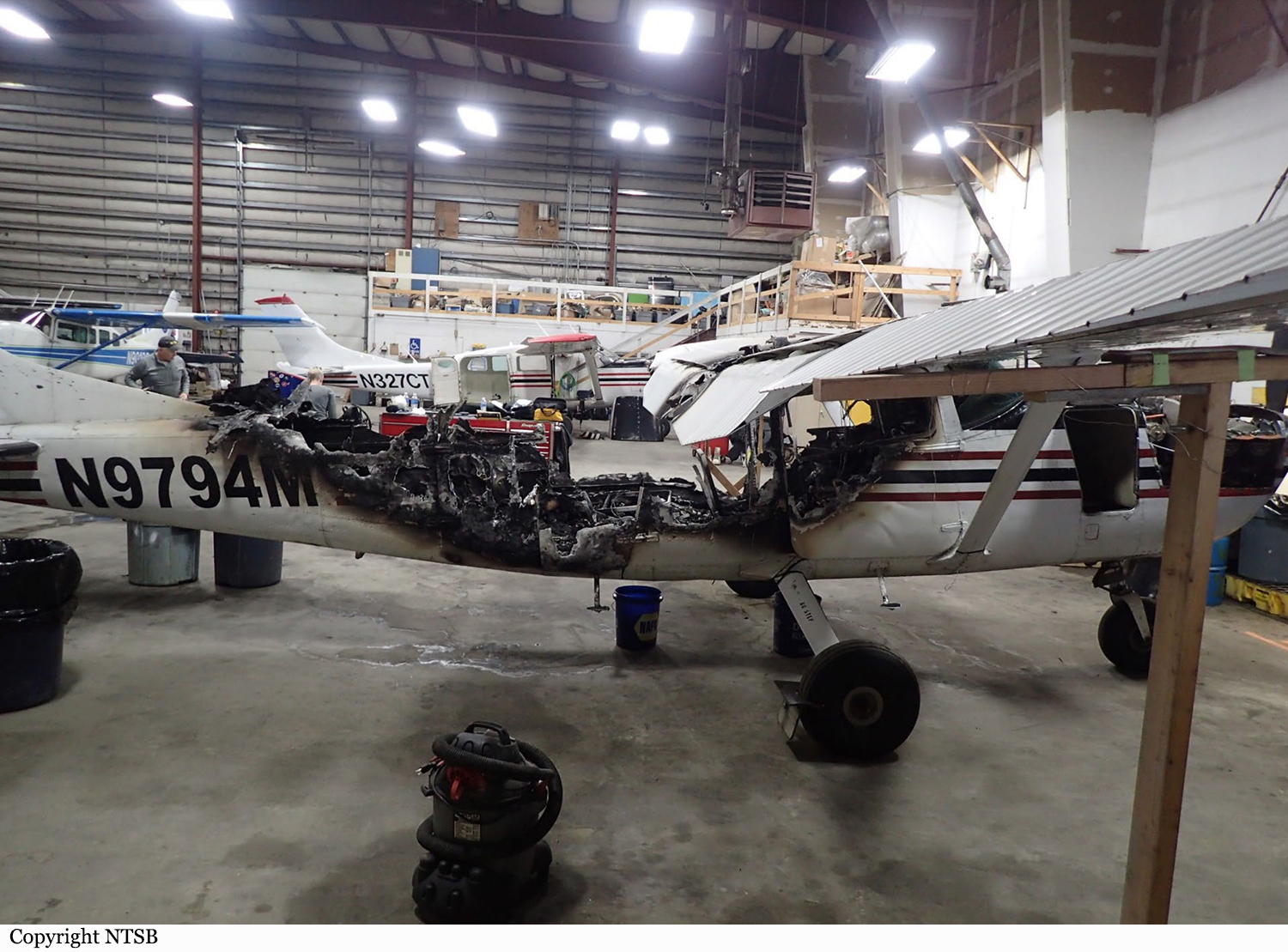
Crash of a Cessna 207 Stationair 8 in Bethel

Date & Time: Nov 20, 2021 at 1755 LT
Operator:
Registration:
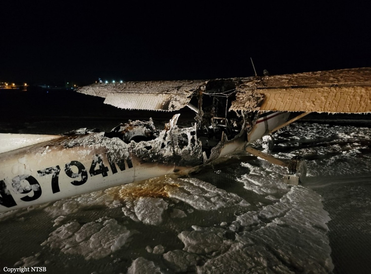
N9794M
Survivors:
Yes
Schedule:
Bethel – Kwethluk
MSN:
207-0730
YOM:
1981
Location:
Crew on board:
1
Crew fatalities:
Pax on board:
5
Pax fatalities:
Other fatalities:
Total fatalities:
0
Captain / Total flying hours:
1480
Captain / Total hours on type:
659.00
Aircraft flight hours:
15727
Circumstances:
The pilot was conducting a scheduled air taxi flight with five passengers onboard. Shortly after departure, the pilot began to smell an electrical burn odor, and he elected to return to the airport. About 1 minute later, the electrical burn smell intensified, which was followed by visible smoke in the cockpit, and the pilot declared an emergency to the tower. After landing and all the passengers had safely departed the airplane, heavy smoke filled the cockpit and passenger compartment, and the pilot saw a candle-like flame just behind the pilot and co-pilot seats, just beneath the floorboards of the airplane. Moments later, the airplane was engulfed in flames. Postaccident examination of the airframe revealed the origin of the fire to be centered behind the pilot’s row of seats, where a wire harness was found improperly installed on top of the aft fuel line from the left tank. Examination of the wire harness found a range of thermal and electrical damage consistent with chafing from the fuel line. It is likely that the installation of the wire harness permitted contact with the fuel line, which resulted in chafing, arcing, and the subsequent fire.
Probable cause:
The improper installation of an avionics wire harness over a fuel line, which resulted in chafing of the wire harness, arcing, and a subsequent fire.
Final Report:

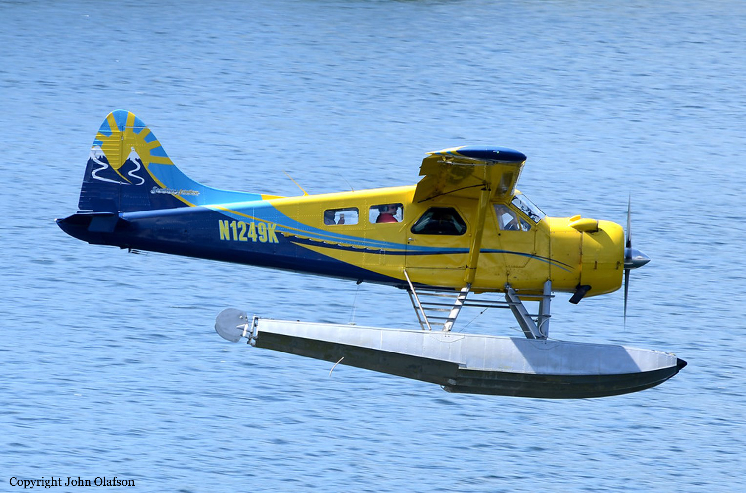
Crash of a De Havilland DHC-2 Beaver near Ketchikan: 6 killed

Date & Time: Aug 5, 2021 at 1050 LT
Type of aircraft:
Operator:
Registration:
N1249K
Flight Phase:
Survivors:
No
Site:
Schedule:
Ketchikan - Ketchikan
MSN:
1594
YOM:
1965
Crew on board:
1
Crew fatalities:
Pax on board:
5
Pax fatalities:
Other fatalities:
Total fatalities:
6
Captain / Total flying hours:
15552
Captain / Total hours on type:
8000.00
Aircraft flight hours:
15028
Circumstances:
The accident flight was the pilot’s second passenger sightseeing flight of the day that overflew remote inland fjords, coastal waterways, and mountainous, tree-covered terrain in the Misty Fjords National Monument. Limited information was available about the airplane’s flight track due to radar limitations, and the flight tracking information from the airplane only provided data in 1-minute intervals. The data indicated that the airplane was on the return leg of the flight and in the final minutes of flight, the pilot was flying on the right side of a valley. The airplane impacted mountainous terrain at 1,750 ft mean sea level (msl), about 250 ft below the summit. Examination of the wreckage revealed no evidence of pre accident failures or malfunctions that would have precluded normal operation. Damage to the propeller indicated that it was rotating and under power at the time of the accident. The orientation and distribution of the wreckage indicated that the airplane impacted a tree in a left-wing-low attitude, likely as the pilot was attempting to maneuver away from terrain. Review of weather information for the day of the accident revealed a conditionally unstable environment below 6,000 ft msl, which led to rain organizing in bands of shower activity. Satellite imagery depicted that one of these bands was moving northeastward across the accident site at the accident time. Federal Aviation Administration (FAA) weather cameras and local weather observations also indicated that lower visibility and mountain obscuration conditions were progressing northward across the accident area with time. Based on photographs recovered from passenger cell phones along with FAA weather camera imagery, the accident flight encountered mountain obscuration conditions, rain shower activity, and reduced visibilities and cloud ceilings, resulting in instrument meteorological conditions (IMC) before the impact with terrain. The pilot reviewed weather conditions before the first flight of the day; however, there was no indication that he obtained updated weather conditions or additional weather information before departing on the accident flight. Based on interviews, the accident pilot landed following the first flight of the day in lowering visibility, ceiling, and precipitation, and departed on the accident flight in precipitation, based on passenger photos. Therefore, the pilot had knowledge of the weather conditions that he could have encountered along the route of flight before departure. The operator had adequate policies and procedures in place for pilots regarding inadvertent encounters with IMC; however, the pilot’s training records indicated that he was signed off for cue-based training that did not occur. Cue-based training is intended to help calibrate pilots’ weather assessment and foster an ability to accurately assess and respond appropriately to cues associated with deteriorating weather. Had the pilot completed the training, it might have helped improve his decision-making skills to either cancel the flight before departure or turn around earlier in the flight. The operator’s lack of safety management protocols resulted in the pilot not receiving the required cue-based training, allowed him to continue operating air tours with minimal remedial training following a previous accident, and allowed the accident airplane to operate without a valid FAA registration. The operator was signatory to a voluntary local air tour operator’s group letter of agreement that was developed to improve the overall safety of flight operations in the area of the Misty Fjords National Monument. Participation was voluntary and not regulated by the FAA, and the investigation noted multiple instances in which the LOA policies were ignored, including on the accident flight. For example, the accident flight did not follow the standard Misty Fjords route outlined in the LOA nor did it comply with the recommended altitudes for flights into and out of the Misty Fjords. FAA inspectors providing oversight for the area reported that, when they addressed operators about disregarding the LOA, the operators would respond that the LOA was voluntary and that they did not need to follow the guidance. The FAA’s reliance on voluntary compliance initiatives in the local air tour industry failed to produce compliance with safety initiatives or to reduce accidents in the Ketchikan region.
Probable cause:
The pilot’s decision to continue visual flight rules (VFR) flight into instrument meteorological conditions (IMC), which resulted in controlled flight into terrain. Contributing to the accident was the FAA’s reliance on voluntary compliance with the Ketchikan Operator’s Letter of Agreement.
Final Report:

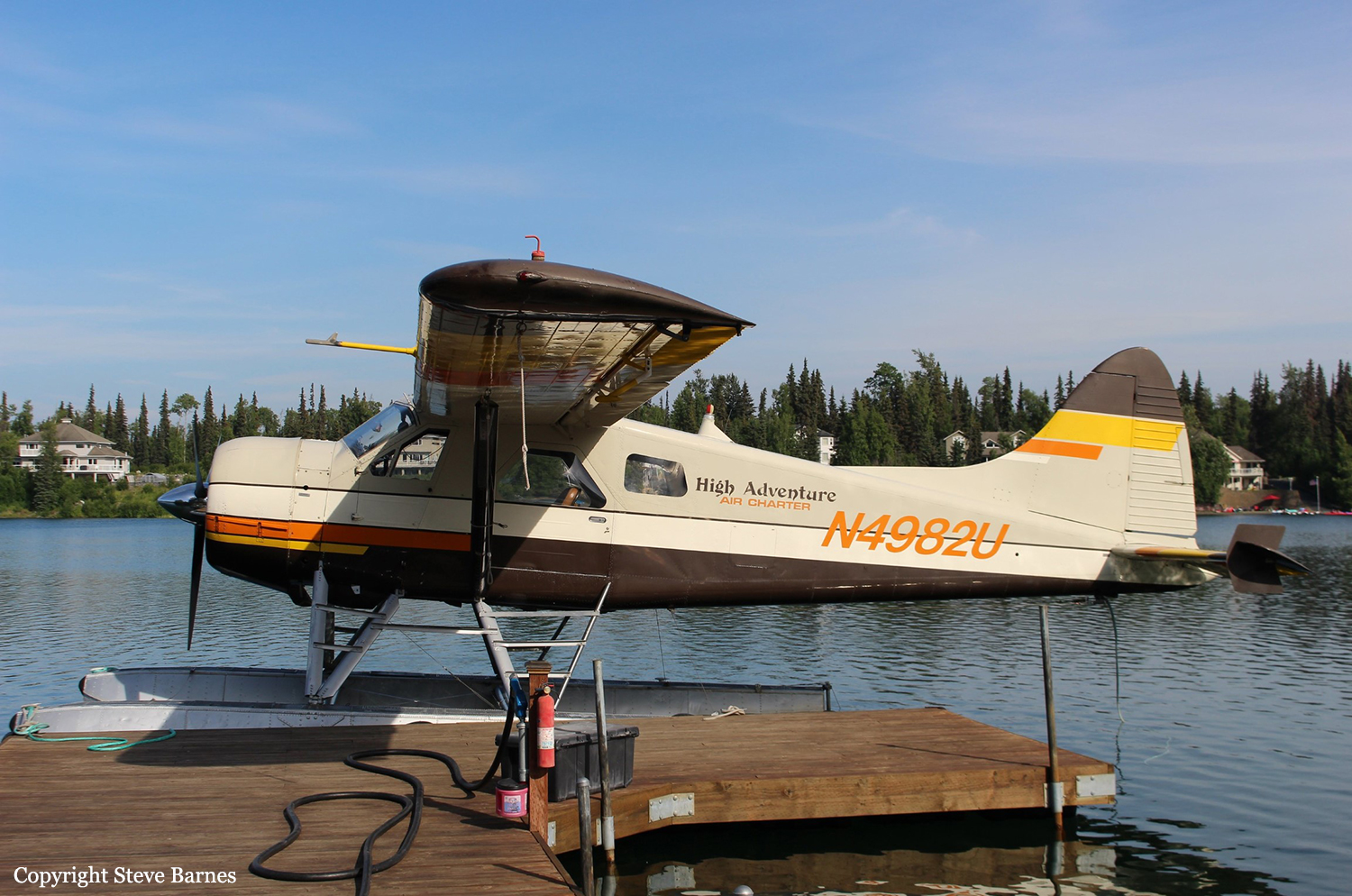
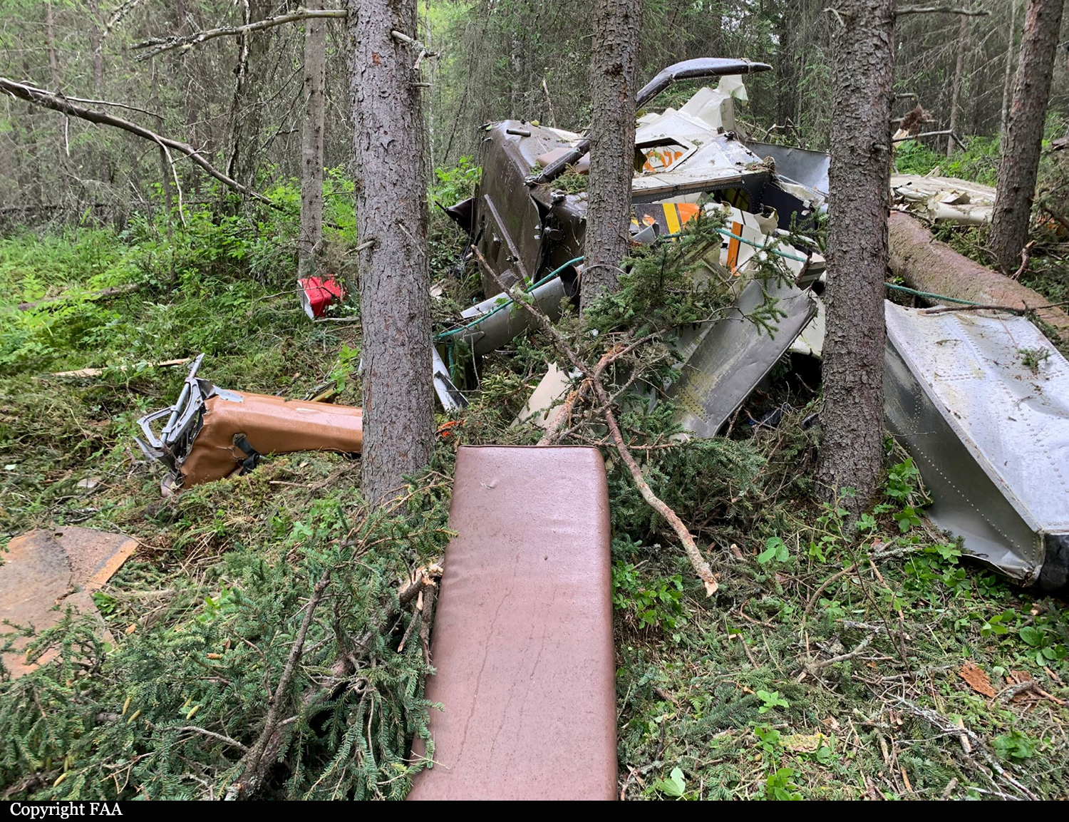
Crash of a De Havilland DHC-2 Beaver in Soldotna: 6 killed

Date & Time: Jul 31, 2020 at 0827 LT
Type of aircraft:
Operator:
Registration:
N4982U
Flight Phase:
Survivors:
No
MSN:
904
YOM:
1956
Location:
Crew on board:
1
Crew fatalities:
Pax on board:
5
Pax fatalities:
Other fatalities:
Total fatalities:
6
Captain / Total flying hours:
19530
Captain / Total hours on type:
13480.00
Aircraft flight hours:
23595
Circumstances:
On July 31, 2020, about 0827 Alaska daylight time, a de Havilland DHC-2 (Beaver) airplane, N4982U, and a Piper PA-12 airplane, N2587M, sustained substantial damage when they were involved in an accident near Soldotna, Alaska. The pilot of the PA-12 and the pilot and the five passengers on the DHC-2 were fatally injured. The DHC-2 was operated as a Title 14 Code of Federal Regulations (CFR) Part 135 on-demand charter flight. The PA-12 was operated as a Title 14 CFR Part 91 personal flight. The float-equipped DHC-2, operated by High Adventure Charter, departed Longmere Lake, near Soldotna, about 0824 bound for a remote lake on the west side of Cook Inlet. The purpose of the flight was to transport the passengers to a remote fishing location. The PA-12, operated by a private individual, departed Soldotna Airport, Soldotna, Alaska, (PASX) about 0824 bound for Fairbanks, Alaska. Flight track data revealed that the DHC-2 was traveling northwest about 78 knots (kts) groundspeed and gradually climbing through about 1,175 ft mean sea level (msl) when it crossed the Sterling Highway. The PA-12 was traveling northeast about 1,175 ft msl and about 71 kts north of, and parallel to, the Sterling Highway. The airplanes collided about 2.5 miles northeast of the Soldotna airport at an altitude of about 1,175 ft msl. A witness located near the accident site observed the DHC-2 traveling in a westerly direction and the PA-12 traveling in a northerly direction. He stated that the PA-12 impacted the DHC-2 on the left side of the fuselage toward the back of the airplane. After the collision, he observed what he believed to be the DHC-2's left wing separate, and the airplane entered an uncontrolled, descending counterclockwise spiral before it disappeared from view. He did not observe the PA-12 following the collision.
Probable cause:
The failure of both pilots to see and avoid the other airplane.
Contributing to the accident were:
1) the PA-12 pilot’s decision to fly with a known severe vision deficiency that had resulted in denial of his most recent application for medical certification and
2) the Federal Aviation Administration’s absence of a requirement for airborne traffic advisory systems with aural alerting among operators who carry passengers for hire.
Final Report:

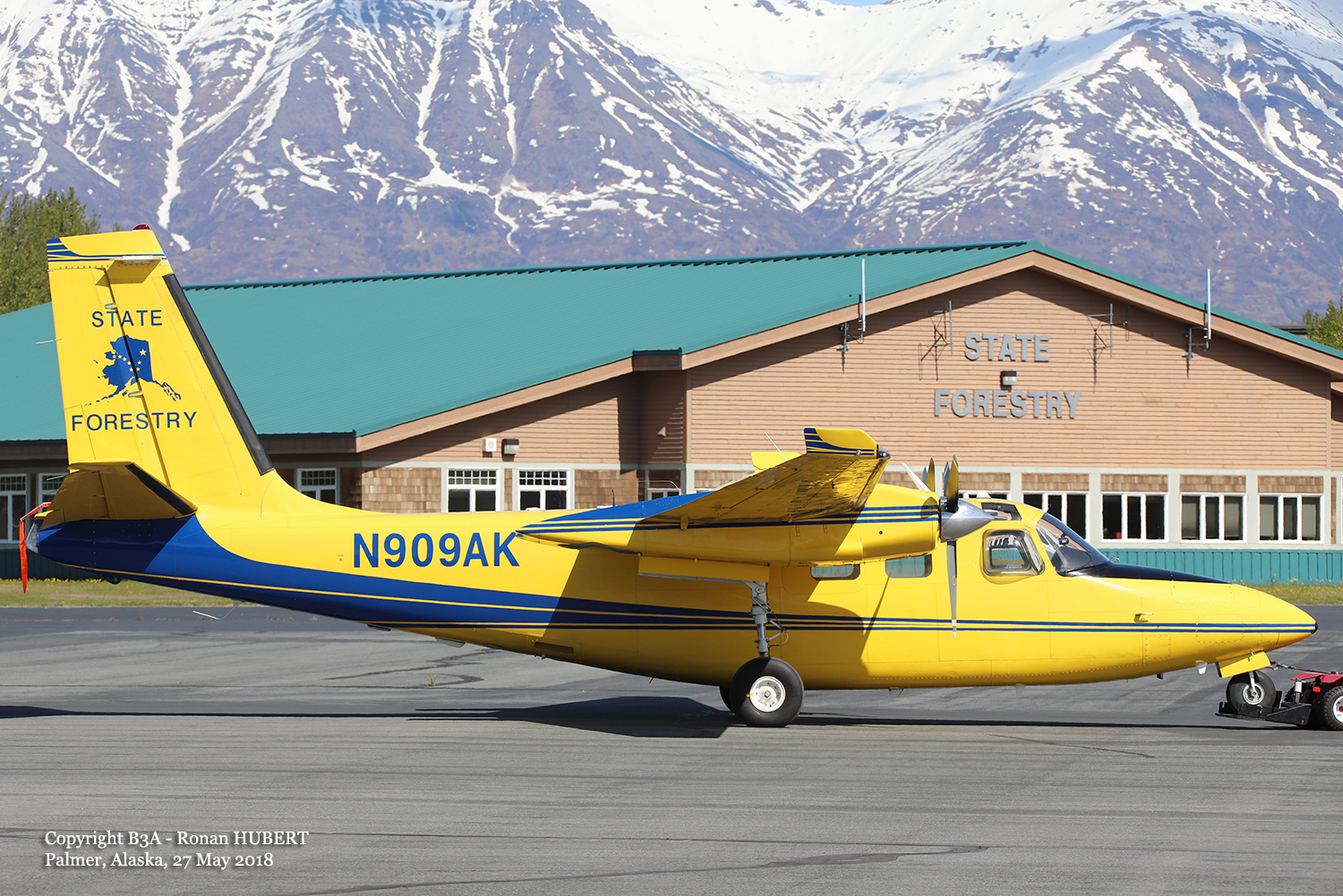
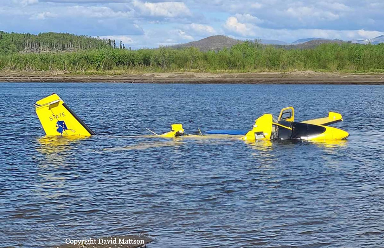
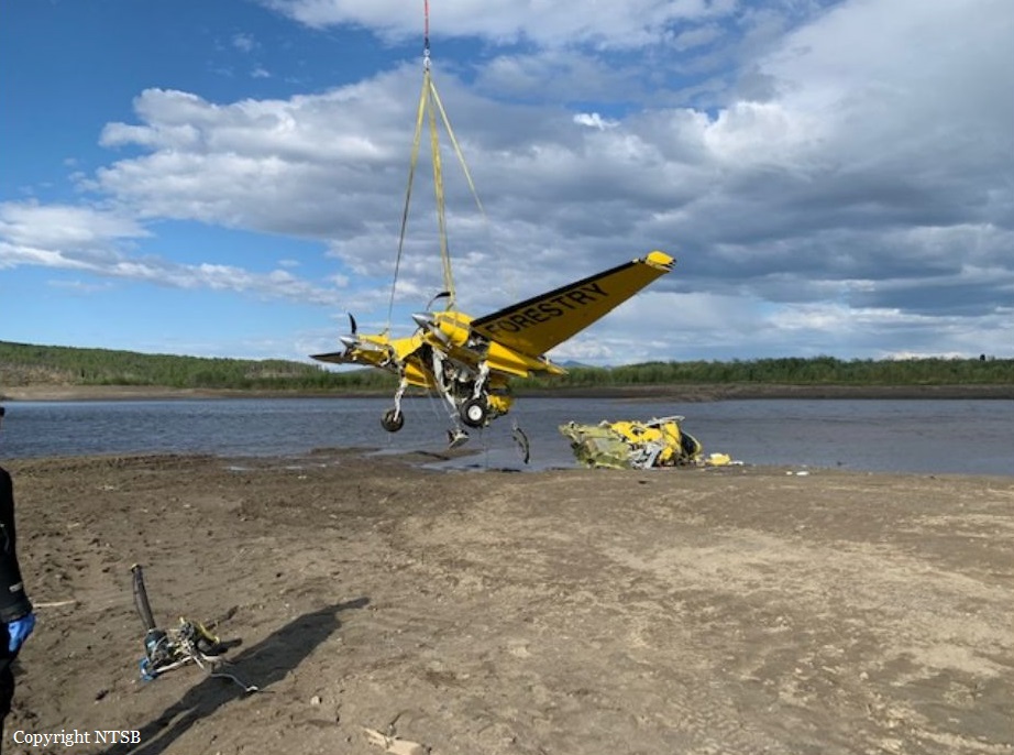
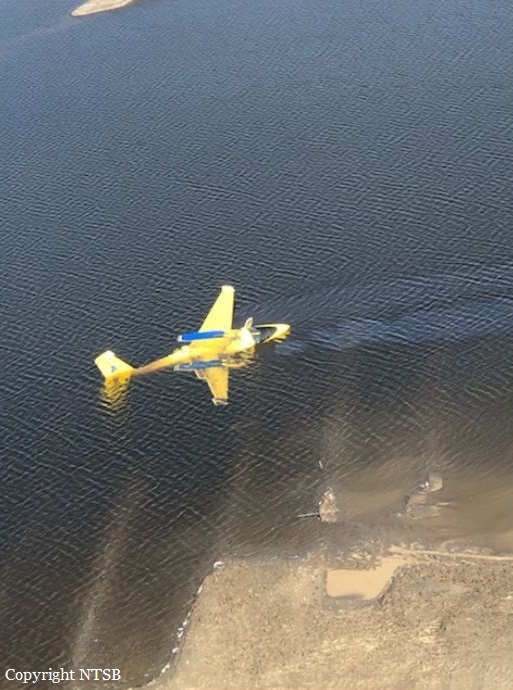
Crash of a Rockwell Shrike Commander 500S off Aniak

Date & Time: May 28, 2020 at 1600 LT
Operator:
Registration:
N909AK
Flight Phase:
Survivors:
Yes
Schedule:
Aniak - Aniak
MSN:
500-3232
YOM:
1975
Location:
Crew on board:
1
Crew fatalities:
Pax on board:
3
Pax fatalities:
Other fatalities:
Total fatalities:
0
Captain / Total flying hours:
4869
Captain / Total hours on type:
30.00
Aircraft flight hours:
6966
Circumstances:
On May 28, 2020, about 1600 Alaska daylight time, an Aero Commander 500S airplane, N909AK sustained substantial damage when it was involved in an accident near Aniak, Alaska. The pilot and three passengers sustained serious injuries. The airplane was operated as a Title 14 Code of Federal Regulations Part 91 public aircraft flight. The airplane was owned by the State of Alaska and operated by the Division of Forestry. According to the pilot, after arriving in Aniak, he had the local fuel vendor's ground service personnel refuel the airplane. He then signed the fuel receipt, and he returned to the airplane's cockpit to complete some paperwork before departure. Once the paperwork was complete, he then loaded his passengers, started the airplane's engines, and taxied to Runway 29 for departure. The pilot said that shortly after takeoff, and during initial climb, he initially noticed what he thought was mechanical turbulence followed by a reduction in climb performance, and the airplane's engines began to lose power. Unable to maintain altitude and while descending about 400 ft per minute, he selected an area of shallow water covered terrain as an off-airport landing site. The airplane sustained substantial damage during the landing. The fueler reported that he was unfamiliar with the airplane, so he queried the pilot as to where he should attach the grounding strap and the location of the fuel filler port. Before starting to refuel the airplane, he asked the pilot "do you want Prist with your Jet" to which the pilot responded that he did not. After completing the refueling process, he returned to his truck, wrote "Jet A" in the meter readings section of the prepared receipt, and presented it to the pilot for his signature. The pilot signed the receipt and was provided a copy. The fueler stated that he later added "no Prist" to his copy of the receipt, and that he did not see a fuel placard near the fueling port. A postaccident examination revealed that the reciprocating engine airplane had been inadvertently serviced with Jet A fuel. A slightly degraded placard near the fuel port on the top of the wing stated, in part: "FUEL 100/100LL MINIMUM GRADE AVIATION GASOLINE ONLY CAPACITY 159.6 US GALLONS."
Probable cause:
Loss of engine power after the aircraft has been refueled with an inappropriate fuel.
Final Report:

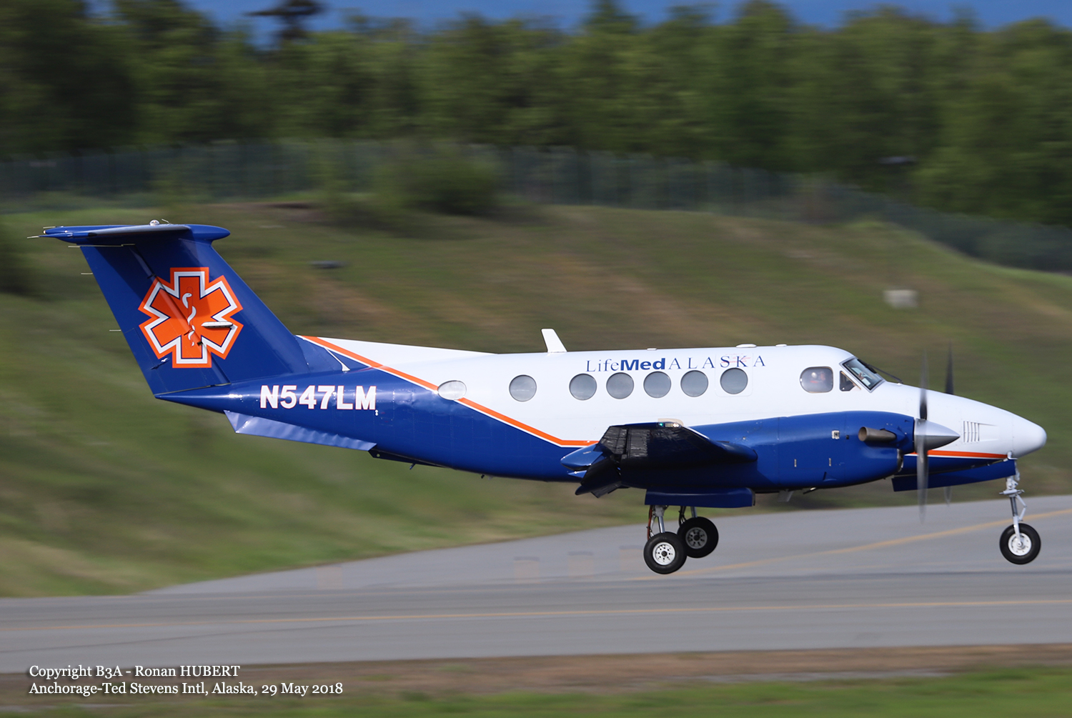
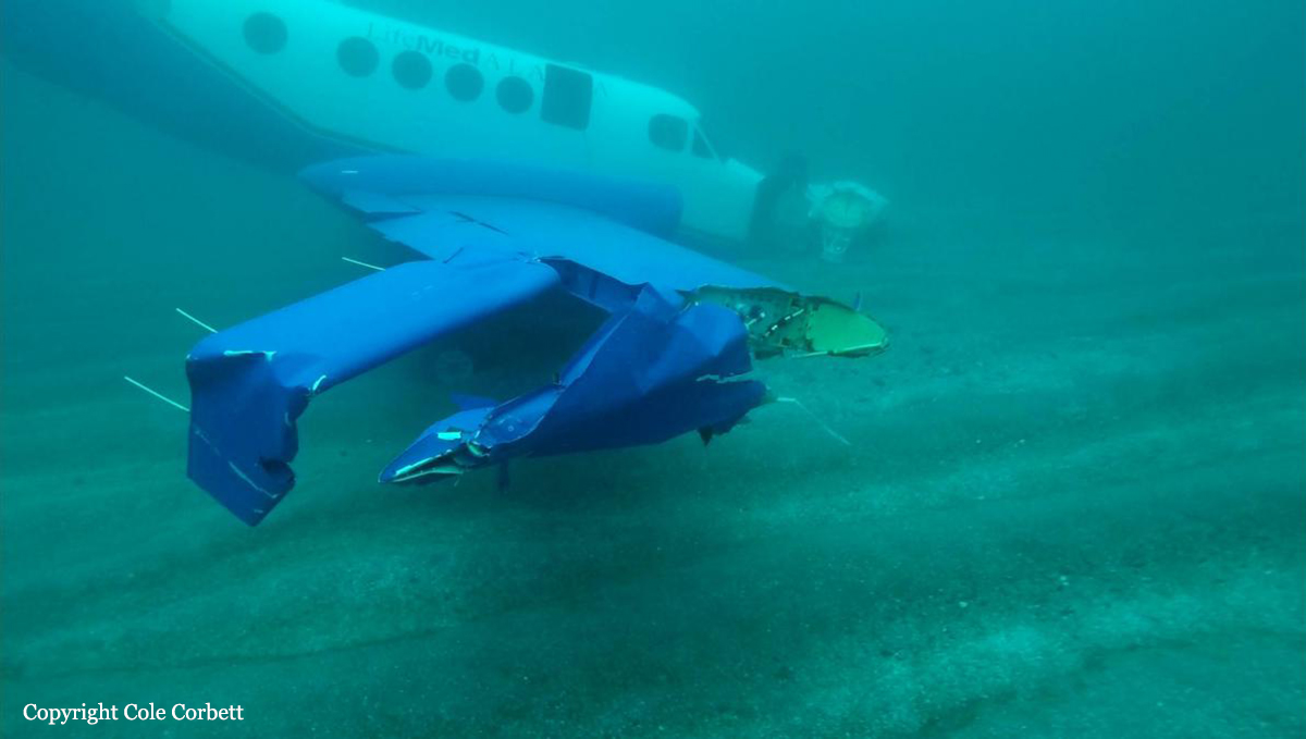
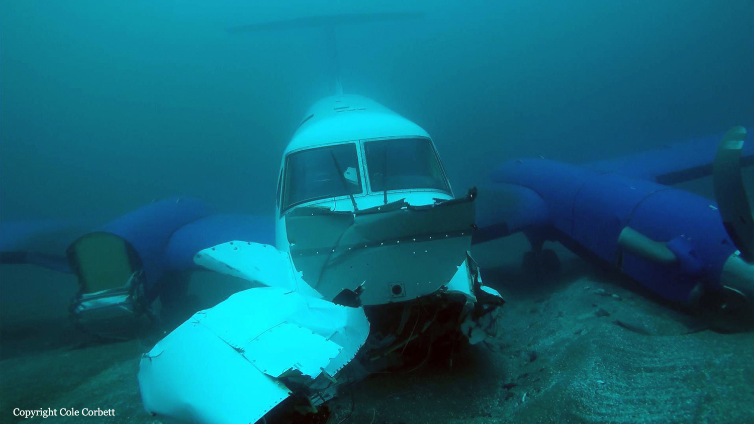
Crash of a Beechcraft B200 King Air off Dutch Harbor

Date & Time: Jan 16, 2020 at 0806 LT
Operator:
Registration:
N547LM
Flight Phase:
Flight Type:
Survivors:
Yes
Schedule:
Dutch Harbor - Adak
MSN:
BB-1642
YOM:
1998
Crew on board:
1
Crew fatalities:
Pax on board:
2
Pax fatalities:
Other fatalities:
Total fatalities:
0
Captain / Total flying hours:
6470
Captain / Total hours on type:
756.00
Aircraft flight hours:
7058
Circumstances:
According to the pilot, when the airplane’s airspeed reached about 90 knots during the takeoff roll, he applied back pressure to the control yoke to initiate the takeoff and noted a brief positive rate of climb followed by a sinking sensation. The airspeed rapidly decayed, and the stall warning horn sounded. To correct for the decaying airspeed, he lowered the nose then pulled back on the airplane’s control yoke and leveled the wings just before impacting the ocean. The pilot stated there were no pre accident mechanical malfunctions or anomalies that would have precluded normal operation. Wind about the time of the accident was recorded as 110º downwind of the airplane at 15 knots gusting to 28 knots. The passengers recalled that the pilot’s preflight briefing mentioned the downwind takeoff but included no discussion of the potential effect of the wind conditions on the takeoff. The airplane’s estimated gross weight at the time of the accident was about 769.6 pounds over its approved maximum gross weight, and the airplane’s estimated center of gravity was about 8.24 inches beyond the approved aft limit at its maximum gross weight. It is likely that the pilot’s decision to takeoff downwind and operate the airplane over the maximum gross weight with an aft center of gravity led to the aerodynamic stall during takeoff and loss of control. Downwind takeoffs result in higher groundspeeds and increase takeoff distance. While excessive aircraft weight increases the takeoff distance and stability, and an aft center of gravity decreases controllability. Several instances of the operator’s noncompliance with its operational procedures and risk mitigations were discovered during the investigation, including two overweight flights, inaccurate and missing information on aircraft flight logs, and the accident pilot’s failure to complete a flight risk assessment for the accident flight. The operator had a safety management system (SMS) in place at the time of the accident that required active monitoring of its systems and processes to ensure compliance with internal and external requirements. However, the discrepancies noted with several flights, including the accident flight, indicate that the operator’s SMS program was inadequate to actively monitor, identify, and mitigate hazards and deficiencies.
Probable cause:
The pilot’s improper decision to takeoff downwind and to load the airplane beyond its allowable gross weight and center of gravity limits, which resulted in an aerodynamic stall and loss of control. Contributing to the accident was the inadequacy of the operator’s safety management system to actively monitor, identify, and mitigate hazards and deficiencies.
Final Report:

Crash of a Piper PA-31-350 Navajo Chieftain near Cooper Landing: 3 killed

Date & Time: Nov 29, 2019 at 1911 LT
Operator:
Registration:
N4087G
Flight Phase:
Flight Type:
Survivors:
No
Site:
Schedule:
Anchorage – Seward
MSN:
31-8152127
YOM:
1981
Flight number:
SVX36
Crew on board:
1
Crew fatalities:
Pax on board:
2
Pax fatalities:
Other fatalities:
Total fatalities:
3
Captain / Total flying hours:
35000
Captain / Total hours on type:
1200.00
Aircraft flight hours:
5502
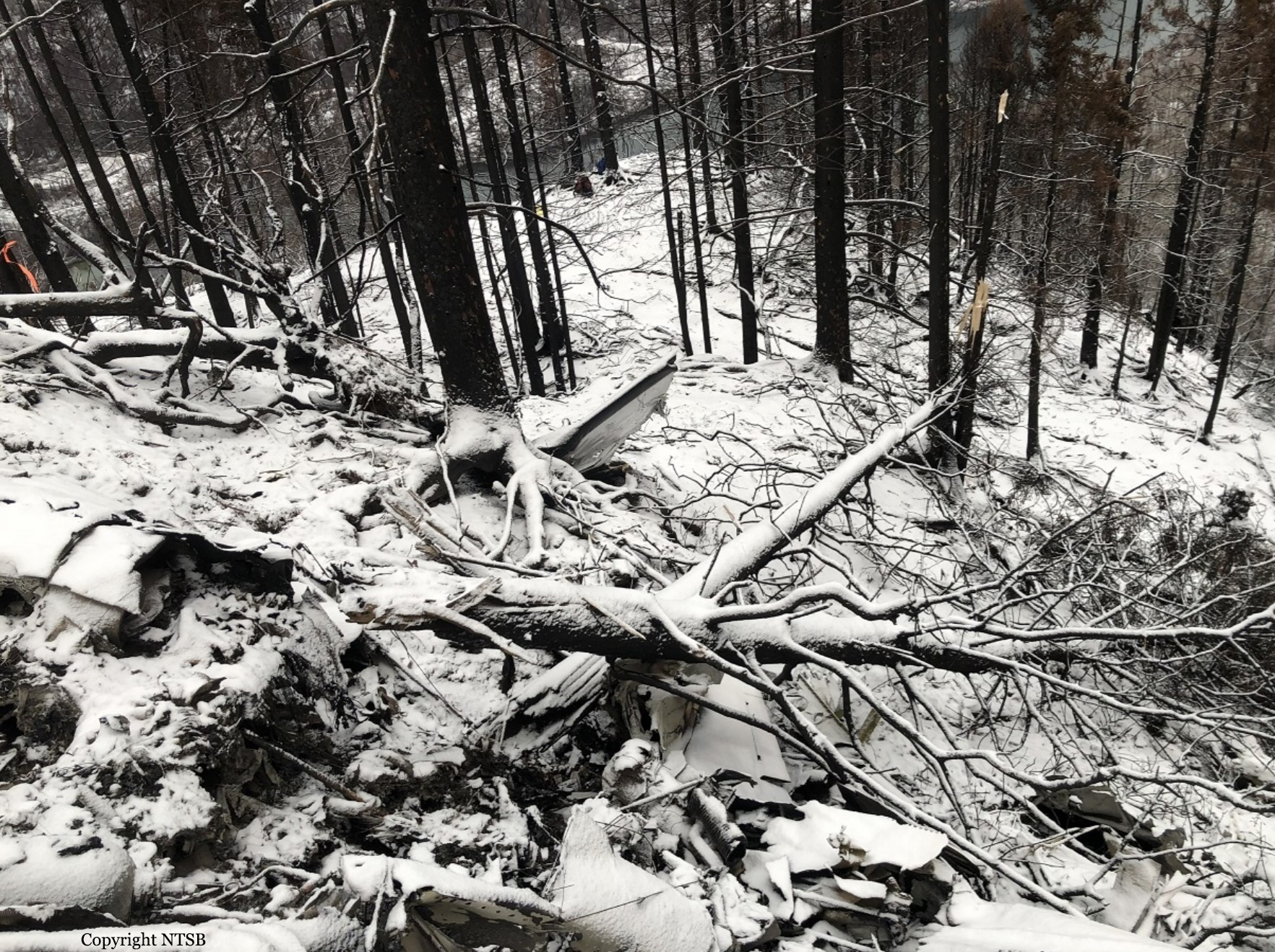
Circumstances:
On November 29, 2019, about 1911 Alaska standard time, a Piper PA-31-350 airplane, N4087G, was destroyed by impact and postcrash fire when it collided with mountainous terrain about 15 miles west of Cooper Landing, Alaska. The three occupants; the airline transport pilot, a flight nurse, and the flight paramedic were fatally injured. The airplane was operated by Fly 4 You Inc., doing business as Security Aviation, as a Title 14 Code of Federal Regulations Part 135 visual flight rules air ambulance flight. Dark night visual meteorological conditions existed at the departure and destination locations and company flight following procedures were in effect. The flight departed Ted Stevens International Airport (PANC), Anchorage, Alaska, about 1848, destined for Seward Airport (PAWD), Seward, Alaska. Dispatch records indicated that, on November 29, Providence Seward Medical Center emergency clinic personnel contacted multiple air ambulance companies with a "weather check" for possible air ambulance transportation of a patient from Seward to Anchorage. The first company contacted was Guardian Flight, who declined the flight at 1624 due to limited daylight hours. The second company, LifeMed Alaska, declined the flight at 1637 due to weather. The third and final company contacted for the flight was Medevac Alaska. Their dispatch officer was not notified of the previous declined flight requests and forwarded the request to Security Aviation, who is their sole air charter provider. At 1731 Security Aviation accepted the flight, and Medevac Alaska flight SVX36 was staffed with a nurse and paramedic. A preliminary review of archived Federal Aviation Administration (FAA) radar and automatic dependent surveillance (ADS-B) data revealed that the accident airplane departed PANC and flew south about 3,000 ft mean sea level (msl) toward the Sterling Highway. The airplane was then observed descending to 2,200 ft msl while flying a right racetrack pattern before flying into the valley toward Cooper Landing. The last data point indicated that at 1911:14 the airplane was over the west end of Jean Lake at 2,100 ft msl, on a 127° course, and 122 kts groundspeed. Ground witnesses who were in vehicles on the Sterling Highway near milepost 63, reported that they saw the lights of the airplane flying over the highway that night. One witness stated that he saw the airplane west of the mountains turn in a circle as it descended and then entered the valley. He observed the wings rocking back and forth and while he was looking elsewhere, he heard an explosion and observed a large fire on the mountainside. Another witness reported seeing the airplane flying low and explode when it impacted the mountain. Witnesses to the fire called 911 and observed the wreckage high on the mountainside burning for a long time after impact. The airplane was reported overdue by the chief pilot for Security Aviation and the FAA issued an alert notice (ALNOT) at 2031. The Alaska Rescue Coordination Center dispatched an MH-60 helicopter to the last known position and located the burning wreckage that was inaccessible due to high winds in the area. On December 1, 2019, the Alaska State Troopers coordinated a mountain recovery mission with Alaska Mountain Rescue Group. The wreckage was observed on the mountain at an elevation of about 1,425 ft msl in an area of steep, heavily tree-covered terrain near the southeast end of Jean Lake in the Kenai National Wildlife Refuge. The airplane was highly fragmented and burned, however all major airplane components were accounted for. Multiple large trees around the wreckage were fractured and indicated an easterly heading prior to the initial impact.