Crash of a Casa NC-212MP Aviocar 200 near Timika: 9 killed

Date & Time: Jan 8, 2001
Type of aircraft:
Operator:
Registration:
U-614
Flight Phase:
Flight Type:
Survivors:
No
Site:
Schedule:
Timika - Jayapura
MSN:
223/63N
YOM:
1984
Country:
Region:
Crew on board:
5
Crew fatalities:
Pax on board:
4
Pax fatalities:
Other fatalities:
Total fatalities:
9
Circumstances:
About 12 minutes after takeoff from Timika Airport, while cruising at an altitude of 11,800 feet, the twin engine aircraft struck the slope of Mt Trikora. All nine occupants were killed, among them high ranking Police and Navy officers.
Probable cause:
Controlled flight into terrain.

Crash of a Britten-Norman BN-2A-2 Islander in Mahdia: 3 killed

Date & Time: Jan 6, 2001
Type of aircraft:
Operator:
Registration:
8R-GFN
Flight Type:
Survivors:
No
Site:
Schedule:
Kato - Mahdia
MSN:
289
YOM:
1971
Country:
Crew on board:
2
Crew fatalities:
Pax on board:
1
Pax fatalities:
Other fatalities:
Total fatalities:
3
Circumstances:
The aircraft was completing a flight from Kato to Mahdia, carrying two pilots and one passenger on behalf of a public work company. On approach, the crew encountered marginal weather conditions when the twin engine aircraft struck the slope of Mt Ebini located 9 km short of runway and crashed in a wooded area. All three occupants were killed.

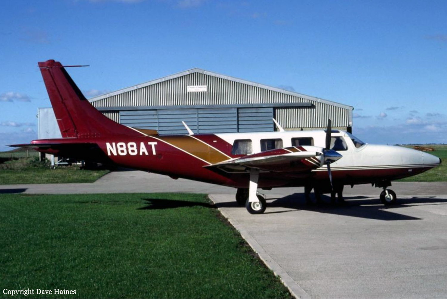
Crash of a Piper PA-60 Aerostar (Ted Smith 602P) on Mt Okanagan: 4 killed

Date & Time: Dec 31, 2000 at 1205 LT
Registration:
N88AT
Flight Phase:
Flight Type:
Survivors:
No
Site:
Schedule:
Salt Lake City – Penticton
MSN:
62-0862-8165003
YOM:
1981
Country:
Crew on board:
1
Crew fatalities:
Pax on board:
3
Pax fatalities:
Other fatalities:
Total fatalities:
4
Captain / Total flying hours:
2500
Aircraft flight hours:
3052
Circumstances:
The Piper Aerostar 602P aircraft, registration N88AT, serial number 62P08628165003, with the pilot, who was also the owner, three passengers, and two dogs on board, took off from the Salt Lake City Airport, Utah, on an instrument flight rules flight to Penticton, British Columbia. At 1149 Pacific standard time, the Kamloops/Castlegar sector controller of Vancouver Centre passed N88AT a special weather observation for Penticton: Awinds calm; visibility : mile in snow; sky obscured; vertical visibility 700 feet; remarks snow eight [8/8 of the sky covered]; temperature zero; 1900 [1100 Pacific standard time] altimeter 30.21.@ When approaching Penticton, the pilot requested the localizer distance-measuring equipment B (LOC DME-B) approach to runway 16. When the pilot confirmed that he could complete the procedure turn within 13 miles of the Penticton airport, the controller issued an approach clearance for the LOC DME-B approach, with a restriction to complete the procedure turn within 13 miles of the Penticton airport. This restriction was to prevent possible conflicts between N88AT and aircraft taking off or carrying out missed approaches from runway 15 at Kelowna. The pilot reported to the Penticton Flight Service Station at 1203 Pacific standard time that he was by the Penticton non-directional beacon (NDB) outbound on the localizer, and he was given the latest runway condition report. When the aircraft then failed to respond to numerous radio calls from the Penticton Flight Service Station and Vancouver Centre, search and rescue staff were notified and a search initiated. The wreckage was found two days later, near the summit of Okanagan Mountain, in a wooded area, at an elevation of about 5100 feet above sea level. There were no survivors. The aircraft was destroyed but did not catch fire.
Probable cause:
Findings as to Causes and Contributing Factors:
1. For reasons not determined, the pilot did not adhere to the procedures depicted for the LOC DME-B approach to runway 16 at Penticton. As a result, the aircraft did not remain within the confines of protected airspace, was below the minimum safe altitude for the procedure turn, and struck the tower.
Findings as to Risk:
1. The approach was flown in weather conditions that virtually precluded the pilot from completing a landing.
Other Findings:
1. The pilot's flight medical certificate had expired one month prior to the accident, and no information could be found that he had submitted to an FAA medical during that time.
Final Report:

Crash of a Beechcraft B200 Super King Air in Rangeley: 2 killed

Date & Time: Dec 22, 2000 at 1716 LT
Registration:
N30EM
Survivors:
No
Site:
Schedule:
Rangeley – Boston – Portland – Rangeley
MSN:
BB-958
YOM:
1982
Crew on board:
1
Crew fatalities:
Pax on board:
1
Pax fatalities:
Other fatalities:
Total fatalities:
2
Captain / Total flying hours:
15500
Aircraft flight hours:
8845
Circumstances:
The pilot and passenger departed on a night IFR flight. Weather en route was a mixture of instrument and visual meteorological conditions. When the airplane was 17 miles southwest of its destination, the pilot was cleared for an instrument approach. At 9 miles, the pilot reported the airport in sight, and canceled his IFR clearance. The airplane continued to descend towards the airport on a modified left base until radar contact was lost at 3,300 feet msl. The pilot was in radio contact with his wife just prior to the accident. He advised her that he was on base for runway 32. Neither the pilot's wife, nor ATC received a distress call from the pilot. The airplane was located the next morning about 100 feet below the top of a mountain. The accident site was 7.9 miles from the airport, and approximately 1,200 feet above the airport elevation. Ground based weather radar recorded light snow showers, in the general vicinity of the accident site about the time of the accident, and satellite imagery showed that the airplane was operating under a solid overcast. A level path was cut through the trees that preceded the main wreckage. Examination of both engines and the airframe revealed no pre impact failures or malfunctions.
Probable cause:
The pilot-in-command's failure to maintain sufficient altitude while maneuvering to land, which resulted in a collision with terrain. Factors in the accident were the dark night, mountainous terrain, snow showers, clouds, and the pilot's decision to cancel his IFR clearance.
Final Report:

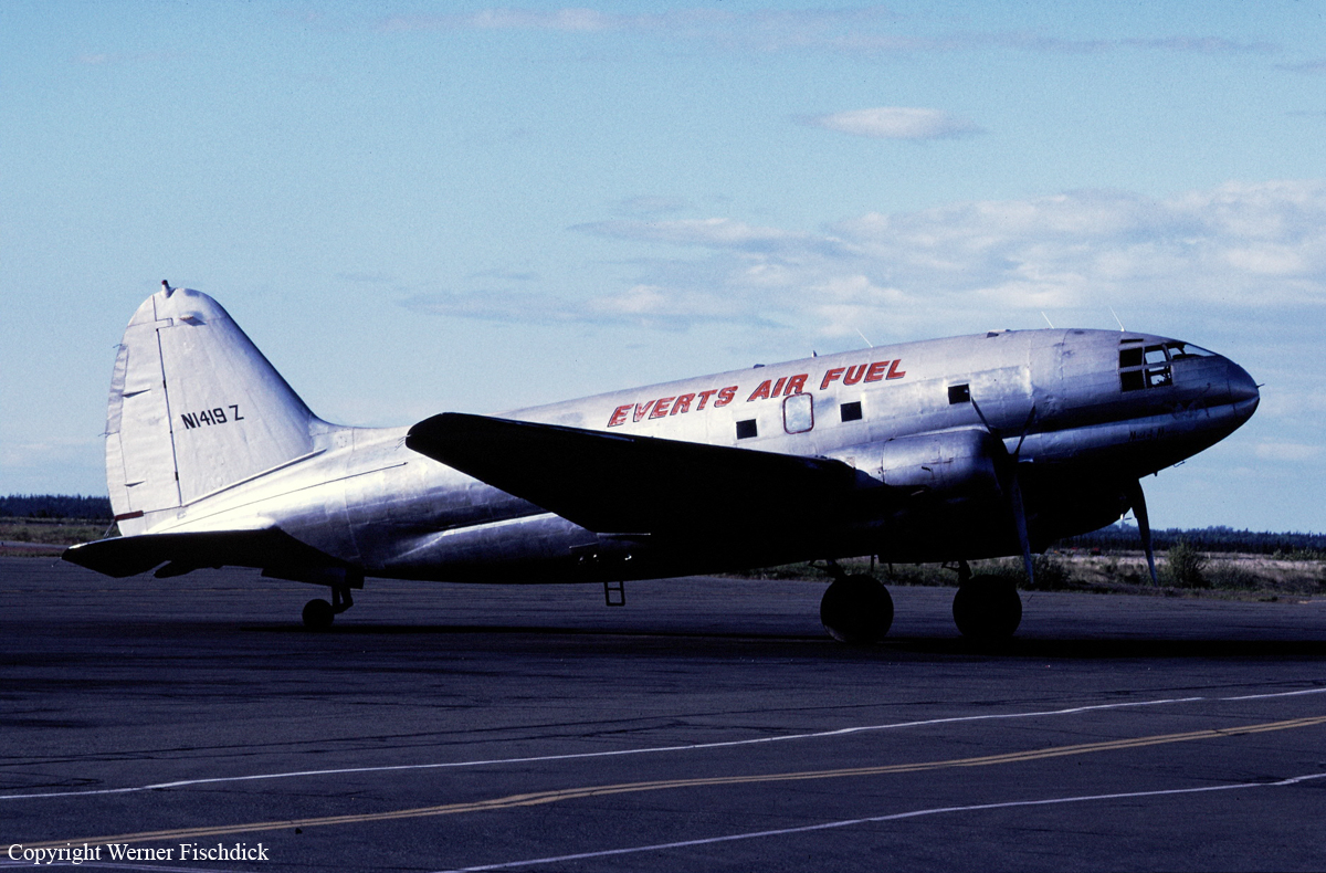
Crash of a Curtiss C-46A-45-CU Commando near Mt Redoubt: 2 killed

Date & Time: Dec 20, 2000 at 1620 LT
Type of aircraft:
Operator:
Registration:
N1419Z
Flight Phase:
Flight Type:
Survivors:
No
Site:
Schedule:
Kenai – Big River Lakes – Nondalton – Kenai
MSN:
30228
YOM:
1944
Crew on board:
2
Crew fatalities:
Pax on board:
0
Pax fatalities:
Other fatalities:
Total fatalities:
2
Captain / Total flying hours:
6302
Captain / Total hours on type:
1540.00
Aircraft flight hours:
10907
Circumstances:
The flight crew was returning from off-loading their cargo at a remote site on the west side of a mountain range. The return flight would provide an option of following a lower mountain pass, or flying over the mountainous terrain. Witnesses related that prior to the flight's departure, the marginal VFR weather conditions began to deteriorate very rapidly, with winds in excess of 50 knots, lowering ceilings, rain, and turbulence. An airmet, valid during the time of the accident, forecast high winds, mountain obscuration, and turbulence. The wreckage of the airplane was located near the crest of a 2,900 feet msl ridge. Wreckage debris was scattered on both sides of the ridge, and the airplane was destroyed by the high speed impact. Inspection of the wreckage disclosed no evidence any mechanical anomalies. A radar track analysis of a target airplane believed to be the accident airplane, depicted a track on a direct route of flight over the mountains from the departure airport towards the destination airport. Altitude data was not received from the target airplane's Mode C transponder, and therefore was extrapolated from the less reliable radar plot information. The maximum altitude plotted was approximately 10,800 feet, prior to a descent as the airplane neared the west side of the range. Mountains along the route of flight exceed 10,000 feet msl.
Probable cause:
The flight crew's decision to continue VFR flight into instrument meteorological conditions. Factors associated with the accident are high winds, turbulence, and low ceilings.
Final Report:

Crash of a Piper PA-60 Aerostar (Ted Smith 602P) in Fortingall: 1 killed

Date & Time: Nov 30, 2000 at 1635 LT
Operator:
Registration:
N64719
Flight Phase:
Flight Type:
Survivors:
No
Site:
Schedule:
Linz – Newcastle – Keflavik – Narsarsuaq – Goose Bay – New York
MSN:
60-8365-006
YOM:
1983
Region:
Crew on board:
1
Crew fatalities:
Pax on board:
0
Pax fatalities:
Other fatalities:
Total fatalities:
1
Captain / Total flying hours:
1860
Circumstances:
Start-up, taxi and take-off were apparently normal with an IFR clearance for a noise abatement right turn-out on track towards the Talla VOR beacon. Soon afterwards the pilot was given clearance to join controlled airspace on track towards Talla at FL 140 and to expect the flight planned level of FL 200 when cleared by Scottish Radar. As the aircraft was climbing through FL 120 the Talla sector controller first cleared the pilot to climb to FL140 and then almost immediately re-cleared him to climb to FL 200. The pilot replied "ER NEGATIVE I WOULD LIKE TO MAINTAIN ONE FOUR ZERO FOR THE TIME BEING" and the controller granted his request. At 16:21 hrs the pilot transmitted "SCOTTISH NOVEMBER SIX FOUR SEVEN ONE NINE ER REQUESTING HIGHER TO GET OUT OF SOME ICING". Initially the controller offered FL 160 but the pilot replied "IF POSSIBLE TWO ZERO ZERO". Immediately he was given clearance to climb to FL 205, the correct quadrantal cruising altitude. Recorded radar data showed that for the next six minutes, the aircraft's rate of climb and airspeed were erratic. The pilot made one brief transmission of "SCOTTISH" at about 16:30 hrs but nothing more was said by him or the controller for another 20 seconds. Then the controller said "NOVEMBER SIX FOUR SEVEN ONE NINE ER I SEE YOU'RE IN THE TURN DO YOU HAVE A PROBLEM". There was no reply and so the controller repeated his message, eventually receiving the reply "YES I HAVE ER AN EMERGENCY". The controller asked the pilot to "SQUAWK SEVEN SEVEN ZERO ZERO" but the pilot replied "HANG ON". By this time the aircraft was descending rapidly in a gentle right turn. The controller twice asked the pilot for the nature of his problem but the pilot asked the controller to 'HANG ON FOR A MOMENT". The controller could see the aircraft was near high ground and losing altitude rapidly. He twice passed messages to this effect to the pilot but he did not receive an immediate reply. At 16:33 hrs the pilot transmitted "CAN YOU GET ME ER SOMEWHERE WHERE I CAN LAND I CAN'T MAINTAIN ALTITUDE AT ALL". Immediately the controller instructed the pilot to take up an easterly heading and gave him the aircraft's position relative to the airport at Perth. The controller then asked the pilot for his flight conditions (twice) to which the pilot eventually replied "I'M COMING OUT OF ER THE CLOUDS NOW" followed by "JUST BREAKING OUT". The controller then said "ROGER DO YOU HAVE ANY POWER AT ALL OR HAVE YOU LOST THE ENGINE". The pilot replied "I GOT POWER AGAIN BUT I HAVE NO CONTROL". That was his last recorded RTF transmission made at 16:34:40 hrs. The final radar return placed the aircraft at an altitude of 3,150 feet overhead Drummond Hill which is on the north bank of Loch Tay, near the village of Fortingall, and rises to 1,500 feet amsl.
Probable cause:
On vacating FL140, the aircraft's climb rate was so erratic at 140 KIAS that it seems likely that by then, the aircraft had already gathered sufficient ice to seriously affect its performance. If all the
turbocharger inlets had become partially blocked, then manually selecting both engines to alternate air induction should have introduced warmer air into the turbochargers and restored power. The description of engine operation in the Superstar manual states:
'If manifold pressure continues to decrease after opening the manual alternate air, it is an indication that turbocharger inlets are still restricted and the engine may become normally aspirated through the automatic alternate air door located below the induction air filter'.
Normal aspiration reduces the manifold pressure to ambient or less and at FL140 the ambient pressure is about 17.6 inches which is less than half the climb rated manifold pressure. That might explain the inability to climb above FL 160 but it would also have deprived the pilot of pressurisation. There was no change in his voice consistent with donning an oxygen mask so he may not have lost pressurisation completely. Nevertheless, since he lost control at around FL160 and 110 KIAS, and because the aircraft initially turned to the right, a combination of airframe icing and asymmetric power loss seem the most likely explanation for the sustained loss of control. The split in the EDP diaphragm which almost certainly occurred during this flight may have contributed to an asymmetric power problem. Alternatively, the pilot might have become mildly hypoxic and decided to begin an emergency descent. If so, he did not declare an emergency at the time he started to descend, although he did utter the word "SCOTTISH" after control was lost, so he was conscious even if his mental abilities had been impaired by hypoxia. On balance, the tone of his voice and his initial failure to respond to ATC messages suggested that the descent was begun through loss of control rather than a deliberate act followed by loss of control. At the time of the accident the aircraft had been flying below the freezing level (8,000 feet) for about five minutes and much of the airframe and induction system ice may have melted. The would-be rescuers would have taken at least five minutes to reach the crash site and so the fact that none of them reported seeing or treading on any ice was not surprising. Witness and propeller evidence indicated that power had been restored on at least one engine but there seemed to be insufficient power to climb out of Glen Lyon. The aircraft was out of control when it crashed at low speed from a sharp turning manoeuvre. Before this manoeuvre the pilot may have had partial control, albeit with a power problem which prevented him from climbing, and he finally lost control totally when he attempted to turn around within the confines of the Glen. He had no choice but to attempt the turn since, had he not turned, he would have flown into the side of the hill above the crash site.
Final Report:

Crash of a Piper PA-31-325 Navajo near Sasaima: 8 killed

Date & Time: Oct 29, 2000 at 1855 LT
Type of aircraft:
Registration:
HK-2644-P
Flight Phase:
Flight Type:
Survivors:
No
Site:
Schedule:
Pereira – Bogotá
MSN:
31-8112044
YOM:
1981
Country:
Crew on board:
2
Crew fatalities:
Pax on board:
6
Pax fatalities:
Other fatalities:
Total fatalities:
8
Captain / Total flying hours:
5066
Copilot / Total flying hours:
1822
Aircraft flight hours:
2869
Circumstances:
The twin engine aircraft departed Pereira-Macareña Airport in the afternoon on a flight to Bogotá-El Dorado Airport, carrying six passengers and two pilots. The flight was completed at an altitude of 15,000 feet and the crew was eventually cleared to start the descent to Bogotá for an approach to runway 13R. Shortly later, the aircraft entered an uncontrolled descent and crashed in a wooded area located near Sasaima, about 42 km northwest of Bogotá Airport. The aircraft was totally destroyed upon impact and all eight occupants were killed.
Probable cause:
It was determined that the loss of control was the consequence of a double engine failure in flight due to a fuel exhaustion. At the time of the accident, all tanks were empty and the crew failed to calculate properly the fuel consumption, and the fuel quantity for the last leg from Pereira to Bogotá was insufficient. The aircraft was completing a series of flight since Octobre 26.
Final Report:

Crash of a Cessna 340A near Julian: 2 killed

Date & Time: Oct 26, 2000 at 1058 LT
Type of aircraft:
Operator:
Registration:
N4347C
Flight Phase:
Survivors:
No
Site:
Schedule:
Santa Ana – Calexico
MSN:
340A-0538
YOM:
1978
Crew on board:
2
Crew fatalities:
Pax on board:
0
Pax fatalities:
Other fatalities:
Total fatalities:
2
Captain / Total flying hours:
20000
Captain / Total hours on type:
180.00
Copilot / Total flying hours:
338
Aircraft flight hours:
3182
Circumstances:
During en route cruise flight at an assigned altitude of 11,000 feet (msl) in instrument meteorological conditions, the airplane impacted mountainous terrain at 5,300 feet, in wings level, descending flight. During the final 12 minutes of the flight (from 1046 to 1058 Pacific daylight time), recorded military search radar height values (primary radar returns) show the aircraft in a steady descent from 11,000 feet to 5,600 feet, where radar contact was lost. During the same time interval, recorded Mode C altitudes received at Los Angeles Air Traffic Control Center (Center) and SoCal Terminal Radar Approach Control (TRACON) indicated the aircraft was level at 11,000 feet. At 1055:49, when the pilot was handed off from SoCal TRACON to Los Angeles Center, the pilot checked in with the Center ". . . level at one one thousand." At 1057:28, the pilot asked the Center controller "what altitude you showing us at" to which the controller responded "not receiving your mode C right now sir." At 1057:37, the pilot transmitted "o k we'd like to climb to vfr on top, our uh altimeter just went down to uh fifty three hundred." The controller approved the pilot's request to climb to VFR conditions on-top and, at 1057:54, the pilot responded "roger we're out." No further transmissions were received from the aircraft. The airplane was equipped with a single instrument static pressure system with two heated static ports. The static system and static system instruments were damaged or destroyed by impact and post-crash fire sufficiently to preclude post-accident testing.
Probable cause:
Total blockage of the instrument static system due to ice.
Final Report:

Crash of an Ilyushin II-18D near Batumi: 84 killed

Date & Time: Oct 25, 2000 at 1722 LT
Type of aircraft:
Operator:
Registration:
RA-74295
Flight Type:
Survivors:
No
Site:
Schedule:
Moscow – Batumi
MSN:
187 0106 02
YOM:
1967
Location:
Country:
Region:
Crew on board:
11
Crew fatalities:
Pax on board:
73
Pax fatalities:
Other fatalities:
Total fatalities:
84
Captain / Total flying hours:
1579
Captain / Total hours on type:
212.00
Copilot / Total flying hours:
1242
Aircraft flight hours:
15256
Aircraft flight cycles:
7694
Circumstances:
This flight between Moscow and Batumi was operated by the Russian Air Force twice a month. On board were Russian soldiers and family members returning to their base in Batumi following a leave period. Due to poor weather conditions west of Batumi, the crew was cleared to initiate the approach to Batumi-Chorokh Airport from the northeast to runway 31 while the usual approach is from the sea to runway 13. While descending in poor visibility at an altitude of 940 metres and a speed of 340 km/h, the aircraft struck the slope of Mt Mtirala (,1336 metres high) located about 17 km northeast of Batumi Airport. The aircraft disintegrated on impact and all 84 occupants were killed.
Probable cause:
Controlled flight into terrain after the crew continued the approach in poor weather conditions below the minimum prescribed altitude and while deviated from the approach path. The following contributing factors were identified:
- Navigational error on part of the crew during the final stage of the approach,
- ATC based at Batumi Airport failed to determine the exact position of the aircraft and failed to warn the crew accordingly,
- The crew 's decision to continue the approach in such conditions rather than to divert to a suitable alternate airport,
- Erroneous data transmitted by ground navigational aids in the Batumi area.

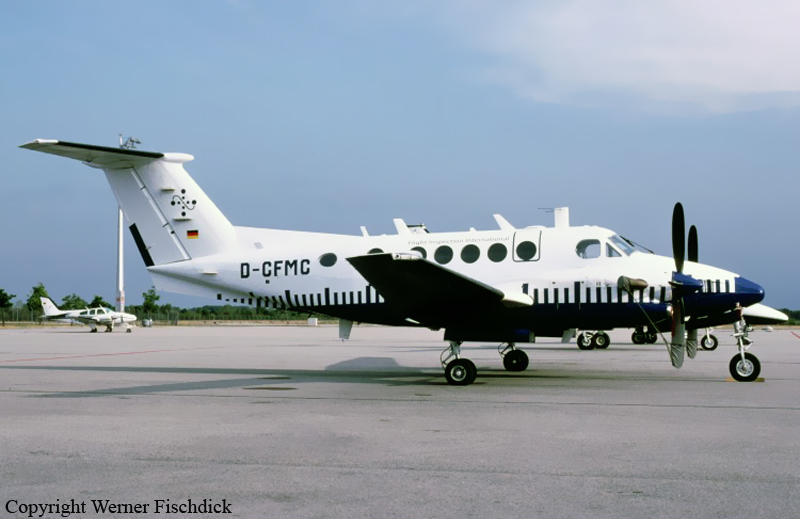
Crash of a Beechcraft 300 Super King Air near Donaueschingen: 4 killed

Date & Time: Oct 24, 2000 at 1716 LT
Registration:
D-CFMC
Flight Type:
Survivors:
No
Site:
Schedule:
Donaueschingen - Donaueschingen
MSN:
FA-104
YOM:
1986
Country:
Region:
Crew on board:
2
Crew fatalities:
Pax on board:
2
Pax fatalities:
Other fatalities:
Total fatalities:
4
Circumstances:
The twin engine aircraft departed Donaueschingen-Villingen Airport in the afternoon on a local calibration mission. After several circuits over the area at an altitude of 7,000 feet, both NDB and DME systems have been calibrated and the crew was returning to the airport at the end of the afternoon. While approaching runway 36 in marginal weather conditions, the crew failed to realize his altitude was insufficient when the aircraft struck trees and crashed in a wooded area located about 15 km from the airport. The aircraft was destroyed and all four occupants were killed. According to published procedures, the crew was supposed to continue the approach at a minimum altitude of 4,500 feet until 11 km from the runway threshold then descending to 2,650 feet. For unknown reasons, the crew started the descent prematurely, causing the aircraft to impact terrain.
Probable cause:
Controlled flight into terrain after the crew descended too low under VFR mode in IMC conditions. The following contributing factors were identified:
- The crew canceled the IFR flight plan for an approach under VFR mode despite weather conditions were marginal and the visibility was insufficient,
- The crew failed to follow the approach checklist,
- The crew failed to complete an approach briefing,
- The crew did not proceed to any callouts on approach,
- The second pilot was procedurally not involved in cockpit work processes and decision-making,
- On approach, the crew referred to the Flight Management System (FMS type III series) which was initially dedicated to flight inspection purposes only,
- Measurement was performed by the flight engineer.