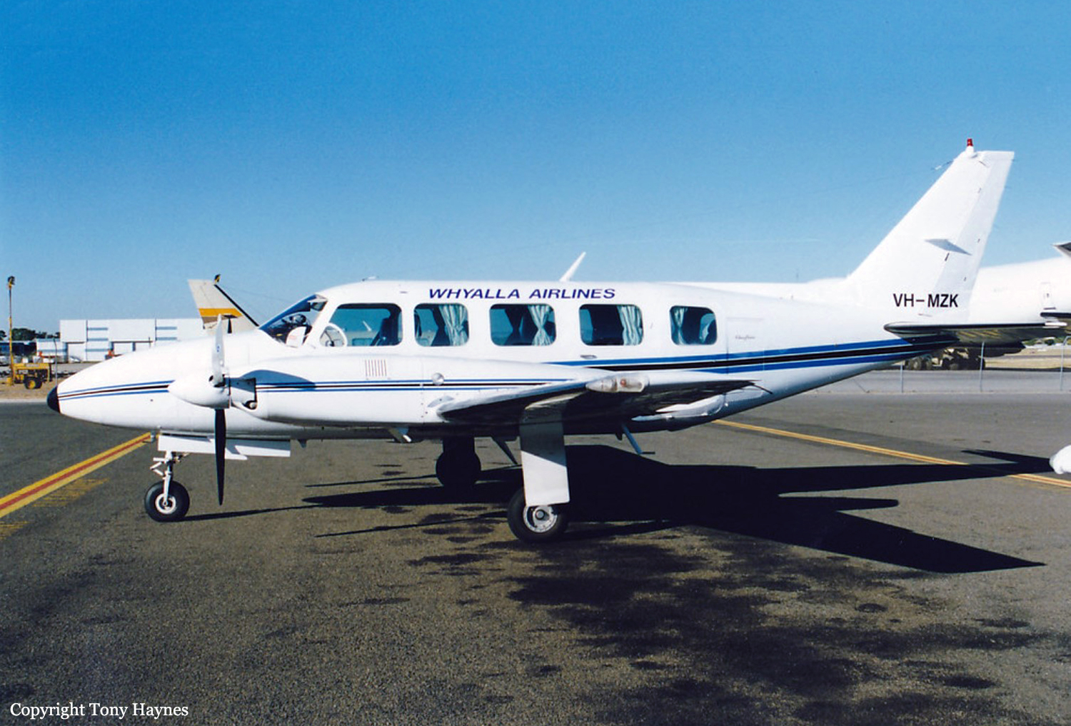
Crash of a Rockwell Shrike Commander 500S on Thornton Peak: 4 killed

Date & Time: Apr 10, 2001 at 0725 LT
Operator:
Registration:
VH-UJB
Flight Phase:
Survivors:
No
Site:
Schedule:
Cairns - Hicks Island
MSN:
500-3152
YOM:
1973
Country:
Region:
Crew on board:
1
Crew fatalities:
Pax on board:
3
Pax fatalities:
Other fatalities:
Total fatalities:
4
Captain / Total flying hours:
9680
Captain / Total hours on type:
2402.00
Circumstances:
The aircraft departed Cairns airport at 0707 Eastern Standard Time (EST) on a charter flight to Hicks Island. The aircraft was being operated under the Instrument Flight Rules (IFR) and the expected flight time was 2 hours. Shortly after takeoff the pilot requested an amended altitude of 4,000 ft. He indicated that he was able to continue flight with visual reference to the ground or water. Air Traffic Services (ATS) issued the amended altitude as requested. The IFR Lowest Safe Altitude for the initial route sector to be flown was 6,000 ft Above Mean Sea Level (AMSL). Data recorded by ATS indicated that approximately 13 minutes after departure, the aircraft disappeared from radar at a position 46NM north of Cairns. At the last known radar position the aircraft was cruising at a ground speed of 180 kts and at an altitude of 4,000 ft AMSL. An extensive search located the wreckage the following afternoon at a location consistent with the last known radar position, on the north-western side of Thornton Peak at an altitude of approximately 4,000 ft (1219 metres) AMSL. The aircraft was destroyed by impact forces and post-impact fire. The pilot and three passengers received fatal injuries. Thornton Peak is the third highest mountain in Queensland and is marked on topographic maps as 4,507 ft (1,374 metres) in elevation. Local residents reported that the mountain was covered by cloud and swept by strong winds for most of the year. The aircraft had been observed by witnesses approximately two minutes prior to impact cruising at high speed, on a constant north-westerly heading, in a wings level attitude and with flaps and landing gear retracted. They stated that the engines appeared to sound normal.
Probable cause:
Radar data recorded by Air Traffic Services and witness reports indicated that the aircraft was flying straight and level and maintaining a constant airspeed. Therefore, it is unlikely that the aircraft was experiencing any instrumentation or engine problems. Why the pilot continued flight into marginal weather conditions at an altitude that was insufficient to ensure terrain clearance, could not be established. The aircraft was flown at an altitude that was insufficient to ensure terrain clearance.
Final Report:

Crash of a Beechcraft 200 Super King Air in Wernadinga Station: 8 killed

Date & Time: Sep 4, 2000 at 1510 LT
Operator:
Registration:
VH-SKC
Flight Phase:
Survivors:
No
Schedule:
Perth - Leonora
MSN:
BB-47
YOM:
1975
Country:
Region:
Crew on board:
1
Crew fatalities:
Pax on board:
7
Pax fatalities:
Other fatalities:
Total fatalities:
8
Captain / Total flying hours:
2053
Captain / Total hours on type:
138.00
Aircraft flight hours:
18771
Circumstances:
On 4 September 2000, a Beech Super King Air 200 aircraft, VH-SKC, departed Perth, Western Australia at 1009 UTC on a charter flight to Leonora with one pilot and seven passengers on board. Until 1032 the operation of the aircraft and the communications with the pilot appeared normal. However, shortly after the aircraft had climbed through its assigned altitude, the pilot’s speech became significantly impaired and he appeared unable to respond to ATS instructions. Open microphone transmissions over the next 8-minutes revealed the progressive deterioration of the pilot towards unconsciousness and the absence of any sounds of passenger activity in the aircraft. No human response of any kind was detected for the remainder of the flight. Five hours after taking off from Perth, the aircraft impacted the ground near Burketown, Queensland, and was destroyed. There were no survivors.
Probable cause:
Due to the limited evidence available, it was not possible to draw definitive conclusions as to the factors leading to the incapacitation of the pilot and occupants of VH-SKC.
The following findings were identified:
1. The pilot was correctly licensed, had received the required training, and there was no evidence to suggest that he was other than medically fit for the flight.
2. The weather conditions on the day presented no hazard to the operation of the aircraft on its planned route.
3. The flightpath flown was consistent with the aircraft being controlled by the autopilot in heading and pitch-hold modes with no human intervention after the aircraft passed position DEBRA.
4. After the aircraft climbed above the assigned altitude of FL250, the speech and breathing patterns of the pilot, evidenced during the radio transmissions, displayed changes consistent with hypoxia.
5. Testing revealed that Carbon Monoxide and Hydrogen Cyanide were highly unlikely to have been factors in the occurrence.
6. The low Carbon Monoxide and Cyanide levels, and the absence of irritation in the airways of the occupants indicated that a fire in the cabin was unlikely.
7. The incapacitation of the pilot and passengers was probably due to hypobaric hypoxia because of the high cabin altitude and their not receiving supplemental oxygen.
8. A rapid or explosive depressurisation was unlikely to have occurred.
9. The reasons for the pilot and passengers not receiving supplemental oxygen could not be determined.
10. Setting the visual alert to operate when the cabin pressure altitude exceeds 10,000 ft and incorporating an aural warning in conjunction with the visual alert, may have prevented the accident.
11. The training and actions of the air traffic controller were not factors in the accident.
Significant factors:
1. The aircraft was probably unpressurised for a significant part of its climb and cruise for undetermined reasons.
2. The pilot and passengers were incapacitated, probably due to hypobaric hypoxia, because of the high cabin altitude and their not receiving supplemental oxygen.
Final Report:

Crash of a Piper PA-60 Aerostar (Ted Smith 600) near Port Keats: 1 killed

Date & Time: Sep 2, 2000 at 2125 LT
Operator:
Registration:
VH-IXG
Flight Phase:
Flight Type:
Survivors:
No
Schedule:
Port Keats – Darwin
MSN:
60-0567-7961185
YOM:
1979
Country:
Region:
Crew on board:
1
Crew fatalities:
Pax on board:
0
Pax fatalities:
Other fatalities:
Total fatalities:
1
Captain / Total flying hours:
15000
Captain / Total hours on type:
122.00
Circumstances:
The pilot had submitted a flight plan nominating a charter category, single pilot, Instrument Flight Rules flight, from Darwin to Port Keats and return. The Piper Aerostar 600A aircraft, with 6 Passengers on board, departed Darwin at 2014 Central Standard Time and arrived at Port Keats at 2106 hours after an uneventful flight. The passengers disembarked at Port Keats and the pilot prepared to return to Darwin alone. At 2119 hours the pilot reported taxying for runway 34 to Brisbane Flight Service. That was the last radio contact with the aircraft. Witnesses noted nothing unusual as the aircraft taxied and then took off from runway 34. As a departure report was not received, a distress phase was declared and subsequently a search was instigated. The following morning a number of major structural components of the aircraft, including the outer left wing, were located at a position 24 km north-east of Port Keats aerodrome and close to the aircraft's flight planned track. The main portion of wreckage was found four days later, destroyed by ground impact. The impact crater was located a considerable distance from the previously located structural components and indicated that an inflight breakup had occurred. The accident was not survivable.
Probable cause:
Shortly after departure from Port Keats aerodrome, the pilot lost control of the aircraft for reasons unknown. Aerodynamic loading of the left wing in excess of the ultimate load limit occurred, resulting in an inflight breakup of the airframe. The investigation was unable to determine the circumstances that led to the loss of control and subsequent inflight break-up of the aircraft.
Final Report:

Crash of a Beechcraft 70 Queen Air in Leonora

Date & Time: Jun 24, 2000 at 1740 LT
Type of aircraft:
Registration:
VH-MWJ
Flight Phase:
Survivors:
Yes
Schedule:
Leonora – Laverton
MSN:
LB-29
YOM:
1970
Country:
Region:
Crew on board:
1
Crew fatalities:
Pax on board:
5
Pax fatalities:
Other fatalities:
Total fatalities:
0
Circumstances:
The Beechcraft Queen Air and Rockwell Aero Commander were being used by a company to conduct private category passenger-carrying flights to transport its workers from Leonora to Laverton in Western Australia. The Aero Commander had departed and was established in the Leonora circuit area when the Queen Air took off. The pilot and one of the passengers of the Queen Air reported the take-off roll appeared normal until the aircraft crossed the runway intersection, when they felt a bump in the aircraft. The pilot reported hearing a loud bang and noticed that the inboard cowl of the right engine had opened. He also reported that he believed he had insufficient runway remaining to stop safely, so he continued the takeoff. The cowl separated from the aircraft at the time, or just after the pilot rotated the aircraft to the take-off attitude. He reported that although the aircraft had left the ground after the rotation, it then would not climb. The aircraft remained at almost treetop level until the pilot and front-seat passenger noticed the side of a tailings dump immediately in front of the aircraft. The pilot said that he pulled the control column fully back. The aircraft hit the hillside parallel to the slope of the embankment, with little forward speed. The impact destroyed the aircraft. Although the occupants sustained serious injuries, they evacuated the aircraft without external assistance. There was no post-impact fire. The aircraft-mounted emergency locator transmitter (ELT) did not activate.
Probable cause:
The examination of the Queen Air wreckage found no mechanical fault that may have contributed to the accident sequence other than the inboard cowl of the right engine detaching during the takeoff. The cowl latching mechanisms appeared to have been capable of operating normally. The two top hinges failing in overload associated with the lack of cowl latch damage suggested that the cowl was probably improperly secured before takeoff. The cowl appeared to have subsequently opened when it experienced the jolt when the aircraft crossed the runway intersection. The lack of any further cowl damage indicated that it detached cleanly and consequently its dislodgment should not have adversely affected the flying qualities of the aircraft.
Final Report:

Crash of a Piper PA-31-350 Navajo Chieftain off Whyalla: 8 killed

Date & Time: May 31, 2000 at 1905 LT
Operator:
Registration:
VH-MZK
Survivors:
No
Schedule:
Adelaide - Whyalla
MSN:
31-8152180
YOM:
1981
Flight number:
WW904
Country:
Region:
Crew on board:
1
Crew fatalities:
Pax on board:
7
Pax fatalities:
Other fatalities:
Total fatalities:
8
Captain / Total flying hours:
2211
Captain / Total hours on type:
113.00
Aircraft flight hours:
11837
Circumstances:
On the evening of 31 May 2000, Piper Chieftain, VH-MZK, was being operated by Whyalla Airlines as Flight WW904 on a regular public transport service from Adelaide to Whyalla, South Australia. One pilot and seven passengers were on board. The aircraft departed at 1823 central Standard Time (CST) and, after being radar vectored a short distance to the west of Adelaide for traffic separation purposes, the pilot was cleared to track direct to Whyalla at 6,000 ft. A significant proportion of the track from Adelaide to Whyalla passed over the waters of Gulf St Vincent and Spencer Gulf. The entire flight was conducted in darkness. The aircraft reached 6,000 ft and proceeded apparently normally at that altitude on the direct track to Whyalla. At 1856 CST, the pilot reported to Adelaide Flight Information Service (FIS) that the aircraft was 35 NM south-south-east of Whyalla, commencing descent from 6,000 ft. Five minutes later the pilot transmitted a MAYDAY report to FIS. He indicated that both engines of the aircraft had failed, that there were eight persons on board and that he was going to have to ditch the aircraft, but was trying to reach Whyalla. He requested that assistance be arranged and that his company be advised of the situation. About three minutes later, the pilot reported his position as about 15 NM off the coast from Whyalla. FIS advised the pilot to communicate through another aircraft that was in the area if he lost contact with FIS. The pilot’s acknowledgment was the last transmission heard from the aircraft. A few minutes later, the crew of another aircraft heard an emergency locater transmitter (ELT) signal for 10–20 seconds. Early the following morning, a search and rescue operation located two deceased persons and a small amount of wreckage in Spencer Gulf, near the last reported position of the aircraft. The aircraft, together with five deceased occupants, was located several days later on the sea–bed. One passenger remained missing.
Probable cause:
Engine operating practices:
• High power piston engine operating practices of leaning at climb power, and leaning to near ‘best economy’ during cruise, may result in the formation of deposits on cylinder and piston surfaces that could cause preignition.
• The engine operating practices of Whyalla Airlines included leaning at climb power and leaning to near ‘best economy’ during cruise.
Left engine:
The factors that resulted in the failure of the left engine were:
• The accumulation of lead oxybromide compounds on the crowns of pistons and cylinder head surfaces.
• Deposit induced preignition resulted in the increase of combustion chamber pressures and increased loading on connecting rod bearings.
• The connecting rod big end bearing insert retention forces were reduced by the inclusion, during engine assembly, of a copper–based anti-galling compound.
• The combination of increased bearing loads and decreased bearing insert retention forces resulted in the movement, deformation and subsequent destruction of the bearing inserts.
• Contact between the edge of the damaged Number 6 connecting rod bearing insert and the Number 6 crankshaft journal fillet resulted in localised heating and consequent cracking of the nitrided surface zone.
• Fatigue cracking in the Number 6 journal initiated at the site of a thermal crack and propagated over a period of approximately 50 flights.
• Disconnection of the two sections of the journal following the completion of fatigue cracking in the journal and the fracture of the Number 6 connecting rod big end housing most likely resulted in the sudden stoppage of the left engine.
Right engine:
The factors that were involved in the damage/malfunction of the right engine following the left engine malfunction/failure were:
• Detonation of combustion end-gas.
• Disruption of the gas boundary layers on the piston crowns and cylinder head surface increasing the rate of heat transfer to these components.
• Increased heat transfer to the Number 6 piston and cylinder head resulted in localised melting.
• The melting of the Number 6 piston allowed combustion gases to bypass the piston rings.
The flight:
The factors that contributed to the flight outcome were:
• The pilot responded to the failed left engine by increasing power to the right engine.
• The resultant change in operating conditions of the right engine led to loss of power from, and erratic operation of, that engine.
• The pilot was forced to ditch the aircraft into a 0.5m to 1m swell in the waters of Spencer Gulf, in dark, moonless conditions.
• The absence of upper body restraints, and life jackets or flotation devices, reduced the chances of survival of the occupants.
• The Emergency Locator Transmitter functioned briefly on impact but ceased operating when the aircraft sank.
Final Report:

Crash of a Britten-Norman BN-2A-26 Islander off Cocos Islands: 3 killed

Date & Time: Jan 16, 1999 at 1430 LT
Type of aircraft:
Operator:
Registration:
VH-XFF
Survivors:
Yes
Schedule:
Horn Island - Cocos Islands
MSN:
763
YOM:
1975
Country:
Region:
Crew on board:
1
Crew fatalities:
Pax on board:
3
Pax fatalities:
Other fatalities:
Total fatalities:
3
Captain / Total flying hours:
2540
Captain / Total hours on type:
197.00
Aircraft flight cycles:
16775
Circumstances:
Uzu Air conducted passenger and freight operations between Horn Island and the island communities in the Torres Strait. It operated single-engine Cessna models 206 and 208 aircraft, and twin-engine Britten Norman Islander aircraft. On the morning of the accident, the pilot flew a company Cessna 206 aircraft from Horn Island to Yam, Coconut, and Badu Islands, and then returned to Horn Island. The total flight time was about 93 minutes. The pilot's schedule during the afternoon was to fly from Horn Island to Coconut, Yam, York, and Coconut Islands and then back to Horn Island, departing at 1330 eastern standard time. The flight was to be conducted in Islander, VH-XFF. Three passengers and about 130 kg freight were to be carried on the Horn Island - Coconut Island sector. Another company pilot had completed three flights in XFF earlier in the day for a total of 1.9 hours. He reported that the aircraft operated normally. Witnesses at Horn Island reported that the preparation for the flight, and the subsequent departure of the aircraft at 1350, proceeded normally. The pilot of another company aircraft heard the pilot of XFF report 15 NM SW of Coconut Island at 3,500 ft. A few minutes later, the pilot reported downwind for runway 27 at Coconut Island. Both transmissions sounded normal. Three members of the Coconut Island community reported that, at about 1410, they were on the beach at the eastern extremity of the island, about 250 m from the runway threshold and close to the extended runway centreline. Their recollections of the progress of the aircraft in the Coconut Island circuit are as follows: the aircraft joined the downwind leg and flew a left circuit for runway 27; the aircraft appeared to fly a normal approach until it passed over their position at an altitude of 200-300 ft; and it then veered left and commenced a shallow climb before suddenly rolling right and descending steeply onto a tidal flat, about 30 m seaward from the high-water mark, and about 200 m from their position. A passenger was seriously injured while three other occupants were killed.
Probable cause:
The following findings were identified:
- The pilot initiated a go-around from final approach because of a vehicle on the airstrip.
- The left propeller showed little evidence of rotation damage. The reason for a possible loss of left engine power could not be determined.
- For reasons that could not be established, the pilot lost control of the aircraft at a low height.
Final Report:

Crash of a Rockwell Shrike Commander 500S off Horn Island

Date & Time: Oct 21, 1998 at 0940 LT
Registration:
VH-YJT
Survivors:
Yes
Schedule:
Boigu Island - Horn Island
MSN:
500-3089
YOM:
1970
Country:
Region:
Crew on board:
1
Crew fatalities:
Pax on board:
4
Pax fatalities:
Other fatalities:
Total fatalities:
0
Captain / Total flying hours:
2045
Captain / Total hours on type:
79.00
Circumstances:
A Shrike Commander departed Horn Island on a charter flight to Saibai and Boigu Islands in accordance with the visual flight rules (VFR). The flight to Saibai took 32 minutes, and a further 13 minutes to Boigu Island. The aircraft then departed Boigu to return to Horn Island with an expected flight time of 35 minutes. The pilot reported that he had maintained 5,500 ft until commencing descent at 35 NM from Horn Island. He tracked to join final approach to runway 14 by 5 NM, reducing power at 1,500 ft. At 5 NM from the runway, the pilot extended the landing gear and approach flap and commenced a long final approach. When the aircraft was approximately 3 NM from the runway both engines commenced to surge, with the aircraft initially yawing to the right. The pilot commenced engine failure procedures and retracted the flaps. He tried a number of times to determine which engine was losing power by retarding the throttle for each engine, before deciding that the right engine was failing. The pilot shut down that engine and feathered the propeller. A short time later, when the aircraft was approximately 200 ft above the water, the left engine also lost power. The pilot established the aircraft in a glide, advised the passengers to prepare for a ditching, and transmitted a MAYDAY report on the flight service frequency before the aircraft contacted the sea. The aircraft quickly filled with water and settled on the seabed. All five occupants were able to escape and make their way ashore.
Probable cause:
The following findings were identified:
- The pilot was correctly licensed and qualified to operate the flight as a VFR charter operation.
- The aircraft was dispatched with an unusable fuel quantity indicator.
- The right engine fuel control unit was worn and allowed additional fuel through the system, increasing fuel consumption by approximately 6 L/hr.
- Inappropriate fuel consumption rates were used for flight planning.
- The aircraft fuel log contained inaccuracies that resulted in a substantial underestimation of the total fuel used.
- At the time of the occurrence, there was no useable fuel in the aircraft fuel system.
- Although the pilot met the Civil Aviation Safety Authority criteria to fulfil his role as chief pilot, he did not have the expertise to effectively ensure the safety of company flight operations.
Final Report:

Crash of a Partenavia P.68B in Wagga Wagga: 2 killed

Date & Time: Jul 20, 1998 at 1739 LT
Type of aircraft:
Registration:
VH-IXH
Flight Type:
Survivors:
No
Schedule:
Corowa – Albury – Wagga Wagga
MSN:
186
YOM:
1979
Country:
Region:
Crew on board:
1
Crew fatalities:
Pax on board:
1
Pax fatalities:
Other fatalities:
Total fatalities:
2
Captain / Total flying hours:
1014
Captain / Total hours on type:
217.00
Circumstances:
The aircraft operator had been contracted to provide a regular service transporting bank documents, medical pathology samples and items of general freight between Wagga Wagga, Albury and Corowa. On the day of the accident a passenger was accompanying the pilot for the day's flying. The pilot commenced the flight from Corowa to Albury under the Visual Flight Rules, flying approximately 500 ft above ground level. At Albury he obtained the latest aerodrome weather report for Wagga Wagga, which indicated that there was scattered cloud at 300 ft above ground level, broken cloud at 600 ft above ground level, visibility restricted to 2,000 m in light rain and a sea-level barometric pressure (QNH) of 1008 hPa. At 1715 Eastern Standard Time (EST) the aircraft departed Albury for Wagga Wagga under the Instrument Flight Rules. The pilot contacted the Melbourne en-route controller at 1728 and reported that he was maintaining 5,000 ft. Although the aircraft was operating outside controlled airspace, the en-route controller did have a radar surveillance capability and was providing the pilot with a flight information service. However, no return was recorded from the aircraft's transponder and at 1732 the pilot reported that he was transferring to the Wagga Wagga Mandatory Broadcast Zone frequency. This was the pilot's last contact with the controller. Although air traffic services do not monitor or record the Wagga Wagga Mandatory Broadcast Zone frequency, transmissions made on this frequency are recorded by AVDATA for the purpose of calculating aircraft landing charges. This information was reviewed following the accident. The pilot broadcast his position inbound to the aerodrome on the mandatory broadcast zone frequency and indicated that he was conducting a Global Positioning System (GPS) arrival. He established communication with the pilot of another inbound aircraft and at 9 NM from the aerodrome, broadcast his position as he descended through 2,900 ft. Approximately 1 minute and 20 seconds later, the pilot advised that he was passing 2,000 ft but immediately corrected this to state that he was maintaining 2,000 ft. He also stated that it was "getting pretty gloomy" and that according to the latest weather report he should be visual at the procedure's minimum descent altitude. The aircraft would have been approximately 6 NM from the aerodrome at this time. This was the last transmission heard from the pilot. The resident of a house to the south of Gregadoo Hill sighted the aircraft a short time before the accident. He was standing outside his house and stated that the aircraft was visible as it passed directly overhead at what appeared to be an unusually low height. The aircraft then disappeared into cloud that was obscuring Gregadoo Hill, approximately 350 m from where he was standing. Moments later he heard the sound of an impact followed almost immediately by a red flash of light. The noise from the engines appeared to be normal up until the sound of the impact. The aircraft had collided with steeply rising terrain on the southern face of Gregadoo Hill, approximately 40 ft below the crest. The hill is 4 NM from the aerodrome and is marked on instrument approach charts as a spot height elevation of 1,281 ft. The estimated time of the accident was 1739. The pilot and passenger sustained fatal injuries.
Probable cause:
The pilot had received an accurate appreciation of the weather conditions in the vicinity of Wagga Wagga prior to departing Albury. At that stage it would have been apparent that low cloud and poor visibility were likely to affect the aircraft's arrival. Under such conditions it would not have been possible to land from the GPS arrival procedure. As the reported cloud base and visibility were both below the minimum criteria, it is difficult to rationalise the pilot's transmission that, according to the latest weather report, he would be visual at the minimum descent altitude. This statement suggests that the pilot had already made the decision to continue his descent below the minimum altitude for the procedure and to attempt to establish visual reference for landing. Based on the report of broken low cloud in the vicinity of the aerodrome, the pilot would have needed to descend to 1,324 ft above mean sea level to establish the aircraft clear of cloud. This is within 50 ft of the last altitude recorded on the GPS receiver. Due to the difference between the actual and forecast QNH, the left altimeter would over-read by approximately 150 ft. At the time of the occurrence an otherwise correctly functioning instrument would have indicated an altitude of approximately 1,400 ft. The pilot had probably set the right altimeter to the local QNH prior to departing Albury. As this setting also corresponded to the actual QNH at Wagga Wagga, that instrument would have provided the more accurate indication of the aircraft's operating altitude. However, because of its location on the co-pilot's instrument panel, it is unlikely that the pilot would have included that altimeter in his basic instrument scan. It was not possible to assess the extent to which illicit drugs may have influenced the pilot's performance during the flight and affected his ability to safely operate the aircraft.
The following factors were identified:
- The pilot was operating the aircraft in instrument meteorological conditions below the approved minimum descent altitude.
- Low cloud was covering Gregadoo Hill at the time of the accident.
Final Report:

Crash of a Lockheed PV-1 Ventura in Richmond

Date & Time: Nov 18, 1996 at 1335 LT
Type of aircraft:
Operator:
Registration:
VH-SFF
Flight Type:
Survivors:
Yes
Schedule:
Richmond - Richmond
MSN:
5378
YOM:
1943
Country:
Region:
Crew on board:
0
Crew fatalities:
Pax on board:
0
Pax fatalities:
Other fatalities:
Total fatalities:
0
Captain / Total flying hours:
11444
Captain / Total hours on type:
25.00
Circumstances:
The aircraft was approaching to land after completing a handling display during an Open Day at RAAF Richmond. At an altitude of about 800 feet, on the base leg for runway 28, both engines stopped simultaneously and without warning. As there was insufficient altitude to reach the field for a power off landing, the flaps and landing gear were retracted and a successful forced landing carried out into a cleared field short of the airfield. The crew evacuated the aircraft without injury.
Probable cause:
A subsequent investigation failed to positively determine the cause of the simultaneous stoppage of both engines. A large quantity of fuel remained in the tanks and no defects were found with either of the engine fuel systems. The engine ignition systems were tested and functioned normally after the accident. The design of this aircraft, as with other ex-military multi-reciprocating engine types, includes a master ignition switch. The switch is guarded, and when turned off results in the termination of ignition to all engines simultaneously. The switch was removed from the aircraft after the accident and subjected to extensive testing, including vibration tests, but could not be faulted. It was noted however that ignition isolation resulted with only a small movement of the switch from the ON position. The most likely reason for the sudden stoppage of both engines was movement of the master ignition switch from the ON position, possibly as the result of vibration or by a crew member inadvertently bumping the switch prior to landing.
Final Report:

Crash of a De Havilland DHC-2 Beaver in Point Lookout: 1 killed

Date & Time: Nov 15, 1996 at 1300 LT
Type of aircraft:
Operator:
Registration:
VH-IDI
Flight Phase:
Survivors:
No
Schedule:
Kotupna - Kotupna
MSN:
1535
YOM:
1963
Country:
Region:
Crew on board:
1
Crew fatalities:
Pax on board:
0
Pax fatalities:
Other fatalities:
Total fatalities:
1
Captain / Total flying hours:
1400
Captain / Total hours on type:
200.00
Circumstances:
On the morning of the accident, the pilot and the loader-driver left Armidale in the aircraft between 0715 and 0730 and flew to the property "KOTUPNA". The task required the aircraft to operate from an agricultural strip 4,400 ft above mean sea level. Superphosphate spreading operations commenced between 0745 and 0800 and continued for approximately 1.5 hours after which the pilot and driver refuelled the aircraft and had a break. The pilot remarked to the driver that the aircraft was going very well and requested him to load a tonne of superphosphate. Operations resumed for about 1.5 hours and then ceased again whilst the aircraft was refuelled. After refuelling, the driver and the pilot had lunch and a break for about half an hour. The pilot again advised the loader driver that he would take a tonne, as the aircraft was performing well. After warming up the engine, the pilot made a normal take-off in a northeasterly direction and banked to the left to head southwest to the treatment area. The driver observed that the aircraft was lower and closer into the strip than had been the normal route to the treatment area. The aircraft did not seem to be climbing sufficiently to pass over the hill in front of it. The aircraft was then seen to be in a climbing left turn, toward the driver with superphosphate dumping from it. The aircraft's left wingtip contacted the ground after which the aircraft cartwheeled and came to rest 200-300 meters from the superphosphate dump. The driver ran down to the aircraft and found the pilot still strapped in the seat with no apparent sign of life. He moved the pilot clear of the aircraft in case of fire and then summoned help.
Probable cause:
The following factors were reported:
- Wind conditions, which were conducive to windshear and turbulence, were present in the area.
- The aircraft was climbing at near maximum weight.
- The aircraft was climbing into rising ground.
- The aircraft was operating at a high-density altitude, which would have placed it near its performance limit.
- Control of the aircraft was lost with insufficient height to effect recovery.
Final Report: