Country

Crash of a De Havilland DHC-6 Twin Otter 200 in Panua Pohuwato: 4 killed

Date & Time: Oct 20, 2024 at 0720 LT
Operator:
Registration:
PK-SMH
Survivors:
No
Schedule:
Gorontalo - Panua Pohuwato
MSN:
684
YOM:
1980
Country:
Region:
Crew on board:
3
Crew fatalities:
Pax on board:
1
Pax fatalities:
Other fatalities:
Total fatalities:
4
Circumstances:
The twin engine airplane departed Gorontalo-Jalaluddin Airport at 0702LT on a schedule service to Panua Pohuwato, in the southwest part of the Gorontalo Province. On final approach to Panua Pohuwato Airfield, the airplane lost height and crashed in a marshy field located near the airport. The airplane was destroyed and all four occupants were killed.

Crash of a Viking Air DHC-6 Twin Otter 400 off Half Moon Bay: 2 killed

Date & Time: May 20, 2023 at 1415 LT
Operator:
Registration:
N153QS
Flight Phase:
Flight Type:
Survivors:
No
Schedule:
Santa Rosa - Honolulu
MSN:
869
YOM:
2013
Crew on board:
2
Crew fatalities:
Pax on board:
0
Pax fatalities:
Other fatalities:
Total fatalities:
2
Circumstances:
The airplane departed Santa Rosa-Sonoma County Airport on a ferry flight to Honolulu, carrying two pilots. It crashed in unknown circumstances into the Pacific Ocean some 54 km west of Half Moon Bay. No trace of the aircraft or the crew was found.

Crash of a De Havilland DHC-6 Twin Otter 300 near Sanosware: 22 killed

Date & Time: May 29, 2022 at 1010 LT
Operator:
Registration:
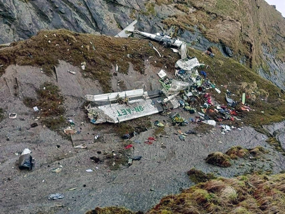
9N-AET
Flight Phase:
Survivors:
No
Site:
Schedule:
Pokhara – Jomsom
MSN:
619
YOM:
1979
Flight number:
TRA197
Country:
Region:
Crew on board:
3
Crew fatalities:
Pax on board:
19
Pax fatalities:
Other fatalities:
Total fatalities:
22
Captain / Total flying hours:
17500
Captain / Total hours on type:
13500.00
Copilot / Total flying hours:
520
Copilot / Total hours on type:
315
Aircraft flight hours:
41336
Aircraft flight cycles:
71338
Circumstances:
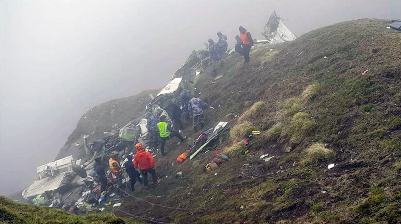
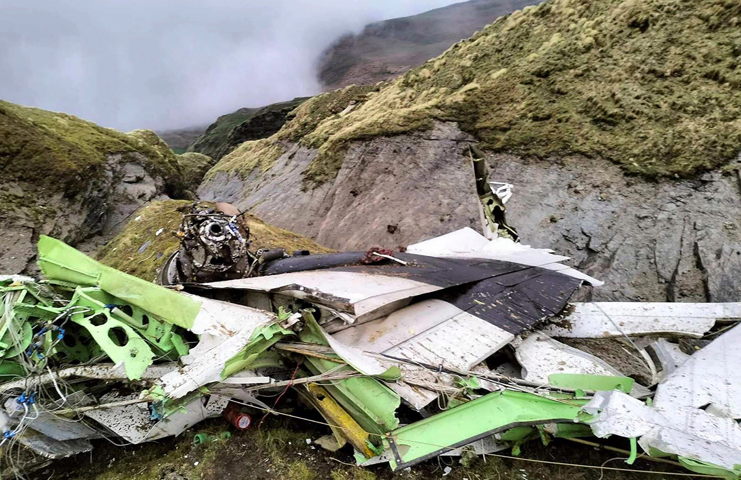
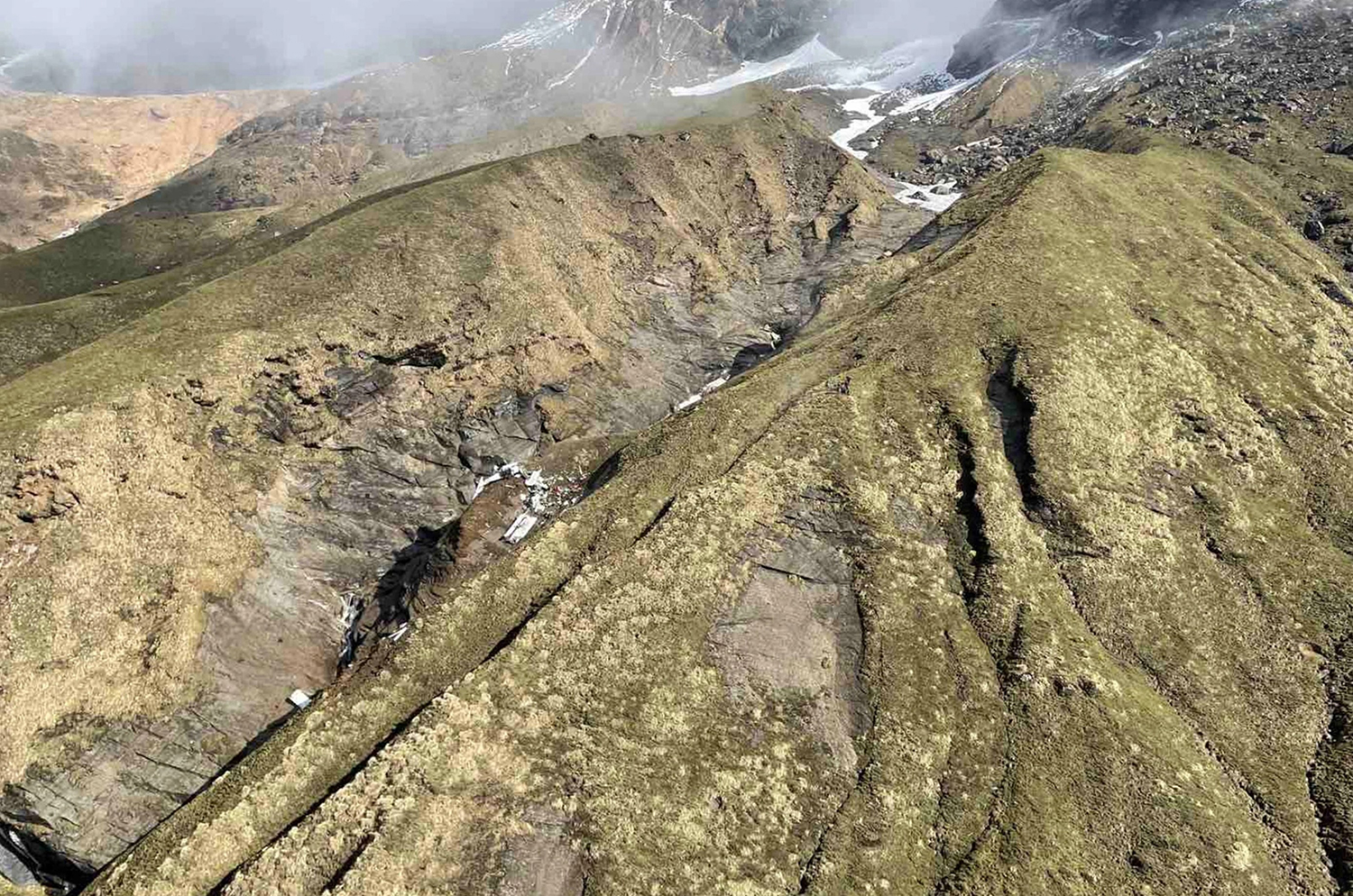
On 29 May 2022, Tara Air’s 9N-AET, Twin Otter (DHC-6/300) aircraft was scheduled for three flights on Pokhara-Jomsom-Pokhara sector. Tara Air had also filed flight plans for two additional Charter flights on the same sector. Among those five flights, four flights were to be conducted by a set of crews already positioned at Pokhara while the last flight was scheduled to be commanded by the PIC who had reached Pokhara from Kathmandu that very morning. Since Jomsom Airport was closed for operations due to bad weather, the PIC went to Tara Air crew camp and waited for the updates of weather improvement of Jomsom. After Jomsom Airport was open for operations at 0321 UTC, Tara Air operation decided to operate the first scheduled flight. However suspecting the next flight operation to Jomsom could not be operated, the original PIC assigned to the flight seated on board as a passenger to Jomsom for his scheduled business trip and the PIC assigned for the last flight took command. The Flight Plan was amended accordingly. At 0342 UTC, Summit Air’s 9N-AKZ, LET-410 took-off from Pokhara to Jomsom. At 0405 UTC, it reported an altitude of 12,500 ft and patches of cloud over Tatopani. At 0409 UTC, Summit Air’s second aircraft 9N-AMG, LET-410, took-off for Jomsom and subsequently, at 0410 UTC, 9N-AET of Tara Air (TRA197) took-off with 19 passengers and three crews on board. The Copilot had initially reported 3 crew and 18 passengers onboard to Pokhara Tower but later, revised the passenger figure was 19 prior to takeoff. 9N-AET was supposed to take-off before SMT 601 but the PIC seemed hesitant to commence the flight due to weather PIREP from 9N-AKZ that, the en-route weather was not favorable for VFR flights and critical around LETE and TATOPANI. All the crew members of TRA 197 and SMT 601 were in their respective cockpits and communicating with the preceding flight 9N-AKZ as well as with Pokhara tower for the updated information of en-route and destination weather. No flights had been conducted since morning and most of the passengers of Tara air and Summit Air were already at airport. In this situation it can be assumed that there was pressure to conduct flight from each angle. While listening to the CVR of TRA 197, it was observed that someone, either ground staff or some intimate passenger to the crew, advising strongly to the PIC to conduct the flight. Following the PIREP from 9NAKZ, both TRA197 and SMT 601 subsequently started their engines to commence the flights. The PIC of TRA 197 was still hesitant to conduct the flight for Jomsom even after the engine start and delayed the taxi as he was not yet convinced about the weather report received from preceding 9N-AKZ aircraft. In the meantime, SMT 601 lined up for departure to Jomsom. That was one of the most important pressure points to the PIC of TRA 197 to initiate departure. TRA 197 finally lined up and took off from Pokhara at 0410 UTC following the SMT 601 based on the en-route weather information (VMC) from 9N-AKZ, through Pokhara Tower. The en-route weather provided by Summit Air’s 9N-AKZ to Pokhara Tower and the crewmembers of TRA 197 and SMT 601 was not the same. Aircraft took off from Pokhara from runway 04 heading North. Tower instructed “report 5 DME northwest RW 04”. Then after departure at 90 climb power aircraft turned left to maintain a heading of 345 and planned to join heading 305 degree towards Ghodepani. After four minutes, TRA 197 reported, “Now on course…. 6000 climbing and ETA Jomsom 32” (0432 UTC). At 04:21 TRA 197 reported to Pokhara Tower as position approaching Ghodepani 12000 climbing for 12500. After 6 Seconds ATC Pokhara asked TRA 197, “confirm would like to change level and TRA 197 replied, “No Ma'am we have crossed Ghodepani and like to be on”. Pokhara Tower instructed, “Tara 197 contact Jomsom Tower 122.5” CVR recordings show that after TRA 197 crossed Ghodepani, the PIC was not comfortable with the en-route weather. However, the flight was continued following the advice of SMT 601. At 0426 UTC, TRA 197made the first contact with Jomsom AFS and reported its position to which Jomsom Tower conveyed the prevailing weather as “Wind South Westerly up to 30 kts, QNH 1019, Temp 18º”. The PIC of TRA 197 reconfirmed twice if the wind was maximum, up to 30 Kts and currently South Westerly-25kts. The crew was discussing about the bad weather being encountered and the PIC himself voiced his dissatisfaction about the behavior of other pilots who conduct VFR flights in such unfavorable weather. The CVR recordings reveal that the aircraft was encountering clouds and the PIC was trying his best to remain clear of the clouds. During the course of flight, TRA 197 hadn’t reported any abnormalities encountered and neither any technical defect on aircraft either to Jomsom tower or Pokhara Tower. As per CVR, PIC was searching for light and brighter areas and adamantly heading towards it. As per CVR and V2 tracker data, the aircraft was maintaining 12000 ft and was in a climbing attitude. During the continuous attempts of crew to avoid the clouds with Terrain Avoidance and Warning System [TAWS] inhibited, the aircraft met with an unfortunate CFIT accident into the rocky terrain at an altitude of 4050 meter AMSL at Sanusare Mountain, Thasang Rural Municipality, Mustang. As per V2 tracker, last position of 9N-AET was 7.7 nm SW of Jomsom Airport. The aircraft was completely destroyed by the impact and there were no survivors.
Probable cause:
The probable cause of this accident was the flight crew's failure to monitor and maintain the proper course while inadvertently flying in IMC conditions with the aircraft Terrain Avoidance and Warning System (TAWS) inhibited which resulted into a Controlled Flight Into Terrain (CFIT) accident.
The following contributing factors were identified:
1. The flight crew's failure to follow the SOP of company.
2. The aircraft flight operation with TAWS inhibited during deteriorating en-route weather condition.
3. Loss of situational awareness of crew.
4. Deteriorating en route weather.
5. Less experienced copilot for that sector and high crew gradient.
6. Poor CRM during the flight.
7. The whole cockpit duties [both PF and PM] were undertaken by the PlC, which likely impaired his performance.
8. Underutilization of the available Navigation instruments.
Final Report:

Crash of a Viking Air DHC-6 Twin Otter 400 near Nanga Eboko: 11 killed

Date & Time: May 11, 2022
Operator:
Registration:
TJ-TIM
Flight Phase:
Survivors:
No
Schedule:
Yaoundé – Dompta – Belabo
MSN:
934
YOM:
2015
Country:
Region:
Crew on board:
2
Crew fatalities:
Pax on board:
9
Pax fatalities:
Other fatalities:
Total fatalities:
11
Circumstances:
The twin engine airplane departed Yaoundé at 1246LT on a charter flight to Dompta and Belabo, carrying 9 employees of the Cameroon Oil Transportation Company (COTCO) and two crew members. En route, the airplane crashed in unknown circumstances near the village of Nanga Eboko. All 11 occupants were killed.

Crash of a De Havilland DHC-6 Twin Otter 300 in Bilogai: 3 killed

Date & Time: Sep 15, 2021 at 0730 LT
Operator:
Registration:
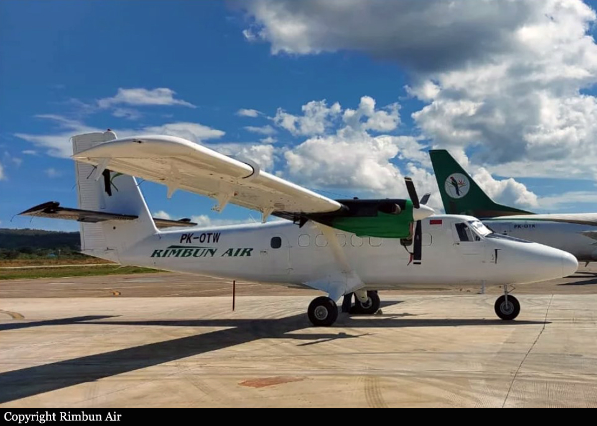
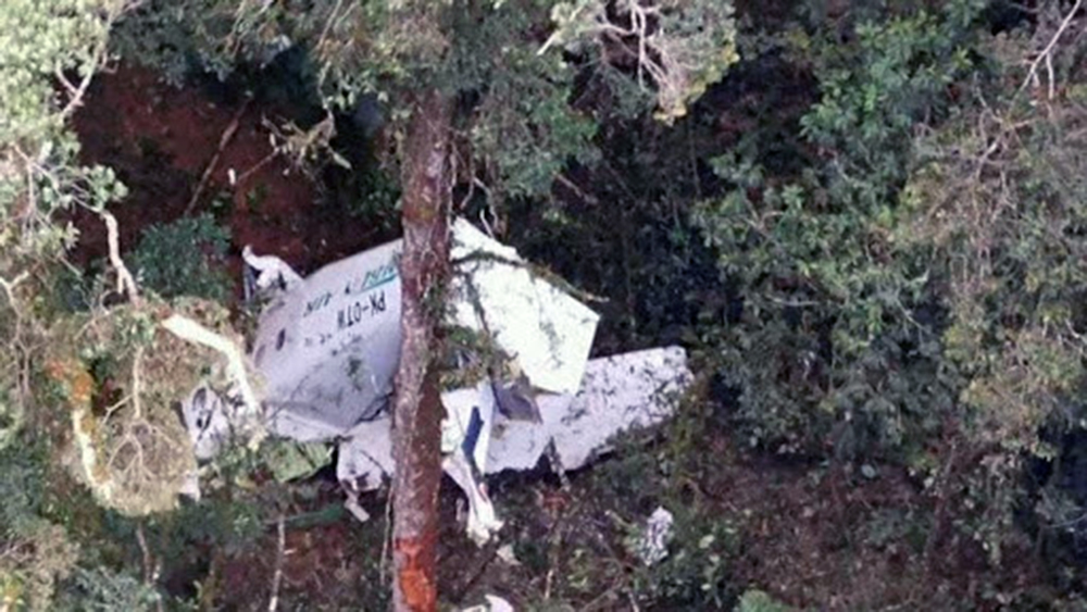
PK-OTW
Flight Type:
Survivors:
No
Site:
Schedule:
Nabire – Bilogai
MSN:
493
YOM:
1976
Country:
Region:
Crew on board:
3
Crew fatalities:
Pax on board:
0
Pax fatalities:
Other fatalities:
Total fatalities:
3
Captain / Total flying hours:
13158
Captain / Total hours on type:
8051.00
Copilot / Total flying hours:
974
Copilot / Total hours on type:
807
Aircraft flight hours:
10333
Aircraft flight cycles:
1569
Circumstances:
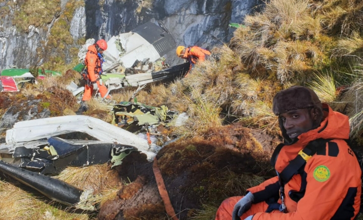
On 15 September 2021, a DHC-6-300 (Twin Otter) aircraft registered PK-OTW was being operated for an unscheduled cargo flight from Douw Aturure Airport (WABI), Nabire, Papua to Bilorai Airport (WAYB), Intan Jaya, Papua. The aircraft was operated by two pilots accompanied by one engineer on board. The filed flight plan for the flight indicated that the aircraft would be operated under Visual Flight Rule (VFR) with fuel endurance of 2 hours 30 minutes. The estimate time departure for the flight was at 0640 LT. At 0610 LT, the pilot received weather observation report from the Bilorai aeronautical communication officer (ACO) that the visibility was 5 up to 7 kilometers, several clouds over the airport and all final areas were clear. About 7 minutes later, the ACO updated the observation report which indicated that the visibility changed to 7 up to 8 kilometers (km). After the cargo loading process and the flight preparation had completed, the aircraft taxied to Runway 16. At 0644 LT, the aircraft departed and climbed to the cruising altitude of 9,500 feet. Prior to the departure, there was no record or report of aircraft system malfunction. The Pilot in Command (PIC) acted as Pilot Monitoring (PM) while the Second in Command (SIC) acted as Pilot Flying (PF). At 0658 LT, the PK-OTW pilot reported to the Nabire air traffic control that the aircraft was at 25 Nm with altitude of 9,500 feet. At 0702 LT, the SIC asked the PIC to have the aircraft control as PF. During flight, the PK-OTW pilots monitored weather information provided by the pilots of two other aircraft that flew ahead of the PK-OTW to Bilorai. Both pilots monitored that the first aircraft (Cessna 208B EX) landed using Runway 27 while the second aircraft (Cessna 208B) would use Runway 09. At 0715 LT, the PIC advised the SIC to use the Runway 27 for landing. At 0719 LT, the SIC made initial contact with the ACO and advised that the aircraft was approaching Bilai at altitude of 9,500 feet and the estimate time arrival at Bilorai was 0726 LT. The ACO acknowledged the pilot report and provided current weather observation as follows “…wind westerly 3 until 5 knots, final 09 open with broken fog and final 27 open, visibility 5 until 7 km, blue sky overhead”. The SIC acknowledged the weather information and advised the ACO would report when the aircraft position was on left downwind Runway 27. At 0721 LT, the SIC read the descent checklist included the item of Landing Data/Approach Briefing and was replied by completed. The Cockpit Voice Recorder (CVR) did not record any pilot’s discussion regarding to the airport minimum safe altitude since the beginning of the recording. At 0723 LT, a pilot of DHC-6-400 aircraft registered PK-OTJ, asked the PK-OTW pilot of the weather condition in Bilorai. The PK-OTJ flew behind the PK-OTW with from Nabire to Bilorai. The SIC then responded that the PK-OTW was on descend and would fly through clouds about 5 Nm to Bilorai. Thereafter, the ACO provided traffic information to PK-OTW pilot that there was an aircraft (Cessna 208B aircraft) on final Runway 09. The PIC who acted as PF acknowledged the traffic information and advised to the ACO that the PK-OTW would join left downwind Runway 27 for the landing approach. At 0725 LT, the SIC advised to the ACO that the aircraft was on left downwind Runway 27. The ACO then advised the PK-OTW pilot to report when on final Runway 27. At 07:26:12 LT, a stall warning recorded in the Cockpit Voice Recorder (CVR) then the PIC asked to the SIC to check the aircraft speed. The SIC responded the aircraft speed was 65 knots. At 07:26:16 LT, the PIC asked to the SIC to advise the ACO that they were making a go around. The SIC then advised the ACO that the PK-OTW was making a go around and was responded to report when on final. The CVR did not record pilot’s discussion about the plan maneuver of the go around. At 07:26:45 LT, the PIC informed that they were making a go around to the PK-OTJ pilot. The PK-OTJ pilot responded that the aircraft was approaching Homeyo and would reduce the speed to make enough separation with the PK-OTW. The PIC then advised the PK-OTJ that the PK-OTW would attempt to land using Runway 09. Based on the data transmitted from the flight following system, at 07:27:57 LT, the aircraft was about 3 Nm outbound from Bilorai on direction of 238°. At 07:28:22 LT, the PK-OTJ pilot advised to the ACO that the aircraft was about 6 nm to Bilai and the pilot intended to make holding maneuver over Bilai to make enough separation with the PK-OTW. At 07:28:33 LT, the SIC advised the PIC that the aircraft was at 8,200 feet and was responded that the PIC initiated turning the aircraft. A few second later, the SIC advised to the PIC that the aircraft was turning, and the aircraft was at 3.2 Nm outbound from Bilorai. At 07:28:38 LT, the last data of the flight following system recorded that the aircraft was on direction of 110°. At 07:29:25 LT, the SIC advised the PIC to fly left. Thereafter, the SIC advised the PIC that the aircraft was passing 8,000 feet. At 07:29:35 LTC, the PIC asked to the SIC about the distance to Bilorai and was responded 2.5 Nm. The SIC, reminded the PIC to fly left as the aircraft flew too close to the terrain. At 07:29:49 LT, the CVR recorded the first impact sound and the CVR recording stopped at 07:29:55 LT. At 0730 LT, the ACO asked the PK-OTW pilot intention as the aircraft was not visible from the ACO working position, and the pilot did not respond the ACO. At about the same time, the ACO heard impact sound that was predicted coming from terrain area on west of Bilorai. The ACO then called the PK-OTW pilot several times without response. Several pilots also attempted to contact the PK-OTW with the same result. The PK-OTW was found on a ridge at elevation of 8,100 feet, about 2 Nm on bearing 260° from Bilorai.


Crash of a Viking Air DHC-6 Twin Otter 400 near Kampung Mamontoga: 4 killed

Date & Time: Sep 18, 2019 at 1100 LT
Operator:
Registration:
PK-CDC
Flight Phase:
Flight Type:
Survivors:
No
Site:
Schedule:
Timika - Ilaga
MSN:
950
YOM:
2016
Country:
Region:
Crew on board:
3
Crew fatalities:
Pax on board:
1
Pax fatalities:
Other fatalities:
Total fatalities:
4
Circumstances:
The twin engine airplane departed Timika Airport at 1036LT on a cargo flight to Ilaga, carrying one passenger, a crew of four and a load of 1,7 ton of rice. At 1054LT, the crew gave his ETA at Ilaga Airport when the contact was lost about six minutes later. As the airplane failed to arrive at destination, SAR operations were initiated. The wreckage was found four days later in a mountainous terrain, at an altitude of 4,115 meters, about 10 km from Kampung Mamontoga. The aircraft was totally destroyed and all four occupants were killed.