Crash of a Beechcraft 200 Super King Air in Oscoda: 1 killed

Date & Time: Sep 25, 2018 at 0613 LT
Operator:
Registration:
N241CK
Flight Type:
Survivors:
No
Schedule:
Detroit - Oscoda
MSN:
BB-272
YOM:
1977
Flight number:
K985
Crew on board:
1
Crew fatalities:
Pax on board:
0
Pax fatalities:
Other fatalities:
Total fatalities:
1
Captain / Total flying hours:
3806
Captain / Total hours on type:
201.00
Aircraft flight hours:
13933
Circumstances:
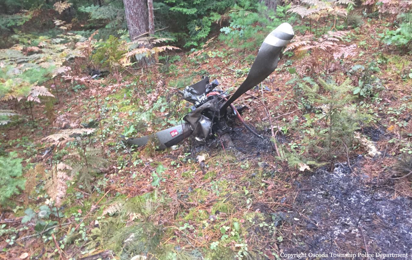
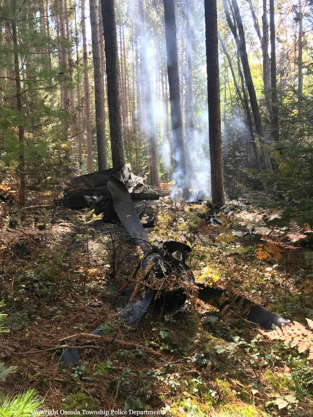
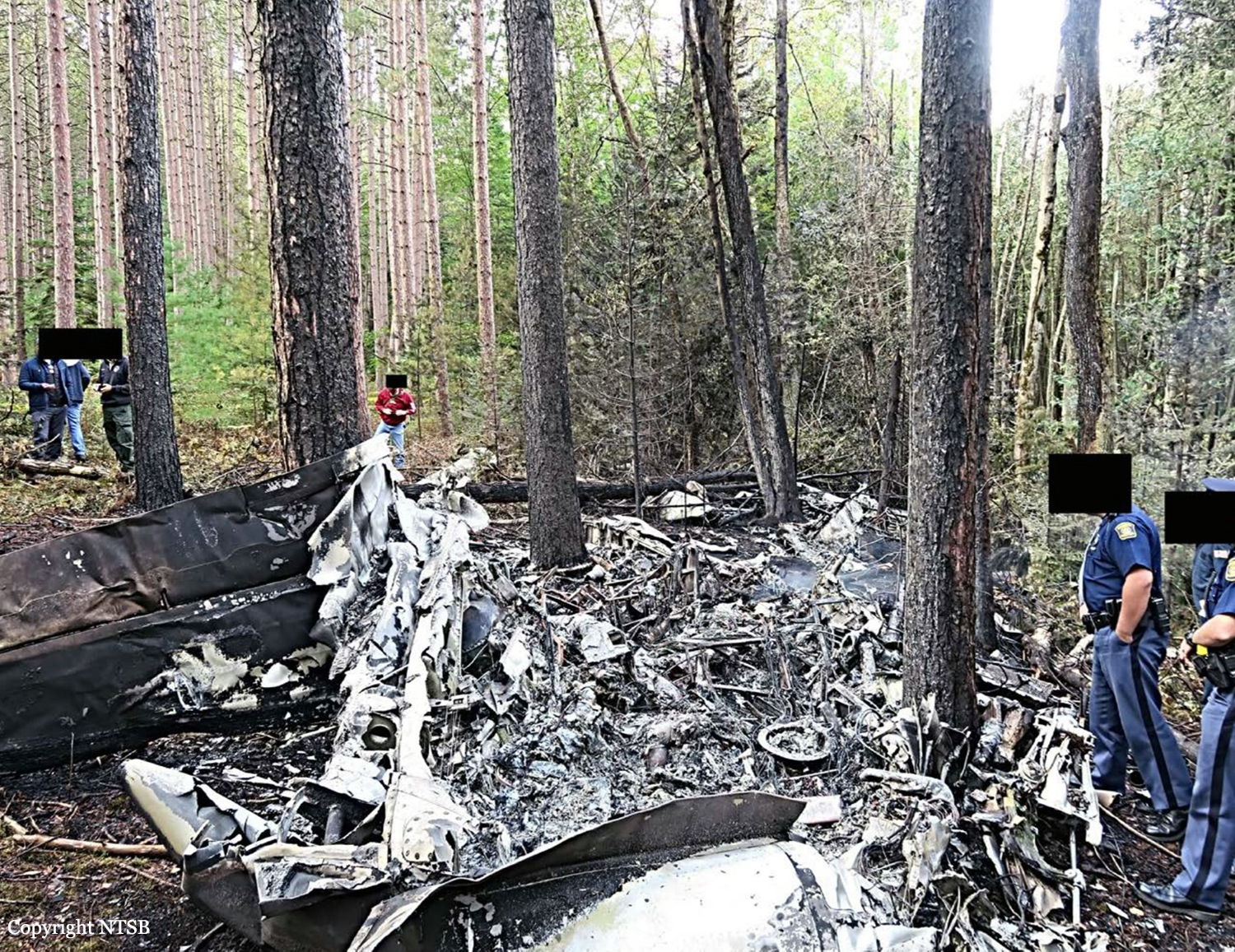
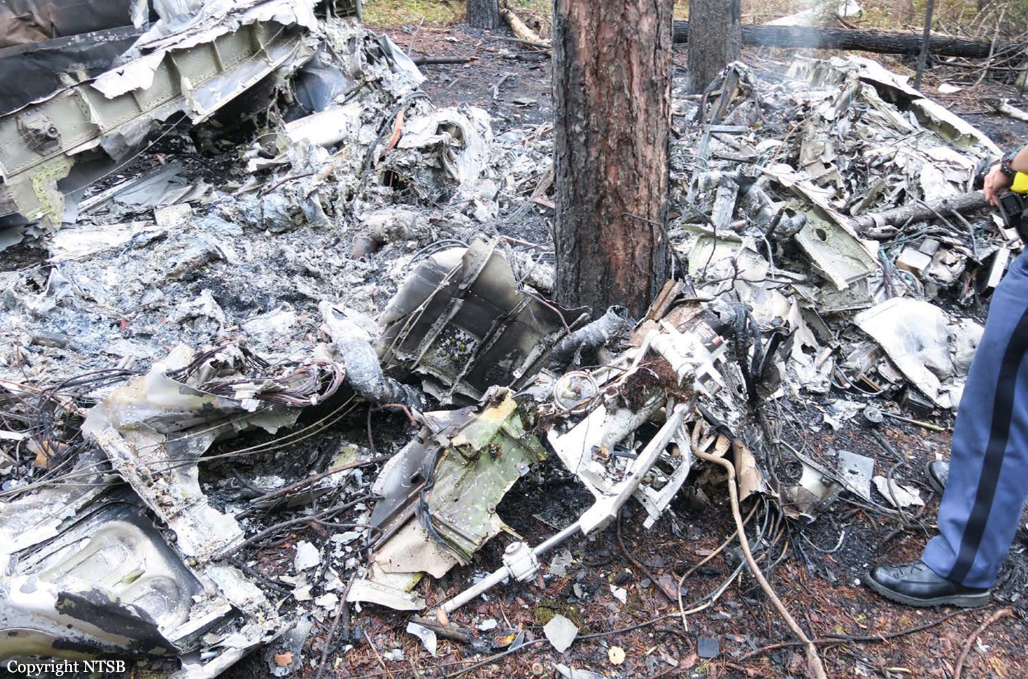
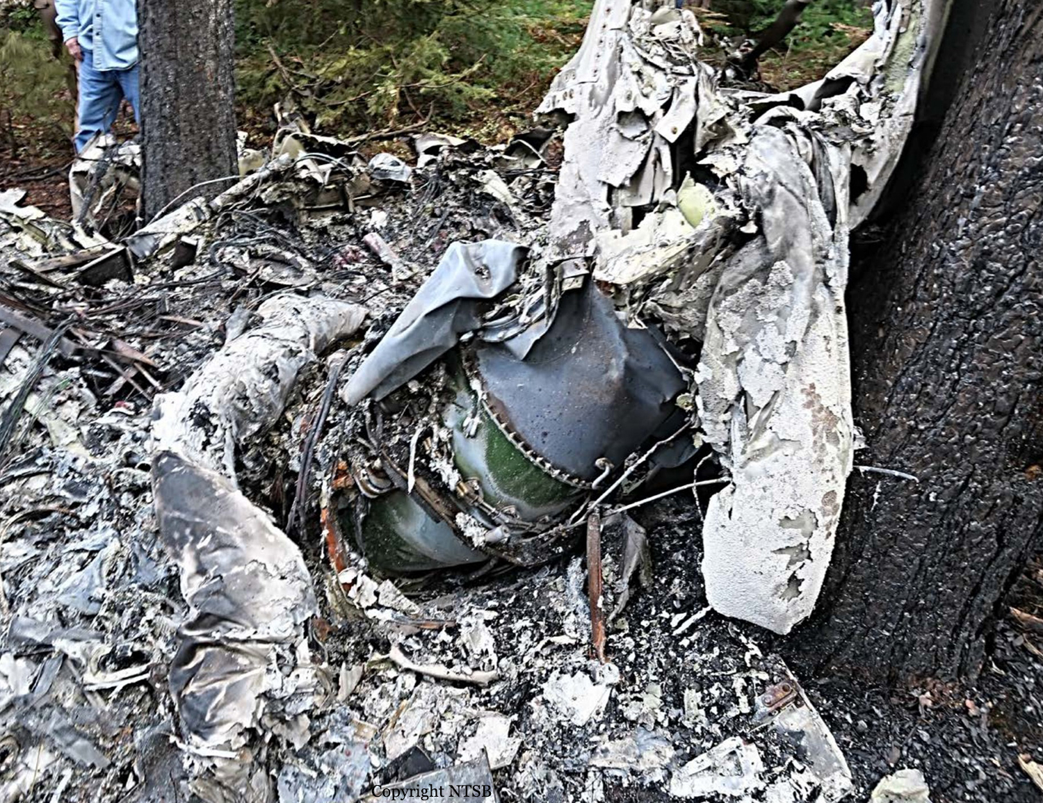
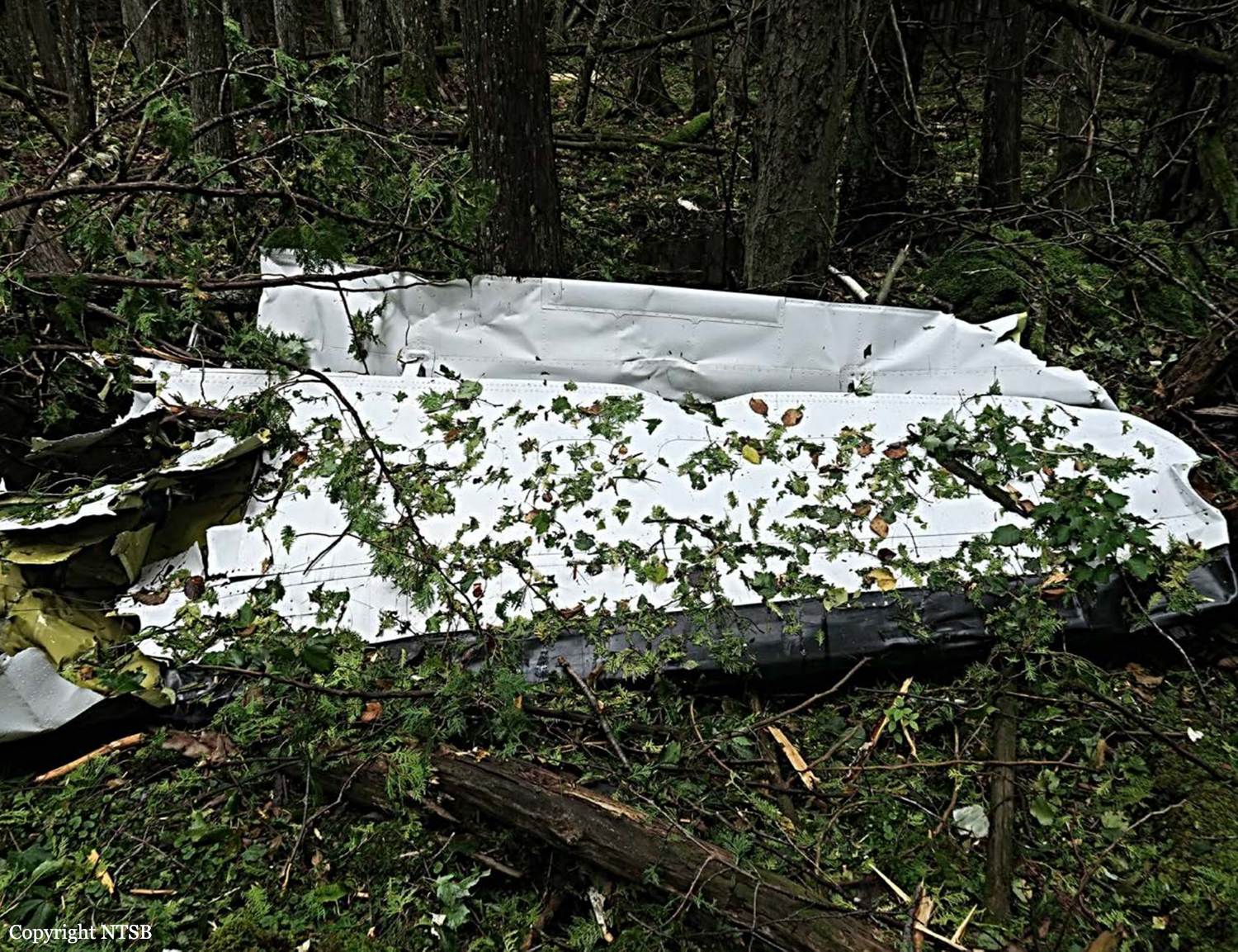
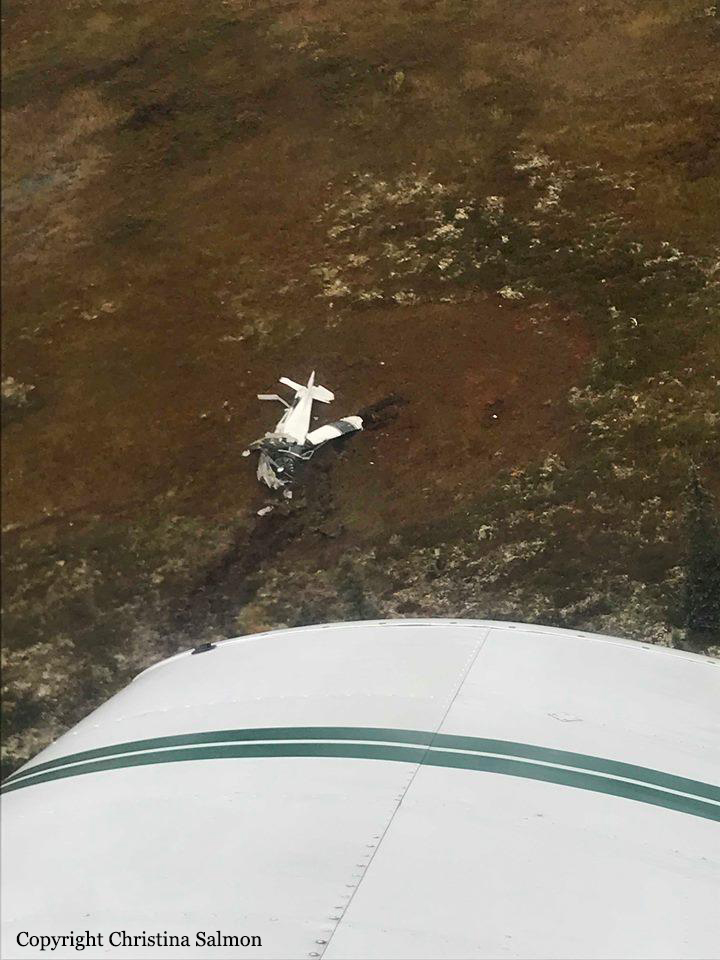
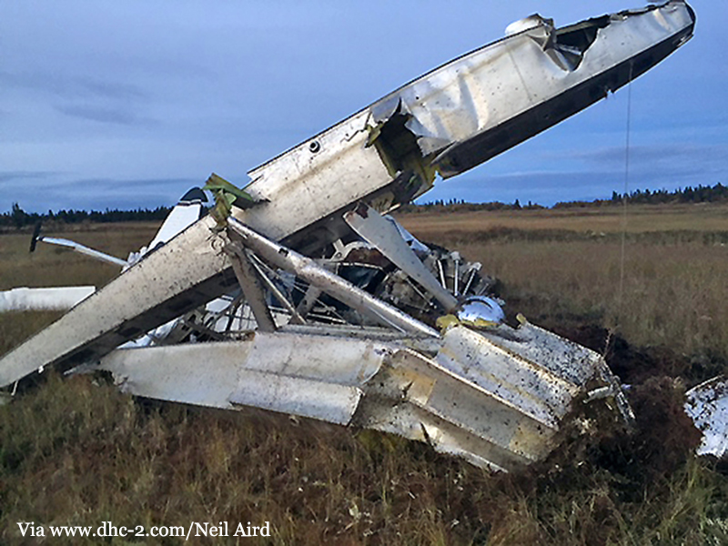
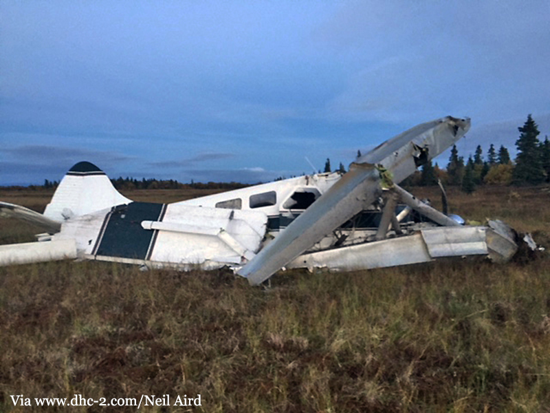
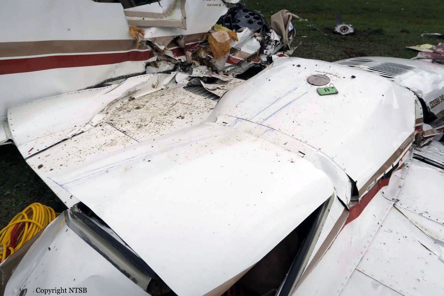
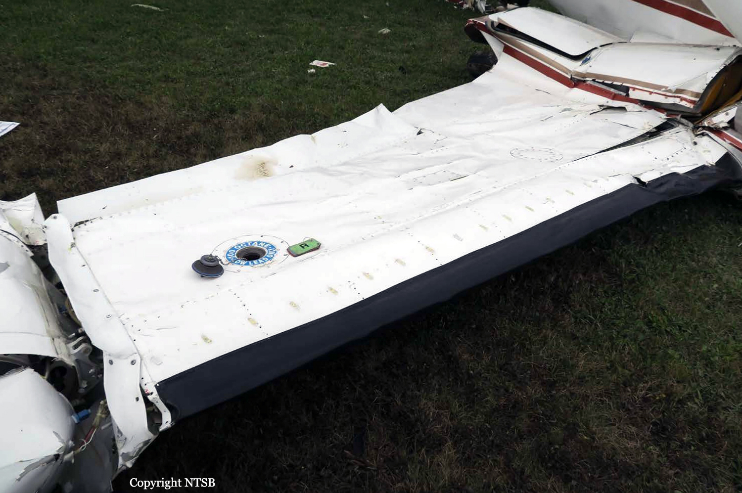
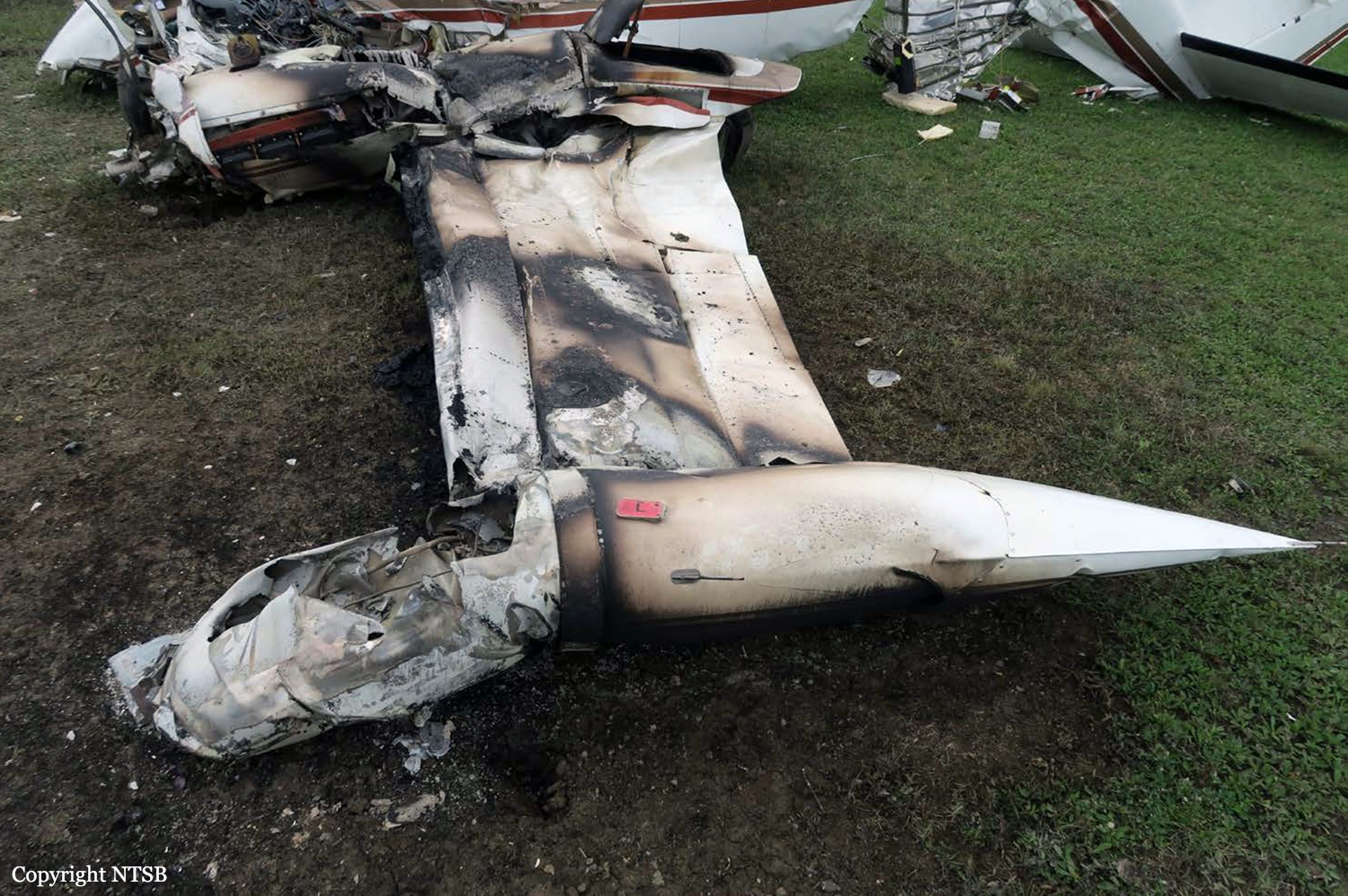
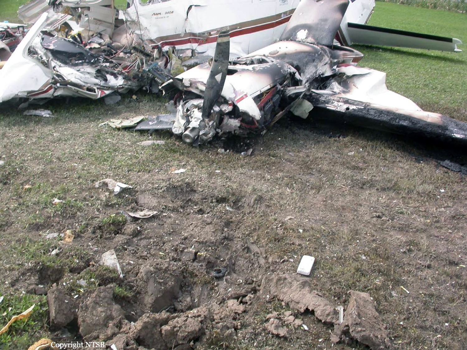
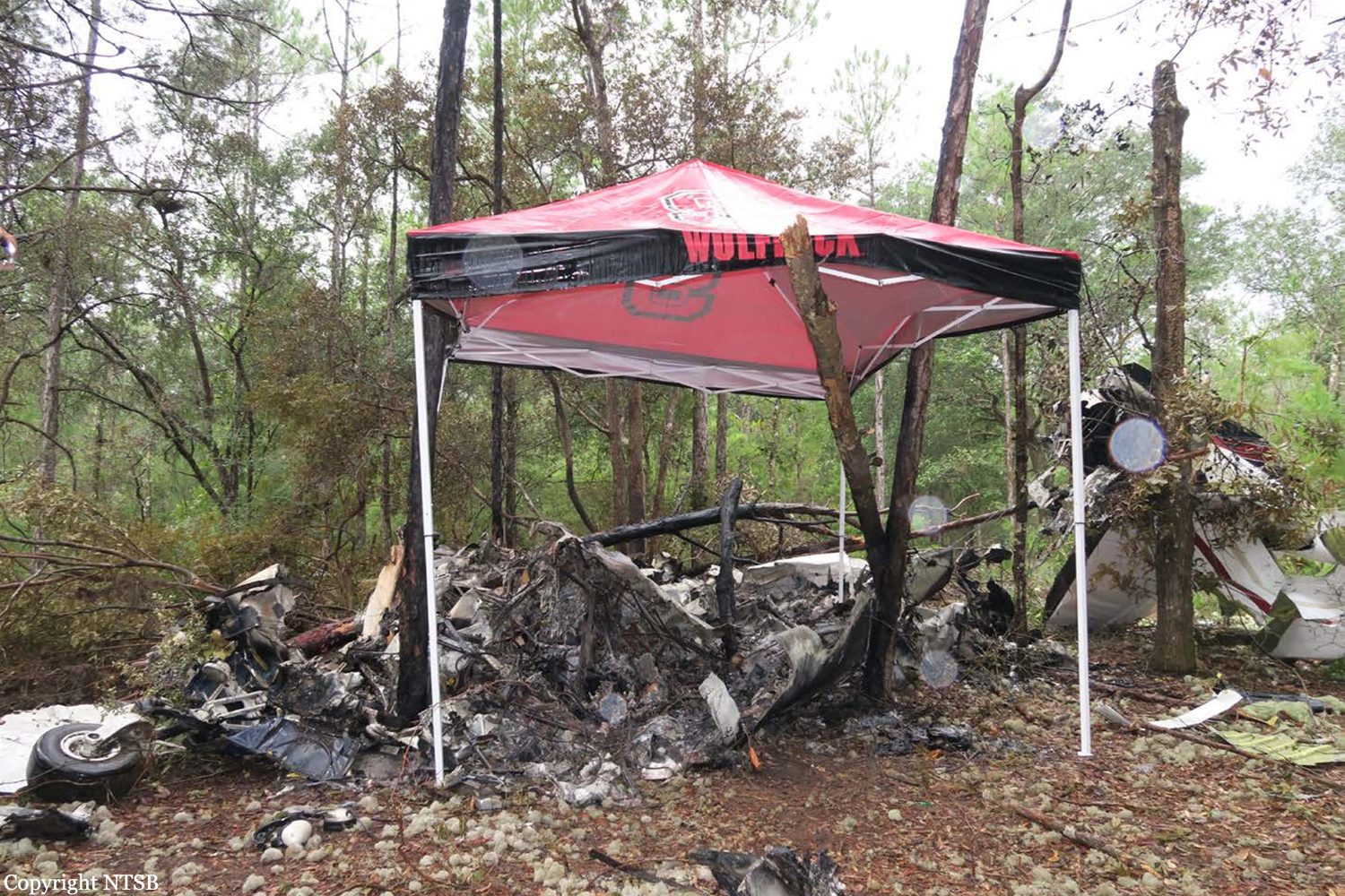
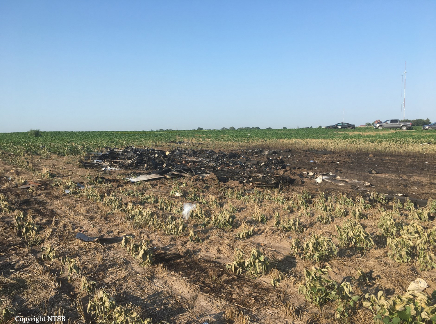
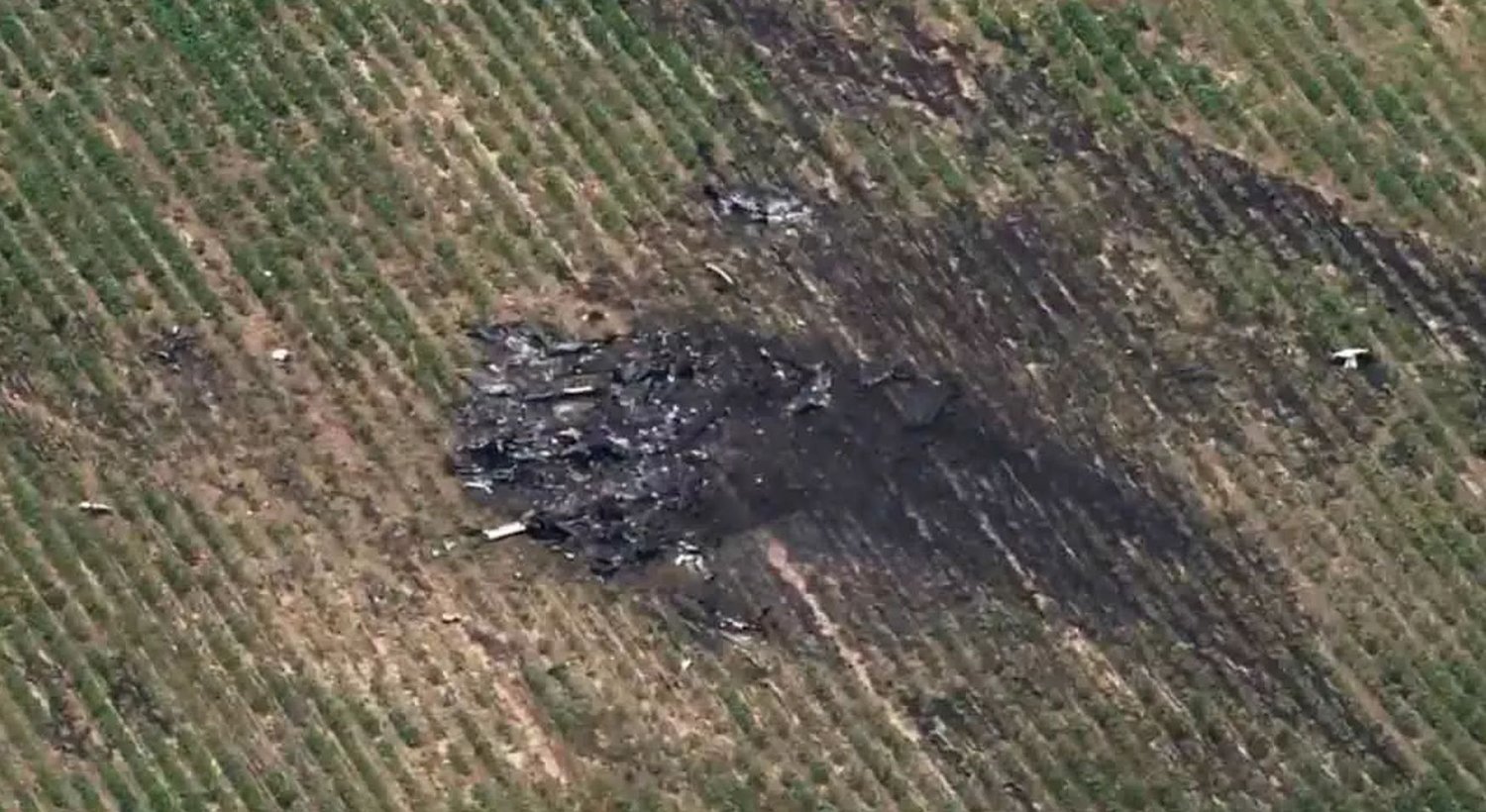
The airline transport pilot of the multiengine airplane was cleared for the VOR approach. The weather at the airport was reported as 400 ft overcast with 4 miles visibility in drizzle. When the airplane failed to arrive at the airport as scheduled, a search was initiated, and the wreckage was located soon thereafter. Radar data indicated that the pilot was provided vectors to intercept the final approach course. The last radar return indicated that the airplane was at 2,200 ft and 8.1 miles from the runway threshold. It impacted terrain 3.5 miles from the runway threshold and left of the final approach course. According to the published approach procedure, the minimum descent altitude was 1,100 feet, which was 466 ft above airport elevation. Examination of the wreckage revealed that the airplane had impacted the tops of trees and descended at a 45° angle to ground contact; the airplane was destroyed by a postcrash fire, thus limiting the examination; however, no anomalies were observed that would have precluded normal operation. The landing gear was extended, and approach flaps had been set. Impact and fire damage precluded an examination of the flight and navigation instruments. Autopsy and toxicology of the pilot were not performed; therefore, whether a physiological issue may have contributed to the accident could not be determined. The location of the wreckage indicates that the pilot descended below the minimum descent altitude (MDA) for the approach; however, the reason for the pilot's descent below MDA could not be determined based on the available information.
Probable cause:
The pilot's descent below minimum descent altitude during the non precision instrument approach for reasons that could not be determined based on the available information.
Final Report:

Crash of a De Havilland DHC-2 Beaver in Igiugig

Date & Time: Sep 20, 2018 at 1530 LT
Type of aircraft:
Operator:
Registration:
N121AK
Flight Phase:
Survivors:
Yes
MSN:
121
YOM:
1951
Location:
Crew on board:
1
Crew fatalities:
Pax on board:
6
Pax fatalities:
Other fatalities:
Total fatalities:
0
Captain / Total flying hours:
12496
Captain / Total hours on type:
5000.00
Circumstances:
The pilot of the float-equipped airplane reported that, during the initial climb after a water takeoff, about 200 feet, he turned right, and the engine lost power. He immediately switched fuel tanks and attempted to restart the engine to no avail. The airplane descended and struck trees, and the right wing impacted terrain. The airplane sustained substantial damage to the right wing. The pilot reported that there were no preaccident mechanical failures or malfunctions with the airplane that would have precluded normal operation. The pilot reported to the Federal Aviation Administration inspector that, during the initial climb and after the engine lost power, he noticed that the center tank, which was selected for takeoff, was empty. He added that passengers stated that the engine did regain power after switching tanks, but the airplane had already struck trees. The pilot reported as a recommendation to more closely follow checklists.
Probable cause:
The pilot's selection of an empty fuel tank for takeoff, which resulted in fuel starvation and the subsequent total loss of engine power.
Final Report:

Crash of a Cessna 340A in Saint Clair County: 1 killed

Date & Time: Sep 6, 2018 at 2347 LT
Type of aircraft:
Operator:
Registration:
C-GLKX
Flight Type:
Survivors:
No
Schedule:
Saint Thomas - Saint Clair County
MSN:
340A-1221
YOM:
1981
Crew on board:
1
Crew fatalities:
Pax on board:
0
Pax fatalities:
Other fatalities:
Total fatalities:
1
Captain / Total flying hours:
690
Captain / Total hours on type:
51.00
Aircraft flight hours:
4038
Circumstances:
The private pilot of the multi-engine airplane was conducting an instrument approach during night visual meteorological conditions. About 1.3 nautical miles (nm) from the final approach fix, the right engine lost total power. The pilot continued the approach and notified air traffic control of the loss of power about 1 minute and 13 seconds later. Subsequently, the pilot contacted the controller again and reported that he was unable to activate the airport's pilot-controlled runway lighting. In the pilot's last radio transmission, he indicated that he was over the airport and was going to "reshoot that approach." The last radar return indicated that the airplane was about 450 ft above ground level at 72 kts groundspeed. The airplane impacted the ground in a steep, vertical nose-down attitude about 1/2 nm from the departure end of the runway. Examination of the wreckage revealed that the landing gear and the flaps were extended and that the right propeller was not feathered. Data from onboard the airplane also indicated that the pilot did not secure the right engine following the loss of power; the left engine continued to produce power until impact. The airplane's fuel system held a total of 203 gallons. Fuel consumption calculations estimated that there should have been about 100 gallons remaining at the time of the accident. The right-wing locker fuel tank remained intact and contained about 14 gallons of fuel. Fuel blight in the grass was observed at the accident site and the blight associated with the right wing likely emanated from the right-wing tip tank. The elevator trim tab was found in the full nose-up position but was most likely pulled into this position when the empennage separated from the aft pressure bulkhead during impact. Examination of the airframe and engine revealed no evidence of mechanical malfunctions or failures that would have precluded normal operation. Although there was adequate fuel on board the airplane, the pilot may have inadvertently moved the right fuel selector to the OFF position or an intermediate position in preparation for landing instead of selecting the right wing fuel tank, or possibly ran the right auxiliary fuel tank dry, which resulted in fuel starvation to the right engine and a total loss of power. The airplane manufacturer's Pilot Operating Handbook (POH) stated that the 20-gallon right- and left-wing locker fuel tanks should be used after 90 minutes of flight. However, 14 gallons of fuel were found in the right-wing locker fuel tank which indicated that the pilot did not adhere to the POH procedures for fuel management. The fuel in the auxiliary fuel tank should be used when the main fuel tank was less than 180 pounds (30 gallons) per tank. As a result of not using all the fuel in the wing locker fuel tanks, the pilot possibly ran the right auxiliary fuel tank empty and was not able to successfully restart the right engine after he repositioned the fuel selector back to the right main fuel tank. Postaccident testing of the airport's pilot-controlled lighting system revealed no anomalies. The airport's published approach procedure listed the airport's common traffic advisory frequency, which activated the pilot-controlled lighting. It is possible that the pilot did not see this note or inadvertently selected an incorrect frequency, which resulted in his inability to activate the runway lighting system. In addition, the published instrument approach procedure for the approach that the pilot was conducting indicated that the runway was not authorized for night landings. It is possible that the pilot did not see this note since he gave no indication that he was going to circle to land on an authorized runway. Given that the airplane's landing gear and flaps were extended, it is likely that the pilot intended to land but elected to go-around when he was unable to activate the runway lights and see the runway environment. However, the pilot failed to reconfigure the airplane for climb by retracting the landing gear and flaps. The pilot had previously failed to secure the inoperative right engine following the loss of power, even though these procedures were designated in the airplane's operating handbook as "immediate action" items that should be committed to memory. It is likely that the airplane was unable to climb in this configuration, and during the attempted go-around, the pilot exceeded the airplane's critical angle of attack, which resulted in an aerodynamic stall. Additionally, the pilot had the option to climb to altitude using singleengine procedures and fly to a tower-controlled airport that did not have any landing restrictions, but instead, he decided to attempt a go-around and land at his destination airport.
Probable cause:
The pilot's improper fuel management, which resulted in a total loss of right engine power due to fuel starvation; the pilot's inadequate flight planning; the pilot's failure to secure the right engine following the loss of power; and his failure to properly configure the airplane for the go-around, which resulted in the airplane's failure to climb, an exceedance of the critical angle of attack, and an aerodynamic stall.
Final Report:

Crash of a Beechcraft 60 Duke in Destin: 4 killed

Date & Time: Aug 30, 2018 at 1030 LT
Type of aircraft:
Registration:
N1876L
Flight Type:
Survivors:
No
Schedule:
Toledo - Destin
MSN:
P-386
YOM:
1976
Crew on board:
1
Crew fatalities:
Pax on board:
3
Pax fatalities:
Other fatalities:
Total fatalities:
4
Captain / Total flying hours:
2427
Captain / Total hours on type:
100.00
Aircraft flight hours:
4167
Circumstances:
The commercial pilot and three passengers departed on a cross-country flight in a twin-engine airplane. As the flight neared the destination airport, the pilot canceled his instrument flight rules (IFR) clearance. The approach controller transferred the flight to the tower controller, and the pilot reported to the tower controller that the airplane was about 2 miles from the airport. However, the approach controller contacted the tower controller to report that the airplane was 200 ft over a nearby joint military airport at the time. GPS data revealed that, when pilot reported that the airplane was 2 miles from the destination airport, the airplane's actual location was about 10 miles from the destination airport and 2 miles from the joint military airport. The airplane impacted a remote wooded area about 8 miles northwest of the destination airport. At the time of the accident, thunderstorm cells were in the area. A review of the weather information revealed that the pilot's view of the airport was likely obscured because the airplane was in an area of light precipitation, restricting the pilot's visibility. A review of airport information noted that the IFR approach course for the destination airport passes over the joint military airport. The Federal Aviation Administration chart supplement for the destination airport noted the airport's proximity to the other airport. However, it is likely that the pilot mistook the other airport for the destination airport due to reduced visibility because of weather. The accident circumstances were consistent with controlled flight into terrain. The ethanol detected in the pilot's blood specimens but not in his urine specimens was consistent with postmortem bacteria production. The carbon monoxide and cyanide detected in the pilot's blood specimens were consistent with inhalation after the postimpact fire.
Probable cause:
The pilot's controlled flight into terrain after misidentifying the destination airport during a period of restricted visibility due to weather.
Final Report:

Crash of a Cessna 525 CitationJet CJ1 in Payson: 1 killed

Date & Time: Aug 13, 2018 at 0230 LT
Type of aircraft:
Operator:
Registration:
N526CP
Flight Phase:
Flight Type:
Survivors:
No
Site:
MSN:
525-0099
YOM:
1995
Location:
Crew on board:
1
Crew fatalities:
Pax on board:
0
Pax fatalities:
Other fatalities:
Total fatalities:
1
Captain / Total flying hours:
4000
Circumstances:
Owned by a construction company and registered under Vancon Holdings LLC (VanCon Inc.), the aircraft was parked at Spanish Fork-Springville Airport when it was stolen at night by a private pilot. After takeoff, hew flew southbound to Payson, reduced his altitude and voluntarily crashed the plane onto his house located in Payson. The airplane disintegrated on impact and was destroyed by impact forces and a post crash fire. The pilot was killed. His wife and daughter who were in the house at the time of the accident were uninjured despite the house was also destroyed by fire. Local Police declared that the pilot intentionally flew the airplane into his own home hours after being booked for domestic assault charges. An examination of the airplane found no anomalies with the flight controls that would have contributed to the accident. Toxicology testing revealed the presence of a medication used to treat depression, obsessive-compulsive disorder, some eating disorders, and panic attacks; the pilot did not report the use of this medication to the Federal Aviation Administration. The pilot had a known history of depression, anxiety, and anger management issues. The circumstances of the accident were consistent with the pilot's intentional flight into his home.
Probable cause:
The pilot's intentional flight into his residence.
Final Report:

Crash of a De Havilland DH.89A Dragon Rapide 4 in Abbotsford

Date & Time: Aug 11, 2018 at 1731 LT
Operator:
Registration:
N683DH
Flight Phase:
Flight Type:
Survivors:
Yes
Schedule:
Abbotsford - Abbotsford
MSN:
6782
YOM:
1944
Country:
Crew on board:
1
Crew fatalities:
Pax on board:
4
Pax fatalities:
Other fatalities:
Total fatalities:
0
Captain / Total flying hours:
10000
Captain / Total hours on type:
20.00
Circumstances:
The vintage de Havilland DH-89A MKIV Dragon Rapide biplane (U.S. registration N683DH, serial number 6782) operated by Historic Flight Foundation was part of the static aircraft display at the Abbotsford International Airshow at Abbotsford Airport (CYXX), British Columbia. Following the conclusion of the airshow that day, the aircraft was being used to provide air rides. At approximately 1731 on 11 August 2018, the aircraft began its takeoff from Runway 25 with the pilot and 4 passengers on board for a local flight to the southeast. During the takeoff, the aircraft encountered strong, gusting crosswinds. It climbed to about 30 feet above ground level before descending suddenly and impacting the runway, coming to rest on its nose immediately off the right edge of the runway. Within 2 minutes, 2 aircraft rescue firefighting trucks arrived on the scene along with an operations/command vehicle. About 10 minutes later, 2 St. John Ambulances arrived. A representative of the HFF was escorted to the scene to ensure all electronics on the aircraft were turned off. Shortly thereafter, 2 BC Ambulance Service ground ambulances arrived, followed by 2 City of Abbotsford fire trucks. Two BC Ambulance Service air ambulances arrived after that. The fire trucks stabilized the aircraft, and the first responders who arrived with the fire truck finished evacuating the occupants. The pilot and 1 passenger received serious injuries; the other 3 passengers received minor injuries. All of the aircraft occupants were taken to the hospital. The aircraft was substantially damaged. There was a fuel spill, but no fire. The emergency locator transmitter activated.
Final Report:

Crash of a De Havilland Dash-8-400 on Ketron Island: 1 killed

Date & Time: Aug 10, 2018 at 2043 LT
Operator:
Registration:
N449QX
Flight Phase:
Flight Type:
Survivors:
No
MSN:
4410
YOM:
2012
Crew on board:
1
Crew fatalities:
Pax on board:
0
Pax fatalities:
Other fatalities:
Total fatalities:
1
Circumstances:
On August 10, 2018, about 2043 Pacific daylight time, a De Havilland DHC-8-402, N449QX, was destroyed when it impacted trees on Ketron Island, near Steilacoom, WA. The noncertificated pilot was fatally injured. The airplane was registered to Horizon Air Industries, Inc,. and was being operated by the noncertificated pilot as an unauthorized flight. Visual meteorological conditions prevailed in the area at the time of the event, and no flight plan was filed. The airplane departed from the Seattle-Tacoma International Airport, Seattle, Washington, about 1932. Horizon Air personnel reported that the noncertificated pilot was employed as a ground service agent and had access to the airplanes on the ramp. The investigation of this event is being conducted under the jurisdiction of the Federal Bureau of Investigation (FBI). The NTSB provided requested technical assistance to the FBI, and any material generated by the NTSB is under the control of the FBI. The NTSB does not plan to issue an investigative report or open a public docket.
Probable cause:
The NTSB did not determine the probable cause of this event and does not plan to issue an investigative report or open a public docket. The investigation of this event is being conducted under the jurisdiction of the Federal Bureau of Investigation.
Final Report:

Crash of a Cessna 414 Chancellor in Santa Ana: 5 killed

Date & Time: Aug 5, 2018 at 1229 LT
Type of aircraft:
Registration:
N727RP
Flight Type:
Survivors:
No
Site:
Schedule:
Concord – Santa Ana
MSN:
414-0385
YOM:
1973
Crew on board:
1
Crew fatalities:
Pax on board:
4
Pax fatalities:
Other fatalities:
Total fatalities:
5
Captain / Total flying hours:
980
Captain / Total hours on type:
120.00
Aircraft flight hours:
3963
Circumstances:
The pilot and four passengers were nearing the completion of a cross-county business flight. While maneuvering in the traffic pattern at the destination airport, the controller asked the pilot if he could accept a shorter runway. The pilot said he could not, so he was instructed to enter a holding pattern for sequencing; less than a minute later, the pilot said he could accept the shorter runway. He was instructed to conduct a left 270° turn to enter the traffic pattern. The pilot initiated a left bank turn and then several seconds later the bank increased, and the airplane subsequently entered a steep nose-down descent. The airplane impacted a shopping center parking lot about 1.6 miles from the destination airport. A review of the airplane's flight data revealed that, shortly after entering the left turn, and as the airplane’s bank increased, its airspeed decreased to about 59 knots, which was well below the manufacturer’s published stall speed in any configuration. Postaccident examination of the airframe and engines revealed no anomalies that would have precluded normal operation. It is likely that the pilot failed to maintain airspeed during the turn, which resulted in an exceedance of the aircraft's critical angle of attack and an aerodynamic stall.
Probable cause:
The pilot’s failure to maintain adequate airspeed while maneuvering in the traffic pattern which resulted in an aerodynamic stall and subsequent spin at a low altitude, which the pilot was unable to recover from.
Final Report:

Crash of a De Havilland DHC-2 Beaver I on Mt Kahiltna: 5 killed

Date & Time: Aug 4, 2018 at 1753 LT
Type of aircraft:
Operator:
Registration:
N323KT
Flight Phase:
Survivors:
No
Site:
Schedule:
Talkeetna - Talkeetna
MSN:
1022
YOM:
1957
Crew on board:
1
Crew fatalities:
Pax on board:
4
Pax fatalities:
Other fatalities:
Total fatalities:
5
Captain / Total flying hours:
2550
Captain / Total hours on type:
346.00
Aircraft flight hours:
15495
Circumstances:
The commercial pilot was conducting a 1-hour commercial air tour flight over Denali National Park and Preserve with four passengers on board. About 48 minutes after departure, the Alaska Rescue Coordination Center received an alert from the airplane's emergency locator transmitter. About 7 minutes later, company personnel received a call from the pilot, who reported that the airplane had run "into the side of a mountain." Although a search was initiated almost immediately, due to poor weather conditions in the area, the wreckage was not located until almost 36 hours later in a crevasse on a glacier about 10,920 ft mean sea level. Due to the unique challenges posed by the steepness of terrain, the crevasse, avalanche hazard, and the condition of the airplane, neither the occupants nor the wreckage were recovered from the accident site. A weather model sounding for the area of the accident site estimated broken cloud bases at 700 ft above ground level (agl) with overcast clouds at 1,000 ft agl and cloud tops to 21,000 ft agl and higher clouds above. The freezing level was at 9,866 ft and supported light-to-moderate rime type icing in clouds and precipitation. The on-scene assessment indicated that the right wing impacted snow while the airplane was flying in a wings-level attitude; the right wing had separated from the remainder of the wreckage. Based upon available weather data and forecast models and the impact evidence, it is likely that the pilot entered an area of reduced visibility and was unable to see the terrain before the airplane's right wing impacted the snow. The company's organizational structure was such that one group of management personnel oversaw operations in both Anchorage and Talkeetna. Interviews with company management revealed that they were not always aware of the exact routing a pilot would take for a tour; the route was pilot's discretion based upon the weather at the time of the flight to provide the best tour experience. Regarding risk mitigation, the company did not utilize a formal risk assessment process, but rather relied on conversations between pilots and flight followers. This could lead to an oversight of actual risk associated with a particular flight route and weather conditions. About 8 months after the accident, an assessment flight conducted by the National Park Service determined that during the winter, the hazardous hanging glacier at the accident site calved, releasing an estimated 4,000 to 6,000 tons of ice and debris. There was no evidence of the airplane wreckage near the crash site, in the steep fall line, or on the glacier surface over 3,600 ft below. Although the known circumstances of the accident are consistent with a controlled flight into terrain event, the factual information available was limited because the wreckage was not recovered and no autopsy or toxicology of the pilot could be performed; therefore, whether other circumstances may have contributed to the accident could not be determined.
Probable cause:
Impact with terrain for reasons that could not be determined because the airplane was not recovered due to the inaccessible nature of the accident site.
Final Report:

Crash of an Extra EA-400 in Ponca City: 5 killed

Date & Time: Aug 4, 2018 at 1045 LT
Type of aircraft:
Operator:
Registration:
N13EP
Flight Phase:
Flight Type:
Survivors:
No
Schedule:
Ponca City - Independence
MSN:
10
YOM:
2000
Crew on board:
1
Crew fatalities:
Pax on board:
4
Pax fatalities:
Other fatalities:
Total fatalities:
5
Captain / Total flying hours:
4200
Captain / Total hours on type:
200.00
Aircraft flight hours:
1198
Circumstances:
The pilot was conducting a personal flight with four passengers. A witness observed the airplane take off and climb slowly from the airport. A pilot flying in the vicinity observed the airplane maneuver erratically before the airplane impacted terrain in a near-vertical attitude. The airplane was destroyed by impact forces and a postimpact fire. The wreckage was contained to a confined area in the field and the remains of the major airplane components were all accounted for. Extensive thermal damage to the airframe and engine limited the scope of the postaccident examination. The impact energy needed to drive the engine into the ground suggested that the engine was producing power at the time of the accident. A postaccident examination of the remaining airframe and engine components did not reveal any anomalies which would have precluded normal operation of the airplane. Depending on the amount of fuel, baggage and equipment on board, and the location of the adult passenger, the center of gravity (CG) could have been within or aft of the recommended CG. Since fuel load and location of the passengers could not be determined or may have shifted during flight, it is not known if loading contributed to the accident. The pilot was not operating with valid medical certification. His second-class medical certificate had expired several years prior to the accident and Federal Aviation Administration records did not indicate that he had obtained BasicMed medical certification. A pilot-rated passenger was seated in the rightfront seat. Investigators were unable to determine who was manipulating the flight controls of the airplane at the time of the accident. The circumstances of the accident are consistent with the pilot’s loss of control. However, the reason for the loss of control could not be determined with the available evidence.
Probable cause:
The pilot's loss of control for reasons that could not be determined with the available evidence.
Final Report: