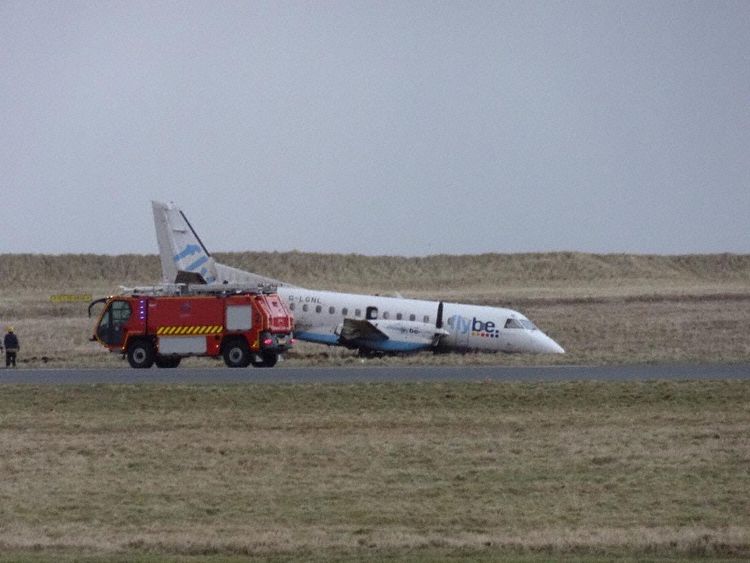
Crash of a Saab 340B in Stornoway

Date & Time: Jan 2, 2015 at 0833 LT
Type of aircraft:
Operator:
Registration:
G-LGNL
Flight Phase:
Survivors:
Yes
Schedule:
Stornoway – Glasgow
MSN:
246
YOM:
23
Flight number:
BE6821
Region:
Crew on board:
3
Crew fatalities:
Pax on board:
26
Pax fatalities:
Other fatalities:
Total fatalities:
0
Captain / Total flying hours:
3880
Captain / Total hours on type:
3599.00
Circumstances:
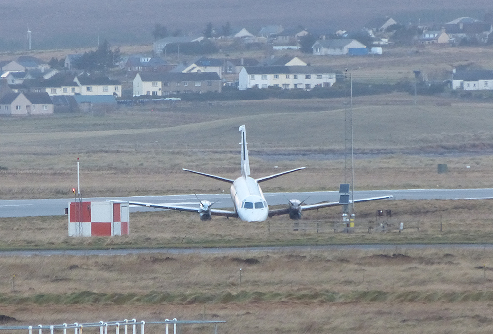
The aircraft had been prepared for a Commercial Air Transport flight from Stornoway Airport to Glasgow Airport with 26 passengers and three crew on board; the commander was the Pilot Flying (PF) and the co-pilot was the Pilot Monitoring (PM). At 0825 hrs the aircraft was taxied towards Holding Point A1 for a departure from Runway 18. At 0832 hrs G-LGNL was cleared to enter the runway from Holding Point A1 and take off, and the ATC controller transmitted that the surface wind was from 270° at 27 kt. The commander commented to the co-pilot that the wind was across the runway and that there was no tailwind. As the aircraft taxied onto the runway, the co-pilot applied almost full right aileron input consistent with a cross-wind from the right, and the commander said to the co-pilot “charlie1, one hundred, strong wind from the right”. The commander advanced the power levers, the co-pilot said “autocoarsen high” and the engine torques increased symmetrically. The commander instructed the co-pilot to “set takeoff power” to which the co-pilot replied “apr armed”. Approximately one second after this call, the engine torques began to increase symmetrically, reaching 100% as the aircraft accelerated through 70 kt. During the early stages of the takeoff, left rudder was applied and the aircraft maintained an approximately constant heading. As the aircraft continued accelerating, the rudder was centralised, after which there was a small heading change to the left, then to the right, then a rapid heading change to the left causing the aircraft to deviate to the left of the runway centreline. The pilot applied right rudder but although the aircraft changed heading to the right in response, it did not alter the aircraft’s track significantly and the aircraft skidded to the left, departing the runway surface onto the grass at an IAS of 80 kt. The power levers remained at full power as the aircraft crossed a disused runway and back onto grass. During this period the nose landing gear collapsed before the aircraft came to a halt approximately 38 m left of the edge of the runway and 250 m from where it first left the paved surface. After the aircraft came to a halt, the captain saw that the propellers were still turning and so called into the cabin for the passengers to remain seated. One of the passengers shouted for someone to open the emergency exit but the cabin crew member instructed the passengers not to do so because the propellers were still turning. The co-pilot observed that the right propeller was still turning so operated the engine fire extinguishers to shut down both engines. When the passenger seated in the emergency exit row on the right of the aircraft saw that the right propeller had stopped, he decided to open the exit. He climbed out onto the wing and helped the remaining passengers leave the aircraft through the same exit, instructing them to slide off the rear of the wing onto the ground. The left propeller was still turning at the time the right over-wing exit was opened and the passenger seated in the left-side emergency exit row decided not to open the left exit. The crash alarm was activated by ATC at 0833 hrs. An aircraft accident was declared and the aerodrome emergency plan was put into action. When the Rescue and Fire Fighting Services (RFFS) arrived at the scene, passengers were still exiting the aircraft and the left propeller was still turning. After leaving the aircraft, the cabin crew member confirmed to the RFFS that all passengers had exited the cabin and had been accounted for outside. The passengers were taken to the fire station and then on to the passenger terminal. There were no injuries.
Probable cause:
During the attempted takeoff, the rudder was central from 40 kt and remained so until approximately 65 kt. Between approximately 52 and 65 kt, the aircraft turned right slightly before it turned left sharply at approximately 65 kt. Given that the rudder was central, this change of direction might have been caused by one, or a combination of the following factors:
a. Differential braking
b. Asymmetric thrust
c. A change in wind speed and direction
d. A nose wheel steering input
Data from the FDR showed that thrust was applied symmetrically throughout the takeoff run, and the manufacturer did not consider that the data for longitudinal acceleration and indicated airspeed supported the use of differential braking.
Final Report:

Crash of a Britten-Norman BN-2B-26 Islander off Campbeltown: 2 killed

Date & Time: Mar 15, 2005 at 0018 LT
Type of aircraft:
Operator:
Registration:
G-BOMG
Flight Type:
Survivors:
No
Schedule:
Glasgow – Campbeltown
MSN:
2205
YOM:
1989
Region:
Crew on board:
1
Crew fatalities:
Pax on board:
1
Pax fatalities:
Other fatalities:
Total fatalities:
2
Captain / Total flying hours:
3553
Captain / Total hours on type:
205.00
Aircraft flight hours:
6221
Aircraft flight cycles:
40018
Circumstances:
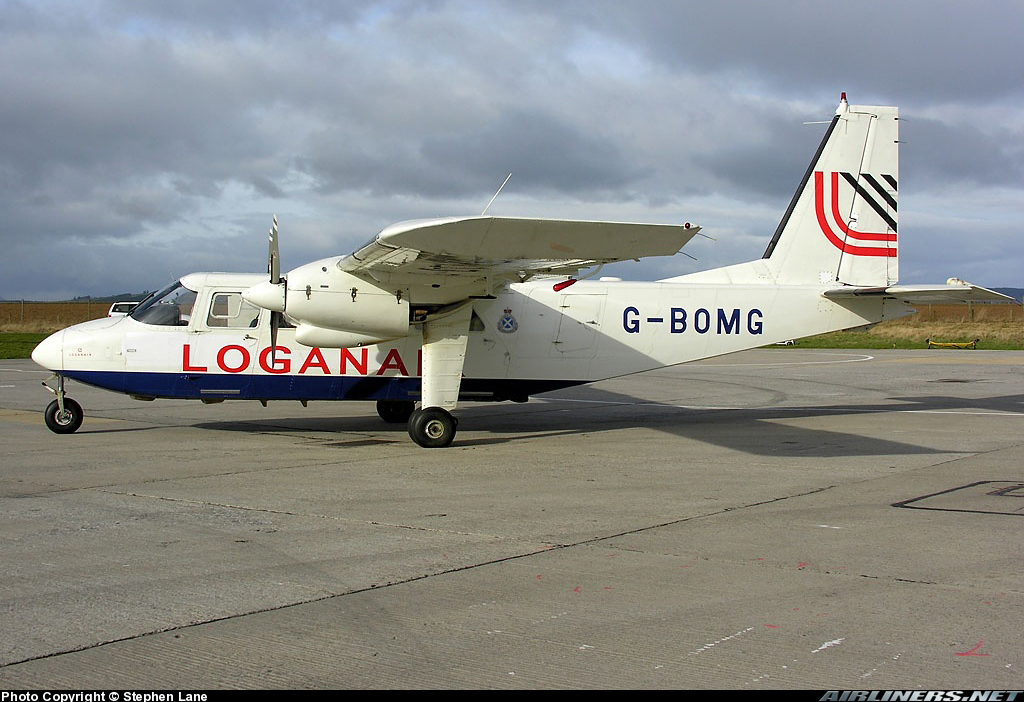
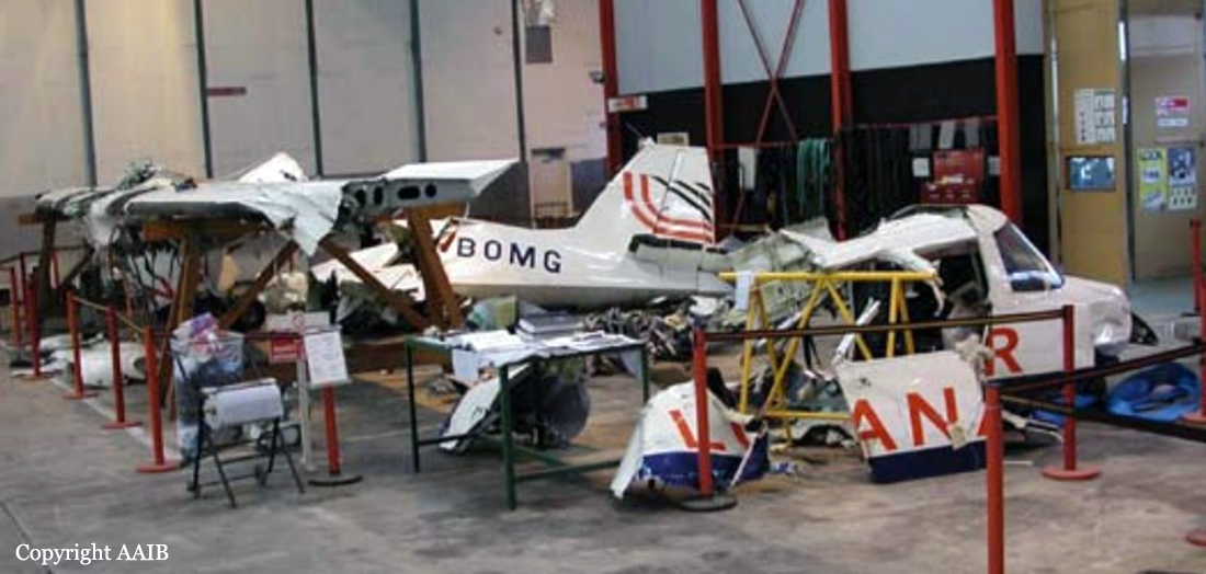
The Glasgow based Islander aircraft was engaged on an air ambulance task for the Scottish Ambulance Service when the accident occurred. The pilot allocated to the flight had not flown for 32 days; he was therefore required to complete a short flight at Glasgow to regain currency before landing to collect a paramedic for the flight to Campbeltown Airport on the Kintyre Peninsula. Poor weather at Campbeltown Airport necessitated an instrument approach. There was neither radar nor Air Traffic Control Service at the airport, so the pilot was receiving a Flight Information Service from a Flight Information Service Officer in accordance with authorised procedures. After arriving overhead Campbeltown Airport, the aircraft flew outbound on the approach procedure for Runway 11 and began a descent. The pilot next transmitted that he had completed the ‘base turn’, indicating that he was inbound to the airport and commencing an approach. Nothing more was seen or heard of the aircraft and further attempts at radio contact were unsuccessful. The emergency services were alerted and an extensive search operation was mounted in an area based on the pilot’s last transmission. The aircraft wreckage was subsequently located on the sea bed 7.7 nm west-north-west of the airport; there were no survivors.
Probable cause:
The investigation identified the following causal factors:
1. The pilot allowed the aircraft to descend below the minimum altitude for the aircraft’s position on the approach procedure, and this descent probably continued unchecked until the aircraft flew into the sea.
2. A combination of fatigue, workload and lack of recent flying practise probably contributed to the pilot’s reduced performance.
3. The pilot may have been subject to an undetermined influence such as disorientation, distraction or a subtle incapacitation, which affected his ability to safely control the aircraft’s flightpath.
Final Report:
Crash of a Cessna 404 Titan II in Glasgow: 8 killed

Date & Time: Sep 3, 1999 at 1236 LT
Type of aircraft:
Registration:
G-ILGW
Flight Phase:
Survivors:
Yes
Schedule:
Glasgow – Aberdeen
MSN:
404-0690
YOM:
1980
Flight number:
Saltire 3W
Region:
Crew on board:
2
Crew fatalities:
Pax on board:
9
Pax fatalities:
Other fatalities:
Total fatalities:
8
Captain / Total flying hours:
4190
Captain / Total hours on type:
173.00
Copilot / Total flying hours:
2033
Copilot / Total hours on type:
93
Aircraft flight hours:
6532
Circumstances:
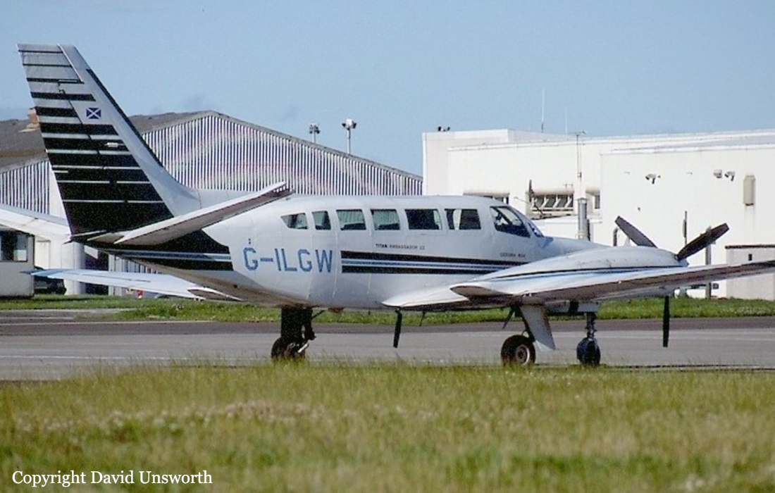
The aircraft had been chartered to transport an airline crew of nine persons from Glasgow to Aberdeen. The aircraft was crewed by two pilots and, so far as could be determined, its take-off weight was between 8,320 and 8,600 lb. The maximum permitted take-off weight was 8,400 lb. ATC clearance for an IFR departure was obtained before the aircraft taxied from the business aviation apron for take-off from runway 23, with a take-off run available of 2,658 metres. According to survivors, the take-off proceeded normally until shortly after the aircraft became airborne when they heard a thud or bang. The aircraft was then seen by external witnesses at low height, to the left of the extended runway centerline, in a wings level attitude that later developed into a right bank and a gentle descent. Witnesses reported hearing an engine spluttering and saw at least one propeller rotating slowly. There was a brief 'emergency' radio transmission from the commander and the aircraft was seen entering a steep right turn. It then entered a dive. A witness saw the wings levelled just before the aircraft struck the ground on a northerly track. Three survivors were helped from the wreckage by a nearby farm worker before flames from a severe post-impact fire engulfed the cabin.
Probable cause:
The following causal factors were identified:
- The left engine suffered a catastrophic failure of its accessory gear train leading to a progressive but complete loss of power from that engine,
- The propeller of the failed engine was not feathered and therefore the aircraft was incapable of climbing on the power of one engine alone,
- The commander feathered the propeller of the right-hand engine, which was mechanically capable of producing power resulting in a total loss of thrust,
- The commander attempted to return to the departure airfield but lost control of the aircraft during a turn to the right.
Final Report:
Crash of an Embraer EMB-110P1 Bandeirante in Sellafield: 2 killed

Date & Time: Jan 13, 1993 at 0820 LT
Operator:
Registration:
G-ZAPE
Flight Phase:
Flight Type:
Survivors:
No
Site:
Schedule:
Southend - Glasgow
MSN:
110-391
YOM:
1982
Region:
Crew on board:
2
Crew fatalities:
Pax on board:
0
Pax fatalities:
Other fatalities:
Total fatalities:
2
Captain / Total flying hours:
2063
Captain / Total hours on type:
271.00
Circumstances:
The aircraft departed Southend at 06:59 UTC, about one hour before sunrise, on a Special VFR clearance. The aircraft flew to Wallasey via Daventry, White gate and the Liverpool Special Rules Zone at 2,400 feet. It could not be determined why the commander chose to fly this route however, some two weeks before the accident he had spent a short holiday at Haverigg which is close to the direct track from Wallasey to Glasgow. On leaving Wallasey, the aircraft tracked north towards Glasgow and, at 08:01 hrs, the crew called Warton aerodrome stating that they were descending to 1,000 feet and requesting a 'Radar Service'. At 08:10 hrs, an aircraft that had just taken off from Blackpool reported a cloud base of between 2,500 and 3,000 feet and a visibility greater than 20 km. At this time the radar transponder on the aircraft was operating but the height encoding facility had not been selected. Recordings of the Great Dunn Fell and the St Anne's ATC radar heads indicated that the aircraft had left Wallasey on a track of 007°M which was maintained until radar contact was lost at 08:13 hrs at a position one mile to the south west of Walney Island airfield near Barrow in Furness. Consideration of the obscuration due to terrain between the radar heads and the aircraft indicated that, at the time of loss of radar contact, the aircraft would have been no higher than 350 feet amsl and possibly lower. At 08:09 hrs, the time of local sunrise, the crew had called Walney Island stating that they were nine miles south of the airfield at 1,000 feet and requesting overflight of the airfield. At 08:12 hrs, the controller at Walney Island sighted the aircraft abeam the airfield at an estimated height of 800 feet and asked the crew to report at Millom which is about eight miles north of Walney Island. At about the same time, a witness on the beach near the airfield saw the aircraft heading north in and out of cloud at a height estimated to be not above 400 feet. The aircraft did not make the requested position report at Millom and, at 08:16 hrs, the controller advised the crew to call London Information for further service. There was no reply to this call. The last person to see the aircraft reported that it was flying steadily north towards Ponsonby Fell and that the cloud in the area of the Fell was covering the ground at 500 feet above sea level. At about 08:15 hrs a farmer, who was some 600 metres from the crash site, heard a bang from the direction of Ponsonby Fell. He stated that at the time that he heard the bang the weather was very bad with a strong wind, rain and mist covering the fell. The aircraft had flown into ground about 15 metres below the top of Ponsonby Fell. The aircraft was destroyed upon impact and both occupants were killed.
Final Report:

Crash of a Britten-Norman BN-2A-26 Islander in Walney Island

Date & Time: Jun 14, 1986 at 0415 LT
Type of aircraft:
Operator:
Registration:
G-BMDT
Flight Type:
Survivors:
Yes
Schedule:
Glasgow – Walney
MSN:
3012
YOM:
1985
Region:
Crew on board:
1
Crew fatalities:
Pax on board:
0
Pax fatalities:
Other fatalities:
Total fatalities:
0
Captain / Total flying hours:
2658
Captain / Total hours on type:
936.00
Circumstances:
The aircraft took off from Glasgow at 0317 hrs to fly to Barrow-in-Furness via Dean Cross. It left Dean Cross at flight level 50 on track for Walney Island aerodrome using radar advisory service from Manchester Control. When 12 miles north of his destination, the pilot began a slow descent over a layer of stratus cloud. On reaching Walney Island, he was still above cloud so, using positional advice from radar, he turned out to sea to continue his descent. He turned back to the airfield,still in cloud at 1500 feet and, shortly after fading from radar at approximately 1200 feet over the sea, he advised Manchester Control that he vas overhead the airfield. Air traffic control at Walney Island was not manned at the time and no formal record of local weather exists. Witnesses close to the airfield reported that the wind was calm and visibility was reduced by patchy, low-lying, sea fog. One witness, some 600 meters southwest of the touchdown zone of runway 06, saw the aircraft flying due north at a height he estimated to be between 50 and 100 feet but heard nothing unusual. Another witness, also near the southwest corner of the airfield, heard the aircraft pass overhead travelling north and then heard a cessation of engine noise followed immediately by a dull thud. Both witnesses estimated the surface visibility to be more than 200 meters at the time. The aircraft struck the ground on the centerline but some 30 meters short of the beginning of runway 06 in a steep nose-down, left wing low attitude, and came to rest within 10 meters of the initial impact. Ground marks showed the first impact to have been by the port wingtip followed immediately by the nose of the aircraft, which was crushed. The aircraft appeared then to have pivoted to the right about the nose and starboard wingtip, and to have bounced laterally to the right of the centerline before coming to rest with its tail toward the runway. The flaps were set to 25°. The main undercarriage was relatively undamaged and showed no evidence of having struck the ground during the initial impact sequence.
Probable cause:
The accident occured approximately 35 minutes after sunrise, and the approach to runway 06 would have been towards the rising sun. Examination of the wreckage revealed no pre-existing defects on the aircraft that could have had any bearing on the accident.
Final Report:

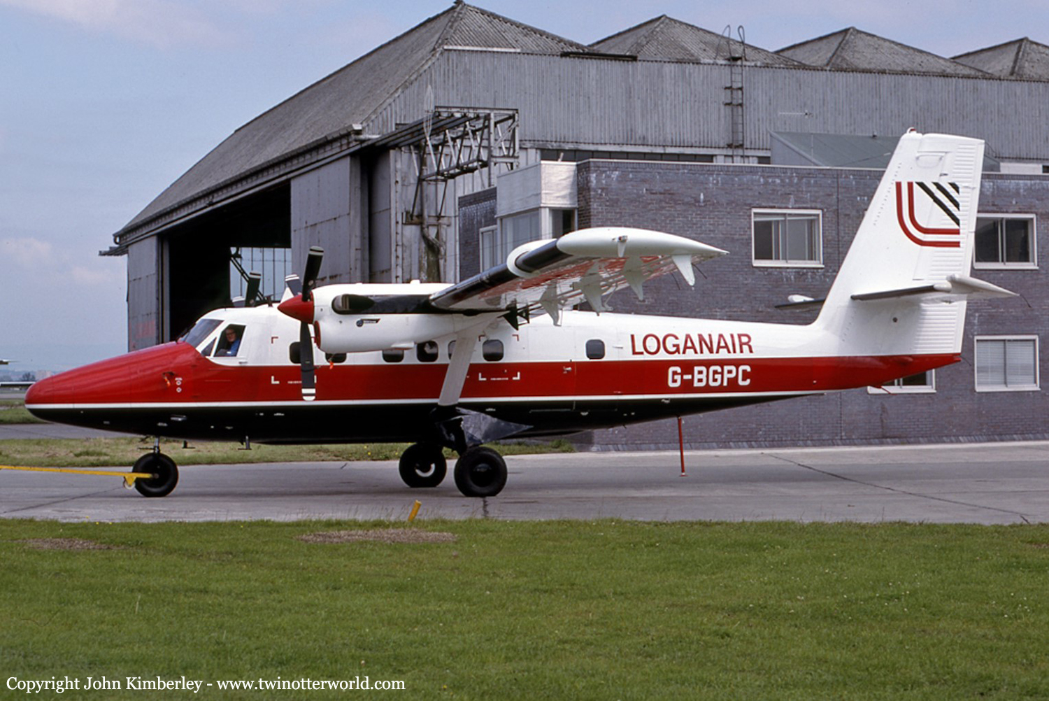
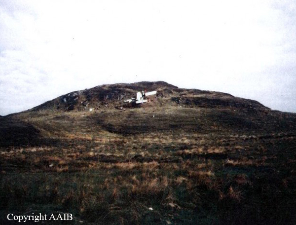
Crash of a De Havilland DHC-6 Twin Otter 300 in Port Ellen: 1 killed

Date & Time: Jun 12, 1986 at 1522 LT
Operator:
Registration:
G-BGPC
Survivors:
Yes
Schedule:
Glasgow - Port Ellen
MSN:
635
YOM:
1979
Flight number:
LC423
Region:
Crew on board:
2
Crew fatalities:
Pax on board:
14
Pax fatalities:
Other fatalities:
Total fatalities:
1
Captain / Total flying hours:
12421
Captain / Total hours on type:
867.00
Copilot / Total flying hours:
2110
Copilot / Total hours on type:
27
Aircraft flight hours:
9206
Circumstances:
Loganair Flight LC423 was a scheduled passenger flight from Glasgow Airport (GLA) to Islay/Port Ellen (ILY). The handling pilot, who occupied the first pilot's position, had recently converted to flying the DHC-6 Twin Otter aircraft, and was completing a series of supervised route flights required by the airline before the award of full command status. A company supervisory captain, the designated commander for this flight, occupied the co-pilot's position. The Twin Otter's engines were started at 14:38, and, at 14:44, Glasgow Airport ATC approved taxy clearance to the holding point of runway 28. The aircraft was operating on a stored Instrument Flight Rules (IFR) flight plan. The requested routeing was a Standard Instrument Departure (SID), to join Airway Blue 2 for the Skipness VOR beacon, and thereafter direct to the Islay/Port Ellen NDB. The direct track is the 272° Magnetic (M) radial from Skipness. At 14:46 Glasgow ATC advised LC423 of their flight clearance. The requirement to fly the SID was cancelled and the aircraft was cleared direct to Skipness, cruising level FL55. The aircraft took off from runway 28 at 14:48. The aircraft reported a position overhead the Skipness VOR at 15:08. At this point Scottish Airways Control informed LC423 that they should clear controlled airspace, contact Port Ellen, and that there was no known traffic to affect their descent. After passing overhead the Skipness VOR the aircraft did not depart that position on the 272° radial, but instead turned 15° left, and descended on the 257° radial towards the south of the island of Islay. At 15:10, having already started to descend, LC423 contacted Islay/Port Ellen, reported an arrival time of 15:23, and requested details of the latest weather. The Islay/Port Ellen radio operator replied that the weather details were a surface wind of 220°/05 knots, visibility 2000 metres in drizzle, cloud 3 oktas at 400 feet, 5 oktas at 700 feet, and 8 oktas at 1400 feet. The sea level barometric pressure was 1018 millibars. LC423 acknowledged the information and was asked to advise when overhead the aerodrome at 3600 feet, or when in visual contact. The aircraft then continued to descend, on a track of about 260° M towards the south of the island, until it disappeared from radar cover at a height of 1400 feet and at a position 12 nautical miles (nm) from Islay/Port Ellen aerodrome on the 106° M radial. From the position that the aircraft descended below radar cover it is estimated that a direct track was flown towards the southern coast of the Isle of Islay. The flight continued at very low level parallel to the south coast. At 15:21 the Islay/Port Ellen radio operator transmitted further weather information which recorded that cloud conditions were similar to the previous report but that there was then heavy drizzle. Changes in barometric pressure settings were also reported. LC423 acknowledged this information and reported "over Port Ellen". However, the aircraft was not, at that time, over Port Ellen, but was in fact turning inland at very low level over Laphroaig. From overhead Laphroaig the aircraft settled on to a northwesterly heading and very shortly afterwards crashed into rising ground, that was obscured in hill fog, approximately 1 nm from the coast at a height of 360 feet amsl.
Probable cause:
The commander's decision to allow the handling pilot to carry out a visual approach in totally unsuitable meteorological conditions. An error in visual navigation was a contributory factor.
Final Report:

Crash of a Vickers 735 Viscount in Kirkwall

Date & Time: Oct 25, 1979 at 1520 LT
Type of aircraft:
Operator:
Registration:
G-BFYZ
Survivors:
Yes
Schedule:
Glasgow – Kirkwall
MSN:
69
YOM:
1955
Location:
Region:
Crew on board:
4
Crew fatalities:
Pax on board:
47
Pax fatalities:
Other fatalities:
Total fatalities:
0
Captain / Total flying hours:
14485
Captain / Total hours on type:
3601.00
Copilot / Total flying hours:
13587
Copilot / Total hours on type:
2000
Aircraft flight hours:
25641
Aircraft flight cycles:
16275
Circumstances:
Following an unstable approach, the aircraft touched down initially on its starboard main landing wheels to the left of the centre line, drifting to the right, then n°4 propeller struck the runway. The aircraft bounced and about three seconds later it touched down again on its starboard wheels, striking the runway for the second time to the left of the centre line with n°4 propeller. The commander then called for full power, not knowing that the aircraft was damaged, the copilot however, did not apply any power because he was aware that damage has been sustained. The aircraft diverged to the right, it left the runway then ran parallel along the grass until it crossed the intersecting runway paving where the nose landing gear collapsed. The aircraft came to rest on water-logged grass near the right hand edge of runway 25 and the commander ordered an evacuation which was carried out without injury. There was no fire and the airport fire and rescue services arrived promptly.
Probable cause:
The accident was caused by the commander failing to take overshoot action at an early stage in the approach to land when it became apparent that the approach was unstabilised and the windscreen wiper was unserviceable.
Final Report:

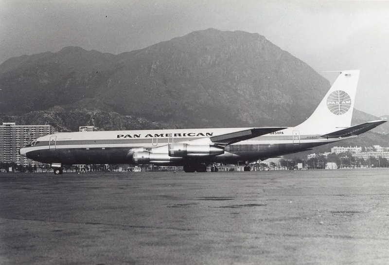
Crash of a Boeing 707-321C in Boston: 3 killed

Date & Time: Nov 3, 1973 at 0939 LT
Type of aircraft:
Operator:
Registration:
N458PA
Flight Type:
Survivors:
No
Schedule:
New York - Glasgow - Frankfurt
MSN:
19368/640
YOM:
1967
Flight number:
PA160
Crew on board:
3
Crew fatalities:
Pax on board:
0
Pax fatalities:
Other fatalities:
Total fatalities:
3
Captain / Total flying hours:
16477
Captain / Total hours on type:
5824.00
Copilot / Total flying hours:
3843
Copilot / Total hours on type:
3843
Aircraft flight hours:
24537
Circumstances:
Pan American World Airways Clipper Flight 160 was a scheduled cargo flight from New York-JFK to Frankfurt (FRA), Germany, with a scheduled stop at Prestwick (PIK), Scotland. At 08:25 the flight departed JFK. The aircraft was carrying 52912 lb (24000 kg) of cargo, 15,360 lb (6967 kg) of which were chemicals. After departure, Clipper 160 was vectored on course while climbing to FL330. At 08:44, Clipper 160's clearance was amended, and it was instructed to maintain FL310 as a final cruising altitude. Clipper 160 reported level at FL310 at 08:50. As the flight approached Sherbrooke VORTAC 100 miles east of Montreal, Canada, at about 09:04, it advised Pan American Operations (PANOP) in New York that smoke had accumulated in the "lower 41" electrical compartment, and that the flight was diverting to Boston. At 09:08, Clipper 160 advised Montreal Center that they were level at FL310 and wanted to return to JFK. Montreal Center cleared Clipper 160 for a right turn to a heading of 180 degrees. At 09:10, Clipper 160 advised PANOP that it was returning to New York and that the smoke seemed to be "getting a little thicker in here." At 09:11, the crew advised PANOP that they were now going to Boston and that "this smoke is getting too thick." They also requested that emergency equipment be available when they arrived at Boston. During this conversation, the comment was made that the "cockpit's full back there." During its return to Boston, the flight was given preferential air traffic control treatment, although it had not declared an emergency. After issuing appropriate descent clearances en route so that fuel could be burned off more rapidly at lower altitudes, at 09:26:30 Boston Center advised Boston Arrival Radar that the flight was at 2,000 feet. At 09:29, Clipper 160 asked Boston Center for the flight's distance from Boston, and added, "The DME's don't seem to be working." The Center answered, "You're passing abeam, Pease Air Force Base, right now, sir, and you're about 40 to 45 miles to the northwest of Boston." The first communication between Clipper 160 and the arrival radar controller was at 09:31:21. The flight was cleared "direct Boston, maintain 2,000." The controller asked if the flight was declaring an emergency; the reply was "negative on the emergency, and may we have runway 33 left?" The controller approved the request, and the flight proceeded to Boston as cleared. At approximately the same time, the captain instructed the crew to "shut down everything you don't need." At 09:34:20, the controller asked, "Clipper 160, what do you show for a compass heading right now?" Clipper 160 answered, "Compass heading at this time is 205." The controller then asked, "will you accept a vector for a visual approach to a 5-mile final for runway 33 left, or do you want to be extended out further?" The crew replied, "Negative, we want to get it on the ground as soon as possible." At 09:35:46, the controller stated, "Clipper 160, advise anytime you have the airport in sight." Clipper 160 did not reply. At 09:37:04, the arrival controller made the following transmission: "Clipper 160, this is Boston approach control. If you read, squawk ident on any transponder. I see your transponder just became inoperative. Continue inbound now for runway 33 left, you're No. 1. There is a Lufthansa 747 on a 3-mile final for runway 27, the spacing is good. Remain on this frequency, Clipper 160." There was no reply from the flight. With flaps and spoilers had been extended for speed reduction, the airplane approached runway 33L. The yaw damper was rendered inoperative by the uncoordinated execution of emergency procedures earlier. This made the 707 extremely difficult to control at low speeds. Control was lost and the airplane struck the ground nose down about 262 feet from the right edge of the approach end of runway 33.Pan American World Airways Clipper Flight 160 was a scheduled cargo flight from New York-JFK to Frankfurt (FRA), Germany, with a scheduled stop at Prestwick (PIK), Scotland. At 08:25 the flight departed JFK. The aircraft was carrying 52912 lb (24000 kg) of cargo, 15,360 lb (6967 kg) of which were chemicals. After departure, Clipper 160 was vectored on course while climbing to FL330. At 08:44, Clipper 160's clearance was amended, and it was instructed to maintain FL310 as a final cruising altitude. Clipper 160 reported level at FL310 at 08:50. As the flight approached Sherbrooke VORTAC 100 miles east of Montreal, Canada, at about 09:04, it advised Pan American Operations (PANOP) in New York that smoke had accumulated in the "lower 41" electrical compartment, and that the flight was diverting to Boston. At 09:08, Clipper 160 advised Montreal Center that they were level at FL310 and wanted to return to JFK. Montreal Center cleared Clipper 160 for a right turn to a heading of 180 degrees. At 09:10, Clipper 160 advised PANOP that it was returning to New York and that the smoke seemed to be "getting a little thicker in here." At 09:11, the crew advised PANOP that they were now going to Boston and that "this smoke is getting too thick." They also requested that emergency equipment be available when they arrived at Boston. During this conversation, the comment was made that the "cockpit's full back there." During its return to Boston, the flight was given preferential air traffic control treatment, although it had not declared an emergency. After issuing appropriate descent clearances en route so that fuel could be burned off more rapidly at lower altitudes, at 09:26:30 Boston Center advised Boston Arrival Radar that the flight was at 2,000 feet. At 09:29, Clipper 160 asked Boston Center for the flight's distance from Boston, and added, "The DME's don't seem to be working." The Center answered, "You're passing abeam, Pease Air Force Base, right now, sir, and you're about 40 to 45 miles to the northwest of Boston." The first communication between Clipper 160 and the arrival radar controller was at 09:31:21. The flight was cleared "direct Boston, maintain 2,000." The controller asked if the flight was declaring an emergency; the reply was "negative on the emergency, and may we have runway 33 left?" The controller approved the request, and the flight proceeded to Boston as cleared. At approximately the same time, the captain instructed the crew to "shut down everything you don't need." At 09:34:20, the controller asked, "Clipper 160, what do you show for a compass heading right now?" Clipper 160 answered, "Compass heading at this time is 205." The controller then asked, "will you accept a vector for a visual approach to a 5-mile final for runway 33 left, or do you want to be extended out further?" The crew replied, "Negative, we want to get it on the ground as soon as possible." At 09:35:46, the controller stated, "Clipper 160, advise anytime you have the airport in sight." Clipper 160 did not reply. At 09:37:04, the arrival controller made the following transmission: "Clipper 160, this is Boston approach control. If you read, squawk ident on any transponder. I see your transponder just became inoperative. Continue inbound now for runway 33 left, you're No. 1. There is a Lufthansa 747 on a 3-mile final for runway 27, the spacing is good. Remain on this frequency, Clipper 160." There was no reply from the flight. With flaps and spoilers had been extended for speed reduction, the airplane approached runway 33L. The yaw damper was rendered inoperative by the uncoordinated execution of emergency procedures earlier. This made the 707 extremely difficult to control at low speeds. Control was lost and the airplane struck the ground nose down about 262 feet from the right edge of the approach end of runway 33. The aircraft was totally destroyed and all three crew members were killed.
Probable cause:
The presence of smoke in the cockpit which was continuously generated and uncontrollable. The smoke led to an emergency situation that culminated in loss of control of the aircraft during final approach, when the crew in uncoordinated action deactivated the yaw damper in conjunction with incompatible positioning of flight spoilers and wing flaps. The NTSB further determines that the dense smoke in the cockpit seriously impaired the flight crew's vision and ability to function effectively during the emergency. Although the source of the smoke could not be established conclusively, the NTSB believes that the spontaneous chemical reaction between leaking acid, improperly packaged and stowed, and the improper sawdust packing surrounding the acid's package initiated the accident sequence. A contributing factor was the general lack of compliance with existing regulations governing the transportation of hazardous materials which resulted from the complexity of the regulations, the industry wide lack of familiarity with the regulations and the working level, the over-lapping jurisdictions, and the inadequacy of government surveillance.
Final Report:

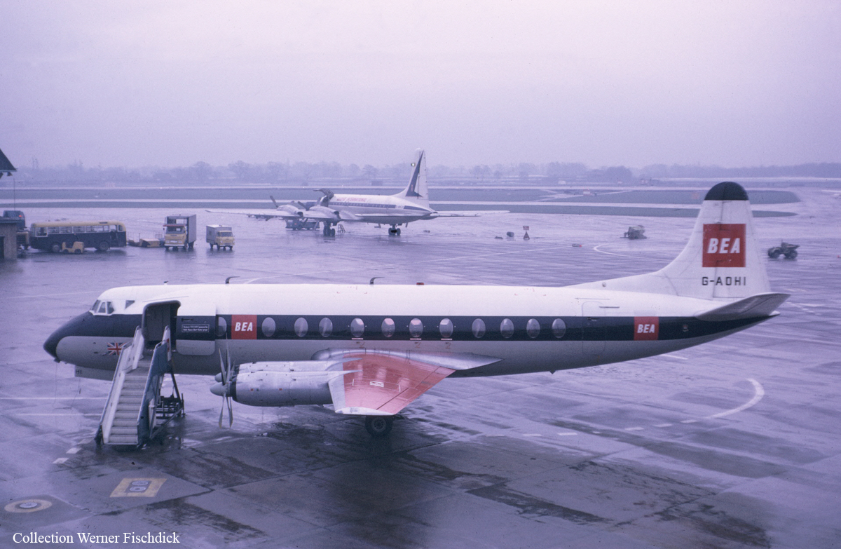
Crash of a Vickers 802 Viscount on Mt Ben More: 4 killed

Date & Time: Jan 19, 1973 at 1431 LT
Type of aircraft:
Operator:
Registration:
G-AOHI
Flight Phase:
Flight Type:
Survivors:
No
Site:
Schedule:
Glasgow - Glasgow
MSN:
158
YOM:
1957
Region:
Crew on board:
2
Crew fatalities:
Pax on board:
2
Pax fatalities:
Other fatalities:
Total fatalities:
4
Captain / Total flying hours:
8346
Captain / Total hours on type:
1835.00
Copilot / Total flying hours:
4340
Copilot / Total hours on type:
606
Aircraft flight hours:
32677
Circumstances:
The crew departed Glasgow Airport at 1422LT on a local post-maintenance test flight with two engineers and two pilots on board. The airplane flew north at an altitude of 4,000 feet under VFR mode for approximately 7 minutes and a half when the captain asked for clearance back into the Glasgow Control Zone. Less than two minutes later, while cruising in poor weather conditions (snow showers), the airplane struck the slope of Mt Ben More (3,852 feet high). The aircraft disintegrated on impact and all four occupants were killed.
Crew:
Walter Duward, pilot,
Stan Kemp, copilot.
Passengers:
Paddy Quinn, engineer,
Jimmy Moore, engineer.
Probable cause:
The aircraft struck a mountain peak whilst flying over snow covered high terrain in marginal visual meteorological conditions. Failure to maintain a safe altitude and insufficient attention to navigational procedures were contributory factors. The following factors were reported:
- Although the Captain obtained some weather information during his visit to the meteorological office he did not seek a briefing from the Duty Forecaster. This may have deprived him of information about the strong winds at his proposed flight level,
- The minimum sector altitude for the area was 4,400 feet and BEA's minimum safe altitude was 5,000 feet; nevertheless the decision to fly at FL 40 (3,800 feet amsl) was permissible for a VFR flight,
- The decision to operate under VFR in the prevailing weather conditions was questionable but probably explicable in the light of the nature of the flight,
- Map reading over snow covered terrain in the prevailing weather conditions would have presented obvious difficulties. The possibility of error may have been increased by temporary distractions resulting from preoccupation with the flight engineering test programme,
- The exact circumstances of the accident are not known, but it probably occurred whilst the aircraft was flying in 'whiteout' conditions associated with a snow shower.
Final Report:

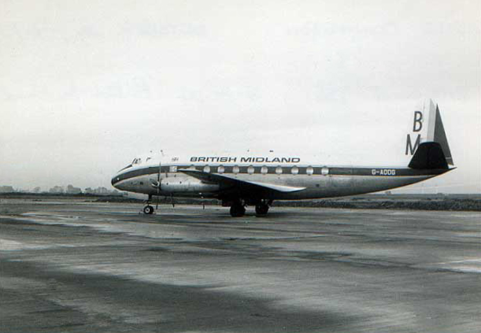
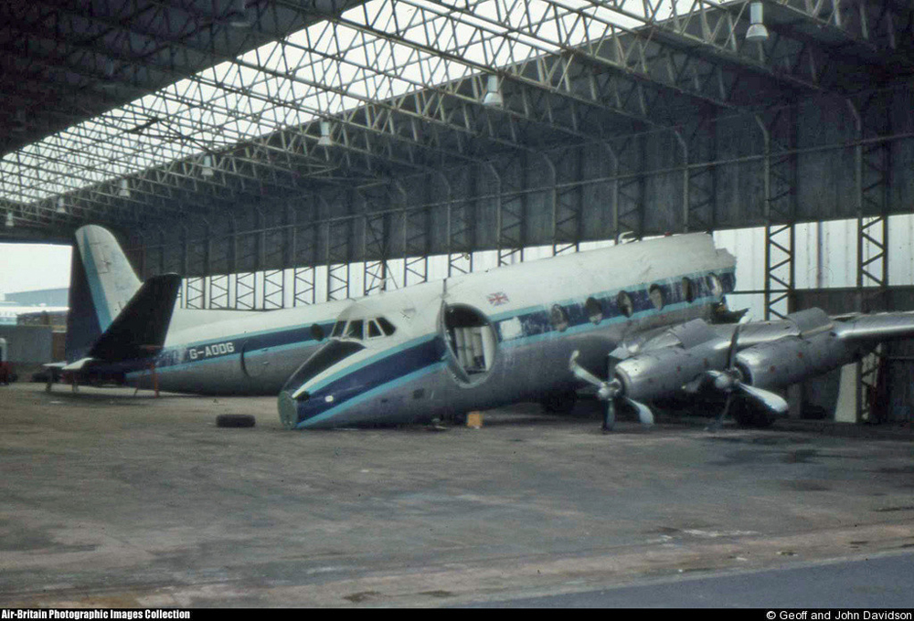
Crash of a Vickers 736 Viscount in East Midlands

Date & Time: Feb 20, 1969
Type of aircraft:
Operator:
Registration:
G-AODG
Survivors:
Yes
Schedule:
Glasgow – East Midlands
MSN:
77
YOM:
1955
Region:
Crew on board:
5
Crew fatalities:
Pax on board:
48
Pax fatalities:
Other fatalities:
Total fatalities:
0
Circumstances:
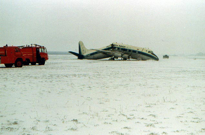
On approach to East Midlands Airport, the crew encountered poor weather conditions (snow falls) and the captain decided to go-around. During a second attempt to land on runway 10, the pilot-in-command failed to realize his exact position when the airplane struck the ground 1,000 feet prior to the touchdown zone. Upon impact, the nose gear was torn off and the aircraft came to rest in a snow covered field, broken in two. All 53 occupants escaped uninjured while the aircraft was written off.
Probable cause:
Wrong approach configuration in poor weather conditions.