code

CA

Crash of a Lockheed 12A Electra Junior in Chino: 2 killed

Date & Time: Jun 15, 2024 at 1235 LT
Type of aircraft:
Registration:
N93R
Flight Phase:
Flight Type:
Survivors:
No
Schedule:
Chino - Chino
MSN:
1257
YOM:
1939
Crew on board:
2
Crew fatalities:
Pax on board:
0
Pax fatalities:
Other fatalities:
Total fatalities:
2
Circumstances:
Shortly after takeoff from Chino Airport runway 21, while climbing, the twin engine airplane rolled to the left, descended to the ground and crashed in a grassy area, bursting into flames. Both occupants were fatally injured. The airplane was operated on behalf of the Yanks Air Museum.

Crash of a Rockwell Gulfstream 695A Jetprop 1000 in San Bernardino: 1 killed

Date & Time: Apr 13, 2024 at 2019 LT
Operator:
Registration:
N965BC
Flight Type:
Survivors:
No
Site:
Schedule:
Stockton - Chino
MSN:
96071
YOM:
1984
Crew on board:
1
Crew fatalities:
Pax on board:
0
Pax fatalities:
Other fatalities:
Total fatalities:
1
Circumstances:
The pilot departed Stockton Airport on a solo flight to Chino. On a standard approach in rainy conditions, the airplane suffered two altitude deviations which the pilot attributed to a problem with the autopilot. Towards the end of the flight, the airplane descended past the Minimum Vectoring Altitude (MVA) of 7,400 feet and was issued an altitude alert by the controller, but there was no response from the pilot. The airplane entered an uncontrolled descent with a rate of about 10'000 feet per minute until it crashed in mountainous terrain. The airplane was destroyed by impact forces and the pilot was killed.

Crash of a Socata TBM-960 in Truckee: 2 killed

Date & Time: Mar 30, 2024 at 1838 LT
Type of aircraft:
Registration:
N960LP
Flight Type:
Survivors:
No
Schedule:
Denver - Truckee
MSN:
1441
YOM:
2022
Crew on board:
1
Crew fatalities:
Pax on board:
1
Pax fatalities:
Other fatalities:
Total fatalities:
2
Circumstances:
On final approach to Truckee-Tahoe Airport runway 20 in marginal weather conditions, it is believed that the pilot initiated a go around procedure. While climbing to an altitude of 7,200 feet, control was lost. The airplane entered a dive and crashed in a snow covered forest located near the airport, bursting into flames. Both occupants, Liron and Naomi Petrushka, were killed. At the time of the accident, visibility was limited due to snow showers.

Crash of a Cessna 550 Citation II in Temecula: 6 killed

Date & Time: Jul 8, 2023 at 0414 LT
Type of aircraft:
Registration:
N819KR
Flight Type:
Survivors:
No
Schedule:
Las Vegas - Temecula
MSN:
550-0114
YOM:
1979
Crew on board:
2
Crew fatalities:
Pax on board:
4
Pax fatalities:
Other fatalities:
Total fatalities:
6
Circumstances:
On approach to Temecula-French Airport Runway 36 at night, the crew encountered foggy conditions. Due to poor visibility, the crew initiated a go around then made a right hand turn and followed a circuit for a second attempt to land. On short final, at a speed of approximately 130 knots, the airplane impacted the ground and crashed short of runway, bursting into flames. The airplane was totally destroyed and all six occupants were killed.

Crash of a Viking Air DHC-6 Twin Otter 400 off Half Moon Bay: 2 killed

Date & Time: May 20, 2023 at 1415 LT
Operator:
Registration:
N153QS
Flight Phase:
Flight Type:
Survivors:
No
Schedule:
Santa Rosa - Honolulu
MSN:
869
YOM:
2013
Crew on board:
2
Crew fatalities:
Pax on board:
0
Pax fatalities:
Other fatalities:
Total fatalities:
2
Circumstances:
The airplane departed Santa Rosa-Sonoma County Airport on a ferry flight to Honolulu, carrying two pilots. It crashed in unknown circumstances into the Pacific Ocean some 54 km west of Half Moon Bay. No trace of the aircraft or the crew was found.

Crash of a Learjet 36A off San Clemente NAS: 3 killed

Date & Time: May 10, 2023 at 0755 LT
Type of aircraft:
Operator:
Registration:
N56PA
Flight Phase:
Flight Type:
Survivors:
No
Schedule:
Point Mugu - Point Mugu
MSN:
36-023
YOM:
1976
Flight number:
Fenix 01
Crew on board:
3
Crew fatalities:
Pax on board:
0
Pax fatalities:
Other fatalities:
Total fatalities:
3
Circumstances:
The airplane was engaged in a mission on behalf of the US Navy (callsign Fenix 01) when it crashed in unknown circumstances into the sea about a mile southwest off San Clemente Island NAS. Few debris were found floating on water and all three crew members were killed.

Crash of a Cessna 414 Chancellor in Modesto: 1 killed

Date & Time: Jan 18, 2023 at 1307 LT
Type of aircraft:
Registration:
N4765G
Flight Type:
Survivors:
No
Schedule:
Modesto - Modesto
MSN:
414-0940
YOM:
1977
Crew on board:
1
Crew fatalities:
Pax on board:
0
Pax fatalities:
Other fatalities:
Total fatalities:
1
Circumstances:
The pilot departed Modesto City-County Airport for a local solo flight. After takeoff from runway 10L, he reported technical problems with the engine and elected to return for an emergency landing. He completed a circuit south of the airport then returned in a left hand turn to join the runway 28R. On short final, he lost control of the airplane that crashed by trees, nearby the Tuolomne River, less than 500 metres from the runway threshold. The airplane was destroyed and the pilot was killed.

Crash of a Learjet 36 at North Island NAS

Date & Time: Sep 9, 2022 at 1314 LT
Type of aircraft:
Operator:
Registration:
N26FN
Flight Type:
Survivors:
Yes
Schedule:
North Island - North Island
MSN:
36-011
YOM:
1975
Flight number:
FST26
Crew on board:
2
Crew fatalities:
Pax on board:
0
Pax fatalities:
Other fatalities:
Total fatalities:
0
Circumstances:
On September 9, 2022, at 1314 Pacific daylight time, a Gates Lear Jet Corp. 36, N26FN, was substantially damaged when it was involved in an accident at North Island Naval Station (Halsey Field) Airport (NZY), San Diego, California. The two pilots sustained minor injuries. The airplane was operated as a Title 14 Code of Federal Regulations Part 91 business flight. The flight departed from NZY to provide air services to a naval ship. During the return flight to NZY, the crew planned for an instrument approach. Air Traffic Control (ATC) advised that the airport was reporting visual flight rules (VFR) and if the airport was in sight, a visual approach was available. The pilots noted a staggered cloud base and maneuvered to maintain visual contact with the airport. The pilots calculated Vref (reference speed) as 140 KIAS (knots indicated airspeed) for their landing weight (14,900 lbs.) with 20° of flaps; the landing distance was approximately 4,200 ft and included factors for 20° flaps and wet runway conditions. According to the pilots’ statement, runway 36 has a total distance of 8,000 ft. The pilots reported that the spoilers were deployed on touchdown and breaking was applied. The airplane did not decelerate in a normal manner and appeared to be hydroplaning. The antiskid system was activated, and the brakes were briefly released before they were reapplied; there was no difference in deceleration. At the 5,000 ft remaining sign, a callout was made that the airplane was not decelerating and appeared to be accelerating. At the 1,000 ft remaining runway sign, the second in command called out ‘100 kts.’ There was not enough available runway to stop, and the airplane exited the runway and went over the sea wall and came to rest in the bay.

Crash of a Cessna 340A in Watsonville: 2 killed

Date & Time: Aug 18, 2022 at 1455 LT
Type of aircraft:
Operator:
Registration:
N740WJ
Flight Type:
Survivors:
No
Schedule:
Turlock – Watsonville
MSN:
340A-0740
YOM:
1979
Crew on board:
1
Crew fatalities:
Pax on board:
1
Pax fatalities:
Other fatalities:
Total fatalities:
2
Captain / Total flying hours:
111
Captain / Total hours on type:
77.00
Circumstances:
The pilot of the single-engine airplane was operating in the airport traffic pattern and had been making position reports on the airport’s common traffic advisory frequency (CTAF). The pilot of the multi-engine airplane made an initial radio call on the CTAF 10 miles from the airport, announcing his intention to perform a straight-in approach for landing. Both pilots continued to make appropriate position reports, but did not communicate with each other until the multi engine airplane was about one mile from the airport and the single-engine airplane had turned onto the base leg of the traffic pattern for landing. Realizing that the multi-engine airplane was converging upon him, the pilot of the single-engine airplane announced a go-around, and the airplanes collided on final approach for the runway about 150 ft above ground level (agl). Examination of the airplanes revealed no evidence of mechanical malfunctions or anomalies that would have precluded normal operation. The multi-engine airplane’s wing flaps and landing gear were both retracted at the accident site, consistent with the pilot’s failure to configure the airplane for landing, and flight track information indicated that the pilot maintained a ground speed of about 180 knots throughout the approach until the collision occurred, which may have reduced the time available for him to see and avoid the single engine airplane. The toxicology report for the pilot of the single-engine airplane revealed THC, metabolites for THC, metabolites for cocaine, and ketamine; the low amounts of each drug were not considered causal to the accident. The toxicology report for the multi-engine airplane pilot revealed THC, and metabolites of THC; the low amounts of each drug were not considered causal to the accident.
Probable cause:
The failure of the pilot of the multi-engine airplane to see and avoid the single-engine airplane while performing a straight-in approach for landing.
Final Report:

Crash of a Cessna 208B Grand Caravan in Oceanside: 1 killed

Date & Time: Jun 3, 2022 at 1347 LT
Type of aircraft:
Operator:
Registration:
N7581F
Survivors:
Yes
Schedule:
Oceanside - Oceanside
MSN:
208B-0389
YOM:
1994
Crew on board:
1
Crew fatalities:
Pax on board:
1
Pax fatalities:
Other fatalities:
Total fatalities:
1
Circumstances:
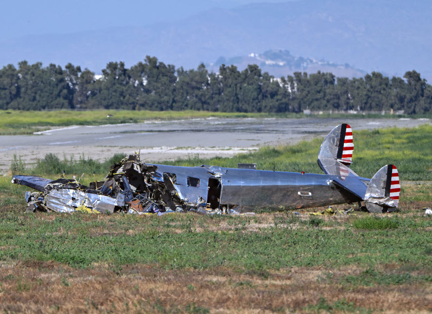
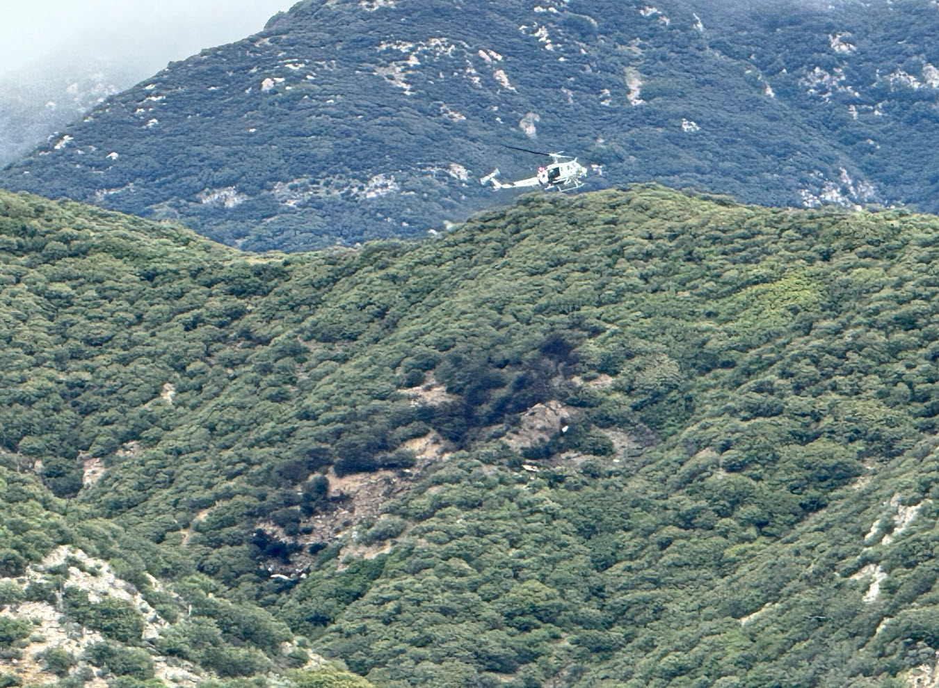
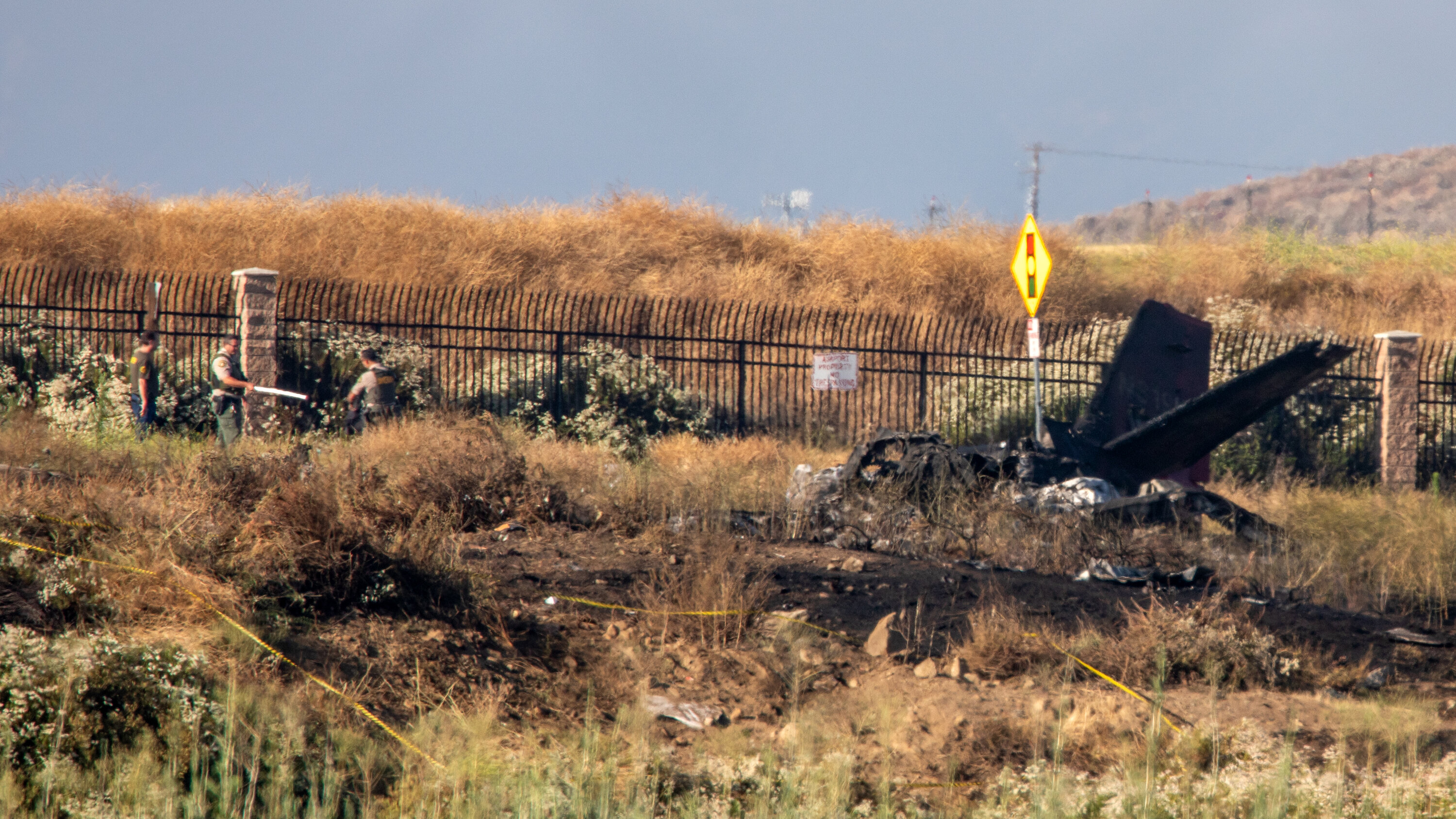
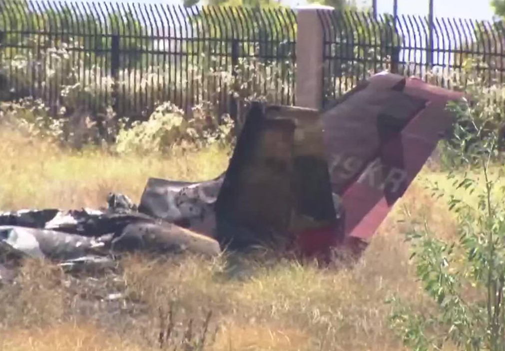
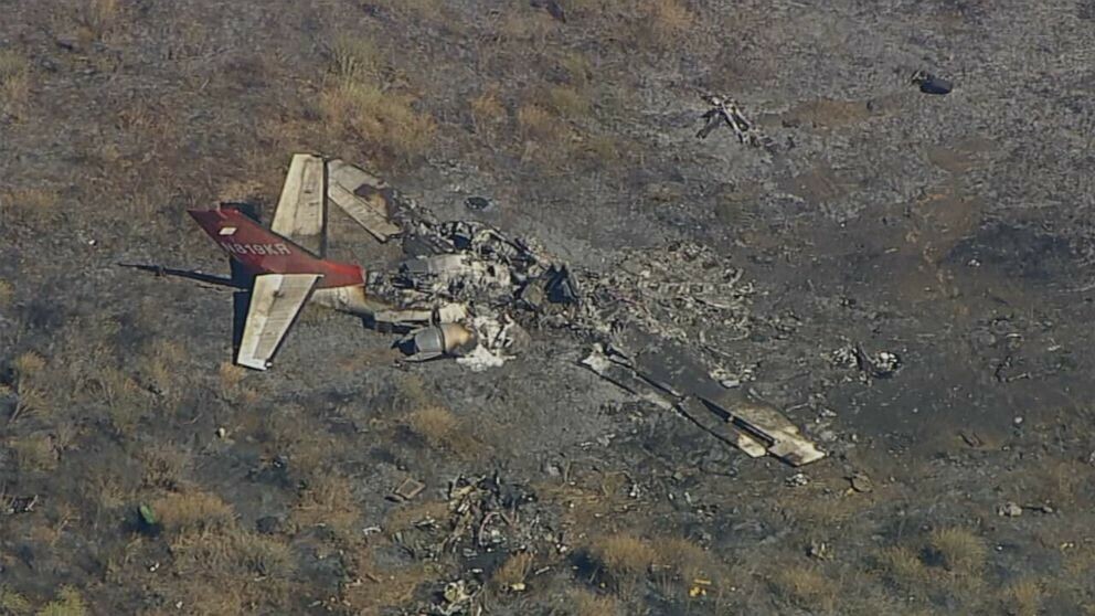
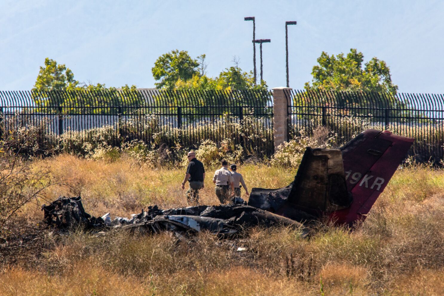
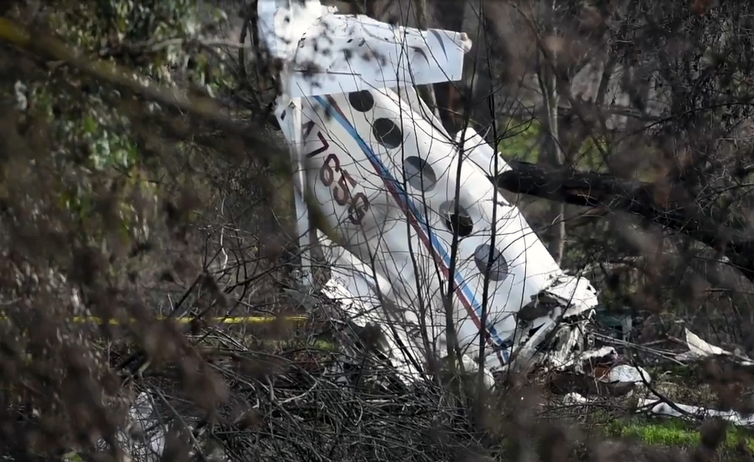
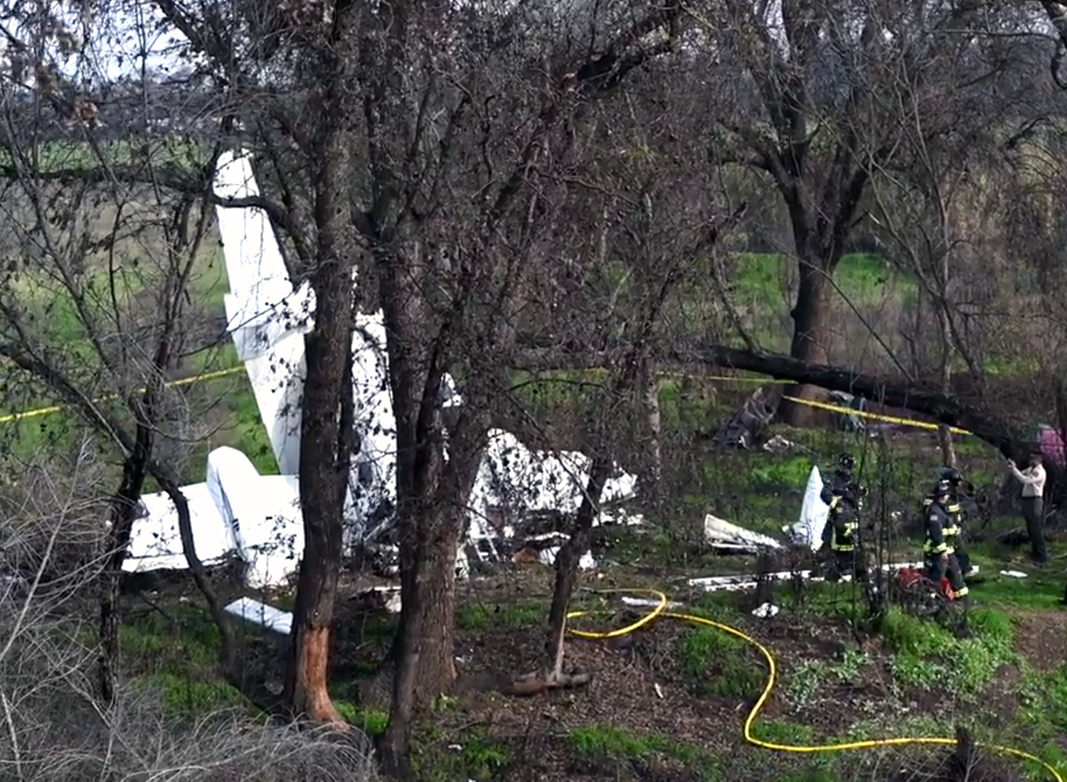
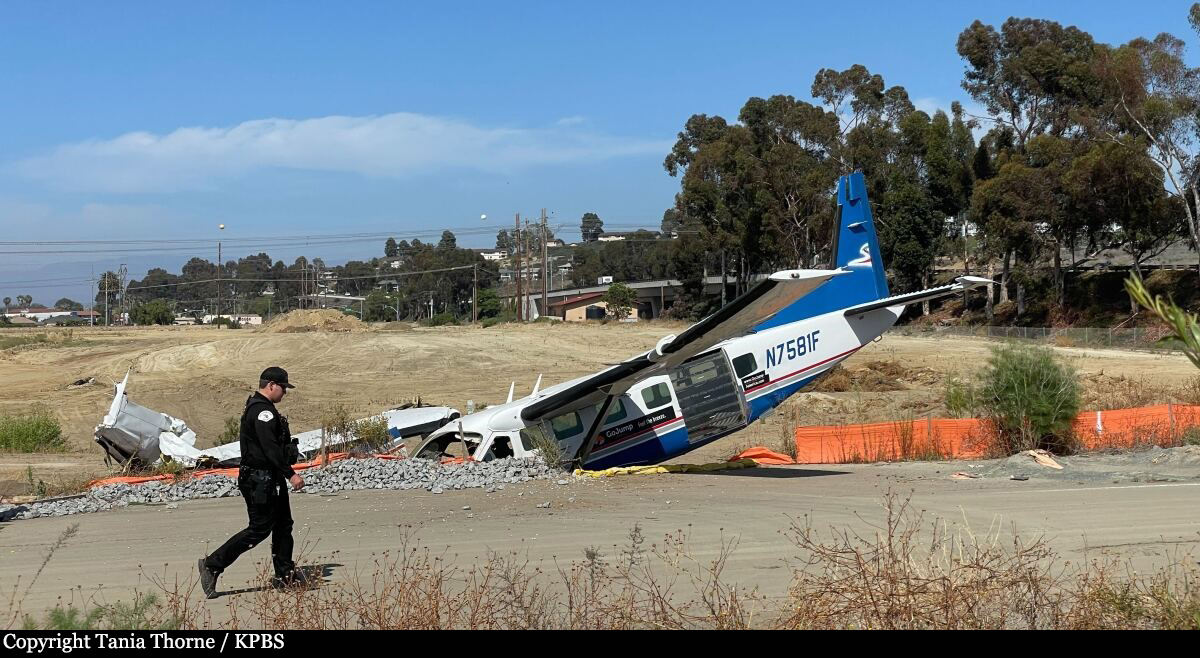
On June 03, 2022, about 1347 Pacific daylight time, a Cessna C208B Supervan 900 airplane, N7581F, was substantially damaged when it was involved in an accident near Bob Maxwell Memorial Airfield, Oceanside, California. The left-seated pilot was fatally injured and right seated pilot was seriously injured. The airplane was operated as a Title 14 Code of Federal Regulations (CFR) Part 91 skydiving flight. On the day of the accident, the pilots were performing skydiving flights while the right-seated pilot was training the left-seated pilot on the operation. A flight would consist of the pilots taking a group of approximately 17 skydivers to an altitude of about 11,500 feet mean sea level (msl) to jump out and then they would land back at the airport. The flights started about 1015 and were an average of 17 minutes in duration with about 15 minutes on the ground between each flight; the airplane’s engine was operating the entire duration. The pilots completed six flights without incident and departed on the accident flight at 1331. The right-seated pilot stated that he could not recall many of the details leading up to the accident. He remembered that on the accident flight everything was normal with the departure and the unloading of the skydivers. The airplane was descending as expected with the power at idle. As the airplane turned onto final approach, about 3 miles from the approach end of runway 25, the right-seated pilot attempted to increase the power by slightly nudging the throttle forward. He noticed that the engine power did not increase as expected and moved the throttle lever further forward. The lever was still unresponsive, and he estimated the airplane was about 400 ft above ground level (agl). He aimed for an open dirt field and observed a berm in the immediate flight path. In an effort to avoid the berm, the pilot maneuvered the airplane into a right turn.Investigators reviewed Federal Aviation Administration (FAA) provided Automatic Dependent Surveillance-Broadcast (ADS-B) flight track data covering the area of the accident during the time surrounding the accident. After departing from runway 25, the airplane made a gradual climb to 11,575 ft msl as it circled to the right, back to the airport. The airspeed was reduced (presumably to unload the skydivers) and then the airplane made a steep, turning decent reaching 133 kts when transitioning to the downwind leg of the traffic pattern. The airplane was at an altitude of about 2,400 ft msl and 2.6 nautical miles (nm) from the approach end of runway 25 when it turned onto final approach. When the airplane was about 2 nm from the runway, it made a 360° right turn which was about 0.5 nm in diameter. At 1346:10, about 1,025 ft msl, the airplane rolled out of the 360° turn and continue west toward the runway. The airplane was roughly following Highway 76 making a gradual decent (see Figure 2 below). About 33 seconds later the airplane’s speed dropped to 92 kts as it passed through 500 ft msl. The last recorded hit was at 1347:10 and located about 975 feet east of the accident site. At that time, the data indicated that the airplane was at 100 msl (equivalent to 60 feet above ground level) at a speed of 68 kts. Witness stated that they observed the airplane flying at a very low altitude (see Figure 3). The airplane then pitched down in a nose-low attitude and bank to the right. The airplane impacted terrain and collided with the side of a berm.