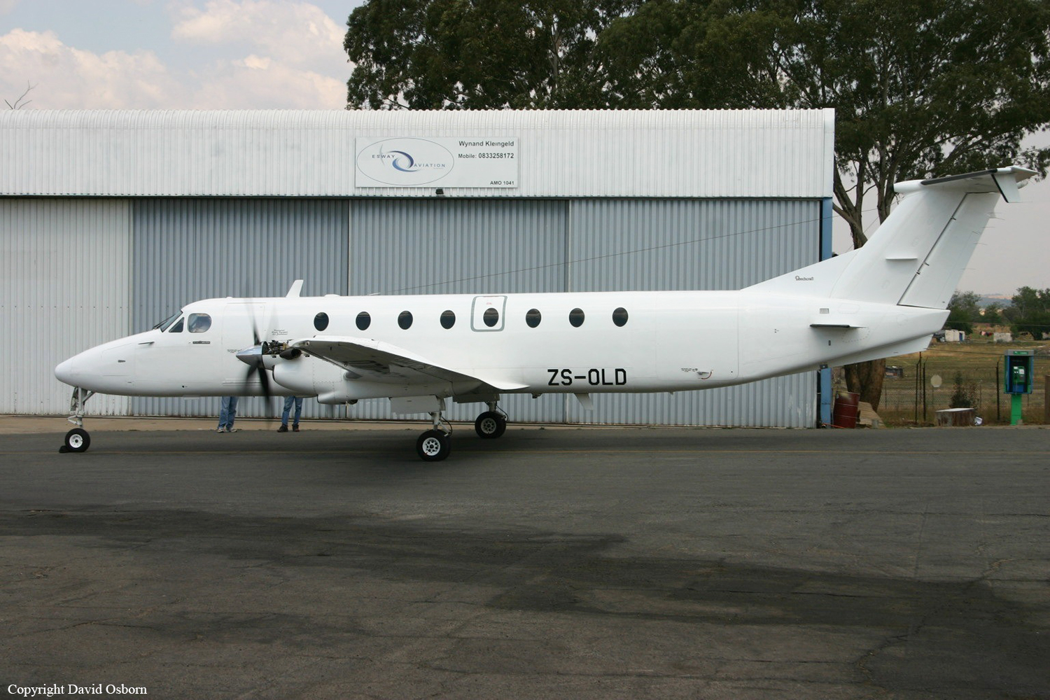
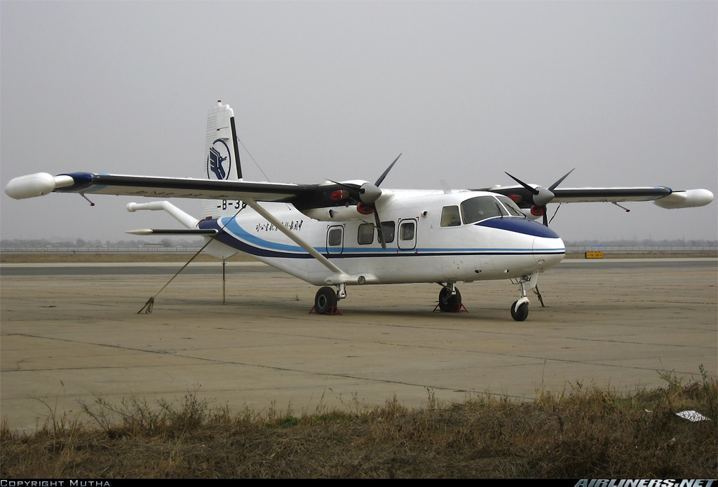
Crash of a Britten-Norman BN-2A-26 near Barberton: 9 killed

Date & Time: Oct 5, 2008 at 1538 LT
Type of aircraft:
Operator:
Registration:
ZS-OSD
Flight Phase:
Flight Type:
Survivors:
No
Site:
Schedule:
Inhambane - Nelspruit - Bloemfontein
MSN:
461
YOM:
1975
Country:
Region:
Crew on board:
1
Crew fatalities:
Pax on board:
8
Pax fatalities:
Other fatalities:
Total fatalities:
9
Captain / Total flying hours:
275
Captain / Total hours on type:
9.00
Circumstances:
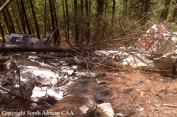
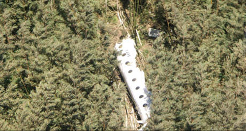
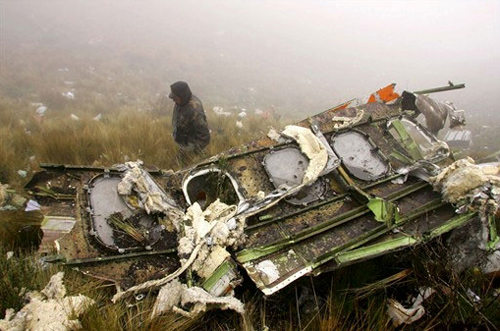
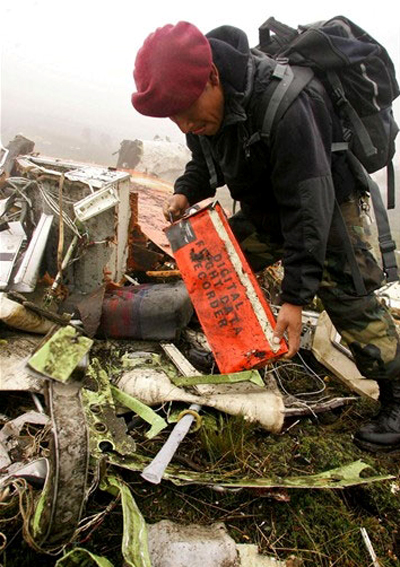
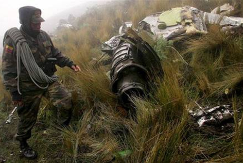
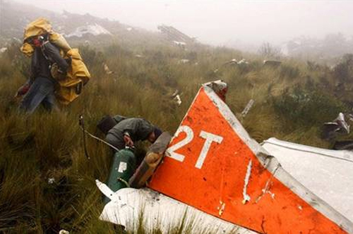
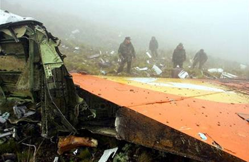
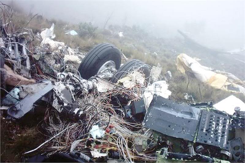
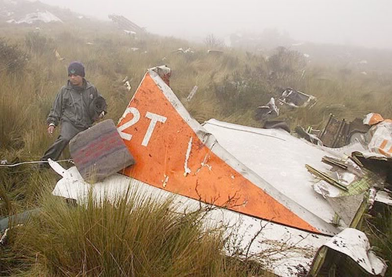
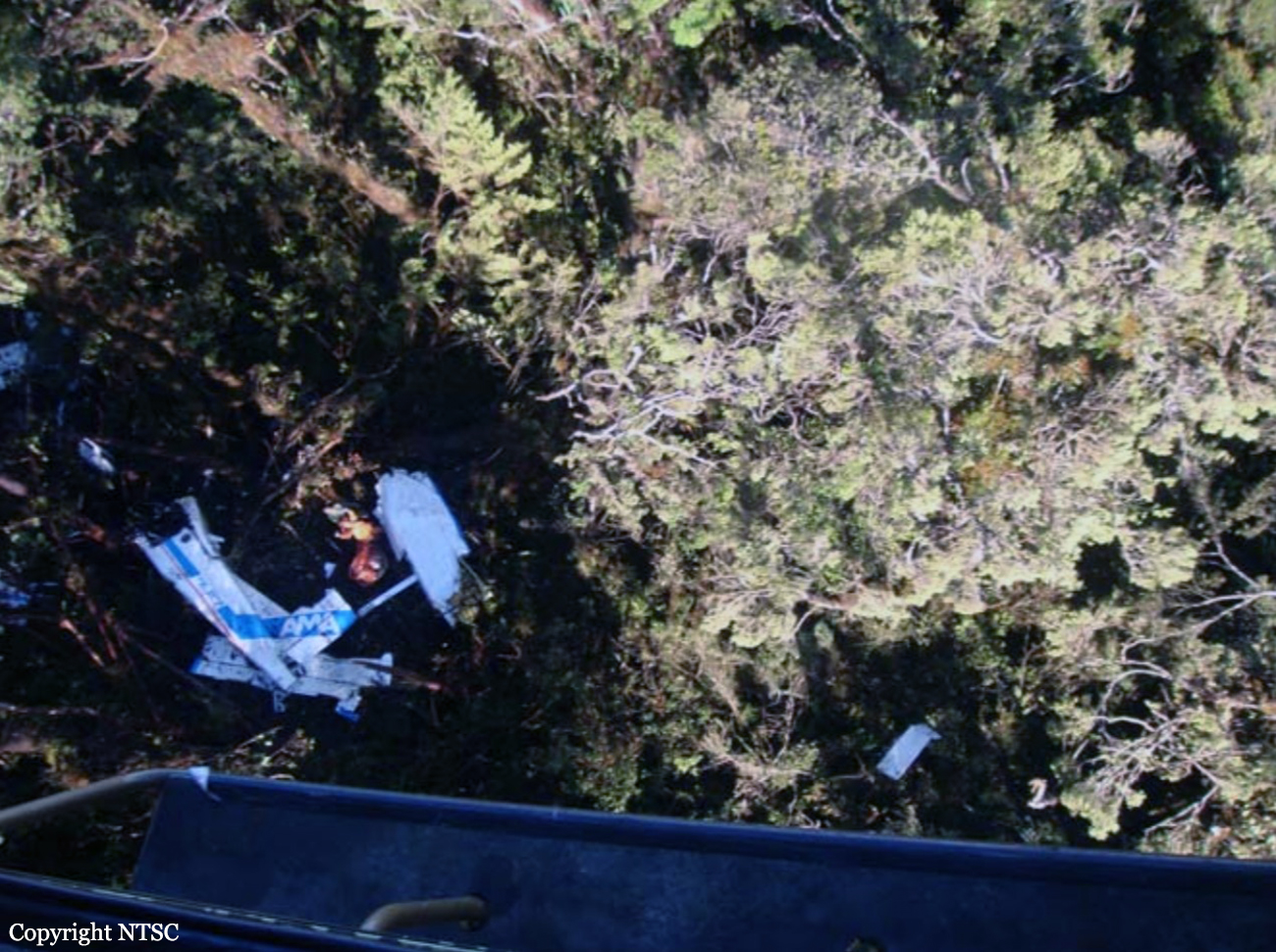
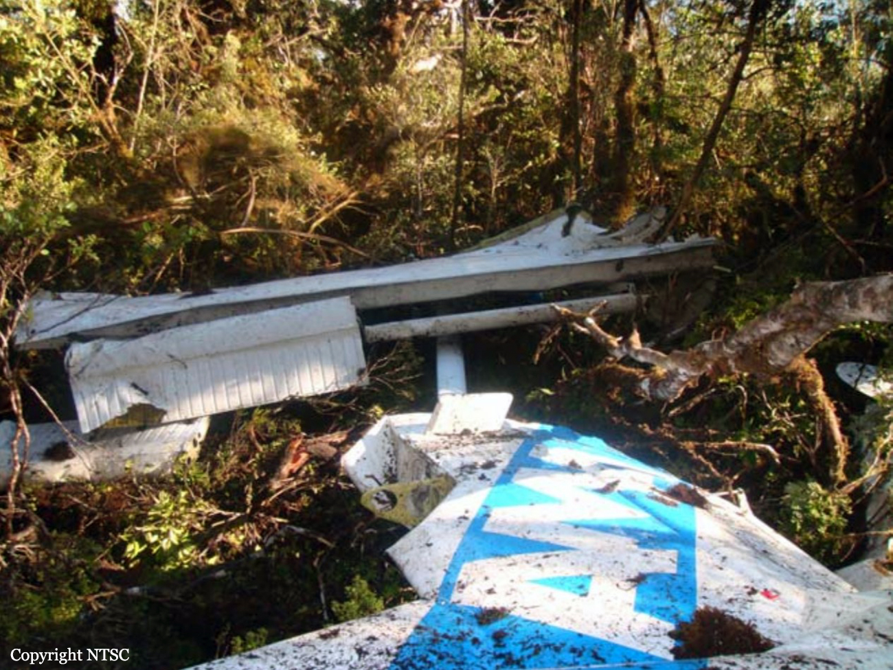
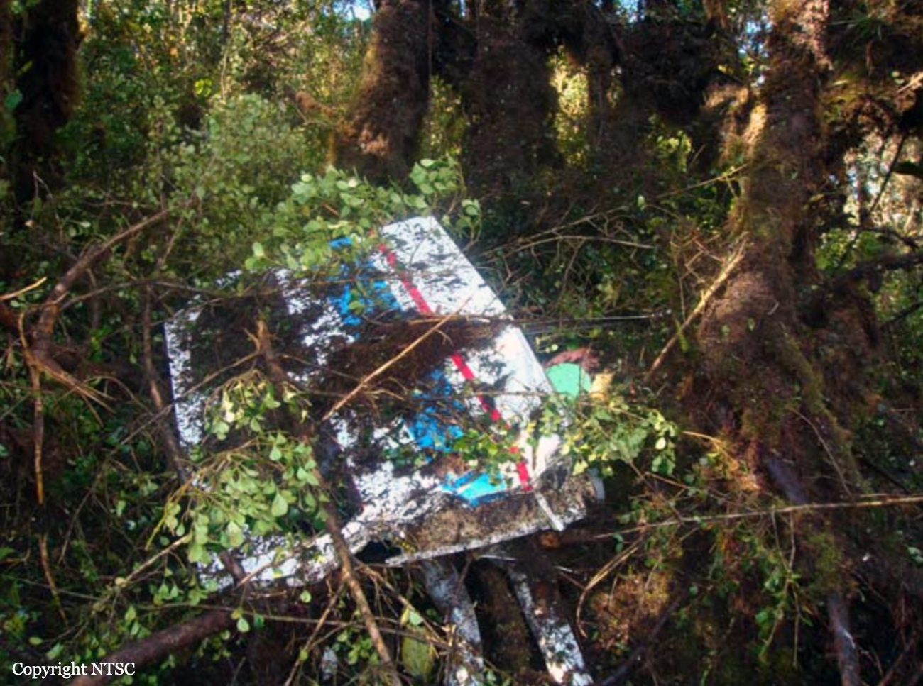
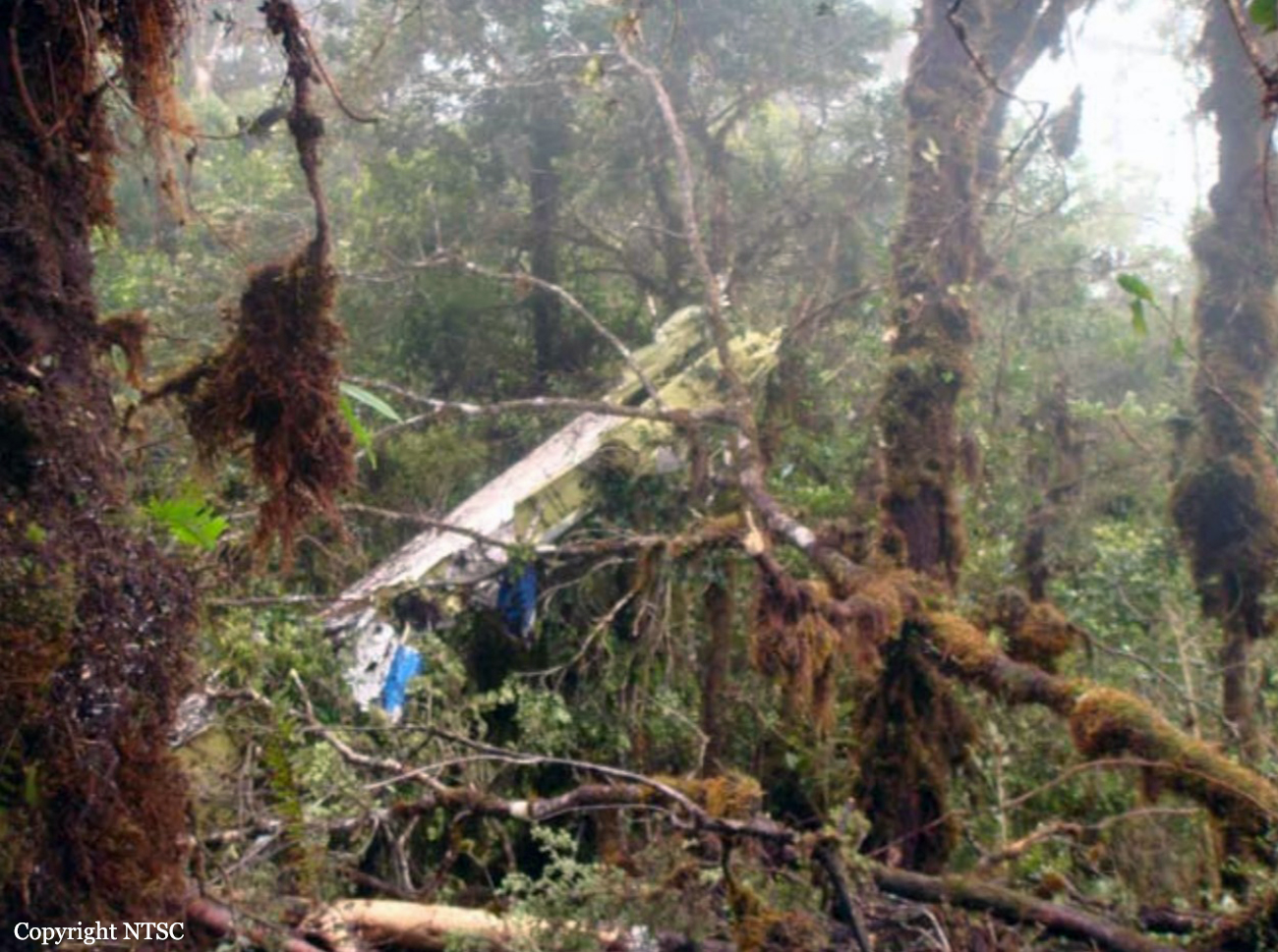
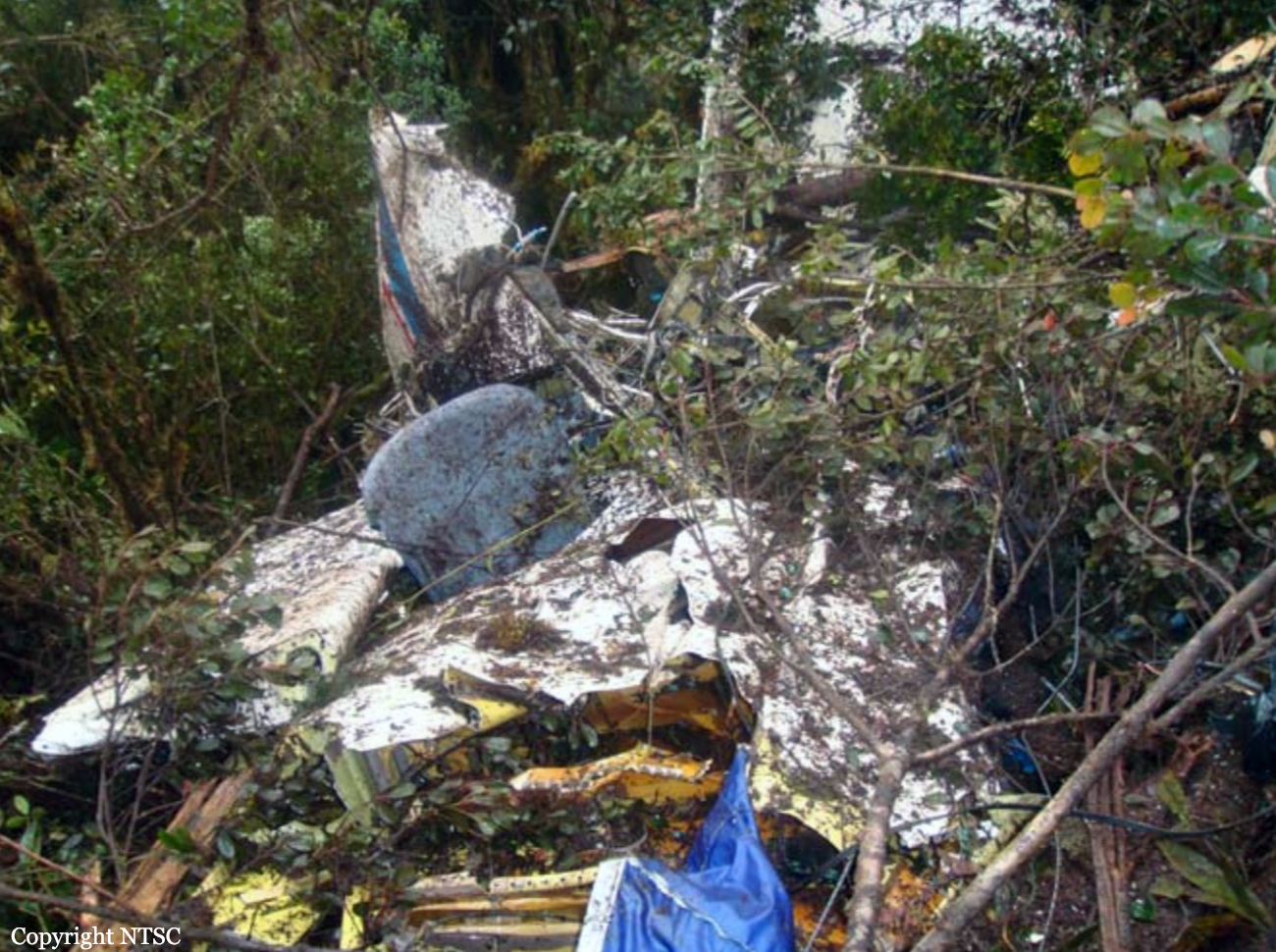
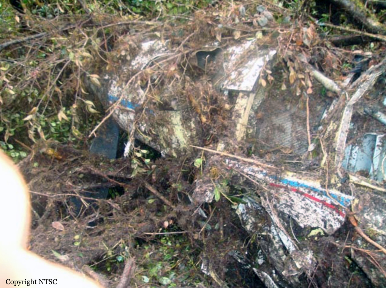
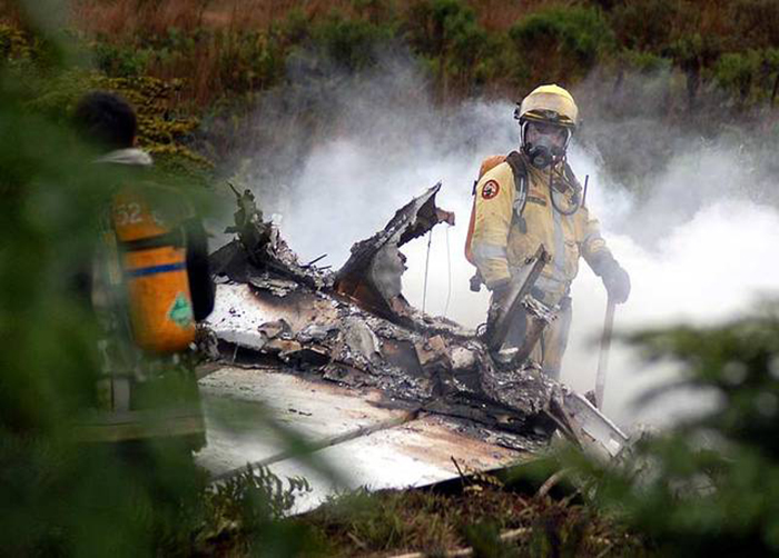
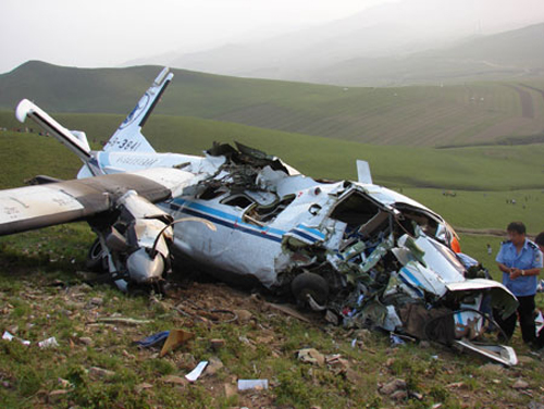
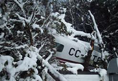
The purpose of the flight was to spend a week in Mozambique during the school holidays following the 3rd term. The regular pilot of the aircraft was unable to undertake the journey due to an injured leg, so a replacement pilot was trained over a three-day period to fly two families to Mozambique. The pilot, together with four adults accompanied by four children, departed New Tempe aerodrome (FATP) on the 27th of September 2008. The first leg of the journey would see the aircraft fly from New Tempe aerodrome (FATP) to Kruger Mpumalanga International Airport (FAKN). After a brief stop at Kruger Mpumalanga International Airport (FAKN) for customs formalities, the aircraft then proceeded to Inhambane (FQIN) in Mozambique. On the 5th of October 2008, the aircraft was refuelled with 200 litres of fuel at Inhambane (FQIN) in Mozambique for the return leg of the journey. The return leg of the journey would see the aircraft fly from Inhambane (FQIN) in Mozambique to Kruger Mpumalanga International Airport (FAKN) for customs formalities and refuelling. 326 litres of fuel was uplifted at Kruger Mpumalanga International Airport (FAKN). The pilot filed a visual flight rules (VFR) flight plan with the ATC at Kruger Mpumalanga International Airport (FAKN) for the flight to New Tempe aerodrome (FATP) on the day of the accident. The aircraft departed Kruger Mpumalanga International Airport (FAKN) at 1317Z for the final leg of the flight to New Tempe aerodrome (FATP). Approximately 20 minutes after take-off from FAKN, a witness observed the aircraft flying at an altitude of approximately 1,000 feet AGL with the wings level in a southerly direction, overhead the farm, in the direction of the mountains. The witness noted that the aircraft was flying much lower than aircraft would normally fly when they flew over the farm. Thick mist covered approximately one third (1/3) of the top of the mountain at the time. The witness then lost sight of the aircraft and approximately two minutes later he heard an explosion. The witness immediately notified the Kruger Mpumalanga Airport authorities that an aircraft may have been involved in an accident. A search and rescue operation was initiated after the appropriate authorities had been informed. The search and rescue operation that consisted of air and ground searches were hampered by adverse weather conditions in the area from where the witness had heard the explosion emanating. The wreckage was located the following day during the air search operation, approximately 170 feet below the mountain top, where the aircraft had impacted with terrain. The aircraft had ploughed through a pine tree plantation, and was destroyed in the impact sequence and by the post-impact fire that had erupted. All the occupants on board the aircraft were fatally injured in the accident.
Probable cause:
The pilot encountered adverse weather (IMC) conditions en route during a VFR flight, which resulted in controlled flight into terrain (CFIT) near the top of the mountain.
Final Report:

Crash of a Cessna 421B Golden Eagle near San Antonio del Bravo: 4 killed

Date & Time: Sep 14, 2008 at 1318 LT
Registration:
N7560Q
Flight Phase:
Survivors:
No
Site:
Schedule:
El Paso - Presidio
MSN:
421B-0346
YOM:
1973
Country:
Crew on board:
1
Crew fatalities:
Pax on board:
3
Pax fatalities:
Other fatalities:
Total fatalities:
4
Circumstances:
On September 15, 2008 Cessna 421B, N7560Q, was substantially damaged after it collided with mountainous terrain approximately 28 miles northwest of Ojinaga, Mexico, near the border town of Presidio, Texas. The air transport rated pilot and the three passengers were fatally injured. The pilot contacted the Fort Worth Automated Flight Service Station (AFSS), Fort Worth, Texas, at 1016, approximately 15 minutes after he departed El Paso International Airport, El Paso, Texas, and filed a visual flight rules flight plan to Presidio, Texas. The pilot informed an AFSS specialist that he intended to enter Mexican airspace for the purpose of flying over the Luis Leon Dam, but had no intentions of landing in Mexico. The pilot did not request a weather briefing for the flight however, he was informed by the specialist that visual flight rules were not recommended due to mountain obscuration. Onboard the airplane were the pilot, the United States and Mexican Commissioners of the International Boundary and Water Commission (IBWC), and the Executive Director for the Rio Grande Council of Governments. The purpose of the flight was to assess Rio Grande flood conditions at Presidio-Ojinaga and to coordinate joint US-Mexican efforts with local officials to address flood control concerns in the area due to heavy inflows to the Rio Grande from reservoirs inside Mexico as a result of recent storms. The airplane wreckage was located on September 17, 2008, by the Marfa Sector of the US Customs and Border Protection Air and Marine Division, on the west side of the Sierra Grande Mountains, at an approximate elevation of 6,500 feet mean sea level (msl). The airplane came to rest approximately 100-150 feet below the top of a ridgeline on a heading of 055 degrees along victor-airway V81.

Crash of a Beechcraft 1900C-1 near Bukavu: 17 killed

Date & Time: Sep 1, 2008 at 1600 LT
Type of aircraft:
Operator:
Registration:
ZS-OLD
Flight Type:
Survivors:
No
Site:
Schedule:
Kinshasa - Mbandaka - Kisangani - Bukavu - Goma
MSN:
UC-137
YOM:
1900
Location:
Region:
Crew on board:
2
Crew fatalities:
Pax on board:
15
Pax fatalities:
Other fatalities:
Total fatalities:
17
Captain / Total flying hours:
2031
Circumstances:
The aircraft departed Kinshasa on a humanitarian flight to Goma with intermediate stops in Mbandaka, Kisangani and Bukavu. While approaching Bukavu-Kamembe Airport, the crew encountered poor visibility due to bad weather conditions. At an altitude of about 10,800 feet, the aircraft struck the slope of Mt Kahuzi located some 15 km northwest of Bukavu. The wreckage was found a day later in a wooded area. All 17 occupants were killed, among them emissaries.
Probable cause:
Controlled flight into terrain after the crew initiated the descent prematurely. The lack of visibility was a contributing factor.

Crash of a Boeing 737-291 near Toacaso: 3 killed

Date & Time: Aug 30, 2008 at 2103 LT
Type of aircraft:
Operator:
Registration:
YV102T
Flight Phase:
Flight Type:
Survivors:
No
Site:
Schedule:
Caracas – Latacunga
MSN:
21545/525
YOM:
1978
Country:
Crew on board:
3
Crew fatalities:
Pax on board:
0
Pax fatalities:
Other fatalities:
Total fatalities:
3
Captain / Total flying hours:
9018
Captain / Total hours on type:
5915.00
Copilot / Total flying hours:
3000
Copilot / Total hours on type:
989
Aircraft flight hours:
60117
Aircraft flight cycles:
52091
Circumstances:
The aircraft was parked at Caracas Airport for a while and had just been sold to an Ecuadorian operator. A crew of three departed Caracas-Maiquetía-Simón Bolívar Airport in the evening on a delivery flight to Latacunga, Ecuador. After being cleared to descend to FL180, FL150 then FL130, the crew was flying over a mountainous area when the GPWS alarm sounded. The crew apparently elected to gain height but the alarm sounded for 22 seconds when the aircraft collided with the Iliniza Volcano. The aircraft disintegrated on impact and all three occupants were killed. The wreckage was found the following day at an altitude of 3,992 metres.
Probable cause:
Non-compliance by the crew of the technical procedures, configuration, speed and bank angle of the aircraft required for the completion of the initial turn of the Instrument Approach Procedure n°4 published in the AIP Ecuador, to Latacunga Airport, a failure that placed the aircraft outside of the protected area (published pattern), leading to high elevation mountainous terrain.
Contributing factors:
- Ignorance of the crew of the area which was under the approach path.
- Lack of documentation and procedures of the airline that govern the conduct of flights to non-scheduled and special airports.

Crash of a Pilatus PC-6/B2-H4 Turbo Porter near Ndundu: 1 killed

Date & Time: Aug 9, 2008 at 2000 LT
Operator:
Registration:
PK-RCZ
Flight Phase:
Flight Type:
Survivors:
No
Site:
Schedule:
Wamena - Ndundu
MSN:
903
YOM:
1994
Country:
Region:
Crew on board:
1
Crew fatalities:
Pax on board:
0
Pax fatalities:
Other fatalities:
Total fatalities:
1
Captain / Total flying hours:
4624
Captain / Total hours on type:
2275.00
Aircraft flight hours:
6321
Circumstances:
On the Saturday 9 August 2008, a Pilatus Porter PC-6 B2-H4 aircraft, registered PK-RCZ, operated by AMA (Association of Mission Aviation) on a charter flight from Wamena, Papua, to Taive II, Papua departed at 1000 UTC. The aircraft was to pick up a medical patient from Taive II. After landing and unloading cargo at Taive II, the aircraft departed from Taive II for NduNdu, Papua, at 1106 with an estimated time of arrival of 1113. The flight was to be operated in accordance with the visual flight rules (VFR), remaining clear of cloud and navigating visually. When the aircraft had not arrived by 1213, the Wamena authorities decided to search for the aircraft. Three operators assisted the search; Association of Mission Aviation (AMA), Mission Aviation Fellowship (MAF), and Yajasi. They all reported hearing PK-RCZ’s emergency locator transmitter (ELT) signal, but were unable to reach the crash site due to the weather conditions. At 2020 (0520 local time on Sunday 10 August), the aircraft wreckage was found at an elevation of 6,400 feet at the coordinates 03° 26’ 08” S, 138° 21’ 58” E, in the area of NduNdu Pass, on the aircraft’s planned track. The crash site was about 200 feet to the left (east) of the southerly track across the Pass, on the slope of an 11,000 foot mountain. The coordinates and elevation of the lowest point in the NduNdu Pass were
03° 26’ 26” S, 138° 21’ 22” E and 5,700 feet. The pilot, the sole occupant, was fatally injured.
Probable cause:
The pilot continued the flight into cloud and did not initiate action to maintain visual flight conditions. The sector of the flight across the mountain pass was not conducted in conformance with the visual flight rules, and the pilot was did ensure that the aircraft remained clear of the terrain.
Final Report:

Crash of a Grumman G-21A Goose near Port Hardy: 5 killed

Date & Time: Aug 3, 2008 at 0722 LT
Type of aircraft:
Operator:
Registration:
C-GPCD
Flight Phase:
Survivors:
Yes
Site:
Schedule:
Port Hardy - Chamiss Bay
MSN:
B76
YOM:
1944
Country:
Crew on board:
1
Crew fatalities:
Pax on board:
6
Pax fatalities:
Other fatalities:
Total fatalities:
5
Captain / Total flying hours:
3998
Captain / Total hours on type:
500.00
Circumstances:
At 0708 Pacific daylight time, the Pacific Coastal Airlines G-21A amphibian (registration C-GPCD, serial number B76) operating as a charter flight departed Port Hardy Airport, British Columbia, on a visual flight rules flight to Chamiss Bay, British Columbia. At 0849 and again at 0908, the flight follower attempted to contact the tugboat meeting the aircraft at Chamiss Bay by radiotelephone but was unsuccessful. At 0953, the flight follower reported the aircraft overdue to the Joint Rescue Coordination Centre in Victoria, British Columbia, and an aerial search was initiated. A search and rescue aircraft located the wreckage on a hillside near Alice Lake, approximately 14 nautical miles from its departure point. A post-crash fire had ignited. The emergency locator transmitter had been destroyed in the crash and did not transmit. The accident happened at about 0722. Of the seven occupants, the pilot and four passengers were fatally injured, one passenger suffered serious injuries, while another suffered minor injuries. The two survivors were evacuated from the accident site at approximately 1610.
Probable cause:
Findings as to Causes and Contributing Factors:
1. While likely climbing to fly above a cloud-covered ridge and below the overcast ceiling, the aircraft stalled aerodynamically at a height from which full recovery could not be made before striking the trees.
2. The aircraft broke apart upon impact, and electrical arcing from exposed wires in the presence of spilled fuel caused a fire that consumed most of the aircraft.
Findings as to Risk:
1. While the company’s established communications procedures and infrastructure met the regulatory requirements, they were not effective in ascertaining an aircraft’s position and flight progress, which delayed critical search and rescue (SAR) action.
2. The emergency locator transmitter was destroyed in the crash and failed to operate, making it difficult for SAR to find the aircraft. This prolonged the time the injured survivors had to wait for rescue and medical attention.
Final Report:

Crash of a De Havilland DHC-6 Twin Otter 300 near Cochamó: 3 killed

Date & Time: Jul 2, 2008 at 1430 LT
Operator:
Registration:
947
Flight Phase:
Flight Type:
Survivors:
No
Site:
Schedule:
Puerto Montt - Puerto Montt
MSN:
404
YOM:
1974
Country:
Crew on board:
3
Crew fatalities:
Pax on board:
0
Pax fatalities:
Other fatalities:
Total fatalities:
3
Circumstances:
The crew departed Puerto Montt-El Tepual for a training flight. En route, the twin engine aircraft collided with the cables of a 23,000 volts powerline and crashed on a hilly terrain, bursting into flames. All three crew members were killed.

Crash of a Casa 212 Aviocar 200M on Mt Salak: 18 killed

Date & Time: Jun 26, 2008 at 1100 LT
Type of aircraft:
Operator:
Registration:
A-2106
Flight Phase:
Flight Type:
Survivors:
No
Site:
Schedule:
Jakarta – Bogor
MSN:
228/N68
YOM:
1984
Country:
Region:
Crew on board:
5
Crew fatalities:
Pax on board:
13
Pax fatalities:
Other fatalities:
Total fatalities:
18
Circumstances:
While flying in poor weather conditions, the twin engine aircraft struck the slope of Mt Salak located about 55 km south of Jakarta. All 18 occupants were killed.
Probable cause:
Controlled flight into terrain.

Crash of a Harbin Yunsunji Y-12-II near Chifeng: 3 killed

Date & Time: Jun 15, 2008
Type of aircraft:
Operator:
Registration:
B-3841
Flight Phase:
Survivors:
Yes
Site:
MSN:
0061
YOM:
1992
Country:
Region:
Crew on board:
2
Crew fatalities:
Pax on board:
2
Pax fatalities:
Other fatalities:
Total fatalities:
3
Circumstances:
The twin engine aircraft was engaged in an aluminium prospecting flight. In unknown circumstances, it collided with the slope of a mountain and was destroyed. A pilot survived while three other occupants were killed.

Crash of a Cessna 208B Grand Caravan near La Junta: 1 killed

Date & Time: Jun 7, 2008 at 1350 LT
Type of aircraft:
Operator:
Registration:
CC-CTR
Flight Phase:
Survivors:
Yes
Site:
Schedule:
Puerto Montt – La Junta
MSN:
208B-1137
YOM:
2005
Country:
Crew on board:
1
Crew fatalities:
Pax on board:
9
Pax fatalities:
Other fatalities:
Total fatalities:
1
Captain / Total flying hours:
15132
Captain / Total hours on type:
283.00
Circumstances:
The single engine aircraft departed Puerto Montt-El Tepual Airport at 1315LT on a flight to La Junta, carrying 9 passengers and one pilot. En route, the pilot reported to ATC his ETA at La Junta at 1425LT. Few minutes later, while cruising under VFR mode in IMC conditions, the aircraft impacted trees and crashed on a wooded area located on Mt Estero Yeco. The wreckage was found four days later, on June 11, at an altitude of 3,300 feet and 18 km west of La Junta Airport. All 9 passengers were rescued while the pilot was killed.
Probable cause:
The decision of the pilot to continue the flight under VFR mode in IMC conditions. As a result, he lost visual references and was unable to maintain a safe separation with the ground, causing the aircraft to impact terrain. Inadequate planning by the pilot by not considering the existing weather conditions en route and at destination was considered as a contributing factor.
Final Report: