Crash of a Piper PA-31-350 Navajo Chieftain in Lanai: 3 killed

Date & Time: Feb 26, 2014 at 2130 LT
Operator:
Registration:
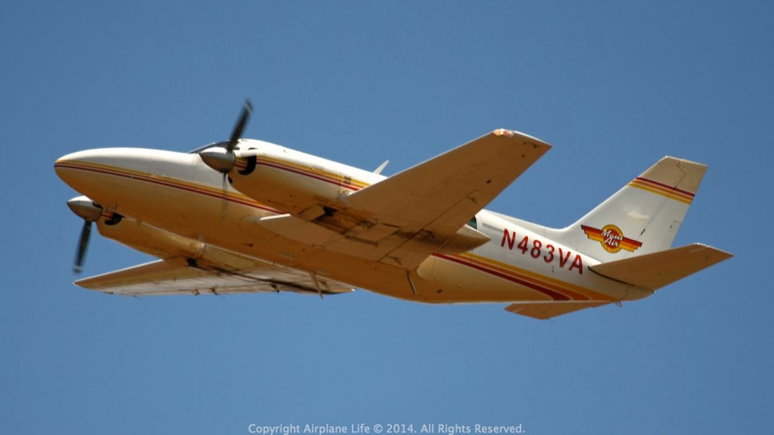
N483VA
Flight Phase:
Survivors:
Yes
Schedule:
Lanai – Kahului
MSN:
31-7552124
YOM:
1975
Location:
Crew on board:
1
Crew fatalities:
Pax on board:
5
Pax fatalities:
Other fatalities:
Total fatalities:
3
Captain / Total flying hours:
4570
Aircraft flight hours:
12172
Circumstances:
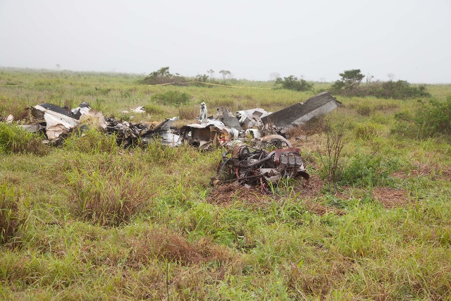
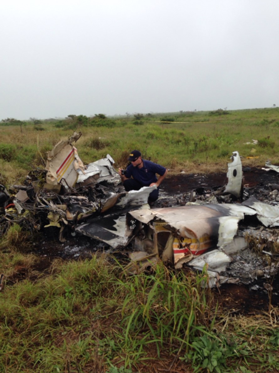
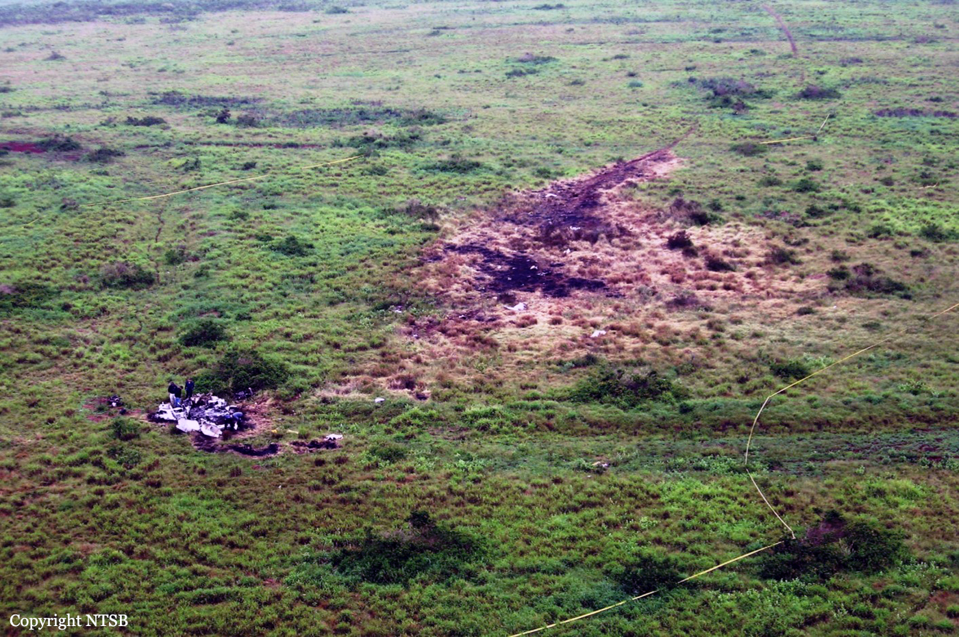
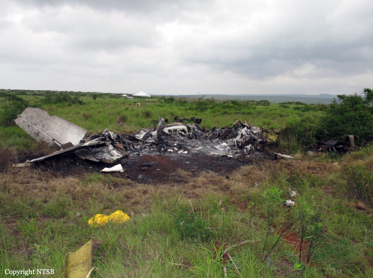
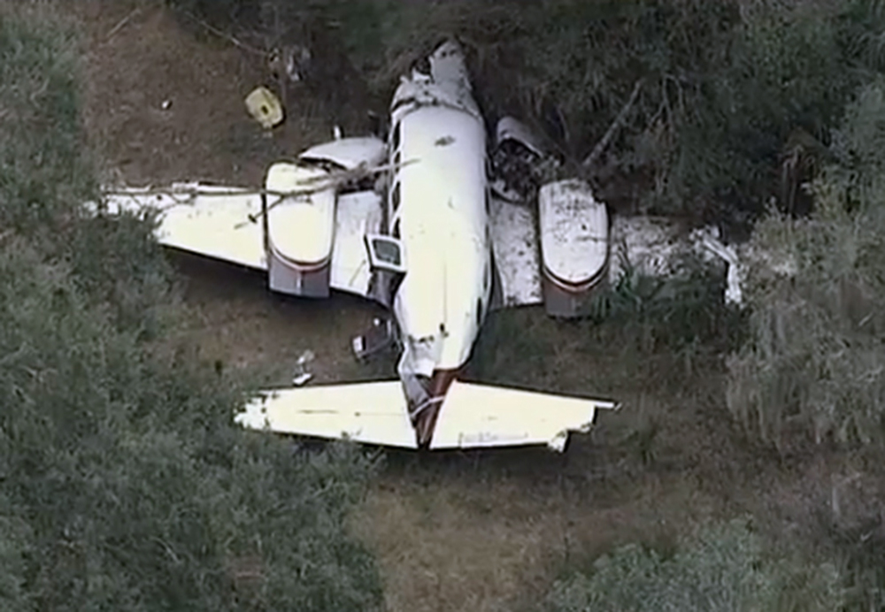
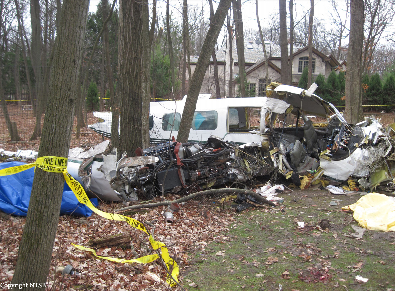
The airplane departed during dark (moonless) night conditions over remote terrain with few ground-based light sources to provide visual cues. Weather reports indicated strong gusting wind from the northeast. According to a surviving passenger, shortly after takeoff, the pilot started a right turn; the bank angle continued to increase, and the airplane impacted terrain in a steep right bank. The accident site was about 1 mile from the airport at a location consistent with the airplane departing to the northeast and turning right about 180 degrees before ground impact. The operator's chief pilot reported that the pilot likely turned right after takeoff to fly direct to the navigational aid located southwest of the airport in order to escape the terrain induced turbulence (downdrafts) near the mountain range northeast of the airport. Examination of the airplane wreckage revealed damage and ground scars consistent with a high-energy, low-angle impact during a right turn. No evidence was found of preimpact mechanical malfunctions or failures that would have precluded normal operation. It is likely that the pilot became spatially disoriented during the right turn. Although visual meteorological conditions prevailed, no natural horizon and few external visual references were available during the departure. This increased the importance for the pilot to monitor the airplane's flight instruments to maintain awareness of its attitude and altitude. During the turn, the pilot was likely performing the additional task of engaging the autopilot, which was located on the center console below the throttle quadrant. The combination of conducting a turn with few visual references in gusting wind conditions while engaging the autopilot left the pilot vulnerable to visual and vestibular illusions and reduced his awareness of the airplane's attitude, altitude, and trajectory. Based on toxicology findings, the pilot most likely had symptoms of an upper respiratory infection but the investigation was unable to determine what effects these symptoms may have had on his performance. A therapeutic level of doxylamine, a sedating antihistamine, was detected, and impairment by doxylamine most likely contributed to the development of spatial disorientation.
Probable cause:
The pilot's spatial disorientation while turning during flight in dark night conditions and terrain-induced turbulence, which resulted in controlled flight into terrain. Contributing to the accident was the pilot's impairment from a sedating antihistamine.
Final Report:

Crash of a Piper PA-31-350 Navajo Chieftain in Langgur: 4 killed

Date & Time: Jan 19, 2014 at 1225 LT
Operator:
Registration:
PK-IWT
Flight Type:
Survivors:
No
Schedule:
Jayapura – Langgur – Kendari – Surabaya
MSN:
31-7752090
YOM:
1977
Country:
Region:
Crew on board:
1
Crew fatalities:
Pax on board:
3
Pax fatalities:
Other fatalities:
Total fatalities:
4
Captain / Total flying hours:
2860
Captain / Total hours on type:
1045.00
Aircraft flight hours:
5859
Circumstances:
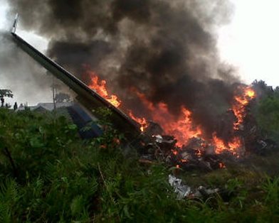
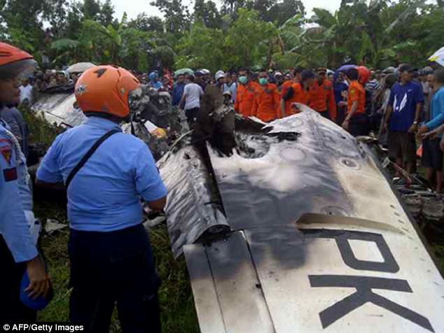
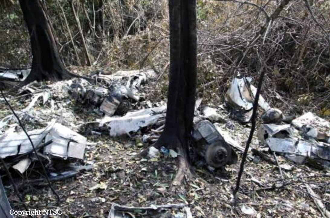
On 19 January 2014, a PA-31-350 Piper Chieftain, registered PK-IWT, was being operated by PT. Intan Angkasa Air Service, on positioning flight from Sentani Airport, Jayapura with intended destination of Juanda Airport, Surabaya for aircraft maintenance. The positioning flight was planned to transit at Dumatubun Airport Langgur of Tual, Maluku and Haluoleo Airport, Kendari at South East Sulawesi for refuelling. On the first sector, the aircraft departed Sentani Airport at 2351 UTC (0851 WIT) and estimated arrival at Langgur was 0320 UTC. On board on this flight was one pilot, two company engineers and one ground staff. At 0240 UTC the pilot contacted to the Langgur FISO, reported that the aircraft position was 85 Nm to Langgur Airport at altitude 10,000 feet and requested weather information. Langgur FISO acknowledged and informed that the weather was rain and thunderstorm and the runway in used was 09. When the aircraft passing 5,000 feet, the pilot contacted the Langgur FISO and reported that the aircraft position was 50 Nm from langgur and informed the estimated time of arrival was 0320 UTC. The Langgur FISO acknowledged and advised the pilot to contact when the aircraft was at long final runway 09. At 0318 UTC, the pilot contacted Langgur FISO, reported the position was 25 Nm to Langgur at altitude of 2,500 feet and requested to use runway 27. The Langgur FISO advised the pilot to contact on final runway 27. At 0325 UTC, Langgur FISO contacted the pilot with no reply. At 0340 UTC, Langgur FISO received information from local people that the aircraft had crashed. The aircraft was found at approximately 1.6 Nm north east of Langgur Airport at coordinate 5° 38’ 30.40” S; 132° 45’ 21.57” E. All occupants fatally injured and the aircraft destroyed by impact force and post impact fire. The aircraft was destroyed by impact forces and post impact fire, several parts of the remaining wreckage such as cockpit could not be examined due to the level of damage. The aircraft was not equipped with flight recorders and the communication between ATC and the pilot was not recorded. No eye witness saw the aircraft prior to impact. Information available for the investigation was limited. The analysis utilizes available information mainly on the wreckage information including the information of the wings, engines and propellers.
Probable cause:
The investigation concluded that the left engine most likely failed during approach and the propeller did not set to feather resulted in significant asymmetric forces. The asymmetric forces created yaw and roll tendency and the aircraft became uncontrolled, subsequently led the aircraft to impact to the terrain.
Final Report:

Crash of a Piper PA-31-350 Navajo Chieftain near Jérémie: 2 killed

Date & Time: Jun 25, 2013
Operator:
Registration:
HI-892
Flight Phase:
Flight Type:
Survivors:
No
Site:
MSN:
31-7552078
YOM:
1975
Country:
Crew on board:
2
Crew fatalities:
Pax on board:
0
Pax fatalities:
Other fatalities:
Total fatalities:
2
Circumstances:
The aircraft departed the Dominican Republic for an international flight and no flight plan was filed. While cruising in the region of Jérémie, the twin engine aircraft hit a mountain some 30 km from Jérémie. The aircraft was destroyed by impact forces and a post-crash fire and both occupants were killed. According to Dominican Authorities, the owner of the plane, a businessman, leased it to a couple from Honduras who were certainly performing an illegal flight.

Crash of a Piper PA-31-350 Navajo Chieftain in Leesburg: 1 killed

Date & Time: Dec 24, 2012 at 1435 LT
Registration:
N78WM
Flight Type:
Survivors:
Yes
Schedule:
Crescent City - Leesburg
MSN:
31-7952047
YOM:
1979
Crew on board:
1
Crew fatalities:
Pax on board:
1
Pax fatalities:
Other fatalities:
Total fatalities:
1
Captain / Total flying hours:
3000
Captain / Total hours on type:
900.00
Aircraft flight hours:
4912
Circumstances:
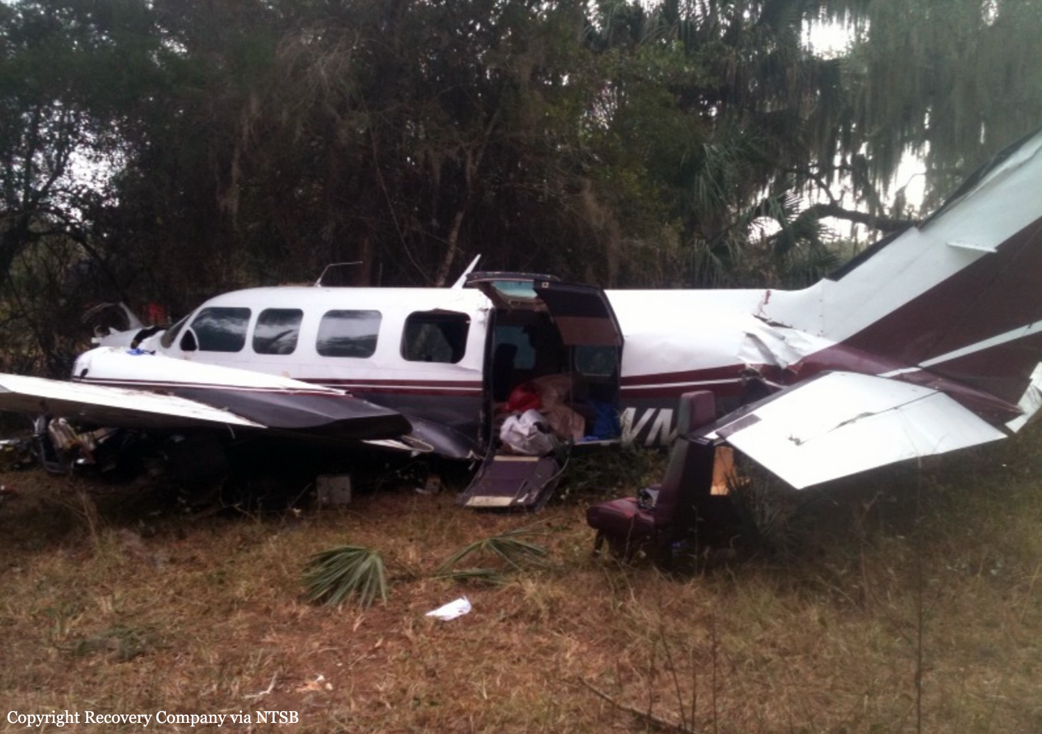
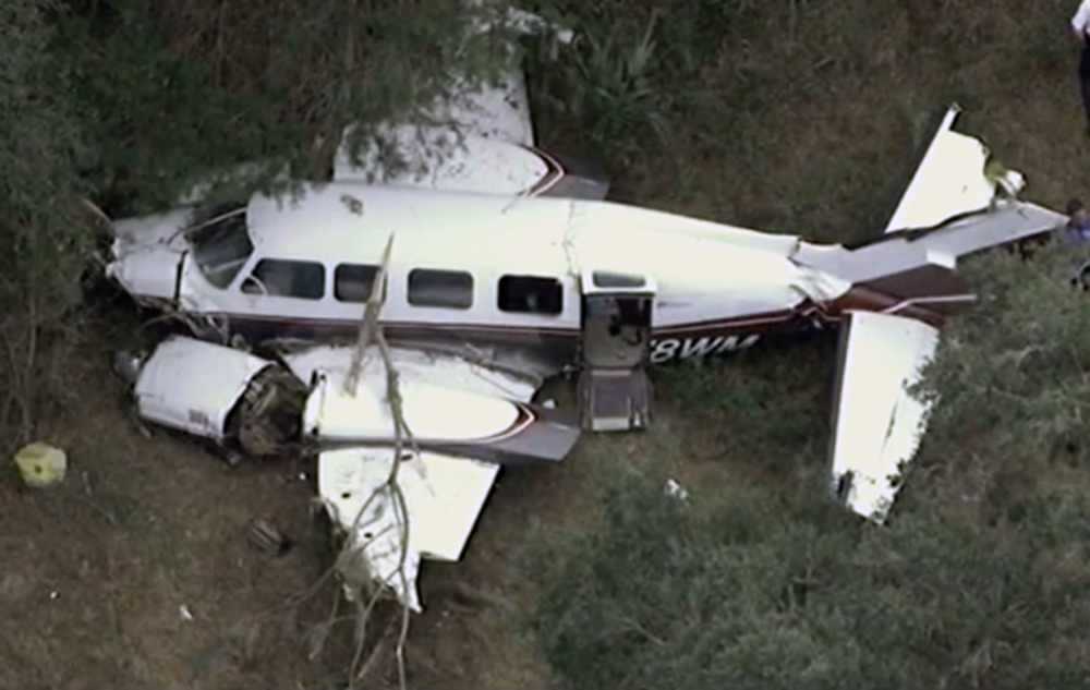
The pilot and the pilot-rated passenger were flying from their home, which was located at a residential airpark where no fuel services were available, to an airport located about 37 miles away. According to the passenger, shortly after departure, she queried the pilot about the airplane's apparent low fuel state. The pilot responded that one of the fuel gauges always indicated more available fuel than the other, and that if necessary they could use fuel from that tank. However, about 15 minutes after departure, the pilot advised air traffic control that the airplane was critically low on fuel. About 5 minutes later, both engines lost total power, and the airplane descended into trees and terrain. Examination of the airframe and engines after the accident confirmed that all of the airplane's fuel tanks were essentially empty, and that the trace amounts of fuel recovered were absent of contamination. Based on the autopsy and toxicology results, the pilot had emphysema, hypertension, dilated cardiomyopathy, and severe coronary artery disease; however, given that the passenger did not report any signs of acute incapacitation, and that the pilot did not communicate any medical issues to air traffic control, it does not appear that these conditions affected his performance on the day of the accident. The pilot did not report any chronically painful conditions to the FAA in his most recent medical certificate applications; however, postaccident toxicology tests indicated that the pilot was taking several pain medications (diclofenac, gabapentin, and oxycodone) and one illegal substance (marijuana). Based on the medications' Food and Drug Administration warnings, gabapentin and oxycodone may be individually impairing and sedating; their combined effect may be additive. The effects of the underlying conditions that necessitated the medication could not be determined. It is impossible to determine from the available information what direct effect the marijuana alone may have had on the pilot's judgment and psychomotor functioning; however, the combination of marijuana, oxycodone, and gabapentin likely significantly impaired the pilot's judgment and contributed to his failure to ensure the airplane had sufficient fuel to complete the planned flight.
Probable cause:
The pilot's inadequate preflight planning, which resulted in fuel exhaustion and a subsequent total loss of power in both engines during cruise flight. Contributing to the accident was the pilot’s use of prescription and illicit drugs, which likely impaired his judgment.
Final Report:

Crash of a Piper PA-31-350 Navajo Chieftain near Payson: 1 killed

Date & Time: Dec 18, 2012 at 1825 LT
Operator:
Registration:
N62959
Flight Phase:
Flight Type:
Survivors:
No
Site:
Schedule:
Holbrook - Payson - Phoenix
MSN:
31-7752008
YOM:
1977
Flight number:
AMF3853
Location:
Crew on board:
1
Crew fatalities:
Pax on board:
0
Pax fatalities:
Other fatalities:
Total fatalities:
1
Captain / Total flying hours:
1908
Captain / Total hours on type:
346.00
Aircraft flight hours:
19188
Circumstances:
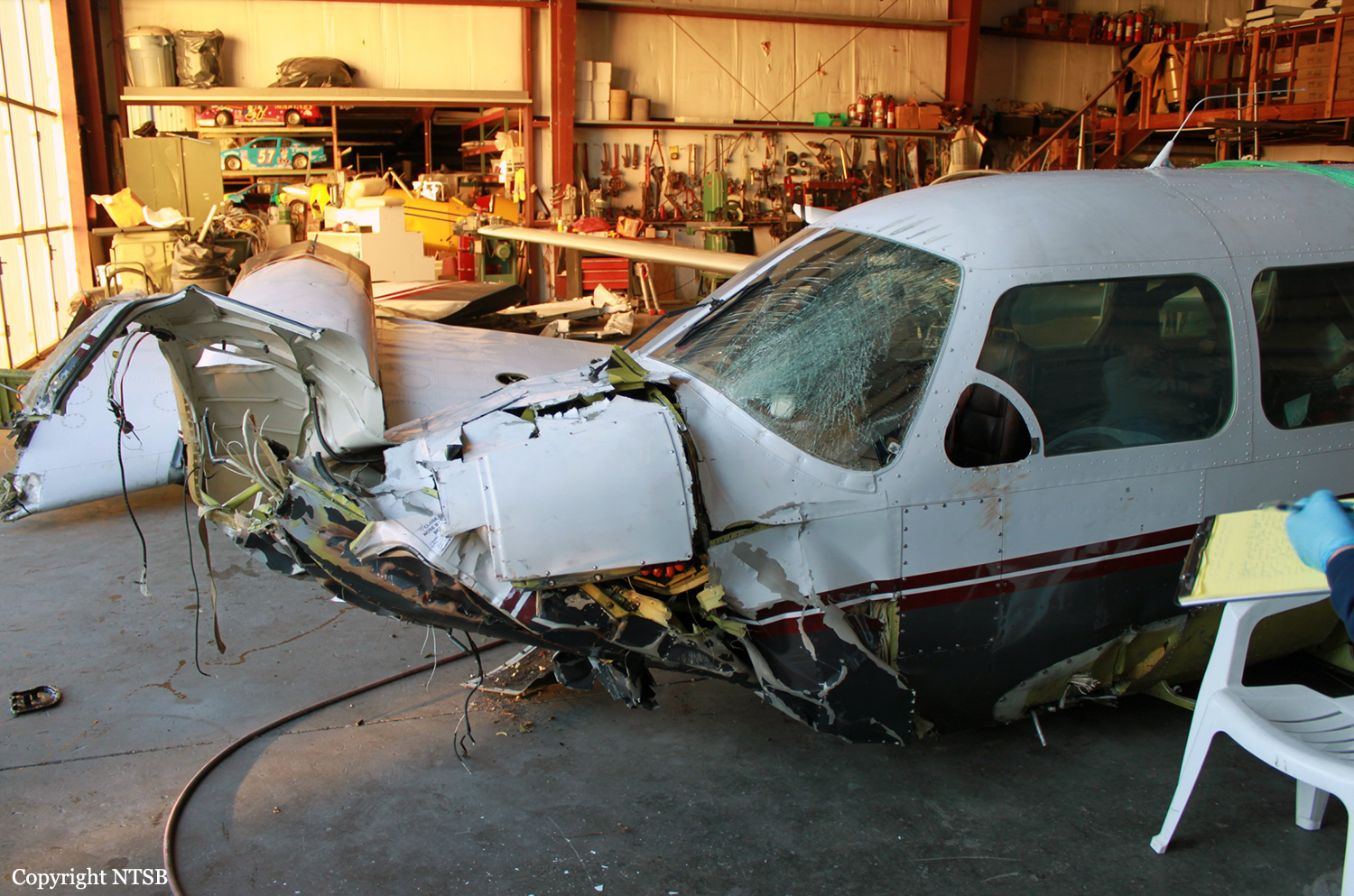
The pilot began flying the twin piston-engine airplane model for the cargo airline about 11 months before the accident. Although he had since upgraded to one of the airline’s twin turboprop airplane models, due to the airline’s logistical needs, the pilot was transferred back to the piston-engine model about 1 week before the accident. The flight originated at one of the airline’s outlying destination airports and was planned to stop at an interim destination to the southwest before continuing to the airline’s base as the final destination. The late afternoon departure meant that the flight would arrive at the interim destination about 10 minutes after sunset. That interim destination was situated in a sparsely populated geographic bowl just south of terrain that was significantly higher, and the ceilings there included multiple broken and overcast cloud layers near, or lower than, the surrounding terrain. Although not required by Federal Aviation Administration (FAA) regulations, the airline employed dedicated personnel who performed partial dispatch-like activities, such as providing relevant flight information, including weather, to the pilots. Before takeoff on the accident flight, the pilot conferred briefly with the dispatch personnel by telephone, and, with little discussion, they agreed that the flight would proceed under visual flight rules to the interim destination. Information available at the time indicated that the cloud cover almost certainly precluded access to the airport without an instrument approach; however, the airplane was not equipped to conduct the only available instrument approach procedure for that airport. Additionally, the pilot did not have in-flight access to any GPS or terrain mapping/database information to readily assist him in either locating the airport or remaining safely clear of the local terrain. Although the airplane was not being actively tracked or assisted by air traffic control (ATC) early in the flight, review of ground tracking radar data showed that the flight initially headed directly toward the interim destination but then began a series of turns, descents, and climbs. The airplane then disappeared from radar as the result of radar coverage floor limitations due to high terrain and radar antenna siting. The airplane reappeared on radar about 24 minutes after it disappeared and about 9 minutes after the FAA-defined beginning of night. Based on the flight track, it is likely that the pilot made a dedicated effort to access the airport, while concurrently remaining clear of the clouds and terrain, strictly by visual means. This task was made considerably more difficult and hazardous by attempting it in dusk conditions, and then darkness, instead of during daylight hours. About 15 minutes after the airplane reappeared on radar, when it was at an altitude of about 13,500 ft, the pilot contacted ATC and requested and was granted an instrument flight rules clearance to his final destination. About 3 minutes later, the controller cleared the flight to descend to 10,000 ft, and the airplane leveled off at that altitude about 6 minutes later. However, upon reaching 10,000 ft, the pilot requested a lower altitude to escape “heavy” upand down-drafts, but the controller was unable to comply because the ATC minimum vectoring altitude was 9,700 ft in that region. About 1 minute later, radar contact was lost. Shortly thereafter, the airplane impacted terrain in a steep nose-down attitude in a near-vertical trajectory. Although examination of the wreckage did not reveal any preimpact mechanical deficiencies that would have prevented normal operation and continued flight, the extent of the damage precluded, except on a macro scale, any determination of the preimpact integrity or functionality of any systems, subsystems, or components, including the ice protection systems, autopilot, and nose baggage door. Analysis of the radar data indicated that the airplane was above 10,000 ft for at least 41 minutes (possibly in two discontinuous periods) and above 12,000 ft (in two discontinuous periods) for at least 18 minutes. Although the airplane was reportedly equipped with supplemental oxygen, the investigation was unable to verify either its presence or its use by the pilot. Lack of supplemental oxygen at those altitudes for those periods could have contributed to a decrease in the pilot’s mental acuity and his ability to safely conduct the light. Analysis of air mass data revealed that mountain-wave activity and up- and downdrafts with vertical velocities of about 1,000 ft per minute (fpm) were present near the accident site and that the largest and most rapid transitions from up- to down-drafts occurred near the accident site, which was also supported by the airplane’s altitude data trace. The analysis also indicated that the last radar target from the airplane was located in a downdraft with a velocity of between 600 and 1,000 fpm. Other meteorological analysis indicated that the airplane encountered icing conditions, likely in the form of supercooled large droplets (SLD), several minutes before the accident. Aside from pilot reports from aircraft actually encountering SLD, no tools currently exist to detect airborne SLD. Further, the tools and processes to reliably forecast SLD do not exist. SLD is often associated with rapid ice accumulation, especially on portions of the airplane that are not served by ice protection systems. Airframe icing, whether due to accumulation rates or locations that exceed the airplane’s deicing system capabilities, mechanical failure, or the pilot’s failure to properly use the system, can impose significant adverse effects on airplane controllability and its ability to remain airborne. Because of the pilot’s recent transition from the Beechcraft BE-99, in which the pitot heat was always operating during flight, he may have forgotten that the accident airplane’s pitot heat procedures were different and that the pitot heat had to be manually activated when the airplane encountered the icing conditions. If the pitot heat is not operating in icing conditions, the airspeed information becomes unreliable and likely erroneous. Erroneous airspeed indications, particularly in night instrument meteorological conditions when the pilot has no outside references, could result in a loss of control. The investigation was unable to determine whether the pitot heat was operating during the final portion of the flight. The investigation was unable to determine whether the pilot used the autopilot during the last portion of the flight. If he was using the autopilot, it is possible that, at some point, he was forced to revert to flying the airplane manually due to the unit’s inability and to a corresponding Pilot’s Operating Handbook prohibition against using it to maintain altitude in the strong up- and downdrafts, which would increase the pilot’s workload. Another possibility is that the autopilot was unable to maintain altitude, and, instead of disconnecting it, the pilot overpowered it via the control wheel. If that occurred and the pilot overrode the autopilot for more than 3 seconds, the pitch autotrim system would have activated in the direction opposite the pilot’s input, and, when the pilot released the control wheel, the airplane could have been significantly out of trim, which could result in uncommanded pitch, altitude, and speed excursions and possible loss of control. Whether the pilot was hand-flying the airplane or was using the autopilot, the encounter with the strong up- and downdrafts and consequent altitude loss likely prompted the pilot to input corrective actions to regain the lost altitude, specifically increasing pitch and possibly power. Such corrections typically result in airspeed losses; those losses can sometimes be significant as a function of downdraft strength and the airplane’s climb capability. If that capability is compromised by the added weight, drag, and other adverse aerodynamic effects of ice, aerodynamic stall and a loss of control could result. Radar tracking data and ATC communications revealed that another, similar-model airplane flew a very similar track about 6 minutes behind the accident airplane, except that that other airplane was at 12,000 ft not 10,000 ft. The 10,000-ft ATC-mandated altitude placed the accident airplane closer to the underlying high terrain and into the clouds with the icing conditions and the strong vertical air movements. In contrast, the pilot of the second airplane reported that he was in and out of the cloud tops and did not report any weather-induced difficulties. The accident pilot did not have any efficient in-flight means for accurately determining the airborne meteorological conditions ahead, and the ATC controller did not advise him of any adverse conditions. Therefore, the pilot did not have any objective or immediate reason to refuse the ATC-assigned altitude of 10,000 ft. Ideally, based on both the AIRMET and the ambient temperatures, the pilot should have been aware of the likelihood of icing once he descended into clouds. That, particularly combined with his previously expressed lack of confidence in the airplane’s capability in icing conditions, could have prompted him to request either an interim stepdown altitude of 12,000 ft or an outright delay in a direct descent to 10,000 ft, but, for undetermined reasons, the pilot did not make any such request of ATC. Based on the available evidence, if the ATC controller had not descended the airplane to 10,000 ft when he did, either by delaying or by assigning an interim altitude of 12,000 ft, it is likely that the airplane would not have encountered the icing conditions and the strong up- and downdrafts. In addition, if the presence of SLD and/or strong up- and downdrafts had been known or explicitly forecast and then communicated to the pilot either via his weather briefing, his onboard equipment, or by ATC, it is likely that the pilot would have opted to avoid those phenomena to the maximum extent possible. The flight’s encounter with airframe icing and strong up-and downdrafts placed the pilot and airplane in an environment that either exacerbated or directly caused a situation that resulted in the loss of airplane control.
Probable cause:
The airplane’s inadvertent encounter, in night instrument meteorological conditions, with unforecast strong up- and downdrafts and possibly severe airframe icing conditions (which
likely included supercooled large droplets that the airplane was not certificated to fly in) that led to the pilot's loss of airplane control.
Final Report:

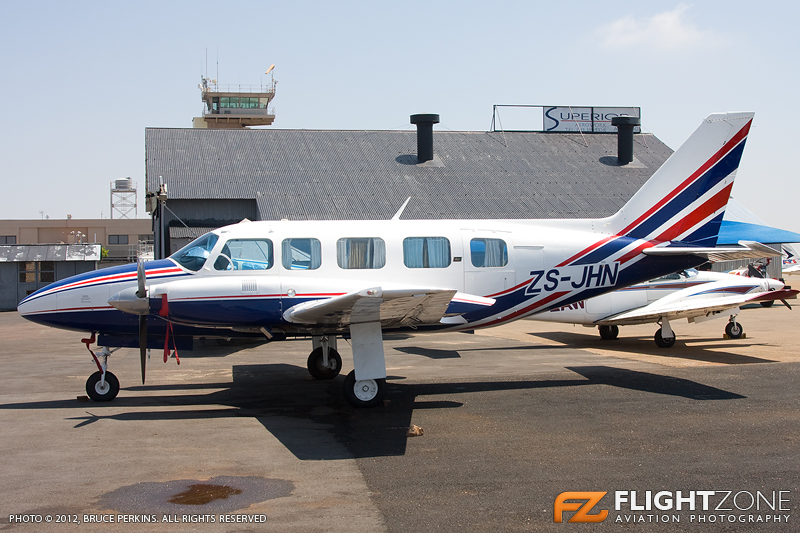
Crash of a Piper PA-31-350 Navajo Chieftain in Grand Central

Date & Time: Nov 25, 2012 at 1027 LT
Registration:
ZS-JHN
Flight Type:
Survivors:
Yes
Schedule:
Grand Central – Tzaneen
MSN:
31-7405496
YOM:
1974
Country:
Region:
Crew on board:
1
Crew fatalities:
Pax on board:
0
Pax fatalities:
Other fatalities:
Total fatalities:
0
Captain / Total flying hours:
1699
Captain / Total hours on type:
1.00
Aircraft flight hours:
8029
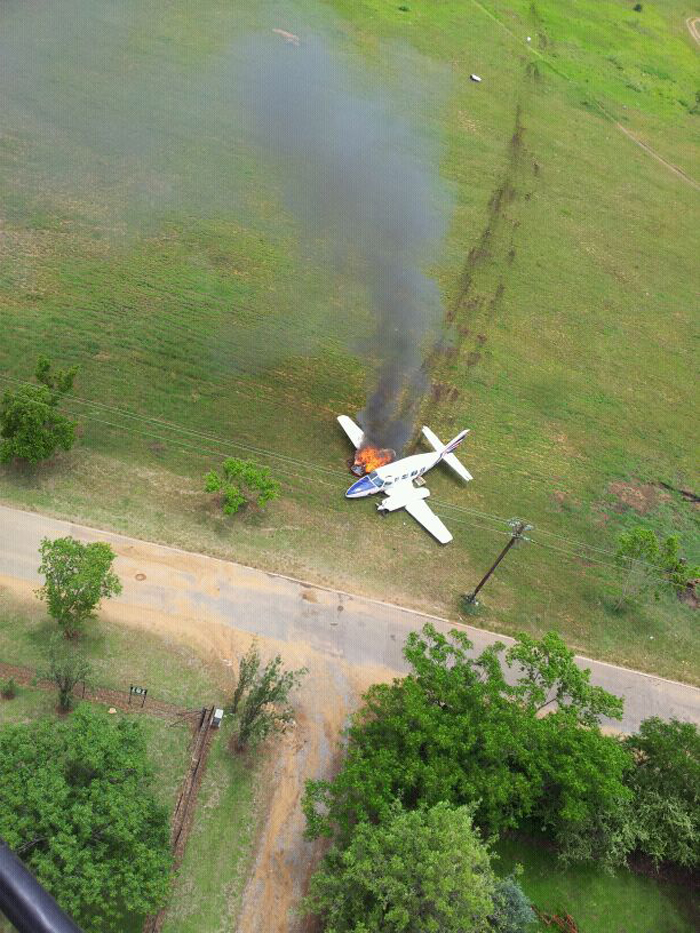
Circumstances:
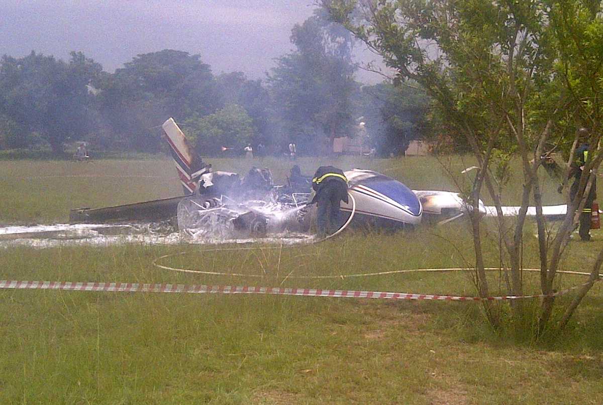
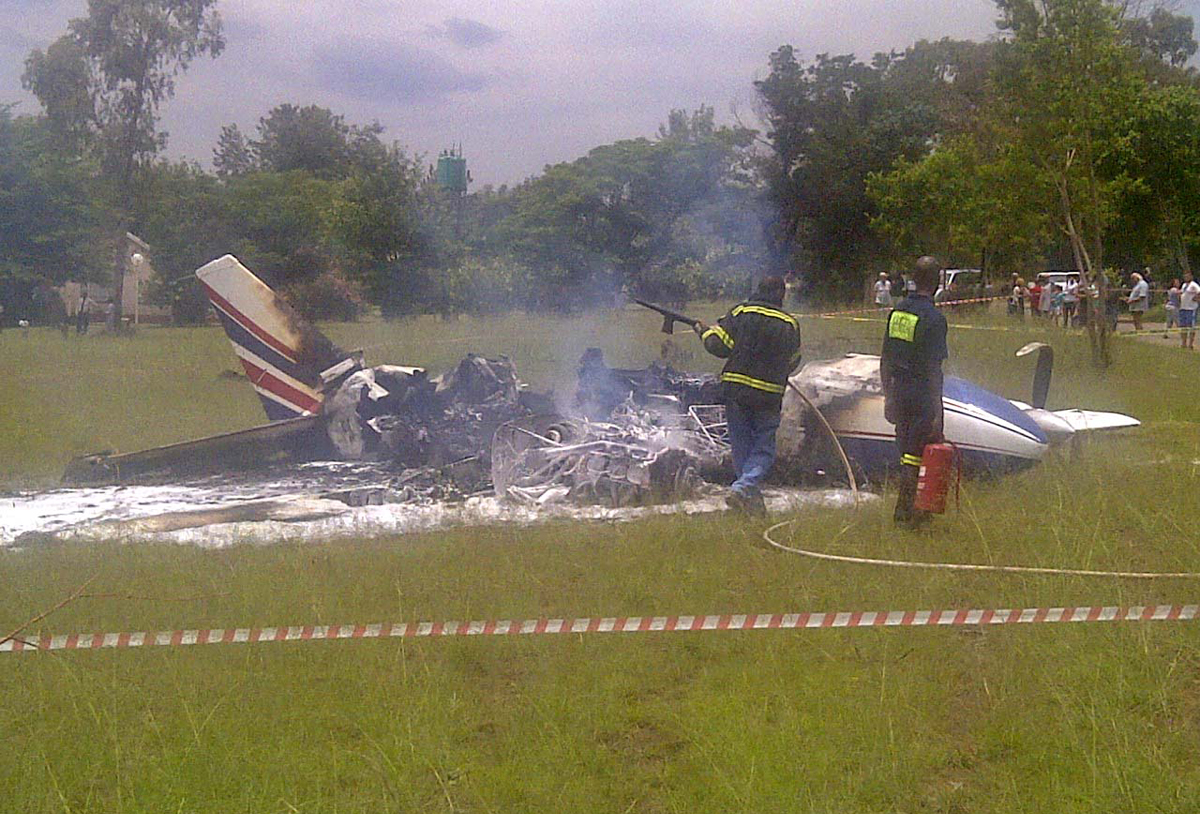
On the morning of 25 November 2012 at 0902Z the pilot, sole occupant on board the aircraft, took off from FAGC to FATZ. He filed an IFR flight plan to cruise at F110 in controlled airspace. The take-off roll and initial climb from RWY 17 was uneventful and passing FL075 FAGC Tower Controller transferred the aircraft to Johannesburg Approach Control (Approach) on 124.5 MHz. On contact with Approach the pilot was cleared to climb to FL110. On the climb approaching FL090 the aircraft lost power on the left engine, oil pressure dropped and the cylinder head temperature increased. He then advised Approach of the problem and requested to level out at FL090 to attempt to identify the problem. He requested radar vectors from Approach to route direct to FAGC and proceeded to shut down the left engine. The pilot continued routing FAGC using the right engine but was unable to maintain height. He noticed the oil pressure and manifold pressure on the right engine dropping. The pilot also reported seeing fire through the cooling vents of the right engine cowling. The pilot requested distance to FAGC from Approach and was told it is 2.5nm (nautical miles) and the aircraft continued loosing height. An update from Approach seconds later indicated that the aircraft was 1nm from FAGC. The pilot decided to do a wheels up forced landing on an open field when he realized that the aircraft was too low. He landed wheels up in a wings level attitude. The aircraft impacted and skidded across an uneven field and came to a stop 5m from Donovan Street. The pilot disembarked the aircraft and attempted to put out the fire which had started inflight on the right engine but without success. Eventually the right wing and the fuselage were engulfed by fire. Minutes later the FAGC fire department using two vehicles extinguished the fire. The pilot escaped with no injuries and the aircraft was destroyed by the ensuing fire.
Probable cause:
An inspection the left wings outboard tank was full and the main tank was empty. Both fuel selectors were also found on main tanks (left and right) position. Unsuccessful forced landing due to fuel starvation and the cause of the fire was undetermined. The left engine failed because of fuel exhaustion and the cause of fire could not be determined.
Final Report:

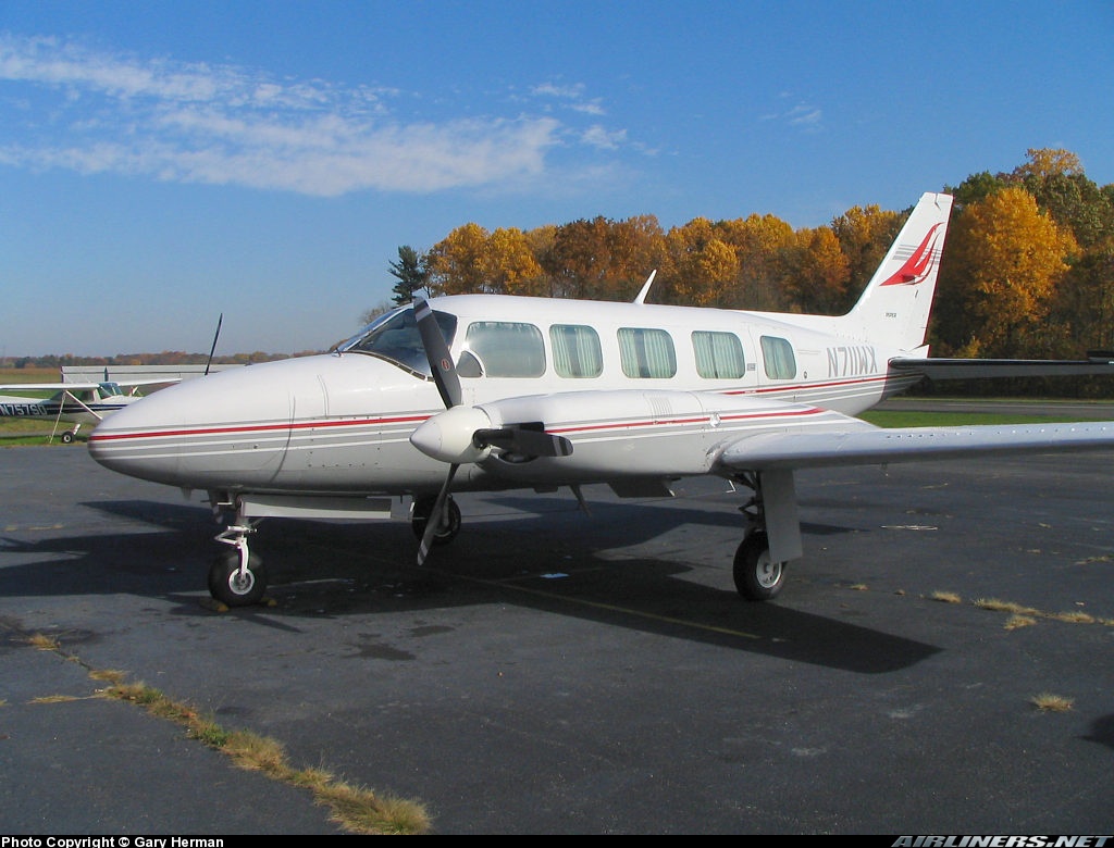
Crash of a Piper PA-31-350 Navajo Chieftain in Constanza: 2 killed

Date & Time: Sep 27, 2012 at 1545 LT
Registration:
N711WX
Flight Phase:
Flight Type:
Survivors:
No
Schedule:
Constanza - Santo Domingo
MSN:
31-7552131
YOM:
1975
Crew on board:
2
Crew fatalities:
Pax on board:
0
Pax fatalities:
Other fatalities:
Total fatalities:
2
Circumstances:
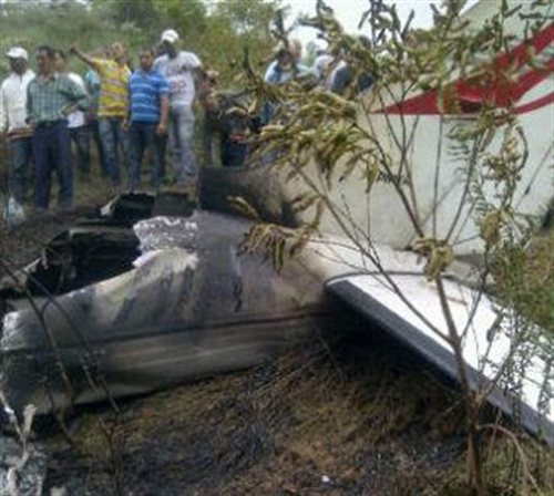
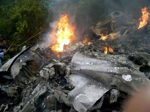
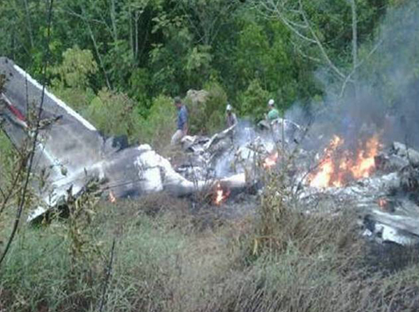
Shortly after takeoff from Constanza-14 de Junio Airport, bound to Las Américas Airport in Santo Domingo, the twin engine aircraft went out of control and crashed in a wooded area, bursting into flames. The burnt wreckage was found near the village of Tireo, about 3 km northeast of the airport. The aircraft was destroyed and both occupants were killed. The exact circumstances of the accident are unclear. It is believed that the flight was illegal and that a load of 11 of cocaine was found at the crash site.

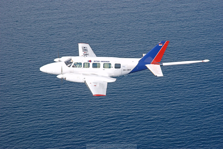
Crash of a Piper PA-31-350 Navajo Chieftain near Bontang: 4 killed

Date & Time: Aug 24, 2012 at 0810 LT
Operator:
Registration:
PK-IWH
Flight Phase:
Survivors:
No
Schedule:
Samarinda - Bontang
MSN:
31-7852065
YOM:
1978
Country:
Region:
Crew on board:
1
Crew fatalities:
Pax on board:
3
Pax fatalities:
Other fatalities:
Total fatalities:
4
Captain / Total flying hours:
17547
Captain / Total hours on type:
4250.00
Aircraft flight hours:
16743
Aircraft flight cycles:
14830
Circumstances:
On 24 August 2012, a Piper Chieftain PA-31-350 aircraft, registered PK-IWH, was being operated by PT. Intan Angkasa Airservice to conduct an aerial survey (aero magnetic) flight at a survey area located north of Bontang, East Kalimantan. There were 4 persons on board; one pilot, one security officer and two surveyors. Based on the flight plan submitted by the Pilot in Command (PIC) to the Briefing Office, the flight was planned with an altitude of 3,000 feet AMSL en-route and 500 feet AGL while surveying the area. The fuel endurance was for 6 hours flight time and the aircraft equipped with an Emergency Locator Transmitter (ELT). The aircraft departed from Temindung Airport (WALS), Samarinda at 0751 local time (LT - 2351 UTC). At 0004 UTC, the pilot informed to the Temindung Control Tower controller (Temindung Tower) that the aircraft was abeam Tanjung Santan descending from 3,000 feet and established contact with Bontang Info officer (Bontang Info). At 0005 UTC, the pilot informed the Bontang Info that the aircraft altitude was 300 feet and estimated over Bontang at 0011 UTC. Bontang info acknowledged this transmission and advised the pilot to report when the flight left the Bontang Area. At 0010 UTC, the SureTrack (flight following system) stopped receiving data from the aircraft. The last recorded information was an aircraft speed of 138 knots, heading 352°, latitude 0°8’33” N and longitude 117°12’54” E. At 0600 UTC, the engineer of the PK-IWH aircraft asked the Temindung Tower about the flight as the fuel endurance had been exceeded. The Temindung Tower contacted Bontang Info to get information about the aircraft. After receiving the request, Bontang Info tried to contact the pilot twice and there was no reply. Bontang Info also contacted the Tanjung Bara Airstrip to request information about the aircraft but there was no information. The Temindung Tower reported that:
• at 0610 UTC declared INCERFA (Uncertainty phase);
• at 0630 UTC declared ALERFA (Alert phase);
• at 0700 UTC declared DETRESFA (Distress phase).
At 0730 UTC, the search and rescue team was assembled; the team consisted of the Temindung Airport Authority, National Search and Rescue, Indonesian Police, Army and Airforce. The search operation was conducted via ground and air using three helicopters. On 26 August 2012 at 0850 UTC, the aircraft wreckage was located by a ground search team on a ridge of Mayang Hill, Bontang at approximately 1,200 feet AMSL at coordinates 00°12’34.3”N, 117°16’57.3”E, 12 NM from Bontang Aerodrome on bearing of 294°. The accident site was within the planned aircraft survey area. All occupants were fatally injured and the aircraft was destroyed by impact force and post impact fire.
Probable cause:
The accident was typical of a Controlled Flight into Terrain (CFIT). Low altitude VFR flying in a low visibility environment limited the pilot’s visibility and increased the probability of impact with terrain.
Final Report:

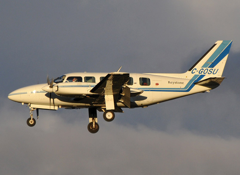
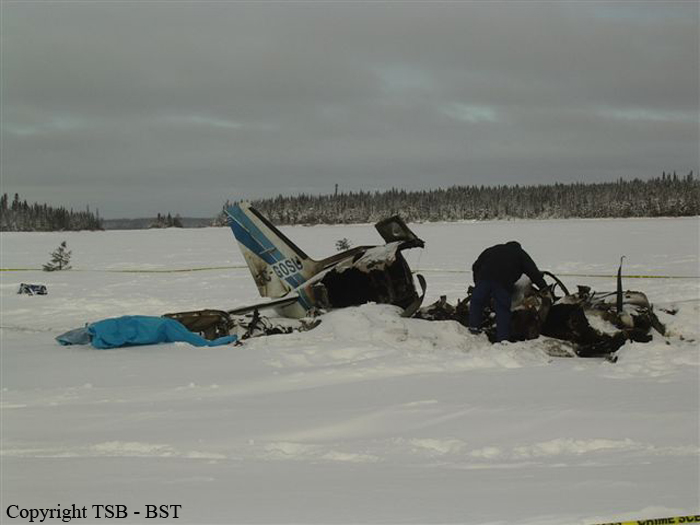
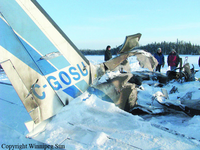
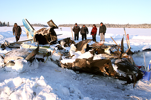
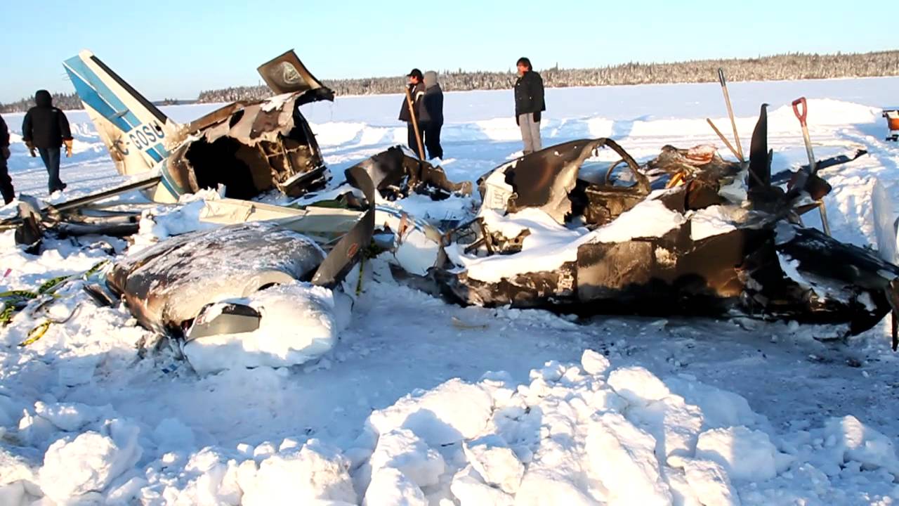
Crash of a Piper PA-31-350 Navajo Chieftain in North Spirit Lake: 4 killed

Date & Time: Jan 10, 2012 at 0957 LT
Operator:
Registration:
C-GOSU
Survivors:
Yes
Schedule:
Winnipeg - North Spirit Lake
MSN:
31-7752148
YOM:
1977
Flight number:
KEE213
Country:
Crew on board:
1
Crew fatalities:
Pax on board:
4
Pax fatalities:
Other fatalities:
Total fatalities:
4
Captain / Total flying hours:
2400
Captain / Total hours on type:
95.00
Circumstances:
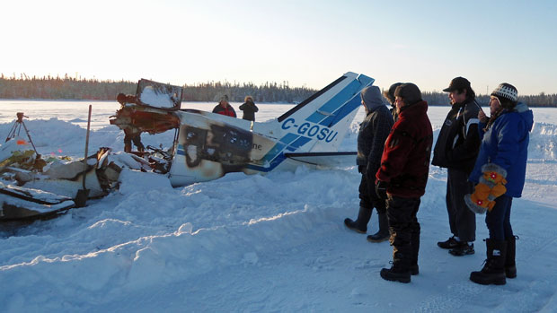
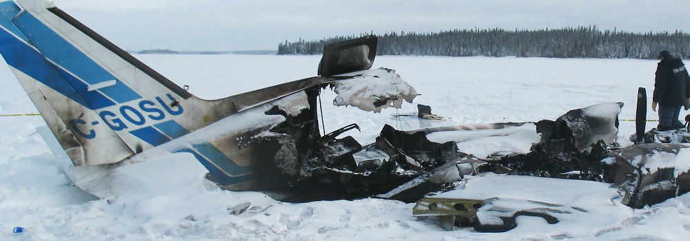
The Piper PA31-350 Navajo Chieftain (registration C-GOSU, serial number 31-7752148), operating as Keystone Air Service Limited Flight 213, departed Winnipeg/James Armstrong Richardson International Airport, Manitoba, enroute to North Spirit Lake, Ontario, with 1 pilot and 4 passengers on board. At 0957 Central Standard Time, on approach to Runway 13 at North Spirit Lake, the aircraft struck the frozen lake surface 1.1 nautical miles from the threshold of Runway 13. The pilot and 3 passengers sustained fatal injuries. One passenger sustained serious injuries. The aircraft was destroyed by impact forces and a post-impact fire. After a short period of operation, the emergency locator transmitter stopped transmitting when the antenna wire was consumed by the fire.
Probable cause:
Findings as to causes and contributing factors:
1. The pilot's decision to conduct an approach to an aerodrome not serviced by an instrument flight rules approach in adverse weather conditions was likely the result of the pilot's inexperience, and may have been influenced by the pilot's desire to successfully complete the flight.
2. The pilot's decision to descend into cloud and continue in icing conditions was likely the result of inadequate awareness of the Piper PA31-350 aircraft's performance in icing conditions and of its de-icing capabilities.
3. While waiting for the runway to be cleared of snow, the aircraft held near North Spirit Lake (CKQ3) in icing conditions. The resulting ice accumulation on the aircraft's critical surfaces would have led to an increase in the aircraft's aerodynamic drag and stall speed, causing the aircraft to stall during final approach at an altitude from which recovery was not possible.
Findings as to risk:
1. Terminology contained in aircraft flight manuals and regulatory material regarding “known icing conditions,” “light to moderate icing conditions,” “flight in,” and “flight into” is inconsistent, and this inconsistency increases the risk of confusion as to the aircraft’s certification and capability in icing conditions.
2. If confusion and uncertainty exist as to the aircraft’s certification and capability in icing conditions, then there is increased risk that flights will dispatch into icing conditions that exceed the capability of the aircraft.
3. The lack of procedures and tools to assist pilots in the decision to self-dispatch leaves them at increased risk of dispatching into conditions beyond the capability of the aircraft.
4. When management involvement in the dispatch process results in pilots feeling pressure to complete flights in challenging conditions, there is increased risk that pilots may attempt flights beyond their competence.
5. Under current regulations, Canadian Aviation Regulations (CARs) 703 and 704 operators are not required to provide training in crew resource management / pilot decision-making or threat- and error-management. A breakdown in crew resource management / pilot decision-making may result in an increased risk when pilots are faced with adverse weather conditions.
6. Descending below the area minimum altitude while in instrument meteorological conditions without a published approach procedure increases the risk of collision with terrain.
7. If onboard flight recorders are not available to an investigation, this unavailability may preclude the identification and communication of safety deficiencies to advance transportation safety.
Final Report:

Crash of a Piper PA-31-350 Navajo Chieftain in Palwaukee: 3 killed

Date & Time: Nov 28, 2011 at 2250 LT
Registration:
N59773
Flight Type:
Survivors:
Yes
Schedule:
Jesup - Chicago
MSN:
31-7652044
YOM:
1976
Crew on board:
2
Crew fatalities:
Pax on board:
3
Pax fatalities:
Other fatalities:
Total fatalities:
3
Captain / Total flying hours:
6607
Captain / Total hours on type:
120.00
Copilot / Total flying hours:
314
Aircraft flight hours:
17630
Circumstances:
The airplane was dispatched on an emergency medical services flight. While being vectored for an instrument approach, the pilot declared an emergency and reported that the airplane was out of fuel. He said the airplane lost engine power and that he was heading toward the destination airport. The airplane descended through clouds and impacted trees and terrain short of its destination. No preimpact anomalies were found during a postaccident examination. The postaccident examination revealed about 1.5 ounces of a liquid consistent with avgas within the airplane fuel system. Based on the three previous flight legs and refueling receipts, postaccident calculations indicated that the airplane was consuming fuel at a higher rate than referenced in the airplane flight manual. Based on this consumption rate, the airplane did not have enough fuel to reach the destination airport; however, a 20-knot tailwind was predicted, so it is likely that the pilot was relying on this to help the airplane reach the airport. Regardless, he would have been flying with less than the 45-minute fuel reserve that is required for an instrument flight rules flight. The pilot failed to recognize and compensate for the airplane’s high fuel consumption rate during the accident flight. It is likely that had the pilot monitored the gauges and the consumption rate for the flight he would have determined that he did not have adequate fuel to complete the flight. Toxicology tests showed the pilot had tetrahydrocannabinol and tetrahydrocannabinol carboxylic acid (marijuana) in his system; however, the level of impairment could not be determined based on the information available. However, marijuana use can impair the ability to concentrate and maintain vigilance and can distort the perception of time and distance. As a professional pilot, the use of marijuana prior to the flight raises questions about the pilot’s decision-making. The investigation also identified several issues that were not causal to the accident but nevertheless raised concerns about the company’s operational control of the flight. The operator had instituted a fuel log, but it was not regularly monitored. The recovered load manifest showed the pilot had been on duty for more than 15 hours, which exceeded the maximum of 14 hours for a regularly assigned duty period per 14 Code of Federal Regulations Part 135. The operator stated that it was aware of the pilot’s two driving while under the influence of alcohol convictions, but the operator did not request a background report on the pilot before he was hired. Further, the operator did not list the pilot-rated passenger as a member of the flight crew, yet he had flown previous positioning legs on the dispatched EMS mission as the pilot-in-command.
Probable cause:
The pilot's inadequate preflight planning and in-flight decision-making, which resulted in a loss of engine power due to fuel exhaustion during approach. Contributing to the accident was the pilot's decision to operate an airplane after using illicit drugs.
Final Report: