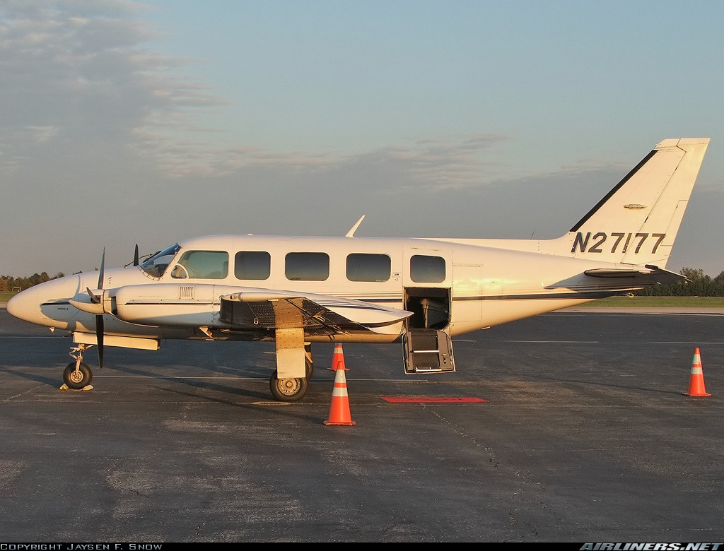
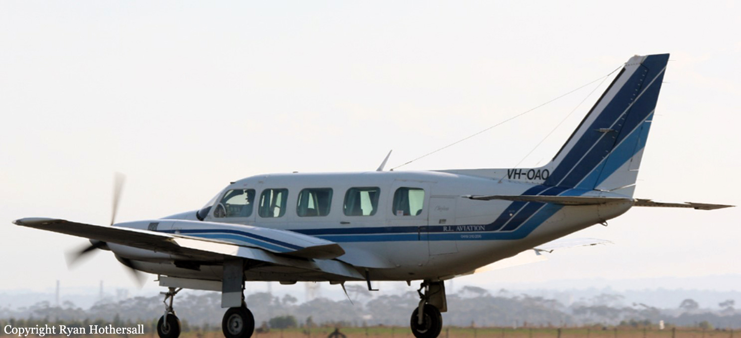
Crash of a Piper PA-31-350 Navajo Chieftain in Grand Lac Germain: 1 killed

Date & Time: Apr 1, 2007 at 0700 LT
Operator:
Registration:
C-FTIW
Flight Phase:
Flight Type:
Survivors:
No
Schedule:
Seven Islands - Wabush
MSN:
31-7752123
YOM:
1977
Country:
Crew on board:
1
Crew fatalities:
Pax on board:
0
Pax fatalities:
Other fatalities:
Total fatalities:
1
Captain / Total flying hours:
5475
Captain / Total hours on type:
790.00
Circumstances:
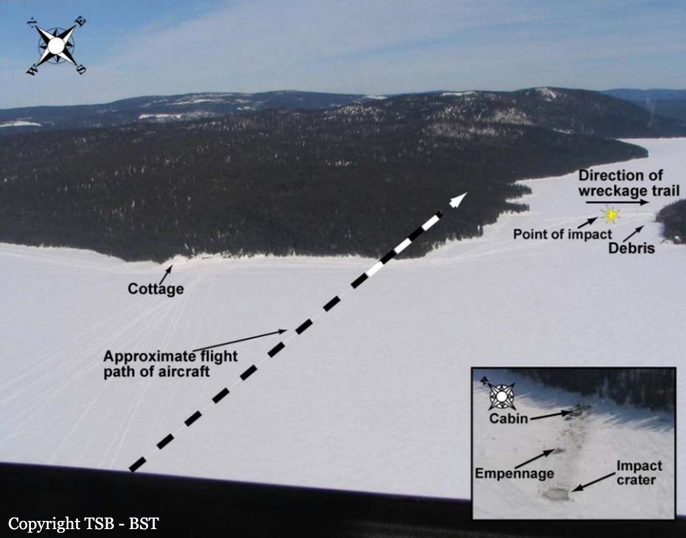
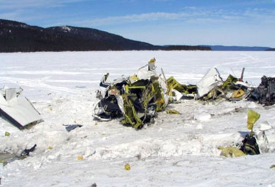
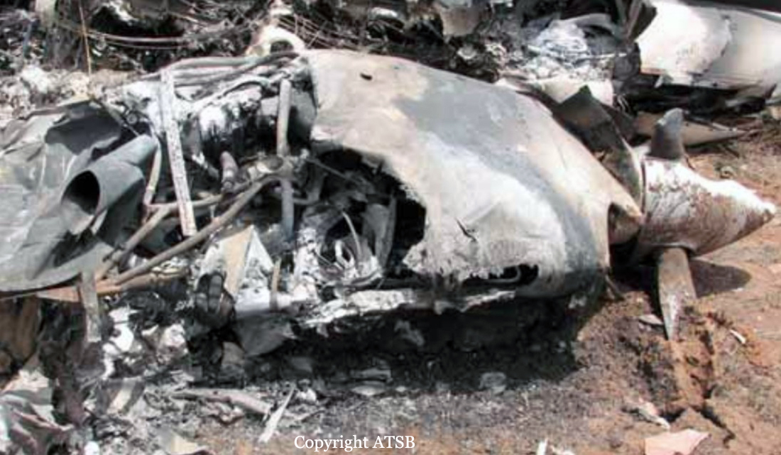
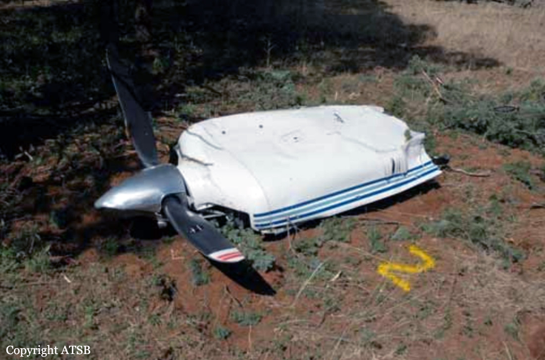
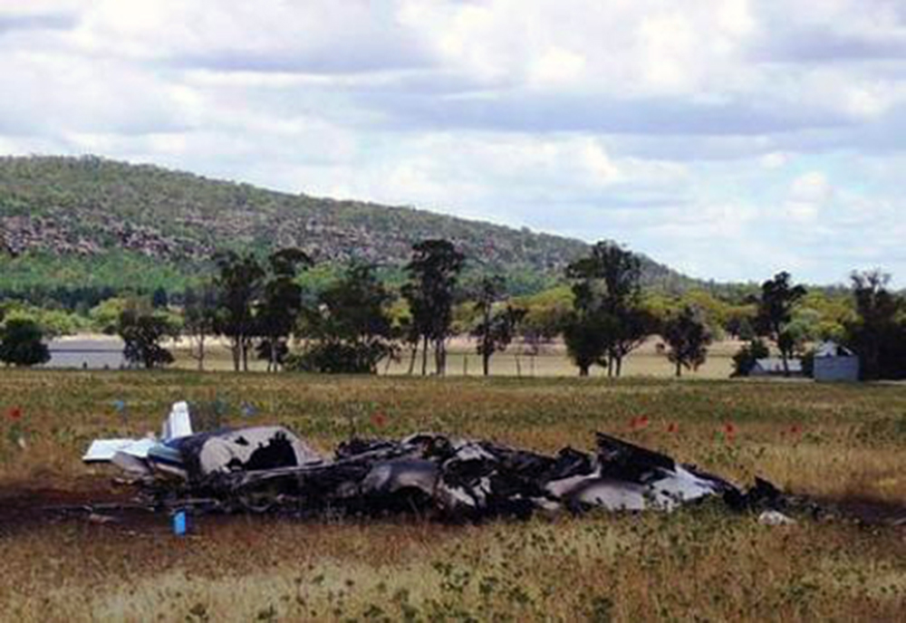
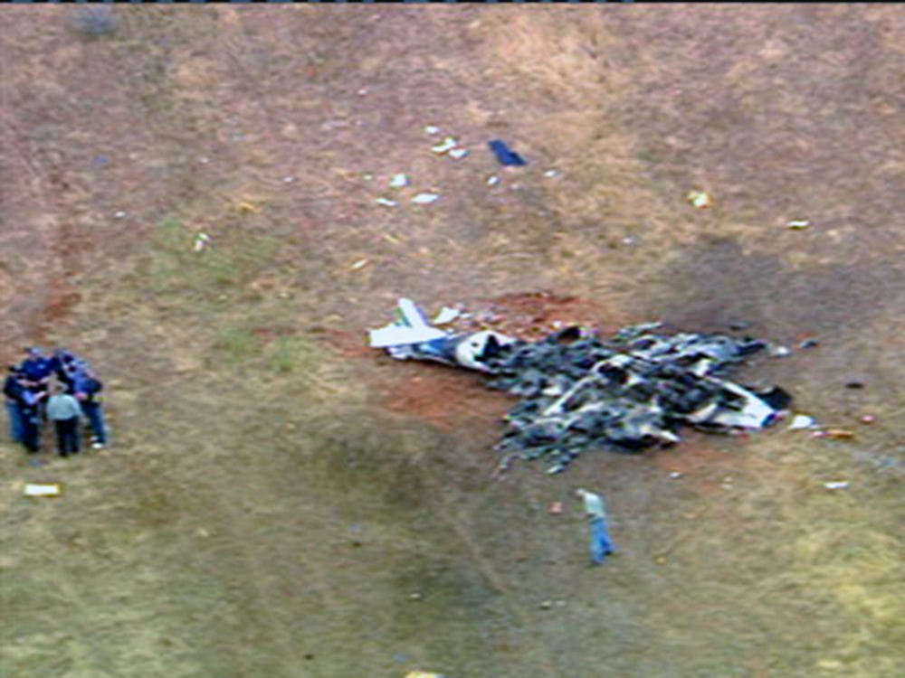
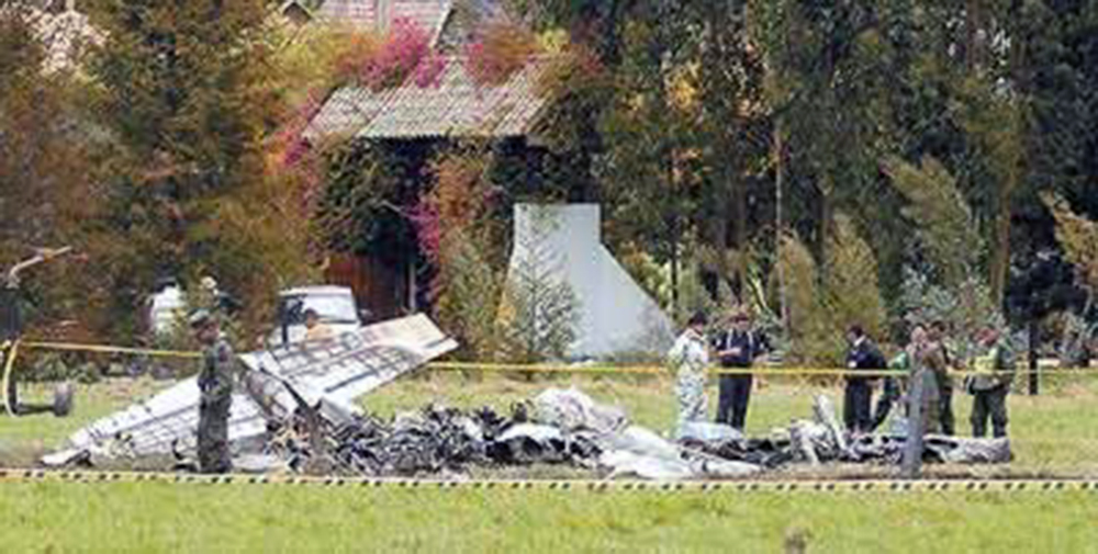
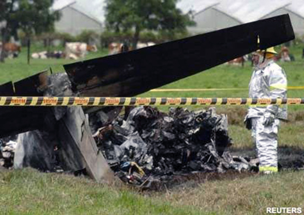
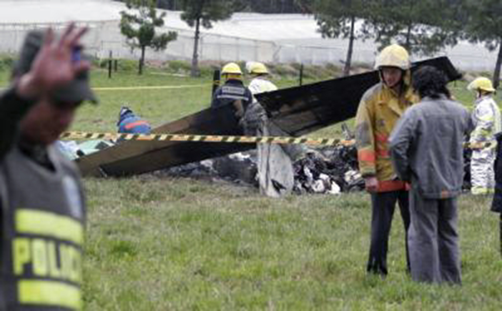
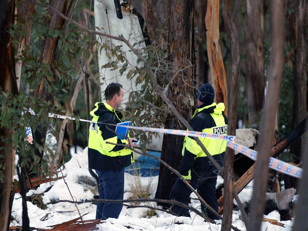
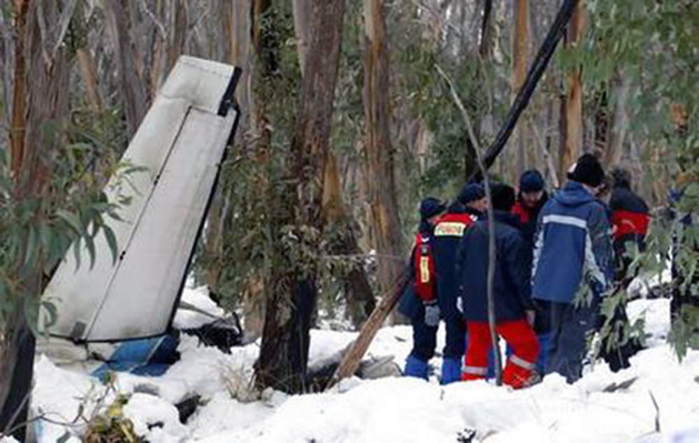
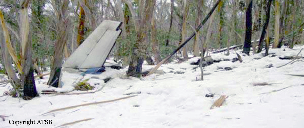
The aircraft, operated by Aéropro, was on a visual flight rules (VFR) flight from Sept-Îles, Quebec, to Wabush, Newfoundland and Labrador. The pilot, who was the sole occupant, took off around 0630 eastern daylight time. Shortly before 0700, the aircraft turned off its route and proceeded to Grand lac Germain to fly over the cottage of friends. Around 0700, the aircraft overflew the southeast bay of Grand lac Germain. The pilot then overflew a second time. The aircraft proceeded northeast and disappeared behind the trees. A few seconds later, the twin-engine aircraft crashed on the frozen surface of the lake. The pilot was fatally injured; the aircraft was destroyed by impact forces.
Probable cause:
Finding as to Causes and Contributing Factors:
1. The aircraft stalled at an altitude that was too low for the pilot to recover.
Findings as to Risk:
1. The aircraft was flying at an altitude that could lead to a collision with an obstacle and that did not allow time for recovery.
2. The steep right bank of the aircraft considerably increased the aircraft’s stall speed.
3. The form used to record the pilot’s flight time, flight duty time, and rest periods had not been updated for over a month; this did not allow the company manager to monitor the pilot’s hours.
4. At the time of the occurrence, the Aéropro company operations manual did not make provision for the restrictions on daytime VFR flights prescribed in Section 703.27 of the Canadian Aviation Regulations.
Other Findings:
1. The fact that the aircraft was not equipped with a flight data recorder (FDR) or a cockpit voice recorder (CVR) limited the information available for the investigation and limited the scope of the investigation.
2. Since the aircraft was on a medical evacuation (MEDEVAC) flight, the company mistakenly advised the search and rescue centre that there were two pilots on board the aircraft when it was reported missing.
Final Report:

Crash of a Piper PA-31-350 Navajo Chieftain near Raglan: 3 killed

Date & Time: Oct 31, 2006 at 1855 LT
Operator:
Registration:
VH-ZGZ
Flight Phase:
Flight Type:
Survivors:
No
Schedule:
Emerald – Gladstone
MSN:
31-7752006
YOM:
1977
Country:
Region:
Crew on board:
1
Crew fatalities:
Pax on board:
2
Pax fatalities:
Other fatalities:
Total fatalities:
3
Captain / Total flying hours:
3900
Captain / Total hours on type:
70.00
Aircraft flight hours:
3977
Circumstances:
The aircraft was being operated on a private category instrument flight rules (IFR) flight from Emerald to Gladstone, Qld. On board the aircraft were the pilot in command and two passengers. One of the passengers was a qualified pilot, but who was not endorsed on the aircraft type. After departing Emerald at 1807 Eastern Standard Time, the pilot contacted air traffic control and reported climbing to 7,000 ft with an estimated time of arrival at Gladstone of 1915. At 1813:25, air traffic control advised the pilot that ZGZ was radar identified 15 NM east of Emerald. At 1815:12, the pilot requested clearance to climb to 9,000 ft. At 1817:05, air traffic control issued a clearance to the pilot for the aircraft to climb 9,000 ft, and to track direct to Gladstone. At 1820:26, the pilot reported level at 9,000 ft and requested clearance to divert up to 10 NM left and right of track to avoid anticipated weather activity ahead. Air traffic control approved that request. At 1830:56, the pilot requested clearance to divert up to 15 NM left and right of track, and 10 seconds later changed the request to 15 NM left of track. Air traffic control approved that request. At 1835:17, the pilot reported clear of the weather and requested clearance to track direct to Gladstone and to descend to 7,000 ft. Air traffic control approved those requests. At 1848:52, the pilot reported at ‘top of descent’ to Gladstone. Air traffic control cleared the pilot to descend. At 1852:45, the pilot reported changing frequency to the Gladstone common traffic advisory frequency (CTAF). Air traffic control advised the pilot that the aircraft was leaving 5,500 ft and that the radar and control services were terminated. The pilot acknowledged that transmission at 1852:57. Approximately 3 minutes later, at 1855:45, air traffic control noticed that the aircraft’s symbol was no longer evident on the air situation display screen and the controller attempted to contact the pilot of the aircraft by radio. The controller also requested pilots of other aircraft operating in the Gladstone area to attempt to contact the pilot of ZGZ on the Gladstone CTAF frequency. All attempts were unsuccessful. A witness in the Raglan area recalled hearing the sound of aircraft engine(s) overhead. He then heard the engine(s) ‘roar and shut off again’ a few times. A short time later, he saw a flash and a few seconds later heard the sound of an explosion. He realised that the aircraft had crashed and telephoned the Gladstone Police. Subsequently, wreckage of the aircraft was located near Raglan, approximately 39 km west of Gladstone. The three occupants were fatally injured. The aircraft was destroyed by impact forces and post-impact fire.
Probable cause:
From the evidence available, the following findings are made with respect to the loss of control event involving Piper Aircraft Corporation PA-31-350 aircraft registered VH-ZGZ and should not be read as apportioning blame or liability to any particular organisation or individual.
Contributing safety factors:
• The aircraft diverged left from a steady, controlled descent and entered a steep, left spiral descent from which recovery was not achieved.
Other safety factors:
• The dark and very likely cloudy conditions that existed in the area where the aircraft suddenly diverged from its flight path meant that recovery to normal flight could only have been achieved by sole reference to the aircraft’s flight instruments. The difficulty associated with such a task when the aircraft was in a steep descent was likely to have been significant.
Final Report:

Crash of a Piper PA-31-350 Navajo Chieftain in Easton: 1 killed

Date & Time: Jul 11, 2006 at 1735 LT
Operator:
Registration:
N40ST
Flight Type:
Survivors:
No
Schedule:
Spokane - Seattle
MSN:
31-7405183
YOM:
1974
Crew on board:
1
Crew fatalities:
Pax on board:
0
Pax fatalities:
Other fatalities:
Total fatalities:
1
Captain / Total flying hours:
1430
Captain / Total hours on type:
102.00
Aircraft flight hours:
3646
Circumstances:
While cruising en route in VFR conditions, the aircraft lost power on both engines. The pilot attempted an emergency forced landing at a nearby unpaved State airport, but after encountering a 20 mph tailwind on downwind and a 20 mph headwind on final, the aircraft impacted a tall conifer tree while about one-half mile from the approach end of the runway. The reason for the dual engine power loss was not determined.
Probable cause:
The loss of power in both engines for undetermined reasons while in cruise flight, leading to an attempted forced landing. Factors include unfavorable winds at the site of the forced landing, and trees off the approach end of the grass runway the pilot was attempting to land on.
Final Report:

Crash of a Piper PA-31-350 Navajo Chieftain in Powell River: 1 killed

Date & Time: Mar 8, 2006 at 1639 LT
Operator:
Registration:
C-GNAY
Flight Type:
Survivors:
Yes
Schedule:
Vancouver – Powell River
MSN:
31-8052095
YOM:
1980
Country:
Crew on board:
2
Crew fatalities:
Pax on board:
0
Pax fatalities:
Other fatalities:
Total fatalities:
1
Captain / Total flying hours:
1200
Copilot / Total flying hours:
500
Circumstances:
The aircraft departed from its home base at Vancouver, British Columbia, with two crew members on board. The aircraft was being repositioned to Powell River (a 30-minute flight) to commence a freight collection route. On arriving at Powell River, the crew joined the circuit straight-in to a right downwind for a visual approach to Runway 09. A weather system was passing through the area at the same time and the actual local winds were shifting from light southwesterly to gusty conditions (11 to 37 knots) from the northwest. The aircraft was lower and faster than normal during final approach, and it was not aligned with the runway. The crew completed an overshoot and set up for a second approach to the same runway. On the second approach, at about 1639 Pacific standard time, the aircraft touched down at least halfway down the wet runway and began to hydroplane. At some point after the touchdown, engine power was added in an unsuccessful attempt to abort the landing and carry out an overshoot. The aircraft overran the end of the runway and crashed into an unprepared area within the airport property. The pilot-in-command suffered serious injuries and the first officer was fatally injured. A local resident called 911 and reported the accident shortly after it occurred. The pilot-in-command was attended by paramedics and eventually removed from the wreckage with the assistance of local firefighters. The aircraft was destroyed, but there was no fire. The ELT (emergency locator transmitter) was automatically activated, but the signal was weak and was not detected by the search and rescue satellite.
Probable cause:
Findings as to Causes and Contributing Factors:
1. The downwind condition on approach contributed to the aircraft landing long and with a high ground speed. This, in combination with hydroplaning, prevented the crew from stopping the aircraft in the runway length remaining.
2. When the decision to abort the landing was made, there was insufficient distance remaining for the aircraft to accelerate to a sufficient airspeed to lift off.
3. The overrun area for Runway 09 complied with regulatory standards, but the obstacles and terrain contour beyond the overrun area contributed to the fatality, the severity of injuries, and damage to the aircraft.
Finding as to Risk:
1. Alert Service Bulletin A25-1124A (dated 01 June 2000), which recommended replacing the inertia reel aluminum shaft with a steel shaft, was not completed, thus resulting in the risk of failure increasing over time.
Other Findings:
1. The weather station at the Powell River Airport does not have any air–ground communication capability with which to pass the flight crew timely wind updates.
2. The decision to make a second approach was consistent with normal industry practice, in that the crew could continue with the intent to land while maintaining the option to break off the approach if they assessed that the conditions were becoming unsafe.
Final Report:

Crash of a Piper PA-31-350 Navajo Chieftain near Condobolin: 4 killed

Date & Time: Dec 2, 2005 at 1350 LT
Registration:
VH-PYN
Flight Phase:
Flight Type:
Survivors:
No
Schedule:
Brisbane – Swan Hill
MSN:
31-8252075
YOM:
1982
Country:
Region:
Crew on board:
2
Crew fatalities:
Pax on board:
2
Pax fatalities:
Other fatalities:
Total fatalities:
4
Captain / Total flying hours:
4600
Captain / Total hours on type:
1000.00
Aircraft flight hours:
2900
Circumstances:
On 2 December 2005, at 1122 Eastern Daylight-saving Time, a Piper Aircraft Corporation PA-31-350 Chieftain aircraft, registered VH-PYN (PYN), departed Archerfield, Qld, on a private flight to Griffith, NSW. The flight was planned under the instrument flight rules (IFR). On board the aircraft were the pilot, two passengers and an observer-pilot who was on the flight to gain knowledge of the aircraft operation. The aircraft tracked direct to Moree and then Coonamble at 10,000 ft, in accordance with the flight plan. At 1303, the pilot amended the destination to Swan Hill, Vic, tracking via Hillston, NSW. At 1314, the pilot advised air traffic control that the aircraft had passed overhead Coonamble at 1312 maintaining 10,000 ft, and was estimating Hillston at 1418. At 1316, the pilot reported that he was tracking 5 NM (9 km) left of track due to weather. At 1337, the pilot advised that he was diverting up to 20 NM (37 km) left of track due to weather. At 1348, the pilot reported that he was diverting 29 NM (54 km) left of track, again due to weather. No further radio transmission from the pilot was heard. At about 1400, police received a report that an aircraft had crashed on a property approximately 28 km north of Condobolin, NSW. The extensively burned wreckage was subsequently confirmed as PYN. Other wreckage, spread along a trail up to 4 km from the main wreckage, was located the following day. Examination of air traffic control recorded radar data indicated that the aircraft entered radar coverage about 50 km north of Condobolin at 1346:34. The last valid radar data from the secondary surveillance radar located on Mount Bobbara was at 1349:53. During that 3 minute 19 second period, the recorded aircraft track was approximately 56 km left of the Coonamble to Hillston track and showed a change in direction from southerly to south-westerly. The aircraft’s groundspeed was in the range between 200 and 220 kts. The aircraft’s altitude remained steady at 10,000 ft. The last recorded radar position of the aircraft was approaching the limit of predicted radar coverage and was within 10 km of the location of the main aircraft wreckage. Earlier that day, the aircraft had departed Bendigo, Vic, at 0602 and arrived at Archerfield at 1034. The pilot and the observer-pilot were on board. The aircraft was refuelled to full tanks with 314 litres of aviation gasoline at Archerfield. The refuelling agent reported that the main and auxiliary tanks were full at the completion of refuelling. He also reported that the pilots had commented that the forecast for their return flight indicated that weather conditions would be ‘patchy’.
Probable cause:
Contributing factors:
• A line of thunderstorms crossed the aircraft’s intended track.
• The aircraft was operating in the vicinity of thunderstorm cells.
• In circumstances that could not be determined, the aircraft’s load limits were exceeded, causing structural failure of the airframe.
Other safety factors:
• Air traffic control procedures, did not require the SIGMET information to be passed to the aircraft.
• There were shortcomings in the Airservices Australia Hazard Alert procedures and guidelines for assessing SIGMET information.
• Air traffic control procedures for the dissemination of SIGMET information contained in the Aeronautical Information Publication were inconsistent with procedures contained in International Civil Aviation Organization (ICAO) Doc. 4444 and ICAO Doc. 7030.
Other key findings:
• The aircraft was not equipped with weather radar or lightning strike detection systems.
• The pilot did not make any request for additional information regarding the weather to air traffic services.
• The pilot in command was occupying the right cockpit seat and the observer- pilot the left cockpit seat at the time of the breakup, but that arrangement was not considered to have influenced the development of the accident.
Final Report:

Crash of a Piper PA-31-350 Navajo Chieftain in Ankeny: 2 killed

Date & Time: Nov 8, 2005 at 1017 LT
Registration:
N27177
Flight Phase:
Survivors:
No
Schedule:
Ankeny - Emmetsburg
MSN:
31-7752065
YOM:
1977
Location:
Crew on board:
1
Crew fatalities:
Pax on board:
1
Pax fatalities:
Other fatalities:
Total fatalities:
2
Captain / Total flying hours:
9400
Captain / Total hours on type:
460.00
Aircraft flight hours:
8336
Circumstances:
The twin-engine airplane was destroyed by impact with terrain about 2.5 miles northeast of the airport while returning to the airport with an engine problem. A witness reported that the FAR Part 135 on-demand passenger flight had been scheduled for a 0900 departure, but because the flight had not been confirmed, a pilot was not scheduled to fly the flight. The accident pilot arrived at the airport about 1005. A witness reported that the pilot was not in the office for more than two minutes when he "grabbed the status book," walked straight to the airplane, and boarded. A lineman serviced both engines at 0930 with oil, but failed to put the dipstick back in the right engine oil filler tube. Witnesses reported that they did not see the pilot perform a preflight. The pilot was unaware that the dipstick was left on the right wing of the airplane. The pilot taxied the airplane forward about 5 feet and abruptly stopped and shut down both engines. The pilot got out of the airplane. The lineman reported that he approached the pilot and asked what was wrong. The lineman reported that the pilot closed the oil flap door on the right engine, and said that the oil flap door had been left open. The pilot restarted the engines and departed about 1008. About three minutes after takeoff, the pilot informed departure control that he needed to return to the airport due to an oil leak. The pilot reported over the Unicom radio frequency that he was returning because he was having trouble with the right engine. Radar track data indicated that about 1013, the airplane's position was about 1.5 miles directly north of the airport about 1,800 feet msl, heading south at 126 knots calibrated airspeed (CAS). The airplane continued to fly south directly to the airport. The radar track data indicated that instead of landing on runway 18, the airplane flew over the airport, paralleling runway 18. About 1014, the airplane's position was over the airport at an altitude of about 1,460 feet msl (550 feet above ground level), heading south at about 97 knots CAS. The airplane continued to fly south past the airport, entered a left turn, and turned back to the north. The last radar return was recorded about 1016. The airplane's position was approximately 1.5 miles east of the approach end of runway 18 at an altitude of about 1,116 feet msl (344 feet agl), heading north at about 99 knots CAS. The impact site was located about 2.5 miles north of the last radar return. A witness, located about 1/4 mile from the accident site, observed the airplane flying "really low." He reported, "The motor on the plane wasn't cutting out or sputtering." Another witness reported, "The plane lifted up over power lines then went across a field about 50 to 80 ft off ground." The airplane impacted a harvested cornfield in a Page 2 of 11 CHI06FA026 steep nose-down attitude, and traveled 45 feet before stopping. The inspection of the airplane revealed that the landing gear was down, flaps were found in a 20-degree down position, and neither propeller was feathered. The post accident inspection of the airplane's engines and airframe revealed no preexisting anomalies that could be associated with a pre-impact condition.
Probable cause:
The pilot's failure to preflight the airplane, the pilot's improper in-flight decision not to land the airplane on the runway when he had the opportunity, and the inadvertent stall when the pilot allowed the airspeed to get too low. Factors that contributed to the accident were the lineman's improper servicing of the airplane when he left the oil dipstick out and the subsequent oil leak.
Final Report:

Crash of a Piper PA-31-350 Navajo Chieftain in Bogotá: 8 killed

Date & Time: Sep 1, 2005 at 1045 LT
Operator:
Registration:
HK-3069P
Flight Phase:
Survivors:
No
Schedule:
Bogotá - Puerto Berrío
MSN:
31-8352036
YOM:
1983
Country:
Crew on board:
2
Crew fatalities:
Pax on board:
6
Pax fatalities:
Other fatalities:
Total fatalities:
8
Captain / Total flying hours:
753
Captain / Total hours on type:
83.00
Copilot / Total flying hours:
105
Aircraft flight hours:
2090
Circumstances:
Shortly after takeoff from Bogotá-Guaymaral Airport runway 10, while in initial climb, the crew initiated a left turn in accordance with procedures. The copilot contacted ATC and declared an emergency following technical problems. The crew was immediately cleared to land at his discretion when the aircraft entered an uncontrolled descent and crashed in a prairie located 600 metres from the runway 28 threshold. The aircraft was totally destroyed and all eight occupants were killed.
Probable cause:
A possible fuel contamination affected the power on one engine or both. The aircraft was overloaded at takeoff, which, compounded by the considerable loss of power to the engines due to the altitude of the aerodrome, did not allow the pilot to maneuver the aircraft to return to the runway. In addition, the center of gravity, despite being within the permissible limits, was too far behind for an operation in adverse weather conditions.
Final Report:

Crash of a Piper PA-31-350 Navajo Chieftain in Fort Lauderdale

Date & Time: Aug 13, 2005 at 1557 LT
Operator:
Registration:
N318JL
Survivors:
Yes
Schedule:
North Eleuthera - Fort Lauderdale
MSN:
31-8152033
YOM:
1981
Flight number:
TTL217
Crew on board:
1
Crew fatalities:
Pax on board:
6
Pax fatalities:
Other fatalities:
Total fatalities:
0
Captain / Total flying hours:
14500
Captain / Total hours on type:
6550.00
Circumstances:
The pilot provided an emergency briefing to the passengers before departure. The outboard fuel tanks were empty and the inboard fuel tanks were filled before departure. After takeoff, the flight climbed to 8,500 feet msl and proceeded towards the destination airport. During cruise flight while flying at 1,000 feet msl approximately 10 miles from the destination airport , the left engine started losing power, but the airplane did not yaw; the left cowl flap was closed at the time. The pilot reported the left fuel flow light was on, but the fuel pressure was in the green arc (indicating approximately 38 to 42 psi). He switched each fuel selector to its respective outboard fuel tank though the outboard tanks were empty, turned on both emergency fuel pumps, and also attempted cross feeding fuel to the left engine in an effort to restore engine power but was unsuccessful. The left engine manifold pressure decreased to 18 inHg, and he was maintaining "blue line" airspeed plus a few knots with the right engine at full power. He slowed the airplane to less than blue line airspeed in an attempt to "gain altitude", and approximately 2 to 3 minutes after first noticing the loss of engine power from the left engine with the manifold pressure indication of 15 inHg, and after seeing boats nearby, he moved the left propeller control to the feather position but later reported the propeller did not feather. The left engine rpm was in the upper green arc through the whole event, and he did not see any oil coming out of the left engine cowling. The flight was unable to maintain altitude, and he advised the passengers to don but not inflate their life vests. He maneuvered the airplane into the wind near boats, and ditched with the flaps and landing gear retracted. All occupants exited the airplane and were rescued by one of the nearby boats. Each inboard fuel tank is equipped with a "surge tank" and a flapper valve, and also a sensing probe installed at the outlet of the tank. The airplane POH/AFM indicates that if the fuel flow light illuminates, and there is fuel in the corresponding tank, a malfunction of the flapper valve has occurred. The airplane was not recovered; therefore no determination could be made as to the reason for the reported loss of engine power from the left engine, nor the reason for the failure of the left propeller to feather.
Probable cause:
The reported loss of engine power from the left engine, and the failure of the left propeller to feather for undetermined reasons, resulting in the inability to maintain altitude, and subsequent ditching.
Final Report:

Crash of a Piper PA-31-350 Navajo Chieftain in Mount Hotham: 3 killed

Date & Time: Jul 8, 2005 at 1725 LT
Operator:
Registration:
VH-OAO
Survivors:
No
Schedule:
Melbourne - Mount Hotham
MSN:
31-8252021
YOM:
1982
Country:
Region:
Crew on board:
1
Crew fatalities:
Pax on board:
2
Pax fatalities:
Other fatalities:
Total fatalities:
3
Captain / Total flying hours:
4770
Captain / Total hours on type:
1269.00
Aircraft flight hours:
9137
Circumstances:
On 8 July 2005, the pilot of a Piper PA-31-350 Navajo Chieftain, registered VH-OAO, submitted a visual flight rules (VFR) flight plan for a charter flight from Essendon Airport to Mount Hotham, Victoria. On board the aircraft were the pilot and two passengers. At the time, the weather conditions in the area of Mount Hotham were extreme. While taxiing at Essendon, the pilot requested and was granted an amended airways clearance to Wangaratta, due to the adverse weather conditions at Mount Hotham. The aircraft departed Essendon at 1629 Eastern Standard Time. At 1647 the pilot changed his destination to Mount Hotham. At 1648, the pilot contacted Flightwatch and requested that the operator telephone the Mount Hotham Airport and advise an anticipated arrival time of approximately 1719. The airport manager, who was also an accredited meteorological observer, told the Flightwatch operator that in the existing weather conditions the aircraft would be unable to land. At 1714, the pilot reported to air traffic control that the aircraft was overhead Mount Hotham and requested a change of flight category from VFR to instrument flight rules (IFR) in order to conduct a Runway 29 Area Navigation, Global Navigation Satellite System (RWY 29 RNAV GNSS) approach via the initial approach fix HOTEA. At 1725 the pilot broadcast on the Mount Hotham Mandatory Broadcast Zone frequency that the aircraft was on final approach for RWY 29 and requested that the runway lights be switched on. No further transmissions were received from the aircraft. The wreckage of the aircraft was located by helicopter at 1030 on 11 July. The aircraft had flown into trees in a level attitude, slightly banked to the right. Initial impact with the ridge was at about 200 ft below the elevation of the Mount Hotham aerodrome. The aircraft had broken into several large sections and an intense fire had consumed most of the cabin. The occupants were fatally injured.
Probable cause:
Findings:
• There were no indications prior to, or during the flight, of problems with any aircraft systems that may have contributed to the circumstances of the occurrence.
• The pilot continued flight into forecast and known icing conditions in an aircraft not approved for flight in icing conditions.
• The global navigation satellite constellation was operating normally.
• The pilot did not comply with the requirements of the published instrument approach procedure.
• The pilot was known, by his Chief Pilot and others, to adopt non-standard approach procedures to establish his aircraft clear of cloud when adverse weather conditions existed at Mount Hotham.
• The pilot may have been experiencing self-imposed and external pressures to attempt a landing at Mount Hotham.
• Terrain features would have been difficult to identify due to a heavy layer of snow, poor visibility, low cloud, continuing heavy snowfall, drizzle, sleet and approaching end of daylight.
• The pilot’s attitude, operational and compliance practices had been of concern to some Airservices’ staff.
• The operator’s operational and compliance history was recorded by CASA as being of concern, and as a result CASA staff continued to monitor the operator. However, formal surveillance of the operator in the preceding two years had not identified any significant operational issues.
Significant factors:
• The weather conditions at the time of the occurrence were extreme.
• The extreme weather conditions were conducive to visual illusions associated with a flat light phenomenon.
• The pilot did not comply with the requirements of flight under either the instrument flight rules (IFR) or the visual flight rules (VFR).
• The pilot did not comply with the requirements of the published instrument approach procedure and flew the aircraft at an altitude that did not ensure terrain clearance.
• The aircraft accident was consistent with controlled flight into terrain.
Final Report: