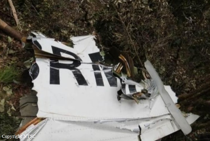
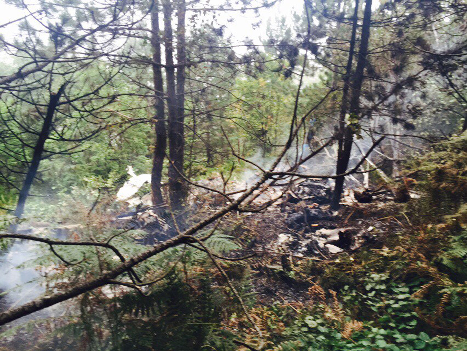
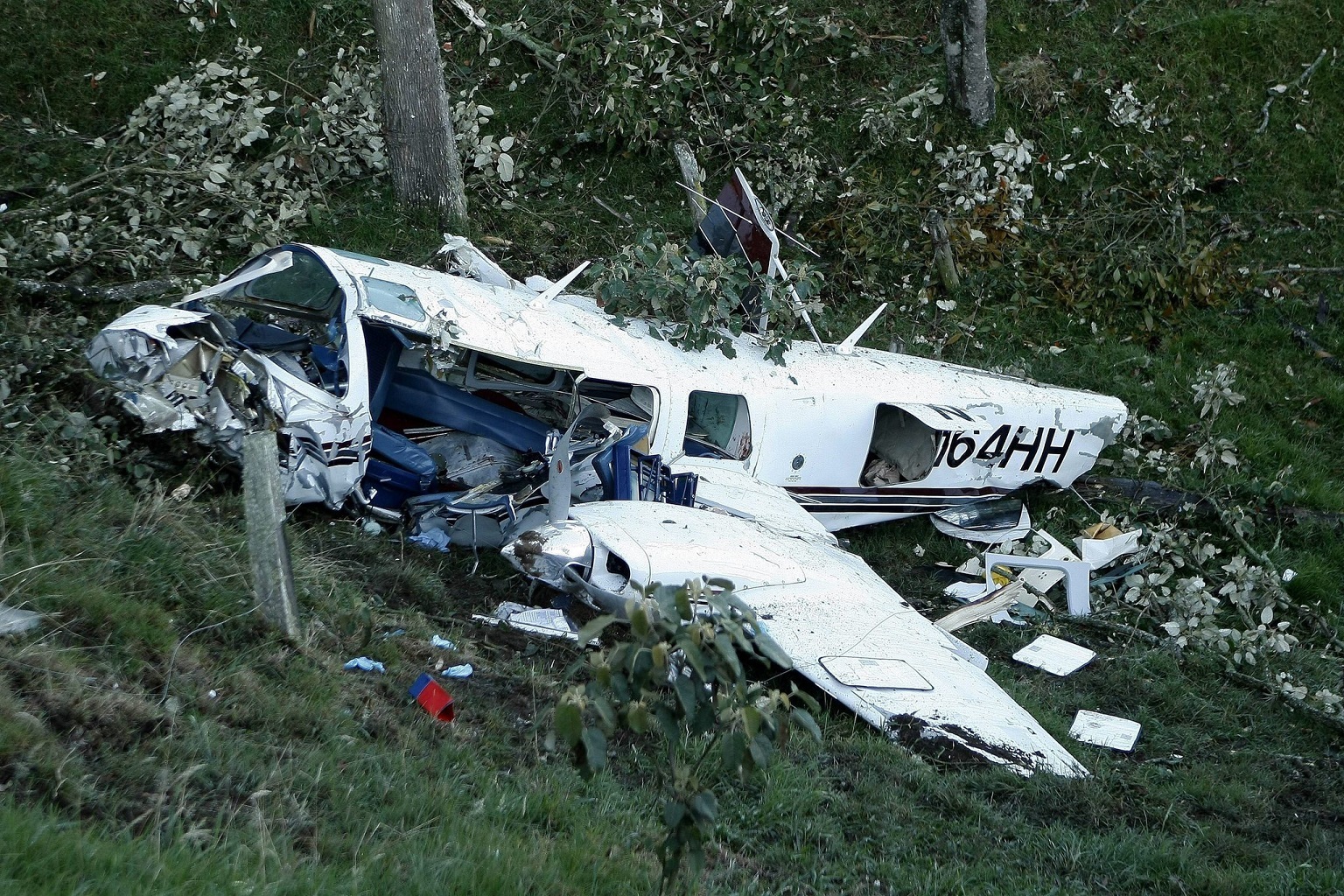
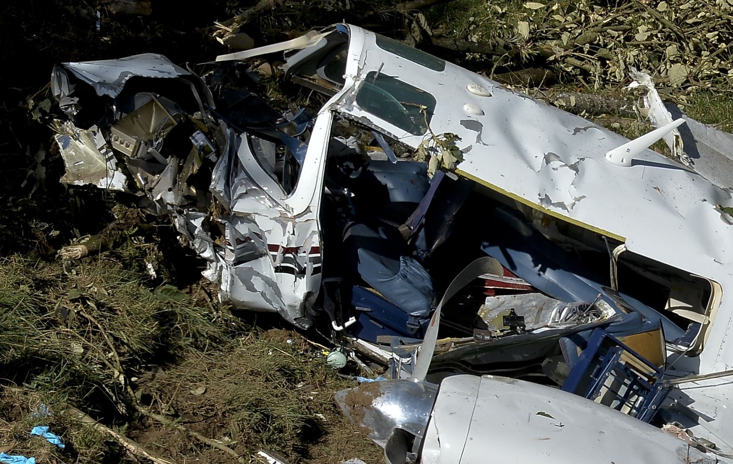
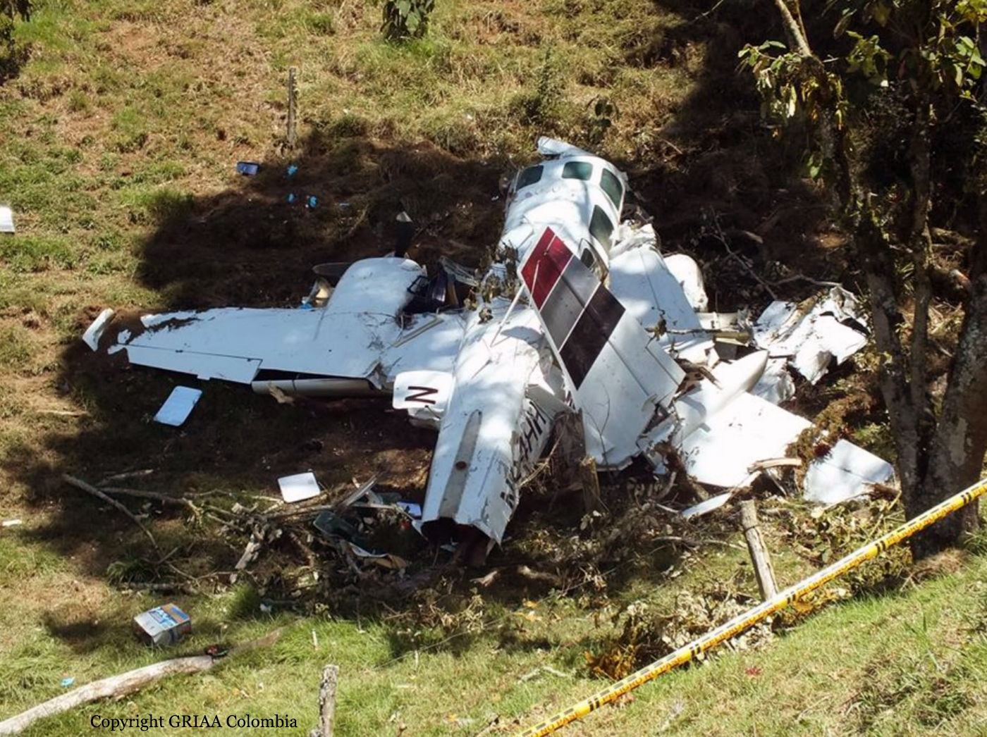
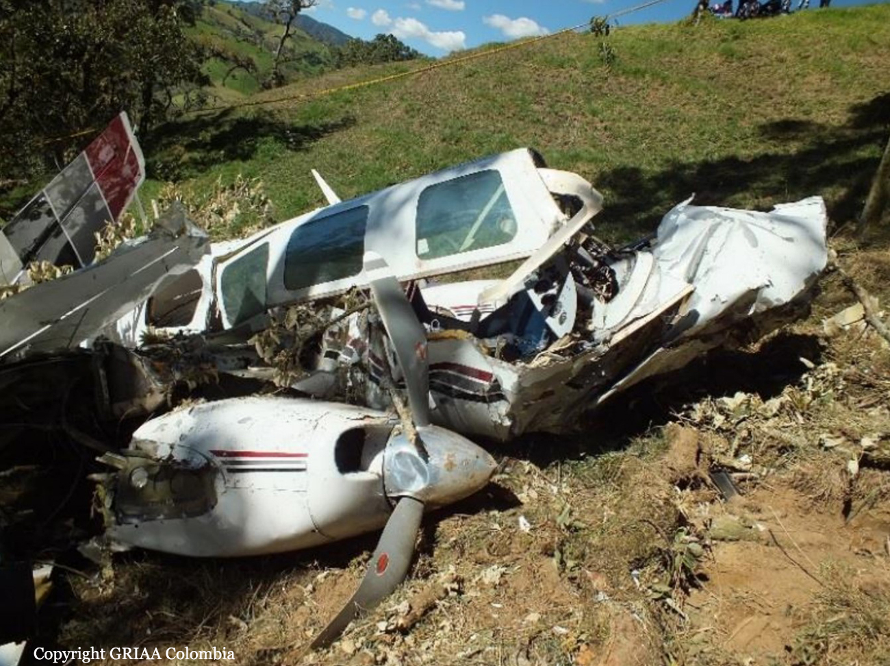
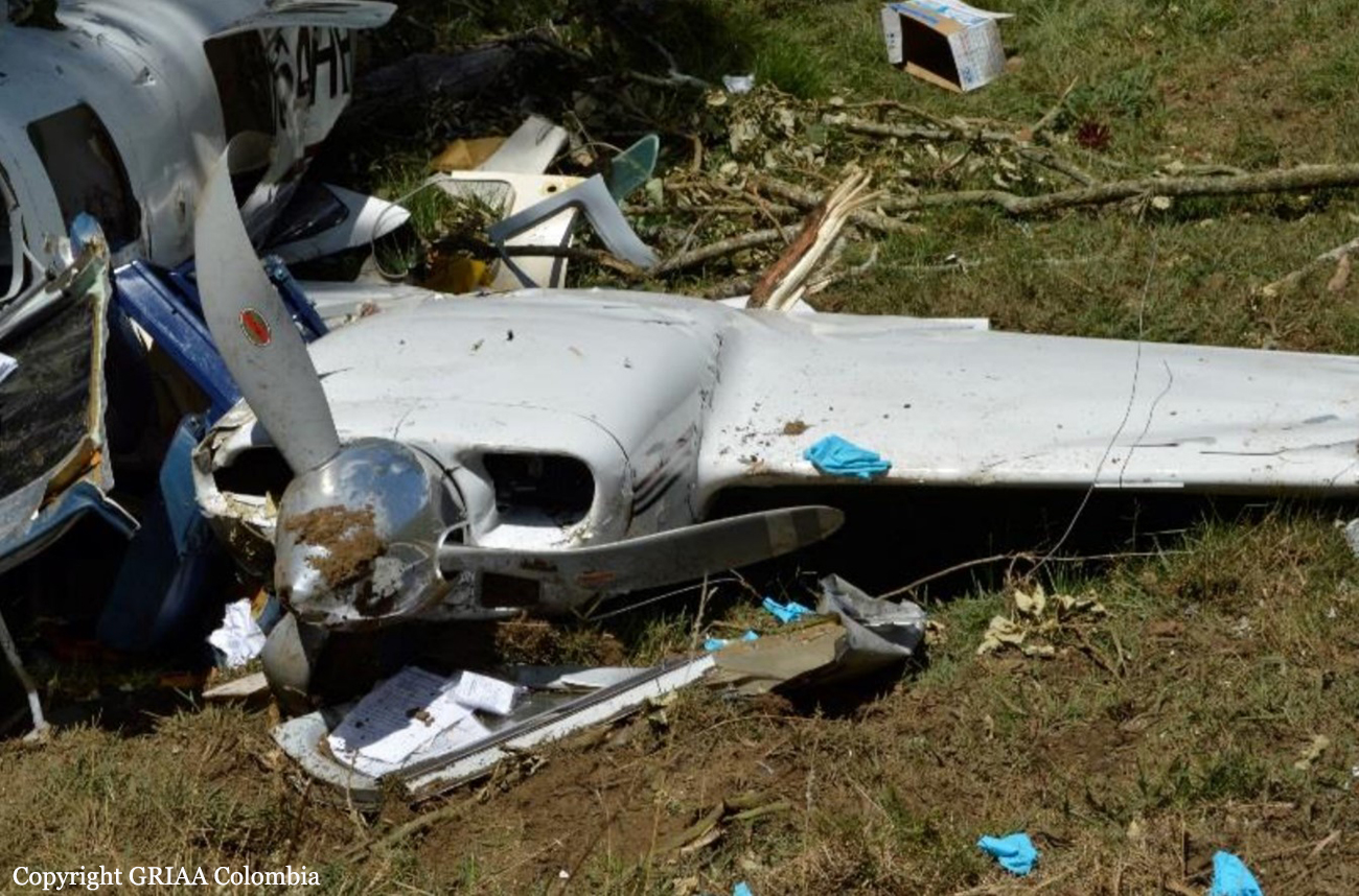
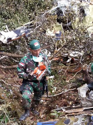
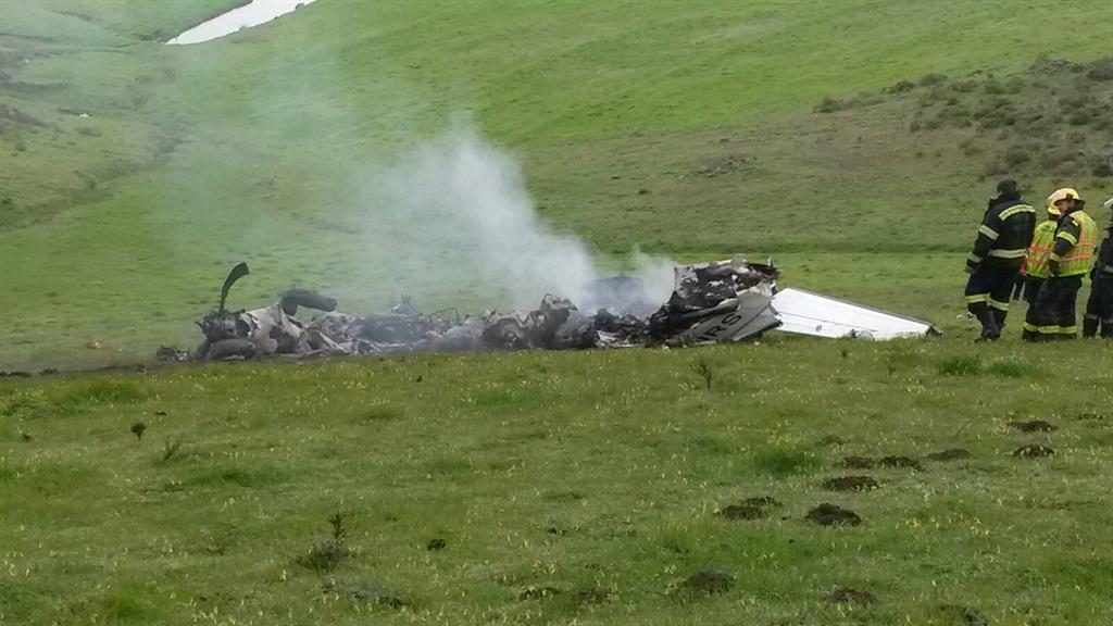
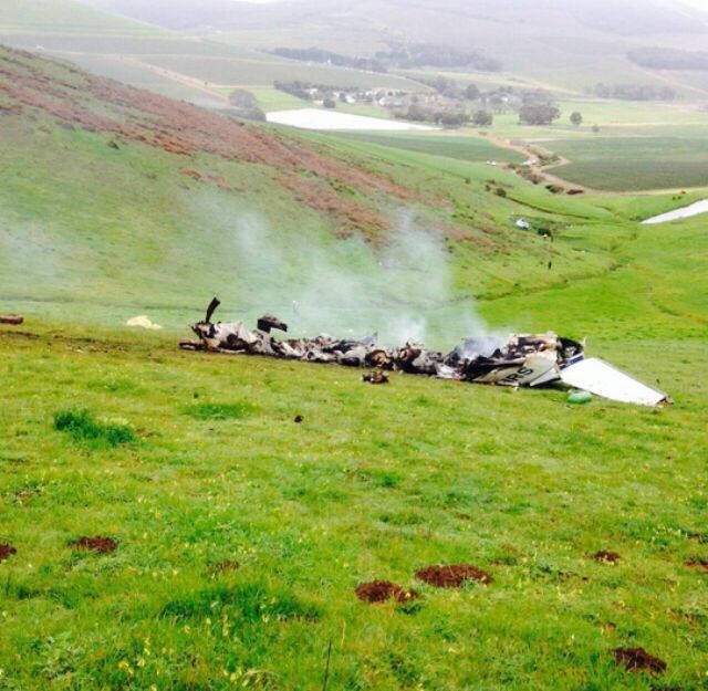
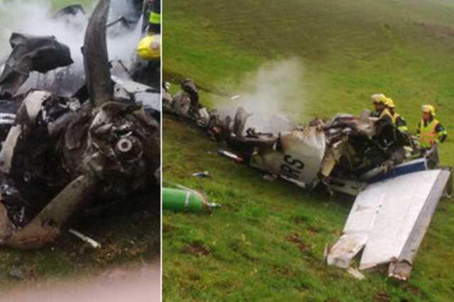
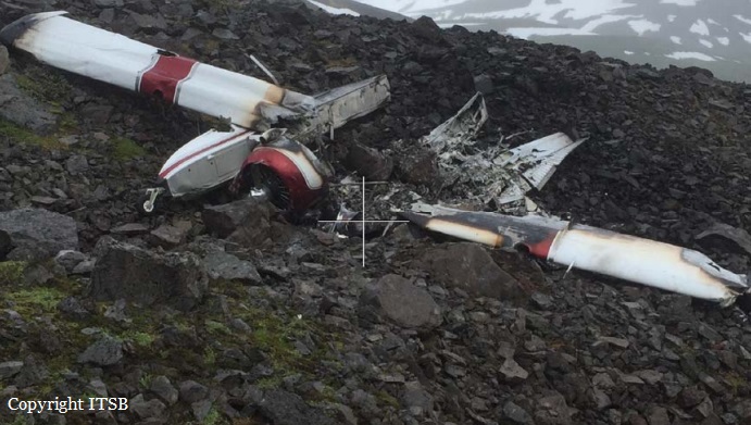
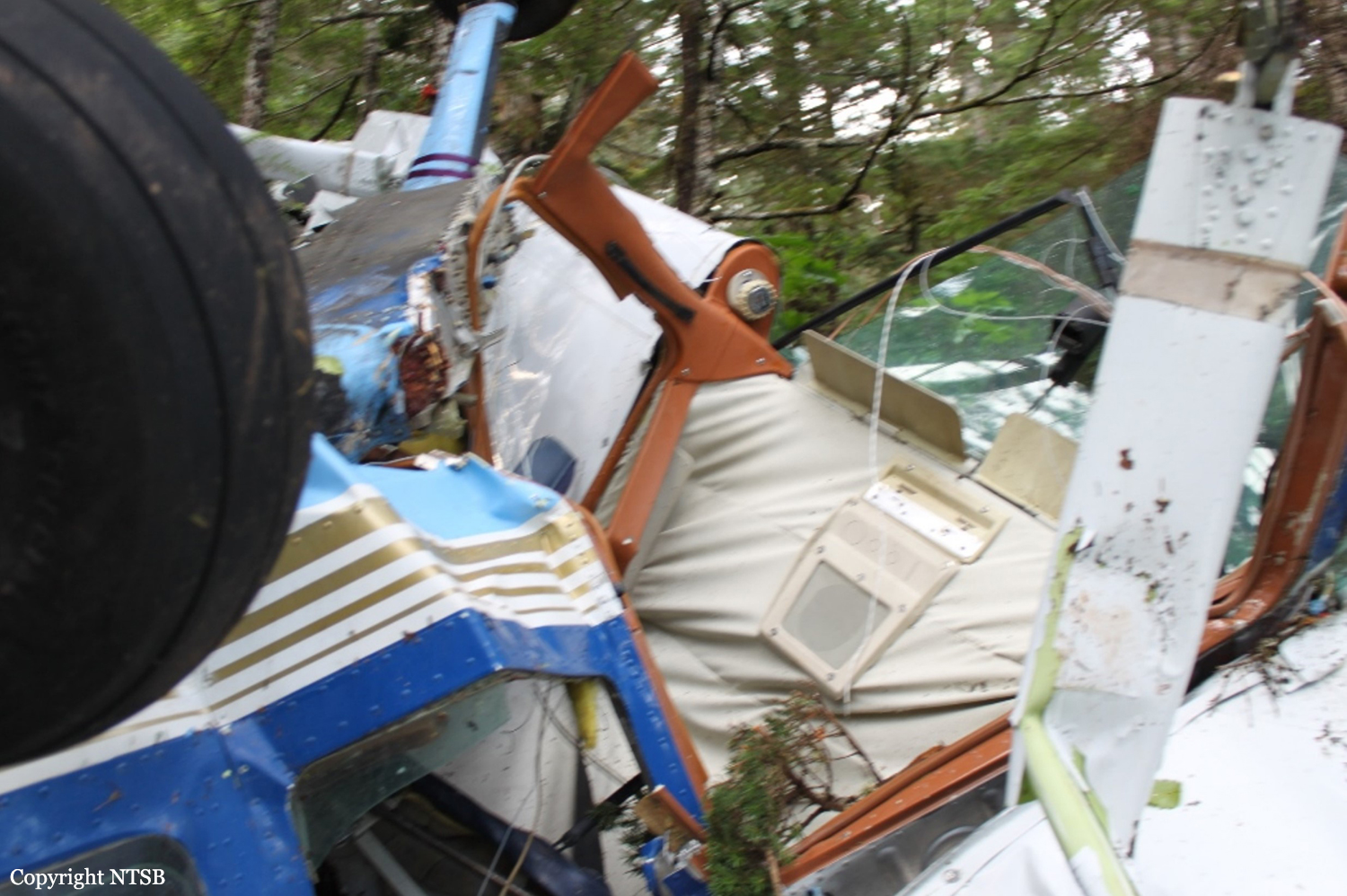
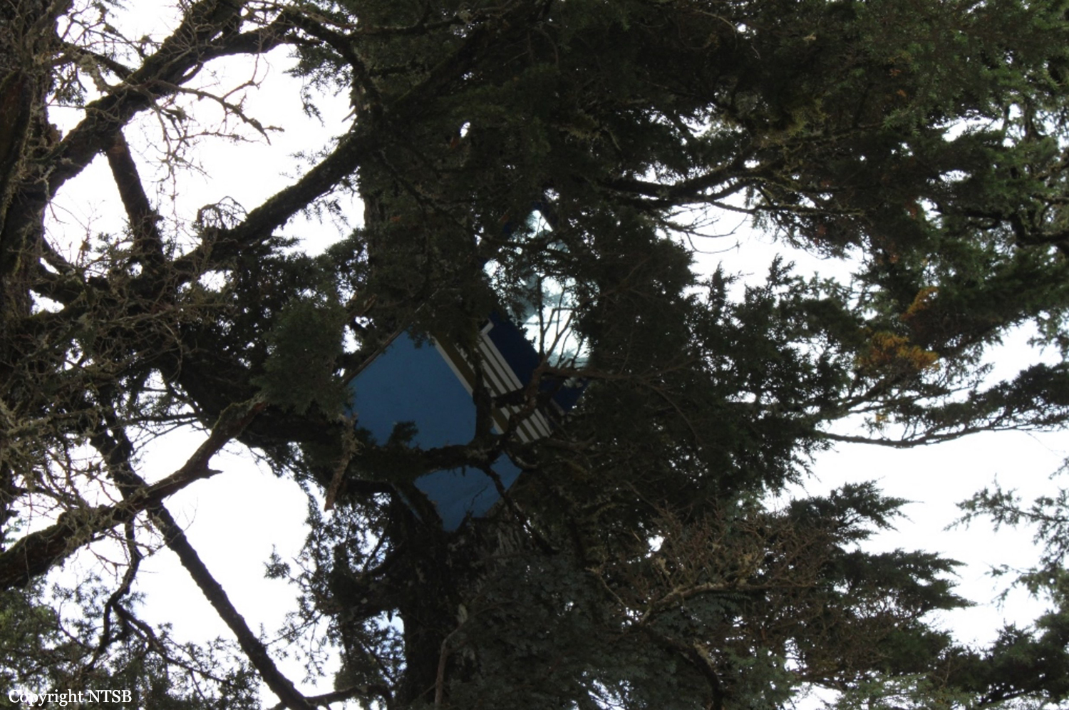
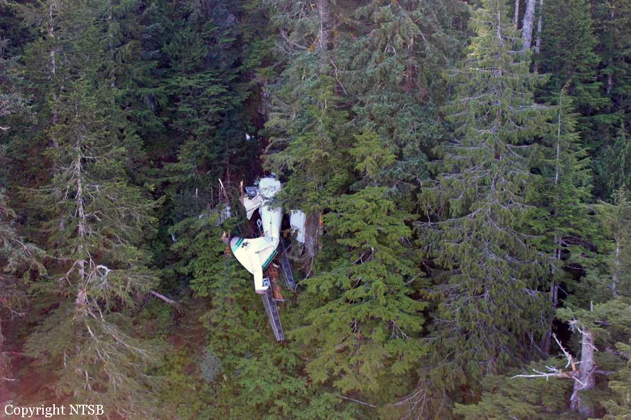
Crash of a Cessna 208B Grand Caravan near Bamyan: 2 killed

Date & Time: Oct 12, 2015 at 1400 LT
Type of aircraft:
Operator:
Registration:
YA22382
Flight Phase:
Flight Type:
Survivors:
Yes
Site:
MSN:
208B-2382
YOM:
2012
Location:
Country:
Region:
Crew on board:
2
Crew fatalities:
Pax on board:
5
Pax fatalities:
Other fatalities:
Total fatalities:
2
Circumstances:
Few minutes after takeoff from Bamyan Airport, the single engine crashed on the top of a rocky mountain. Both pilots were killed while five passengers were injured. The aircraft was destroyed. The aircraft was repatriating the body of a deceased soldier when the accident occurred.

Crash of a De Havilland DHC-6 Twin Otter 300 on Mt Bajaja: 10 killed

Date & Time: Oct 2, 2015 at 1451 LT
Operator:
Registration:
PK-BRM
Flight Phase:
Survivors:
No
Site:
Schedule:
Masamba – Makassar
MSN:
741
YOM:
1981
Flight number:
VIT7503
Country:
Region:
Crew on board:
2
Crew fatalities:
Pax on board:
8
Pax fatalities:
Other fatalities:
Total fatalities:
10
Captain / Total flying hours:
2911
Captain / Total hours on type:
2911.00
Copilot / Total flying hours:
4035
Copilot / Total hours on type:
4035
Aircraft flight hours:
45242
Aircraft flight cycles:
75241
Circumstances:
On 2 October 2015, a DHC-6 Twin Otter, registered PK-BRM, was being operated by PT. Aviastar Mandiri as a scheduled passenger flight with flight number MV 7503. The aircraft departed from Andi Jemma Airport, Masamba (WAFM)1 with the intended destination of Sultan Hasanuddin International Airport, Makassar (WAAA) South Sulawesi, Indonesia. On board the flight were 10 persons consisting of two pilots and eight passengers, including one company engineer. The previous flights were from Makassar – Tana Toraja – Makassar – Masamba – Seko - Masamba and the accident flight was from Masamba to Makassar which was the 6th sector of the day. The aircraft departed from Masamba at 1425 LT (0625 UTC2 ) with an estimated time of arrival at Makassar of 0739 UTC. The Pilot in Command (PIC) acted as Pilot Flying (PF) while the Second in Command (SIC) acted as Pilot Monitoring (PM). The flight was conducted under the Visual Flight Rules (VFR) and cruised at an altitude of 8,000 feet. At 0630 UTC, the pilot reported to Ujung Pandang Information officer that the aircraft passed an altitude of 4,500 feet and was climbing to 8,000 feet. The Ujung Pandang Information officer requested the pilot of the estimate time of aircraft position at 60 Nm out from MKS VOR/DME. At 0632 UTC, the pilot discussed about the calculation of estimate time to reach 60 Nm out from MKS and afterward the pilot informed Ujung Pandang Information officer that the estimate at 60 Nm was at 0715 UTC. At 0633 UTC, the Ujung Pandang Information officer informed the pilot to call when reaching 8,000 feet and was acknowledged by the pilot. At 0636 UTC, the pilot informed the Ujung Pandang Information officer that the aircraft had reached 8,000 feet and requested the squawk number (ATC transponder code). The Ujung Pandang Information officer acknowledged and gave the squawk number of A5616, which was acknowledged by the pilot. At 0637 UTC, the pilots discussed to fly direct to BARRU. BARRU is a town located at about 45 Nm north of Makassar. Both pilots agreed to fly direct and the SIC explained the experience of flying direct on the flight before. At 0651 UTC, the PIC told the SIC that he wanted to climb and one second later the CVR recorded the sound of impact.
Probable cause:
The following findings were identified:
1. The aircraft had valid Certificate of Airworthiness prior to the accident and was operated within the weight and balance envelope.
2. Both pilots had valid licenses and medical certificates.
3. The accident flight from Masamba (WAFM) to Makassar (WAAA) was the 6th sector for the aircraft and the crew that day. The PIC acted as Pilot Flying and the
SIC acted as Pilot Monitoring.
4. The satellite image published by BMKG at 0700 UTC showed that there were cloud formations at the accident area. The local villagers stated that the weather
on the accident area was cloudy at the time of the accident.
5. The aircraft departed Masamba at 0625 UTC (1425 LT), conducted under VFR with cruising altitude of 8,000 feet and estimated time of arrival Makassar at 0739 UTC.
6. After reached cruising altitude, at about 22 Nm from Masamba, the flight deviated from the operator visual route and directed to BARRU on heading 200° toward the area with high terrain and cloud formation based on the BMKG satellite image
7. The pilots decision making process did not show any evidence that they were concerned to the environment conditions ahead which had more risks and required correct flight judgment.
8. The CVR did not record EGPWS aural caution and warning prior to the impact. The investigation could not determine the reason of the absence of the EGPWS.
9. The CVR data and cut on the trees indicated that the aircraft was on straight and level flight and there was no indication of avoid action by climb or turn.
10. The SAR Agency did not receive any crashed signal from the aircraft ELT most likely due to the ELT antenna detached during the impact.
11. Regarding to the operation of the EGPWS for the flight crew, a special briefing was performed however there was no special training.
12. The operational test of TAWS system was not included in the pilot checklist.
13. The investigation could not determine the installation and the last revision of TAWS terrain database.
14. The investigation could not find the functional test result document after the installation of the TAWS.
15. Some of the DHC-6 pilots have not been briefed for the operation of the TAWS and EGPWS.

Contributing Factors:
Deviation from the company visual route without properly considering the elevated risks of cruising altitude lower than the highest terrain and instrument meteorological condition in addition with the absence of the EGPWS warning resulted in the omission of avoidance actions.
Final Report:

Crash of a Cessna 421B Golden Eagle II in Ozren: 1 killed

Date & Time: Sep 24, 2015 at 1230 LT
Operator:
Registration:
YU-BSW
Flight Phase:
Survivors:
Yes
Site:
Schedule:
Banja Luka – Tuzla
MSN:
421B-0248
YOM:
1972
Region:
Crew on board:
1
Crew fatalities:
Pax on board:
2
Pax fatalities:
Other fatalities:
Total fatalities:
1
Circumstances:
The twin engine aircraft, operated by STS Avijacija (STS Aviation), departed Banja Luka on a charter flight to Tuzla, carrying two passengers and one pilot taking part to a foxes vaccination program. While cruising at low altitude, the airplane entered an area of clouds when it impacted trees and crashed on the slope of a mountain located near the Monastery of Ozren, southeast part of the Serbian Republic of Bosnia, bursting into flames. Both passengers were seriously injured and the pilot was killed.
Probable cause:
The root cause of the accident is the entry of the aircraft into the cloud at a low altitude, in conditions of increased cloudiness, which led to the impact of the aircraft in the ground. The accident is caused by inadequate preparation of the crew for the flight, deviation of the crew from the planned and approved route by location (diversion from the given route) and flight height (flight at a lower altitude than the approved one), as well as not taking timely procedures to return to the given route and flight height, as well as incorrect actions in case of encountering a deteriorated weather situation on the route under VFR flight conditions.
The accident was affected by:
a) The decision of the manager on the manner of execution of the flight,
b) Ignoring information about the meteorological situation and weather forecast,
c) Inadequate preparation of the crew for the execution of the flight at a low altitude and in conditions of fire of the meteorological situation,
d) Non-compliance with VFR rules for minimum flight height and meteorological minimum for airspace class “F” and “G”,
e) Loss of visual contact with the ground.

Crash of a Piper PA-60 Aerostar in San Pedro de los Milagros: 2 killed

Date & Time: Sep 11, 2015 at 1740 LT
Operator:
Registration:
N164HH
Flight Phase:
Flight Type:
Survivors:
Yes
Site:
Schedule:
Santa Fe de Antioquia - Medellín
MSN:
60-0012
YOM:
1969
Country:
Crew on board:
2
Crew fatalities:
Pax on board:
1
Pax fatalities:
Other fatalities:
Total fatalities:
2
Captain / Total flying hours:
8800
Copilot / Total flying hours:
7000
Circumstances:
The twin engine aircraft departed Santa Fe de Antioquia on a flight to Medellín, carrying one passenger and two pilots who were taking part to the production of the Tom Cruise movie 'Barry Seal - American Traffic'. While flying over mountainous terrain in IMC conditions, the airplane struck the slope of a hill with its right wing then crashed at the bottom of trees. A pilot was seriously injured and both other occupants were killed. The aircraft was destroyed.
Probable cause:
The accident was the consequence of a controlled flight into terrain after the crew decided to continue the flight at low height in IMC conditions.
The following contributing factors were identified:
- The foreign crew was not familiarized with the area of flight,
- Poor flight planning,
- CFIT.
Final Report:

Crash of an ATR42-300 near Oksibil: 54 killed

Date & Time: Aug 16, 2015 at 1455 LT
Type of aircraft:
Operator:
Registration:
PK-YRN
Flight Phase:
Survivors:
No
Site:
Schedule:
Jayapura - Oksibil
MSN:
102
YOM:
1988
Flight number:
TGN267
Country:
Region:
Crew on board:
4
Crew fatalities:
Pax on board:
50
Pax fatalities:
Other fatalities:
Total fatalities:
54
Captain / Total flying hours:
25287
Captain / Total hours on type:
7340.00
Copilot / Total flying hours:
3818
Copilot / Total hours on type:
2640
Aircraft flight hours:
50133
Aircraft flight cycles:
55663
Circumstances:
An ATR 42-300 aircraft registered PK-YRN was being operated by PT Trigana Air Service on 16 August 2015 as scheduled passenger flight with flight number IL267 from Sentani to Oksibil. On board of this flight were 54 persons. This flight was the fifth flight of the day and the second flight from Sentani to Oksibil. The aircraft departed Sentani at 0522 UTC and estimated time of arrival Oksibil was at 0604 UTC. The Second in Command (SIC) acted as Pilot Flying while the Pilot in Command (PIC) acted as Pilot Monitoring. The weather at Oksibil reported that the cloud was broken (more than half area of the sky covered by cloud) and the cloud base was 8,000 feet (4,000 feet above airport elevation) and the visibility was 4 up to 5 km. The area of final approach path was covered by clouds. The flight cruising at 11,500 feet and at 0555 UTC, the pilot made first contact with Oksibil Aerodrome Flight Information Services (AFIS) officer, reported on descent at position Abmisibil and intended to direct left base leg runway 11. At 0600 UTC, Oksibil AFIS officer expected the aircraft would have been on final but the pilot had not reported, the AFIS officer contacted the pilot but did not reply. The AFIS officer informed Trigana in Sentani that they had lost contact with IL267. The aircraft wreckage was found on a ridge of Tanggo Mountain, Okbape District, Oksibil at approximately 8,300 feet AMSL at coordinates of 04°49’17.34” S, 140°29’51.18” E, approximately 10 NM from Oksibil Aerodrome on bearing of 306°. All occupants were fatally injured and the aircraft was destroyed by impact force and post impact fire. The Flight Data Recorder (FDR) and Cockpit Voice Recorder were recovered and transported to KNKT recorder facility. The recovery of FDR data was unsuccessful while the recovery of CVR data successfully retrieved accident flight data. The CVR did not record any crew briefing, checklist reading not EGPWS warning prior to impact. The CVR also did not record EGPWS altitude call out on two previous flights. The investigation concluded that the EGPWS was probably not functioning.
Probable cause:
The following findings were identified:
1. The aircraft had valid Certificate of Airworthiness and was operated within the weight and balance envelope.
2. All crew had valid licenses and medical certificates.
3. The flight plan form was filed with intention to fly under Instrument Flight Rule (IFR), at flight level 155, with route from Sentani to MELAM via airways W66 then to Oksibil. The MORA of W66 between Sentani to MELAM was 18,500 feet.
4. The flight was the 5th flight of the day for the crew with the same aircraft and the second flight on the same route of Sentani to Oksibil.
5. The CVR data revealed that the previous flight from Sentani to Oksibil the flight cruised at altitude of 11,500 feet and the approach was conducted by direct to left base runway 11.
6. The CVR data also revealed that on the accident flight, the flight cruised at altitude 11,500 feet and intended to direct left base leg runway 11 which was deviate from the operator visual guidance approach that described the procedure to fly overhead the airport prior to approach to runway 11.
7. The witness stated that most of the time, the flight crew deviated from the operator visual approach guidance. The deviation did not identify by the aircraft operator.
8. The downloading process to retrieve data from the FDR was unsuccessful due to the damage of the FDR unit that most likely did not record data during the accident flight. The repetition problems of the FDR unit showed that the aircraft operator surveillance to the repair station was not effective.
9. The CVR did not record any crew briefing, checklist reading and EGPWS altitude callout prior to land on two previous flights nor the EGPWS caution and warning prior to impact.
10. The spectrum analysis of the CVR determined that both engines were operating prior to the impact.
11. Several pilots, had behavior of pulling the EGPWS CB to eliminate the nuisance of EGPWS warning. The pilots stated that the reason for pulling the EGPWS CB was due to the pilots considered this warning activation was not appropriate for the flight conditions. The correction to this behavior was not performed prior to the accident.
12. The investigation could not determine the actual EGPWS CB position during the accident flight.
13. The installation of EGPWS by the aircraft operator was not conducted according to the Service Bulletin issued by the aircraft manufacturer.
14. The terrain data base installed in the EGPWS of PK-YRN was the version MK_VIII_Worldwide_Ver_471 that was released in 2014. The Oksibil Airport was not included in the high-resolution update in this version of terrain database.
15. The information for Oksibil published in AIP volume IV (Aerodrome for Light Aircraft/ALA) did not include approach guidance. The operator issued visual guidance of circling approach runway 11 for internal use.
16. The visual approach guidance chart stated that the minimum safe altitude was 8,000 feet while the aircraft impacted with terrain at approximately 8,300 feet. This indicated an incorrect information in the chart. The investigation considered that the pattern on the approach guidance chart was not easy to fly, as many altitudes and heading changes.
17. Several maintenance records such as component status installed on the aircraft and installation of EGPWS was not well documented. This indicated that the maintenance management was not well performed.
18. The investigation could not find any regulation that describes the pilot training requirement for any addition or modification of aircraft system which affect to the aircraft operation.
19. There was no information related to the status of ZX NDB published on NOTAM prior to the accident.
20. Several safety issues indicated that the organization oversight of the aircraft operator by the regulator was not well implemented.
Contributing Factors:
1. The deviation from the visual approach guidance in visual flight rules without considering the weather and terrain condition, with no or limited visual reference to the terrain resulted in the aircraft flew to terrain.
2. The absence of EGPWS warning to alert the crew of the immediate hazardous situation led to the crew did not aware of the situation.
Final Report:

Crash of a Cessna 441 Conquest II in Cape Town: 5 killed

Date & Time: Aug 16, 2015 at 0629 LT
Type of aircraft:
Operator:
Registration:
V5-NRS
Flight Type:
Survivors:
No
Site:
Schedule:
Oranjemund - Cape Town
MSN:
441-0288
YOM:
1983
Country:
Region:
Crew on board:
2
Crew fatalities:
Pax on board:
3
Pax fatalities:
Other fatalities:
Total fatalities:
5
Captain / Total flying hours:
6353
Captain / Total hours on type:
1357.00
Copilot / Total flying hours:
1394
Copilot / Total hours on type:
1
Aircraft flight hours:
7605
Circumstances:
On 15 August 2015 at 2351Z a Cessna 441 aeroplane, with two crew and a paramedic on board took off from Eros Airport (FYWE) on a medical evacuation flight with their intended final destination Cape Town International Airport (FACT). The aircraft landed at Oranjemund (FYOG) to pick up a male patient and his daughter. At 0206Z the aircraft departed from FYOG on a mercy flight to FACT. At 0343Z the aircraft made the first contact with FACT area and the aircraft was put under radar control. At 0355Z, area control advised the crew that there was a complete radar failure. The aircraft was on a descent to 6500 ft when approach advised them to prepare for a VOR approach for runway 19. At 0429Z, while on approach for landing at FACT, all contact was lost with the aircraft. At approximately 0556Z the aircraft’s wreckage was located approximately 8 nm to the north of FACT. All five occupants on board were fatally injured and the aircraft was destroyed by impact and post impact fire. The investigation revealed the aircraft collided with terrain during instrument meteorological condition (IMC) conditions while on the VOR approach for Runway 19 at FACT. At the time the ILS was working, however the approach controller offered a VOR approach for separation with an outbound aircraft as the radar was unserviceable.
Probable cause:
The aircraft collided with terrain during instrument meteorological flight conditions while on the VOR approach Runway 19.
Final Report:

Crash of a De Havilland DHC-2 Beaver near Barkárdal: 1 killed

Date & Time: Aug 9, 2015 at 1445 LT
Type of aircraft:
Operator:
Registration:
N610LC
Flight Phase:
Flight Type:
Survivors:
Yes
Site:
Schedule:
Akureyri – Keflavik
MSN:
1446
YOM:
1960
Country:
Region:
Crew on board:
2
Crew fatalities:
Pax on board:
0
Pax fatalities:
Other fatalities:
Total fatalities:
1
Captain / Total flying hours:
22000
Captain / Total hours on type:
250.00
Circumstances:
At 14:01 on August 9th, 2015, a pilot along with a friend, a contracted ferry flight pilot, planned to fly airplane N610LC, which is of the type De Havilland DHC-2 Beaver, under Visual Flight Rules (VFR) from Akureyri Airport to Keflavik Airport in Iceland. The purpose of the flight was to ferry the airplane from Akureyri to Minneapolis/St. Paul in the United States, where the airplane was to be sold. The airplane was initially flown in Eyjafjörður in a northernly direction from Akureyri, over Þelamörk and then towards and into the valley of Öxnadalur. The cloud ceiling was low and it was not possible to fly VFR flight over the heath/ridge of Öxnadalsheiði. The airplane was turned around in the head of the valley of Öxnadalur and flown towards the ridge of Staðartunguháls, where it was then flown towards the heath/ridge of Hörgárdalsheiði at the head of the valley of Hörgárdalur. In the valley of Hörgárdalur it became apparent that the cloud base was blocking off the heath/ridge of Hörgárdalsheiði, so the airplane was turned around again. The pilots then decided to fly around the peninsula of Tröllaskagi per their original backup plan, but when they reached the ridge of Staðartunguháls again the pilots noticed what looked like a break in the cloud cover over the head of the valley of Barkárdalur. A spontaneous decision was made by the pilots to fly into the valley of Barkárdalur. The valley of Barkárdalur is a long narrow valley with 3000 – 4500 feet high mountain ranges extending on either side. At the head of the valley of Barkárdalur there is a mountain passage at an elevation of approximately 3900 ft. About 45 minutes after takeoff the airplane crashed in the head of the valley of Barkárdalur at an elevation of 2260 feet. The pilot was severely injured and the ferry flight pilot was fatally injured in a post crash fire.
Probable cause:
Causes:
- According to the ITSB calculations the airplane was well over the maximum gross weight and the airplane’s performance was considerably degraded due to its overweight condition.
Weather
- VFR flight was executed, with the knowledge of IMC at the planned flight route across Tröllaskagi. The airplane was turned around before it entered IMC on two occasions and it crashed when the PF attempted to turn it around for the third time.
- Favorable weather on for the subsequent flight between Keflavik Airport and Greenland on August 10th may have motivated the pilots to fly the first leg of the flight in poor weather conditions on August 9th.
Terrain
- The pilots failed to take into account the geometry of the valley of Barkárdalur, namely its narrow width and the fast rising floor in the back of the valley.
Contributing factors:
CRM - Inadequate planning
- The W&B calculations performed by the PF prior to the flight were insufficient, as the airplane’s weight was well over the maximum gross weight of the airplane.
- The plan was to look for an opening (in the weather), first in the head of the valley of Öxnadalur, then the head of Hörgárdalur and finally in the head of Barkárdalur.
- The decision to fly into the valley of Barkárdalur was taken spontaneously, when flying out of the valley of Hörgárdalur and the pilots noticed what looked like a break in the cloud cover over the head of the valley of Barkárdalur.
CRM – Failed to conduct adequate briefing
- A failure of CRM occurred when the PNF did not inform the PF of the amount of fuel he added to the airplane prior to the flight.
Overconfidence
- The special ferry flight permit the pilots received for the ferry flight to Iceland in 2008 may have provided the pilots with a misleading assumption that such loading of the airplane in 2015 was also satisfactory.
Continuation bias
- The pilots were determined to continue with their plan to fly to Keflavik Airport, over the peninsula of Tröllaskagi, in spite of bad weather condition.
Loss of situational awareness
- The pilots were not actively managing the flight or staying ahead of the aircraft, taking into account various necessary factors including performance, weather and terrain.
- The airplane most likely incurred severe carburetor icing in Barkárdalur.
Final Report:

Crash of a Cessna 207A Skywagon near Point Howard: 1 killed

Date & Time: Jul 17, 2015 at 1318 LT
Operator:
Registration:
N62AK
Flight Phase:
Survivors:
Yes
Site:
Schedule:
Juneau – Hoonah
MSN:
207-0780
YOM:
1984
Flight number:
K5202
Crew on board:
1
Crew fatalities:
Pax on board:
4
Pax fatalities:
Other fatalities:
Total fatalities:
1
Captain / Total flying hours:
845
Captain / Total hours on type:
48.00
Aircraft flight hours:
26613
Circumstances:
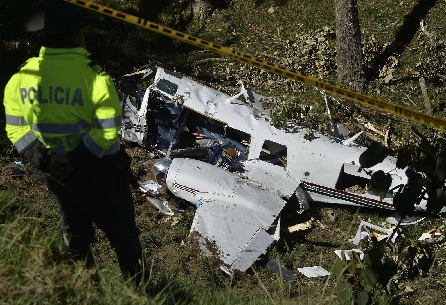
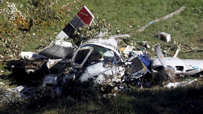
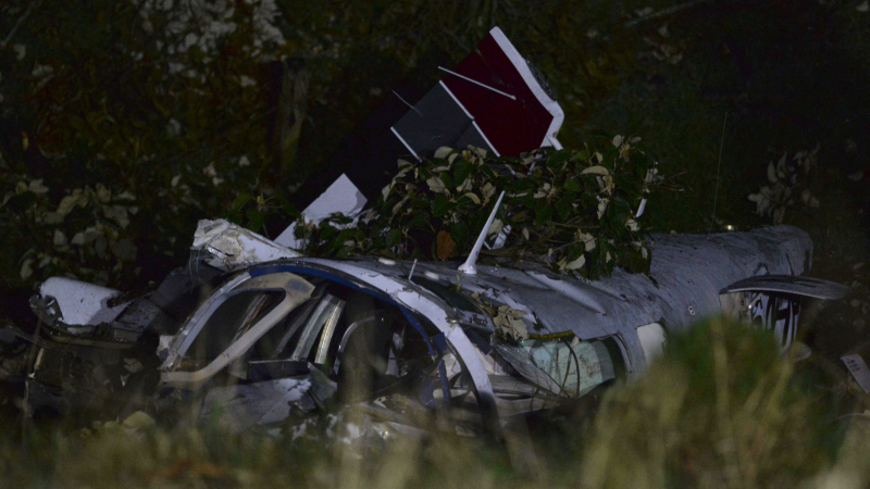
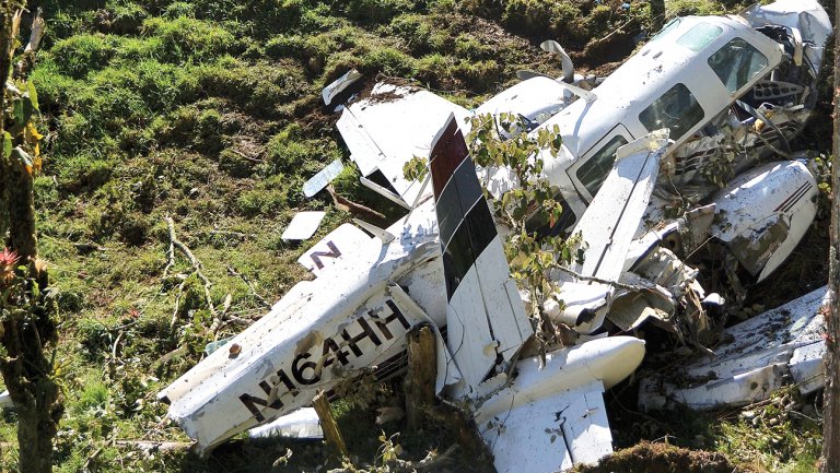
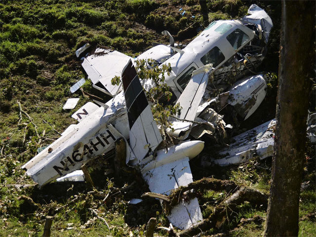
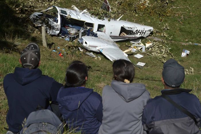
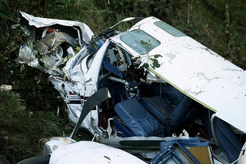
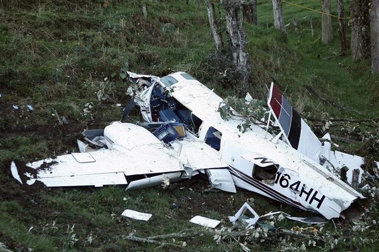
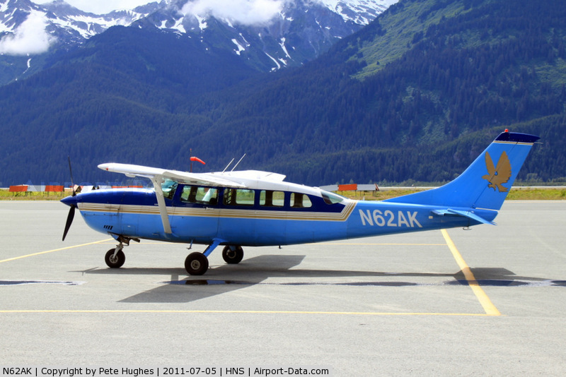
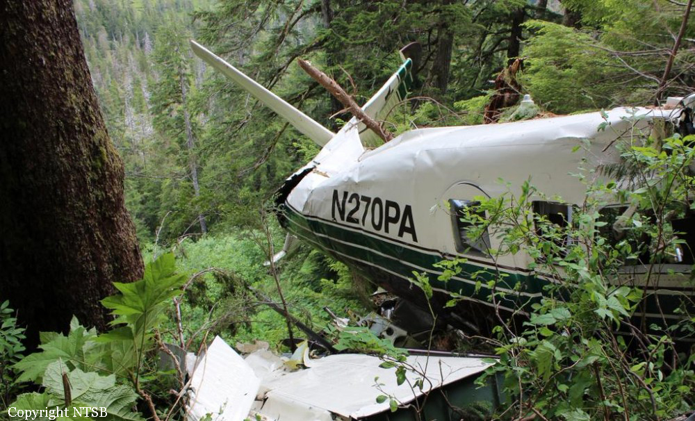
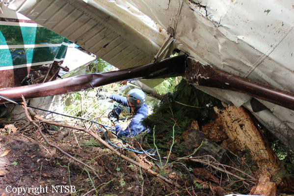
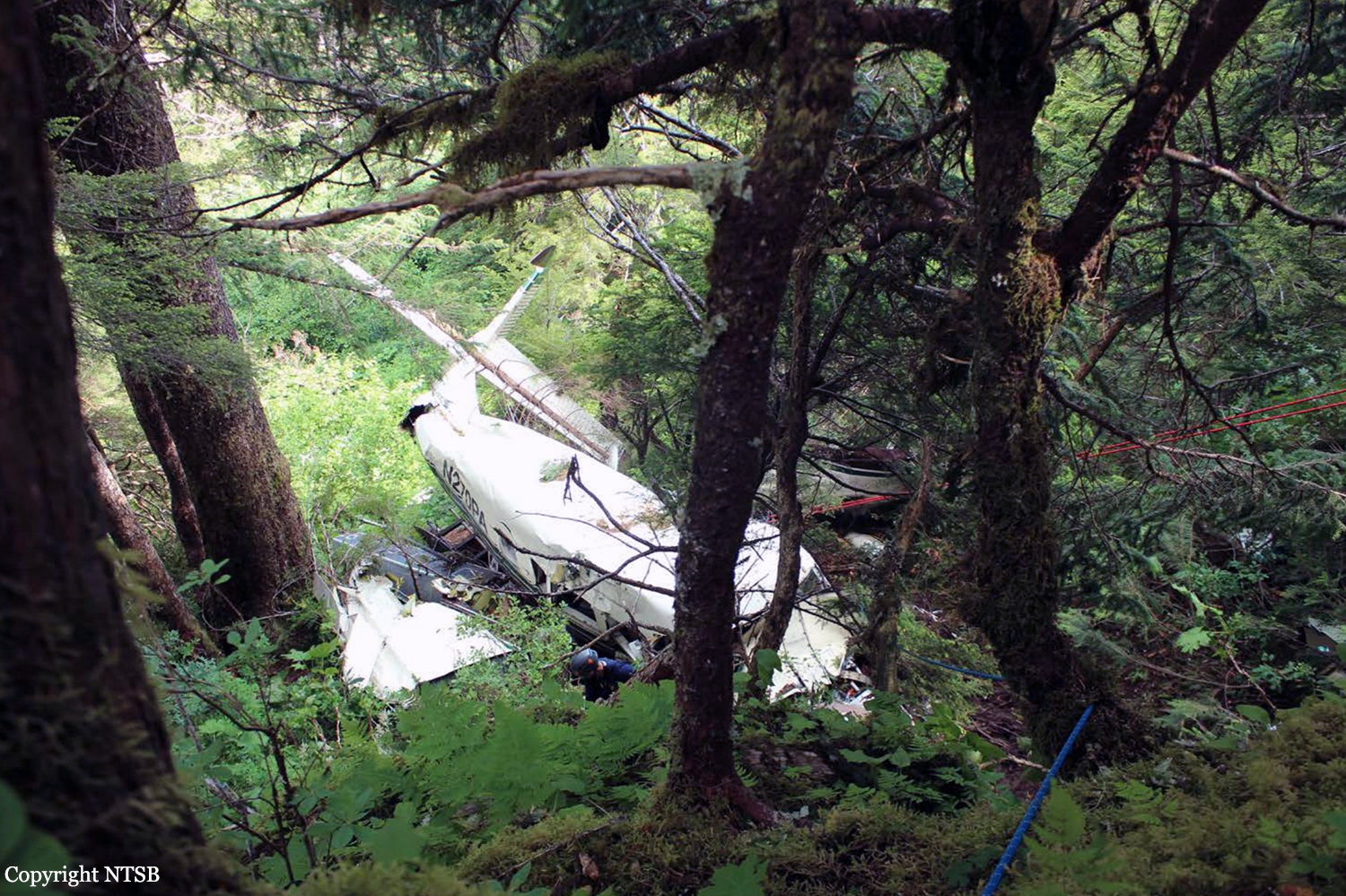
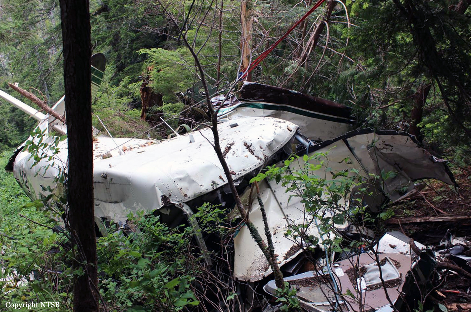
The company flight coordinator on duty when the pilot got her "duty-on" briefing reported that, during the "duty-on" briefing, he informed the commercial pilot that most flights to the intended destination had been cancelled in the morning due to poor weather conditions and that one pilot had turned around due to weather. No record was found indicating that the pilot used the company computer to review weather information before the flight nor that she had received or retrieved any weather information before the flight. If she had obtained weather information, she would have seen that the weather was marginal visual flight rules to instrument flight rules conditions, which might have affected her decision to initiate the flight. The pilot subsequently departed for the scheduled commuter flight with four passengers on board; the flight was expected to be 20 minutes long. Review of automatic dependent surveillance-broadcast data transmitted by the airplane showed that the airplane's flight track was farther north than the typical track for the destination and that the airplane did not turn south toward the destination after crossing the channel. Data from an on board multi-function display showed that, as the airplane approached mountainous terrain on the west side of the channel, the airplane made a series of erratic pitch-and-roll maneuvers before it impacted trees and terrain. Post-accident examination of the airframe and engine revealed no mechanical malfunctions or anomalies that would have precluded normal operation. One of the passengers reported that, after takeoff, the turbulence was "heavy," and there were layers of fog and clouds and some rain. Based on the weather reports, the passenger statement regarding the weather, and the flight's erratic movement just before impact, it is likely that the flight encountered instrument meteorological conditions as it approached the mountainous terrain and that the pilot then lost situational awareness and flew into trees and terrain. According to the company's General Operations Manual (GOM), operational control was delegated to the flight coordinator for the accident flight, and the flight coordinator and pilot-in-command (PIC) were jointly responsible for preflight planning, flight delay, and flight release, which included completing the flight risk assessment (FRA) process. This process required the PIC to fill out an FRA form and provide it to the flight coordinator before flight. However, the pilot did not fill out the form. The GOM stated that one of the roles of the flight dispatcher (also referred to as "flight coordinator") was to assist the pilot in flight preparation by gathering and disseminating pertinent information regarding weather and any information deemed necessary for the safety of flight. It also stated that the dispatcher was to assist the PIC as necessary to ensure that all items required for flight preparation were accomplished before each flight. However, the flight coordinator did not discuss all the risks and weather conditions associated with the flight with the pilot, which was contrary to the GOM. When the flight coordinator who was on duty at the time the airplane was ready to depart did not receive a completed FRA, he did not stop the flight from departing, which was contrary to company policy. By not completing an FRA, it is likely the total risks associated with the accident flight were not adequately assessed. Neither the pilot nor the flight coordinator should have allowed the flight to be released without having completed an FRA form, which led to a loss of operational control and the failure to do so likely contributed to the accident. Interviews with company personnel and a review of a sampling of FRA forms revealed that company personnel, including the flight coordinators, lacked a fundamental knowledge of operational control theory and practice and operational practices (or lack thereof), which led to a loss of operational control for the accident flight. The company provided no formal flight coordinator training nor was a formal training program required. All of the company's qualified flight coordinators were delegated operational control and, thus, were required by 14 Code of Federal Regulations Section 119.69 to be qualified through training, experience, and expertise and to fully understand aviation safety standards and safe operating practice with respect to the company's operation and its GOM. However, the company had no formal method of documenting these requirements; therefore, it lacked a method of determining its flight coordinators' qualifications. In post-accident interviews, the previous Federal Aviation Administration (FAA) principal operations inspector (POI), who became the frontline manager over the certificate, stated that the company used the minimum regulatory standard when it came to ceiling and visibility requirements and that the company did not have any company minimums in place. He further stated that a cloud ceiling of 500 ft and 2 miles visibility would not allow for power-off glide to land even though the company was required to meet this regulation. When asked if he believed the practice of allowing the pilot to decide when to fly was adequate, he said it was not and there should have been route altitudes. However, no action was taken to change SeaPort's operations. The POI at the time of the accident stated that she was also aware that the company was operating contrary to federal regulatory standards for gliding distance to shore. A review of FAA surveillance activities of the company revealed that the POI provided surveillance of the company following the accident, including an operational control inspection, and noted deficiencies with the company's operational procedures; however, the FAA did not hold the company accountable for correcting the identified operational deficiencies. If the FAA had conducted an investigation or initiated an enforcement action pertaining to the company's apparent disregard of the regulatory standard for maintaining glide distance before the accident similar to the inspection conducted following the accident, it is plausible the flight would not have departed or continued when glide distance could not be maintained. The FAA's failure to ensure that the company corrected these deficiencies likely contributed to this accident which resulted, in part, from the company's failure to comply with its GOM and applicable federal regulations, including required glide distance to shore. The company was the holder of a Medallion Shield until they voluntarily suspended the Shield status but retained the "Star" status and continued advertising as a Shield carrier. Medallion stated in an email "With this process of voluntarily suspension, there will be no official communication to the FAA…" Given that Medallion advertises that along with the Shield comes recognition by the FAA as an operator who incorporates higher standards of safety, it seems contrary to safety that they would withhold information pertaining to a suspension of that status.
Probable cause:
The pilot's decision to initiate and continue visual flight into instrument meteorological conditions, which resulted in a loss of situational awareness and controlled flight into terrain.
Contributing to the accident were the company's failure to follow its operational control and flight release procedures and its inadequate training and oversight of operational control
personnel. Also contributing to the accident was the Federal Aviation Administration's failure to hold the company accountable for correcting known regulatory deficiencies and ensuring that it complied with its operational control procedures.
Final Report:

Crash of a Canadair CL-215-1A10 in Faraklo

Date & Time: Jul 17, 2015 at 1305 LT
Type of aircraft:
Operator:
Registration:
1070
Flight Phase:
Flight Type:
Survivors:
Yes
Site:
MSN:
1070
YOM:
1980
Country:
Region:
Crew on board:
2
Crew fatalities:
Pax on board:
0
Pax fatalities:
Other fatalities:
Total fatalities:
0
Circumstances:
The crew was engaged in a fire fighting mission over the Peloponnese Area when he encountered technical problems. He attempted an emergency landing when the aircraft crash landed in a hilly terrain. Both pilots escaped uninjured and the aircraft was damaged beyond repair.

Crash of a De Havilland DHC-3T Turbo Otter near Ella Lake: 9 killed

Date & Time: Jun 25, 2015 at 1215 LT
Type of aircraft:
Operator:
Registration:
N270PA
Flight Phase:
Survivors:
No
Site:
Schedule:
Ketchikan - Ketchikan
MSN:
270
YOM:
1958
Crew on board:
1
Crew fatalities:
Pax on board:
8
Pax fatalities:
Other fatalities:
Total fatalities:
9
Captain / Total flying hours:
4070
Captain / Total hours on type:
40.00
Aircraft flight hours:
24439
Circumstances:
The airplane collided with mountainous, tree-covered terrain about 24 miles east-northeast of Ketchikan, Alaska. The commercial pilot and eight passengers sustained fatal injuries, and the airplane was destroyed. The airplane was owned by Pantechnicon Aviation, of Minden, Nevada, and operated by Promech Air, Inc., of Ketchikan. The flight was conducted under the provisions of 14 Code of Federal Regulations (CFR) Part 135 as an on-demand sightseeing flight; a company visual flight rules flight plan (by which the company performed its own flight-following) was in effect. Marginal visual flight rules conditions were reported in the area at the time of the accident. The flight departed about 1207 from Rudyerd Bay about 44 miles east-northeast of Ketchikan and was en route to the operator’s base at the Ketchikan Harbor Seaplane Base, Ketchikan. The accident airplane was the third of four Promech-operated float-equipped airplanes that departed at approximate 5-minute intervals from a floating dock in Rudyerd Bay. The accident flight and the two Promech flights that departed before it were carrying cruise-ship passengers who had a 1230 “all aboard” time for their cruise ship that was scheduled to depart at 1300. (The fourth flight had no passengers but was repositioning to Ketchikan for a tour scheduled at 1230; the accident pilot also had his next tour scheduled for 1230.) The sightseeing tour flight, which the cruise ship passengers had purchased from the cruise line as a shore excursion, overflew remote inland fjords; coastal waterways; and mountainous, tree-covered terrain in the Misty Fjords National Monument Wilderness. Promech pilots could choose between two standard tour routes between Rudyerd Bay and Ketchikan, referred to as the “short route” (which is about 52 nautical miles [nm], takes about 25 minutes to complete, and is primarily over land) and the “long route” (which is about 63 nm, takes about 30 minutes to complete, and is primarily over seawater channels). Although the long route was less scenic, it was generally preferred in poor weather conditions because it was primarily over water, which enabled the pilots to fly at lower altitudes (beneath cloud layers) and perform an emergency or precautionary landing, if needed. Route choice was at each pilot’s discretion based on the pilot’s assessment of the weather. The accident pilot and two other Promech pilots (one of whom was repositioning an empty airplane) chose the short route for the return leg, while the pilot of the second Promech flight to depart chose the long route. Information obtained from weather observation sources, weather cameras, and photographs and videos recovered from the portable electronic devices (PEDs) of passengers on board the accident flight and other tour flights in the area provided evidence that the accident flight encountered deteriorating weather conditions. Further, at the time of the accident, the terrain at the accident site was likely obscured by overcast clouds with visibility restricted in rain and mist. Although the accident pilot had climbed the airplane to an altitude that would have provided safe terrain clearance had he followed the typical short route (which required the flight to pass two nearly identical mountains before turning west), the pilot instead deviated from that route and turned the airplane west early (after it passed only the first of the two mountains). The pilot’s route deviation placed the airplane on a collision course with a 1,900-ft mountain, which it struck at an elevation of about 1,600 ft mean sea level. In the final 2 seconds of the flight, the airplane pitched up rapidly before colliding with terrain. The timing of this aggressive pitch-up maneuver strongly supports the scenario that the pilot continued the flight into near-zero visibility conditions, and, as soon as he realized that the flight was on a collision course with the terrain, he pulled aggressively on the elevator flight controls in an ineffective attempt to avoid the terrain. Although Promech’s General Operations Manual specified that both the pilot and the flight scheduler must jointly agree that a flight can be conducted safely before it is launched, no such explicit concurrence occurred between the accident pilot and the flight scheduler (or any member of company management) before the accident flight. As a result, the decision to initiate the accident tour rested solely with the accident pilot, who had less than 2 months’ experience flying air tours in Southeast Alaska and had demonstrated difficulty calibrating his own risk tolerance for conducting tour flights in weather that was marginal or below Federal Aviation Administration (FAA) minimums. Further, evidence from the accident tour flight and the pilot’s previous tour flights support that the pilot’s decisions regarding his tour flights were influenced by schedule pressure; his attempt to emulate the behavior of other, more experienced pilots whose flights he was following; and Promech’s organizational culture, which tacitly endorsed flying in hazardous weather conditions, as evidenced (in part) by the company president/chief executive officer’s own tour flight below FAA minimums on the day of the accident.
Probable cause:
The National Transportation Safety Board determines that the probable cause of this accident was
(1) the pilot’s decision to continue visual flight into an area of instrument meteorological conditions, which resulted in his geographic disorientation and controlled flight into terrain; and
(2) Promech’s company culture, which tacitly endorsed flying in hazardous weather and failed to manage the risks associated with the competitive pressures affecting Ketchikan-area air tour operators; its lack of a formal safety program; and its inadequate operational control of flight releases.
Final Report: