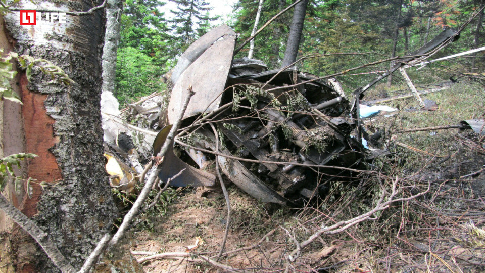
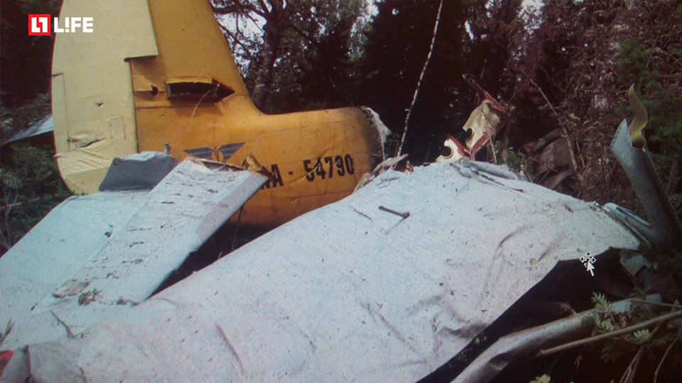
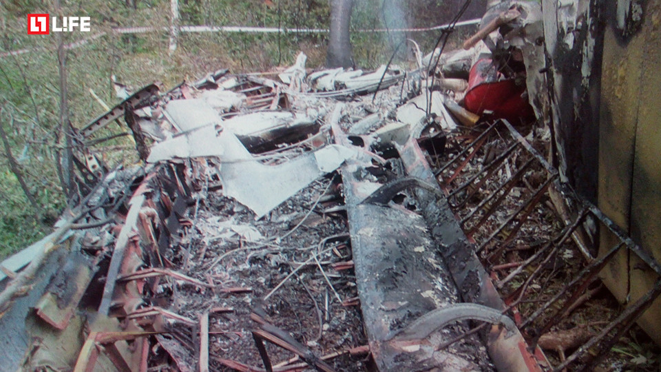
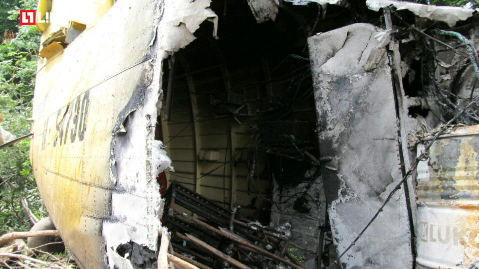
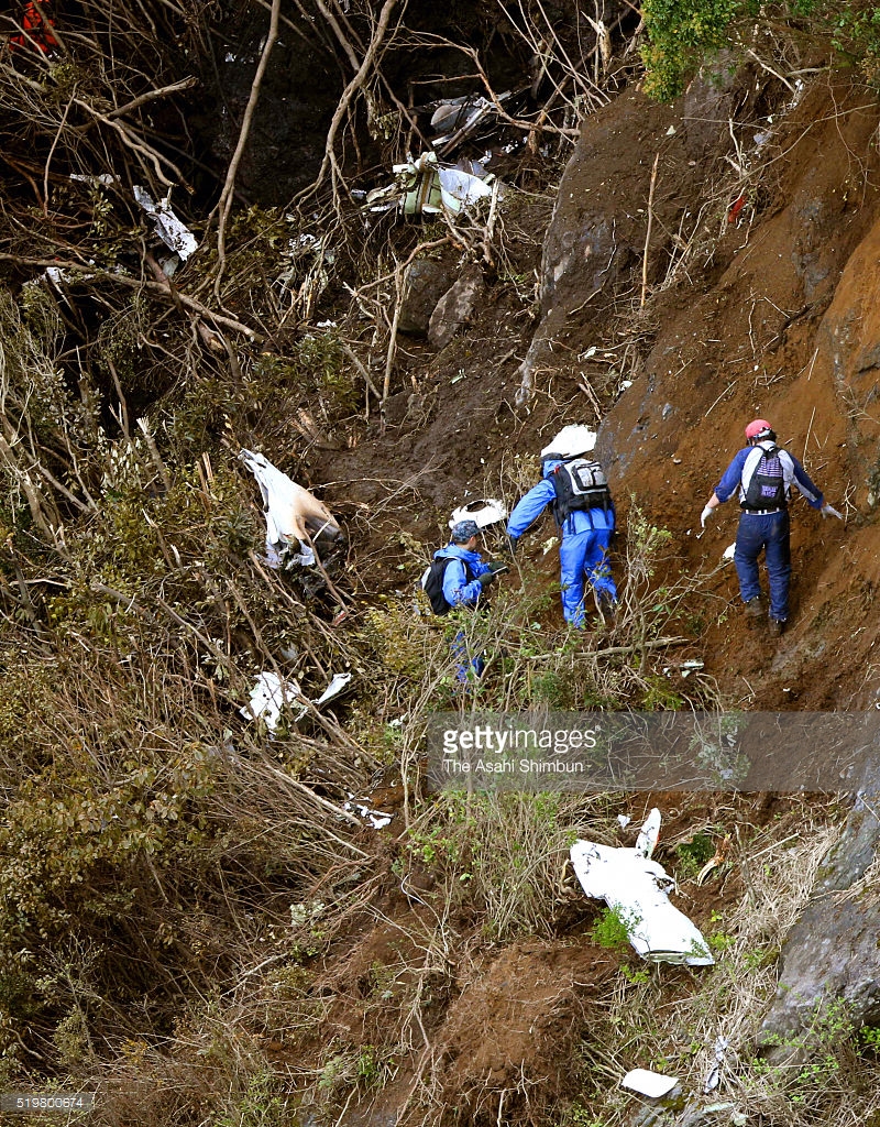
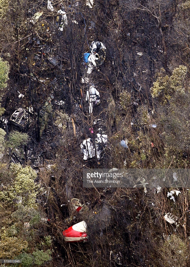
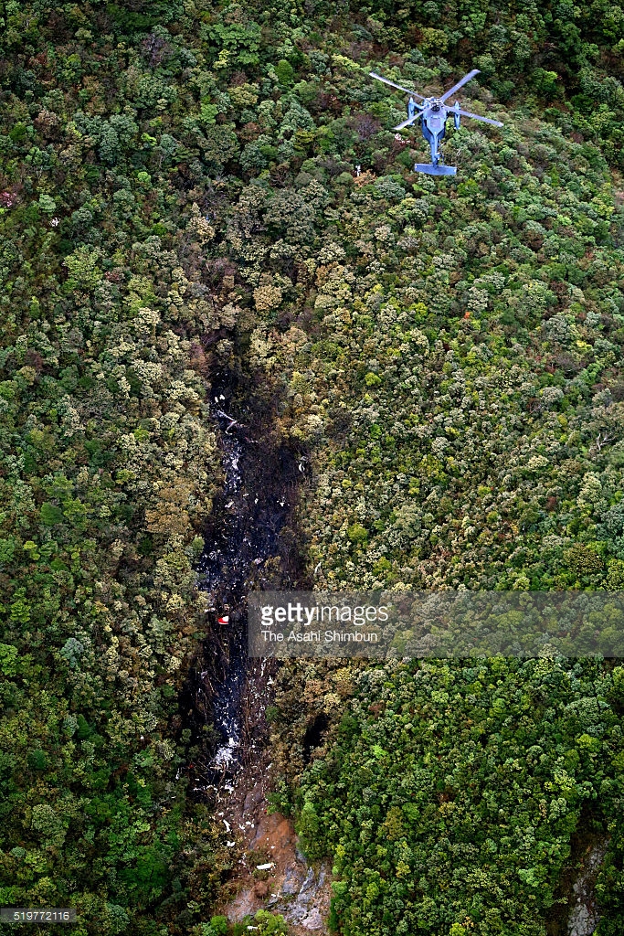
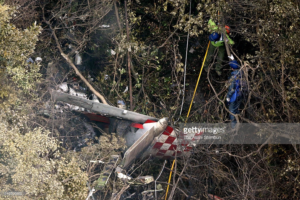
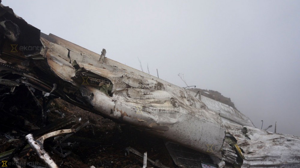
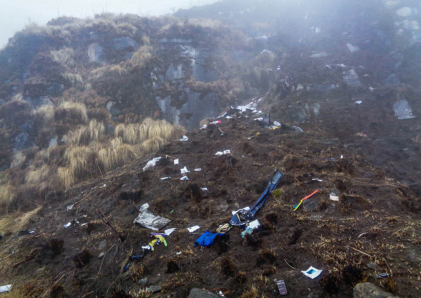
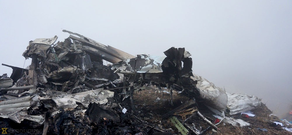
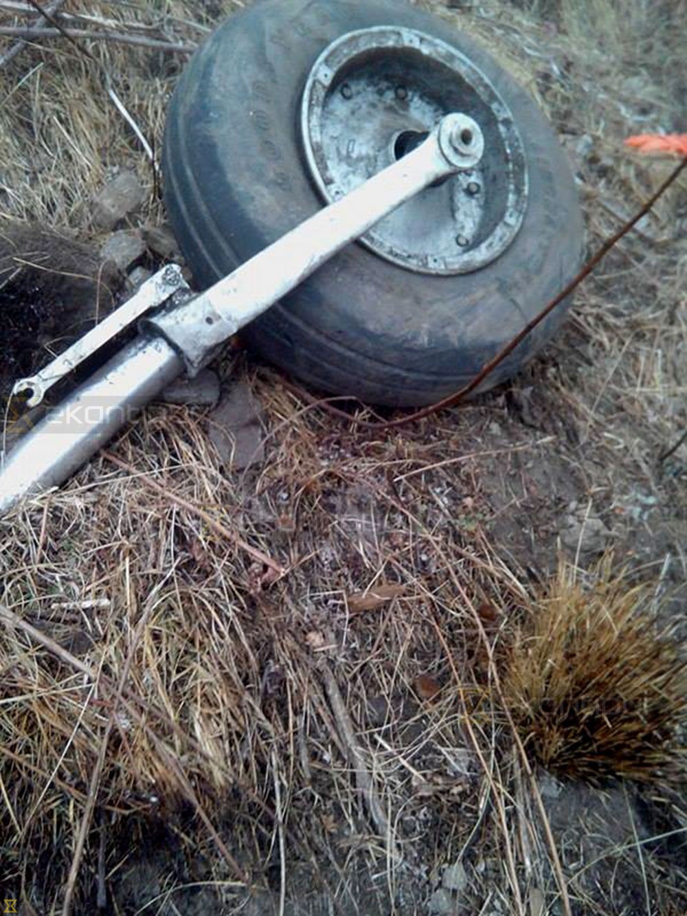
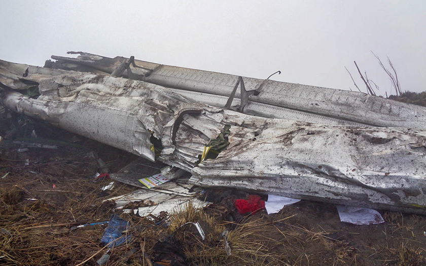
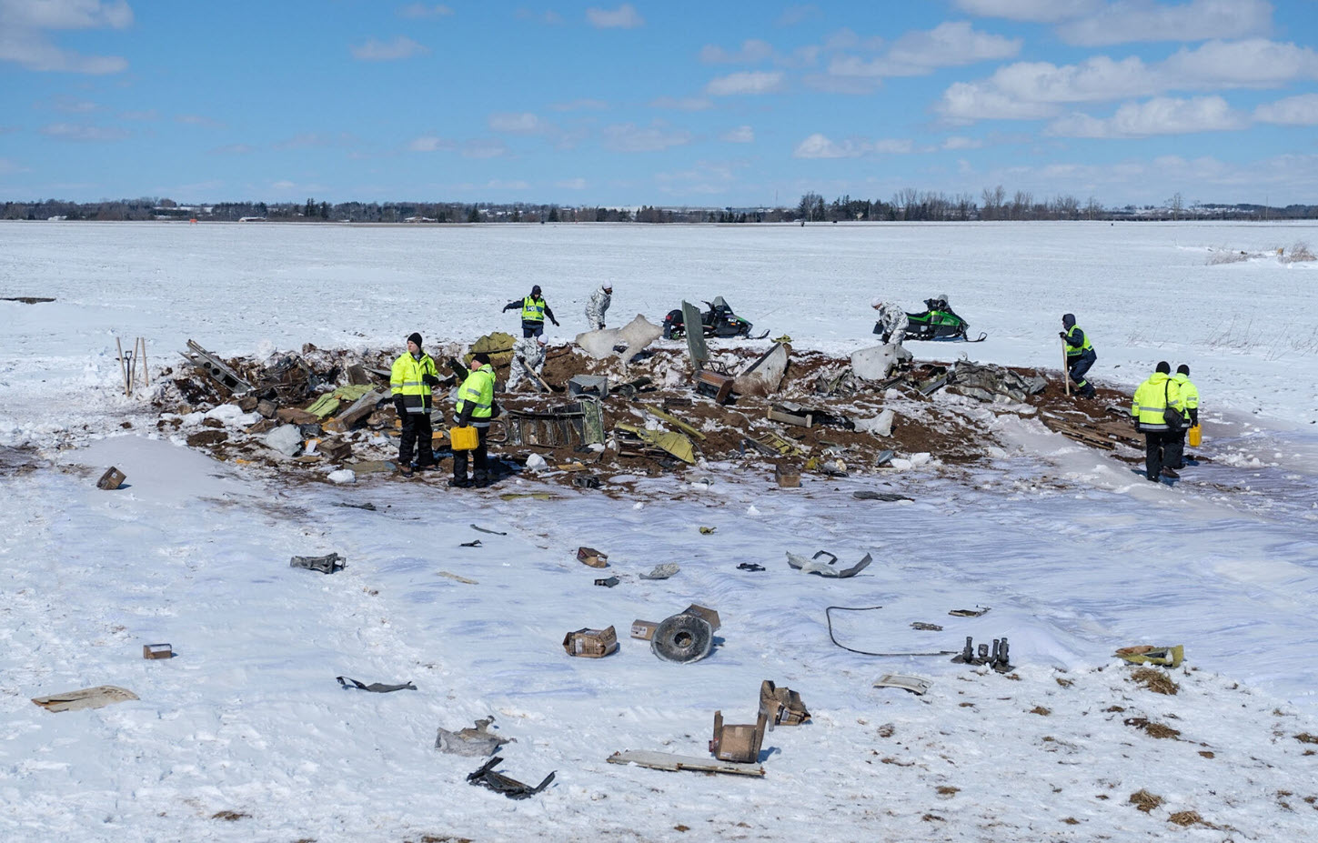
Crash of a Cessna 208B Grand Caravan in San Antonio de Prado: 4 killed

Date & Time: Sep 30, 2016 at 1204 LT
Type of aircraft:
Registration:
HK-3804
Flight Phase:
Survivors:
Yes
Site:
Schedule:
Medellín – Juradó
MSN:
208B-0315
YOM:
1992
Country:
Crew on board:
2
Crew fatalities:
Pax on board:
9
Pax fatalities:
Other fatalities:
Total fatalities:
4
Captain / Total flying hours:
3534
Captain / Total hours on type:
335.00
Copilot / Total flying hours:
6378
Copilot / Total hours on type:
1245
Aircraft flight hours:
2867
Circumstances:
The single engine aircraft departed Medellín-Enrique Olaya Herrera Airport on a charter flight to Juradó, carrying nine passengers and two pilots. Shortly after takeoff, the crew encountered difficulties to gain sufficient altitude and apparently attempted an emergency landing when the aircraft impacted a hill and eventually crashed into trees. The copilot and three passengers were killed and seven others occupants were injured, some seriously. The aircraft was destroyed.
Probable cause:
The following findings were identified:
- Execution of a take-off with a weight approximately 17% higher than the maximum gross operating weight (MTOW) established for the C208B aircraft.
- Limited climb rate with signs of lift loss due to the low performance given by the overweight during the initial climb phase.
- Forced landing in mountainous terrain due to loss of lift caused by overweight during the initial climb.
- Absence in the identification of the risks associated to an overweight operation of the aircraft.
- Lack of supervision by the Aircraft Operator in relation to the dispatch of aircraft operating from the outside at the main base of operation.
Final Report:

Crash of a PZL-Mielec AN-2R near Krapivninsky: 3 killed

Date & Time: Jul 31, 2016 at 1335 LT
Type of aircraft:
Operator:
Registration:
RA-54790
Flight Phase:
Flight Type:
Survivors:
No
Site:
Schedule:
Berdsk – Mansky
MSN:
1G183-54
YOM:
1979
Country:
Region:
Crew on board:
2
Crew fatalities:
Pax on board:
1
Pax fatalities:
Other fatalities:
Total fatalities:
3
Captain / Total flying hours:
5787
Captain / Total hours on type:
1342.00
Aircraft flight hours:
8853
Circumstances:
The single engine airplane was completing a positioning flight from Berdsk to Mansky where insecticides should be pulverized on wooded area. On board were a pilot, a mechanic and a passenger. Following a night in Berdsk, the airplane took off at 1201LT for the last leg to Mansky. En route, weather conditions deteriorated and the visibility was poor. Too low, the aircraft impacted trees and crashed in a wooded area located on the slope of Mt Abatova (747 metres high) located 40 km east of Krapivninsky. The airplane was destroyed by impact forces and a post crash fire. The wreckage was found the following day at an altitude of 541 metres. All three occupants were killed.
Crew:
R. Rodzhapov, pilot,
I. Valiullin, mechanic.
Passenger:
Yuri Pakhomov, maybe acting as a copilot on this flight, despite he was not licensed anymore.
Probable cause:
Controlled flight into terrain following the decision of the pilot to fly under VFR mode in IMC conditions in an uncontrolled area. Poor flight planning and flying without a copilot were considered as contributing factors.
Final Report:

Crash of a De Havilland DHC-2 Beaver I in Elwyn Creek: 1 killed

Date & Time: Jul 15, 2016 at 2220 LT
Type of aircraft:
Operator:
Registration:
C-GWDW
Flight Phase:
Flight Type:
Survivors:
No
Site:
Schedule:
Telegraph Creek – Mowdade Lake
MSN:
306
YOM:
1952
Country:
Crew on board:
1
Crew fatalities:
Pax on board:
0
Pax fatalities:
Other fatalities:
Total fatalities:
1
Circumstances:
The Beaver floatplane departed Telegraph Creek Water Aerodrome, BC (CAH9) destined for Mowdade Lake, BC, at approximately 2040 PDT on 15 July 2016 on a VFR flight itinerary round-trip with one pilot on board. When the aircraft did not arrive at Mowdade Lake and did not return to CAH9, a search was initiated. The aircraft's wreckage was located at approximately 2000 PDT the following day in a ravine at an elevation of about 5,000 feet near the headwaters of Elwyn Creek, BC. The aircraft was consumed by fire and the pilot was fatally injured.

Crash of a Cessna 207 Stationair 7 near Goodnews Bay

Date & Time: Jun 17, 2016 at 1200 LT
Operator:
Registration:
N91170
Flight Phase:
Flight Type:
Survivors:
Yes
Site:
Schedule:
Quinhagak - Goodnews Bay
MSN:
207-00101
YOM:
1969
Crew on board:
1
Crew fatalities:
Pax on board:
0
Pax fatalities:
Other fatalities:
Total fatalities:
0
Captain / Total flying hours:
1150
Captain / Total hours on type:
78.00
Aircraft flight hours:
15089
Circumstances:
During cruise flight through an area of mountainous terrain, the commercial pilot became geographically disoriented and selected the incorrect route through the mountains. Upon realizing it was the incorrect route, he initiated a steep climb while executing a 180° turn. During the steep climbing turn, the airplane inadvertently entered instrument meteorological conditions, and the airplane subsequently impacted an area of rocky, rising terrain. The pilot reported there were no mechanical malfunctions or anomalies that would have precluded normal operation of the airplane.
Probable cause:
The pilot's failure to select the correct route through the mountains as a result of geographic disorientation, and his subsequent visual flight into instrument meteorological conditions, which resulted in collision with terrain.
Final Report:

Crash of a BAe U-125 at Kanoya AFB: 6 killed

Date & Time: Apr 6, 2016 at 1435 LT
Type of aircraft:
Operator:
Registration:
49-3043
Flight Type:
Survivors:
No
Site:
Schedule:
Kanoya - Kanoya
MSN:
258242
YOM:
1993
Country:
Region:
Crew on board:
6
Crew fatalities:
Pax on board:
0
Pax fatalities:
Other fatalities:
Total fatalities:
6
Circumstances:
The aircraft departed Kanoya AFB at 1315LT on a calibration flight with six people on board. After he complete a counter clockwise arc, the crew started the descent to Kanoya AFB Runway 08R. The visibility was poor due to low clouds. On approach, at an altitude of 3,000 feet, the aircraft entered clouds when the GPWS alarm sounded. Two second later, the crew deactivated the alarm and continued the approach. Ten seconds later, the aircraft impacted trees and crashed on the slope of Mt Takakuma (1,182 metres high) located 10 km north of the airbase. The wreckage was found a day later and all six crew members were killed.
Probable cause:
Controlled flight into terrain after the crew continued the approach in poor visibility without visual contact with the environment. Misidentification of the environment on part of the crew was a contributing factor, as well as the fact that the crew deactivated the GPWS alarm and failed to initiate corrective maneuver.

Crash of a Viking Air DHC-6 Twin Otter 400 near Dana: 23 killed

Date & Time: Feb 24, 2016 at 0819 LT
Operator:
Registration:
9N-AHH
Flight Phase:
Survivors:
No
Site:
Schedule:
Pokhara – Jomsom
MSN:
926
YOM:
2015
Flight number:
TA193
Country:
Region:
Crew on board:
3
Crew fatalities:
Pax on board:
20
Pax fatalities:
Other fatalities:
Total fatalities:
23
Captain / Total flying hours:
20108
Captain / Total hours on type:
18500.00
Copilot / Total flying hours:
760
Copilot / Total hours on type:
560
Aircraft flight hours:
270
Aircraft flight cycles:
482
Circumstances:
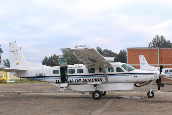
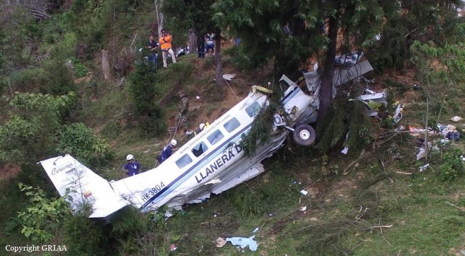
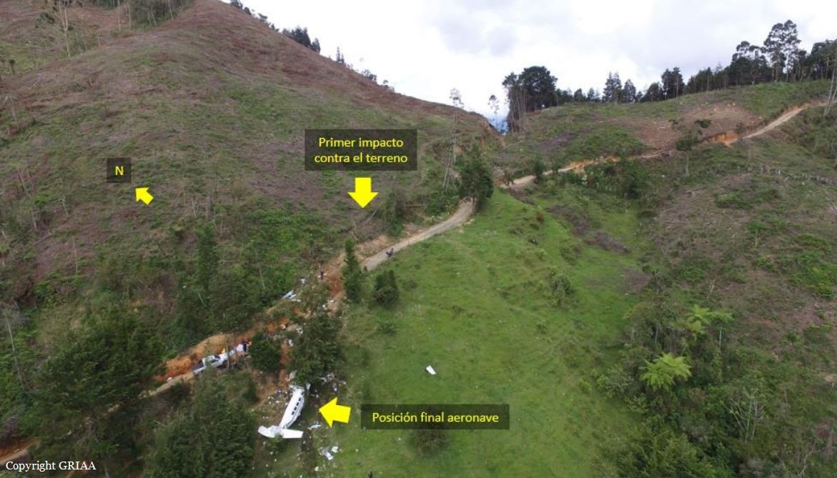
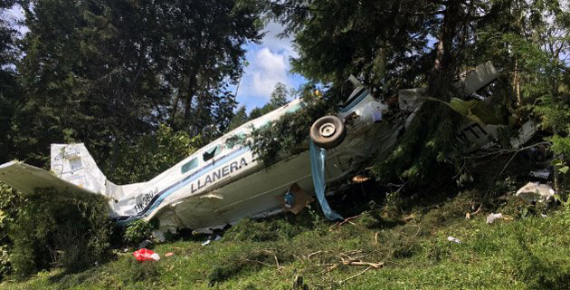
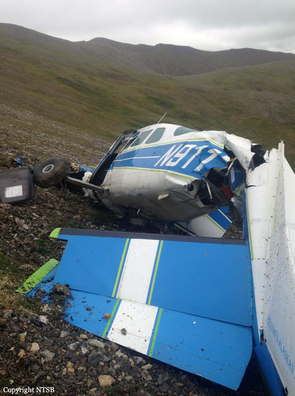
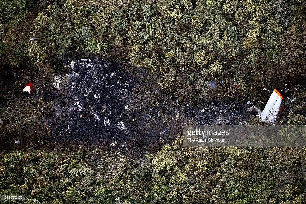
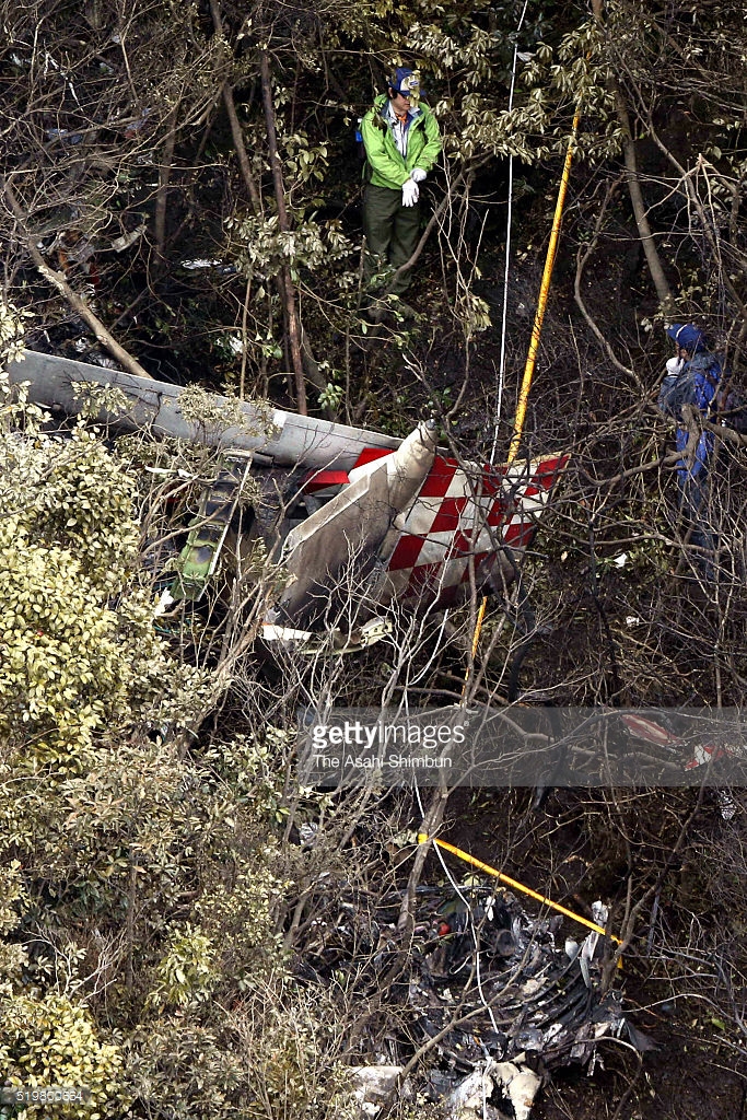
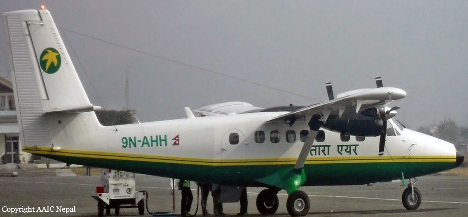
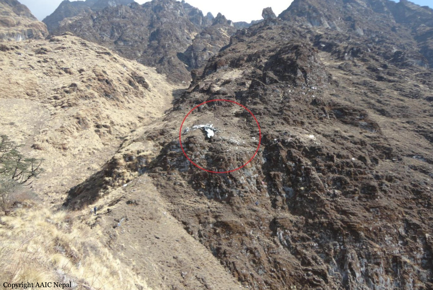
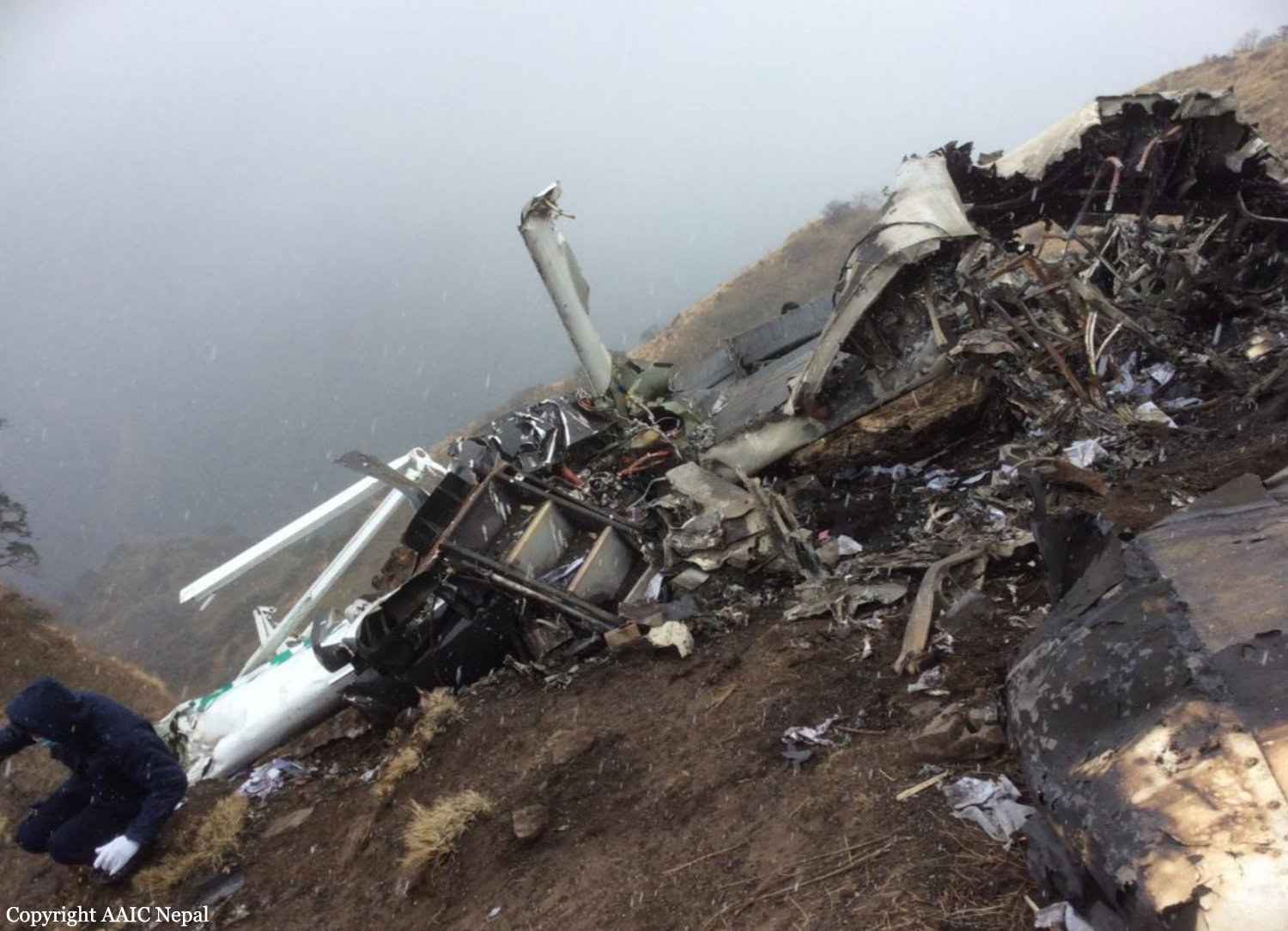
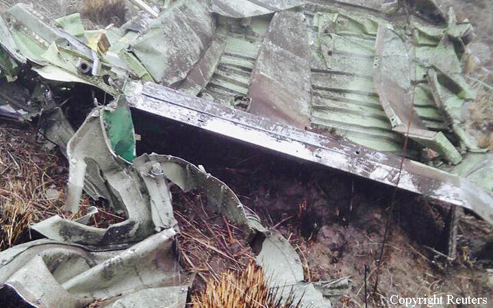
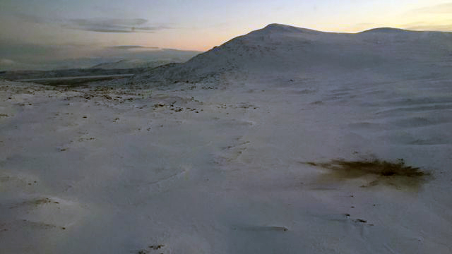
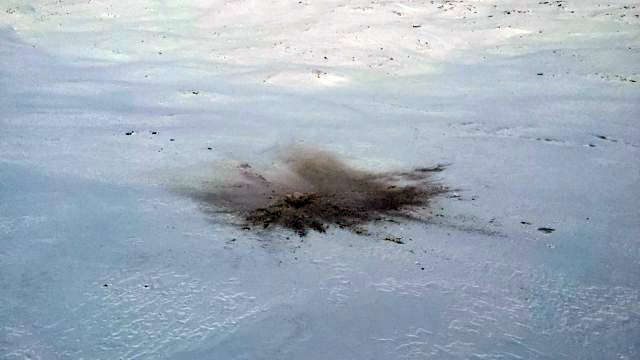
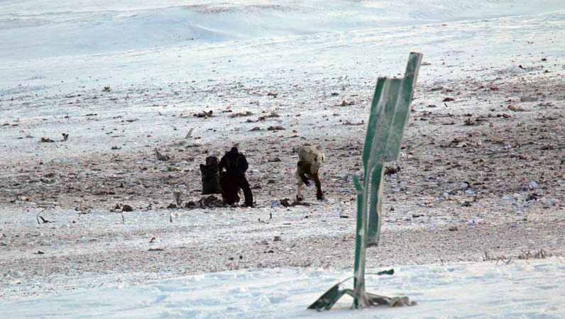
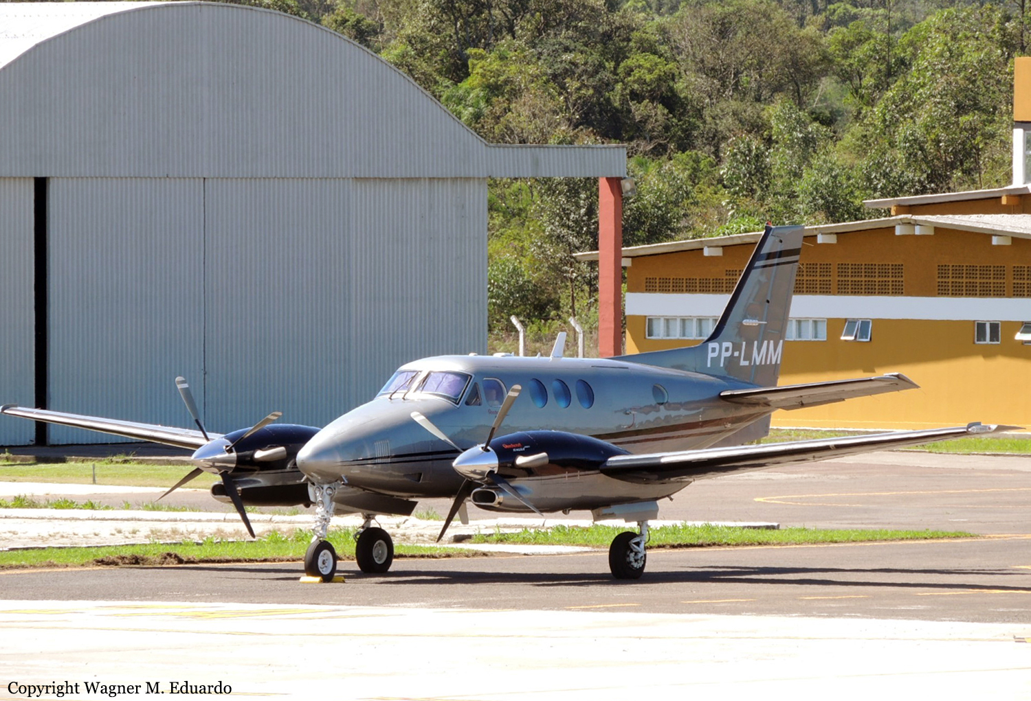
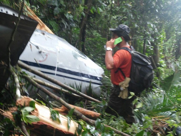
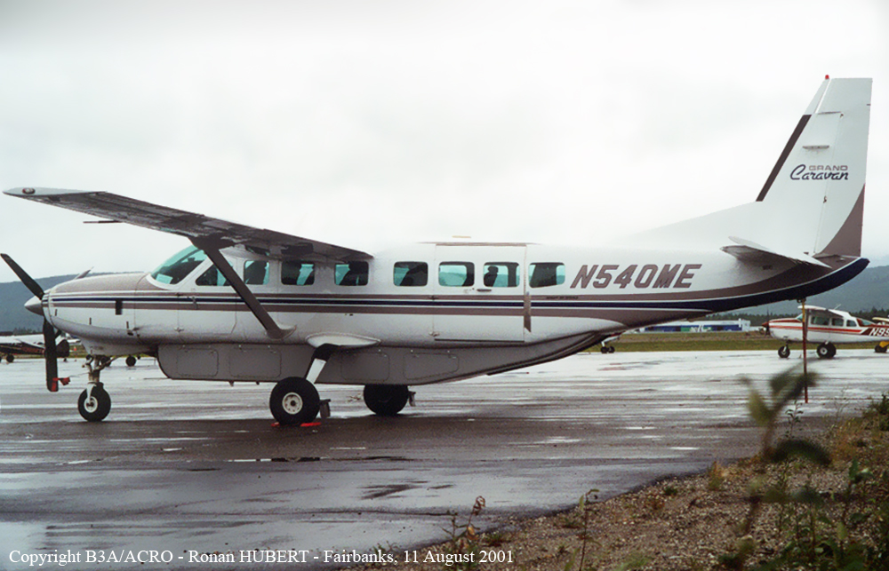
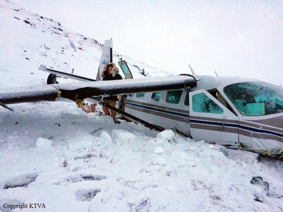
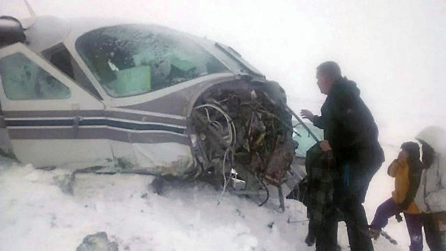
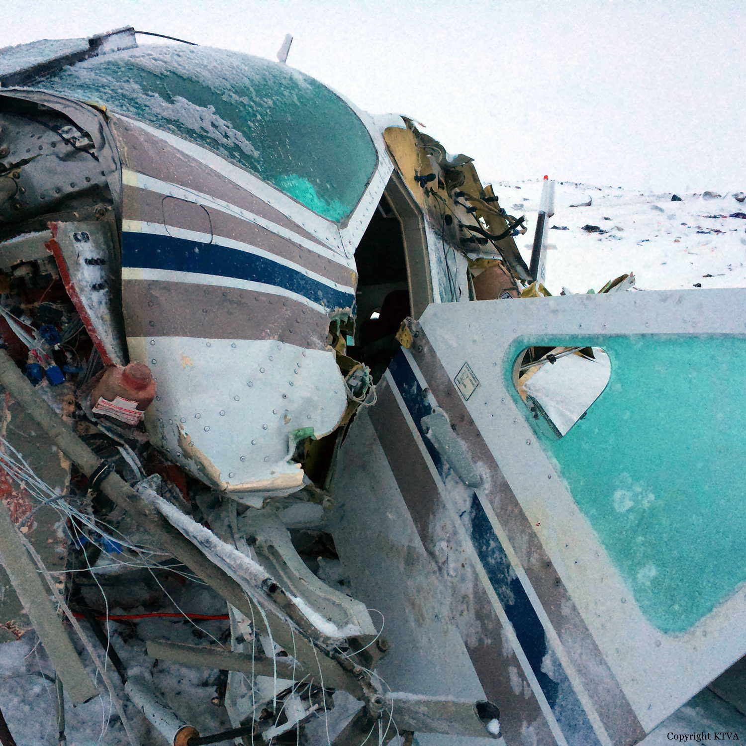
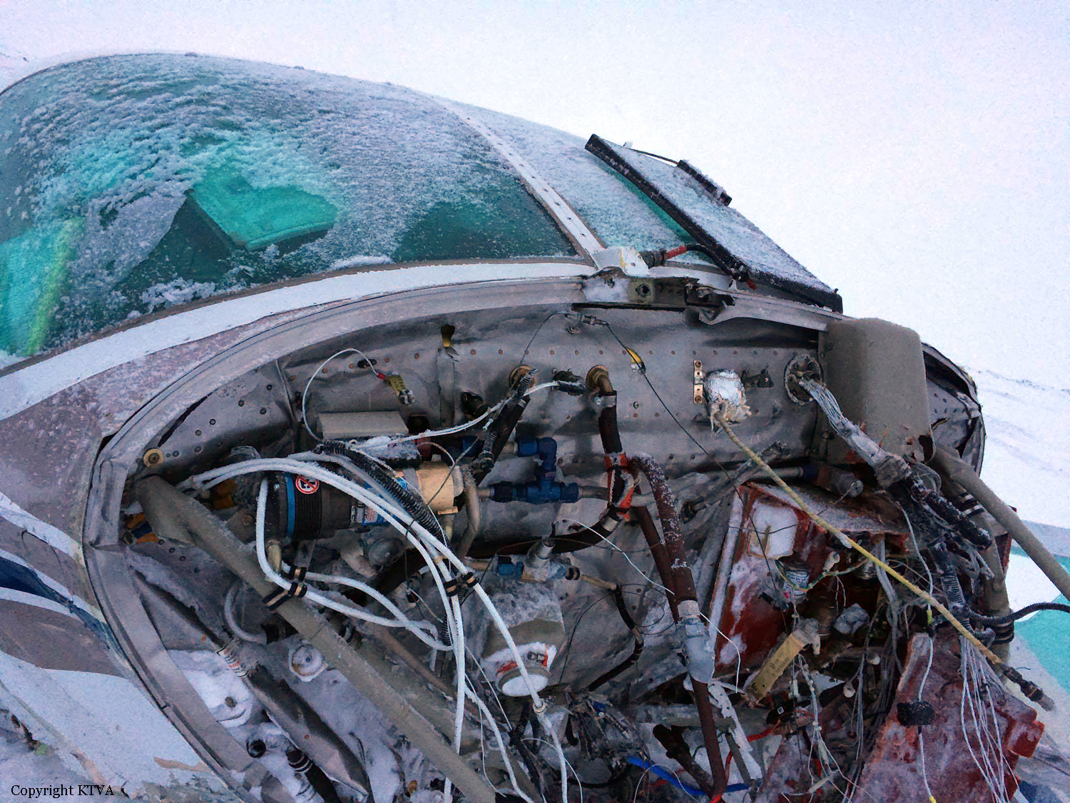
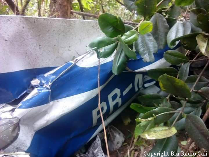
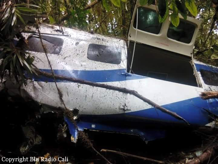
As per the flight plan submitted on 23rd February 2016, the aircraft was scheduled for VFR flight to Jomsom (VNJS) on 24th February with estimated off-block time of 01:00, intended cruising speed of 150 knots, intended level of 10,500 ft and via direct track. The first and second alternate aerodromes were Bhairahawa (VNBW) and Pokhara (VNPK) respectively and estimated elapsed time was 20 minutes with the fuel endurance of 2 hours and 30 minute. Based on the information from the CVR, FDR and ATC records, the following description of the history of the flight was reconstructed: At 01:55, the first-officer contacted Pokhara tower requesting Jomsom and Bhairahawa weather. Upon receiving Jomsom weather which was 8 km visibility towards Lete (arrival track) and foothill partially visible; at 01:56 F/O requested start-up for Jomsom. First-officer then briefed the weather to the captain, in response to this the captain responded by saying 'Let‘s have a look, if not possible we will return' (Translated from Nepali conversation). While performing the 'before start checklist', they received weather of Bhairahawa as closed. After completing the checklist and start-up the first-officer at 02:00 requested taxi clearance. The ATC informed runway change to 22 instead of runway 04 and gave taxi clearance. At 02:03 while taxiing the captain considering bad weather condition expressed his concern over the runway change with F/O but failed to express it to the ATC. As briefed by captain earlier, the control was transferred to F/O and at 02:04 F/O made a normal take-off. At 02:08 the captain reported 5 miles at 6,200 ft to ATC. At 02:09, while passing through 7,000 ft the captain informed the actual weather, which was light haze, mountain not visible but had ground contact, to an ultra-light aircraft upon his request. As per the cockpit conversation, the crew were comparing the base of the cloud which was higher than the day before and proposed to continue climb to 12,500 ft if not on-top of the cloud at 10,500 ft. Around 5 miles before Ghorepani passing 10,100 ft, the captain told that cells were still present so advised F/O to continue climb to 12,000 ft and told that they will proceed till TATOPANI and decide to continue or divert. At 02:14 approaching GHOREPANI and passing 11,400 ft, Captain told F/O to maintain level to be in between the cloud layers and briefed F/O that if they had to divert it would be a left turn. At the same time captain asked repeatedly to F/O if his side was raining for which F/O told and confirmed not visual, after which captain told they would see and decide (regarding continuation of flight). At 02:14:50 while over Ghorepani area at 11,500 ft the EGPWS TERRAIN alert and at 02:14:52 PULL UP warning came while they were not visual and at 02:15:01 it was stated that they were visual and by 02:14:53 the warning stopped. At 02:15 while maintaining 11,500 ft the captain reported ATC that they are at Ghorepani at level 10,500 ft after which frequency changeover to Jomsom tower was given. At 02:15:27 the captain instructed F/O to maintain heading of 3300 and flight level just below the cloud, after which a shallow descent was initiated. At this time captain asked F/O if his side was visual, in response F/O replied somewhat visual. The Captain then instructed F/O to descent to 10,000 ft. Once the descent was started at 02:15:55 passing 11,000 ft an OVERSPEED warning sounded in the cockpit for 2 seconds as the speed reached 152 knots. At 02:16 while passing 10,700 ft captain advised F/O to make a left turn so that it would be easy to turn if required as he was able to see his side. Then F/O asked if left side was visual for which the captain informed that not that side (towards the track) but somewhat visual to the left of him and told that the TRACK TO GO was TO THE LEFT whereas they were actually left of the track and had descended to 10,300 ft. At 02:17:58 EGPWS TERRAIN alert sounded when the aircraft was at 10,200 ft and descending on heading of 3210 with right bank angle of around 30 . At 02:18:06 when the aircraft had descended to 10,100 ft the PULL UP WARNING sounded for which the captain said not to worry and at 02:18:12; when the aircraft was at 10,000 ft the captain took-over the control, continued descent and asked F/O if his side was visual. The F/O informed that right side was not visual at all by which the aircraft had continued shallow descent on heading 3250 with right bank angle reaching up to 130 at 2:18:19 and by 02:18:23 the aircraft once again returned back to 0° bank angle. At 02:18:23 the captain started left bank followed by right bank again while still on a shallow descent until 02:18:27.Upon reaching 9,850 ft (lowest altitude) the aircraft started very shallow climb. At 02:18:35 when aircraft was 9,920 ft the captain told F/O that they reached Landslide (a checkpoint which is on track to Jomsom on the right side of the Kali-Gandaki River). At 02:18:44 when aircraft reached 10,150 ft captain told ―what I will do is now I will turn to heading of LETTE‖ (another way point on route to Jomsom); while the PULL-UP warning was continuously sounding. At 02:18:49 when the aircraft was at 10,300 ft right bank angle increased up to 16° with pitch up attitude of 7°. At 02:18:52 the captain told that he would start climb when the aircraft had reached 10,350 ft; pitch attitude of 10° and still on right bank. The aircraft reached zero degree bank at 02:18:53 and started shallow left bank with pitch attitude of 12° nose up. By 02:18:57 the bank angle reached 200 left with pitch attitude of 11.8 and altitude of 10,550 ft and captain was still questioning F/O about the visibility towards his side but F/O informed his side not visible completely. The last data recorded in FDR was at 02:19:03 when the altitude had reached around 10,700 ft; pitch attitude of 7° nose up and left bank angle of 25° heading of 335° with EGPWS PULL-UP warning ON.
Probable cause:
The Commission concludes that the probable cause of this accident was the fact that despite of unfavourable weather conditions, the crew‘s repeated decision to enter into cloud during VFR flight and their deviation from the normal track due to loss of situational awareness aggravated by spatial disorientation leading to CFIT accident.
The contributing factors for the accident are:
1. Loss of situational awareness,
2. Deteriorating condition of weather,
3. Skill base error of the crew during critical phases of flight,
4. Failure to utilize all available resources (CRM), especially insensitivity to EGPWS cautions/warnings.
Final Report:

Crash of a Canadair Regional Jet CRJ-200PF near Akkajaure Lake: 2 killed

Date & Time: Jan 8, 2016 at 0020 LT
Operator:
Registration:
SE-DUX
Flight Phase:
Flight Type:
Survivors:
No
Site:
Schedule:
Oslo – Tromsø
MSN:
7010
YOM:
1993
Flight number:
SWN294
Country:
Region:
Crew on board:
2
Crew fatalities:
Pax on board:
0
Pax fatalities:
Other fatalities:
Total fatalities:
2
Captain / Total flying hours:
3365
Captain / Total hours on type:
2208.00
Copilot / Total flying hours:
3232
Copilot / Total hours on type:
1064
Aircraft flight hours:
38601
Aircraft flight cycles:
31036
Circumstances:
The flight was uneventful until the start of the event, which occurred during the approach briefing in level flight at FL 330. The event started at 00:19:20 hrs during darkness without moonlight, clouds or turbulence. The lack of external visual references meant that the pilots were totally dependent on their instruments which, inter alia consisted of three independent attitude indicators. According to recorded data and simulations a very fast increase in pitch was displayed on the left attitude indicator. The pilot in command, who was the pilot flying and seated in the left seat exclaimed a strong expression. The displayed pitch change meant that the pilot in command was subjected to a surprise effect and a degradation of spatial orientation The autopilot was, most probably, disconnected automatically, a “cavalry charge” aural warning and a single chime was heard, the latter most likely as a result of miscompare between the left and right pilots’ flying displays (PFD). Both elevators moved towards nose down and nose down stabilizer trim was gradually activated from the left control wheel trim switch. The airplane started to descend, the angle of attack and G-loads became negative. Both pilots exclaimed strong expressions and the co-pilot said “come up”. About 13 seconds after the start of the event the crew were presented with two contradictory attitude indicators with red chevrons pointing in opposite directions. At the same time none of the instruments displayed any comparator caution due to the PFDs declutter function in unusual attitude. Bank angle warnings were heard and the maximum operating speed and Mach number were exceeded 17 seconds after the start of the event, which activated the overspeed warning. The speed continued to increase, a distress call was transmitted and acknowledged by the air traffic control and the engine thrust was reduced to flight idle. The crew was active during the entire event. The dialogue between the pilots consisted mainly of different perceptions regarding turn directions. They also expressed the need to climb. At this stage, the pilots were probably subjected to spatial disorientation. The aircraft collided with the ground one minute and twenty seconds after the initial height loss. The two pilots were fatally injured and the airplane was destroyed.
Probable cause:
The erroneous attitude indication on PFD 1 was caused by a malfunction of the Inertial Reference Unit (IRU 1). The pitch and roll comparator indications of the PFDs were removed when the attitude indicators displayed unusual attitudes. In the simulator, in which the crew had trained, the corresponding indications were not removed. During the event the pilots initially became communicatively isolated from each other. The current flight operational system lacked essential elements which are necessary. In this occurrence a system for efficient communication was not in place. SHK considers that a general system of initial standard calls for the handling of abnormal and emergency procedures and also for unusual and unexpected situations should be incorporated in commercial aviation. The accident was caused by insufficient operational prerequisites for the management of a failure in a redundant system.
Contributing factors were:
- The absence of an effective system for communication in abnormal and emergency situations,
- The flight instrument system provided insufficient guidance about malfunctions that occurred,
- The initial maneuver that resulted in negative G-loads probably affected the pilots' ability to manage the situation in a rational manner.
Final Report:

Crash of a Beechcraft C90GTi King Air in Paraty: 2 killed

Date & Time: Jan 3, 2016 at 1430 LT
Type of aircraft:
Operator:
Registration:
PP-LMM
Flight Type:
Survivors:
No
Site:
Schedule:
Campo de Marte - Paraty
MSN:
LJ-1866
YOM:
2008
Country:
Crew on board:
2
Crew fatalities:
Pax on board:
0
Pax fatalities:
Other fatalities:
Total fatalities:
2
Captain / Total flying hours:
801
Captain / Total hours on type:
319.00
Copilot / Total flying hours:
159
Circumstances:
The twin engine aircraft departed Campo de Marte Airport at 1334LT on a positioning flight to Paraty, with an ETA at 1415LT. While descending to Paraty Airport, the crew encountered instrument meteorological conditions. On final, while approaching under VFR mode, the aircraft impacted trees and crashed in a dense wooded area located in hilly terrain few km short of runway. The aircraft was destroyed and both pilots were killed.
Probable cause:
Contributing factors:
- Attention - undetermined
Moments before the accident, another aircraft successfully completed the landing at the Paraty aerodrome. It is possible that the pilot's attention was focused on this information, which indicated the possibility of landing, despite the critical conditions faced, leading him to take high risks to make the landing in critical conditions.
Also, the presence of a copilot not qualified to operate the aircraft may have influenced the pilot's cognitive processes, causing deconcentration or deviation of attention from the pilot.
- Attitude - contributed
Recurring attempts to make the landing indicated an excess of self-confidence on the part of the pilot, leading him to continue the flight to the Paraty aerodrome, even in adverse weather conditions.
The bold operational profile of the pilot, his past experience and the rules and values ​​adopted informally in the group of pilots are possible factors that influenced the development of this attitude of excessive self-confidence.
- Adverse weather conditions - contributed
On the day of the accident, the weather conditions were not favorable for visual flight at the Paraty aerodrome.
- Culture of the working group - contributed
Among the pilots who operated in the Paraty region, competitive behavior had been installed, valued by the social recognition attributed to those who managed to operate in critical conditions. Above all, landing under conditions adverse weather conditions in the region was considered a manifestation of proficiency and professional competence. The values ​​shared by that group of pilots favored the weakening of the collective perception about the present operational risks. The presence of other pilots who were also trying to land in the region on the day of the occurrence, as well as the landing made by one of these aircraft, moments before the accident, and also the accomplishment of two failed attempts of the PP-LMM aircraft, translates clear evidence of that behavior.
- Pilot forgetfulness - undetermined
The fact that the landing gear was not retracted during the second launch in the air indicated a failure, fueled by the possible forgetfulness of the crew, to perform the planned procedure. Maintaining the landing gear in the lowered position affected the aircraft's performance during the ascent, which may have contributed to the aircraft not reaching the height required to clear obstacles.
- Pilotage Judgment - undetermined
The possible decision not to retract the landing gear during the launch affected the aircraft's performance during the climb, which may have contributed to the aircraft not reaching the height necessary to clear the obstacles.
- Motivation - undetermined
The successful landing by the pilot of another aircraft, even under unfavorable conditions, may have increased the motivation of the pilot of the PP-LMM aircraft to complete the landing, in order to demonstrate his proficiency and professional competence.
- Perception - contributed
The occurrence of a collision with the ground, in controlled flight, indicated that the crew had a low level of situational awareness at the time of the occurrence. This inaccurate perception of the circumstances of the flight made it impossible to adopt the possible measures that could prevent the collision.
- Decision making process - contributed
The pilot chose to make two landing attempts at the Paraty aerodrome, despite adverse weather conditions, indicating an inaccurate assessment of the risks involved in the operation. This evaluation process may have been adversely affected by the competition behavior installed among the pilots. In this context, it is possible that the pilot based his decision only on the successful landing of another aircraft, a fact that limited his scope of evaluation.
- Organizational processes - undetermined
The PP-LMM aircraft was operated by a group of pilots, mostly composed of freelance professionals, who were informally managed by a hired pilot. Therefore, there was no formal system used by the operator to recruit, select, monitor and evaluate the performance of professionals. The failures related to the management of this process, possibly, caused inadequacies in the selection of pilots, in the crew scale, in untimely activations and, as in the case in question, in the choice of crew member not qualified to exercise function on board.
Final Report:

Crash of a Cessna 208B Grand Caravan near Anaktuvuk Pass

Date & Time: Jan 2, 2016 at 1205 LT
Type of aircraft:
Operator:
Registration:
N540ME
Flight Phase:
Survivors:
Yes
Site:
Schedule:
Fairbanks - Anaktuvuk Pass
MSN:
208B-0540
YOM:
1996
Crew on board:
1
Crew fatalities:
Pax on board:
7
Pax fatalities:
Other fatalities:
Total fatalities:
0
Captain / Total flying hours:
8854
Captain / Total hours on type:
4142.00
Aircraft flight hours:
19555
Circumstances:
The airline transport pilot was conducting a scheduled passenger flight in an area of remote, snow-covered, mountainous terrain with seven passengers on board. The pilot reported that, after receiving a weather briefing, he chose to conduct the flight under visual flight rules (VFR). While en route about 10,000 ft mean sea level (msl), the visibility began "getting fuzzy." The pilot then descended the airplane to 2,500 ft msl (500 ft above ground level) to fly along a river. When the airplane was about 10 miles southwest of the airport, he climbed the airplane to about 3,000 ft msl in order to conduct a straight-in approach to the runway. He added that the visibility was again a little "fuzzy" due to snow and clouds, and that he never saw the airport. The pilot also noted that the flat light conditions limited his ability to determine his distance from the surrounding mountainous, snow-covered terrain. Shortly after climbing to 3,000 ft msl, the airplane collided with the rising terrain about 6 miles southwest of the airport. Another pilot, who had just departed from the airport, confirmed that flat light and low-visibility conditions existed in the area at the time of the accident. Further, camera images of the weather conditions recorded at the airport showed that, although conditions were marginal VFR at the surface at the time of the accident, there was mountain obscuration and reduced visibility due to light snow and clouds along the accident flight path and that the worst conditions were located along and near the higher terrain. The pilot reported no preimpact mechanical malfunctions or failures with the airplane that would have precluded normal operation. It is likely that that the pilot encountered flat light and low-visibility conditions as he neared the airport at 3,000 ft msl while operating under VFR and that he did not see the rising, snow-covered mountainous terrain and subsequently failed to maintain clearance from it.
Probable cause:
The pilot's continued flight into deteriorating, flat light weather conditions, which resulted in impact with mountainous, snow-covered terrain.
Final Report:

Crash of a Cessna 208B Grand Caravan near Yumbo: 3 killed

Date & Time: Oct 14, 2015 at 1146 LT
Type of aircraft:
Operator:
Registration:
PR-MIC
Flight Phase:
Survivors:
No
Site:
Schedule:
Cali - Cali
MSN:
208B-0841
YOM:
2000
Country:
Crew on board:
3
Crew fatalities:
Pax on board:
0
Pax fatalities:
Other fatalities:
Total fatalities:
3
Captain / Total flying hours:
9388
Captain / Total hours on type:
4155.00
Copilot / Total flying hours:
6343
Copilot / Total hours on type:
1029
Aircraft flight hours:
10519
Circumstances:
The single engine airplane departed Cali-Alfonso Bonilla Aragón Airport on an geophysical exploration mission of the south part of Chocó, carrying three crew members, two pilots and one operator in charge of the LIDAR equipment. At 1144LT, the crew reported his altitude at 5,600 feet. Two minutes later, while cruising in poor visibility, the aircraft struck trees and crashed in wooded and hilly terrain near Yambo. The wreckage was found few hours later and all three occupants were killed.
Probable cause:
The following factors were identified:
- Controlled flight into terrain,
- Execution of a VFR flight in reduced visibility weather conditions,
- Poor decision making by the crew in continuing VFR operation as they were in an environment of significantly reduced visibility,
- Inadequate operational risk assessment due to the lack of familiarity of the foreign crew with the topography and meteorological evolution of the sector.
Final Report: