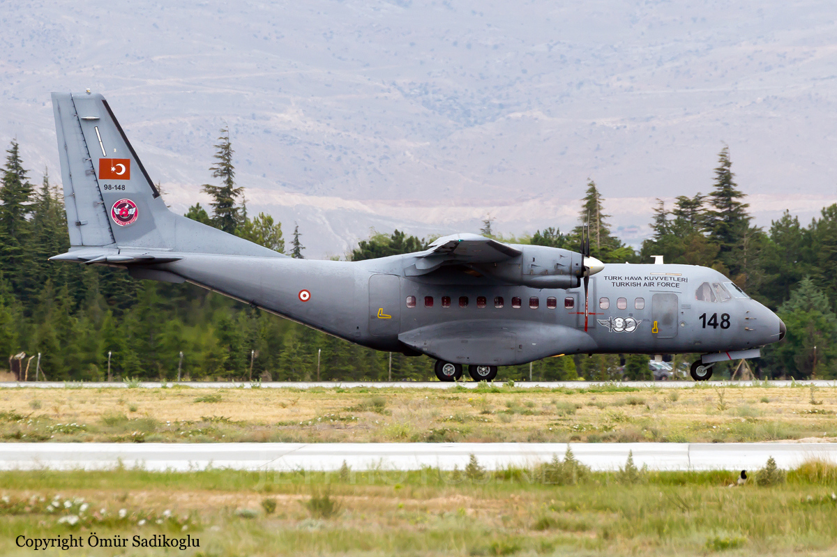
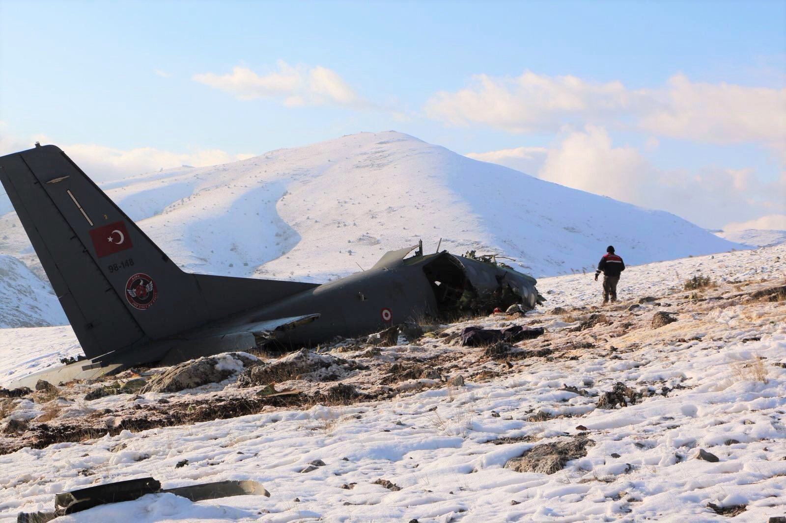
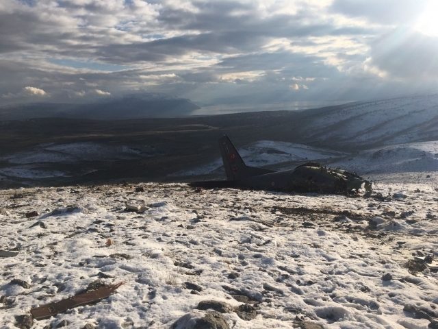
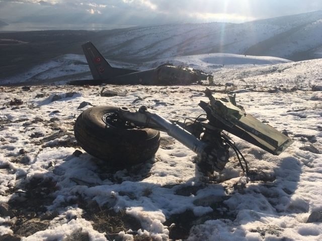
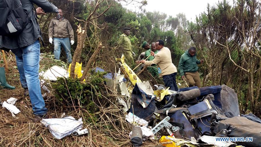
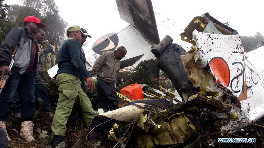
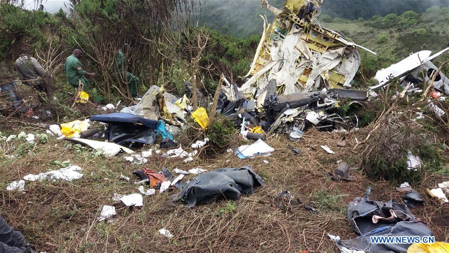
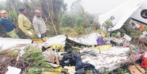
Crash of a Casa-Nurtanio CN-235M-100 near Yalvaç: 3 killed

Date & Time: Jan 17, 2018 at 1250 LT
Operator:
Registration:
98-148
Flight Phase:
Flight Type:
Survivors:
No
Site:
Schedule:
Eskişehir - Eskişehir
MSN:
C-148
YOM:
1998
Country:
Region:
Crew on board:
3
Crew fatalities:
Pax on board:
0
Pax fatalities:
Other fatalities:
Total fatalities:
3
Circumstances:
The twin engine aircraft departed Eskişehir Airport at 1103LT on a training flight, carrying one technician and two pilots. While flying in good weather conditions, the airplane struck the top of a snow covered mountain located in the region of Yalvaç, some 80 km northeast of Isparta. The wreckage was found at 1430LT. All three crew members were killed.

Crash of a Britten-Norman BN-2A Islander in Saidor Gap: 1 killed

Date & Time: Dec 23, 2017 at 1010 LT
Type of aircraft:
Operator:
Registration:
P2-ISM
Flight Phase:
Flight Type:
Survivors:
No
Site:
Schedule:
Derim - Lae
MSN:
227
YOM:
1970
Region:
Crew on board:
1
Crew fatalities:
Pax on board:
0
Pax fatalities:
Other fatalities:
Total fatalities:
1
Captain / Total flying hours:
1982
Captain / Total hours on type:
139.00
Aircraft flight hours:
32232
Circumstances:
On 23 December 2017, at 00:10 UTC (10:10 local), a Britten Norman BN-2A Islander aircraft, registered P2-ISM (ISM), owned and operated by North Coast Aviation, impacted a ridge, at about 9,500 ft (6°11'29"S, 146°46'11"E) that runs down towards the Sapmanga Valley from the Sarawaget Ranges, Morobe Province. The pilot elected to track across the Sarawaget ranges (See figure 1), from Derim Airstrip to Nadzab Airport, Morobe Province, not above 10,000 ft. The track flown from Derim was to the northwest 6.5 nm (12 km) to a point 0.8 nm (1.5 km) westsouthwest of Yalumet Airstrip where the aircraft turned southwest to track to the Saidor Gap. GPS recorded track data immediately prior to the last GPS fix showed that the aircraft was on a shallow descent towards the ridge. The aircraft impacted the ridge about 150 m beyond the last fix. There were no reports of a transmission of an ELT distress signal. During the search for the aircraft, what appeared to be the right aileron was found hanging from a tree near the top of the heavily-timbered, densely-vegetated ridge. The remainder of the wreckage was found about 130 m from the aileron along the projected track. The aircraft impacted the ground in a steep nose-down, right wing-low attitude. The majority of the aircraft wreckage was contained at the ground impact point. The aircraft was destroyed by impact forces. The pilot, the sole occupant, who initially survived, was reported deceased by the rescue team on 27 December 2017 at 22:10. The pilot had made contact with one of the operator’s pilots at 16:15 on 23 December. The pilot’s time of death, recorded on the Death Certificate, was 10:40 am local on 24 December. Rescuers felled trees on the steep heavily timbered, densely vegetated slope about 20 metres from the wreckage and constructed a helipad.
Probable cause:
Cloud build up along the pilot’s chosen route may have forced him to manoeuvre closer than normal to the ridge, in order to avoid flying into the cloud. The aircraft’s right wing struck a tree protruding from the forest canopy during controlled flight into terrain. It is likely that the right aileron mass balance became snagged on the tree and rapidly dislodged the aileron from the wing. The loss of roll control, and the aerodynamic differential, forced the aircraft to descend steeply through the forest and impacted terrain.
Final Report:

Crash of a Cessna 208B Grand Caravan in Empakaai Camp: 11 killed

Date & Time: Nov 15, 2017 at 1113 LT
Type of aircraft:
Operator:
Registration:
5H-EGG
Flight Phase:
Survivors:
No
Site:
MSN:
208B-0476
YOM:
1995
Country:
Region:
Crew on board:
1
Crew fatalities:
Pax on board:
10
Pax fatalities:
Other fatalities:
Total fatalities:
11
Circumstances:
The single engine airplane departed Arusha Airport on a charter flight to the Serengeti National Park, carrying 10 tourists and one pilot. While flying in marginal weather conditions, the aircraft impacted hilly terrain near Empakaai Camp and was destroyed upon impact. All 11 occupants were killed.
Probable cause:
Controlled flight into terrain.

Crash of a Piper PA-31-350 Navajo Chieftain near San Vicente: 2 killed

Date & Time: Sep 13, 2017 at 1500 LT
Operator:
Registration:
XB-OUE
Flight Phase:
Flight Type:
Survivors:
No
Site:
Schedule:
Toluca – Acapulco
Country:
Crew on board:
1
Crew fatalities:
Pax on board:
1
Pax fatalities:
Other fatalities:
Total fatalities:
2
Circumstances:
En route from Toluca to Acapulco, the pilot encountered poor weather conditions. In limited visibility, the twin engine airplane struck hilly and wooded terrain in the Sierra de Chilpancingo, near San Vicente. The aircraft was destroyed by impact forces and a post crash fire and both occupants were killed.

Crash of a Socata TBM-700 in Yamazoe: 2 killed

Date & Time: Aug 14, 2017 at 1215 LT
Type of aircraft:
Registration:
N702AV
Flight Phase:
Flight Type:
Survivors:
No
Site:
Schedule:
Yao – Fukushima
MSN:
182
YOM:
2001
Location:
Country:
Region:
Crew on board:
1
Crew fatalities:
Pax on board:
1
Pax fatalities:
Other fatalities:
Total fatalities:
2
Captain / Total flying hours:
3750
Captain / Total hours on type:
7.00
Aircraft flight hours:
2094
Circumstances:
The single engine aircraft departed Yao Airport at 1157LT on a leisure flight to Fukushima, carrying one passenger and one pilot. Few minutes later, the pilot reported an unexpected situation to ATC and was cleared to return to Yao. At an altitude of 17,200 feet and a speed of 150 knots, the aircraft entered an uncontrolled descent, partially disintegrated in the air and eventually crashed in a hilly and wooded terrain near the village of Yamazoe, bursting into flames. Both occupants were killed.
Probable cause:
In the accident, it is highly probable that the Aircraft lost control during flight, nose-dived while turning, and disintegrated in mid-air, resulting in the crash. It is somewhat likely that the Aircraft lost control during flight, because the captain did not have pilot skills and knowledge necessary for the operation of the Aircraft, and was not able to perform proper flight operations.
Final Report:

Crash of a Pilatus PC-6/B2-H4 Turbo Porter near Wamena: 5 killed

Date & Time: Jul 5, 2017 at 1110 LT
Operator:
Registration:
PK-RCX
Flight Phase:
Survivors:
No
Site:
Schedule:
Wamena – Derakma
MSN:
922
YOM:
1998
Country:
Region:
Crew on board:
2
Crew fatalities:
Pax on board:
3
Pax fatalities:
Other fatalities:
Total fatalities:
5
Circumstances:
The single engine aircraft departed Wamena Airport at 1100LT with three passengers, two pilots and 508 kg of various goods. About 10 minutes later, the airplane struck the slope of a mountain at an altitude of 2,300 metres. It was scheduled to arrive at Derakma at 1125LT. The wreckage was found a day later by the crew of a helicopter. All five occupants were killed. At the time of the accident, VMC conditions prevailed.

Crash of a Beechcraft LR-2 Hayabusa near Assabu: 4 killed

Date & Time: May 15, 2017 at 1147 LT
Operator:
Registration:
23057
Flight Phase:
Flight Type:
Survivors:
No
Site:
Schedule:
Sapporo – Hakodate
MSN:
FL-677
YOM:
2009
Country:
Region:
Crew on board:
2
Crew fatalities:
Pax on board:
2
Pax fatalities:
Other fatalities:
Total fatalities:
4
Circumstances:
The Beechcraft LR-2 Hayabusa (a version of the Beechcraft 350 Super King Air) departed Sapporo-Okadama Airport at 1123LT on a flight to Hakodate to evacuate a patient. On board were two doctors and two pilots. While descending to Hakodate at an altitude of 3,000 feet, the crew encountered poor weather conditions with low clouds and rain showers when the airplane registered 23057 (JG-3057) impacted the slope of a mountain located near Assabu, about 40 km northwest of Hakodate Airport. The aircraft disintegrated on impact and all four occupants were killed.

Crash of a Cessna 208B Grand Caravan near Guaymaral: 8 killed

Date & Time: May 1, 2017 at 1630 LT
Type of aircraft:
Operator:
Registration:
EJC-1130
Flight Type:
Survivors:
No
Site:
Schedule:
Tolemaida - Bogotá
MSN:
208B-1194
YOM:
2006
Country:
Crew on board:
3
Crew fatalities:
Pax on board:
5
Pax fatalities:
Other fatalities:
Total fatalities:
8
Circumstances:
The single engine aircraft was performing a short flight from Tolemaida AFB to Guaymaral Airport in Bogotá. While approaching the airport from the west, the crew encountered limited visibility due to marginal weather conditions when the aircraft impacted trees and crashed on the slope of Cerro Manjui, about 5 km west of the airport. The aircraft was destroyed and all 8 occupants were killed, among them three civilians.

Crash of a Cessna 208B Grand Caravan near Chignik: 1 killed

Date & Time: May 1, 2017 at 1350 LT
Type of aircraft:
Operator:
Registration:
N803TH
Flight Phase:
Flight Type:
Survivors:
No
Site:
Schedule:
Port Heiden - Perryville
MSN:
208B-0321
YOM:
1992
Flight number:
GV341
Location:
Crew on board:
1
Crew fatalities:
Pax on board:
0
Pax fatalities:
Other fatalities:
Total fatalities:
1
Captain / Total flying hours:
4989
Captain / Total hours on type:
904.00
Aircraft flight hours:
17990
Circumstances:
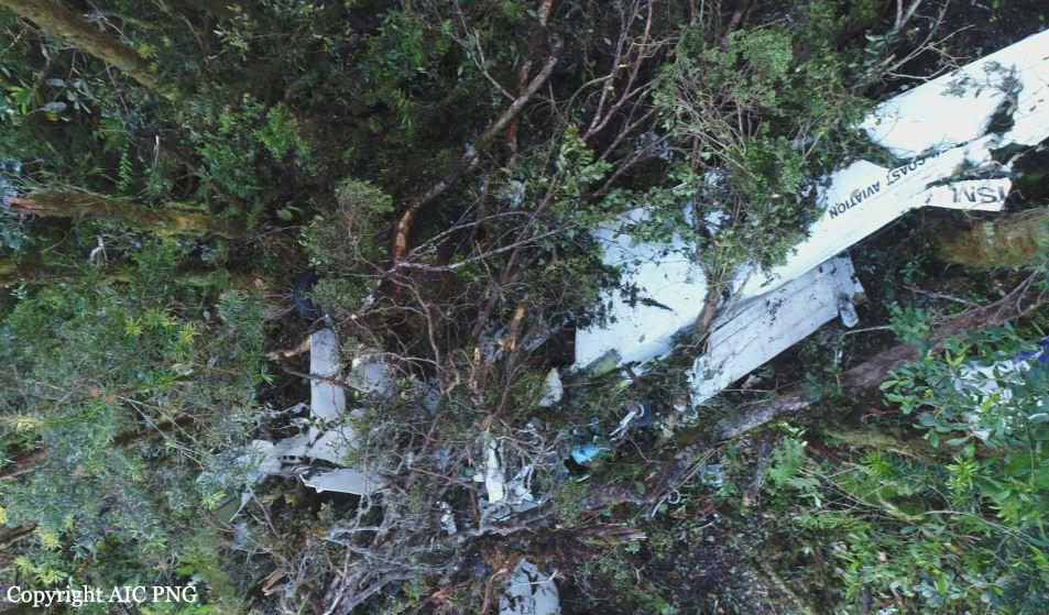
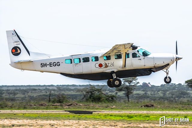
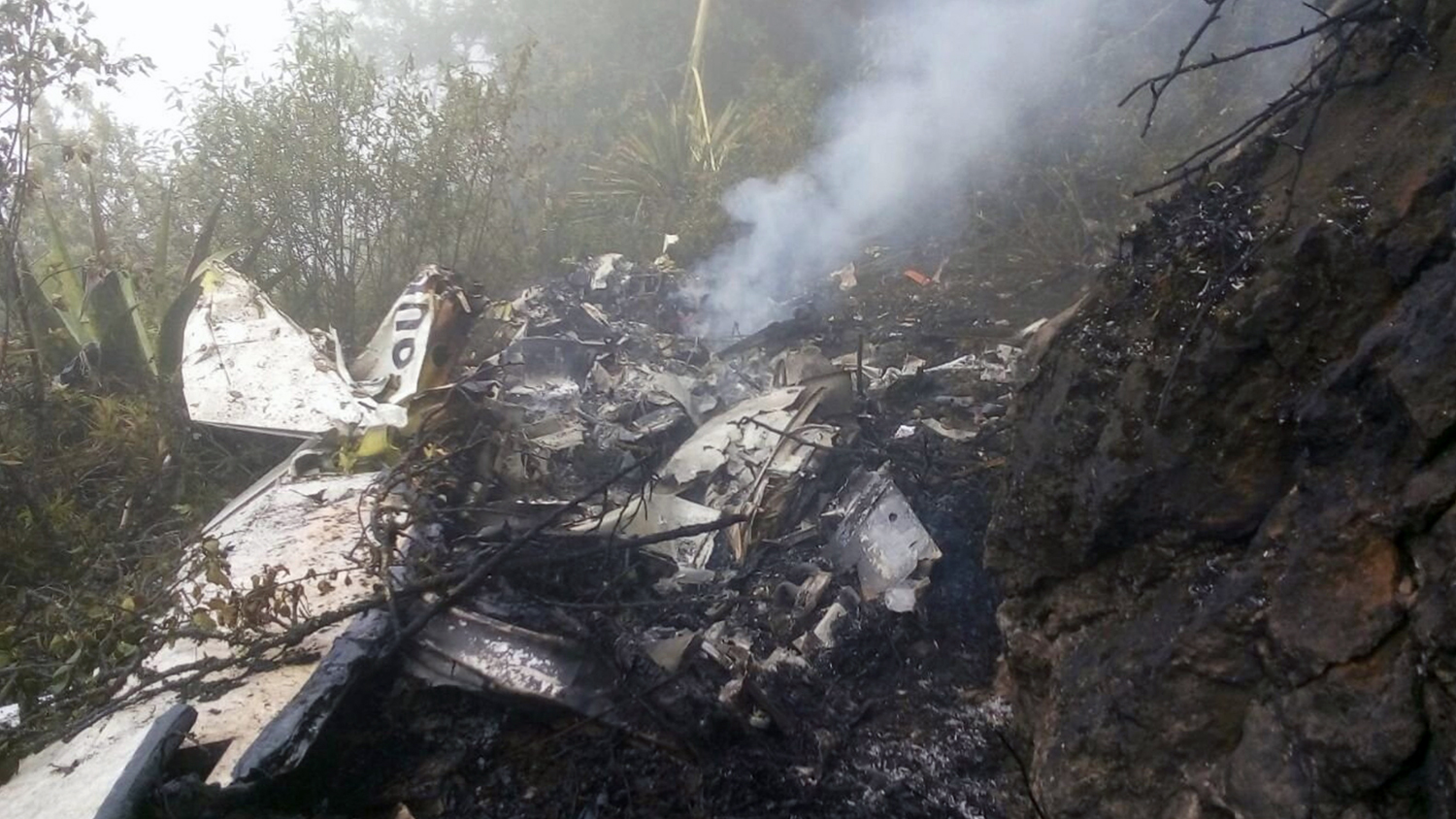
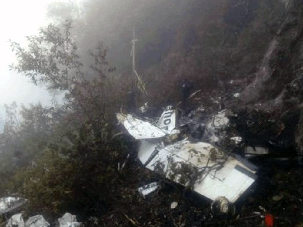
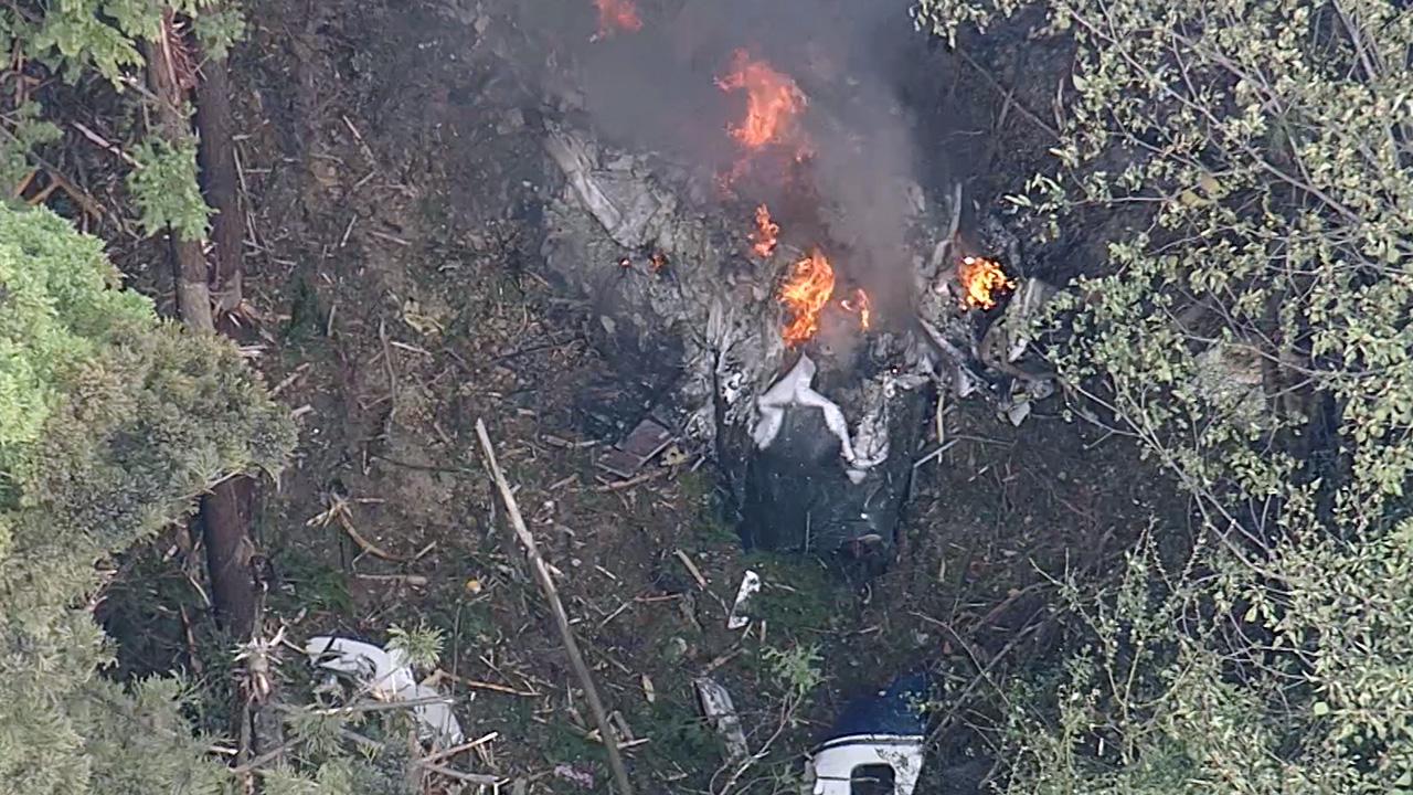
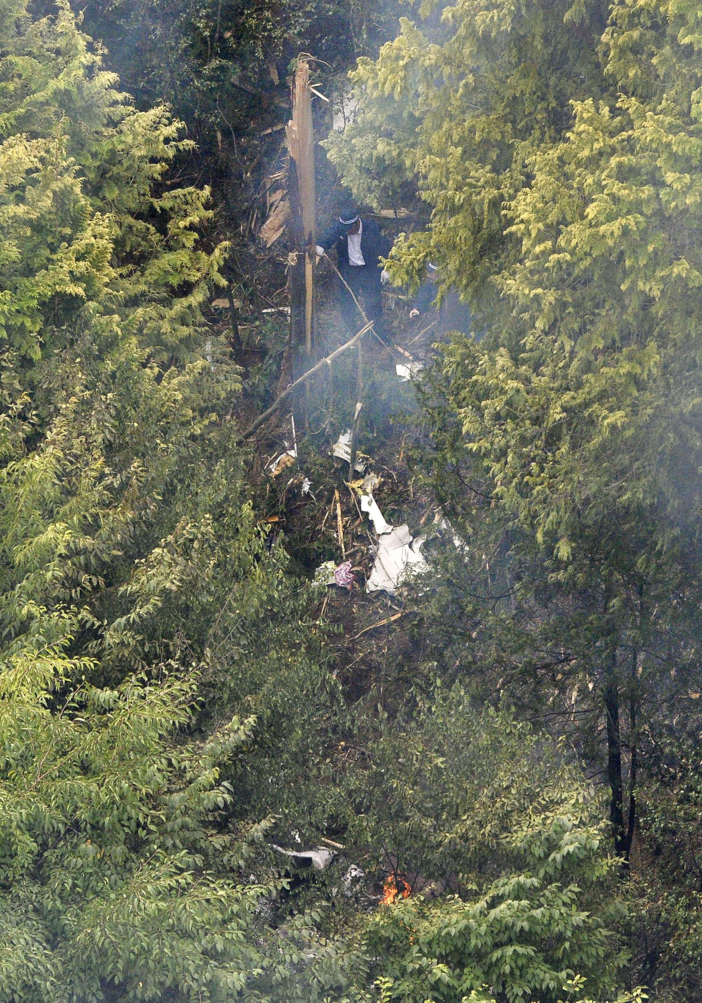
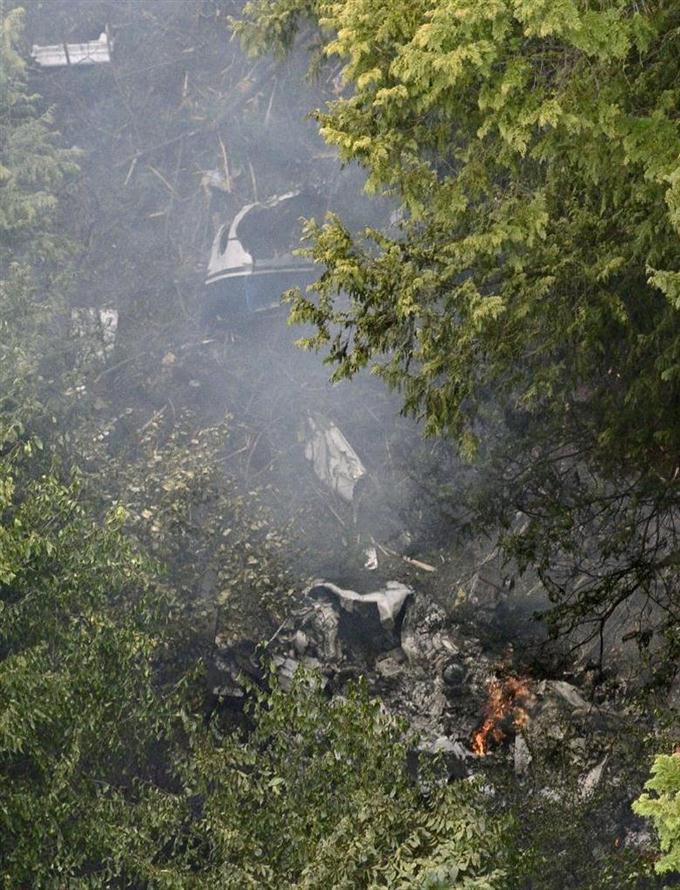
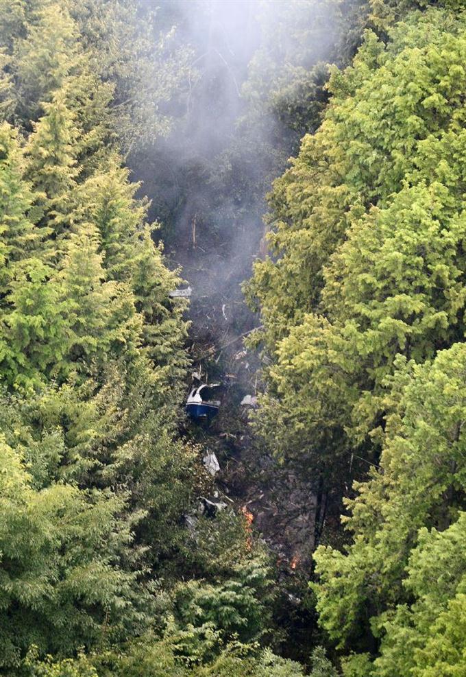
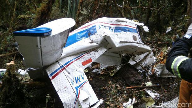
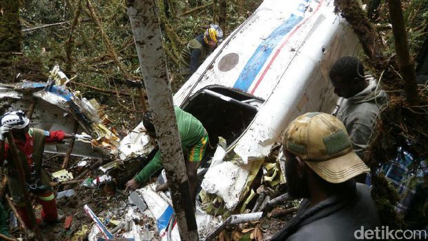
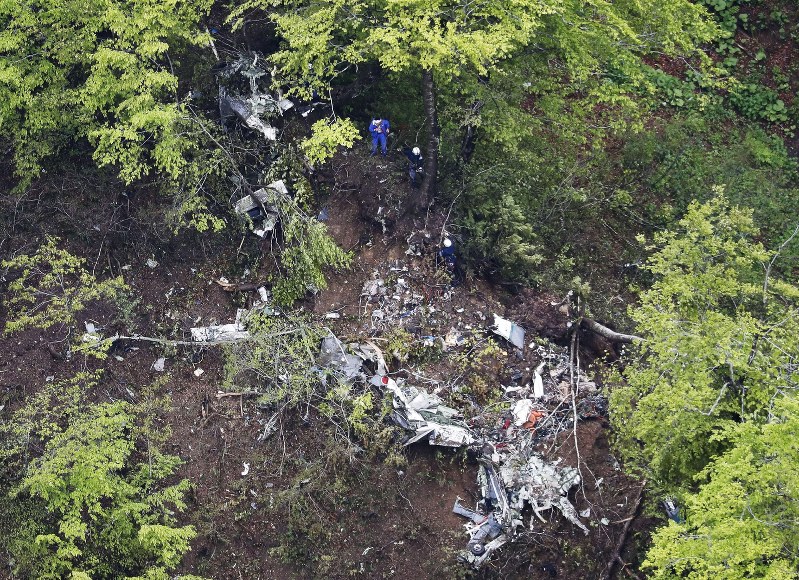
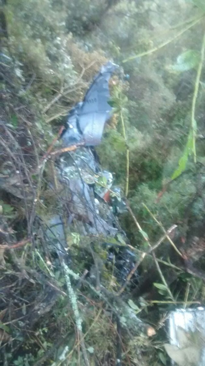
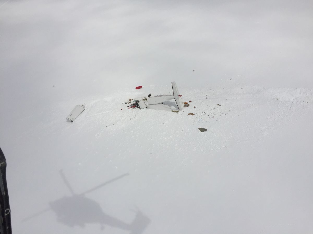
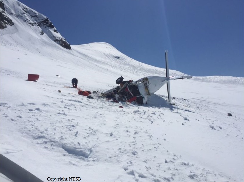
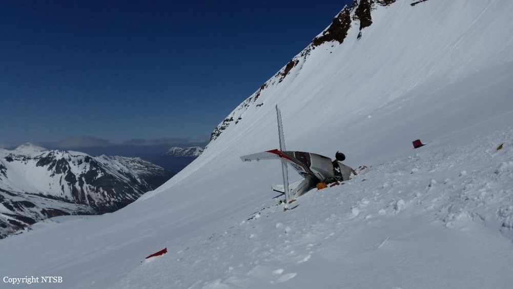
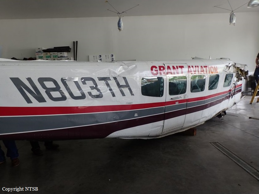
The airline transport pilot was conducting a commercial visual flight rules (VFR) flight. A passenger who was on the first segment stated that the pilot flew the airplane lower than usual for that route, and that the airplane flew through clouds during the flight. The passenger disembarked and the pilot departed on the second segment of the flight with a load of mail. The route included flight across a peninsula of mountainous terrain to a remote coastal airport that lacked official weather reporting or instrument approach procedures. About 28 minutes after departure, an emergency locator transmitter (ELT) signal from the airplane was received and a search and rescue operation was initiated. The wreckage was located about 24 miles from the destination in deep snow on the side of a steep, featureless mountain at an elevation about 3,000 ft mean sea level. The accident site displayed signatures consistent with impact during a left turn. Examination of the airplane revealed no evidence of mechanical malfunctions or anomalies that would have precluded normal operation. The airplane was not equipped with any recording or flight tracking devices, nor was it required to be; therefore, the airplane's flight track before the accident could not be determined. The airplane was certified for instrument flight and flight in icing conditions and was equipped with a terrain avoidance warning system (TAWS) which was not inhibited during the accident. Although the TAWS should have provided the pilot with alerts as the airplane neared the terrain, it could not be determined if this occurred or if the pilot heeded the alerts. A review of nearby weather camera images revealed complete mountain obscuration conditions with likely rain shower activity in the vicinity of the accident site. Visible and infrared satellite imagery indicated overcast cloud cover over the accident site at the time of the accident. The graphical forecast products that were available to the pilot before the flight indicated marginal VFR conditions for the entire route. There was no evidence that the pilot obtained an official weather briefing, and what weather information he may have accessed before the flight could not be determined. Additionally, the cloud conditions and snow-covered terrain present in the area likely resulted in flat light conditions, which would have hindered the pilot's ability to perceive terrain features and closure rates. Based on the weather camera, surface, and upper air observations, it is likely that the pilot encountered instrument meteorological conditions inflight, after which he performed a left turn to return to visual meteorological conditions and did not recognize his proximity to the mountain due to the flat light conditions. The pilot and the dispatch agent signed a company flight risk assessment form before the flight, which showed that the weather conditions for the flight were within the company's acceptable risk parameters. Although the village agents at the departure and destination airports stated that the weather at those coastal locations was good, the weather assessment for the accident flight was based on hours-old observations provided by a village agent who was not trained in weather observation and did not include en route weather information, the area forecast, or the AIRMET for mountain obscuration effective during the dispatch time and at the time of the accident. Since acquiring the accident route from another operator years earlier, the company had not performed a risk assessment of the route and its associated hazards. Multiple company pilots described the accident route of flight as hazardous and considered it an undesirable route due to the terrain, rapidly changing weather, and lack of weather reporting infrastructure; however, the company did not address or attempt to mitigate these known hazards through its risk assessment processes. The company's controlled-flight-into-terrain (CFIT)-avoidance program stated that each pilot shall have one classroom training session and one CFIT-avoidance training session in an aviation training device (ATD) each year; however, the pilot's training records indicated that his most recent ATD session was 15 months prior. More recent CFIT avoidance training may have resulted in the pilot recognizing and responding to the reduced visibility and flat light conditions sooner.
Probable cause:
The pilot's continued visual flight rules flight into an area of mountainous terrain and instrument meteorological conditions, which resulted in controlled flight into terrain (CFIT). Contributing to the accident was the company's failure to provide the pilot with CFIT-avoidance recurrent simulator training as required by their CFIT avoidance program and the company's inadequate flight risk assessment processes, which did not account for the known weather hazards relevant to the accident route of flight.
Final Report:

Crash of an Antonov AN-26 near San Cristóbal: 8 killed

Date & Time: Apr 29, 2017
Type of aircraft:
Operator:
Registration:
CU-T1406
Flight Phase:
Flight Type:
Survivors:
No
Site:
Schedule:
Playa Baracoa - Playa Baracoa
MSN:
135 02
YOM:
1985
Flight number:
FAR1436
Country:
Crew on board:
8
Crew fatalities:
Pax on board:
0
Pax fatalities:
Other fatalities:
Total fatalities:
8
Circumstances:
The airplane departed Playa Baracoa Airport at 0638LT on a training flight and continued to the southwest. En route, it impacted the slope of Mt Loma de la Pimienta located about six km north of San Cristóbal, province of Artemisa. The aircraft was destroyed and all eight crew members were killed. Owned by Aerogaviota, the airplane was operated by the Cuban Air Force (Fuerzas Armadas Revolucionarias) under flight code FAR1436.