Crash of a Piper PA-46-350P Malibu Mirage on Mt Lakit: 1 killed

Date & Time: Oct 17, 1999 at 2025 LT
Registration:
N90D
Flight Phase:
Flight Type:
Survivors:
No
Site:
Schedule:
Lynn Lake – Cranbrook – Spokane
MSN:
46-22086
YOM:
1989
Country:
Crew on board:
1
Crew fatalities:
Pax on board:
0
Pax fatalities:
Other fatalities:
Total fatalities:
1
Circumstances:
On October 17, 1999, about 20:25 Mountain Daylight Time, a Piper PA-46-350P, N90D, was substantially damaged while descending to the Cranbrook Airport (CYXC), Cranbrook, British Columbia. The certificated airline transport pilot was fatally injured. Night visual meteorological conditions prevailed, and an instrument flight rules (IFR) flight plan was filed for the flight that originated near Lynn Lake (CYYL), Manitoba. The ferry flight was conducted under Canadian flight rules. According to a Transportation Safety Board of Canada Investigator, the airplane was being ferried from England to Spokane, Washington. At the last departure point, CYYL, the airplane was refueled and the pilot filed an IFR flight plan. During the flight, the pilot was in contact with Vancouver Area Control Center. While approaching CYXC, the pilot contacted Cranbrook Flight Service Station (FSS) and was provided the latest airport information. The pilot did not report any difficulties with the airplane or flight at that time. The pilot's last transmission with the FSS was about 10 miles from the airport. After attempting to contact the airplane, FSS contacted the Rescue Coordination Center, and notified them that the airplane was overdue. An emergency locator transmitter signal was received about 21:55, but the airplane was not found until the following morning. The airplane was located on the eastern side of Lakit Mountain at the 6,500-foot level, 9 miles northeast of CYXC. The weather reported by CYXC, at 20:00 was, wind from 300 degrees at 4 knots, scattered clouds at 10,000 feet, and a broken cloud layer at 24,000 feet. The pilot (sole person on board) was killed.
Probable cause:
Controlled flight into terrain.

Crash of a Piper PA-31-350 Navajo Chieftain on Gass Peak: 1 killed

Date & Time: Oct 14, 1999 at 1946 LT
Operator:
Registration:
N1024B
Flight Phase:
Flight Type:
Survivors:
No
Site:
Schedule:
North Las Vegas – Sacramento
MSN:
31-7652107
YOM:
1976
Flight number:
AMF121
Crew on board:
1
Crew fatalities:
Pax on board:
0
Pax fatalities:
Other fatalities:
Total fatalities:
1
Captain / Total flying hours:
2103
Captain / Total hours on type:
250.00
Aircraft flight hours:
14048
Circumstances:
The airplane collided with mountainous terrain during climb to cruise on a night departure. The pilot of the on-demand cargo flight was brought in off reserve to replace the scheduled pilot who was ill. The flight was behind schedule because the cargo was late. When the instrument flight release created further delay, the pilot opted to depart into the clear, dark night under visual flight rules (VFR) with the intention of picking up his instrument clearance when airborne. When clearing the flight for takeoff, the tower controller issued a suggested heading of 340 degrees, which headed the aircraft toward mountainous terrain 11 miles north of the airport. The purpose of the suggested heading was never stated to the pilot as required by FAA Order 7110.65L. After a frequency change to radar departure control, the controller asked the pilot 'are you direct [the initial (route) fix] at this time?' and the pilot replied, 'we can go ahead and we'll go direct [the initial fix].' A turn toward the initial fix would have headed the aircraft away from high terrain. The controller then diverted his attention to servicing another VFR aircraft and the accident aircraft continued to fly heading 340 degrees until impacting the mountain. ATC personnel said the 340-degree heading was routinely issued to departing aircraft to avoid them entering Class B airspace 3 miles from the airport. The approach control supervisor said this flight departs daily, often VFR, and routinely turns toward the initial fix, avoiding mountainous terrain. When the pilot said that he would go to the initial fix, the controller expected him to turn away from the terrain. Minimum Safe Altitude Warning (MSAW) was not enabled for the flight because the original, instrument flight plan did not route the aircraft through this approach control's airspace and the controller had not had time to manually enter the flight data. High terrain was not displayed on the controller's radar display and no safety alert was issued.
Probable cause:
The failure of the pilot-in-command to maintain separation from terrain while operating under visual flight rules. Contributing factors were the improper issuance of a suggested heading by air traffic control personnel, inadequate flight progress monitoring by radar departure control personnel, and failure of the radar controller to identify a hazardous condition and issue a safety alert.
Final Report:

Crash of a Piper PA-31-350 Navajo Chieftain on Mt Mauna Loa: 10 killed

Date & Time: Sep 25, 1999 at 1726 LT
Operator:
Registration:
N411WL
Flight Phase:
Survivors:
No
Site:
Schedule:
Kona - Kona
MSN:
31-8352039
YOM:
1983
Flight number:
BIA058
Crew on board:
1
Crew fatalities:
Pax on board:
9
Pax fatalities:
Other fatalities:
Total fatalities:
10
Captain / Total flying hours:
11500
Aircraft flight hours:
4523
Circumstances:
On September 25, 1999, about 1726 Hawaiian standard time, Big Island Air flight 58, a Piper PA-31-350 (Chieftain), N411WL, crashed on the northeast slope of the Mauna Loa volcano near Volcano, Hawaii. The pilot and all nine passengers on board were killed, and the airplane was destroyed by impact forces and a postimpact fire. The sightseeing tour flight was operating under 14 Code of Federal Regulations Part 135 as an on-demand air taxi operation. A visual flight rules flight plan was filed, and visual meteorological conditions existed at the Keahole-Kona International Airport, Kona, Hawaii, from which the airplane departed about 1622. The investigation determined that instrument meteorological conditions prevailed in the vicinity of the accident site.
Probable cause:
The pilot's decision to continue visual flight into instrument meteorological conditions (IMC) in an area of cloud-covered mountainous terrain. Contributing to the accident were the pilot's failure to properly navigate and his disregard for standard operating procedures, including flying into IMC while on a visual flight rules flight plan and failure to obtain a current preflight weather briefing.
Final Report:

Crash of a Lockheed C-130A Hercules on Mt La Paila: 5 killed

Date & Time: Sep 17, 1999
Type of aircraft:
Operator:
Registration:
3610
Flight Phase:
Flight Type:
Survivors:
No
Site:
Schedule:
Santa Lucía AFB - Santa Lucía AFB
MSN:
3217
YOM:
1959
Country:
Crew on board:
5
Crew fatalities:
Pax on board:
0
Pax fatalities:
Other fatalities:
Total fatalities:
5
Circumstances:
The four engine aircraft departed Santa Lucía AFB on a local training flight. While flying in clouds, the aircraft struck the slope of Mt La Paila (2,865 metres high) located about 57 km northeast of the airbase. All five crew members were killed.
Probable cause:
Controlled flight into terrain.

Crash of an Avro 748-501-2B in Kathmandu: 15 killed

Date & Time: Sep 5, 1999 at 1030 LT
Type of aircraft:
Operator:
Registration:
9N-AEG
Survivors:
No
Site:
Schedule:
Pokhara - Kathmandu
MSN:
1806
YOM:
1988
Flight number:
3Z104
Country:
Region:
Crew on board:
5
Crew fatalities:
Pax on board:
10
Pax fatalities:
Other fatalities:
Total fatalities:
15
Circumstances:
On approach to Kathmandu-Tribhuvan Airport under VFR mode, the crew encountered limited visibility due to a low cloud layer. On final, at an altitude of about 6,000 feet, the aircraft collided with a radio antenna (100 feet high) located on the top of a hill and owned by the Nepalese National Broadcasting Company. The aircraft went out of control and crashed seven km short of runway 02. All 15 occupants.
Probable cause:
Collision with obstacle on a VFR approach in limited visibility.

Crash of a Cessna 404 Titan II on Mt Meru: 12 killed

Date & Time: Sep 1, 1999 at 1026 LT
Type of aircraft:
Operator:
Registration:
5H-NAT
Flight Phase:
Survivors:
No
Site:
Schedule:
Seronera Lodge - Kilimanjaro
MSN:
404-0805
YOM:
1981
Country:
Region:
Crew on board:
1
Crew fatalities:
Pax on board:
11
Pax fatalities:
Other fatalities:
Total fatalities:
12
Captain / Total flying hours:
16500
Captain / Total hours on type:
2000.00
Circumstances:
Two Cessna 404 Titan II operated by Northern Air departed Seronera Lodge in the mid morning on a charter flight to Kilimanjaro Airport, carrying a total of 18 US tourists and two pilots (7 passengers and one pilot in the first aircraft and 11 passengers and one pilot in the second aircraft). The passengers should be later transferred from Kilimanjaro to Nairobi with an Air Kenya aircraft. After takeoff, the pilot in the first Cessna warned the second pilot about the lack of visibility in the area. While cruising in marginal weather conditions at an altitude of 8,770 feet, the second aircraft struck the southern slope of Mt Meru (4,565 metres high). The wreckage was found the following day at an altitude of 2,833 metres. The aircraft was destroyed by impact forces and all 12 occupants were killed.
Probable cause:
Controlled flight into terrain after the pilot failed to maintain the minimum safe altitude for the area of Mt Meru. It was determined that the pilot informed his colleague he wanted to maintain FL110 at a distance of 53 km from the first beacon but for unknown reasons, he was maintaining an insufficient altitude of 9,500 feet at a distance of 45 km from the first beacon. Investigations were unable to determine the reason why the pilot was unable to maintain the minimum safe altitude. Poor weather conditions with low clouds and drizzle was a contributing factor.
Final Report:

Crash of a Dornier DO228-201 on Santo Antão Island: 18 killed

Date & Time: Aug 7, 1999 at 1202 LT
Type of aircraft:
Registration:
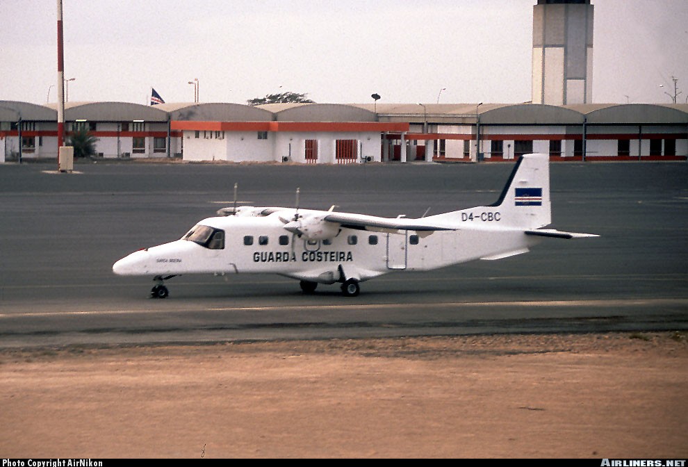
D4-CBC
Flight Phase:
Survivors:
No
Site:
Schedule:
São Pedro – Ponta do Sol
MSN:
8091
YOM:
1986
Flight number:
VR5002
Country:
Region:
Crew on board:
2
Crew fatalities:
Pax on board:
16
Pax fatalities:
Other fatalities:
Total fatalities:
18
Circumstances:
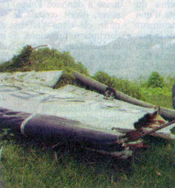
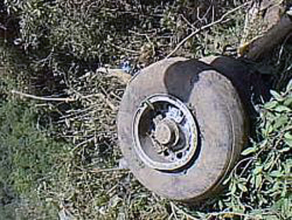
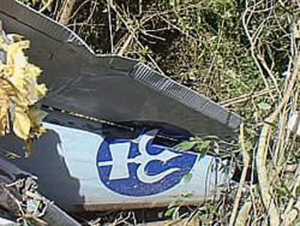
The schedule service from São Pedro to Ponta do Sol was normally operated by a Twin Otter from TACV - Transportes Aéreos de Cabo Verde. As the aircraft was unserviceable due to technical problems, TACV leased the Dornier DO228 from the Cabo Verde Coast Guards (Guarda Costeira de Cabo Verde). The aircraft departed São Pedro Airport on a 13 minutes flight to Ponta do Sol-Agostinho Neto Airport located on the north coast of the Santo Antão Island. While approaching the destination, the crew was informed about the poor weather conditions. Because the visibility was below minimums, the crew decided to return to São Pedro Airport. Few minutes later, while cruising in limited visibility due to rain falls, the aircraft struck the slope of a mountain located in the center of the Santo Antão Island. The aircraft was destroyed and all 18 occupants were killed, among them three Austrian and two French citizens.
Probable cause:
Controlled flight into terrain after the crew descended below the minimum safe altitude in IMC conditions.

Crash of a Beechcraft C90 King Air near Mankayan: 8 killed

Date & Time: Jul 28, 1999 at 0645 LT
Type of aircraft:
Operator:
Registration:
RP-C990
Flight Phase:
Survivors:
No
Site:
Schedule:
Poro Point – Mankayan
MSN:
LJ-247
YOM:
1967
Country:
Region:
Crew on board:
2
Crew fatalities:
Pax on board:
6
Pax fatalities:
Other fatalities:
Total fatalities:
8
Circumstances:
While descending to Mankayan Airport on a flight from Poro Point, the crew encountered poor weather conditions with rain falls and limited visibility. The crew just requested the last weather bulletin for Mankayan when the aircraft struck the slope of a mountain and crashed about 20 km from Mankayan. All eight occupants were killed.
Probable cause:
Controlled flight into terrain after the crew descended below the minimum prescribed altitude in IMC conditions.

Crash of an Embraer EMB-110P1 Bandeirante near Nasirotu: 17 killed

Date & Time: Jul 24, 1999 at 0533 LT
Operator:
Registration:
DQ-AFN
Flight Phase:
Survivors:
No
Site:
Schedule:
Nausori - Nadi
MSN:
110-416
YOM:
1983
Flight number:
PC121
Country:
Region:
Crew on board:
2
Crew fatalities:
Pax on board:
15
Pax fatalities:
Other fatalities:
Total fatalities:
17
Aircraft flight hours:
13563
Aircraft flight cycles:
22411
Circumstances:
The twin engine aircraft departed Suva-Nausori Airport at 0525LT on a regular schedule service (flight PC121) to Nadi, carrying 15 passengers and two pilots. The crew continued to climb via route 28 Golf in relative good weather conditions. At 0532LT, the pilot reported 5,500 feet 22,4 km from the airport. One minute later, he reported at 6,000 feet when the aircraft disappeared from radar screens, eight minutes after takeoff. The wreckage was found at an altitude of 540 metres in a wooded an mountainous area located in the Mataicicia Mountain Range, 35,2 km west of Nausori Airport, south of the village of Nasirotu. The aircraft was totally destroyed by impact forces and all 17 occupants were killed, among them nine Fidjians, five Australians, one New Zealander, one Chinese and one Japanese.
Probable cause:
The following findings were identified:
- The wreckage was found 3 km south of the intended route,
- The aircraft struck a tall tree with its right wing 390 metres above ground, flew for another 1,300 metres then crashed,
- The minimum safe altitude for the area is 5,400 feet,
- No technical anomalies were found on the aircraft,
- Investigations were unable to determine the exact cause why the crew failed to comply with the minimum safe altitude,
- The captain had insufficient rest time prior to the flight and consumed an above-therapeutic level of antihistamine prior to the flight, which may have affected his capabilities to fly,
- The operator's published standard operating procedures for the Embraer Bandeirante aircraft were inadequate,
- Weather conditions were considered as good with a 40 km visibility, scattered clouds at 2,200 feet and no wind,
- The total weight of the aircraft was just below the MTOW.

Crash of a De Havilland RC-7B on Mt Patascoy de Santa Lucía: 7 killed

Date & Time: Jul 23, 1999 at 0330 LT
Operator:
Registration:
N5382W
Flight Phase:
Survivors:
No
Site:
Schedule:
Apiay - Apiay
MSN:
95
YOM:
1982
Country:
Crew on board:
7
Crew fatalities:
Pax on board:
0
Pax fatalities:
Other fatalities:
Total fatalities:
7
Circumstances:
The crew (five US citizens and two Colombians) departed Apiay AFB near Villavicencio at 0230LT on an anti-narcotic control flight over the southern part of Colombia and along the border with Ecuador. About an hour into the flight, while cruising at an altitude of 7,000 feet in limited visibility, the four engine aircraft struck the slope of Mt Patascoy de Santa Lucía (3,923 meters high) located about 35 km southeast of San Juan de Pasto. The wreckage was found five days later at an altitude of 2,100 metres. The aircraft was destroyed and all seven occupants were killed.
Probable cause:
Controlled flight into terrain due to navigational errors on part of the flying crew. The following contributing factors were identified:
- The crew input wrong settings in the Flight Management System, causing the aircraft to deviate from the initial prescribed route and to fly over a mountainous area,
- The crew was relatively inexperienced,
- Crew complacency,
- Lack of visibility due to the night,
- Lack of ground visual references,
- Crew fatigue due to an insufficient rest time.