Crash of a Grumman S-2E Tracker in Hopland: 1 killed

Date & Time: Aug 27, 2001 at 1840 LT
Type of aircraft:
Operator:
Registration:
N442DF
Flight Phase:
Flight Type:
Survivors:
No
Site:
Schedule:
Ukiah - Ukiah
MSN:
255
YOM:
1952
Flight number:
Tanker 92
Crew on board:
1
Crew fatalities:
Pax on board:
0
Pax fatalities:
Other fatalities:
Total fatalities:
1
Captain / Total flying hours:
12725
Captain / Total hours on type:
340.00
Aircraft flight hours:
9868
Circumstances:
During an aerial fire suppression mission for the California Department of Forestry (CDF), two Grumman TS-2A airplanes, operating as Tanker 92 (N442DF) and Tanker 87 (N450DF), collided in flight while in a holding pattern awaiting a retardant drop assignment on the fire. All of the airplanes fighting the fire were TS-2A's, painted in identical paint schemes. The Air Tactical Group Supervisor (AirTac) was orbiting clockwise 1,000 feet above the tankers, who were in a counterclockwise orbit at 3,000 feet mean sea level (msl). The pilots of both aircraft involved in the collision had previously made several drops on the fire. Records from the Air Tac show that Tankers 86, 91, and 92 were in orbit, and investigation found that Tanker 87 was inbound to enter the orbit after reloading at a nearby airport base. AirTac would write down the tanker numbers as they made their 3-minutes-out call, and usually ordered their drops in the same order as their check-in. The AirTac's log recorded the sequence 86, 91, 21, and 92. The log did not contain an entry for Tanker 87. Other pilots on frequency did not recall hearing Tanker 87 check in. Based on clock codes with 12-o'clock being north, the tankers were in the following approximate positions of the orbit when the collision occurred. Tanker 92 was at the 2-o'clock position; Tanker 86 was turning in at the 5-o'clock position; and Tanker 91 was in the 7-o'clock position. The AirTac's log indicated that Tanker 92 was going to move up in sequence and follow Tanker 86 in order to drop immediately after him. Post accident examination determined that Tanker 92's flaps were down, indicating that the pilot had configured the airplane for a drop. Tanker 92 swung out of the orbit wide (in an area where ground witnesses had not seen tankers all day) to move behind Tanker 86, and the pilot would likely have been focusing on Tanker 86 out of his left side window. Tanker 87 was on line direct to the center of the fire on a path that witnesses had not observed tankers use that day. Reconstruction of the positions of the airplanes disclosed that Tankers 86 and 91 would have been directly in front of Tanker 87, and Tanker 92 would have been wide to his left. Ground witnesses said that Tanker 87 had cleared a ridgeline just prior to the collision, and this ridgeline could have masked both collision aircraft from the visual perspective of the respective pilots. The right propeller, engine, and cockpit of Tanker 92 contacted and separated the empennage of Tanker 87. The propeller chop was about 47 degrees counterclockwise to the longitudinal axis of Tanker 87 as viewed from the top. The collision appeared to have occurred about 2,500 feet, which was below orbit altitude. CDF had no standard operating manual, no established reporting or entry point for the holding orbits, and a tanker could enter any point of the orbit from any direction. While no standardized procedures were encoded in an operating manual, a CDF training syllabus noted that a tanker was not to enter an orbit until establishing positive radio contact with the AirTac. The entering tanker would approach 1,000 feet below AirTac's altitude and stay in a left orbit that was similar to a salad bowl, high and wide enough to see and clear all other tankers until locating the tanker that it was to follow, then adjust speed and altitude to fall in behind the preceding airplane.
Probable cause:
The failure of both pilots to maintain an adequate visual lookout. The failure of the pilot in Tanker 87 to comply with suggested procedures regarding positive radio contact and orbit entry was a factor.
Final Report:

Crash of a Piper PA-46-350P Malibu Mirage in Black Mountain: 1 killed

Date & Time: Jul 21, 2001 at 1707 LT
Registration:
N396PM
Flight Phase:
Flight Type:
Survivors:
No
Site:
Schedule:
Asheville – Burnsville
MSN:
46-36024
YOM:
1996
Crew on board:
1
Crew fatalities:
Pax on board:
0
Pax fatalities:
Other fatalities:
Total fatalities:
1
Captain / Total flying hours:
2555
Captain / Total hours on type:
127.00
Aircraft flight hours:
709
Circumstances:
The pilot had left the airplane at Asheville on the day before the accident due to low cloud ceilings and visibility at Mountain Air Airport, his destination, and completed the trip by rental car. On the day of the accident the pilot returned the rental car and at 1656 departed Asheville in N396PM, enroute to Mountain Air Airport, 27 miles north of Asheville. The last radio contact with the pilot was at 1701:44, when the pilot told controllers at Asheville that he was in visual flight rule conditions, at 4,000 feet. The last radar contact with the flight was by FAA Atlanta Center, at 1704:00, when the flight was about 5 miles south of the accident site at 3,800 feet. The flight did not arrive at the destination, an emergency locator transmitter signal was received by satellite, and search and rescue operations were begun. The pilot and the wreckage of the airplane was located the next day about 1400. The airplane had collided with 75-foot tall trees, at about the 4,800-foot msl level on the side of Bullhead Mountain, while in a wings level attitude, while on a 170 degree heading. After the initial impact the airplane continued for another 300 feet, causing general breakup of the airplane. The main wreckage came to rest on a northerly heading. All components of the airplane were located at the crash site and there was no evidence of precrash failure or malfunction of the airplane structure, flight controls, airplane systems, engine, or propeller. A witness reported that the weather near the time of the accident on the Blue Ridge Parkway, located about 3/4 mile to the west of the crash site, was very foggy. Satellite images show clouds were present at the crash site and the Asheville airport, located 20 miles south-southwest of the crash site, reported overcast clouds 2,600 feet agl or 4,765 feet msl, and visibility 4 miles in haze, at the time of the accident. An Airmet for mountain obscuration due to clouds, mist, and haze was in effect at the time the pilot departed and the at the time of the accident. No record to show that the pilot received a weather briefing from a FAA Flight Service Station was found.
Probable cause:
The pilot's continued VFR flight into IMC conditions resulting in the airplane colliding with mountainous terrain.
Final Report:

Crash of a Yakovlev Yak-40 near Sari: 30 killed

Date & Time: May 17, 2001 at 0745 LT
Type of aircraft:
Operator:
Registration:
EP-TQP
Survivors:
No
Site:
Schedule:
Tehran - Gorgan
MSN:
9 74 08 56
YOM:
1977
Location:
Country:
Region:
Crew on board:
5
Crew fatalities:
Pax on board:
25
Pax fatalities:
Other fatalities:
Total fatalities:
30
Aircraft flight hours:
11156
Aircraft flight cycles:
6706
Circumstances:
The three engine aircraft departed Tehran-Mehrabad Airport at 0645LT on a charter flight to Gorgan, carrying members of the parliament and government who were flying to Gorgan to inaugurate the new airport. En route, the crew was informed by ATC about the deterioration of the weather conditions at destination and was instructed to divert to Sari Airport. While descending to Sari in marginal weather conditions, the crew failed to realize his altitude was too low when the aircraft struck the slope of a mountain located about 20 km south of the airport. The aircraft disintegrated on impact and all 30 occupants were killed. Among the passengers were Rahman Dadman, Iranian Minister of Transport and two vice-ministers.
Probable cause:
Controlled flight into terrain while descending in stormy weather below the MDA.

Crash of a Cessna 404 Titan II near Pena Pobre: 1 killed

Date & Time: May 13, 2001 at 1933 LT
Type of aircraft:
Operator:
Registration:
N404BA
Flight Phase:
Flight Type:
Survivors:
No
Site:
Schedule:
Christiansted – San Juan
MSN:
404-0237
YOM:
1978
Country:
Crew on board:
1
Crew fatalities:
Pax on board:
0
Pax fatalities:
Other fatalities:
Total fatalities:
1
Captain / Total flying hours:
1000
Captain / Total hours on type:
103.00
Aircraft flight hours:
12000
Circumstances:
The flight was being handled as a VFR aircraft by air traffic control, was given a discreet transponder code, and was radar contact at an altitude of 4,500 feet. The pilot requested a VFR descent from 4,500 feet, and was cleared to "…descend unrestricted west bound." Radar and radio contact were lost at an altitude of 2,700 feet. The controller tried to re-establish radio contact with the airplane's pilot 10 times before initiating search and rescue efforts. A U.S. Coast Guard helicopter found the wreckage, using the aircraft's emergency locator transmitter. The next day a ground search for the aircraft was halted because of hazardous terrain. Search and rescue personnel had to be airlifted into the crash site to remove the victim. A police helicopter was vectored to the crash site by ATC about an 1 1/2 hours after contact was lost with the flight, and the pilot reported that he could not fly near the crash site because of fog. He reported the ceiling about 2,400 feet. The aircraft impacted in heavily wooded, mountainous terrain at the 2,700-foot level of a 3,524-foot mountain. Toxicology test showed that venlafaxine and desmethylvenlafaxine drugs were found in the pilot's blood, and the levels found were consistent with the recent ingestion of more than 10 times a normal dose of venlafaxine.
Probable cause:
Failure of the pilot-in-command to maintain altitude/clearance, resulting in an in-flight collision with rising terrain.
Final Report:

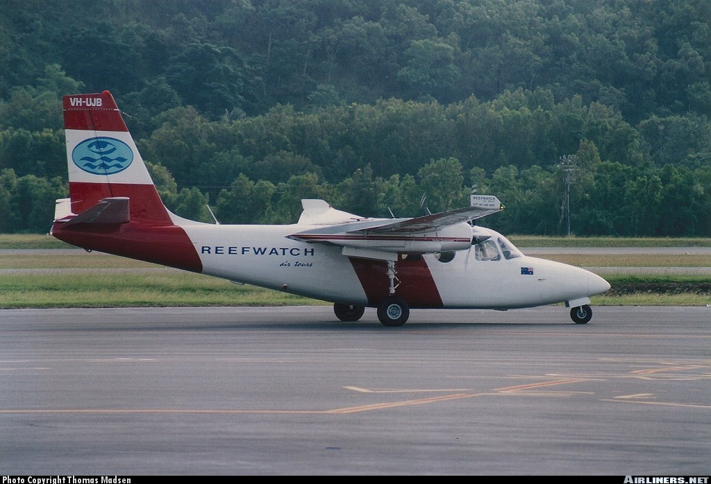
Crash of a Rockwell Shrike Commander 500S on Thornton Peak: 4 killed

Date & Time: Apr 10, 2001 at 0725 LT
Operator:
Registration:
VH-UJB
Flight Phase:
Survivors:
No
Site:
Schedule:
Cairns - Hicks Island
MSN:
500-3152
YOM:
1973
Country:
Region:
Crew on board:
1
Crew fatalities:
Pax on board:
3
Pax fatalities:
Other fatalities:
Total fatalities:
4
Captain / Total flying hours:
9680
Captain / Total hours on type:
2402.00
Circumstances:
The aircraft departed Cairns airport at 0707 Eastern Standard Time (EST) on a charter flight to Hicks Island. The aircraft was being operated under the Instrument Flight Rules (IFR) and the expected flight time was 2 hours. Shortly after takeoff the pilot requested an amended altitude of 4,000 ft. He indicated that he was able to continue flight with visual reference to the ground or water. Air Traffic Services (ATS) issued the amended altitude as requested. The IFR Lowest Safe Altitude for the initial route sector to be flown was 6,000 ft Above Mean Sea Level (AMSL). Data recorded by ATS indicated that approximately 13 minutes after departure, the aircraft disappeared from radar at a position 46NM north of Cairns. At the last known radar position the aircraft was cruising at a ground speed of 180 kts and at an altitude of 4,000 ft AMSL. An extensive search located the wreckage the following afternoon at a location consistent with the last known radar position, on the north-western side of Thornton Peak at an altitude of approximately 4,000 ft (1219 metres) AMSL. The aircraft was destroyed by impact forces and post-impact fire. The pilot and three passengers received fatal injuries. Thornton Peak is the third highest mountain in Queensland and is marked on topographic maps as 4,507 ft (1,374 metres) in elevation. Local residents reported that the mountain was covered by cloud and swept by strong winds for most of the year. The aircraft had been observed by witnesses approximately two minutes prior to impact cruising at high speed, on a constant north-westerly heading, in a wings level attitude and with flaps and landing gear retracted. They stated that the engines appeared to sound normal.
Probable cause:
Radar data recorded by Air Traffic Services and witness reports indicated that the aircraft was flying straight and level and maintaining a constant airspeed. Therefore, it is unlikely that the aircraft was experiencing any instrumentation or engine problems. Why the pilot continued flight into marginal weather conditions at an altitude that was insufficient to ensure terrain clearance, could not be established. The aircraft was flown at an altitude that was insufficient to ensure terrain clearance.
Final Report:

Crash of a Beechcraft 1900C-1 in Lubango: 16 killed

Date & Time: Mar 17, 2001 at 0823 LT
Type of aircraft:
Operator:
Registration:
S9-CAE
Survivors:
Yes
Site:
Schedule:
Luanda – Lubango
MSN:
UC-142
YOM:
1991
Location:
Country:
Region:
Crew on board:
2
Crew fatalities:
Pax on board:
15
Pax fatalities:
Other fatalities:
Total fatalities:
16
Circumstances:
While descending to Lubango Airport following an uneventful flight from Luanda, the crew encountered poor weather conditions with heavy rain falls and low ceiling. In such conditions, the aircraft struck the slope of a mountain located 16 km northwest of runway 10 threshold. One passenger survived while 16 other occupants were killed.
Probable cause:
A possible loss of control after the pilot-in-command suffered a spatial disorientation while descending in IMC conditions.

Crash of a Rockwell Aero Commander 500 near Puerto Plata: 7 killed

Date & Time: Jan 28, 2001 at 0815 LT
Operator:
Registration:
HI-535SP
Flight Type:
Survivors:
No
Site:
Schedule:
Santo Domingo - Puerto Plata
MSN:
500-840
YOM:
1959
Crew on board:
2
Crew fatalities:
Pax on board:
5
Pax fatalities:
Other fatalities:
Total fatalities:
7
Circumstances:
While descending to Puerto Plata Airport, the crew encountered poor weather conditions and limited visibility due to low clouds and fog. The twin engine aircraft struck the slope of Mt Loma del Toro located few km from Puerto Plata and was destroyed. All seven occupants were killed. The crew started the approach prematurely and descended too low in poor visibility.

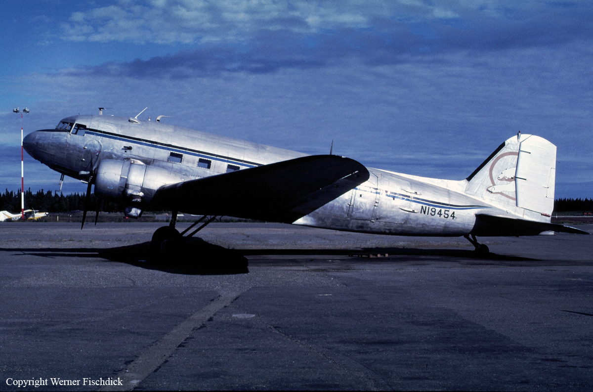
Crash of a Douglas DC-3C-S1C3G in Unalaska: 2 killed

Date & Time: Jan 23, 2001 at 2135 LT
Type of aircraft:
Registration:
N19454
Flight Phase:
Flight Type:
Survivors:
No
Site:
Schedule:
Unalaska - Anchorage
MSN:
25309
YOM:
1944
Location:
Crew on board:
2
Crew fatalities:
Pax on board:
0
Pax fatalities:
Other fatalities:
Total fatalities:
2
Captain / Total flying hours:
15000
Copilot / Total flying hours:
3000
Aircraft flight hours:
55877
Circumstances:
A Douglas DC-3 airplane departed an island runway during dark night, VFR conditions without filing a flight plan. The airplane collided with a volcanic mountain at 1,500 feet msl on the runway heading, 4.5 miles from the airport. Earlier in the day, the airplane arrived from Anchorage, Alaska, without a flight plan, having flown along the Alaska Peninsula when VFR flight was not recommended. The crew of the airplane initially planned to remain overnight on the peninsula, but the captain received a request to transport cargo to Anchorage. The airplane was loaded with cargo and fuel, and departed. The crew did not file a flight plan. The end of the departure runway is positioned at the edge of an ocean bay. Beyond the end of the runway, open water and rising volcanic island terrain are present. In the area of intended flight, no illumination of the terrain, or any ground based lighting was present. An obstacle departure procedure for the departure runway recommends a right turn at 2 DME from the runway heading, and then a climb to 7,000 feet. Forty-five minutes after departure, a fire was spotted on the side of a volcano cone, and an ELT signal was detected in the area. No company flight following procedures were found for the accident flight, and the airplane was not reported overdue until the following day. The day after the accident, the airplane wreckage was located on steep, snow-covered terrain. Due to high winds and blowing snow, a rescue team could not get to the accident site until three days after the crash. The captain was the president, the director of operations, and the sole corporate entity of the company. No current maintenance records, flight logs, or pilot logs were located for the company. In the past, the captain's pilot certificate was suspended for 45 days following an accident in a DC-3 airplane when he ran out of gas. Also, the captain's medical certificate had previously been considered for denial after serving 49 months in federal prison for cocaine distribution, but after review, the FAA issued the captain a first class medical. FAA medical records for the captain do not contain any record of monitoring for substance abuse. The first officer's medical had also been considered for denial after an episode of a loss of consciousness. After a lengthy review and an appeal to the NTSB, the FAA issued the first officer a second-class medical. The first officer was part of the flight crew when the captain ran out of gas, and she had two previous aviation accidents. A toxicological examination of the captain, conducted by the FAA, found cocaine and metabolites of cocaine. A toxicological examination of the first officer found two different prescription antidepressant drugs. The FAA prohibits narcotic and mood-altering drug use by pilots.
Probable cause:
The airplane flightcrew's failure to maintain adequate distance/altitude from mountainous terrain during a departure climb to cruise flight, and the captain's impairment from drugs. Factors in the accident were dark night conditions, and the first officer's impairment from drugs.
Final Report:

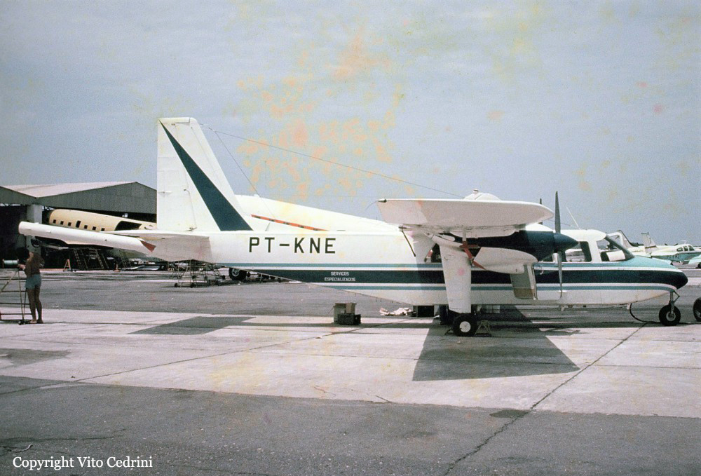
Crash of a Britten-Norman BN-2A-21 Islander near Cascalho: 3 killed

Date & Time: Jan 11, 2001 at 1440 LT
Type of aircraft:
Registration:
PT-KNE
Flight Phase:
Survivors:
No
Site:
Schedule:
Paramirim - Paramirim
MSN:
696
YOM:
1973
Location:
Country:
Crew on board:
2
Crew fatalities:
Pax on board:
1
Pax fatalities:
Other fatalities:
Total fatalities:
3
Captain / Total flying hours:
3886
Captain / Total hours on type:
3263.00
Copilot / Total flying hours:
6088
Copilot / Total hours on type:
23
Circumstances:
The twin engine aircraft departed Paramirim Airport at 1400LT on a 3-hours ore prospecting flight, carrying two pilots and one passenger. En route, weather conditions worsened and the crew apparently decided to return to Paramerim when he encountered atmospheric turbulences and windshear. The aircraft stalled and crashed in a mountainous area. After 17 hours without contact, the aircraft was declared as missing. Its wreckage was found the following day at 1800LT near the summit of Mt Serra Preta, near Cascalho, about 27 km east of Paramirim. The aircraft was destroyed and all three occupants were killed.
Probable cause:
Loss of control after the crew encountered adverse weather conditions with low level windshear. The following contributing factors were identified:
- Although the operations were carried out in accordance with the regulations in force, the pilots regularly exceeded the flight times and this type of prospecting mission is extremely tiring insofar as it is systematically operated at low altitude without the aid of the autopilot system in a high outside temperature environment, leading to greater than normal physical wear of the pilots,
- Poor flight preparation regarding the probable evolution of the weather conditions,
- The accident occurred in low visibility as the crew was presumably trying to return to his base,
- The accident occurred outside of the intended flight area,
- The flight, which was scheduled to take three hours, was started with an aircraft whose tanks were full (seven hours autonomy), unnecessarily increasing its weight,
- Poor flight planning,
- Non-compliance with standard operator procedures on part of the crew who positioned the flaps in an inappropriate angle to fly over obstacles,
- In the days preceding the accident, two incidents occurred at Paramirim Airport involving the captain, and neither of these two events had been reported to the management of the operator, indicating the absence of an effective control of operations,
- The supervision of crew schedules was poor,
- The operator wanted this type of flight to be carried out in the morning in order to avoid atmospheric turbulence specific to the region, but the crew decided to take off in the afternoon when the conditions were not favorable.
Final Report:

Crash of a Casa NC-212MP Aviocar 200 near Timika: 9 killed

Date & Time: Jan 8, 2001
Type of aircraft:
Operator:
Registration:
U-614
Flight Phase:
Flight Type:
Survivors:
No
Site:
Schedule:
Timika - Jayapura
MSN:
223/63N
YOM:
1984
Country:
Region:
Crew on board:
5
Crew fatalities:
Pax on board:
4
Pax fatalities:
Other fatalities:
Total fatalities:
9
Circumstances:
About 12 minutes after takeoff from Timika Airport, while cruising at an altitude of 11,800 feet, the twin engine aircraft struck the slope of Mt Trikora. All nine occupants were killed, among them high ranking Police and Navy officers.
Probable cause:
Controlled flight into terrain.