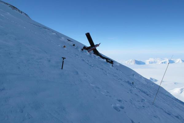
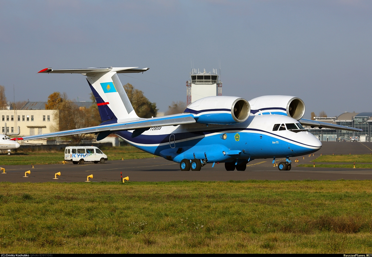
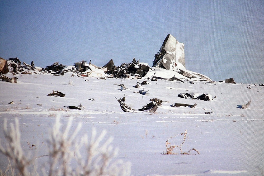
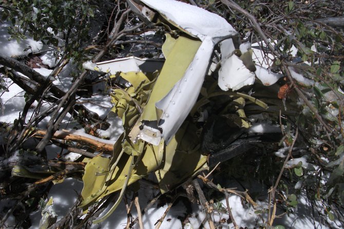
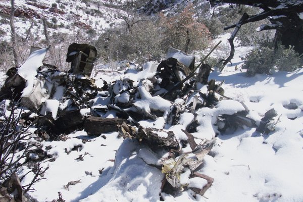
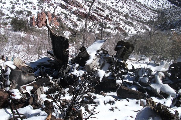
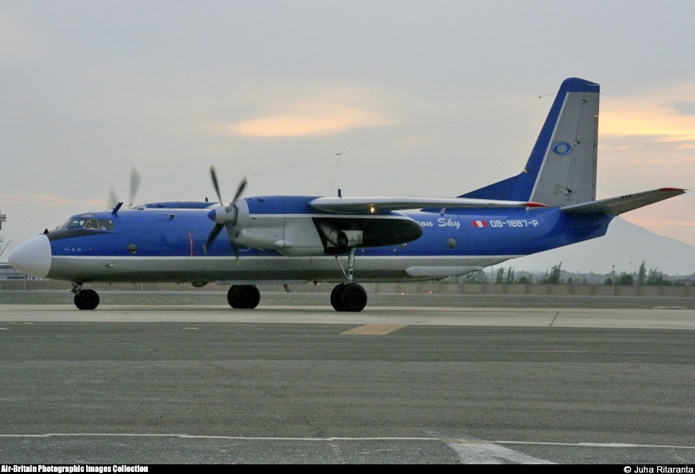
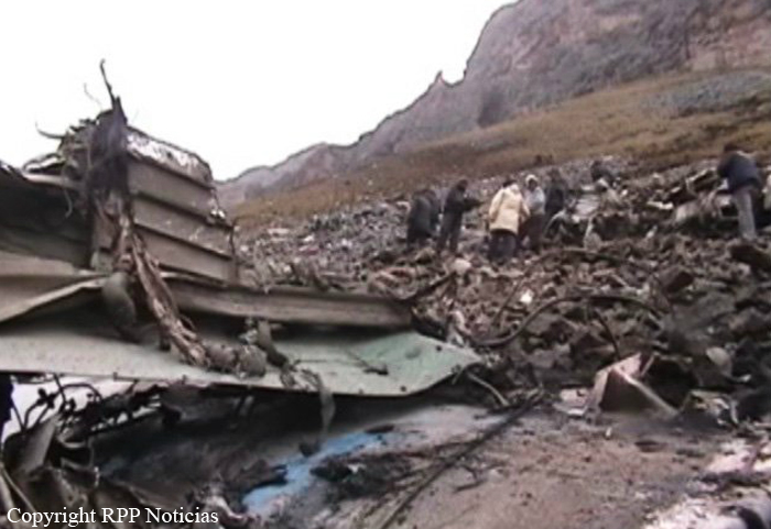
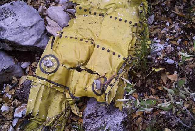
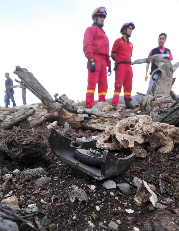
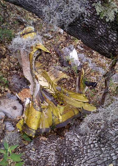
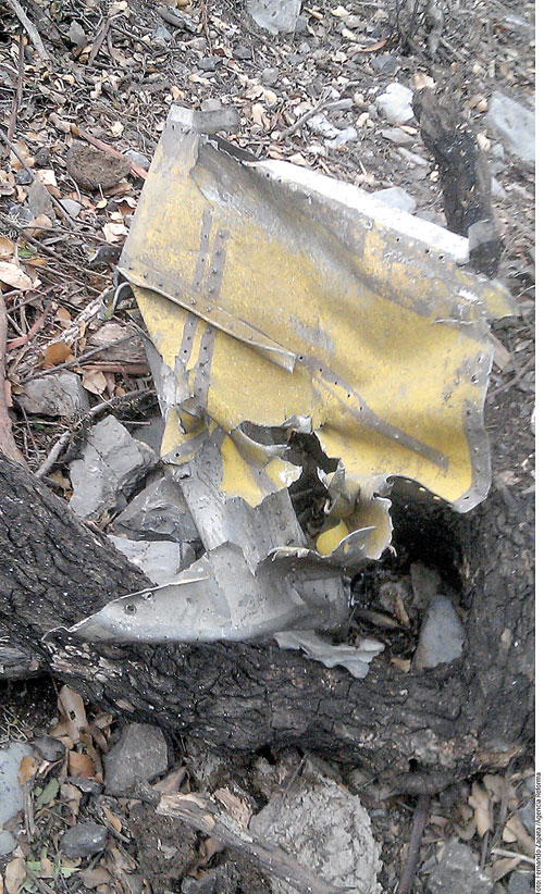
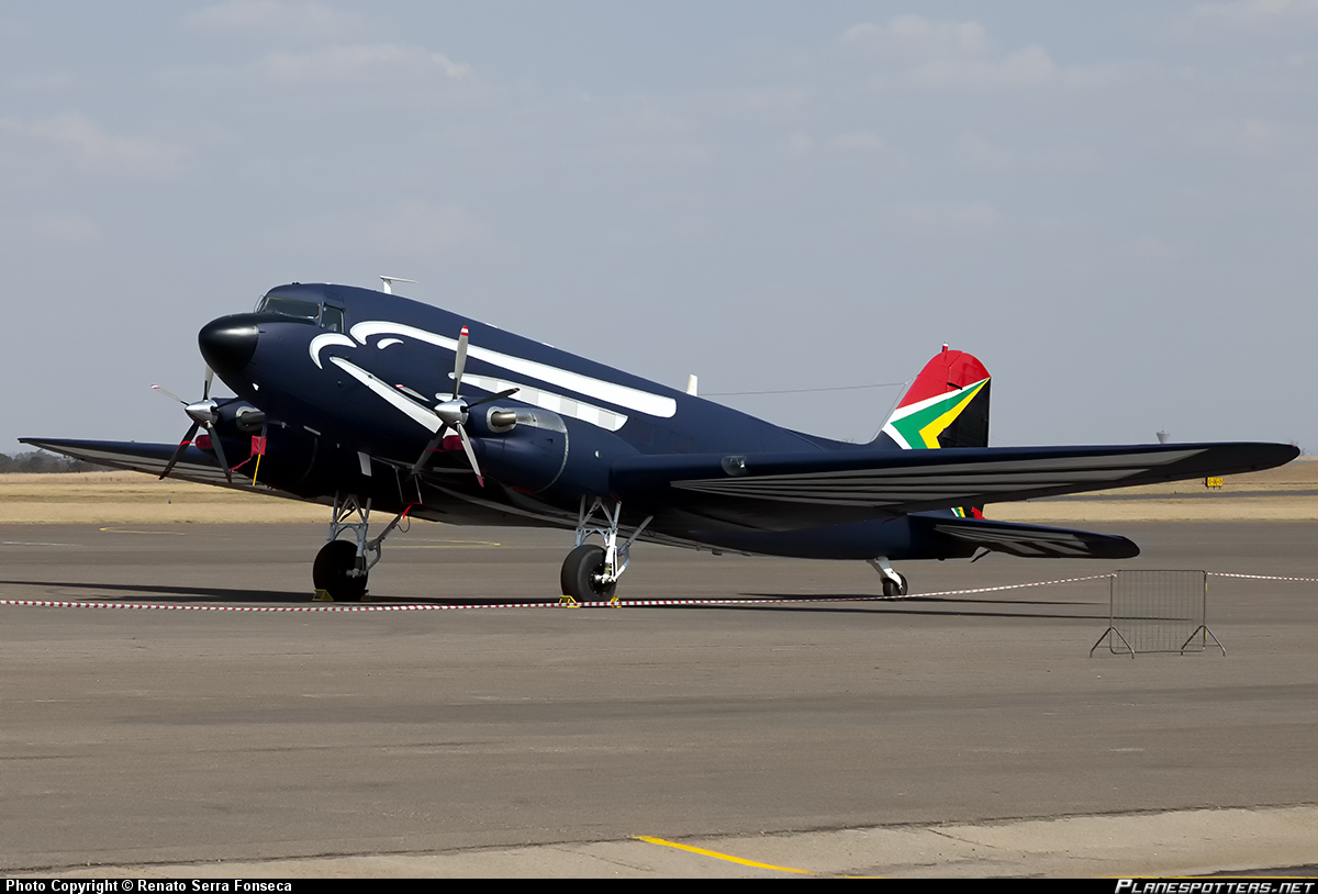
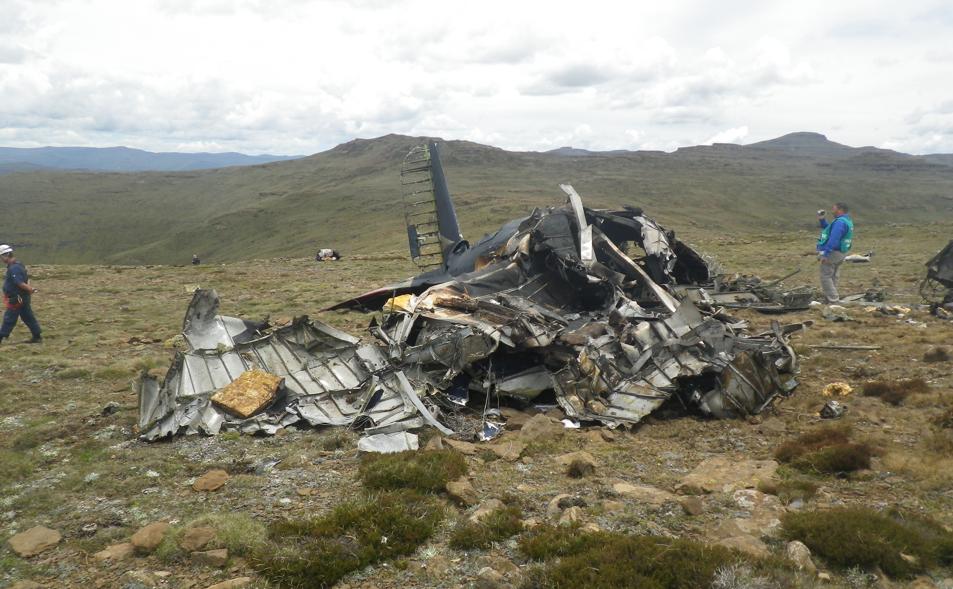
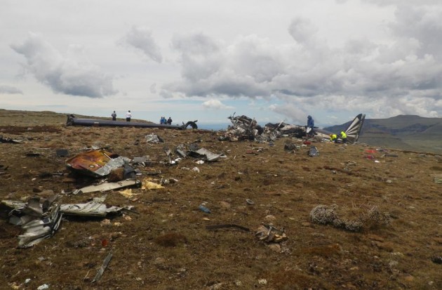
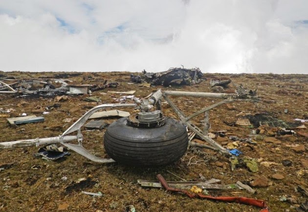
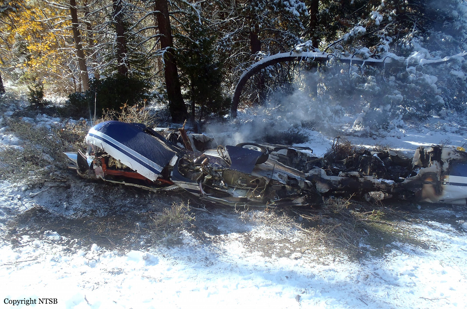
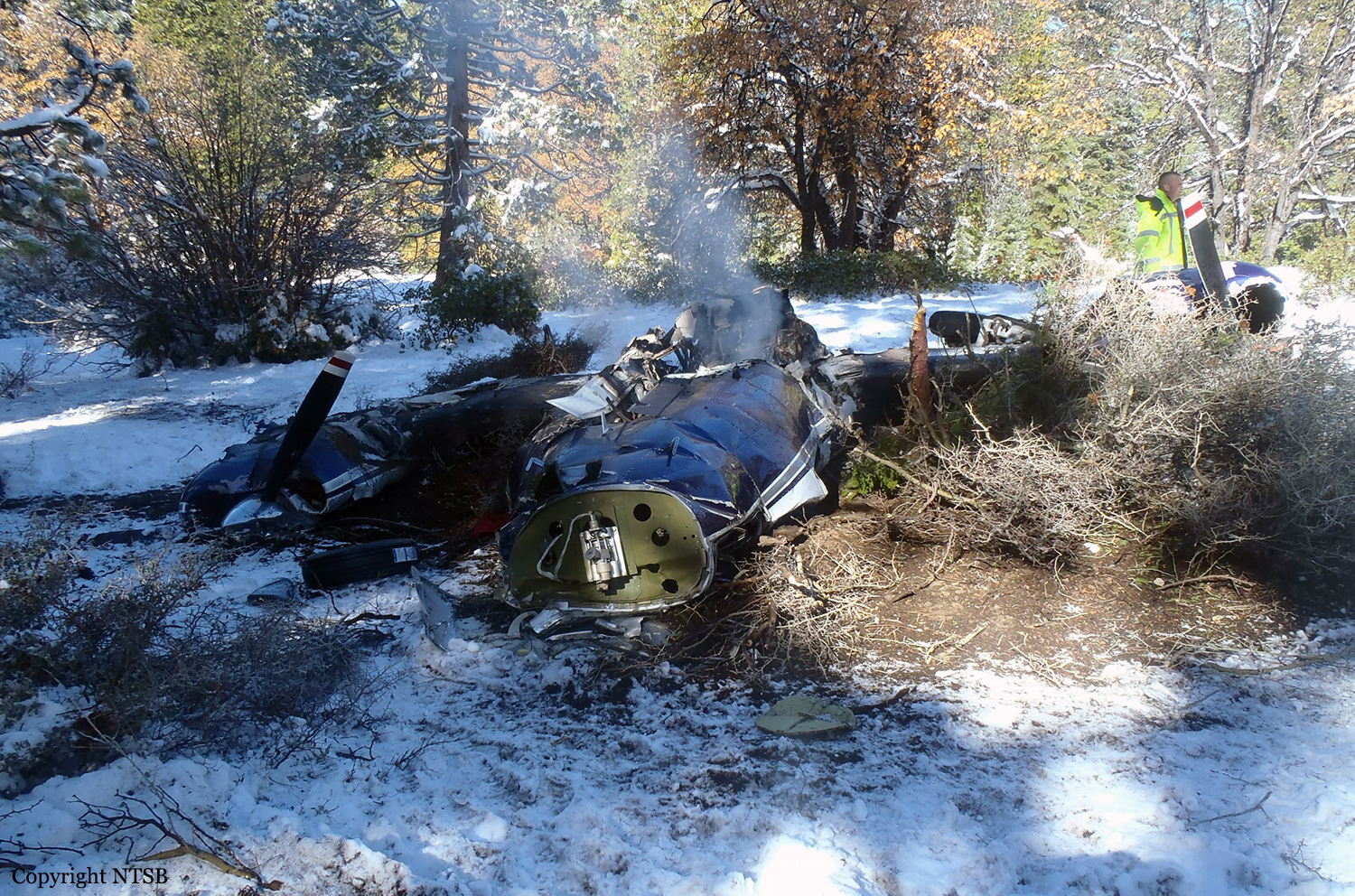
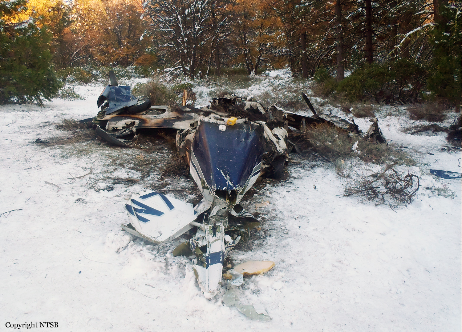
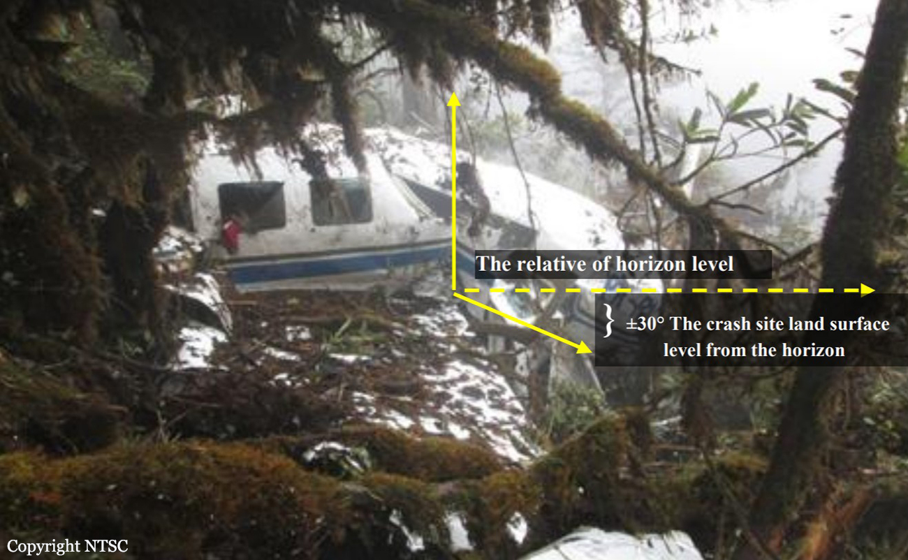
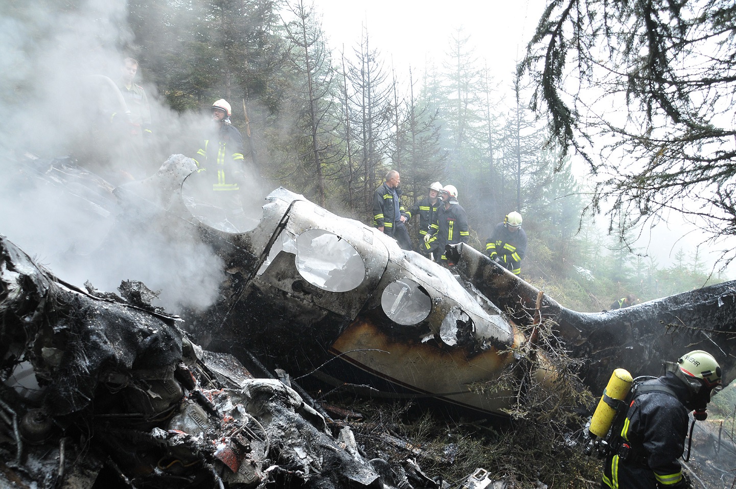
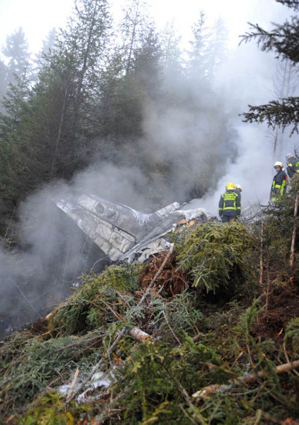
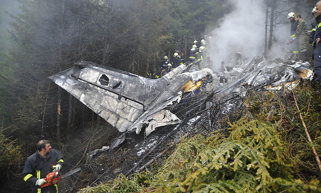
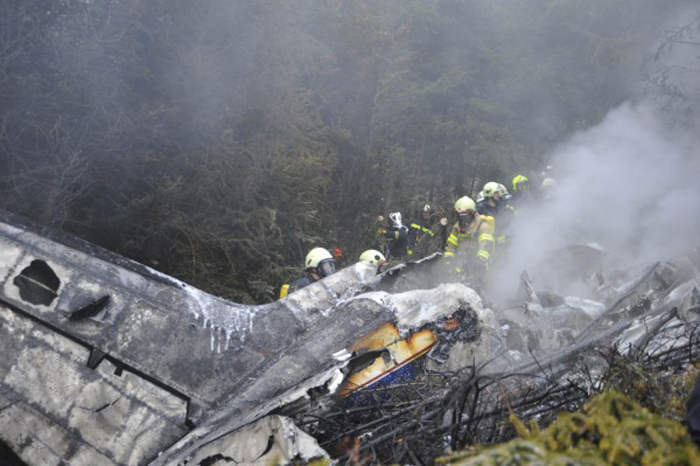
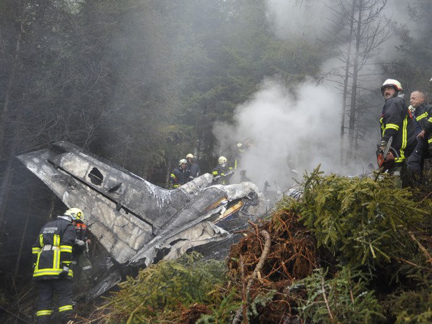
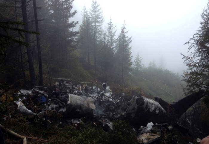
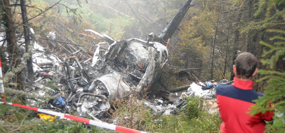
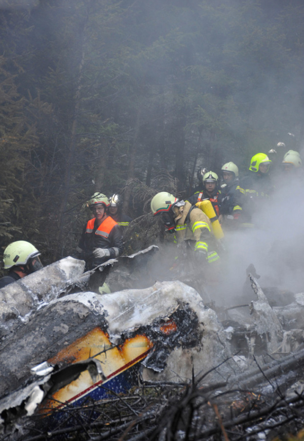
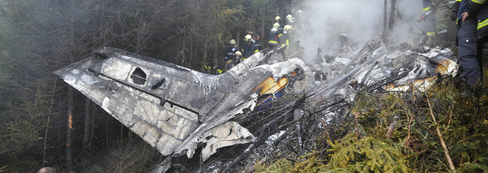
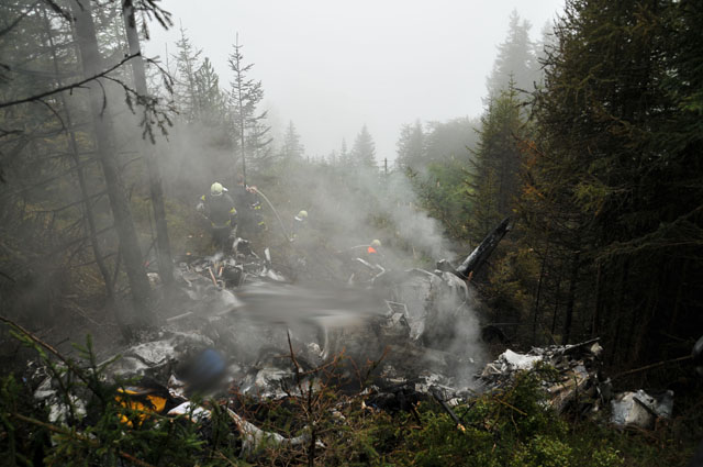
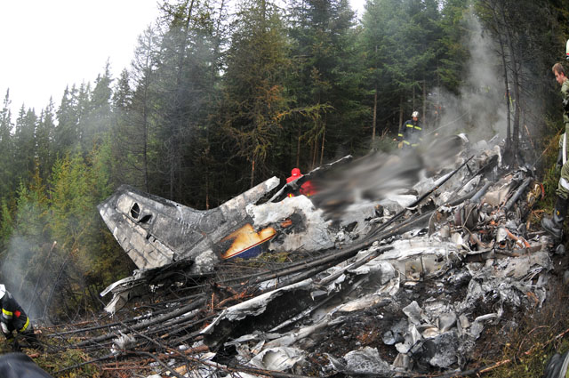
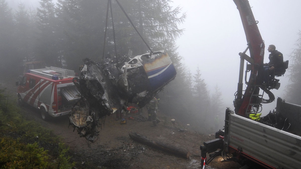
Crash of a De Havilland DHC-6 Twin Otter 300 on Mt Elizabeth: 3 killed

Date & Time: Jan 23, 2013 at 0827 LT
Operator:
Registration:
C-GKBC
Flight Phase:
Flight Type:
Survivors:
No
Site:
Schedule:
Amundsen-Scott Station - Terra Nova-Zucchelli Station
MSN:
650
YOM:
1979
Country:
Region:
Crew on board:
3
Crew fatalities:
Pax on board:
0
Pax fatalities:
Other fatalities:
Total fatalities:
3
Captain / Total flying hours:
22300
Captain / Total hours on type:
7770.00
Copilot / Total flying hours:
790
Copilot / Total hours on type:
450
Aircraft flight hours:
28200
Circumstances:
The aircraft departed South Pole Station, Antarctica, at 0523 Coordinated Universal Time on 23 January 2013 for a visual flight rules repositioning flight to Terra Nova Bay, Antarctica, with a crew of 3 on board. The aircraft failed to make its last radio check-in scheduled at 0827, and the flight was considered overdue. An emergency locator transmitter signal was detected in the vicinity of Mount Elizabeth, Antarctica, and a search and rescue effort was initiated. Extreme weather conditions hampered the search and rescue operation, preventing the search and rescue team from accessing the site for 2 days. Once on site, it was determined that the aircraft had impacted terrain and crew members of C-GKBC had not survived. Adverse weather, high altitude and the condition of the aircraft prevented the recovery of the crew and comprehensive examination of the aircraft. There were no indications of fire on the limited portions of the aircraft that were visible. The accident occurred during daylight hours.
Probable cause:
The accident was caused by a controlled flight into terrain (CFIT).
Findings:
The crew of C-GKBC made a turn prior to reaching the open region of the Ross Shelf. The aircraft might have entered an area covered by cloud that ultimately led to the aircraft contacting the rising terrain of Mount Elizabeth.
Other findings:
The cockpit voice recorder (CVR) was not serviceable at the time of the occurrence.
The company did not have a practice in place to verify the functionality of the CVR prior to flight.
The rate of climb recorded in the SkyTrac ISAT-100 tracking equipment prior to contacting terrain was consistent with the performance figures in the DHC-6 Twin Otter Series 300 Operating Data Manual 1-63-1, Revision 7.
Final Report:

Crash of an Antonov AN-72 in Shymkent: 27 killed

Date & Time: Dec 25, 2012 at 1854 LT
Type of aircraft:
Registration:
UP-72859
Flight Phase:
Flight Type:
Survivors:
No
Site:
Schedule:
Astana - Shymkent
MSN:
36576092859
YOM:
1990
Country:
Region:
Crew on board:
7
Crew fatalities:
Pax on board:
20
Pax fatalities:
Other fatalities:
Total fatalities:
27
Circumstances:
The aircraft was completing a flight on behalf of the Kazakh Border Guard Corp. While approaching Shymkent in low visibility due to the night and heavy snow falls, the aircraft hit a mountain slope located 21 km from the airport and was destroyed by impact forces. All 27 occupants were killed, among them Tourganbek Stambekov, Chief of the Kazakhtan Border Guards. It appears that the automatic pilot system failed shortly after take off from Astana and the captain decided to continue the flight. Two minutes and 40 seconds later, the radio altimeter failed as well and the crew continued the flight, referring to the barometric altimeter. But these suffered a momentary failure 19 minutes later and several differences were observed with the altitude parameters. During the descent to Shymkent in poor weather conditions, the captain failed to set the correct pressure in the barometric altimeters so the setting he was taking for reference was wrong. At the time of the accident, the aircraft was 385 meters too low and as a result, the Board concluded that the accident was the consequence of a controlled flight into terrain (CFIT).
Probable cause:
Controlled flight into terrain (CFIT).

Crash of a Piper PA-31-350 Navajo Chieftain near Payson: 1 killed

Date & Time: Dec 18, 2012 at 1825 LT
Operator:
Registration:
N62959
Flight Phase:
Flight Type:
Survivors:
No
Site:
Schedule:
Holbrook - Payson - Phoenix
MSN:
31-7752008
YOM:
1977
Flight number:
AMF3853
Location:
Crew on board:
1
Crew fatalities:
Pax on board:
0
Pax fatalities:
Other fatalities:
Total fatalities:
1
Captain / Total flying hours:
1908
Captain / Total hours on type:
346.00
Aircraft flight hours:
19188
Circumstances:
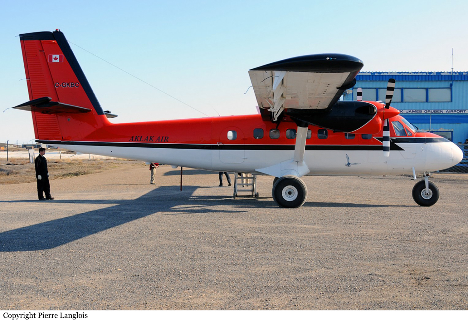
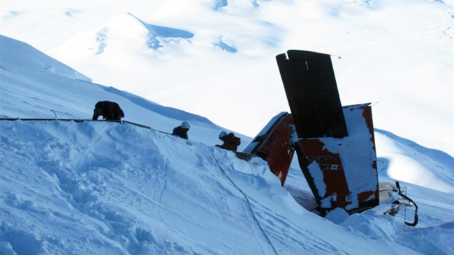
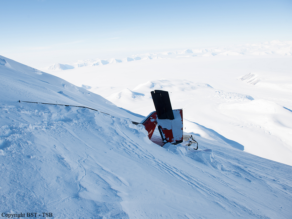
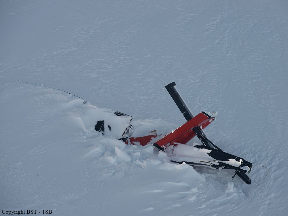
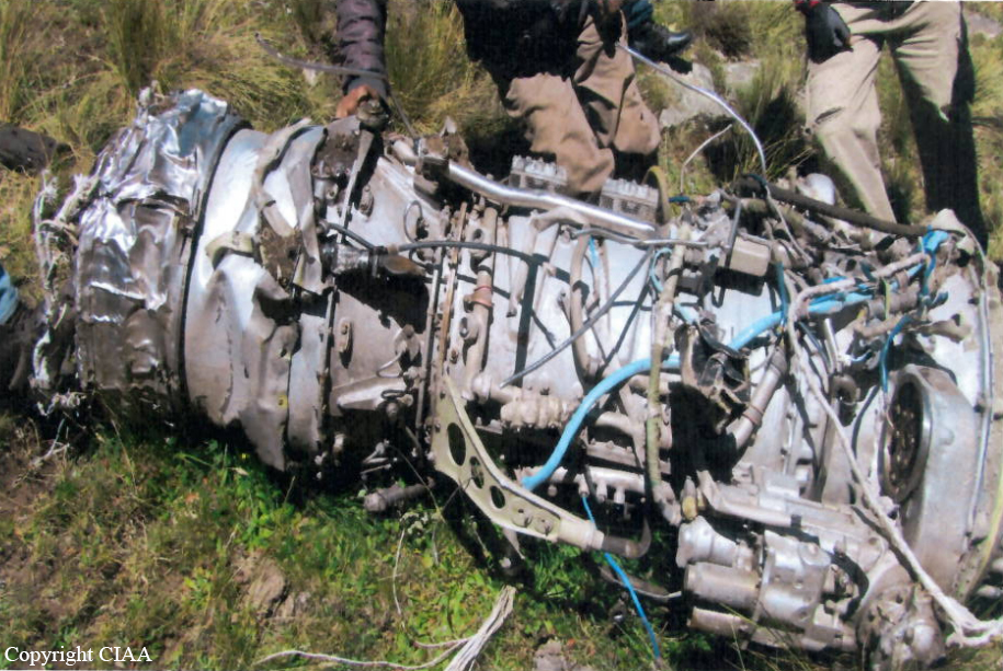
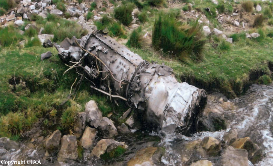
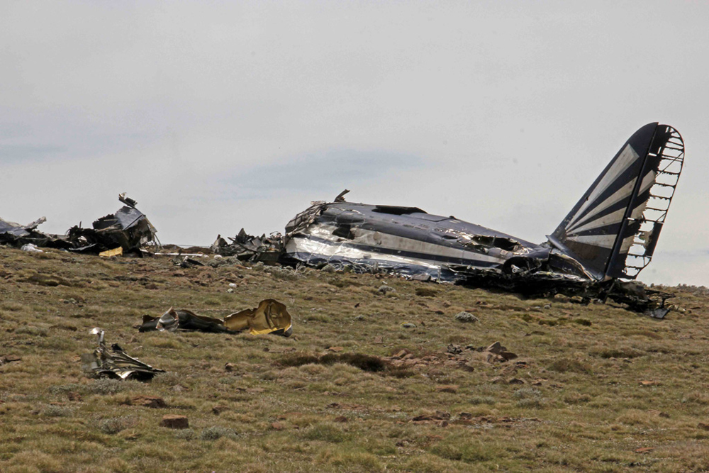
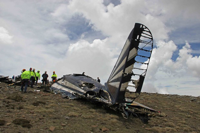
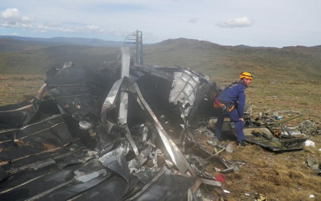
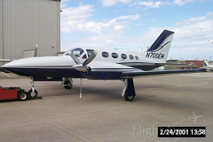
The pilot began flying the twin piston-engine airplane model for the cargo airline about 11 months before the accident. Although he had since upgraded to one of the airline’s twin turboprop airplane models, due to the airline’s logistical needs, the pilot was transferred back to the piston-engine model about 1 week before the accident. The flight originated at one of the airline’s outlying destination airports and was planned to stop at an interim destination to the southwest before continuing to the airline’s base as the final destination. The late afternoon departure meant that the flight would arrive at the interim destination about 10 minutes after sunset. That interim destination was situated in a sparsely populated geographic bowl just south of terrain that was significantly higher, and the ceilings there included multiple broken and overcast cloud layers near, or lower than, the surrounding terrain. Although not required by Federal Aviation Administration (FAA) regulations, the airline employed dedicated personnel who performed partial dispatch-like activities, such as providing relevant flight information, including weather, to the pilots. Before takeoff on the accident flight, the pilot conferred briefly with the dispatch personnel by telephone, and, with little discussion, they agreed that the flight would proceed under visual flight rules to the interim destination. Information available at the time indicated that the cloud cover almost certainly precluded access to the airport without an instrument approach; however, the airplane was not equipped to conduct the only available instrument approach procedure for that airport. Additionally, the pilot did not have in-flight access to any GPS or terrain mapping/database information to readily assist him in either locating the airport or remaining safely clear of the local terrain. Although the airplane was not being actively tracked or assisted by air traffic control (ATC) early in the flight, review of ground tracking radar data showed that the flight initially headed directly toward the interim destination but then began a series of turns, descents, and climbs. The airplane then disappeared from radar as the result of radar coverage floor limitations due to high terrain and radar antenna siting. The airplane reappeared on radar about 24 minutes after it disappeared and about 9 minutes after the FAA-defined beginning of night. Based on the flight track, it is likely that the pilot made a dedicated effort to access the airport, while concurrently remaining clear of the clouds and terrain, strictly by visual means. This task was made considerably more difficult and hazardous by attempting it in dusk conditions, and then darkness, instead of during daylight hours. About 15 minutes after the airplane reappeared on radar, when it was at an altitude of about 13,500 ft, the pilot contacted ATC and requested and was granted an instrument flight rules clearance to his final destination. About 3 minutes later, the controller cleared the flight to descend to 10,000 ft, and the airplane leveled off at that altitude about 6 minutes later. However, upon reaching 10,000 ft, the pilot requested a lower altitude to escape “heavy” upand down-drafts, but the controller was unable to comply because the ATC minimum vectoring altitude was 9,700 ft in that region. About 1 minute later, radar contact was lost. Shortly thereafter, the airplane impacted terrain in a steep nose-down attitude in a near-vertical trajectory. Although examination of the wreckage did not reveal any preimpact mechanical deficiencies that would have prevented normal operation and continued flight, the extent of the damage precluded, except on a macro scale, any determination of the preimpact integrity or functionality of any systems, subsystems, or components, including the ice protection systems, autopilot, and nose baggage door. Analysis of the radar data indicated that the airplane was above 10,000 ft for at least 41 minutes (possibly in two discontinuous periods) and above 12,000 ft (in two discontinuous periods) for at least 18 minutes. Although the airplane was reportedly equipped with supplemental oxygen, the investigation was unable to verify either its presence or its use by the pilot. Lack of supplemental oxygen at those altitudes for those periods could have contributed to a decrease in the pilot’s mental acuity and his ability to safely conduct the light. Analysis of air mass data revealed that mountain-wave activity and up- and downdrafts with vertical velocities of about 1,000 ft per minute (fpm) were present near the accident site and that the largest and most rapid transitions from up- to down-drafts occurred near the accident site, which was also supported by the airplane’s altitude data trace. The analysis also indicated that the last radar target from the airplane was located in a downdraft with a velocity of between 600 and 1,000 fpm. Other meteorological analysis indicated that the airplane encountered icing conditions, likely in the form of supercooled large droplets (SLD), several minutes before the accident. Aside from pilot reports from aircraft actually encountering SLD, no tools currently exist to detect airborne SLD. Further, the tools and processes to reliably forecast SLD do not exist. SLD is often associated with rapid ice accumulation, especially on portions of the airplane that are not served by ice protection systems. Airframe icing, whether due to accumulation rates or locations that exceed the airplane’s deicing system capabilities, mechanical failure, or the pilot’s failure to properly use the system, can impose significant adverse effects on airplane controllability and its ability to remain airborne. Because of the pilot’s recent transition from the Beechcraft BE-99, in which the pitot heat was always operating during flight, he may have forgotten that the accident airplane’s pitot heat procedures were different and that the pitot heat had to be manually activated when the airplane encountered the icing conditions. If the pitot heat is not operating in icing conditions, the airspeed information becomes unreliable and likely erroneous. Erroneous airspeed indications, particularly in night instrument meteorological conditions when the pilot has no outside references, could result in a loss of control. The investigation was unable to determine whether the pitot heat was operating during the final portion of the flight. The investigation was unable to determine whether the pilot used the autopilot during the last portion of the flight. If he was using the autopilot, it is possible that, at some point, he was forced to revert to flying the airplane manually due to the unit’s inability and to a corresponding Pilot’s Operating Handbook prohibition against using it to maintain altitude in the strong up- and downdrafts, which would increase the pilot’s workload. Another possibility is that the autopilot was unable to maintain altitude, and, instead of disconnecting it, the pilot overpowered it via the control wheel. If that occurred and the pilot overrode the autopilot for more than 3 seconds, the pitch autotrim system would have activated in the direction opposite the pilot’s input, and, when the pilot released the control wheel, the airplane could have been significantly out of trim, which could result in uncommanded pitch, altitude, and speed excursions and possible loss of control. Whether the pilot was hand-flying the airplane or was using the autopilot, the encounter with the strong up- and downdrafts and consequent altitude loss likely prompted the pilot to input corrective actions to regain the lost altitude, specifically increasing pitch and possibly power. Such corrections typically result in airspeed losses; those losses can sometimes be significant as a function of downdraft strength and the airplane’s climb capability. If that capability is compromised by the added weight, drag, and other adverse aerodynamic effects of ice, aerodynamic stall and a loss of control could result. Radar tracking data and ATC communications revealed that another, similar-model airplane flew a very similar track about 6 minutes behind the accident airplane, except that that other airplane was at 12,000 ft not 10,000 ft. The 10,000-ft ATC-mandated altitude placed the accident airplane closer to the underlying high terrain and into the clouds with the icing conditions and the strong vertical air movements. In contrast, the pilot of the second airplane reported that he was in and out of the cloud tops and did not report any weather-induced difficulties. The accident pilot did not have any efficient in-flight means for accurately determining the airborne meteorological conditions ahead, and the ATC controller did not advise him of any adverse conditions. Therefore, the pilot did not have any objective or immediate reason to refuse the ATC-assigned altitude of 10,000 ft. Ideally, based on both the AIRMET and the ambient temperatures, the pilot should have been aware of the likelihood of icing once he descended into clouds. That, particularly combined with his previously expressed lack of confidence in the airplane’s capability in icing conditions, could have prompted him to request either an interim stepdown altitude of 12,000 ft or an outright delay in a direct descent to 10,000 ft, but, for undetermined reasons, the pilot did not make any such request of ATC. Based on the available evidence, if the ATC controller had not descended the airplane to 10,000 ft when he did, either by delaying or by assigning an interim altitude of 12,000 ft, it is likely that the airplane would not have encountered the icing conditions and the strong up- and downdrafts. In addition, if the presence of SLD and/or strong up- and downdrafts had been known or explicitly forecast and then communicated to the pilot either via his weather briefing, his onboard equipment, or by ATC, it is likely that the pilot would have opted to avoid those phenomena to the maximum extent possible. The flight’s encounter with airframe icing and strong up-and downdrafts placed the pilot and airplane in an environment that either exacerbated or directly caused a situation that resulted in the loss of airplane control.
Probable cause:
The airplane’s inadvertent encounter, in night instrument meteorological conditions, with unforecast strong up- and downdrafts and possibly severe airframe icing conditions (which
likely included supercooled large droplets that the airplane was not certificated to fly in) that led to the pilot's loss of airplane control.
Final Report:

Crash of an Antonov AN-26-100 near Tomas: 4 killed

Date & Time: Dec 17, 2012 at 1042 LT
Type of aircraft:
Operator:
Registration:
OB-1887-P
Flight Phase:
Flight Type:
Survivors:
No
Site:
Schedule:
Lima - Las Malvinas
MSN:
66 06
YOM:
1978
Location:
Country:
Crew on board:
4
Crew fatalities:
Pax on board:
0
Pax fatalities:
Other fatalities:
Total fatalities:
4
Captain / Total flying hours:
13145
Captain / Total hours on type:
12308.00
Copilot / Total flying hours:
1373
Copilot / Total hours on type:
1193
Circumstances:
The crew was performing a cargo flight from Lima to Las Malvinas (Sabeti), and departed Lima-Jorge Chávez Airport at 1009LT for a 78-minutes flight. 32 minutes into the flight, while overflying the Andes mountains at FL195, the crew lost control of the airplane that crashed in a mountainous area located near Tomas. The wreckage was found the following day and all four occupants were killed while.
Probable cause:
Both engines failed in flight due to icing accumulation and inappropriate use of the deicing systems. The following factors were considered as contributory:
- Poor flight planning on part of the crew,
- Poor crew resources management,
- Poor crew simulator training (icing detection and dual engine failure),
- Lack of procedures relating to icing conditions and dual engine failure,
- Marginal weather conditions which contributed to ice accumulation on engines and airframe.
Final Report:

Crash of a Piper PA-31T1 Cheyenne I near Ely: 2 killed

Date & Time: Dec 15, 2012 at 1000 LT
Type of aircraft:
Registration:
N93CN
Flight Phase:
Flight Type:
Survivors:
No
Site:
Schedule:
Mesa - Portland
MSN:
31-8004029
YOM:
1980
Location:
Crew on board:
1
Crew fatalities:
Pax on board:
1
Pax fatalities:
Other fatalities:
Total fatalities:
2
Captain / Total flying hours:
6336
Aircraft flight hours:
5725
Circumstances:
The private pilot and passenger departed on the 875-nautical-mile cross-country flight and leveled off at a cruise altitude of 24,000 feet mean seal level, which, based on the radar data, was accomplished with the use of the autopilot. About 1 hour 40 minutes after departure, the pilot contacted air traffic control personnel to request that he would “like to leave frequency for a couple of minutes.” No further radio transmissions were made. About 20 seconds after the last transmission, the airplane banked to the right, continued in a spiral while rapidly descending, and subsequently broke apart. At no time during the flight did the pilot indicate that he was experiencing difficulty or request assistance. Just prior to departing from the flight path, the pilot made an entry of the engine parameters in a flight log, which appeared to be consistent with his other entries indicating the airplane was not experiencing any difficulties. Portions of the wings, along with the horizontal stabilizers and elevators, separated during the breakup sequence. Analysis of the fracture surfaces, along with the debris field distribution and radar data, revealed that the rapid descent resulted in an exceedance of the design stress limits of the airplane and led to an in-flight structural failure. The airplane sustained extensive damage after ground impact, and examination of the engine components and surviving primary airframe components did not reveal any mechanical malfunctions or failures that would have precluded normal operation. The airplane was flying on a flight path that the pilot was familiar with over largely unpopulated hilly terrain at the time of the upset. The clouds were well below his cruising altitude, giving the pilot reliable external visual cues should the airplane have experienced a failure of either the flight instruments or autopilot. Further, no turbulence was reported in the area. The airplane was equipped with a supplemental oxygen system, which the pilot likely had his mask plugged into and available in the unstowed position behind his seat; the passenger’s mask was stowed under her seat. The airplane’s autopilot could be disengaged by the pilot by depressing the appropriate mode switch, pushing the autopilot disengage switch on the control wheel, or turning off the autopilot switch on the control head. All autopilot servos were also equipped with a clutch mechanism that allowed the servo to be manually overridden by the pilot at any time. It is likely that the reason the pilot requested to “leave the frequency” was to leave his seat and attend to something in the airplane. While leaving his seat, it is plausible he inadvertently disconnected the autopilot and was unable to recover by the time he realized the deviation had occurred.
Probable cause:
The pilot’s failure to regain airplane control following a sudden rapid descent during cruise flight, which resulted in an exceedance of the design stress limits of the aircraft and led to an in-flight structural failure.
Final Report:

Crash of a Learjet 25 near Iturbide: 7 killed

Date & Time: Dec 9, 2012 at 0333 LT
Type of aircraft:
Registration:
N345MC
Flight Phase:
Survivors:
No
Site:
Schedule:
Monterrey - Toluca
MSN:
25-046
YOM:
1969
Country:
Crew on board:
2
Crew fatalities:
Pax on board:
5
Pax fatalities:
Other fatalities:
Total fatalities:
7
Captain / Total flying hours:
22610
Copilot / Total hours on type:
67
Circumstances:
The aircraft departed Monterrey-General Mariano Escobido Airport at 0315LT on a flight to Toluca, carrying five passengers and two pilots. Few minutes later, while cruising at 28,700 feet via radial 163, the aircraft went out of control, dove into the ground and crashed in a mountainous area located near Iturbide, in the south part of the Parque Natural Sierra de Arteaga, some 100 km south of Monterrey. Debris were found scattered on an area of approximately 300 metres and all seven occupants were killed, among them the American-Mexican singer Dolores Jenney Rivera, aged 43. She was accompanied with her impresario and members of her team. They left Monterrey after she gave a concert and they should fly to Toluca to take part to a TV show.
Probable cause:
The exact cause of the loss of control could not be determined. However, it was reported that the pilot aged 78 was not allowed to conduct commercial flight due to his age. Also, the young copilot aged 21 did not have a type rating for such aircraft.
Final Report:

Crash of an AMI Turbo C-47TP in the Drakensberg Mountains: 11 killed

Date & Time: Dec 5, 2012 at 0945 LT
Operator:
Registration:
6840
Flight Phase:
Flight Type:
Survivors:
No
Site:
Schedule:
Waterkloof - Mthatha
MSN:
13866/25311
YOM:
1944
Country:
Region:
Crew on board:
6
Crew fatalities:
Pax on board:
5
Pax fatalities:
Other fatalities:
Total fatalities:
11
Circumstances:
The aircraft departed Waterkloof AFB south of Pretoria around 0745LT on a flight to Mthatha. While cruising between 10,000 and 11,000 feet, the crew encountered poor weather conditions. in IMC conditions, the aircraft Giant's Castle in the Drakensberg Mountain Range and disintegrated on impact. The wreckage was found a day later and all 11 occupants were killed. The minimum safe altitude for the area was 13,800 feet.
Crew:
Major K. Misrole
Captain Z.M. Smith
Sergeant B.K. Baloyi
Sergeant E. Boes
Sergeant J.M. Mamabolo
Corporal L. Mofokeng
Passengers:
Sergeant L. Sobantu
Corporal N.W. Khomo
Corporal A. Matlaila
Corporal M.J. Mthomben
Lance-corporal N.K. Aphane.
Probable cause:
The crew filed a flight plan with an incorrect flight level (FL) and routing. Contributing causes are given as the weather and lack of situational awareness among the aircrew. The inquiry further found the lack of an aircrew pre-flight briefing was a key issue and that unnecessary time pressure and insufficient flight planning also played a part. The aircrew did not adhere to standard checks and procedures and failed to do a proper risk assessment.

Crash of a Cessna 421C Golden Eagle III in Shaver Lake: 2 killed

Date & Time: Nov 10, 2012 at 1920 LT
Registration:
N700EM
Flight Phase:
Flight Type:
Survivors:
No
Site:
Schedule:
Salinas - Omaha
MSN:
421C-1010
YOM:
1980
Crew on board:
1
Crew fatalities:
Pax on board:
1
Pax fatalities:
Other fatalities:
Total fatalities:
2
Captain / Total flying hours:
637
Captain / Total hours on type:
102.00
Aircraft flight hours:
5118
Circumstances:
The aircraft impacted terrain following an in-flight breakup near Shaver Lake, California. The private pilot/registered owner was operating the airplane under the provisions of 14 Code of Federal Regulations Part 91. The pilot and passenger sustained fatal injuries. The airplane sustained substantial damage during the accident sequence, and was partially consumed by postimpact fire. The cross-country flight departed Salinas Municipal Airport, Salinas, California, at 1837, with a planned destination of Eppley Airfield, Omaha, Nebraska. Visual meteorological conditions prevailed, and an instrument flight rules (IFR) flight plan had been filed. The pilot was the son of the passenger. Both had spent the weekend attending a driving academy at the Laguna Seca Raceway, having arrived in the accident airplane earlier in the week. According to the pilot's wife, they had encountered strong headwinds during the outbound flight from Omaha, and had decided to take advantage of tailwinds for the return flight that night, rather than stay in a hotel. The pilot planned to return his father to Omaha, and then fly to his residence in Missouri the following day. Radar and voice communication data provided by the Federal Aviation Administration (FAA) revealed that prior to departure, the pilot was given an IFR clearance to Omaha, and that during his interaction with clearance delivery personnel he read back the clearance correctly. A few minutes after departing Salinas the airplane was cleared to fly direct to the Panoche VORTAC (co-located very high frequency omnidirectional range (VOR) beacon and tactical air navigation system). The airplane followed a direct course of 60 degrees; reaching Panoche at a mode C reported altitude of 17,200 feet, about 14 minutes later. The airplane continued on that course, reaching the Clovis VOR at 1912, coincident to attaining the pilots stated cruise altitude of 27,000 feet. The pilot reported leveling for cruise, and flying direct to Omaha. The sector controller reported that the pilot should fly direct to the Coaldale VOR and then to Omaha, and the pilot responded, acknowledging the correction. For the next 5 minutes, the airplane continued at the same altitude and heading, with no further transmissions from the pilot. The airplane then began a descending turn to the right, with a final mode C reported radar target recorded 60 seconds later. During that period, it descended to 22,600 feet, with an accompanying increase in ground speed from about 190 to 375 knots. For the remaining 6 minutes, a 6.5-mile-long cluster of primary targets (no altitude information) was observed emanating from the airplane's last location, on a heading of about 150 degrees. Following the initial route deviation, the air traffic controller made five attempts to make contact with the pilot with no success. Throughout the climb and cruise portion of the flight, the airplane flew directly to the assigned waypoints with minimal course variation, in a manner consistent with the pilot utilizing the autopilot.
Probable cause:
The pilot's failure to regain airplane control following a sudden rapid descent during cruise, which resulted in an in-flight breakup. Contributing to the accident was the pilot's decision to make the flight with a failed vacuum pump, particularly at high altitude in night conditions.
Final Report:

Crash of a PAC 750XL near Yahukimo: 2 killed

Date & Time: Oct 3, 2012 at 1120 LT
Operator:
Registration:
PK-RWT
Flight Phase:
Flight Type:
Survivors:
No
Site:
Schedule:
Jayapura - Korupun - Dekai
MSN:
157
YOM:
2009
Country:
Region:
Crew on board:
1
Crew fatalities:
Pax on board:
1
Pax fatalities:
Other fatalities:
Total fatalities:
2
Captain / Total flying hours:
1546
Captain / Total hours on type:
1315.00
Circumstances:
On 03 October 2012, a Pacific Aerospace LTD, PAC 750 XL aircraft registration PK-RWT was being operated by Yayasan Pelayan Penerbangan Tariku on a cargo supply flight from Koropun to Dekai in Papua area. This flight was the 9 th flight of that day. All flights were performed in accordance to the Visual Flight Rules (VFR). The first flight was from Sentani to Langda which was arrived at 2220 UTC (0720 LT). The aircraft arrived Koropun at 0120 UTC (1020 LT) as reported by the pilot through the company flight following system . The aircraft then departed Koropun to Dekai and lost contact during this flight. On board in this flight were one pilot, one passenger and 975 kg of cargo when departure from Sentani. The distance between Koropun to Dekai is about 24.6 Nm and normally takes about 11 minutes. The weather information issued by Badan Meteorologi Klimatologi and Geofisika/BMKG (Indonesia Meteorology Climatology and Geophysics Agency) between 0200 UTC to 0300 UTC, showed the development of cumulus cloud classified as Middle Cloud formation along the route from Koropun to Dekai. According to the company flight following procedure, the pilot should report after the aircraft lands by mentions “aircraft on the ground” which this means that the aircraft had arrived at destination. After aircraft airborne, the pilot should report aircraft airborne time and give the estimate of time arrival at destination. The last contact of the pilot was “the aircraft on the ground Koropun” at 0120 UTC. Normally, the next report would be within 15 up to 20 minutes after arrival. There was no report from the pilot after 20 minutes of the last report. The flight following officer tried to contact the pilot and was unsuccessful. At 0145 UTC, the Operation Manager of the aircraft operator received information from the New Zealand Search and Rescue Agency that informed that Local User Terminal (LUT) has received ELT distress signal from PK-RWT. This information was followed by information through email, which was received at 0150 UTC. Based on this information, the Indonesia Search and Rescue operation was initiated. The aircraft was found on 5 October 2013, in mountainous area with approximate elevation of 7,000 feet, at coordinate 04°28.62’S 139°39’E. The crew and passenger on board were fatally injured and the aircraft substantially damaged.
Probable cause:
The accident was classified as Controlled Flight into Terrain (CFIT), which most likely the aircraft was flown into the weather environment below the VFR margins.
Final Report:

Crash of a Cessna 414A Chancellor in Ellbögen: 6 killed

Date & Time: Sep 30, 2012 at 0658 LT
Type of aircraft:
Operator:
Registration:
N738W
Flight Phase:
Flight Type:
Survivors:
Yes
Site:
Schedule:
Innsbruck - Valencia
MSN:
414A-0027
YOM:
1978
Location:
Country:
Region:
Crew on board:
1
Crew fatalities:
Pax on board:
7
Pax fatalities:
Other fatalities:
Total fatalities:
6
Captain / Total flying hours:
12000
Captain / Total hours on type:
1200.00
Aircraft flight hours:
8600
Circumstances:
The twin engine aircraft departed Innsbruck-Kranebitten Airport at 0654LT on a private flight to Valencia, Spain, carrying seven passengers and one pilot. VFR conditions prevailed at the time of departure. After takeoff from runway 26, the pilot turn to the south when he encountered limited visibility due to foggy conditions. In IMC conditions, the aircraft contacted trees, lost height and crashed in a wooded area located near the village of Ellbögen, about 15 km southeast of Innsbruck Airport, bursting into flames. The wreckage was found at an altitude of 1,612 metres. Two passengers were seriously injure while six other occupants were killed. The aircraft was totally destroyed by a post impact fire.
Probable cause:
Controlled flight into terrain after the pilot continued under VFR mode in IMC conditions.
Final Report: