Country
Operator Image

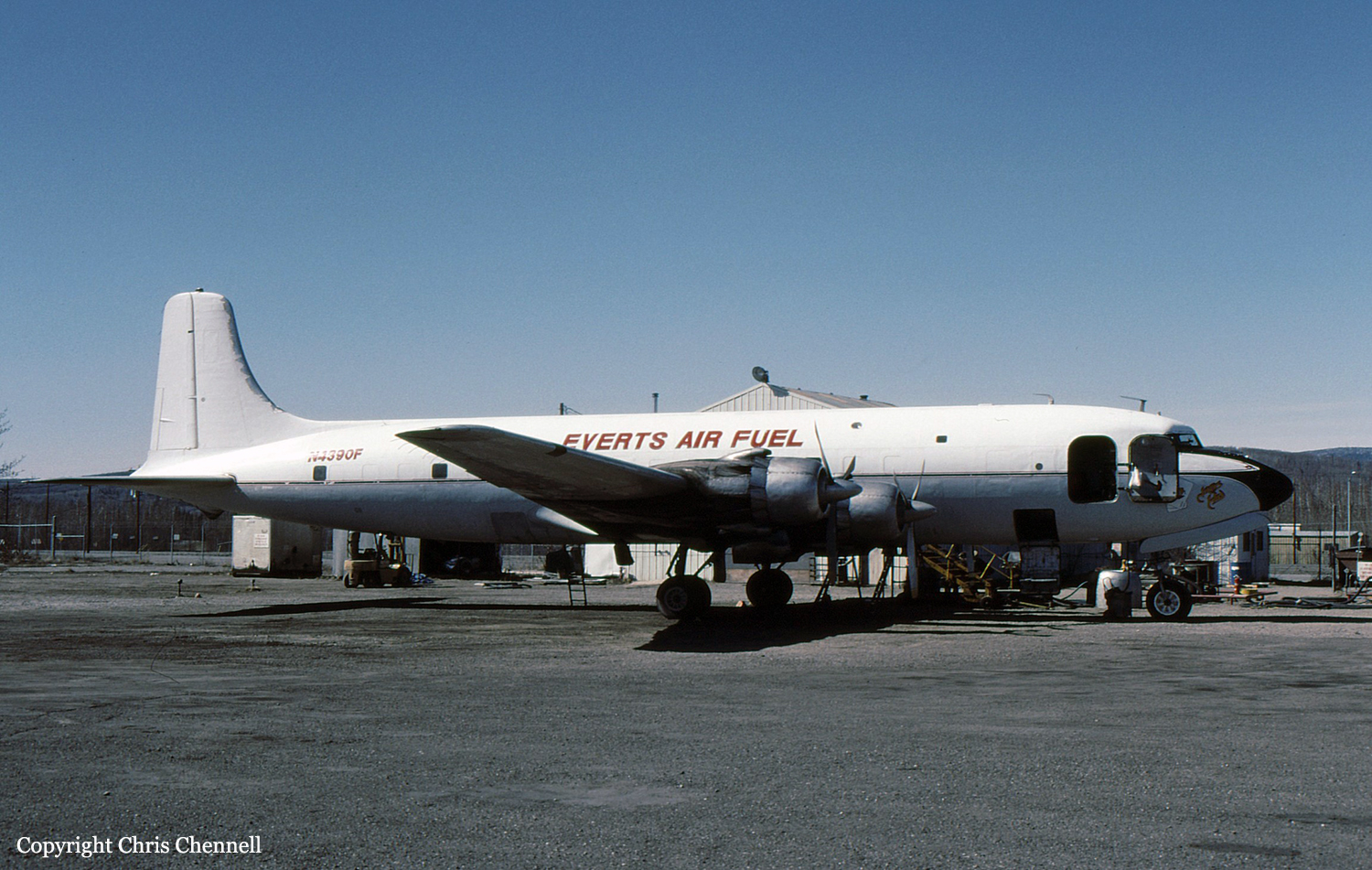
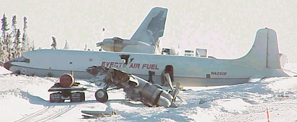
Crash of a Douglas DC-6B in Donlin Creek
Date & Time:
Jan 31, 2001 at 1315 LT
Operator:
Registration:
N4390F
Survivors:
Yes
Schedule:
Fairbanks – Donlin Creek
MSN:
44898
YOM:
1956
Crew on board:
3
Crew fatalities:
Pax on board:
0
Pax fatalities:
Other fatalities:
Total fatalities:
0
Captain / Total hours on type:
8100.00
Aircraft flight hours:
37052
Circumstances:
The certificated airline transport captain related that the purpose of the flight was to deliver about 4,800 gallons of fuel oil to the remote mining site. He said that the 5,400 feet long by 100 feet wide airstrip was situated within hilly, snow-covered terrain. He added that the airstrip has a 7 percent uphill grade. Flat light conditions existed at the airstrip, and light snow showers were present, with visibility reported at 2 miles. The captain stated that during final approach, as the airplane passed over the airstrip threshold, flat light conditions made it very difficult to discern where the airstrip surface was. He said that the initial touchdown was "firm", but was thought to be within acceptable tolerances. Just after touchdown, the left wing broke free from the airplane at the wing to fuselage attach point. The airplane veered to the left, and off the left side of the runway. The captain said that the airplane's computed landing weight was 92,260 pounds.
Probable cause:
The flight crew's misjudged flare while landing. Factors associated with the accident were flat light conditions, snow-covered terrain, and an uphill runway grade.
Final Report:
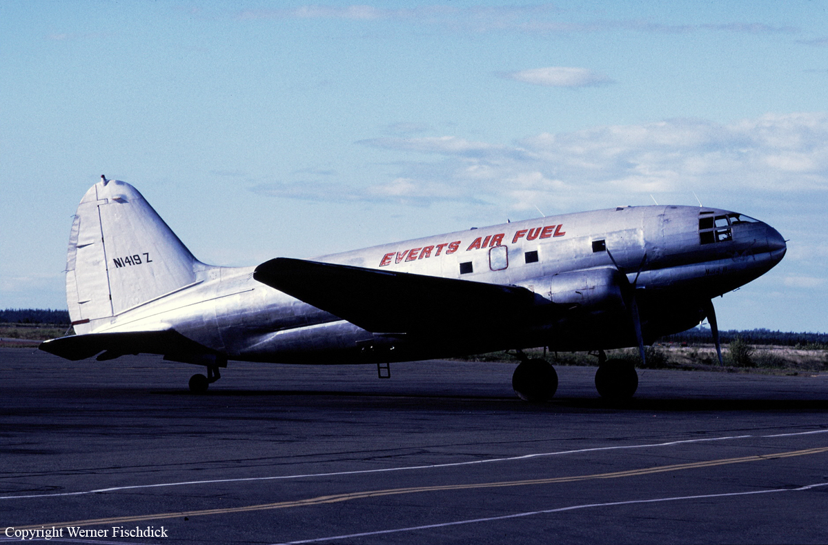
Crash of a Curtiss C-46A-45-CU Commando near Mt Redoubt: 2 killed
Date & Time:
Dec 20, 2000 at 1620 LT
Operator:
Registration:
N1419Z
Survivors:
No
Schedule:
Kenai – Big River Lakes – Nondalton – Kenai
MSN:
30228
YOM:
1944
Crew on board:
2
Crew fatalities:
Pax on board:
0
Pax fatalities:
Other fatalities:
Total fatalities:
2
Captain / Total hours on type:
1540.00
Aircraft flight hours:
10907
Circumstances:
The flight crew was returning from off-loading their cargo at a remote site on the west side of a mountain range. The return flight would provide an option of following a lower mountain pass, or flying over the mountainous terrain. Witnesses related that prior to the flight's departure, the marginal VFR weather conditions began to deteriorate very rapidly, with winds in excess of 50 knots, lowering ceilings, rain, and turbulence. An airmet, valid during the time of the accident, forecast high winds, mountain obscuration, and turbulence. The wreckage of the airplane was located near the crest of a 2,900 feet msl ridge. Wreckage debris was scattered on both sides of the ridge, and the airplane was destroyed by the high speed impact. Inspection of the wreckage disclosed no evidence any mechanical anomalies. A radar track analysis of a target airplane believed to be the accident airplane, depicted a track on a direct route of flight over the mountains from the departure airport towards the destination airport. Altitude data was not received from the target airplane's Mode C transponder, and therefore was extrapolated from the less reliable radar plot information. The maximum altitude plotted was approximately 10,800 feet, prior to a descent as the airplane neared the west side of the range. Mountains along the route of flight exceed 10,000 feet msl.
Probable cause:
The flight crew's decision to continue VFR flight into instrument meteorological conditions. Factors associated with the accident are high winds, turbulence, and low ceilings.
Final Report: