Crash of a Cessna 550 Citation II in Manhuaçu

Date & Time: Oct 7, 2011 at 1738 LT
Type of aircraft:
Registration:
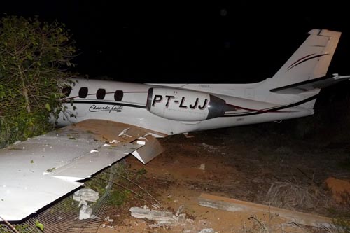
PT-LJJ
Survivors:
Yes
Schedule:
Belo Horizonte – Manhuaçu
MSN:
550-0247
YOM:
1981
Country:
Crew on board:
2
Crew fatalities:
Pax on board:
3
Pax fatalities:
Other fatalities:
Total fatalities:
0
Captain / Total flying hours:
4300
Captain / Total hours on type:
1200.00
Copilot / Total flying hours:
8000
Copilot / Total hours on type:
100
Circumstances:
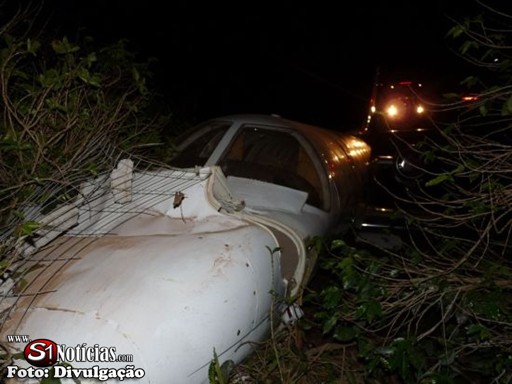
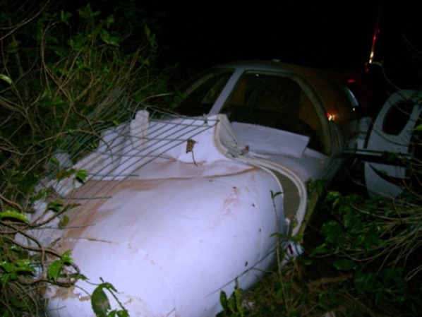
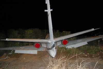
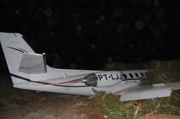
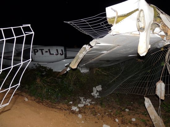
The aircraft departed Belo Horizonte-Pampulha on an executive flight to Manhuaçu, carrying two pilots and three passengers, among them the Brazilian singer Eduardo Costa. Following an uneventful flight, the crew started the descent to Manhuaçu-Elias Breder Airport. After touchdown on runway 02, the crew activated the reverse thrust systems but the aircraft did not decelerate as expected. So the crew started to brake when the tires burst. Unable to stop within the remaining distance, the aircraft overran, lost its undercarriage, collided with a fence and came to rest. There was no fire. All five occupants were rescued. Nevertheless, Eduardo Costa broke his nose and right hand during the accident.
Probable cause:
Late use of the normal brake systems on part of the crew after landing, causing the aircraft to overran. The captain had the habit of braking the aircraft while using the reverse thrust systems only in order to save the braking systems. Doing so, the use of the normal brakes was delayed.
Final Report:

Crash of a Cessna 560XL Citation XLS in Port Harcourt

Date & Time: Jul 14, 2011 at 1953 LT
Operator:
Registration:
5N-BMM
Survivors:
Yes
Schedule:
Lagos – Port Harcourt
MSN:
560-5830
YOM:
2008
Country:
Region:
Crew on board:
2
Crew fatalities:
Pax on board:
4
Pax fatalities:
Other fatalities:
Total fatalities:
0
Captain / Total flying hours:
11751
Captain / Total hours on type:
684.00
Copilot / Total flying hours:
13302
Copilot / Total hours on type:
612
Aircraft flight hours:
982
Circumstances:
5N-BMM departed Lagos at 1856 hrs for Port Harcourt on an Instrument Flight Rules (IFR) and estimated Port Harcourt at 1940 hrs. The aircraft was cleared to maintain FL330. The aircraft’s first contact with Port Harcourt was at 1914 hrs. The pilot reported maintaining FL330 with six souls onboard, four hours fuel endurance and estimating POT VOR at 1940hrs. The aircraft was cleared to POT, to maintain FL330 with no delay expected for ILS Approach Runway 21, QNH 1011 and to report when released by Lagos. At 1921 hrs the pilot reported 100 NM to POT and requested for descent. The aircraft was cleared to descend to FL150. At 1927 hrs the pilot requested for further descent and was cleared to 3,300 feet on QNH 1011 but the pilot acknowledged 3500 feet. At 1931 hrs the aircraft was re-cleared to FL090 initially due to departing traffic on Runway 03. At 1934 hrs 5N-BMM reported maintaining FL090 and was re-cleared to FL050. The aircraft was re-cleared to 2,000 feet on QNH 1011 at 1936 hrs and cleared for the straight-in ILS Approach Runway 21 and to report on the localizer. At 1947 hrs the pilot reported final for Runway 21 and was asked to contact Tower on 119.2 and the Tower asked 5N-BMM to report on glide slope Runway 21. At 1950 hrs the Tower asked 5N-BMM to confirm on the glide slope and the crew confirmed “Charlie, we have three miles to run”. The Tower cleared 5N-BMM to land with surface wind calm but to exercise caution since the Runway surface was wet and 5N-BMM responded “wind calm”. At 1952:26 hrs the auto voice callout "minimums minimums” alerted the crew. At 1952:40 hrs the pilot flying (PF) said "I am not on the centerline". At 1952:48 hrs he said "I can't see down". At 1952:55 hrs the pilot monitoring (PM) said to the pilot flying; " I am telling you to go down" and the pilot flying said " I will go down", five seconds later the aircraft crashed. The crew exited the aircraft without accomplishing the Emergency Evacuation Checklist and therefore left the right engine running for about 28 minutes after the crash. The Fire Service eventually used their water hose to shutdown the running engine. At 19:54 hrs the Tower called 5N-BMM to pass on the landing time as 19:53 hrs, but no response from 5N-BMM. There was no indication that the aircraft was taxing on the Runway because it was dark and no light was visible hence the need to alert the Fire personnel. The watch room was asked to give the Tower information, which they could not give since they do not have a two – way contact with the Fire trucks. The Tower could not raise the Fire truck since there was no two - way communication between them; however, the Fire truck was later cleared to proceed to the Runway as the Tower could not ascertain the position of the aircraft. The aircraft was actually turned 90° because of the big culvert that held the right wing and made the aircraft spin and turned 90o facing the runway, two meters from the active runway, the culvert was uprooted due to the aircraft impact forces. The wheel broke off because of the gully that runs parallel to the runway.
Probable cause:
The decision of the pilot to continue the approach without the required visual references.
Contributory Factors:
- Poor crew coordination (CRM),
- Pairing two captains together,
- The weather was marginal.
Final Report:

Crash of a Beechcraft B200 Super King Air in Goiânia: 6 killed

Date & Time: Jan 14, 2011 at 1810 LT
Registration:
PR-ART
Survivors:
No
Site:
Schedule:
Brasília – Goiânia
MSN:
BB-806
YOM:
1981
Location:
Country:
Crew on board:
1
Crew fatalities:
Pax on board:
5
Pax fatalities:
Other fatalities:
Total fatalities:
6
Captain / Total flying hours:
2500
Captain / Total hours on type:
550.00
Circumstances:
Following an uneventful flight from Brasília, the pilot started the descent to Goiânia-Santa Genoveva Airport in poor weather visibility with heavy rain falls and turbulences. On final approach, the twin engine aircraft descended below the glide until it impact the slope of Mt Santo Antônio located 10,7 km short of runway 32. The aircraft was destroyed by impact forces and a post crash fire and all six occupants were killed.
Probable cause:
The following findings were identified:
- Factors, such as obesity and sedentariness, associated with the high workload in the moments preceding the collision with the hill, may have contributed for the task demand to exceed the margins of safety, resulting in wrong decision-making by the pilot.
- Upon facing adverse meteorological conditions and being aware that aircraft which landed before him had reached better visibility in altitudes below 3,500 ft. on the final approach of the VOR procedure, the pilot may have increased his level of confidence in the situation, to the point of descending even further, without considering the risks involved.
- The weather conditions encountered in the final phase of the flight may have aggravated the level of tension in the aircraft cabin to the point of compromising the management of the situation by the pilot, who delegated responsibility for radiotelephony communication to a passenger.
- If one considers that the pilot may have decided to descend below the minimum safe altitude in order to achieve visual conditions, one may suppose that his decision, probably influenced by the experience of the preceding aircraft, was made without adequate evaluation of the risks involved, and without considering the option of flying IFR, in face of the local meteorological conditions. In addition, the pilot’s decision-making process may have been compromised by lack of information on Mount Santo Antonio in the approach chart.
- The primary radar images obtained by Anápolis Control (APP-AN) indicated the presence of thick nebulosity associated with heavy cloud build-ups on the final approach of the VOR procedure. Such meteorological conditions influenced the occurrence, which culminated in the collision of the aircraft with Mount Santo Antônio, independently of the hypotheses raised during the investigation.
- The final approach on the course 320º, instead of 325º, made the aircraft align with the hill with which it collided.
- Mount Santo Antonio, a control obstacle on the final approach in which the collision occurred, was not depicted in the runway 32 VOR procedure approach chart, in discordance with the prescriptions of the CIRTRAF 100-30, a fact that may have contributed to a possible decrease of the situational awareness.
Final Report:

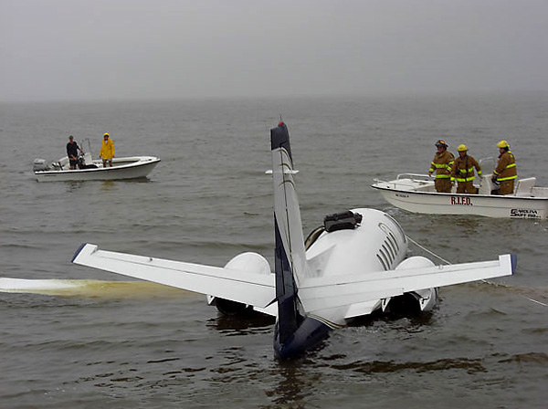
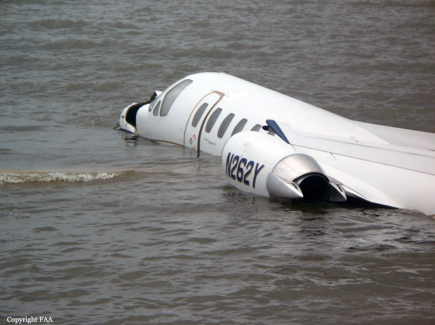
Crash of a Cessna 550 Citation II in Manteo

Date & Time: Oct 1, 2010 at 0830 LT
Type of aircraft:
Operator:
Registration:
N262Y
Survivors:
Yes
Schedule:
Tampa - Manteo
MSN:
550-0291
YOM:
1981
Crew on board:
2
Crew fatalities:
Pax on board:
5
Pax fatalities:
Other fatalities:
Total fatalities:
0
Captain / Total flying hours:
9527
Captain / Total hours on type:
2025.00
Copilot / Total flying hours:
3193
Copilot / Total hours on type:
150
Aircraft flight hours:
9643
Circumstances:
According to postaccident written statements from both pilots, the pilot-in-command (PIC) was the pilot flying and the copilot was the pilot monitoring. As the airplane approached Dare County Regional Airport (MQI), Manteo, North Carolina, the copilot obtained the current weather information. The automated weather system reported wind as 350 degrees at 4 knots, visibility at 1.5 miles in heavy rain, and a broken ceiling at 400 feet. The copilot stated that the weather had deteriorated from the previous reports at MQI. The PIC stated that they would fly one approach to take a look and that, if the airport conditions did not look good, they would divert to another airport. Both pilots indicated in phone interviews that, although they asked the Washington air route traffic control center controller for the global positioning system (GPS) runway 5 approach, they did not expect it due to airspace restrictions. They expected and received a GPS approach to runway 23 to circle-to-land on runway 5. According to the pilots' statements, the airplane was initially fast on approach to runway 23. As a result, the copilot could not deploy approach flaps when the PIC requested because the airspeed was above the flap operating range. The PIC subsequently slowed the airplane, and the copilot extended flaps to the approach setting. The PIC also overshot an intersection but quickly corrected and was on course about 1 mile prior to the initial approach fix. The airplane crossed the final approach fix on speed (Vref was 104) at the appropriate altitude, with the flaps and landing gear extended. The copilot completed the approach and landing checklist items but did not call out items because the PIC preferred that copilots complete checklists quietly. The PIC then stated that they would not circle-to-land due to the low ceiling. He added that a landing on runway 23 would be suitable because the wind was at a 90-degree angle to the runway, and there was no tailwind factor. Based on the reported weather, a tailwind component of approximately 2 knots existed at the time of the accident, and, in a subsequent statement to the Federal Aviation Administration, the pilot acknowledged there was a tailwind about 20 degrees behind the right wing. The copilot had the runway in sight about 200 feet above the minimum descent altitude, which was 440 feet above the runway. The copilot reported that he mentally prepared for a go around when the PIC stated that the airplane was high about 300 feet above the runway, but neither pilot called for one. The flight crew stated that the airplane touched down at 100 knots between the 1,000-foot marker and the runway intersection-about 1,200 feet beyond the approach end of the 4,305-foot-long runway. The speed brakes, thrust reversers, and brakes were applied immediately after the nose gear touched down and worked properly, but the airplane departed the end of the runway at about 40 knots. According to data extracted from the enhanced ground proximity warning system, the airplane touched down about 1,205 feet beyond the approach end of the 4,305-foot-long wet runway, at a ground speed of 127 knots. Data from the airplane manufacturer indicated that, for the estimated landing weight, the airplane required a landing distance of approximately 2,290 feet on a dry runway, 3,550 feet on a wet runway, or 5,625 feet for a runway with 0.125 inch of standing water. The chart also contained a note that the published limiting maximum tailwind component for the airplane is 10 knots but that landings on precipitation-covered runways with any tailwind component are not recommended. The note also indicates that if a tailwind landing cannot be avoided, the above landing distance data should be multiplied by a factor that increases the wet runway landing distance to 3,798 feet, and the landing distance for .125 inch of standing water to 6,356 feet. All distances in the performance chart are based on flying a normal approach at Vref, assume a touchdown point 840 feet from the runway threshold in no wind conditions, and include distance from the threshold to touchdown. The PIC's statement about the airplane being high at 300 feet above the runway reportedly prompted the copilot to mentally prepare for a go around, but neither pilot called for one. However, the PIC asked the copilot what he thought, and his reply was " it's up to you." The pilots touched down at an excessive airspeed (23 knots above Vref), more than 1,200 feet down a wet 4,305-foot-long runway, leaving about 3,100 feet for the airplane to stop. According to manufacturer calculations, about 2,710 feet of ground roll would be required after the airplane touched down, assuming a touchdown speed at Vref; a longer ground roll would be required at higher touchdown speeds. Although a 2 knot crosswind component existed at the time of the accident, the airplane's excessive airspeed at touchdown (23 knots above Vref) had a much larger effect on the outcome of the landing.
Probable cause:
The pilot-in-command's failure to maintain proper airspeed and his failure to initiate a go-around, which resulted in the airplane touching down too fast on a short, wet runway and a subsequent runway overrun. Contributing to the accident was the copilot's failure to adequately monitor the approach and call for a go around and the flight crew's lack of proper crew resource management.
Final Report:

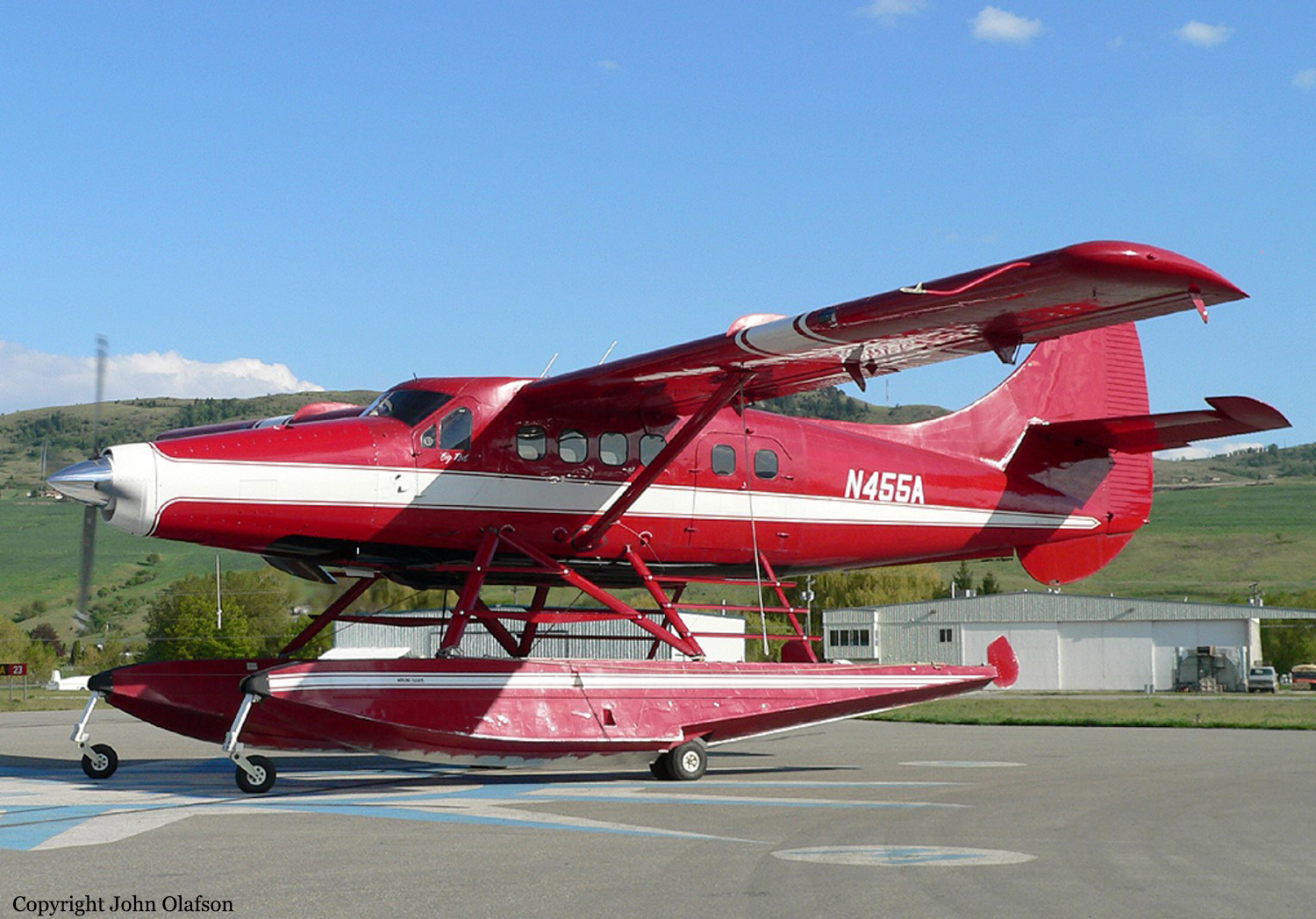
Crash of a De Havilland DHC-3T Turbo Otter near Aleknagik: 5 killed

Date & Time: Aug 9, 2010 at 1442 LT
Type of aircraft:
Operator:
Registration:
N455A
Flight Phase:
Survivors:
Yes
Site:
Schedule:
Nerka Lake - Nushagak River
MSN:
206
YOM:
1957
Crew on board:
1
Crew fatalities:
Pax on board:
8
Pax fatalities:
Other fatalities:
Total fatalities:
5
Captain / Total flying hours:
28768
Captain / Total hours on type:
35.00
Aircraft flight hours:
9372
Circumstances:
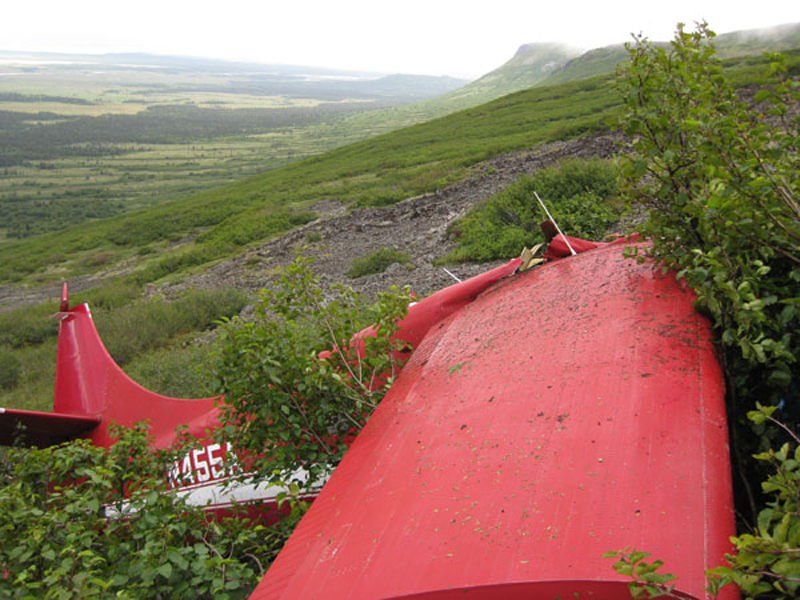
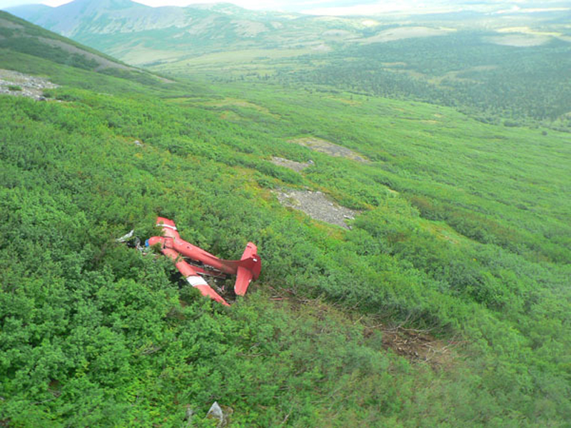
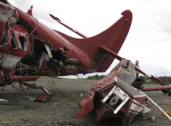
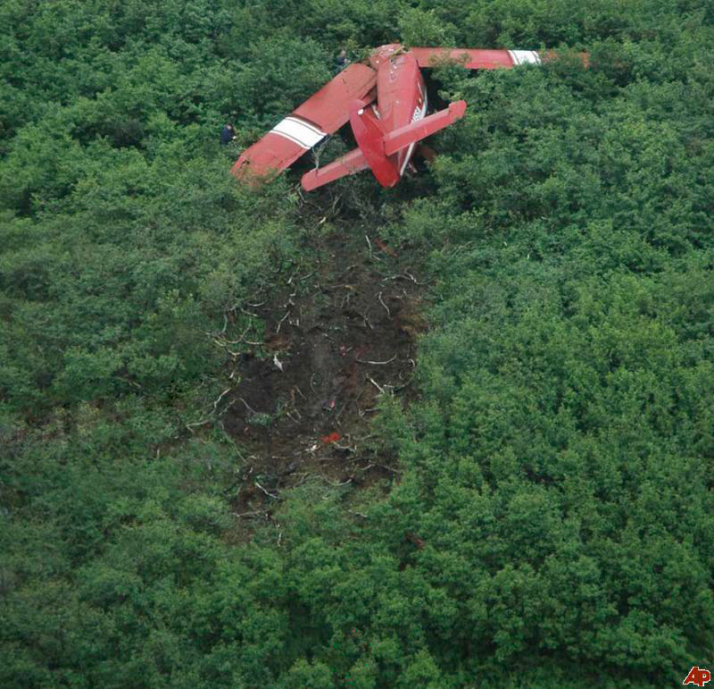
On August 9, 2010, about 1442 Alaska daylight time, a single-engine, turbine-powered, amphibious float-equipped de Havilland DHC-3T airplane, N455A, impacted mountainous, tree-covered terrain about 10 nautical miles (nm) northeast of Aleknagik, Alaska. The airline transport pilot and four passengers received fatal injuries, and four passengers received serious injuries. The airplane sustained substantial damage, including deformation and breaching of the fuselage. The flight was operated by GCI Communication Corp. (GCI), of Anchorage, Alaska, under the provisions of 14 Code of Federal Regulations (CFR) Part 91. About the time of the accident, meteorological conditions that met the criteria for marginal visual flight rules (MVFR) were reported at Dillingham Airport (DLG), Dillingham, Alaska, about 18 nm south of the accident site. No flight plan was filed. The flight departed about 1427 from a GCI-owned private lodge on the shore of Lake Nerka and was en route to a remote sport fishing camp about 52 nm southeast on the Nushagak River. According to GCI lodge personnel, the purpose of the flight was to transport the lodge guests to the fishing camp for an afternoon of fishing. The GCI lodge manager stated that the accident pilot had flown previously that morning in the accident airplane to DLG, where he dropped off another GCI pilot and then returned to the lodge. Sky Connect tracking system data for the accident airplane showed that, on that previous trip, the accident pilot departed the lodge for DLG about 0902 and returned about 1120. A review of DLG flight service station (FSS) recordings revealed that, about 1105, during the return flight from DLG to the lodge, the accident pilot filed a pilot report (PIREP) in which he reported ceilings at 500 feet, visibility of 2 to 3 miles in light rain, and “extremely irritating…continuous light chop” turbulence that he described as “kind of that shove-around type stuff rather than just bumps.” According to GCI lodge personnel, when the pilot returned to the lodge, he stated that the weather was not conducive for a flight to the fishing camp because of the turbulence and low ceilings. Passengers from the accident flight and GCI personnel indicated during postaccident interviews that, by the time that they had lunch about 1300, the weather had improved, and the group discussed with the pilot the option of going to the fishing camp. One passenger characterized the conversation as casual and stated that no pressure was placed on the pilot to make the flight or to depart by a certain time. The GCI lodge manager and some passengers stated that they thought that the pilot checked the weather on the computer during lunch, and the guest party co-host (one of GCI’s senior vice presidents) stated that the pilot informed him about 1400 that he was comfortable taking the group to the fishing camp if the group wanted to go. The GCI lodge manager stated that, before the airplane departed, he sent an e-mail to the fishing camp to indicate that the guests were coming, and personnel there informed him that the pilot had already contacted them. The lodge manager stated that he went down to the dock to help push the airplane off and that, when the flight departed, he could see all of Jackknife Mountain across the lake. (The mountain’s highest peak, which is about 3 nm from the dock, is depicted as 2,326 feet above mean sea level [msl] on an aviation sectional chart, and the elevation of Lake Nerka is depicted as about 40 feet msl on a topographical map.) He stated that the weather included broken ceilings about 2,000 feet above ground level (agl) with some blue patches in the sky and good visibility. The flight route from the lodge to the fishing camp traversed Class G airspace; 14 CFR 91.155 specifies that, for daytime flights below 1,200 feet agl, the flight must be flown clear of clouds and in conditions that allow at least 1 mile flight visibility. During a postaccident interview, the passenger who was in the right cockpit seat stated that, when the airplane departed, the visibility was “fine.” He stated that the pilot went a different direction during takeoff (compared to the passenger’s experiences during previous flights to the fishing camp) and that the pilot said it was to avoid “wind and weather.” The passenger described the weather as cloudy above with light turbulence. He stated that the airplane stayed below the clouds and that he noticed water “running across” the outside of the windshield before he fell asleep about 10 minutes into the flight. Another passenger, who was seated in the second seat behind the pilot on the left side of the airplane, stated that some fog was present beneath the airplane but that he did not think that the airplane flew into any clouds. He estimated that he fell asleep about 3 to 4 minutes after departure. The passenger who was in the first seat behind the pilot on the left side of the airplane stated in an initial interview that he could not see well out his side window and that he had no indication of the weather; however, in a subsequent interview, he stated that, once the airplane was airborne, he could not see the ground and could see only “white-out” conditions outside the airplane. He stated in the subsequent interview that he did not know if the airplane had climbed into clouds initially or if it had entered clouds at some point along the way. The passenger who was in the third seat behind the pilot on the left side of the airplane stated that the pilot kept the airplane below the cloud ceiling and flew along the tree line, followed streams, and maneuvered to avoid terrain. The passenger stated that the airplane banked into a left turn (he said that the bank angle was not unusual) and then immediately impacted terrain. Neither he nor the other passenger who was awake at the time of impact recalled noticing any unusual maneuvering, unusual bank or pitch angles, or change in engine noises that would indicate any problem before the airplane impacted terrain. The wreckage was found at an elevation of about 950 feet msl in steep, wooded terrain in the Muklung Hills, about 16 nm southeast of the GCI lodge. Figure 1 shows the accident site (view looking north-northwest).

Probable cause:
The pilot's temporary unresponsiveness for reasons that could not be established from the available information. Contributing to the investigation's inability to determine exactly what occurred in the final minutes of the flight was the lack of a cockpit recorder system with the ability to capture audio, images, and parametric data.
Final Report:

Crash of a Cessna 414A Chancellor off Sydney: 2 killed

Date & Time: Aug 5, 2010 at 2337 LT
Type of aircraft:
Operator:
Registration:
C-GENG
Survivors:
No
Schedule:
Butonville - Sydney
MSN:
414A-0288
YOM:
1979
Country:
Crew on board:
1
Crew fatalities:
Pax on board:
1
Pax fatalities:
Other fatalities:
Total fatalities:
2
Aircraft flight hours:
9677
Circumstances:
The privately owned Cessna 414A departed Toronto/Buttonville Municipal Airport, Ontario, en route to Sydney, Nova Scotia. The flight was operating under an instrument flight rules flight plan with the pilot-in-command and the aircraft owner on board. Nearing Sydney, the aircraft was cleared to conduct an instrument approach. At the final approach waypoint the pilot was advised to discontinue the approach due to conflicting traffic. While manoeuvring for a second approach, the aircraft departed from controlled flight, entered a rapid descent and impacted the water at 2335 Atlantic Daylight Time. The aircraft wreckage was located using a side-scan sonar 11 days later, in 170 feet of water. The aircraft had been destroyed and both occupants were fatally injured. No signal was detected from the emergency locator transmitter.
Probable cause:
Findings as to Causes and Contributing Factors:
1. It is likely that the PIC and the owner were both suffering some degree of spatial disorientation during the final portion of the flight. This resulted in a loss of control of the aircraft and the crew was unable to recover prior to contacting the surface of the water.
2. The PIC did not accept assistance in the form of radar vectors, which contributed to the workload during the approach.
3. Self-imposed pressure likely influenced the crew’s decision to depart Buttonville despite the flight conditions, lengthy day, and lack of experience with the aircraft and the destination airport.
Other Findings:
1. It could not be conclusively determined who was flying the aircraft at the time of the occurrence.
2. The lack of onboard recording devices prevented the investigation from determining the reasons why the aircraft departed controlled flight.
3. The practice of placing aircraft technical records on board aircraft may impede an investigation if the records are lost due to an accident.
Final Report:

Crash of an Antonov AN-74 in Ivanovo

Date & Time: Mar 30, 2010 at 1400 LT
Type of aircraft:
Operator:
Registration:
RA-74017
Flight Phase:
Survivors:
Yes
Schedule:
Ivanovo - Moscow
MSN:
471 95 015
YOM:
2004
Country:
Region:
Crew on board:
5
Crew fatalities:
Pax on board:
0
Pax fatalities:
Other fatalities:
Total fatalities:
0
Circumstances:
Just after liftoff, at a height of about 3 meters, left engine thrust reverser deployed. The takeoff procedure was aborted but the aircraft veered off runway and came to rest in a field with the cockpit partially separated. All five occupants were injured, both pilots seriously. The aircraft was damaged beyond repair. Configured in a VIP version, it was used by the FSB's Director Nikolai Patrushev and flying back to Moscow at the time of the accident.
Probable cause:
The thrust reverser deployed accidentally on the left engine after rotation due to inappropriate maintenance.

Crash of a Beechcraft F90 King Air in Egelsbach: 3 killed

Date & Time: Dec 7, 2009 at 1616 LT
Type of aircraft:
Operator:
Registration:
D-IDVK
Survivors:
No
Schedule:
Bremen - Egelsbach
MSN:
LA-96
YOM:
1981
Location:
Country:
Region:
Crew on board:
1
Crew fatalities:
Pax on board:
2
Pax fatalities:
Other fatalities:
Total fatalities:
3
Captain / Total flying hours:
2200
Aircraft flight hours:
6069
Aircraft flight cycles:
5353
Circumstances:
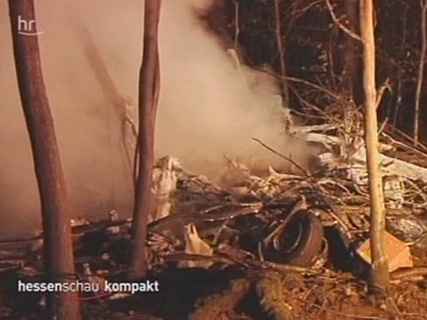
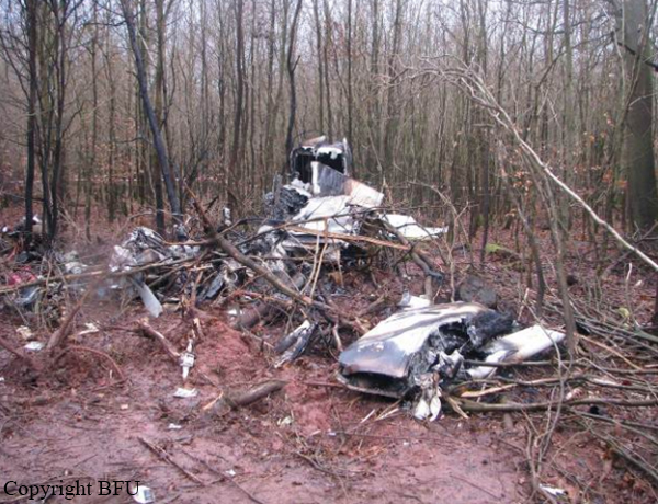
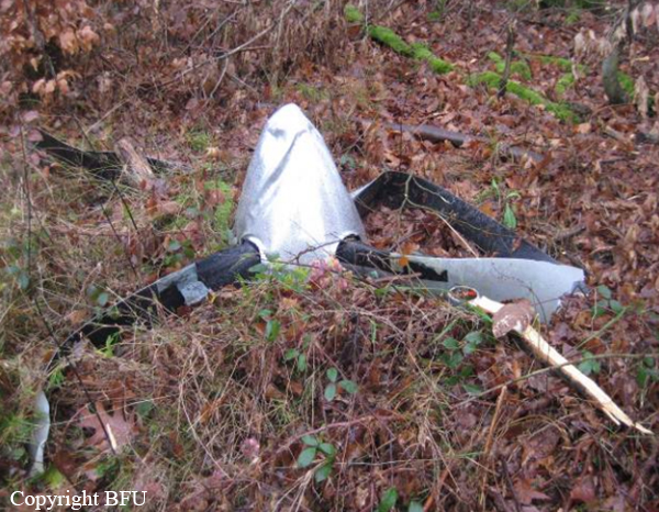
On a flight from Bremen (EDDW) to Frankfurt-Egelsbach (EDFE), a Beechcraft King Air (F90) changed from IFR to VFR rules prior to the final approach, during which it collided with trees, crashing in a wood and catching fire. On board were the pilot and two passengers. The right hand cockpit seat was occupied by a passenger who conducted radio communications. The approach to runway 27 at EDFE was chosen and executed via the so-called High Performance Aircraft Approach (HPA-approach) as published in the Aeronautical Information Publication (AIP). From 1558 hrs onwards the aircraft was under control by Langen Radar (120.8 MHz), and radar contact was confirmed by the controller. After about six minutes the controller issued the instruction: “[call sign], report if able to cancel IFR”. Subsequently, further instructions were issued to descend to altitude 5,000 ft on QNH 1,012 hPa and fly towards Egelsbach entry point Hotel 1. About four minutes later the controller gave instructions to descend to 4,000 ft, then 3,000 ft. Simultaneously, clearance was given to fly from entry point Hotel 1 to Hotel 2 and then Hotel 3. When overhead entry point Hotel 2 at 1613 hrs, the King Air reported flight conditions as ‘Victor Mike Charlie’ (VMC – Visual Meteorological Conditions) and the switch to VFR (Visual Flight Rules). At this time, the radar recorded the aircraft’s ground speed as about 180 kt. Langen Radar confirmed the report and gave an instruction to continue the descent and report passing 1,500 ft. About 42 seconds later the pilot was instructed to contact Egelsbach Info (130.9 MHz). The radar trace indicated that at this time the aircraft was at an altitude of about 1,800 ft and about 5.5 NM from the airfield. The ground speed was about 180 kt. The first radio call from the Beech to Egelsbach Info took place about 15 seconds later at 1615:06 hrs, at an altitude of about 1,500 ft and ground speed of about 190 kt. Egelsbach Info gave the information that the aircraft was north of the approach centreline and asked for a course correction to the left. They further reported the wind as Easterly at 4 knots with Runway 27 in use. After the response “[call sign], thank you” Egelsbach Info responded: “lights and flashes are on“. During the subsequent approach, the aircraft ground speed reduced over a distance of about 1.3 NM from about 190 kt to about 130 kt (distance to aerodrome about 3 NM). The radar trace indicates that from a position of 3.7 NM from the aerodrome to 2.5 NM from the aerodrome, the aircraft descended from 1,500 ft to 1,000 ft.At about 1616:03 hrs Egelsbach Info advised: “[…]coming up onto centreline”. This was acknowledged with “[call sign]”, following which Egelsbach Info advised: “you are now on centreline”. This was acknowledged with “thank you very much“. The radar trace indicates that at this time the aircraft descended from 900 ft to 800 ft. When Egelsbach Info advised “check your altitude”, the aircraft was at an altitude of about 800 ft. After a further two seconds, at 1616:18 hrs, the radar data indicated the aircraft height as about 700 ft; there was no more indication on the radar screen afterwards. In this area, the terrain is about 620 ft, with trees extending to about 700 ft AMSL. At 1616:24 hrs the aircraft was requested by Egelsbach Info to alter course slightly to the right. Neither a reply was received to this request nor to a subsequent transmission from Egelsbach Info about 22 seconds later. Egelsbach Info assumed there had been a crash and alerted the emergency services, the first of which arrived at the accident site at about 1638 hrs and found a burning wreck.
Probable cause:
The accident was caused by the descent during final approach which led into a fog layer and obstacles.
Contributing factors were:
- A too high descent rate
- An impaired performance and an insufficient situational awareness favored by the intake of alcohol
- That no visual contact with the PAPI or airfield was established
- That the on-board aids to navigation were not or not sufficiently used.
Final Report:

Crash of a Pilatus PC-12/47E in Weert: 2 killed

Date & Time: Oct 16, 2009 at 0824 LT
Type of aircraft:
Registration:
PH-RUL
Flight Phase:
Survivors:
No
Schedule:
Budel - Egelsbach
MSN:
1130
YOM:
2009
Flight number:
PHRUL
Location:
Country:
Region:
Crew on board:
1
Crew fatalities:
Pax on board:
1
Pax fatalities:
Other fatalities:
Total fatalities:
2
Captain / Total flying hours:
783
Captain / Total hours on type:
84.00
Aircraft flight hours:
95
Circumstances:
The aircraft took off from Budel-Kempen Airport runway 21 at 0822LT. After liftoff, pilot was instructed to make a left turn and was cleared to climb to 2,000 feet. While flying in clouds, the autopilot was disengaged. The aircraft rolled to the right then entered a steep descent and crashed in an open field located in Weert, east of the airport. The aircraft disintegrated on impact and both occupants were killed, among them Paul Evers, Director of Alko International.
Probable cause:
Technical or medical problems could not be ruled out according to Dutch Safety Board. However, it was considered likely that the pilot suffered from spatial disorientation.
Factors were:
- the fact that the autopilot disengaged;
- the high work load following loss of autopilot, during a single-pilot flight;
- the lack of training and experience on advanced aircraft like the PC-12 in manually flying the aircraft in IMC in a non-normal situation.
Final Report:

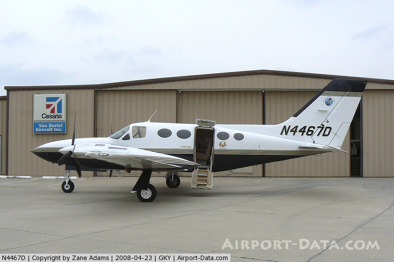
Crash of a Cessna 421C Golden Eagle III off New Port Richey: 5 killed

Date & Time: Jul 8, 2009 at 1352 LT
Operator:
Registration:
N4467D
Flight Phase:
Survivors:
No
Schedule:
McKinney - Tampa
MSN:
421C-0634
YOM:
1979
Crew on board:
1
Crew fatalities:
Pax on board:
4
Pax fatalities:
Other fatalities:
Total fatalities:
5
Captain / Total flying hours:
1940
Aircraft flight hours:
4326
Circumstances:
Prior to the accident flight, the pilot indicated that he was aware of the thunderstorm activity along his route of flight and that he anticipated deviating around the weather as necessary. While enroute to his destination, the pilot requested and was provided both weather information and pilot reports from other aircraft by air traffic control (ATC). Upon encountering an area of thunderstorm activity that extended east-to-west across the route of flight, the pilot reported encountering significant turbulence, and then downdrafts of 2,000 feet per minute. He then requested a course reversal to exit the weather before he declared an emergency and advised ATC that the airplane was upside down. There were no further transmissions from the pilot and radar contact with the airplane was lost. Review of radar data revealed that the pilot had deviated south and then southwest when the airplane entered a strong and intense echo of extreme intensity. Visible imaging revealed that the echo was located in an area of a rapidly developing cumulonimbus cloud with a defined overshooting top, indicating the storm was in the mature stage or at its maximum intensity. Two debris fields were later discovered near the area where the cumulonimbus cloud had been observed. This was indicative that the airplane had penetrated the main core of the cumulonimbus cloud, which resulted in an inflight breakup of the airplane. Near the heavier echoes the airplane's airborne weather radar may have been unable to provide an accurate representation of the radar echoes along the aircraft's flight path; therefore the final penetration of the intense portion of the storm was likely unintentional.
Probable cause:
The pilot’s decision to operate into a known area of adverse weather, which resulted in the inadvertent penetration of a severe thunderstorm, a subsequent loss of control, and in-flight breakup of the airplane.
Final Report: