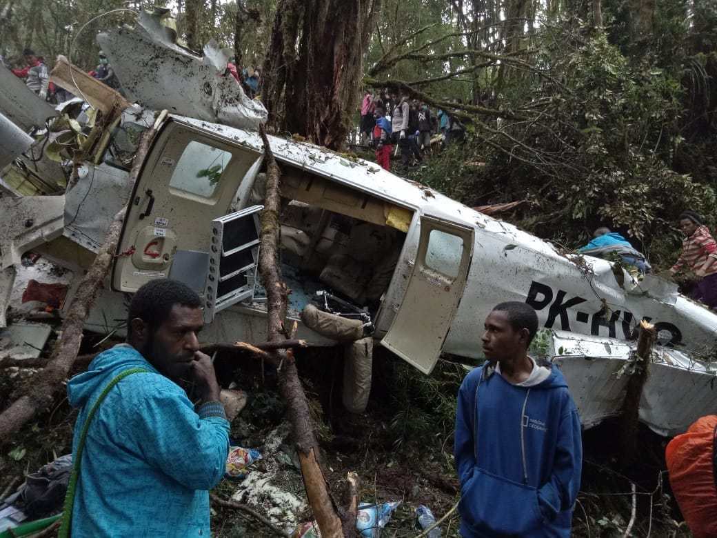
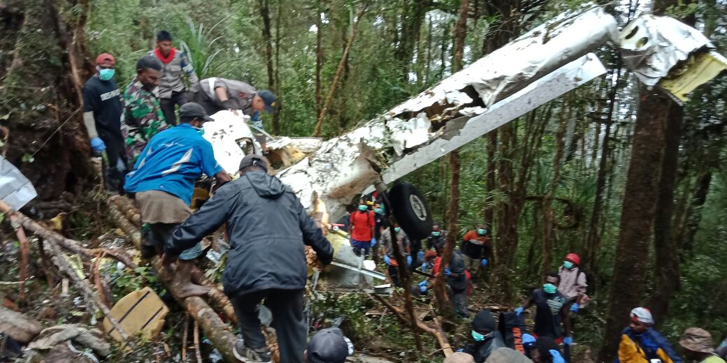
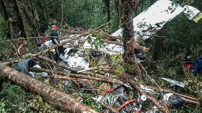
Crash of a Viking Air DHC-6 Twin Otter 400 near Kampung Mamontoga: 4 killed

Date & Time: Sep 18, 2019 at 1100 LT
Operator:
Registration:
PK-CDC
Flight Phase:
Flight Type:
Survivors:
No
Site:
Schedule:
Timika - Ilaga
MSN:
950
YOM:
2016
Country:
Region:
Crew on board:
3
Crew fatalities:
Pax on board:
1
Pax fatalities:
Other fatalities:
Total fatalities:
4
Circumstances:
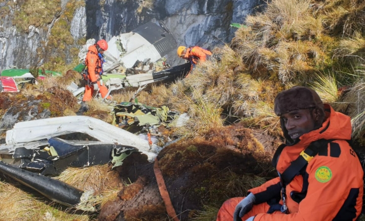
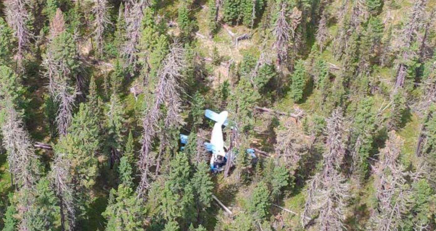
The twin engine airplane departed Timika Airport at 1036LT on a cargo flight to Ilaga, carrying one passenger, a crew of four and a load of 1,7 ton of rice. At 1054LT, the crew gave his ETA at Ilaga Airport when the contact was lost about six minutes later. As the airplane failed to arrive at destination, SAR operations were initiated. The wreckage was found four days later in a mountainous terrain, at an altitude of 4,115 meters, about 10 km from Kampung Mamontoga. The aircraft was totally destroyed and all four occupants were killed.

Crash of a PZL-Mielec AN-2R near Lake Siljan-Kuel: 2 killed

Date & Time: Aug 30, 2019 at 0730 LT
Type of aircraft:
Operator:
Registration:
RA-33061
Flight Phase:
Flight Type:
Survivors:
Yes
Site:
Schedule:
Us-Khatyn – Suordakh
MSN:
1G218-48
YOM:
1986
Country:
Region:
Crew on board:
2
Crew fatalities:
Pax on board:
5
Pax fatalities:
Other fatalities:
Total fatalities:
2
Captain / Total flying hours:
12500
Captain / Total hours on type:
3806.00
Aircraft flight hours:
3848
Circumstances:
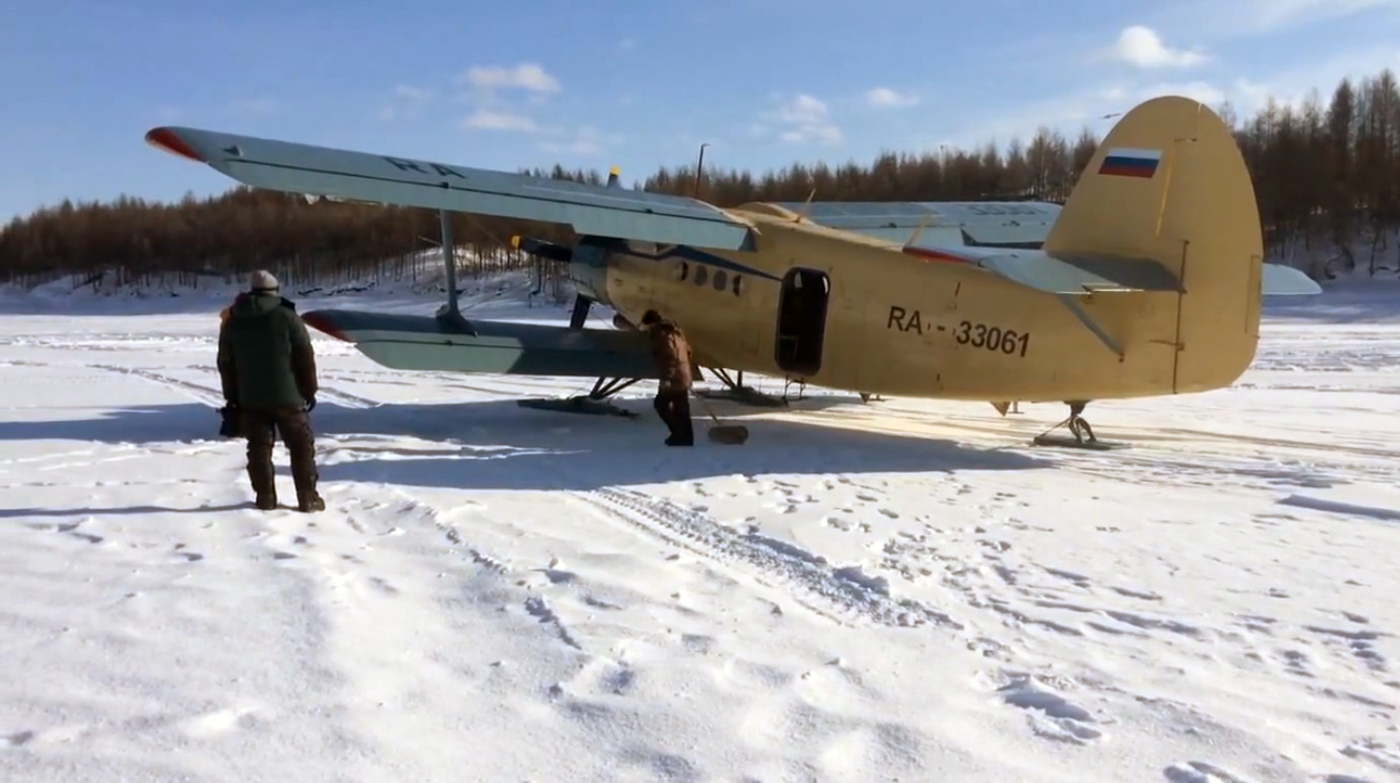
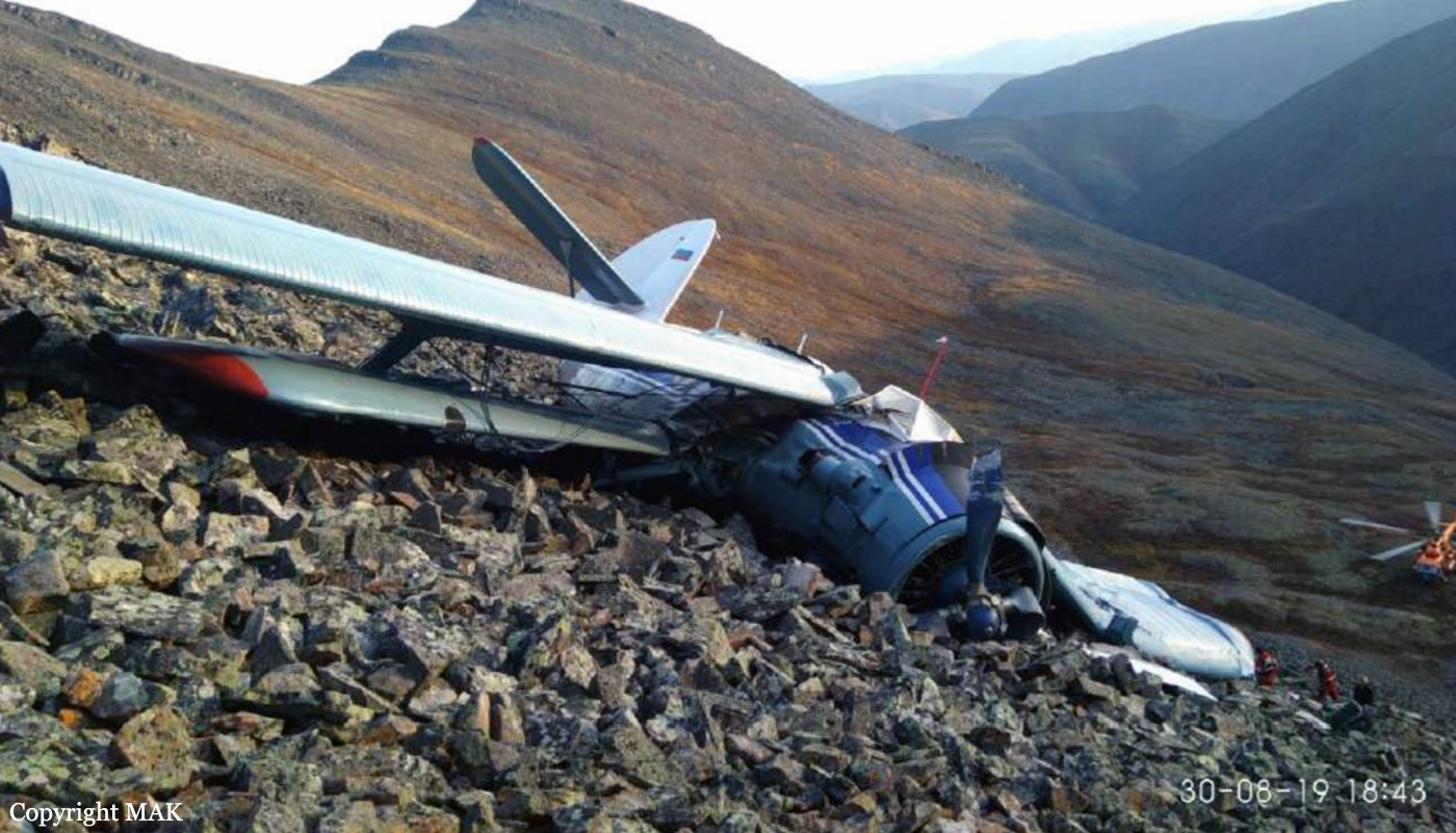
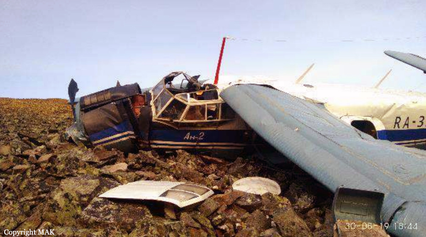
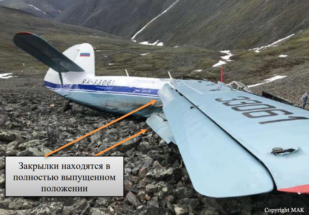
The single engine airplane departed Us-Khatyn on a flight to Suordakh, carrying five passengers, two pilots and a load consisting of 600 kilos of various goods. While cruising at an altitude of about 1,450 metres, the crew encountered moderate atmospheric turbulences and was unable to maintain the altitude. The aircraft lost height and crashed on the rocky slope of amountain located 15 km southeast from the Lake Siljan-Kuel, some 250 km from the destination. Two passengers were killed while five others occupants were injured. The aircraft was destroyed.
Probable cause:
The accident was caused by the fact that the PIC did not maintain a safe flight altitude in mountainous terrain, which led to the aircraft getting into strong downdrafts while flying over the leeward side of the ridge, uncontrolled descent and collision with the top of the mountain.
The contributing factors of AP, most likely, were:
- insufficient analysis of meteorological conditions and the possibility of the formation of strong ascending and descending air currents in the mountains;
- Failure of the PIC to take safety measures when flying in the mountains and to act in case of falling into downward air currents when crossing a mountain ridge;
- the use of motor gasoline with an octane rating of less than 95, which led to a decrease in engine power;
- performing a mission on the An-2 aircraft without the procedure for restoring skills and admission to flights on this type after a significant break in flights (about 15 years).
Final Report:

Crash of a Cessna 208B Grand Caravan near Mayo: 2 killed

Date & Time: Aug 6, 2019 at 1113 LT
Type of aircraft:
Operator:
Registration:
C-FSKF
Flight Phase:
Survivors:
No
Site:
Schedule:
Rackla - Mayo
MSN:
208B-0673
YOM:
1998
Location:
Country:
Crew on board:
1
Crew fatalities:
Pax on board:
1
Pax fatalities:
Other fatalities:
Total fatalities:
2
Captain / Total flying hours:
1694
Captain / Total hours on type:
212.00
Aircraft flight hours:
19060
Circumstances:
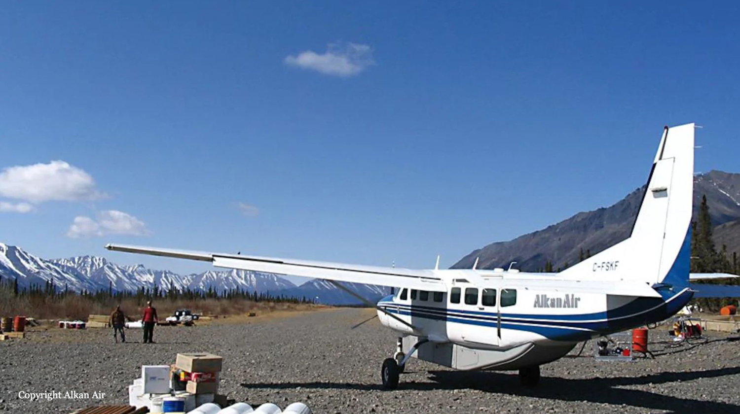
At 1101 Pacific Daylight Time on 06 August 2019, the Alkan Air Ltd. Cessna 208B Grand Caravan aircraft (registration C‐FSKF, serial number 208B0673) departed Rau Strip, Yukon, on a visual flight rules company flight itinerary to Mayo Airport, Yukon. The aircraft had 1 pilot, 1 passenger, and cargo on board. At 1113, the aircraft entered instrument meteorological conditions and struck rising terrain in a box canyon shortly after. The crash occurred approximately 25 nautical miles east‐northeast of Mayo Airport, at an elevation of 5500 feet above sea level. The Canadian Mission Control Centre did not receive a signal from the aircraft’s 406 MHz emergency locator transmitter. Eyewitnesses from a nearby exploration camp arrived at the site after approximately 1 hour. Royal Canadian Mounted Police and emergency medical services arrived on site approximately 90 minutes after the accident. The pilot and passenger received fatal injuries. The aircraft was destroyed; there was a brief post‐impact fire.
Probable cause:
Findings as to causes and contributing factors:
These are conditions, acts or safety deficiencies that were found to have caused or contributed to this occurrence.
1. The pilot’s decision making was influenced by several biases and, as a result, the flight departed and subsequently continued into poor weather conditions in mountainous terrain.
2. The high speed at low altitude and low forward visibility reduced the opportunities for the pilot to take alternative action to avoid terrain.
3. Within the box canyon, the canyon floor elevation increased abruptly within less than 1 NM and the low visibility prevented the pilot from detecting this and taking sufficient actions to prevent collision with terrain.
4. When the pilot turned into the box canyon, the terrain awareness and warning system aural alerts were ineffective in warning the pilot about the rising terrain either because he had already heard multiple similar alerts in the preceding minutes, or because he had silenced the alerts.

Findings as to risk:
These are conditions, unsafe acts, or safety deficiencies that were found not to be a factor in this occurrence but could have adverse consequences in future occurrences.
1. If administrative safety defences are not used as intended, it increases the risk that the hazards associated with the flight will not be identified and mitigated.

Other findings:
These items could enhance safety, resolve an issue of controversy, or provide a data point for future safety studies.
1. The pilot held a valid instrument rating and the aircraft was equipped to fly in instrument meteorological conditions. However, there were no scenarios in the pilot’s flying history on the Cessna 208B Grand Caravan or in his training where a transition from visual flight rules to a flight under instrument flight rules in an emergency was performed.
Final Report:

Crash of a Cessna 208 Caravan 675 on Addenbroke Island: 4 killed

Date & Time: Jul 26, 2019 at 1104 LT
Type of aircraft:
Operator:
Registration:
C-GURL
Flight Phase:
Survivors:
Yes
Site:
MSN:
208-0501
YOM:
2008
Country:
Crew on board:
1
Crew fatalities:
Pax on board:
8
Pax fatalities:
Other fatalities:
Total fatalities:
4
Captain / Total flying hours:
8500
Captain / Total hours on type:
504.00
Aircraft flight hours:
4576
Circumstances:
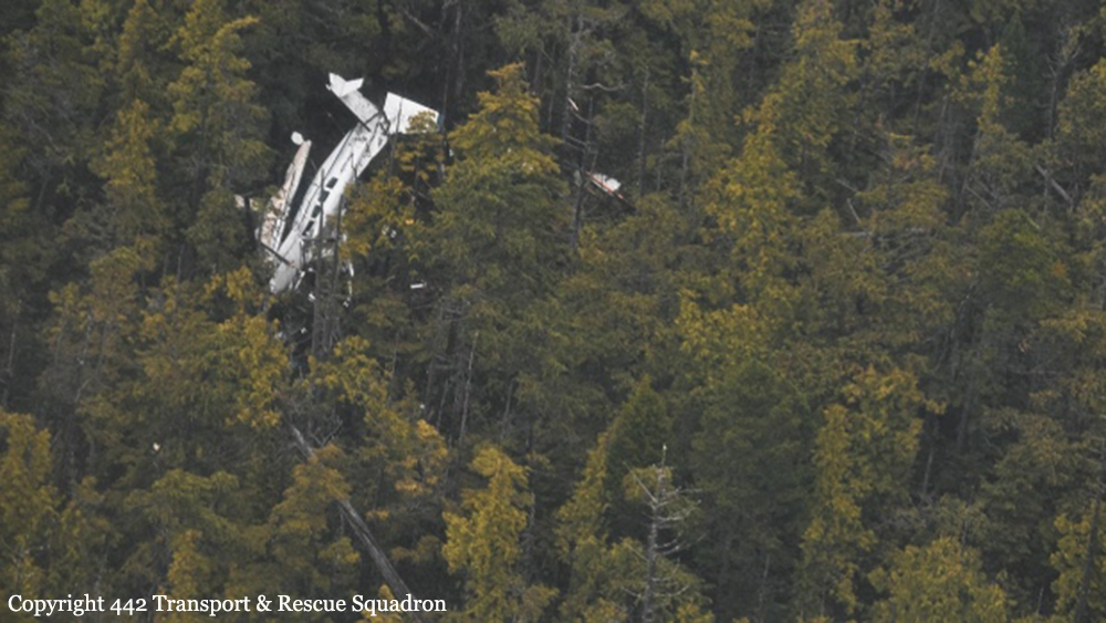
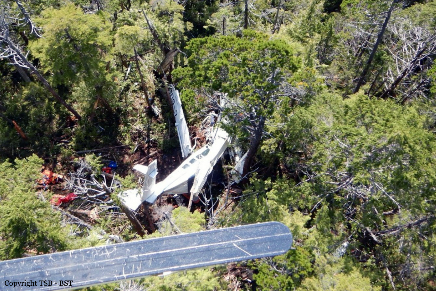
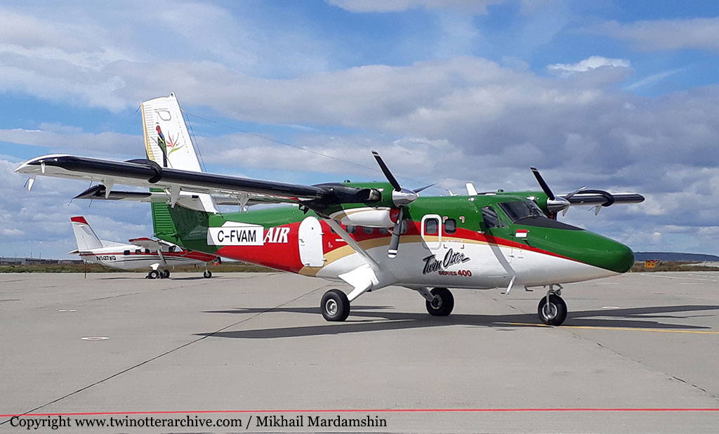
Seair Seaplanes (Seair) was contracted by a remote fishing lodge on the central coast of British Columbia (BC) (Figure 1) to provide seasonal transport of guests and supplies between Vancouver International Water Aerodrome (CAM9), BC, and the lodge, which is located about 66 nautical miles (NM) north-northwest of Port Hardy Airport (CYZT), BC, and about 29 NM southeast of Bella Bella (Campbell Island) Airport (CBBC), BC. On 26 July 2019, the occurrence pilot arrived at Seair’s CAM9 base at approximately 0630. Over the next hour, the pilot completed a daily inspection of the Cessna 208 Caravan aircraft (registration C-GURL, serial number 20800501), added 300 L of fuel to the aircraft, and began flight planning activities, which included gathering and interpreting weather information. On the morning of the occurrence, 4 Seair visual flight rules (VFR) flights were scheduled to fly to the central coast of BC, all on Caravan aircraft: C-GURL (the occurrence aircraft) was to depart CAM9 at 0730, C-GSAS at 0745, C-FLAC at 0800, and C-GUUS at 0900. The first 3 flights were direct flights to the fishing lodge, while the 4th flight had an intermediate stop at the Campbell River Water Aerodrome (CAE3), BC, to pick up passengers before heading to a research institute located approximately 4 NM southwest of the fishing lodge. Because of poor weather conditions in the central coast region, however, all of the flights were delayed. After the crews referred to weather cameras along the central coast region, the flights began to depart, but in a different order than originally scheduled. It is not uncommon for the order of departure to change when groups of aircraft are going to the same general location. One of Seair’s senior operational staff (operations manager) departed CAM9 at 0850 aboard C-FLAC. C-GUUS, bound for the research institute, departed CAM9 next at 0906, and then the occurrence aircraft departed at 0932 (Table 1). The pilot originally scheduled to fly C-GSAS declined the flight. This pilot had recently upgraded to the Caravan, had never flown to this destination before, and was concerned about the weather at the destination. When Seair’s chief pilot returned to CAM9 at 0953 after a series of scheduled flights on a different type of aircraft, he assumed the last remaining flight to the lodge and C-GSAS departed CAM9 at 1024.After departing the Vancouver terminal control area, the occurrence aircraft climbed to 4500 feet above sea level (ASL) and remained at this altitude until 1023, when a slow descent was initiated. The aircraft levelled off at approximately 1300 feet ASL at 1044, when it was approximately 18 NM northeast of Port Hardy Airport (CYZT), BC, and 57 NM southeast of the destination. At 1050, the occurrence aircraft slowly descended again as the flight continued northbound. During this descent, the aircraft’s flaps were extended to the 10° position. At this point, the occurrence aircraft was 37 NM south-southeast of the fishing lodge. The aircraft continued to descend until it reached an altitude of approximately 330 feet ASL, at 1056. By this point, the occurrence aircraft was being operated along the coastline, but over the ocean. C-FLAC departed from the fishing lodge at 1056 on the return flight to CAM9. C-FLAC flew into the Fitz Hugh Sound and proceeded southbound along the western shoreline. At approximately 1100, it flew through an area of heavy rain where visibility was reduced to about 1 statute mile (SM). C-FLAC descended to about 170 feet ASL and maintained this altitude for the next 5 minutes before climbing to about 300 feet ASL. As the southbound C-FLAC entered Fitz Hugh Sound from the north at Hecate Island, the occurrence aircraft entered Fitz Hugh Sound from the south, near the southern tip of Calvert Island. The occurrence aircraft then changed course from the western to the eastern shoreline, and descended again to about 230 feet ASL (Figure 2), while maintaining an airspeed of approximately 125 knots. The 2 aircraft established 2-way radio contact. The pilot of C-FLAC indicated that Addenbroke Island was visible when he flew past it, and described the weather conditions in the Fitz Hugh Sound to the occurrence pilot as heavy rain showers and visibility of approximately 1 SM around Kelpie Point. The occurrence pilot then indicated that he would maintain a course along the eastern shoreline of the sound. At 1103, the 2 aircraft were separated by 2 NM and passed each other on reciprocal tracks, approximately 4 NM south of the accident site. The occurrence aircraft maintained a consistent track and altitude for the next 54 seconds, then slowly began a 25° change in track to the west (0.35 NM from the Addenbroke Island shoreline). Seven seconds after the turn started (0.12 NM from the island’s shoreline), the aircraft entered a shallow climb averaging 665 fpm. At 1104:55, the occurrence aircraft struck trees on Addenbroke Island at an altitude of approximately 490 feet ASL, at an airspeed of 114 knots, and in a relatively straight and level attitude. The aircraft then continued through the heavily forested hillside for approximately 450 feet, coming to rest at an elevation of 425 feet ASL, 9.7 NM east-southeast of the destination fishing lodge. The pilot and three passengers were killed and five other occupants were injured, four seriously.
Probable cause:
Findings as to causes and contributing factors:
These are conditions, acts or safety deficiencies that were found to have caused or contributed to this occurrence.
1. The flight departed Vancouver International Water Aerodrome even though the reported and forecast weather conditions in the vicinity of the destination were below visual flight rules minima; the decision to depart may have been influenced by the group dynamics of Seair pilots and senior staff at the flight planning stage.
2. The pilot continued flight in reduced visibility, without recognizing the proximity to terrain, and subsequently impacted the rising terrain of Addenbroke Island.
3. The configuration of the visual and aural alerting systems and the colouration ambiguity in the primary flight display of the Garmin G1000 was ineffective at alerting the occurrence pilot to the rising terrain ahead.
4. The occurrence pilot’s attention, vigilance, and general cognitive function were most likely influenced to some degree by fatigue.

Findings as to risk:
These are conditions, unsafe acts or safety deficiencies that were found not to be a factor in this occurrence but could have adverse consequences in future occurrences.
1. If pilots do not receive specialized training that addresses the hazards of their flying environment, there is a risk that they will not be proficient in the specific skills necessary to maintain safety margins.
2. If aircraft are operated in excess of the maximum allowable take-off weight, there is a risk of performance degradation and adverse flight characteristics, which could jeopardize the safety of the flight.
3. If cargo is stowed in front of emergency exits, there is a risk that egress may be impeded in an emergency situation, potentially increasing evacuation time and risk of injuries.
4. If air operators do not employ a methodology to accurately assess threats inherent to daily operations, then there is a risk that unsafe practices will become routine and operators will be unaware of the increased risk.
5. If air operators that have flight data monitoring capabilities do not actively monitor their flight operations, they may not be able to identify drift toward unsafe practices that increase the risk to flight crew and passengers.
6. If Transport Canada’s oversight of operators is insufficient, there is a risk that air operators will be non-compliant with regulations or drift toward unsafe practices, thereby reducing safety margins.
7. If Transport Canada does not make safety management systems mandatory, and does not assess and monitor these systems, there is an increased risk that companies will be unable to effectively identify and mitigate the hazards associated within their operations.

Other findings:
These items could enhance safety, resolve an issue of controversy, or provide a data point for future safety studies.
1. The pilot was actively using a cellphone throughout the flight; the operator provided no guidance or limitations on approved cellphone use in flight.
Final Report:

Crash of a De Havilland DHC-2 Beaver near Lake Boulene: 3 killed

Date & Time: Jul 12, 2019 at 1616 LT
Type of aircraft:
Operator:
Registration:
C-GRHF
Flight Phase:
Flight Type:
Survivors:
Yes
Site:
Schedule:
St-Mathias - La Minerve - Barrage Goin - Weakwaten
MSN:
1123
YOM:
1957
Country:
Crew on board:
1
Crew fatalities:
Pax on board:
3
Pax fatalities:
Other fatalities:
Total fatalities:
3
Captain / Total flying hours:
1028
Captain / Total hours on type:
314.00
Aircraft flight hours:
15040
Circumstances:
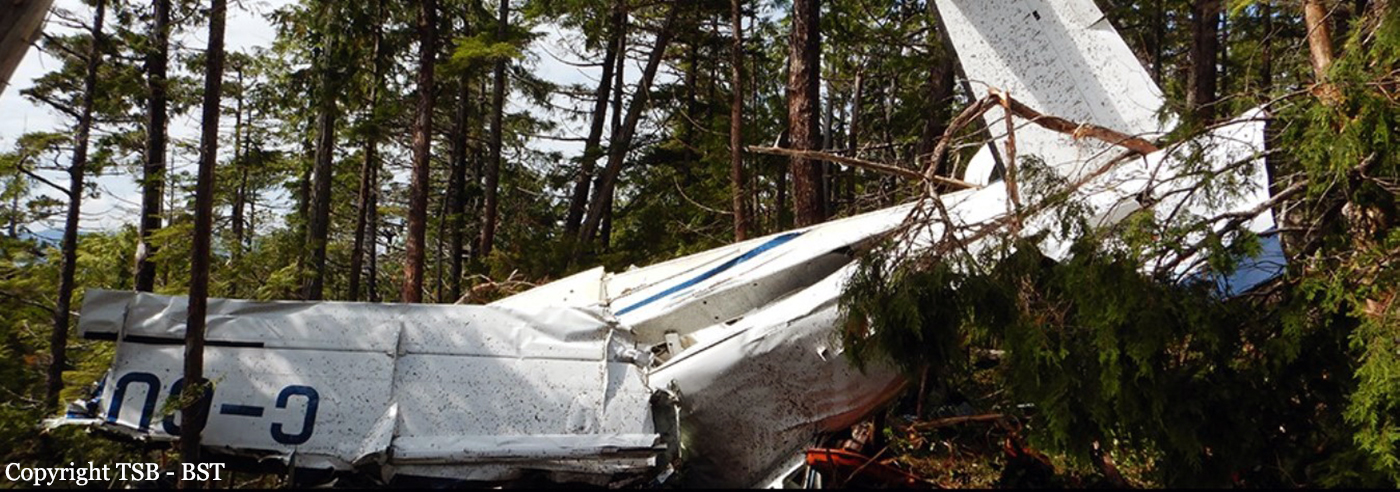
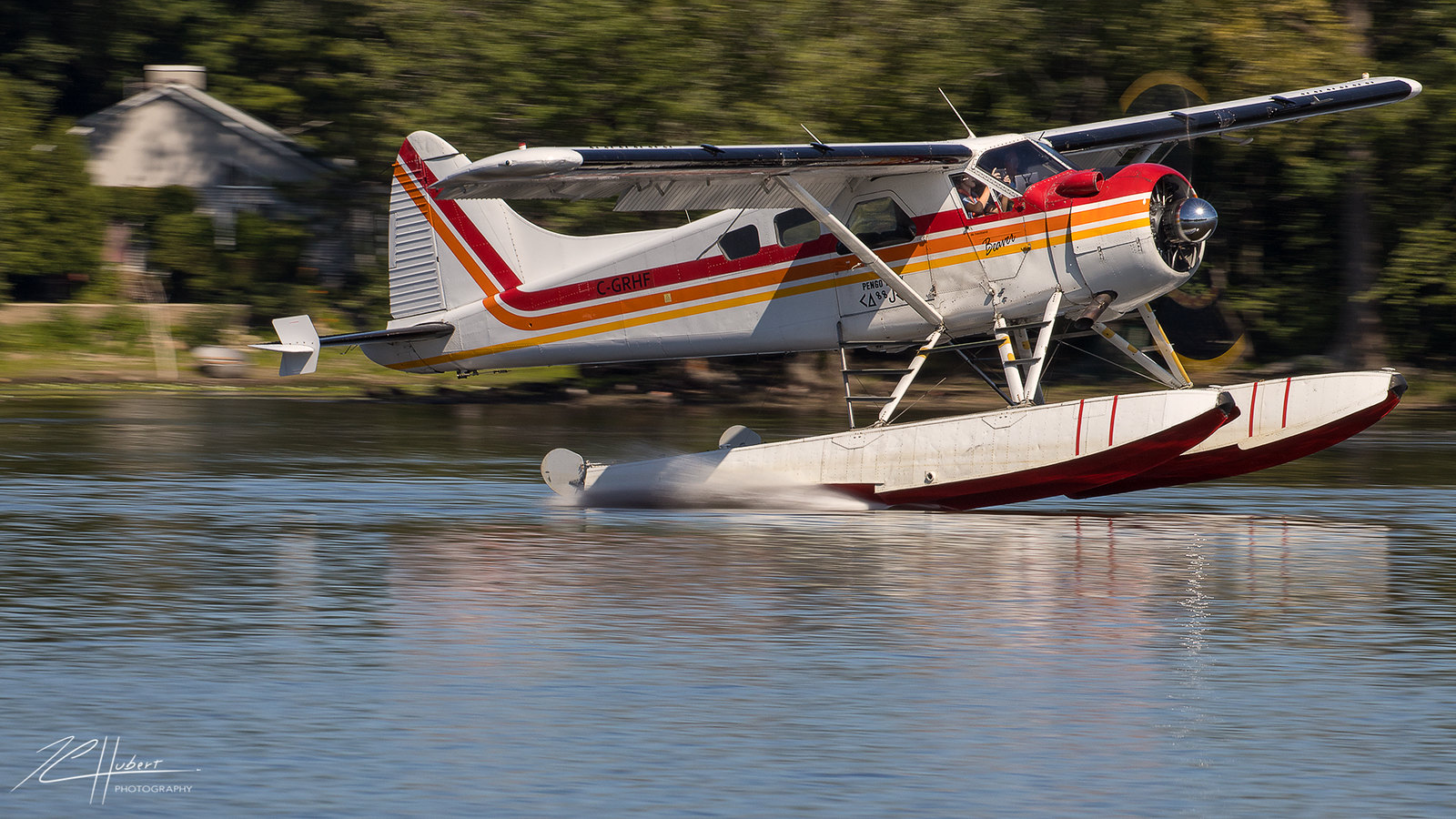
At approximately 1000LT on 12 July 2019, a private de Havilland DHC-2 Mk. 1 Beaver floatplane (registration C‑GRHF, serial number 1123) took off from the St-Mathias Water Aerodrome (CSV9), Quebec, with only the pilot on board, for a series of visual flight rules (VFR) flights. The aircraft landed at approximately 1130 on Désert Lake in La Minerve, Quebec, and came alongside a private dock where 3 individuals were waiting to board and fly to a fishing lodge. Once the baggage was stowed on the aircraft, the pilot provided a safety briefing to the passengers, who were all wearing a personal flotation device. The aircraft took off from Désert Lake at approximately 1215, bound for the Barrage Gouin Water Aerodrome (CTP3), Quebec, where the aircraft was scheduled to be refuelled. The aircraft landed at approximately 1430. Once the refuelling was complete, the aircraft took off once again around 1528, headed northwest to Weakwaten Lake, Quebec, where the fishing lodge was located. After approximately 48 minutes of flight, at around 1616, the aircraft collided with trees and struck the ground. There was no post-impact fire. The emergency locator transmitter was activated by the force of impact, and began transmitting a signal on frequency 121.5 MHz. This signal was detected by the flight crew of a commercial airliner at 1705 and reported to air traffic services. At 1850, the Joint Rescue Coordination Centre in Trenton dispatched a CC130 Hercules aircraft to try to locate the distress signal. The occurrence aircraft was found in a densely wooded area at 2032. Two search and rescue technicians were parachuted to rescue the aircraft occupants. Three of the 4 occupants received fatal injuries. The survivor was evacuated and transported to the hospital in Chibougamau, Quebec.
Probable cause:
Controlled flight into terrain following the pilot's decision to continue the flight at a relatively low speed and in a nose-up attitude, which reduced his field of vision.
Final Report:

Crash of a PZL-Mielec AN-2R near Dabady

Date & Time: Jun 9, 2019 at 1624 LT
Type of aircraft:
Operator:
Registration:
RA-81519
Flight Phase:
Survivors:
Yes
Site:
Schedule:
Kyren - Kyren
MSN:
1G208-19
YOM:
1984
Country:
Region:
Crew on board:
2
Crew fatalities:
Pax on board:
0
Pax fatalities:
Other fatalities:
Total fatalities:
0
Captain / Total flying hours:
6921
Captain / Total hours on type:
6912.00
Copilot / Total flying hours:
3561
Aircraft flight hours:
3720
Circumstances:
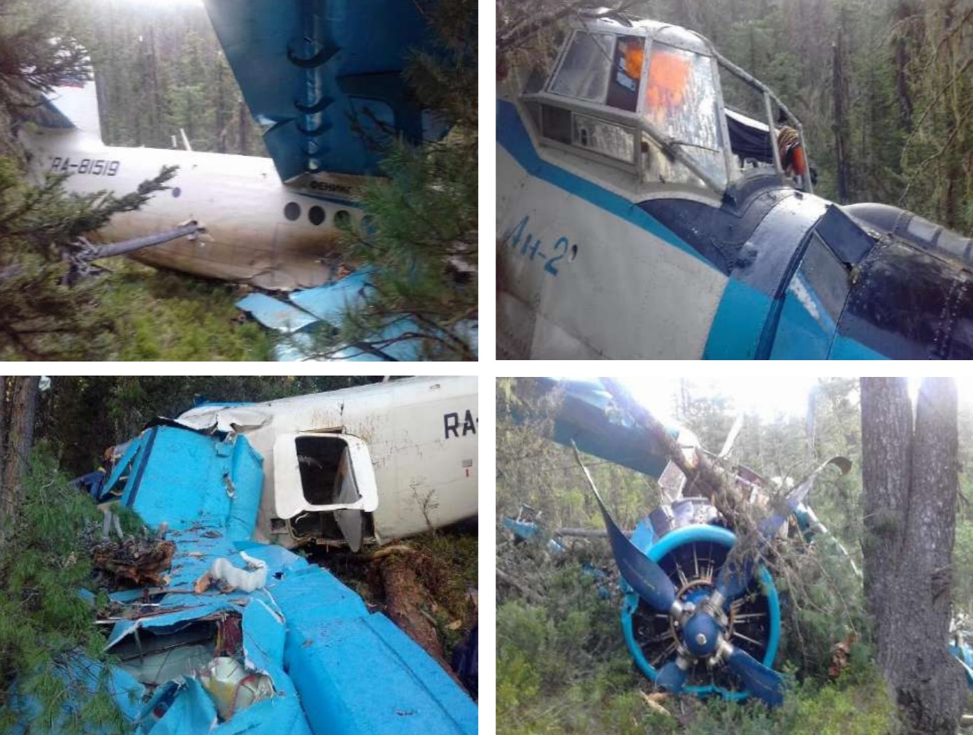
The crew departed Kyren Airport on a crop spraying mission to treat forests. About 40 minutes into the flight, while flying at a speed of 140 km/h, the crew encountered downdrafts and the airplane lost height. Due to mountainous terrain, the crew made a turn to the right but the airplane continued to descend. The captain attempted an emergency landing when, at a speed of 85 km/h, the aircraft struck trees and crashed in a wooded area located 16 km southeast of Dabady. Both pilots were injured and evacuated to Irkutsk a day later. The aircraft was damaged beyond repair.
Probable cause:
Most likely, the reason for the accident with the An-2 RA-81519 aircraft was the execution by the flight crew along the route in the mountainous terrain to the area of ​​the AHR at an altitude not ensuring its safety, which did not allow crossing the mountain pass, led to the need to perform an emergency landing and damage to the aircraft.
The contributing factors were most likely:
- Non-consideration by the crew of a significant increase of the outside air temperature during the day,
- The crew did not set the altimeter properly,
- Lack of instrument control over the flight altitude,
- Downdraft air currents on the leeward side of the mountain slope;
- Operating fatigue, leading to a weakening of attention and a decrease in level of situational awareness.
Final Report:

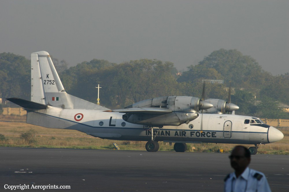
Crash of an Antonov AN-32 near Lipo: 13 killed

Date & Time: Jun 3, 2019 at 1300 LT
Type of aircraft:
Operator:
Registration:
K2752
Flight Phase:
Flight Type:
Survivors:
No
Site:
Schedule:
Jorhat - Mechuka
MSN:
10 09
YOM:
1987
Country:
Region:
Crew on board:
8
Crew fatalities:
Pax on board:
5
Pax fatalities:
Other fatalities:
Total fatalities:
13
Circumstances:
The airplane departed Jorhat Airport at 1227LT on a flight to Mechuka, Arunachal Pradesh. About half an hour later, while in cruising altitude, radio and radar contact were lost. SAR operations were quickly initiated and the wreckage was spotted eight days later, on June 11, by the crew of a Mil Mi-17 helicopter. The wreckage was found at an altitude of 12,000 feet in a wooded and steep area, about 16 km north of Lipo and 32 km east of Mechuka Airport. The aircraft was totally destroyed and all 13 occupants were killed.

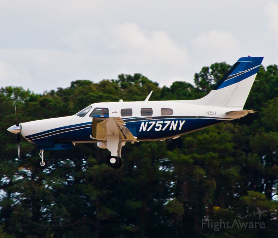
Crash of a Piper PA-46-350P Malibu near Makkovik: 1 killed

Date & Time: May 1, 2019 at 0816 LT
Operator:
Registration:
N757NY
Flight Phase:
Flight Type:
Survivors:
Yes
Site:
Schedule:
Goose Bay - Narsarsuaq
MSN:
46-36657
YOM:
2015
Country:
Crew on board:
2
Crew fatalities:
Pax on board:
0
Pax fatalities:
Other fatalities:
Total fatalities:
1
Captain / Total flying hours:
3500
Captain / Total hours on type:
20.00
Copilot / Total flying hours:
1300
Copilot / Total hours on type:
0
Circumstances:
On 01 May 2019 at 0723, the aircraft departed CYYR on a VFR flight plan direct to BGBW. The ferry pilot, who was the pilot-in-command, occupied the left seat while the co-owner occupied the right seat. The aircraft climbed to 2000 feet ASL and proceeded on a direct track to destination. The altitude and heading did not change significantly along the route, therefore it is likely that the autopilot was engaged. At 0816, the aircraft collided with a snow-covered hill 2250 feet in elevation, located 35 nautical miles (NM) southeast of Makkovik Airport (CYFT), Newfoundland and Labrador. The impact happened approximately 200 feet below the top of the hill. The aircraft came to rest in deep snow on steep sloping terrain. The aircraft sustained significant damage to the propeller, nose gear, both wings, and fuselage. Although the cabin was crush-damaged, occupiable space remained. There was no post-impact fire. The ferry pilot was seriously injured and the co-owner was fatally injured. The Joint Rescue Coordination Centre (JRCC) in Halifax received an emergency locator transmitter (ELT) signal from the aircraft at 0823. The ferry pilot carried a personal satellite tracking device, a personal locator beacon (PLB) and a handheld very high frequency (VHF) radio, which allowed communication with search and rescue (SAR). Air SAR were dispatched to the area; however, by that time, the weather had deteriorated to blizzard conditions and aerial rescue was not possible. Ground SAR then deployed from the coastal community of Makkovik and arrived at the accident site approximately 4 hours later because of poor weather conditions and near zero visibility. The ferry pilot and the body of the co-owner were transported to Makkovik by snowmobile. The following day, they were airlifted to CYYR.
Probable cause:
Controlled flight into terrain.
Final Report:

Crash of a Britten-Norman BN-2A-20 Islander in West Portal: 1 killed

Date & Time: Dec 8, 2018 at 0828 LT
Type of aircraft:
Operator:
Registration:
VH-OBL
Flight Phase:
Flight Type:
Survivors:
No
Site:
Schedule:
Cambridge – Bathurst Harbour
MSN:
2035
YOM:
1986
Country:
Region:
Crew on board:
1
Crew fatalities:
Pax on board:
0
Pax fatalities:
Other fatalities:
Total fatalities:
1
Captain / Total flying hours:
540
Captain / Total hours on type:
80.00
Aircraft flight hours:
12428
Circumstances:
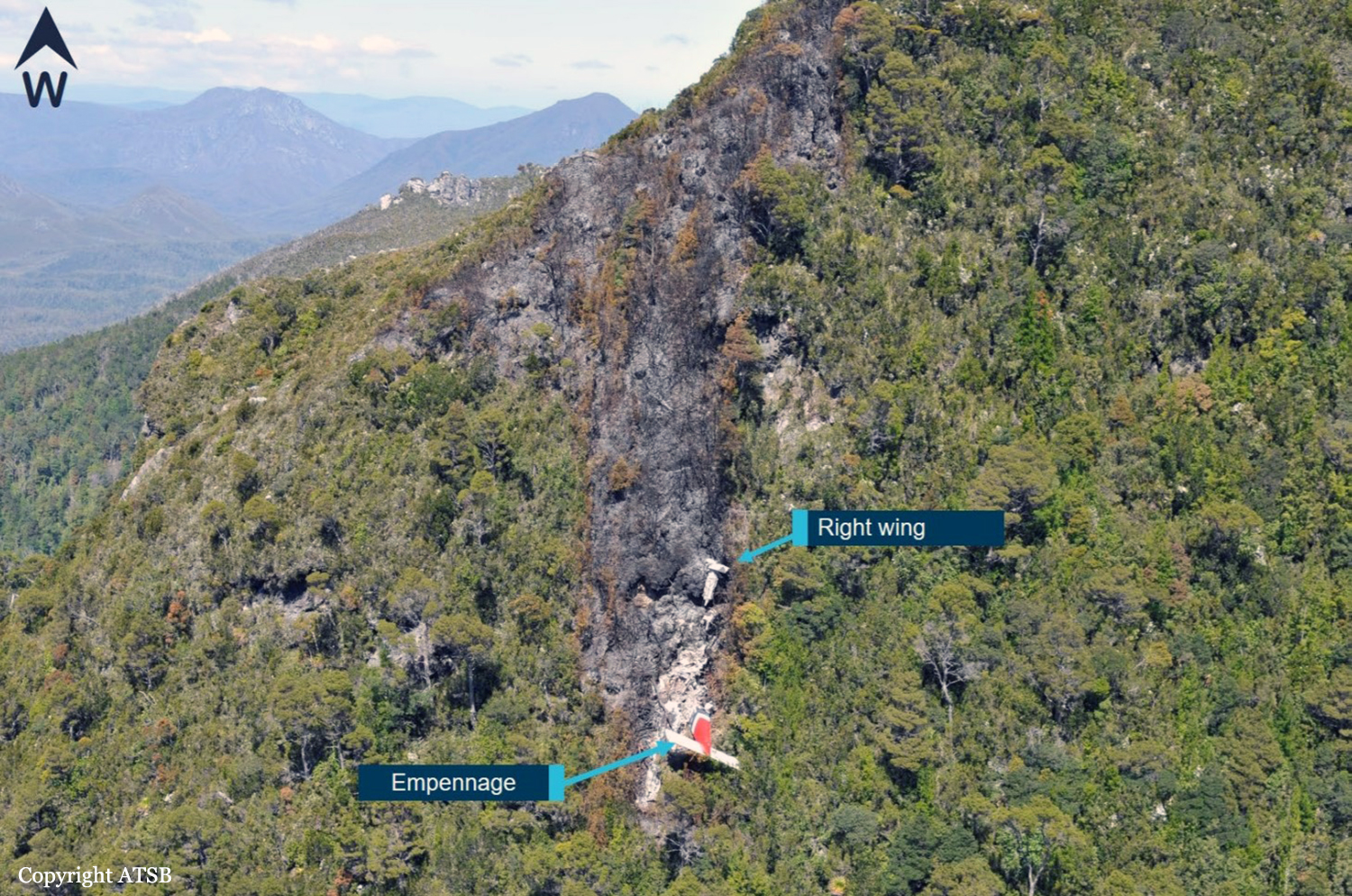
On 8 December 2018, the pilot of a Pilatus Britten-Norman BN2A-20 Islander, registered VH-OBL and operated by Airlines of Tasmania, was conducting a positioning flight under the visual flight rules from Cambridge Airport to the Bathurst Harbour aeroplane landing area (ALA), Tasmania. The aircraft departed Cambridge at about 0748 Eastern Daylight-saving Time and was scheduled to arrive at Bathurst Harbour about 0830 to pick up five passengers for the return flight. The passengers were part of a conservation project that flew to south-west Tasmania regularly, and it was the pilot’s only flight for that day. Automatic dependent surveillance broadcast (ADS-B) position and altitude data (refer to the section titled Recorded information) showed the aircraft tracked to the south-west towards Bathurst Harbour (Figure 1). At about 0816, the aircraft approached a gap in the Arthur Range known as ‘the portals’. The portals are a saddle (lowest area) between the Eastern and Western Arthur Range, and was an optional route that Airlines of Tasmania used between Cambridge and Bathurst Harbour when the cloud base prevented flight over the mountain range. After passing through the portals, the aircraft proceeded to conduct a number of turns below the height of the surrounding highest terrain. The final data point recorded was at about At about 0829, the Australian Maritime Safety Authority received advice that an emergency locator transmitter allocated to VH-OBL had activated. They subsequently advised the Tasmanian Police and the aircraft operator of the activation, and initiated search and rescue efforts. The rescue efforts included two helicopters and a Challenger 604 search and rescue jet aircraft. The Challenger arrived over the emergency locator transmitter signal location at around 0925, however, due to cloud cover the crew were unable to visually identify the precise location of VH-OBL. A police rescue helicopter arrived at the search area at about 1030. The pilot of that helicopter reported observing cloud covering the eastern side of the Western Arthur Range, and described a wall of cloud with its base sitting on the bottom of the west portal. Multiple attempts were made throughout the day to locate the accident site, however, due to low-level cloud, and fluctuating weather conditions, the search and rescue operation was unable to confirm visual location of the aircraft until about 1900. The aircraft wreckage was found in mountainous terrain of the Western Arthur Range in the Southwest National Park (Figure 2) . The search and rescue crew assessed that the accident was unlikely to have been survivable. The helicopter crew considered winching personnel to the site, however, due to a number of risks, including potential for cloud reforming, the time of day and lighting, and other hazards associated with the mountainous location, the helicopter departed the area. The aircraft wreckage was accessed the following day, when it was confirmed that the pilot was fatally injured.
Probable cause:
From the evidence available, the following findings are made with respect to the controlled flight into terrain involving Pilatus Britten-Norman BN2A, VH-OBL, 101 km west-south-west of Hobart, Tasmania, on 8 December 2018.
Contributing factors:
• The pilot continued descending over the Arthur Range saddle to a lower altitude than previous flights, likely due to marginal weather. This limited the options for exiting the valley surrounded
by high terrain.
• While using a route through the Arthur Range due to low cloud conditions, the pilot likely encountered reduced visual cues in close proximity to the ground, as per the forecast conditions. This led to controlled flight into terrain while attempting to exit the range.
Final Report:

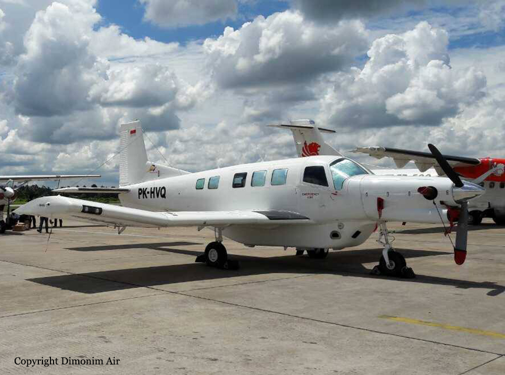
Crash of a Pacific Aerospace PAC 750XL near Oksibil: 8 killed

Date & Time: Aug 11, 2018 at 1420 LT
Operator:
Registration:
PK-HVQ
Survivors:
Yes
Site:
Schedule:
Tanah Merah – Oksibil
MSN:
144
YOM:
2009
Country:
Region:
Crew on board:
2
Crew fatalities:
Pax on board:
7
Pax fatalities:
Other fatalities:
Total fatalities:
8
Captain / Total flying hours:
13665
Captain / Total hours on type:
1468.00
Aircraft flight hours:
4574
Aircraft flight cycles:
5227
Circumstances:
On 11 August 2018, a PAC 750XL aircraft registered PK-HVQ was being operated by PT. Marta Buana Abadi (Dimonim Air) on unscheduled passenger flight from Tanah Merah to Oksibil. At the day of the occurrence the meteorological condition at Oksibil was below the requirement of Visual Flight Rule (VFR) weather minima and did not improve. Being aware that some flights had performed flight to Tanah Merah to Oksibil and returned, the pilot decided to fly to Oksibil. At 1342 LT, on daylight condition the PK-HVQ aircraft departed from Tanah Merah to Oksibil, on board the aircraft were one pilot, one observer pilot and 7 passengers. According to the passenger and cargo manifest, the total weight of passenger and the baggage were 473 kg. Prior to the departure, there was no record or report of aircraft system malfunction. At 1411 LT, the PK-HVQ pilot made initial contact to Oksibil Tower controller and reported that the aircraft was maintaining altitude of 7,000 feet over and the estimate time arrival at Oksibil would be 0520 UTC (1420 LT). The Oksibil Tower controller advised the pilot of the latest meteorological condition that the visibility was 1 up to 2 km and most of the area were covered by cloud. At 1416 LT, the pilot reported that the aircraft position was over Oksibil Aiport and the Oksibil Tower controller instructed the pilot to continue the flight to the final runway 11 and to report when the runway had in sight. The Oksibil Tower controller and pilots of other aircraft called the pilot but no reply. On the following day, the aircraft was found on a ridge of mountain about 3.8 Nm north west of Oksibil on bearing 331° with elevation about 6,800 feet. Eight occupants were fatally injured and one occupant was seriously injured.
Probable cause:
The KNKT concluded the contributing factors as follows:
- The VFR weather minimum requirement that was not implemented properly most likely had made the pilot did not have a clear visual to the surrounding area.
- Considering that the Pilot in Command (PIC) had lack knowledge of the terrain surrounding the Oksibil area, and the absence of voice alert from the TAWS when the aircraft flying close to terrain, resulted in the PIC did not have adequate awareness to the surrounding terrain while flying into clouds and continued to fly below the terrain height until the aircraft impacted the terrain.
Final Report: