


Date & Time:
Oct 11, 2021 at 1214 LT
Type of aircraft:
Cessna 340
Operator:
Samarth Aviation
Registration:
N7022G
Flight Phase:
Landing (descent or approach)
Flight Type:
Private
Survivors:
No
Site:
City
Schedule:
Yuma – San Diego
MSN:
340A-0695
YOM:
1979
Country:
United States of America
Region:
North America
Crew on board:
1
Crew fatalities:
1
Pax on board:
0
Pax fatalities:
0
Other fatalities:
1
Total fatalities:
2
Circumstances:
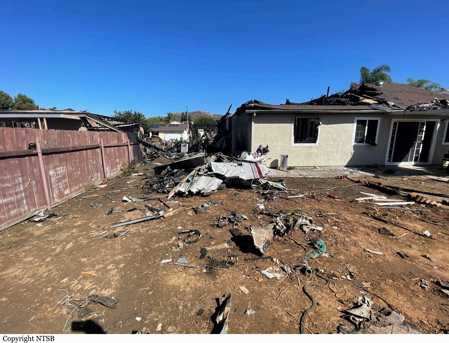
The pilot was on a cross-country flight, receiving vectors for an instrument approach while in instrument meteorological conditions (IMC). The approach controller instructed the pilot to descend to 2,800 ft mean sea level (msl) until established on the localizer, and subsequently cleared the flight for the instrument landing system (ILS) approach to runway 28R, then circle to land on runway 23. About 1 minute later, the controller told the pilot that it looked like the airplane was drifting right of course and asked him if he was correcting back on course. The pilot responded “correcting, 22G.” About 9 seconds later, the pilot transmitted “SoCal, is 22G, VFR runway 23” to which the controller told the pilot that the airplane was not tracking on the localizer and subsequently canceled the approach clearance and instructed the pilot to climb and maintain 3,000 ft. As the pilot acknowledged the altitude assignment, the controller issued a low altitude alert, and provided the minimum vectoring altitude in the area. The pilot acknowledged the controller’s instructions shortly after. At this time, recorded advanced dependent surveillance-broadcast (ADS-B) data showed the airplane on a northwesterly heading at an altitude of 2,400 ft msl. Over the course of the following 2 minutes, the controller issued multiple instructions for the pilot to climb to 4,000 ft, which the pilot acknowledged; however, ADS-B data showed that the airplane remained between 2,500 ft and 3,500 ft. The controller queried the pilot about his altitude and the pilot responded, “2,500 ft, 22G.” The controller subsequently issued a low altitude alert and advised the pilot to expedite the climb to 5,000 ft. No further communication was received from the pilot despite multiple queries from the controller. ADS-B data showed that the airplane had begun to climb and reached a maximum altitude of 3,500 ft before it began a descending right turn. The airplane remained in the right descending turn at a descent rate of about 5,000 ft per minute until the last recorded target at 900 ft msl, located about 1,333 ft northwest of the accident site. The airplane and two houses were destroyed. The pilot and the driver of a UPS truck were killed. Two other people on the ground were injured.
Probable cause:
Loss of control due to spatial disorientation.
Final Report:
N7022G.pdf3.1 MB